A framework for indoor location-based services using geo standards and a magnetic positioning system JÖRG BLANKENBACH*, CATIA REAL-EHRLICH** and EDUARD GASPARIAN** *Geodetic Institute • RWTH Aachen University • Templergraben 55 • 52062 Aachen Tel.: +49 (0)241-80-95300 • E-Mail:
[email protected] **Institute of Geodesy • Technische Universität Darmstadt • Petersenstraße 13 • 64287 Darmstadt Tel.: +49 (0)6151-16-6777 • E-Mail: {realehrlich | gasparian}@geod.tu-darmstadt.de
Keywords: Magnetic Indoor Positioning System, Indoor Location Services, Geo Web Services Summary: In this contribution a framework for mobile indoor location-based services using modern geo standards is introduced. For the position determination a novel system based on artificial magnetic fields generated by coils is used. By determining the distances to reference coils placed inside a building, the unknown position of a mobile station equipped with a magnetic sensor can be estimated. The highly developed technology of smart phones allows a direct capture of the generated magnetic field in the unknown position with the devices’ embedded sensors. The current position can then be estimated and displayed directly in a floor plan, which is provided by a standardized geo web services. First prototypes of mobile applications based on Android and iOS are developed and their interaction with the magnetic positioning system and web services is demonstrated.
Introduction Knowing the location of an object or person indoors would be useful for many fields of application like pedestrian navigation, mobile robotics or inspection and maintenance issues. In contrast to outdoor environments, satellite based systems (Global Navigation Satellite Systems, GNSS) cannot be used for the position determination due to propagation errors of the satellite signals inside of buildings. Consequently, in the past years alternative positioning systems have been developed for indoor environments, which also might be used for location-based services. One of these systems is MILPS as acronym for Magnetic Indoor Local Positioning System. For the localization with MILPS only a magnetic field sensor is needed at the client side. Due to the advanced technology of smart phones, magnetic field sensors are already embedded in many of today’s smart phones. This leads to the idea of using MILPS for the position determination of modern smart phones in order to implement Indoor Location Services. This text introduces on the one hand first evaluation results for the position determination of well-known smart phone platforms Android and iOS using MILPS. On the other hand a mobile software application framework is introduced for the implementation of indoor location services based on geo web services.
MILPS – Magnetic Indoor Local Positioning System Using MILPS, the 3D position of a mobile station equipped with a three-axial magnetic field sensor (magnetometer) can be estimated by determining the distances to at least three reference coils placed inside a building and using the lateration principle (Blankenbach&Norrdine, 2010). With modern smart phones as client, the magnetic signals of MILPS can be captured for the localization of the device enabling mobile location-based services inside buildings. For that reason the measurement of magnetic field is tested on the two most important mobile platforms: Android (Samsung Galaxy Nexus) and iOS (iPhone 4S). Both devices are
equipped with a digital three-axis electronic magnetic field sensor. The signal capturing is accomplished by software applications running on these mobile devices.
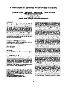
Fig 1: Implemented android application (left) and iOS-App (right) for MILPS measurements.
Android and iOS software applications For the capturing of MILPS’ signals with an Android device an own Java-based application has been developed using the Android Development Tools (ADT) (Android, 2012). The implemented application captures the magnetic field in three axes and displays the measured values graphically and textually (Fig. 1, left). With Apples iPhone test measurements were done by using the customized example iOSApp Teslameter (Fig. 1, right). Teslameter captures the "deviation[s] from the magnetic field lines being tracked by the device" (CLHeading, 2010) for its three space axes. It displays the values and their progression for the three axes and computes the strength of the magnetic field. The app has been extended by logging and archiving capabilities. At the current stage of development both applications store the raw data (magnetic field values) on the device. The data analysis and position calculation is done on a workstation in post processing. Evaluations of positioning experiments have done so far, show a positioning accuracy of better than 1 m with both devices (Blankenbach,Norrdine&Hellmers, 2012).
Geo Web Services for indoor location-based services One crucial aspect for indoor location services is the access to geospatial building information like maps or features of interest. For the sharing of all kinds of geo information and the integration of the data in various applications the Open Geospatial Consortium (OGC) provides open geo standards. These include the Web Map Service (WMS) for the provision of raster data and the Web Feature Service (WFS) for the supply of vector data. The basic idea is to realise indoor location services by chaining geo web services with access to geospatial building information (Blankenbach&Norrdine, 2011; Blankenbach&Real Ehrlich, 2011). For that reason a generic iOS application has been developed. The application consists of a map viewer and is able to handle position information (e.g. from GNSS). For the access to geospatial data both a WMS and a WFS interface to OGC compliant services are implemented. Thus, a mobile device can access web services for requesting geo information belonging to its environmental context: based on the user’s position a base map is requested via the WMS interface displaying the user’s position. In addition, spatial features of interest can be requested over the WFS interface and also displayed in the map viewer. Figure 2 and 3 show the outdoor and indoor usage of the map viewer application implemented for iOS. In this case fire extinguishers as an example of spatial features belonging to
a building are requested from a WFS based on the user’s position and displayed on an aerial map or floor map delivered by a WMS.
Fig 2: Outdoors: Map viewer showing features inside a building on a floor plan.
Fig 3: Indoors: Map viewer showing features inside a building on a floor plan. As mentioned above GNSS based systems are not capable of position estimating inside a building. Hence, it is planned to accomplish the position determination of the mobile device by using MILPS in order to use the application for indoor location services.
Conclusion and Outlook For indoor positioning with MILPS multiple coils are placed inside a building, generating magnetic fields, which can be detected by modern smart phones equipped with a magnetic sensor. The presented mobile applications are able to capture the magnetic field. Currently, the position calculation is done offline on a workstation. In next steps these mobile applications will be extended by functionality in order to estimate the position online (directly on the mobile devices or on a server). Additionally the indoor positioning functionality based on MILPS will be integrated into the map viewer applications, allowing interaction with OGC geo web services, e.g. the visualisation of the current position on a map like a building’s floor plan. Thus, the applications will be able to switch between outdoor systems (Fig. 2) like the GNSS and indoor positioning systems (Fig. 3) in order to enable seamless location-based services.
Acknowledgement We acknowledge the support for the development of MILPS by German Research Foundation (Deutsche Forschungsgemeinschaft, DFG) (BL 1092/1-1).
References BLANKENBACH, J., NORRDINE, A. (2010): Position estimation using artificial generated magnetic fields. In: Mautz, R., Kunz, M. and Ingensand, H. (eds.): Proceedings of the 2010 International Conference on Indoor Positioning and Indoor Navigation (IPIN). ETH Zurich (Switzerland) BLANKENBACH, J., NORRDINE, A. (2011): Building Information Systems based on Precise Indoor Positioning. Journal of Location Based Services, Volume 5 Issue 1, 2011, Taylor & Francis, London, pp. 22-37 BLANKENBACH, J., REAL EHRLICH (2012): Building Information Systems – Extended Buildingrelated Information Systems based on Geospatial Standards. Bookchapter in: Christos Kalloniatis (eds.): Information Systems, chapter 8, pp. 147-166. Intech Open Access Publisher. ISBN 978-953-51-0647-0 BLANKENBACH, J., NORRDINE, A. & HELLMERS, H. (2012): A robust and precise 3D indoor positioning system for harsh environments. Submitted to 3rd International Conference on Indoor Positioning and Indoor Navigation (IPIN). 13-15th November 2012, University of New South Wales, Sydney, Australia Android Develop (2012) Class Reference, last updated: 22.06.2012, URL: http://developer.android.com/reference/android/hardware/SensorEvent.html CLHeading (2010) Class Reference, last updated: 11.05.2010, URL: http://developer.apple.com/library/ios/#documentation/CoreLocation/Reference/CLHeading_ Class/Reference/Reference.html#//apple_ref/occ/instp/CLHeading/