Oct 13, 2017 - dispersion model involving three facility types and five SZs. .... placement for networks of multi-type cameras and manned lookouts placed in.
A multi-objective approach towards geospatial facility location
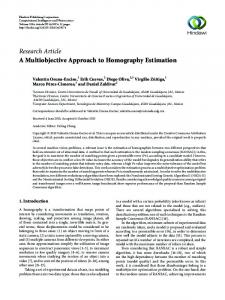
Andries M Heyns
Dissertation presented for the degree of
Doctor of Philosophy in the Faculty of Science at Stellenbosch University
Promoter: Prof JH van Vuuren
March 2016
EXTENDED ABSTRACT: A MULTI-OBJECTIVE APPROACH TOWARDS GEOSPATIAL FACILITY LOCATION
Andries M Heyns
1
Introduction
Facility location (FLo) problems are well-documented in the operations research literature [1, 2, 3, 4, 5]. The aim in these problems is to allocate a number of facilities to candidate locations in a manner that optimises the network’s performance with respect to one, or more, objective function. The research and application scope of traditional FLo problems has expanded in recent times due to factors such as (a) an increase in the need for reliable and efficient telecommunication services, (b) the ever-increasing demand for innovation in respect of military/strategic operations and (c) the increasing need for renewable and sustainable energy sources. These developments have led to a steady rise in research related to geospatial facility location (GFLo), in which the optimal placement of facilities according to terrain and environmental criteria is pursued. GFLo problems are already well-documented and wide-ranging in practical application for facilities with complex location requirements, such as radars, telecommunication towers, watchtowers and wind turbines [6, 7, 8, 9, 10, 11, 12]. In point-based GFLo problems, the aim is to find suitable facility placement configurations at discrete candidate site locations which are contained within a feasible Search Zone (SZ). The process of configuring a candidate solution takes place in the solution space, as illustrated in Fig. 1(a), and such a candidate solution corresponds to a single point in objective function space, as illustrated in Fig. 1(b). The candidate solution’s facility placement configuration is measured with respect to the scores it achieves with respect to the objective functions. When solving covering problems [13], candidate solutions may be evaluated with respect to their influence on sites contained within specified interest zones (IZs), as illustrated in Fig. 1(a). A set of non-dominated solution alternatives, such as those illustrated in Fig. 1(b), are typically presented to one or more
1
decision makers, who desire a diverse set of solutions that offer alternatives in respect of both (a) the proposed site locations, and (b) the expected performance with respect to a set of objectives. In order to solve these complex problems with the aim of satisfying these requirements, multi-objective combinatorial optimisation techniques are typically employed [6, 12, 14, 15, 16, 17]. Problem-specific solution approaches tailored to a single facility type are usually adopted. Point-based GFLo problems are destined to increase in complexity and practical application as a result of requirements such as including more than one facility type in the network and the consideration of multiple geospatial criteria in the problem [18]. The design of a generic, dynamically implementable multi-objective GFLo framework is therefore pursued in this dissertation – with the aim of removing dependency on facility type and allowing for the consideration of a diverse range of geospatial criteria types. A dynamic mathematical foundation, which extends traditional FLo model formulations and eliminates facility-specific solution methodologies, is established. Novel heuristic solution approaches are proposed and implemented in order to accommodate the original concepts considered in the GFLo framework. A computerised concept demonstrator based on this framework is implemented within a generic solution paradigm and accommodates as special cases a variety of popular FLo problems from the literature. The GFLo framework is demonstrated to be a dynamic and useful tool for solving complex GFLo problems that have not previously been encountered, or conceptualised, due to the limitations of problem-specific solution search designs.
2
Research methodology
Following the literature review in the second chapter of the dissertation, the remaining chapters may be summarised into the three sections that follow.
2.1
Generic mathematical framework (Chs 3–4)
Typical GFLo criteria are classified according to similarities that they exhibit, and this provides the theoretical foundation required for the generic mathematical modelling of 2
the geospatial environment. Prior to this dissertation, the FLo problems considered for inclusion in the GFLo framework involved only one type of facility, a single SZ, and a single IZ for GFLo problems with covering objectives – with rare multi-type exceptions [7, 19]. The generic criteria classification allows for GFLo problems to be modelled in a manner that is independent of the type of facility involved in the problem, and allows for a combination of multiple facility types, SZs and IZs to be included in the model for all the classical FLo problems considered. The multi-type, multi-zone (MTZ) extensions of classical FLo problems that are formulated for inclusion (as objectives) in the generic GFLo problem framework are (a) MaxiMin and MiniMax problems, (b) maximal and backup covering location models, and (c) dispersion and centre models [4, 5, 13]. The mathematical modelling of optimal MTZ location constraints for MaxiMin, MiniMax, dispersion and centre models is performed in a similar manner. MTZ functionality is achieved by introducing the novel set-pair concept, whereby facility-SZ pairs are regarded as separate entities. Fig. 2 illustrates this concept in the context of a MTZ dispersion model involving three facility types and five SZs. The conceptualisation and application of MTZ GFLo led to publication in Geographical Analysis [18]. The novel mathematical foundation is performed in such a manner that different combinations of popular FLo problems from the literature, as well as additional userspecific constraints, may be included in a single GFLo problem in a generic manner. For this purpose, a generic mathematical formulation framework for GFLo problems intended for a wide variety of applications is described. The framework is not limited to the customary procedures followed in the GFLo literature, thus facilitating the solution of GFLo problems that were not previously possible, or conceptualised.
2.2
Novel heuristic solution approaches (Chs 5–6)
Two multi-objective optimisation algorithms are applied to MTZ GFLo. The first algorithm, the Non-dominated Sorting Genetic Algorithm-II (NSGA-II) [20], is a popular choice for solving GFLo problems [8, 9, 11, 17, 21, 22]. The second, Asexual Multiobjective Evolutionary-Based Algorithm (AMOEBA), is a novel algorithm developed in this dissertation specifically for the purposes of GFLo. AMOEBA combines a fast and
3
simple single-solution, swap-based search strategy [23], but has been adapted for implementation within a multi-objective, population-based environment. AMOEBA requires minimal parameter testing and tuning, and starts with a single, randomly generated solution only, and rapidly spreads into a population of solutions – much like a virus. Fig. 3 provides an example of the first three stages of an AMOEBA infection spread in objective function space for a GFLo problem with two maximisation objectives. In multiple test studies, AMOEBA consistently outperformed NSGA-II in terms of computation speed, while consistently obtaining results of similar quality. A novel adaptation of the standard chromosome string representation of candidate solutions that is employed in evolutionary algorithms is adopted in both algorithms in order to facilitate MTZ functionality [18], and is illustrated in Fig. 4 for a facility layout involving three facility types and four SZs. A hybridised version of NSGA-II and AMOEBA, the Hybrid Geospatial Algorithm (HGA), is proposed and exploits certain characteristics of the algorithms and their behaviour with respect to the geospatial environment. In multiple example problem instances the HGA outperforms both AMOEBA and NSGA-II in terms of solution quality, yet within computation times similar to AMOEBA and significantly faster than NSGAII. An NSGA-II population halving procedure based on spatial population convergence is investigated, and returned solutions of similar quality to that returned by NSGAII without the halving procedure – however, generally achieved within half the time. Post-optimisation approximation set simplification considerations are investigated, and a spatial proximity-dependent attainment set declustering technique, aimed at simplifying the decision making process, is proposed. A novel Multi-resolution Approach (MRA) was proposed and resulted in publication in Computers, Environment and Urban Systems [24, 25]. The MRA returns superior quality solutions compared to the standard approach of solving a GFLo problem at a single resolution, while computation times are often significantly faster for all three algorithms considered in the dissertation. The MRA is able to identify potentially superior candidate site regions in the SZs and avoids the unnecessary consideration and evaluation of candidate sites in poorer areas. Fewer candidate sites are evaluated as
4
a result, which typically leads to shorter computation times. Fig. 5 shows, in grey, all the locations considered during ten runs of a bi-objective GFLo problem solved at a single resolution, compared to the significantly fewer locations considered during ten runs of the MRA for the same problem. It may be seen for the MRA how certain weaker areas are evaluated at lower resolutions, while some areas are specifically identified and analysed more intensely at higher resolutions. Supplementary GFLo problem instances have illustrated that the MRA is effective in solving problems that consider a diverse range of GFLo criteria and terrain types (e.g. rugged, undulating, small and large) [25].
2.3
Practical implementation (Ch 7)
A generic GFLo decision support system architecture and its components are proposed, and an optimisation interface concept demonstrator of this architecture is developed. An evaluation of observation camera placement within the MeerKAT radio telescope project [26], using the concept demonstrator, was pursued to prove the workability of the framework and resulted in publication in the South African Journal of Industrial Engineering [8]. The NSGA-II and the MRA were used in conjunction to solve the problem of siting three observation cameras (one long range and two short range cameras) in two SZs, with the two objectives of monitoring 64 MeerKAT radio telescope antennas and a large terrain surface area. The study involved collaboration with system engineers who followed a laborious process in choosing the actual sites (a matter of weeks), compared to obtaining site locations using the GFLo framework (a matter of minutes for an optimisation run). The framework’s solutions outperformed the actual configuration and could also predict the interference of any physical structures that may affect facility performance with respect to the visibility objectives. The camera site locations and predicted visibility outcome of one of the framework’s non-dominated solutions are provided in Fig. 7. Feedback from the principal decision maker was positive and has led to the possibility of further collaboration in respect of future facility location sub-projects. An additional selection of realistic GFLo problem instances involving a variety of criteria and facility-SZ assignments that combine objectives and constraints that are absent from the traditional GFLo literature were solved so as to further illustrate the
5
workability of the framework. The novel concepts involved in these GFLo problem instances may spawn new avenues of research in the GFLo domain – an example being the most recent manuscript submitted for publication, on the consideration of multiple IZs in GFLo problems [27].
3
Ongoing and future research applications
The research conducted during the completion of this dissertation has led to numerous practical avenues of application that form the basis of the author’s postdoctoral research. ForestWatch [28] is one of the most advanced automated forest fire detection systems in the world – with detection networks in the USA, Canada, Spain, Australia and South Africa. The GFLo framework is being used to determine optimal fire detection camera tower placement for networks of multi-type cameras and manned lookouts placed in multiple SZs. Multiple visibility covering objectives with respect to multiple IZs are included in the problem, in addition to other criteria such as inter-facility distance and proximity to roads and electricity supply (considered either as objectives or constraints). The author has had numerous meetings and discussions with Grifone Patrol [29], the Rhino Pride Foundation [30] and the Forgotten Parks Foundation [31], with the aim of providing optimal ranger patrol posts, routes and surveillance systems – and MTZ combinations of both – for nature reserves in the Democratic Republic of Congo and South Africa. GFLo criteria considered in such a context include visibility cover determined with respect to multiple IZs, inter-facility distance (e.g. to minimise distances between ranger posts in order to minimise ranger support response times), and proximity to areas known for regular illegal activity. Passive radar networks provide low-cost detection alternatives to traditional radar networks. These networks may be particularly beneficial for the purposes of air traffic control in developing countries with limited financial means, such as those found in Africa [32]. The GFLo framework will be used to propose receiver site combinations in support of research currently being undertaken by the South African Council for Scientific and Industrial Research.
6
4
Resulting publications
The research covered in this dissertation has been published in (a) one article in a peerreview conference proceedings [33], (b) three articles in peer-review journals [8, 18, 24], and (c) one article currently under review in a peer-review journal [27]. Supplementary documentation for the MRA was also made available online [25].
References [1] Drezner, Z. (2012). Facility location: A survey of applications and methods, Springer, New York (NY). [2] Farahani, R. Z., SteadieSeifi, M., & Asgari, N. (2010). Multiple criteria facility location problems: A survey, Applied Mathematical Modelling, 34(7), 1689–1709. [3] Klose, A., & Drexl, A. (2005). Facility location models for distribution system design, European Journal of Operational Research, 162(1), 4–29. [4] Owen, S. H., & Daskin, M. S. (1998). Strategic facility location: A review, European Journal of Operational Research, 111(3), 423–447. [5] ReVelle, C. S., & Eiselt, H. A. (2005). Location analysis: A synthesis and survey, European Journal of Operational Research, 165(1), 1–19. [6] Agarwal, P. K., Bereg, S., Daescu, O., Kaplan, H., Ntafos, S., Shrir, M., & Zhu, B. (2005). Guarding a terrain by two watchtowers, Proceedings of the Twenty-First Annual Symposium on Computational Geometry, 346–355. [7] Bao, S., Xiao, N., Lai, Z., Zhang, H., & Kim, C. (2015). Optimizing watchtower locations for forest fire monitoring using location models, Fire Safety Journal, 71(1), 100–109. [8] Heyns, A. M., & van Vuuren, J. H. (2015). An evaluation of the effectiveness of observation camera placement within the MeerKAT radio telescope project, South African Journal of Industrial Engineering, 26(2), 10–25. [9] Kim, Y., Rana, S., & Wise, S. (2004). Exploring multiple viewshed analysis using terrain features and optimisation techniques, Computers and Geosciences, 30(9–10), 1019–1032. [10] Krzanowski, R. M., & Raper, J. (1999). Hybrid genetic algorithm for transmitter location in wireless networks, Computers, Environment and Urban Systems, 23(5), 359–382. [11] Murray, A. T., Kim, K., Davis, J. W., Machiraju, R., & Parent, R. (2007). Coverage optimization to support security monitoring, Computers, Environment and Urban Systems, 31(2), 133–147. [12] Serrano-Gonz´ alez, J., Burgos-Pay` an, M., & Gonz´alez-Longatt, F. (2013). A review and recent developments in the optimal wind-turbine micro-siting problem, Renewable and Sustainable Energy Reviews, 30(1), 133–144. [13] Farahani, R. Z., Asgari, N., Heidari, N. (2012). Covering problems in facility location: A review, Computers and Industrial Engineering, 62(1), 368–407. [14] Akella, M. R., Delmelle, R., Batta, R., Rogerson, P., & Blatt, A. (2010). Adaptive cell tower location using geostatistics, Geographical Analysis, 42(3), 227–244.
7
[15] Franklin, W. R. (2002). Siting observers on terrain, Proceedings of the 10th International Symposium on Advances in Spatial Data Handling, 109–120. [16] Ghose, D., Prasad, U. R., & Guruprasad, K. (1993). Missile battery placement for air defense: A dynamic programming approach, Applied Mathematical Modelling, 17(9), 450–458. [17] Kim, K., Murray, A. T., & Xiao, N. (2008). A multiobjective evolutionary algorithm for surveillance sensor placement, Environment and Planning B: Planning and Design, 35(5), 935–948. [18] Heyns, A. M., & van Vuuren, J. H. (2017). Multi-type, multi-zone facility location, Geographical Analysis, In Print. [19] Curtin, K. M., & Church, R. L. (2006). A family of location models for multiple-type discrete dispersion, Geographical Analysis, 38(3), 248–270. [20] Deb, K., Pratap, A., Agarwal, S., & Meyarivan, T. (2002). A fast and elitist multi-objective genetic algorithm: NSGA-II, IEEE Transactions on Evolutionary Computation, 6(2), 182–197. [21] Kwong, W. Y., Zhang, P. Y., Romero, D., Moran, J., Morgenroth, M., & Amon, C. (2014). Multiobjective wind farm layout optimization considering energy generation and noise propagation with NSGA-II, Journal of Mechanical Design, 136(9), 1–10. [22] Tran, R., Wu, J., Denison, C., Ackling, T., Wagner, M., & Neumann, F. (2013). Fast and effective multi-objective optimisation of wind turbine placement, Proceedings of the 15th Annual Conference on Genetic and Evolutionary Computation, 1381–1388. [23] Teitz, M. B., & Bart, P. (1968). Heuristic methods for estimating the generalized vertex median of a weighted graph, Operations Research, 16(5), 955–961. [24] Heyns, A. M., & van Vuuren, J. H. (2016). A multi-resolution approach towards point-based multi-objective geospatial facility location, Computers, Environment and Urban Systems, 57(1), 80–92. [25] Heyns, A. M., & van Vuuren, J. H. (2016). Supporting documentation for the multi-resolution approach [PDF file]. Retrieved from http://www.vuuren.co.za/papers/mradoc.pdf. [26] Square Kilometre Array Africa. (2017). Retrieved from http://www.ska.ac.za. Accessed on 13 October 2017. [27] Heyns, A. M. (2017). Towards multiple cover zones in geospatial facility location problems, Operational Research, Under Review. [28] EnviroVision Solutions. 13 October 2017. [29] Grifone Patrol. 13 October 2017.
(2017).
(2017).
Retrieved
Retrieved
from
from
http://www.evsusa.biz.
Accessed
on
http://www.grifonepatrol.com.
Accessed
on
[30] Rhino Pride Foundation. (2017). Retrieved from http://www.rhinopridefoundation.org. Accessed on 13 October 2017. [31] Forgotten Parks Foundation. (2017). Retrieved from http://www.linkedin.com/company/ 19444426/. Accessed on 13 October 2017. [32] Inggs, M., Tong, C., Nadjiasngar, R., Lange, G., Mishra, A., & Maasdorp, F. (2014). Planning and design phases of a commensal radar system in the FM broadcast band, IEEE Aerospace and Electronic Systems Magazine, 29(7), 50–63. [33] Heyns, A. M., & van Vuuren, J. H. (2013). Terrain visibility-dependent facility location through fast dynamic step-distance viewshed estimation within a raster environment, Proceedings of the 42nd Annual Conference of the Operations Research Society of South Africa, 112–121.
8
Gridposts Interest points Candidate site locations Sites included in candidate solution
11 00
00 11 11 00 11 00 11 00 00 11 11 00 11 00 11 00 11 00 11 00 11 00 00 11 11 00 11 00 11 00 11 00 11 00 11 00 00 11 11 00 11 Interest Zone 00 11 00 11 00 Candidate 11 00 11 00 11 00 11 00 11 00 solution 00 11 00 11 00 11 00 11 00 11 00 11 11 00 11 00 11 00 11 00 11 00 11 00 11 00 11 00 11 00 00 11 00 11 00 11 00 11 00 11 00 11 00 11 00 11 00 11 00 11 11 00 11 00 11 00 11 00 11 00 11 00 11 00 11 00 00 11 00 11 00 11 00 11 00 11 00 11 00 11 00 11 00 11 00 11 11 00 11 00 11 00 11 00 11 00 11 00 11 00 11 00 00 11 11 00 11 00 11 00 11 00 11 00 11 00 11 00 00 11 11 00 11 00 00 11 0 1 00 11 0 1 00 11 00 11 00 11 11 00 11 00 00 11 1 0 11 00 1 0 11 00 1 0 00 11 1 0 00 11 0 1 00 11 0 1 00 11 00 11 11 00 11 00 11 00 11 00 11 00 11 00 11 00 00 11 0 1 00 11 0 1 00 11 00 11 11 00 11 00 11 00 11 00 11 00 11 00 11 00 1 0 00 11 1 0 11 00 11 00 00 11 1 0 11 00
Objective 2 (maximise)
Search Zone
Non-dominated solutions (Pareto-front) Dominated solutions
Solutions dominated in terms of Objective 1 Superior solutions Candidate solution
Inferior solutions
Solutions dominated in terms of Objective 2
Objective 1 (maximise)
(a) Solution space (top view)
(b) Objective function space
Figure 1: (a) Point-based representation of terrain and candidate sites and its application to GFLo problems in solution space. (b) Candidate solutions, such as the example in (a), correspond to points in objective function space – decision makers desire the set of non-dominated solutions.
9
1
2 5
Facilities of type 1 Facilities of type 2 Facilities of type 3 Facilities in SZ 1 Facilities in SZ 2
3
Facilities in SZ 3
4
Facilities in SZ 4 Facilities in SZ 5
(a) Random facility layout
(b) Facility types and SZs to which they belong
1
2 5
3
4
F 1 = { 1, 1, 2, 2, 3, 3 } S 1 = { 1, 4, 2, 3, 2, 5 }
disperse
F 2 = { 1, 2, 3 } S 2 = { 3, 1, 4 }
(c) Set-pair dispersion
Figure 2: An illustration of the set-pair concept in the context of MTZ facility dispersion [18], for a GFLo problem instance involving three facility types and five SZs. A facility layout after dispersion has been performed according to specified facility-SZ set pairs is provided in (c).
10
Objective 2
Source amoeba
Objective 2
Objective 2
Parent strains Feasible offstring strains, resulting from parent mutations Infeasible offspring strains Non−dominated strains selected from parents and offspring, to proceed as parent strains of next infection stage
Objective 1
Objective 1
Source infection and mutations
Objective 1
Second infection and mutation stage
Third infection and mutation stage
Next infection stages
Figure 3: The first three stages of an AMOEBA infection spread. The algorithm was developed in the dissertation specifically for the purposes of GFLo.
Transmitter (f = 1)
Short range camera (f = 2)
SZ 1
Long range camera (f = 3)
SZ 3
23
55
62
70
23 SZ 4
25
55
9
62
70
f =1 f =2 f =2 f =1 f =2 f =3
SZ 1 SZ 2 SZ 3
SZ 4
(b) Chromosome representation of solution in (a)
9
25
SZ 2
(a) Facility sites of candidate solution
Figure 4: (a) A facility layout involving three facility types and four SZs. (b) The corresponding MTZ GFLo candidate solution representation scheme of the layout.
11
13 115 sites evaluated 156 sites in non-dominated solutions
5 784 sites evaluated 148 sites in non-dominated solutions
(a) Ten runs single−resolution
(b) Ten runs MRA
Figure 5: (a) Candidate locations (indicated by grey markers) evaluated during ten runs of a single-resolution approach, compared to (b) candidate locations evaluated during ten runs of the MRA for a bi-objective GFLo problem instance involving two SZs and two facility types. Red and blue markers indicate the site locations of the two respective facility types included in the non-dominated solutions. The study area measures 10 × 10 km.
12
13 (b) Constraint selection
(d) MRA parameters
(e) Algorithm selection and parameters
(c) Facility−SZ assignment
Figure 6: The optimisation interface concept demonstrator of the generic GFLo framework.
(a) Objective selection
Figure 7: Visibility results for a non-dominated solution obtained in the real-world observation camera placement study, which was performed in collaboration with system engineers from the MeerKAT radio telescope project [8]. The terrain measures 7×9 km.
14