navigation and transport management are mainly based on static data about traffic ... The sources of such information are mainly field operators and ... Real-time traffic information is a basis for mobile and Web accessible services that support.
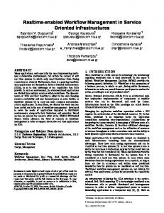
A Real-Time Traffic Information Service for Efficient Navigation and Transport Management Milos Roganovic, Dragan Stojanovic, Bratislav Predic University of Nis, Faculty of Electronic Engineering, Nis, Serbia {milos.roganovic, dragan.stojanovic, bratislav.predic}@elfak.ni.ac.rs
INTRODUCTION Recent advances in mobile devices, wireless communications and mobile positioning technologies enables development of advanced mobile and Web information services to support efficient and secure travel of people and transport of goods. Current mobile applications for navigation and transport management are mainly based on static data about traffic conditions, road surface status, weather conditions, etc. Dynamic traffic information about events that occur in a real time, such as, traffic congestions, traffic accidents, slippery road, road works etc., can significantly improve the functionality and usability of these services (Eriksson et al., 2008) (Santa at al., 2009). Road operators, policy departments and public organizations usually collect and deliver specific traffic information, e.g. road works and radar patrol locations, and publish such information via Web, or radio channels (RDS-TMC). The sources of such information are mainly field operators and sensors integrated in the road infrastructure. In this paper, we particularly focus on vehicles and drivers as the primary sources of traffic information.
A SERVICE FOR COLLECTION AND DELIVERY OF REAL-TIME TRAFFIC INFORMATION Real-time traffic information is a basis for mobile and Web accessible services that support efficient and safe travel of people and transport of goods. The service we developed and described in the rest of the paper collects real-time traffic information from different sources and geo-referencing them on a road network, especially information generated by in-vehicle mobile applications, and mobile users/drivers. The service provides functionality to process, integrate, and deliver traffic information to appropriate users/drivers according to their route and preferences following push notification paradigm (Figure 1).The traffic information service is based on the service platform for development of location-based and contextaware mobile and Web information services – MOWIS (ICEST 2009).
Figure 1: Traffic Information Service The main traffic information sources considered in this paper are users of mobile applications. They can create such information by manual or semi-automatic entry of multimedia data that describe traffic events, or such information can be generated by mobile application itself using data from available sensors (GPS, accelerometer, etc.). Generated traffic information is sent to the central service for storing and integration. The service forwards relevant traffic information to other
AGILE 2011, April 18-22: Milos Roganovic, Dragan Stojanovic, Bratislav Predic
users/drivers either on request or as push notification according to their current location, intended route and preferences. When user/driver or its in-vehicle mobile application detects the particular event, he describe occurred event using appropriate screen form, add camera picture of event, select type of event, predict duration, start and end time, and send it to the traffic information service (figure 2 a). Mobile application automatically adds current GPS location. The mobile application also provides an automatic detection of traffic events by using sensors on mobile device in-vehicle or sensors (activation of ABS, ESP, etc). For example, if the current speed obtained with a GPS sensor or speedometer is dramatically less than the typical rate for a given segment of road, mobile applications can conclude that there was a traffic jam or slow traffic and send the appropriate message to the traffic service in the form of an XML document. The traffic information service references traffic events on a road network and integrates received information. Using road network obtained from OpenStreetMap services, the traffic service transforms map coordinates into segment of road network (map matching) with defined distance from segment endpoints, the length of the segment affected by detected traffic event, as well as the direction. To provide integration of traffic events on the road network, a PostGIS / PostgreSQL spatio-temproal database is used, which stores traffic event data, such as identifier, road segment identifier, distance from endpoints, start and end time, picture location, etc. Service is developed using WCF, Microsoft .NET technology.
(a)
(b)
(c)
(d)
Figure 2: Mobile application client Clients of traffic information service can request traffic information in push and pull mode.. In pull mode, clients access the service by creating a request that contains a geographical area and the types of events that are observed. Depending on the created request the service sends response in the appropriate format. Push clients are registered to the system and get information about registered events proactively. Such users previously requested and obtained a best/shortest route form the service that is also stored in the database. Intended routes used by the service to notify a mobile user about occurred events on her route (figures 2 b and 2 c), and to offer an alternative route to the destination (figure 2d). Users can choose one of the standardized response formats such as tpegML, DATEX II or GML. En example of WFS response is shown on Fig 3. Each type of request is forwarded to the appropriate service function that is responsible for processing, formatting, and delivery of the requested data. Enabling the WFS interface, the traffic information service can be easily incorporation into existing GIS applications, as shown on figure 4.
2
A Real-Time Traffic Information Service for Efficient Navigation and Transport Management
Figure 3: WFS response of traffic information service
Figure 4: A Web GIS application client
CONCLUSIONS Collection and delivery of dynamic traffic information on events on the road network and traffic conditions greatly improve traffic, reduce fuel consumption and also reduce pollutant emissions. The important parts of such cooperative system are mobile users/drivers that generate and use real-time traffic information through specific mobile GIS application and a service that provides processing, integration and exchanges of such information.
3
AGILE 2011, April 18-22: Milos Roganovic, Dragan Stojanovic, Bratislav Predic
BIBLIOGRAPHY Eriksson, J., Girod, L., Hull, B., Newton, R., Madden, S., and Balakrishnan, H. 2008. The pothole patrol: using a mobile sensor network for road surface monitoring. Proc. of the 6th Int. Conf. on Mobile systems, applications, and services, USA, 2008, pp. 29-39. Santa, J. and Gómez-Skarmeta, A.F. 2009. Sharing Context- Aware Road and Safety Information. IEEE Pervasive Computing, Vol. 8, No. 3, 2009, pp. 58-65. Stojanovic, D. Predić, B., Đorđević-Kajan, S. 2009. A Service Platform for Context-Aware Mobile Transport-Related Information Services. ICEST 2009, Bulgaria, June 2009, Vol. 1, pp. 301304
4