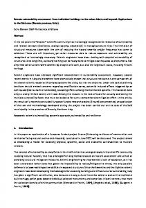
A Unique Vulnerability Assessment Methodology for Agricultural Disasters
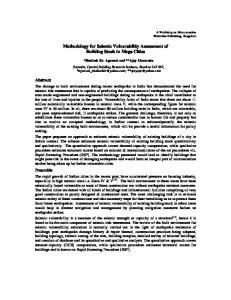
CEGIS professionals carrying out field level workshops with various livelihood group members.
Focusing on drought and flood hazards in the agricultural sector, CEGIS professionals conducted a unique vulnerability study in four pilot upazilas (including char lands) in the two northwestern districts (Gaibandha and Dinajpur) of the country. The study was undertaken with financial and technical support from FAO and developed closely with the Department of Agricultural Extension (DAE) project “Support to the Strengthening of Disaster Preparedness in Agricultural Sector (SSDP)”.
than seventeen local level workshops which involved both local community stakeholders and institutional professionals. The study, with its multidimensional approach that integrated issues of environment, livelihoods and institutions, can also be replicated or utilized in other areas of disaster management. Future adoption of this integrated vulnerability assessment method in other wider initiatives, such as comprehensive disaster management, sustainable livelihoods development, and adaptation to climate change, could prove useful. The method has potential for use in both micro and meso level vulnerability reduction initiatives.
Taking an integrated local level approach, the study looked into the multiple aspects of environment, vulnerable livelihood groups and institutional domain of the study areas. The multi-disciplinary CEGIS team comprising an anthropologist, senior hydrologist, drought expert, flood expert and field researchers, contributed to the study with specialized knowledge useful for local level agricultural vulnerability assessment. An innovative vulnerability assessment methodology, which has great potential for use in other areas of the country as well, has been derived from the study. Under the overall supervision of the anthropologist and vulnerable group-profiling expert of CEGIS, the study team also carried out more
Some of the concrete outputs of this study included development of an innovative methodology for vulnerability assessment at local level, micro level hazard maps (drought and flood), vulnerable group profiling and so forth. Findings of the study are expected to contribute to the overall capacity building process of the DAE and disaster preparedness initiatives in the agricultural sector.
Legend
Ghoraghat Upazila
Drought class Yield loss (%)
T. Aman (dry year)
Very slight 40 Settlements and not T. Aman area
Bulakipur
N
Singra 2
0
2
4 Km
Palsa
Ghoraghat
Figure 2: Hazard maps produced under the study.
2
5 05 e 0 suary 2
IsJanu
the CEGIS
N E W S L E T T E R Bi-annual bulletin of the Center for Environmental and Geographic Information Services (CEGIS)
CEGIS at SoftExpo 2004 CEGIS participated in "SoftExpo2004", the biggest fair on software products, IT Enabled Services (ITES) and Information Communication Technology (ICT) systems solutions in Bangladesh. The event was held at the Bangladesh-China Friendship Conference Centre on 25 -29 November 2004. More than 120 local (government & non government) and international ICT companies took part in the event to introduce their service capabilities. CEGIS receives award for stall (see page 8 for details).
Inside q Vulnerability Assessment Methodology for Agricultural Disasters q Community Participation in Flood Management q Workshop News q Methodology to Compute Inundation Dynamics q Satellite Images q Flood Monitoring 2004 q CEGIS at the Third South Asia Water Forum q CEGIS Publications in 2004
Wishing our readers a very Happy New Year!
Center for Environmental and Geographic Information Services House #6, Road #23/C, Gulshan-1, Dhaka-1212, Bangladesh Phone: 8817648-52, 8821570-2 Fax: 880-2-8855935, Email:
[email protected] Web: www.cegisbd.com
CEGIS participated in the event jointly with the Support to ICT Task Force (SICT) project of the Planning Commission, Institute of Water Modeling (IWM) and the Roads and Highways Department. CEGIS displayed its various IT related service capabilities, especially those it offers to various government institutions. The focus was on its GIS, RS and database related services that include the National Water Resources Database (NWRD), Integrated Coastal Resources Database (ICRD), Aquatic
WATSURF: a new software for water surface forecasting A GIS based flood forecasting information system software named 'WATSURF' has been developed under the project “Community based Information System (CFIS)”. A joint undertaking of CEGIS and Riverside Technology inc. (RTi), USA, CFIS aims at flood risk reduction by providing flood prediction information to the community. The software has been developed in the context of a study area of 250 km2 in Daulatpur and Nagarpur Thana of Manikganj and Tangail districts, respectively. WATSURF uses water levels of the Jamuna River at Sirajganj and the Padma River at Aricha forecasted by the Flood Forecasting and Warning Center (FFWC). The purpose is to estimate 48
Figure 1: Information flow under WATSURF.