water Article
Implications of Human Activities, Land Use Changes and Climate Variability in Mediterranean Lakes of Greece Konstantinos Stefanidis 1,2 , Aikaterini Kostara 1 and Eva Papastergiadou 1, * 1 2
*
Department of Biology, School of Natural Sciences, University of Patras University Campus Rio, GR 26500 Patras, Greece;
[email protected] (K.S.);
[email protected] (A.K.) Department of Water Resources and Environmental Engineering, School of Civil Engineering, National Technical University of Athens (NTUA), 5, Iroon Politechniou Street, 15780 Zografou, Athens, Greece Correspondence:
[email protected]; Tel.: +30-26-1096-9245
Academic Editors: Erik Jeppesen, Martin Søndergaard and Wayne O’Connor Received: 29 June 2016; Accepted: 19 October 2016; Published: 26 October 2016
Abstract: Lakes in the Mediterranean climate zone experience high variation in rainfall and are vulnerable to changes in climate, land cover and anthropogenically induced effects on water level and salinity. This paper presents the results from the analyses of spatiotemporal changes of land cover/uses at catchment scale of two connected lakes in Greece that have recently exhibited a dramatic loss of water volume, and investigates the potential role of climate change as a main driver of the lake water loss. The classification of the historical land cover/uses was based on a series of LANDSAT images from 1972 to 2011. Changes in the landscape structure were assessed using landscape metrics that were calculated with FRAGSTATS software. Climate data and temporal series of water level, conductivity and chloride concentration, were analyzed to investigate the potential role of climate variability to the lake hydrology and water quality. The results showed that between 1972 and 2011 almost 28% of Lake Vegoritis and 13% of Lake Petron were replaced by cultivations and reed beds. Landscape metrics showed that the lake catchment’s area is highly fragmented, indicating a heterogeneous spatial pattern and degradation of the rural habitats. Regarding the climatic factors, it appears that precipitation follows a declining trend correlating with water level fluctuations. The water level in Lake Vegoritis also correlated with the conductivity and chloride concentration, indicating a relationship between hydrological alteration and water quality. Overall, a combined effect of climate- and human-induced land cover changes appeared to be responsible for the drastic environmental changes that urge the need for implementing effective restoration and mitigation measures. Keywords: water level fluctuations; land cover/use changes; landscape metrics; climate variability; mediterranean region
1. Introduction Land cover/use alterations are widely considered as a dominant stressor for the water quality and freshwater ecosystems status within watersheds [1]. In particular, human activities and climate change are considered the most important factors that determine the impact of land cover/use changes on the water bodies around the world [2,3]. On a catchment scale, land uses associated with human presence can significantly alter natural hydrological processes such as runoff and ground water recharge with subsequent effect on the balance between supply and demand of water resources [1,4]. In particular, the hydrology of the freshwater ecosystems, especially those of the dry regions of the world, significantly relies on water level fluctuations, which are closely related to the human pressure Water 2016, 8, 483; doi:10.3390/w8110483
www.mdpi.com/journal/water
Water 2016, 8, 483
2 of 17
from irrigated cultivations [5]. Moreover, land cover/use changes also affect ecosystem processes like nutrient transportation from watershed sources to lakes [6]. In addition, land cover/use changes may not only increase the demands for domestic and agricultural use of water but can also affect nutrient loading and nutrient leaching mechanisms. In the Mediterranean region, climate change is expected to enhance many of these processes not only through changes in the major climate variables (precipitation, air temperature) but also due to predicted land use alterations. Recently, Pulido-Velasquez et al. [7] showed that the combined climate and land use change scenarios predicted a larger effect on the groundwater recharge in the Mancha Oriental aquifer system than climate change only. Such effects are likely to lower water tables and affect water supply, especially in areas where water abstraction will be intensified in order to meet the growing demand for water [8]. Other examples from Greece showed that historical land cover/use changes of lakes and wetlands revealed a significant shrinkage of water surface and its replacement with other types of land cover, mainly cultivations [9–11]. Consequently, these land use changes combined with climate induced hydrologic alterations are expected to have a drastic effect on the ecology of freshwater lakes, including changes of the biotic communities, eutrophication enhancement, increase of turbidity and a shift to brackish or even saline conditions [12–14]. Therefore, understanding the dynamics of land cover/uses in a changing climate and their impacts on freshwater systems is a matter of priority for remote sensing and landscape ecology. Remote sensing techniques are commonly used throughout the world to monitor land cover/use changes [15,16]. Particularly in lake ecology, satellite images and aerial historical photos can provide detailed information on the spatiotemporal changes of land cover/uses and can therefore be used to assess the impacts on various components of ecosystem integrity [15,17]. Recently, Pilgrim et al. [15] applied remote sensing analysis to assess the changes of water quality in a lake of South Carolina (USA) due to related changes of the catchment’s land cover. Other studies investigated the role of climate change for the spatiotemporal changes of lake area [15,16], showing that remote sensing techniques have the potential to be an efficient tool for assessing the role of multiple pressures on lake ecosystems. In this paper, we investigated the spatial and temporal changes of land cover/use and landscape structure of two connected Greek lakes that have exhibited a dramatic loss of water volume during the last four decades. We also examined the potential role of climate as a main driver of the water loss by assessing climate data (precipitation, mean air temperature, evapotranspiration and aridity index) for a thirty-year period and identify climate change trends in the area that might have influenced the pattern of the inter-annual water level fluctuations and land cover/use and landscape changes. Land cover changes were highlighted using remote sensing and spatial analysis techniques and the results were associated with major consequential ecological changes that have been recorded in the case study. Additionally, temporal landscape changes were examined using of commonly applied landscape metrics. Results were examined and discussed within the framework of the overall ecological impact. 2. Materials and Methods 2.1. Description of the Study Area Vegoritis and Petron are two Mediterranean karstic lakes located in the northern part of Greece (Macedonia region) and are listed in the protected areas of the Natura 2000 network (Figure 1). The whole Natura 2000 site is surrounded by high mountains at the northeastern and northwestern boundaries, while in the southern flat part a large plain area extends [18]. Agricultural activity and urban development are mainly located within the southern part of the basin. The important geological formations of the area include mostly metamorphic siliceous rocks and calcareous formations [18]. The climate of the area is semi-dry, Mediterranean, with two distinct, warm-dry and cold-wet, periods. Lake Vegoritis is an ice-free lake [19], with a surface area of approximately 40 km2 and a mean depth of 28.9 m and a maximum depth of approximately 40 m. For the last five decades, the lake has suffered from various environmental pressures, such as agricultural and industrial driven pollution.
Water 2016, 8, 483
3 of 17
Water 2016, 8, 483
3 of 16
suffered from various environmental pressures, such as agricultural and industrial driven pollution.
The water volume of the lake has decreased dramatically, causing a water level drop of approximately The water volume of the lake has decreased dramatically, causing a water level drop of 32 m,approximately from 542 m a.s.l. 1956 tom a.s.l. 510 m in a.s.l. into 510 2002. m This water level change with a 32 m, in from 542 1956 a.s.l. in 2002. This water has level coincided change has gradual change of the trophic state from oligotrophic at the beginning of the 1980s to mesotrophic coincided with a gradual change of the trophic state from oligotrophic at the beginning of the 1980s during the 1990s [18,19]. Lake receives from the smaller shallower Lake Petron to mesotrophic during the Vegoritis 1990s [18,19]. Lake inflow Vegoritis receives inflow and from the smaller and shallower Lake Petron that is situated a few kilometers away. Lake Petron has a surface area of 8 that is situated a few kilometers away. Lake Petron has a surface area of 8 km2 , a mean depth of 2.6 m 2, a mean depth of 2.6 m and a maximum depth of 5 m. The lake used to be deeper with a km and a maximum depth of 5 m. The lake used to be deeper with a maximum depth of around 10 m, maximum depth of around 10 m, but due to changes of the hydrological regime in the area the water but due to changes of the hydrological regime in the area the water volume has decreased, causing reed bedsvolume has decreased, causing reed beds to expand in the shallower part of the lake. to expand in the shallower part of the lake.
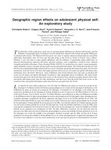
Figure 1. Location of the studied area in north Greece. Figure 1. Location of the studied area in north Greece.
2.2. Climate Data 2.2. Climate Data In order to investigate the trends of precipitation and air temperature of the studied area, we In order to investigate the trends of precipitation and air temperature of the studied area, we used used all available data from four meteorological stations from 1959 to 1994. We then calculated the all available from four meteorological stations from 1959 to 1994. We then potential data evapotranspiration (PET) based on the Thornthwaite method [20] calculated according the to potential the evapotranspiration (PET) based on the Thornthwaite method [20] according to the following equations: following equations:
PETi= 11.6 .6 0 T i / I ) ×aa PETi ×(110Ti/I
(1)
(1)
where Ti is the mean monthly temperature and I is an empirical factor calculated from the sum of
where Ti is the mean monthly temperature and I is an empirical factor calculated from the sum of the the twelve mean air temperatures twelve mean air temperatures
I (Ti / 5)
I=
(2)
∑ (Ti/5)
(2)
The factor a is given by the following formula:
The factor a is given by the following formula:
a = (6.75 × 10⁻⁷)I3 − (7.71 × 10⁻⁵)I2 + (1.792 × 10⁻²)I + 0.49239
a = (6.75 × 10
−7 3
)I − (7.71 × 10
−5 2
)I + (1.792 × 10
−2
(3)
)I + 0.49239
(3)
The PET values were used in order to calculate the Aridity Index [21] according to the following equation: The PET values were used in order to calculate the Aridity Index [21] according to the
following equation:
AI P / PET
where P is the annual precipitation and PET is the evapotranspiration. AI = P/PET
(4)
(4)
where P is the annual precipitation and PET is the evapotranspiration. The AI is a climatic index that can be used to quantify the precipitation availability over the atmospheric water demand [21]. According to the classification limits of AI (Table 1), the AI can be used to identify the wet and the dry years.
Water 2016, 8, 483
4 of 17
Table 1. Classification limits of the Aridity Index according to the UNEP (1992). Climatic Zone
P/PET (Thornthwaite Method)
Hyper-arid Arid Semi-arid Sub-humid Humid
0.65
2.3. Water Level and Chemistry Data In addition to the climate data, we acquired long-term water level data from the Department of Environment, Region of Western Macedonia for the period 1896 to 2002. We also used time series of electrical conductivity and chloride concentration measurements ranging from 1983 to 2011. Chloride concentration and conductivity have been used in several studies as indicators for salinization process and water quality deterioration related to climate change [22,23]. 2.4. Satellite Image Pre-Processing and Interpretation of Satellite Image Time Series Four series of LANDSAT images (1972, 1984, 2002 and 2011) were acquired from the Global Orthorectified Landsat Data via FTP [24]. The most remarkable differences between Landsat MSS and TM sensors are recognized in spatial resolution (60 m and 30 m, respectively) and spectral properties [25]. Based on the selected MSS and TM dataset, a series of pre-processing has to be performed prior to the classification and change detection procedures. These steps include: (1) co-registration; and (2) radiometric calibration. In fact, change detection requires that image extracts pairs for the evaluation period have to be as comparable as possible in terms of geometric and radiometric qualities [25]. Regarding first step, all TM images were geometrically corrected to that of 2011; the MSS imagery MMS (1972) was also resampled to the TM (30 m) imagery resolution. Rectification resulted in the images having a root mean square error (RMSE) of