Jul 1, 1991 - An Extended Relational Database for Remotely. Sensed Image Data Management Within GIS. Hazem M. Raafat, Member, IEEE, Qinghan Xiao, ...
I E E E TRANSACTIONS ON GEOSCIENCE A N D REMOTE SENSING, VOL 29. K O 1. J U L Y 1991
65 I
An Extended Relational Database for Remotely Sensed Image Data Management Within GIS Hazem M . Raafat, Member, IEEE, Qinghan Xiao, Student Member, IEEE, and David A . Gauthier
Abstract-It is now possible to analyze the dynamic phenomena of the Earth’s surface. This is due to the increase in the number of remotely sensed images obtained from resource satellites or low-level airborne platforms and the growing number of geographical information systems (GIS) used to incorporate remotely sensed data. The integration of remotely sensed data within GIS raises the possibility of establishing a database structure that can be used to store and retrieve image histories in the management of those image data. The capability for temporal queries allows for management of image retrieving strategies and detection of significant changes in land use or environmental conditions through multitemporal remotely sensed images within GIS. However, databases in use today generally represent a snapshot of the current data; they a r e neither satisfactory for storing the image processing histories nor for analyzing the dynamics of a series of remotely sensed data. In this paper we review the concepts of valid time and effective time and the structures of static and historical databases. Then a time domain and extended relational algebra a r e introduced into the database management system (DBMS) to manage image-processing histories and analyze remotely sensed data through time. Based on this new database structure, it is possible to develop the image processing strategies and analyze the relations among remote sensing data over a period of time.
I . INTRODUCTION YSTEMATIC and effective manipulation of remotely sensed data is necessary for the utilization of data from resource satellites and low-level airborne platforms for monitoring and analyzing the dynamic phenomena of the Earth’s surface. Because data capture is sequential over time, multiple images for any particular area contain potential information about changes of surface features or conditions. Information on topological relationships and attributes of features within an area for each image can be stored within a geographical information system (GIs). A GIS can allow retrieval and manipulation of the spatial elements of time-specific data captured by remote sensing methods or other means.
S
Manuscript received July 19, 1990; revised Februarq 28, 1991. This work was partially supported by the Natural Scicnces and Engineering Research Council of Canada (NSERC) through Grant A8154. by the Faculty of Graduate Studies and Research. Universtiy of Regina, and by the K . C . Wong Education Foundation, Hong Kong. H . M . Raafat is with the Department of Computer Scicnce. University of Regina, Regina, SK S4S OA2. Canada. Q. Xiao is on leave from the Remote Sensing Satellite Ground Station. Academic Sinica, Beijing, China. He is now with the Department of Computer Science, University o f Regina. Regina. SK S4S OA2. Canada. D. A . Gauthier is with the Department o f Geography. University of Regina, Regina, SK S4S OA2, Canada. IEEE Log Number 9 I0047 I .
GIS database structures most commonly in use today are designed to represent a snapshot of the current data. This static approach is generally unsatisfactory for a query of the image histories as well as for temporal analyses of the dynamics of Earth-surface features. New functions for databases based on both temporal and spatial concepts are needed. This paper provides a conceptual database structure which can serve as a basis for storing and retrieving multitemporal remote sensing images within a GIs. First, the concept of time important to a temporal database is described. Secondly. the characteristics of a relational database structure are discussed. Then a time domain is introduced into DBMS for handling the image historical information and analyzing the remote sensing data through time. To overcome the weakness of the current databases, a multitemporal database structure is presented by extending relational algebra into a GIS remote sensing image-management system. Finally, some examples of the application of the temporal database in forestry management are provided to illustrate its value in the investigation and analysis of Earth-surface changes embodied in time-varying remotely sensed data. OF T I M E 11. DESCRIPTION In recent years several proposals which deal with time domains in database structures have been reported [ 11[ 3 ] . Time can be measured in different units (minutes, hours, days, etc.). When time domains are added into computer systems, they can vary with different applications. The user can choose time representation either as a time-point or as a time-interval. A time-point representation is used to record an event that occurs at a given time-point. The time-interval refers to a time boundary over which an event is valid. In this kind of representation, the time attributes are expressed as a time pair [ t , , t r ) . Here t , is the time when a processing result is recorded into the database; t, is written into the database as soon as the processing result is updated. When time domains are discussed, some papers also make a distinction between valid time and effective time [2]-[4]. In a traditional database, time is usually treated as a single parameter equivalent to the time on a running clock, generally called “physical time” or “valid time.” Valid time begins when the first data is entered into the database and ends with the last data entry. However, this time mark alone is insufficient for GIS remote sensing image data management.
0196-2892/91/0700-065lSOl 00
c
1991 IEEE
652
lEEE TRANSACTIONS ON GEOSCIENCE AND REMOTE SENSING. VOL. 29. NO. 4. JULY
Let us consider using multitemporal remote sensing images to detect forest boundary changes. Data from a forest remote sensing image for a particular area and date are successfully stored in a GIS database, and a subsequent image of the same area is received. If this data is incorporated in the same database as the first image, the second image data will replace the first one unless an additional time parameter is added. For example, extra time marks are required to address queries about forest-boundary changes across time. Many articles dealing with temporal databases add another time mark into the database management system. This time is used to mark the situation changes and is referred to as “logical time” or “effective time” [5]-[7]. It can be changed by a user at will. Effective time allows temporal queries of data to be addressed from successive remotely sensed images. Different authors use different definitions of valid and effective time 141-[6]. In this paper valid time is defined as the time when the data describing an event were stored in the database. Effective time is the time that an event occurs in reality. A valid time value may not be changed after it is added to the database. Effective time values are always subject to change. Valid time is application independent, while effective time is generally considered to be application dependent. 111. STATIC DATABASE STRUCTURE
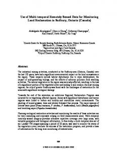
Many current GIS database frameworks are two-dimensional in structure, lacking a temporal positioning capability. In the static model, a database is a collection of relations. Each relation consists of a set of tuples with the same set of attributes. It is changed dynamically. based on a snapshot of attributes at a particular point in time. The state of a database is the current data; past states of the database are discarded and irretrievable. This kind of database is represented as a two-dimensional table (Fig. l ) , which is the standard GIS database structure. For example, remotely sensed data for a particular place and time may be expressed as in Table I. The location refers to a specific flight path and row (i.e., image). The receiving date is the date of data captured by the remote sensing device (i.e., low-level aerial photography). The success or failure of the classification is due to such factors as image quality. In this example, two flights over the same location on 2/9/88 and 4/22/89 failed to produce a satisfactory classification of the area. Therefore a newest set of information for the area after 1 /23/86 is not until 7/29/89. Assume that the area was logged in various cutting patterns in the years preceding our surveys and that we have classified the images according to forest stand composition. Regrowth over time will likely produce a shifting mosaic of forest stands that are detectable by the remote sensing image. The boundaries of classified forest polygons will shift over time. We can detect those shifts visually from the aerial photos and enter each classification as a separate layer in a CIS. We can then over-
1991
Fig. 1 . A static database structure
TABLE I A STATIC TABLE
Location
Receiving Date
Classification Result
Forestry (kin’)
128-026 128-026 128-026 128-016 128-026
1123186 219188 4122189 7129189 81 IS189
Successful Failed Failed Successful Successful
IS00 -
1650 1650
lay the separate classifications and map the areas of boundary changes. However, this process within the GIS requires a data set for each classification, each of which will contain duplicate information (i.e., the unchanged data). We would prefer to have a database structure which contains only the necessary data (defined as the original information and a spatially referenced history of subsequent changes). This requirement is not available through a static database structure. Furthermore, our requirement would necessitate a function to conduct history queries, which is also not available in static databases.
Iv. HISTORICAL DATABASE STRUCTURE One approach to solving the deficiencies mentioned in the previous section is to adopt a time-domain database structure which allows the retrieval of history information along the time profile for each attribute. In order to append time attributes to tables, all tuples belonging to the same table will be treated as equivalent. The history of all the different actions (delete, update, insert, or create) will be treated as equals. The database for historical query can be represented as a three-dimensional structure. The addition and deletion of tuples may only be made to the most recent table (Fig. 2). In case of error in the historical table, the updating commands “insertion” and “replacement” are provided, but not the “deletion” operation. The relations of the images which have been received from the same area can be regarded as a sequence of static relations which are indexed by time. Tracing along the time axis and taking a vertical slice of the cube provides a snapshot of the relation in the past. If a historical database structure were used in a CIS remote sensing image management system, the information could be represented as in Table 11. From this representation the state of forest-stand boundary changes can be found directly and efficiently.
RAAFAT