in most areas (Koraput, Cuttack, and Kalahandi districts) except the hills. May is the ..... These hill ranges are found in the Dhenkanal district of Orissa.
Application of Remote Sensing and GIS in Mapping of Plant Resources of Orissa, India (Chapter head)
Chiranjibi Pattanaik, C Sudhakar Reddy, and PS Roy
Abstract (lvl A) The geospatial presentation of habitat status has become a key issue in conservation planning. The biodiversity character of the habitat provides the basis for prioritizing sites in the conservation effort. Since India is identified as one of the 17 megadiverse countries in the world, this task is of great significance. The Eastern Ghats are recognized as a diverse region with respect to flora and fauna. Landscape fragmentation and large-scale deforestation have been identified as the major reasons for the loss of biodiversity here. This paper uses landscape ecological principles for biodiversity characterization. Satellite remote sensing data has been used for the characterization of the landscape and stratification for ground inventory. A geographic information system has been used to spatially model the disturbance regimes and to integrate the ground-based non-spatial data with the spatial characters of the landscape. A spatial model incorporating ground-based biodiversity attributes of the landscape elements, land-use change patterns, disturbance regimes of the landscape, and terrain complexity have been used to delineate the spatial pattern of biological richness. The present approach is for prioritizing the biodiversity rich sites (with medicinal plants, ecologically and economically important species, RET species) has the advantage of integrating spatial and non-spatial information and horizontal relationships. The information is finally presented in space and time. This approach will facilitate conservation prioritization, systematic inventory, and continuous monitoring.
Keywords: biological richness, landscape analysis, biodiversity, medicinal plants, Orissa
Introduction (lvl A) Biodiversity refers to the variety of living organisms at all levels of organization, from species through gene, to higher taxonomic levels, including the variety of habitats 1
and ecosystems, as well as the processes occurring therein. The levels of biodiversity can be expressed in a hierarchical structure (Figure 1) with the genetic, population-species, community, ecosystem, and landscape. Each of these levels can be further divided into compositional, structural, and functional components. Composition includes the genetic constitution of populations, the identity and relative abundance of species in a natural community, and the kinds of habitats and communities distributed across the landscape. Structure includes the vertical layering and horizontal patchiness of vegetation. Function includes the climatic, geologic, hydrologic, ecological, and evolutionary processes that generate biodiversity and keep it forever changing.
Though biodiversity is generally appreciated at the species level, it needs to be assessed and conserved at all levels of ecological organization and spatio-temporal scales (Figure 2)such as ecosystems containing rich biodiversity, large numbers of threatened or endemic species that are important for migrating species, those that have social, economic, cultural, or scientific significance, or support key processes; species and communities of species that are threatened, related to domesticated or cultivated species, have medicinal, agricultural, or other economic, social, cultural, or scientific significance, and indicator species; genotypes with social, scientific, or economic significance. There is a possibility that the species loss may even overtake the inventorying efforts with the conventional species level approach. A more acceptable approach suggests the conservation of habitats rather than a single species.
Global biodiversity assessment (Heywood, 1995) estimates the total number of animal and plant species in the world to be about 14 million. It further records that, so far, only 1.75 million species have been described and studied. The United Nations Environment Programme’s (UNEP) World Conservation Monitoring Centre (WCMC) (2000) estimates around 270 000 species of vascular plants and 52 000 animals (vertebrates). Nearly 45% of the world’s vascular plant species occur in closed tropical forests of the world (Da Fonseca, Kent, Mittermeier, et al., 2000).
2
Vegetation in the Indian sub-continent is distributed mainly in four distinct geographical zones—the Himalayas, the Vindhyas, and the Western and Eastern Ghats. India possesses a rich diversity of flowering plants (17 000 species) with a high degree of endemism (33.5%). The Western Ghats, one of the biodiversity hotspots of the world, alone contain4000 species of flowering plants, of which 1500 species are endemic (Nayar, 1989;Da Fonseca, Kent, Mittermeier, et al., 2000). Nayar (1996) has recognized 40 hotspots of Indian flora, with concentration of endemics as a major criterion. Similarly, the Eastern Ghats have nearly 3200 flowering plants, of which 136 species are endemic (Brahmam, Raju, and Reddy, 2006). With varied agro-climatic conditions, diversified edaphic factors, and different altitudinal ranges, the state of Orissa has built enormous genetic variation in its natural flora. There are 2727 species of vascular plants found in Orissa (Brahmam and Saxena, 1996). The endemic flora of the state is represented only by 28 taxa (Brahmam and Saxena, 1983).
All global conservation assessments—whether focused on the coverage of protected areas (Andelman, Baker, Cowling, et al., 2004), the impacts of habitat loss (Blackburn, Gaston, and Goldewijk, 2003), or the potential effects of climate change (Bakkenes, Beaumont, Cameron, et al., 2004)—require information on the spatial distribution of the elements of biodiversity. This knowledge of the biodiversity pattern provides the essential foundation on which to build more sophisticated assessments of ecological, evolutionary, and socioeconomic processes. Changing land cover patterns and growing population are largely responsible for the rapid loss of biodiversity. Under the current scenario, about 20% of all species are expected to be lost within 30 years and 50% or more by the end of the 21stcentury (Myers, 1993). Global concern over the loss of biodiversity has forced land managers to evolve better methods for conserving it at various spatial and temporal scales and the same concern has been further emphasized by the Convention on Biological Diversity (CBD). In an important study, high correlation between threat rates and percentage of endemic species would seem attributable to the fact that a narrow geographic range makes species more vulnerable to extinction (McKinney, 1997; Cowlishaw, Gittleman, Mace, et al., 2000).
3
The site-specific studies use theoretical principles in conservation biology that are often inadequately tested in the field. These principles are being used as a framework to guide management plans, with obvious limitations of being applicable in the spatial context (Abbott, 1980). Application of landscape ecological principles for prioritizing biodiversity-rich sites has the advantage of integrating spatial information, non-spatial information, and horizontal relationships in space and time. The landscape approach for biodiversity characterization also addresses some of the limitations of ground-based point inventory.
Recent developments in satellite remote sensing and a geographic information system (GIS) coupled with user-oriented computer programs allow us to use landscape ecological principles for biodiversity characterization at landscape level more efficiently (Ashutosh, Behera, Jha, et al., 2008). The present study hypothesizes biological richness at landscape level as a function of habitat, biogeographical setting, disturbance regime, and environmental
complexity.
The
article
presents
an
approach
for
biodiversity
characterization at landscape level using geospatial techniques. The approach has been validated in one of the biologically rich sites of Orissa. Remote sensing data has been used primarily to stratify habitats, vegetation types, land use, and different land cover association. The ground data by stratum has provided properties of the habitats. Environmental complexity can be spatially estimated based on terrain and climate variability. The surrogate parameters determining phytodiversity have been taken into consideration for the geospatial modelling of biodiversity characterization at landscape level.
Study area (lvl A) Orissa state is situated on the eastern coast of the Indian peninsula, between 81º 24' to 87º 29' E and 17º 48' to 22º 34' N. Bounded on the north by Jharkhand, on the west by Chhattisgarh, on the south by Andhra Pradesh, on the north-east by West Bengal, and on the south-east by the Bay of Bengal with a coastline of 482 km, the state covers an area of 155 707 square kilometres (Figure 3).
4
Orissa has a rich forest, mainly dominated by Sal mixed types. The north-western part of the state forms the part of the Chhotanagpur Plateau and has vegetation mostly dominated by Sal forests, while the central and eastern regions of the Eastern Ghats are part of the central highlands of the Deccan Peninsula, and are dominated by mixed deciduous forest. The northeastern and southern parts have mountainous terrain where the Eastern Ghats run parallel to the coast from Mayurbhanj to Malkangiri districts. This region is biologically very rich, harbouring a large number of economically important and medicinal plants unique to the region. The north-south chain of mountains also exhibits gradients in aspect and altitude. The altitudinal gradient, coupled with the southwest and northeast rainfall patterns and soil conditions, has resulted in a high degree of habitat heterogeneity. Further, the seasonal variations in the form of dry and moist months influence the phenological types representing great biological diversity.
The temperature ranges from 12–42 ºC in the study area. It begins to rise early in March and continues rising till the end of May or early June, when it reaches about 42 ºC in most areas (Koraput, Cuttack, and Kalahandi districts) except the hills. May is the hottest month and December, the coldest. In the Daringibadi area of Phulbani district, the temperature drops as low as 0.5 ºC and causes occasional snowfall. The normal annual rainfall in the study area is 900 mm, but rises to 2000 mm in the hills. Orissa ranks fourth amongst state/union territories of the country in terms of recorded forest area (58 135 km2) and present forest cover (48 366 km2). The forested area is 31.06% of the total geographic area of the state and 7.16% of the total forest cover of the country (FSI, 2003).
Materials and Methodology (lvl A)
Remote sensing and ancillary data (lvl B) The Indian Remote Sensing (IRS) satellite RESOURCESAT-1 Linear Imaging Self Scanner (LISS) III datasets were procured from NRSC Data Centre (NDC), National Remote Sensing Centre. The sensor provides data in four bands: two visible (green: 0.52– 0.59 microns and red: 0.62–68 microns), one near infrared (NIR: 0.77–0.86 microns), and one in short wave infrared (SWIR: 1.55–1.70 microns) with a spatial resolution of 23.5 m. 5
The data used was acquired between November 2003 and January 2004. In addition to this, topographic maps, forest management maps, and protected area maps were used to generate the ancillary layers and ground work.
Satellite data processing (lvl B) The digital data of IRS P6 LISS III was initially loaded into the computer hard disk using the ERDAS Imagine 8.6 image processing software. Radiometric correction was carried out over the raw data sets using the first order dark pixel subtraction technique. Geometric correction was done using topographic maps as reference. The identification of Geometric Control Points (GCPs) on the satellite image and the corresponding satellite image position were carefully selected and assigned in a well-distributed fashion across the entire image set. All the images were rectified with UTM projection and WGS84 datum. A False Colour Composite (FCC) image of Orissa was generated (Figure 4).
Visual interpretation technique (lvl B) A template depicting different vegetation types and certain class codes need to be prepared and followed for visual interpretation. The visual interpretation technique was followed, using certain fundamental image characteristics that help interpret earth features. These are tone, texture, pattern, size, shape, and shadow, coupled with site/location and associated features. After this, the satellite data was interpreted on-screen on a 1:50 000 scale in polygon mode, using ARC GIS 9.0 software. Immediately after the closure of each polygon, pre-decided class assignment or polygon IDs were attributed. At the end of image interpretation, area statistics were obtained.
Ground truthing (lvl B) The field survey was undertaken to get acquainted with the general patterns of vegetation and habitat types in the area. Major cover types and a few prime localities of the characteristic types were recorded. The image elements were correlated with the ground truth realities and the interpretation key developed. The variation and tonal patterns were observed on existing maps/images. Major roads, drainage, and hilltops were traversed to
6
collect ground information. A thorough literature survey and interaction with local institutions were also made for the present study.
Biological richness modelling (lvl B) The regional vegetation, physiography, land use, and climate determine landscape characteristics. A vegetation cover, or land use type map, is the prime input for a landscape analysis to derive intermediate layers. This information, along with phytosociological data, bioclimate, and topography was used for biodiversity characterization. The geospatial model used at present for Biodiversity Characterization at Landscape Level (BCLL) is shown in Figure 5.
Results and discussion (lvl A)
Phytosociological analysis (lvl B) Phytosociological analysis was carried out to understand the floristic and vegetation pattern in the state. For the phytosociological analysis, the vegetation types were grouped into five major types. The forest cover of Orissa has a spatial extent of 48 838 km2. In order to carry out the ground level phytosociological studies, a sampling intensity of 0.002% of forest area was envisaged. Accordingly, the entire state required 2400 sample points, distributed proportionally among all the major forest types. However, based on accessibility and local law and order problems, 1803 sample points were proportionally covered with 113, 417, 750, 386, 97, and 40 sample points for semievergreen, moist deciduous, Sal mixed moist deciduous, Sal mixed dry deciduous, dry deciduous, and mangroves respectively. Based on the species area curve developed initially and studying the land covers of the region, a plot size of 0.04 ha was adopted uniformly for all the types. In each plot, names of trees (with GBH and height), herbs, shrubs, climbers, seedlings, and saplings were recorded for all the species.
A total of 1173 species, including trees, shrubs, herbs, and climbers were recorded based on 1803 sample points (each sample plot was 0.04 ha). Of these, 349 species belonged to the tree category, followed by 172 species of shrubs, 510 species of herbs, and 7
142 species of climbers. Sal mixed moist deciduous forests had the highest number of tree species (241), followed by 203 in moist deciduous, 199 in semi-evergreen, 154 in Sal dry deciduous, and 137 in dry deciduous forests. The most herb species (317) were found in the Sal mixed moist deciduous forest. The highest number of species has been recorded for Sal moist deciduous forests with 785 species, followed by moist deciduous type with625 species. The Sal dry deciduous, dry deciduous and semi-evergreen types had 442, 347, and 484 species respectively. The maximum diversity observed, based on the Shannon-Wiener index (H'), was 6.2 in the moist deciduous and 6.1 in the semi-evergreen forests. The dry deciduous, Sal moist deciduous, Sal dry deciduous, and mangrove forests show H’ values of 5.8, 4.8, 4.4, and 3.4, respectively. The species similarity index between vegetation types was calculated and the highest similarity was found between moist deciduous and dry deciduous types, followed by Sal moist deciduous and moist deciduous forests.
A total of 14 endemic/threatened species were recorded during phytosociological sampling in Orissa. The identification of endemics is based on the available literature (Brahmam and Saxena, 1996; Jadav, Reddy, and Reddy, 2001). The highest number of endemics, 12 species, has been recorded in Sal mixed moist deciduous forests. Of these, eight species are included in the Red Data Book of Indian Plants (seven vulnerable and one endangered). The Total Importance Value (TIV) for each species was calculated considering 10 important uses (Ambasta, 1992). The parameters considered are: 1) Grazing, 2) Medicinal, 3) Food, 4) Timber, 5) Charcoal, 6) Dye, 7) Fuel, 8) Oil, 9) Tannin, and 10) Others.
8
These parameters have been weighted on a scale of 1 to 10 where the maximum value represents the highest economic value. The maximum TIV was observed in the dry deciduous type (TIV =10.81) while the semi-evergreen type had the least value (TIV =6.25). A list of 374 economically important species and 228 medicinal plants were recorded with the help of available literature (Ambasta, 1992; FRLHT, 1998) in Orissa.
Landscape mapping (lvl B) The landscape was mapped in terms of fragmentation, patchiness, interspersion, porosity, and juxtaposition, using a spatial analysis of the vegetation type map generated using remote sensing data. Of the total geographical area, around 31% is under forest cover, calculated from the vegetation type map of the study area (Figure 6). Of the nonforest area, 44% is under agriculture. Scrub-land and barren areas constitute about 8.6% and 4.7% respectively. Areas covered by water bodies in the state are around 3.3%.
The semi-evergreen forests are the least fragmented, with 89.2% in the low fragmentation category, followed by Sal mixed moist deciduous forests, 76.1% and moist deciduous forests, 73.6%. The Sal mixed dry deciduous forest (2.5%) and the dry deciduous forests (2.3%) came under the high fragmentation category. This indicates that the remnant forests in Orissa still have undisturbed core forests with little or no anthropogenic disturbances. The disturbance index map is generated by integrating various landscape parameters of human disturbance, porosity, patchiness, juxtaposition, and interspersion. The medium disturbed areas are high (40.4%) in dry deciduous forests, followed by 31.9% and 29.7% in Sal dry deciduous forests and moist deciduous forests, respectively. The low disturbed areas were found high in the semi-evergreen forests (73.7%), followed by Sal mixed moist deciduous (69.2%), moist deciduous (61.8%), and Sal dry deciduous forests (58.7%).
The biological richness (BR) map of Orissa (Figure 7)is a product of disturbance index, terrain complexity, ecosystem uniqueness, species richness, and biological value and is divided into low, medium, high, and very high categories. The overall distribution of BR in Orissa shows maximum BR at the medium level (44%), followed by low (37%), 9
high (16%), and very high (3%). Of the different forest types in Orissa, semi-evergreen forests represent very high BR, followed by moist deciduous, dry deciduous, Sal mixed moist deciduous, and Sal mixed dry deciduous, respectively. The high BR areas are dominated by semi-evergreen and moist deciduous forests. The very high biodiversity zones have been found in Similipal Biosphere Reserve, Gandhamardan, Mahendragiri, and parts of Malkangiri and Phulbani districts. The high biological richness in these regions is a result of microclimatic conditions and conservation measures. High biodiversity zones are also found in some parts of Malkangiri, Koraput, Rayagada, Gajapati, Phulbani, and Nuapada districts. These areas fall in the transition of Sal and non-Sal zones. The medium biodiversity regions are also seen to be available in parts of Nabarangpur, Kalahandi, Phulbani, Nayagarh, Khurda, Angul, Bargarh, and Keonjhar districts. The low biodiversity zones are found in parts of Sambalpur, Deogarh, Sundergarh, Puri, and Keonjhar districts.
Medicinal plant richness areas (lvl B)
Similipahar hill range (lvl C) Similipal lies between 86º10' to 86º20' E and 21º27' to 22º01' N on the northeastern part of the state and covers an area of 2750 sq. km. There are 1012 wild taxa and 64 cultivated species spread over 168 families (Brahmam and Saxena, 1989). The vegetation of Similipahar forest can be classified into 5 types according to Champion and Seth (1968). Many species have been found to be new records for the flora of Orissa. These new recorded floras are: Colysis pedunculata (Hook. & Grev.) Ching, Salomonia cantoniensis Lour, Oxalis latifolia Kunth, Ziziphus glabrata Heyne ex Roth, Cissus assamica (Lawson) Craib, Luffa cylindrical (L.) Roem. var. minor Chakravarthy, Anaphalis adnata DC, Blumea aromatica (Wall.) DC, Blumea clarkei Hook.f., Embelia floribunda Wall., Cynanchum tunicatum (Retz.) Alston, Toxocarpus kleinii W. & A, Cordia wallichii G.Don, Aneilema ovalifolium (Wight) Hook.f. & C.B.Clarke and Rhapidophora glauca schott.
10
Some species are found exclusively in this area and nowhere else in the state and include Dicrocephala integrifolia, Hypericum gaitti, Cyathia spinulata, Gomphostemma parviflorum, Neocinnamomum caudatum, Saphora bekeri, and Toxocarpus kleinii.
Gandhamardan hill range (lvl C) The Gandhamardan hill ranges lie between 82º46' to 83º01' E and 20º48' to 20º55' N in Bolangir and Baragarh districts bordering Chhattisgarh state. They cover an area of nearly 300 sq. km with hill ranges 250–1050 m in height. There are as many as 912 species of flowering plants present in these hill ranges and more than 500 medicinal plant species (Pattanaik and Reddy, 2007; Pattanaik and Reddy, 2009). Some interesting taxa of the Gandhamardan area are Erythrina resupinata, Tylophora fasciculatae, Heterostemma tanjorense, Actinoplaphne angustifolia, Pittosporum wightii, and Protium serratum.
Mahendragiri Hill range (lvl C) The Mahendragiri hills are an important part of the Eastern Ghats and lie in the Gajapati district and the second highest peak in Orissa (1501 m). Diverse flora is found in these hill ranges since the subtropical climate favours some temperate species. Some of the Lower Himalayan and South Indian species are also found here and include Maoutia puya, Viola serpens, Viola betonicifolia, Clematis roylei, Pittosporum nepalensis, Anotis calycina, Ajuga maerosperma, Thalictrum foliolosum, Rubus ellipticus, Sarcococca trinervia, Zanthoxylum armatum, Ophiopogon intermedius, Tephrosia roxburghiana, Sophora interupta, Litsea latea, Neolitsea zeylanica, Diosyros candolleana, Pavetta brevifolia, and Weldenlandia gamblei. Many new species have been recorded for the flora of Orissa and include Aganosma cymosa, Cyanotis vaga, Justicia glabra, Moutiya puya, Paspalum
conjugatum,
Plectranthus
nilhericus,
Psychotria
fulva,
Neanotis
quadrilocularis, Ophiorhiza trichocarpa, and Eulalia quadrinervis. Three new species were reported from this hill during 1970-1980. These plant species are: Dimeria mahendragiriensis Ravi, Saxsena & Brahmam, Habenaria panigrahiana S.misra, and Habenaria panigrahiana var. parviloba S.misra. The hills look lush and green in every season because they contain several types of forest. The floristic composition of this hill is unique and found nowhere else in Orissa. 11
Deomali hill range(lvl C) The Deomali hill range has the highest peak in the Eastern Ghats and lies in Koraput district. It is the tallest hill in the Eastern Ghats as well as in Orissa, with a height of 1672 m. The vegetation can be divided into sub-tropical broad leaved hill forest, moist deciduous forest, semi-evergreen forest and shrub savannah. Some species specific to this hill and not found elsewhere in the state are Habenaria grandifloriformis, Emilia zeylanica, and Gynura lycopersicifolia. Many tribals live here and exploit the plant resources for their food, household, and medicine.
Saptasajya and Kapilasa hill ranges(lvl C) These hill ranges are found in the Dhenkanal district of Orissa. The Saptasajya hill range is a constituent of seven hills and has a luxuriant forest cover. Most of the species composition are moist in nature as there are a number of rivulets in the hills. A plant species Tetracera sarmentosa (L.) Vahl subsp. sumatrana (Hoogl.) Hoogl. has been added to the flora of India as a new record from this hill range (Pattanaik and Reddy, 2009). The Kapilasa hill range is situated on the otherside of the Saptasajya. A lot of medicinal plants have been collected by local herbal healers from here in the recent past.
Kondakamberu hill range (lvl C) The Kondakamberu hill range is found in the Malkangiri district of Orissa. This particular hill is still unexplored by botanists. During our recent visits to the hill range, we found a number of medicinal plants and more field trips required to explore the region. Nearly 70% of the medicinal plant resources are found in the wild. Most plant resources are confined to semi-evergreen, moist deciduous, and dry deciduous forests. Valley and riverine systems have more medicinal plants due to their moisture content. Some parts of the hills are also used for shifting cultivation, herbal medicine collection, and grazing by livestock from nearby villages. Such areas are extremely important from the conservation point of view and can be regarded as highly sensitive landscape units. Further studies in medicinal-plant-rich areas are urgently required to focus on the ecology and patterns of biodiversity in such areas using high-resolution satellite data with a separate set of 12
environmental variables. Key parameters such as the relative area under various landscape units and vegetation classes, species richness, and high diversity medicinal plant areas will need regular monitoring, for which baseline data has been generated through this study.
Acknowledgements (lvl A) The authors are thankful to the Director, National Remote Sensing Centre, Hyderabad, and the Director, SACON, for their constant support and encouragement. Thanks are also due to the Department of Biotechnology and the Department of Space, Government of India, for the financial assistance under which this particular biodiversity characterization study at landscape level was carried out in the Eastern Ghats.
References (lvl A) Abbott I. 1980. Theories dealing with land birds on islands. Advances in Ecological Research 11: 329–71. Ambastha SP (Editor in chief). 1992. The useful plants of India. Delhi, India: Publication and Information Directorate, CSIR, 918 pp. Champion HG and Seth SK. 1968. Revised Survey of Forest Types in India. New Delhi, India: Government of India Press publication, 404pp. Forest Survey of India.2003. State of Forest Report 2003.New Delhi, India:FSI, Ministry of Environment and Forests, Government of India, 184pp. Fransworth NR. 1988. Screening plants for new medicines. In Biodiversity, edited byEO Wilson and FM Peters. New York: Academic Press, 83-97. Foundation for Revitalisation of Local Health Traditions (FRLHT).1998. Red listed Medicinal Plants of South India. Bangalore: FRLHT, 78pp. Gaston KJ, Blackburn TM, and Goldewijk KK. 2003. Habitat conservation and global avian biodiversity loss. Proceedings of Biological Sciences London B, 270: 1293–1300. Heywood VH (ed.). 1995. Global Biodiversity Assessment. New York:Cambridge University Press, 1152 pp.
13
McKinney, M. L. 1997. How do rare species avoid extinction? A paleontological view. In The Biology of Rarity: causes and consequences of rare-common differences (ed. W. E. Kunin & K. J. Gaston). London: Chapman & Hall, 110-129 pp. Myers N. 1993. Biodiversity and the precautionary principles. Ambio 22(2–3): 74–79. Da Fonseca GAB, Kent J, Mittermeier CG, Mittermeier RA, and Myers N. 2000. Biodiversity hotspots for conservation priorities. Nature 403: 853–58. Nayar MP. 1989. In-situ conservation of wild flora resources. Bulletin Botanical Survey of India 29: 319–33. Nayar MP. 1996. ‘Hotspots’ of endemic plants of India, Nepal and Bhutan. Thiruvananthapuram, India:Tropical Botanic Garden and Research Institute, 252 pp. Pattanaik C and Reddy CS. 2007. Medicinal plant resources of Gandhamardan hill range, Orissa: an urgent need for conservation. National Academy Science Letters 30(1&2): 35–38. Cowlishaw G, Gittleman JL, Mace GM, and Purvis A. 2000. Predicting extinction risk in declining species. Proceedings of the Royal Society of London B, 267: 1947–1952 pp. Pattanaik C and Reddy CS. 2009. An assessment of floristic diversity of Gandhamardan hill range, Orissa, India. Bangladesh J. Plant Taxon., 16(1): 29–36. Brahmam M, Raju VS, and Reddy CS. 2006. Conservation prioritization of endemic plants of Eastern Ghats, India. Journal of Economic and Taxonomic Botany, 30(4): 755–72. Jadhav SN,Reddy CS, and Reddy KN. 2001. Threatened medicinal plants of Andhra Pradesh, India. Hyderabad, India: Environment Protection Training and Research Institute, 34 pp. Andelman SJ, Baker MI, Boitani L, Brooks TM, Cowling RM, DaFonseca GAB, Fishpool LDC, Gaston KJ, Hoffman M, Long JS, Marquet PA, Pilgrim JD, Pressey RL, Rodrigues ASL, Schipper J, Sechrest W, Stuart SN, Underhill LG, Waller RW, Watts MEJ,and Yan X. 2004. Effectiveness of the global protected area network in representing species diversity. Nature 428: 640–43. 14
Ashutosh S, Behera MK, Jha CS, Joshi PK, Karnataka H, Khuhwah SPS, Kimothi MM, Murthy MSR, Paliwal R, Porwal MC, Pujar GS, Rajashekar G, Reddy CS, Roy A, Roy PS, Singh S, and Trivedi S. 2008. Biodiversity characterization at landscape level using satellite remote sensing and Geographic Information System.Hyderabad, India:DOS-DBT Users Manual, National Remote Sensing Centre, Indian Space Research Organization, Dept. of Space, Govt. of India, 225 pp. Brahmam M and Saxena HO. 1983. Rare and endemic flowering plants of Orissa. In An Assessment of Threatened Plants of India, edited by SK Jainand RR Rao.Calcutta, India: Botanical Survey of India. 90 pp. Brahmam M and Saxena HO. 1989. The flora of Similipahar, Orissa.Bhubaneswar, India:Regional Research Laboratory, 234 pp. Brahmam M and Saxena HO. 1996. The Flora of Orissa Vol. 1–4. Bhubaneswar, India:Orissa Forest Development Corporation Limited, 2456 pp. Johri BM,Singh U, and Wadhwani AM. 1996. Dictionary of economic plants in India. New Delhi, India:ICAR, 288 pp. Bakkenes M, Beaumont LJ, Cameron A,Collingham YC, de Siqueira F M, Erasmus BFN, Grainger A,Green RE, Hannah L, Hughes L, Huntley B,Jaarsveld A S V, Midgley GF, Miles L, Ortega-Huerta MA,Peterson AT, Phillips OL, Thomas CD, and Williams SE. 2004. Extinction risk from climate change. Nature 427:145–48. UNEP-WCMC. 2000. Global biodiversity: Earth's living resources in the 21st century.Cambridge:World Conservation Press, 21 pp. Ana S, Calestous, J, Carrie AM, Daniel HJ, Michael, AG, Rodrigo G, Sarah AL, and Walter VR. 1993. Biodiversity prospecting: Using genetic resources for sustainable development. Washington:World Resources Institute. 341 pp. WHO.2000. General guidelines for methodologies on research and evaluation of traditional medicine. Geneva, Switzerland:World Health Organization, 80 pp.
15
Gene
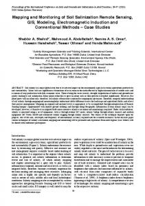
Figure 1Hierarchical depiction of biological organization in nature (DBT-DOS biodiversity manual)
Figure 2 Components of biodiversity assessment (DBT-DOS biodiversity manual)
16
Figure 3 Location map of Orissa State with all districts
17
Figure 4False Colour Composite (FCC) of IRS P6 LISS III image of Orissa
18
Figure 5Schematic representation of the geospatial model for BLCC using spatial landscape analysis modelling (SPLAM)
19
Figure 6Vegetation and land use map of Orissa
20
Figure 7 Biological richness map of Orissa 21