International journal of Advanced Biological and Biomedical Research ISSN: 2322 - 4827, Volume 1, Issue 3, 2013: 285-301 Available online at http://www.ijabbr.com
Assessment of Empirical Methods of Runoff Estimation by Statistical test (Case study: BanadakSadat Watershed, Yazd Province) Khabat Khosravi *1, Haidar Mirzai 2 and Iman Saleh 1
1
Ph.D. student of Watershed management Engineering,Faculty of Natural Resources, Sari Agriculture Science and Natural Resources University,Sari, Mazandaran, Iran. 2
Assistant Profesor of Razi University, Faculty of Natural Resources, Kermanshah, Kermanshah, Iran
ABSTRACT Runoff estimation resulted from precipitation is the basis of more study in various develop and exploit design from water resource, then its measure and calculation due to environmental bottlenecks, always have a plenty problem. As a result of the importance of output runoff estimation and flood volume in watershed for the sake of country integrated watershed management in this study tried to 9 empirical methods of runoff estimation implemented in Banadaksadat and this provided result with observation runoff from Hydrometric station in watershed outlet have been evaluation by paired t-test, MD, BIAS, RE and RMSE tests then selected best model in Banadaksadat watershed to runoff height estimation that it’s have a most efficiency and precision. After preparation of necessary maps in GIS environment and Statistical test implementation in SPSS software, result showed that LACEY method with MD, BIAS, RE and RMSE value 0.016, 0.007, 4.36 , 0.026 respectively and also no significant difference with observation data in 95%confidence level, with runoff height equal to 1.53 cm, 2.29 MCM runoff volume and 18.79%runoff coefficient , determine the best empirical model to runoff estimation in the case study. The sensitivity analysis using Excel software was used for LACEY model to determine the influential reachs, according to the get result, F/Z parameter in 6-8, 8-10 and 18-20 reachs have a most effect in the model output. Keyword: Runoff Estimation, Empirical method, Banadaksadat Watershed, GIS, SPSS, Sensitivity Analysis.
INTRODUCTION If rainfall intensity is more than the capacity of soil infiltration, a part of precipitation would stream along the slope on the watershed surface and will be emitted by water bodies. This part of precipitation which is measurable in the rivers is called surface runoff (Alizadeh, 2009). One of Corresponding Author: Khabat Khosravi, E-mail:
[email protected]
285 | Page
Khosravi et al
Int J Adv Biol Biom Res. 2013; 1(3):285-301
basic requirements in designing soil and water projects, is the estimation of runoff resulted from precipitation. In order to achieve this purpose, various methods can be used like (Coutagine, Turc, Khosla and etc.). Precipitation can be considered as the most important factor which is directly effective in hydrologic cycle. Determination of runoff resulted from precipitation is one of the most important factors in hydrologic problems analysis and water resources management. The relationship between precipitation and runoff is a complicated and non-linear relationship which is depended on several factors. Forecasting and determination of the quantitative amount of created and transported runoff to the outflow point of watershed are very important (Ghafari et al., 2009; khayam and molavi, 2004; and velayati et al., 2004). In order to control and conduct the runoff also, to discharge and transporting surface flows to a proper location which is out of the region, various models have been developed and used by a plenty of researchers of scientific organizations throughout the world ( Minras, 1975; Neshat, 2001). With regard to provide water demands, the importance of surface floods and runoffs in arid areas is really high. Usually, the floods in arid and semi-arid regions are short-time and basic flows are too low and perhaps there is no basic flow at all because, the rivers mostly are temporary or a kind of torrent. Using empirical models for estimating annual runoff in those watersheds in which there is no hydrometric station, has been recommended since several years ago and each empirical model is developed for a special watershed (Bajalan, 2005). Also, the accuracy and efficiency of each model is needed to be tested before using in other watersheds (Jandaghi and Mohammadi, 2007). In arid regions, water cycle has more speed and is formed in the absence of vegetative cover, soil and water management (Rahbar and Maasoudi, 2006). Recent studies have shown that, soil erosion and runoff are related with rainfall intensity, amount of precipitation, ground surface cover and vegetative cover also, soil erosion is more affected than runoff (Nearing et al, 2005). Davarirad (2006) evaluated the efficiency of some empirical methods and announced that, including Khosla, Coutgine, Turc , I.C.A,R, Justin and Lacey in the watershed of Namak lake and announced that I.C.A.R, Coutagine, Justin and Turc methods have more accuracy respectively comparing to other methods and Khosla method has not been proper. Zare et al. (2008) in addition to explain Khosla, Coutgine, Turc and Langbin formulations announced that, sometimes these methods have error compared to constant universal methods. Evaluation and measuring the amount of runoff and flow in watersheds is very important therefore, runoff estimation is needed for using empirical equations in the watersheds without measurement station. The purpose of this study is to apply various empirical methods of runoff estimation and to evaluate them with regard to observed amounts using statistical tests in Banadaksadat watershed. After determining a proper method, the other goal of this study is to apply sensitivity analysis on selected model and to determine the most effective parameter in the model in order to have more accuracy when the most effective parameter is being measured and achieving more proper results.
MATERIALS AND METHODS Study area Area of the studied region is 39.32 km2 located in western south of Mahriz city, Yazd province. Geographically, the watershed is located between latitudes of northern 31 31 8.8 to 31 36 30.6 and longitudes of eastern 54 10 8.9 to 54 14 7.5. The highest point of the region is 3960 m and the lowest point has about 1880 m height from sea level. There are three villages within the study area and a large part of watershed slopes is made by forests and Rangeland Topographically, the
286 | Page
Khosravi et al
Int J Adv Biol Biom Res. 2013; 1(3):285-301
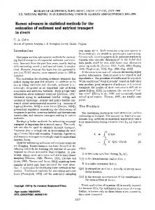
up-slope part of watershed including stony and rocky heights with steep slopes and a few branches of water bodies and almost without soil. Figure 1 shows the situation of study area in the province and Iran.
Fig. 1. The situation of Banadaksadat in the province and Iran
Methodology of study When the rain is occurring, runoff height in arid regions is achieved from the amount of precipitation minus evaporation and infiltrated water. Therefore, the mean precipitation of watershed area should be calculated firstly. For calculation of the mean precipitation of watershed area, the average of recorded precipitations by installed stations should be calculated. A method for calculating average is Tisen multi-aspects method (Jafari et al., 2009). Evaluation of empirical models in annual runoff estimation Empirical models include relationships and equations which have been determined using analysis of limited data and the region characteristics, and the models are used to estimate some special probabilistic parameters. Most of these methods are useful for a special zone so, it is not possible to use them for other areas. But, some of these methods have more expanded domain and can be used for some same regions by applying some corrections and choosing proper coefficients. There are several empirical models have been developed in order to estimate surface runoff (extra flow). The mentioned methods are divided to four categories including: 1. Surface runoff coefficient 2. Relationships between precipitation and runoff
287 | Page
Khosravi et al
Int J Adv Biol Biom Res. 2013; 1(3):285-301
3. The methods about surface flow shortage 4. The methods about to use physiographic characteristics Where, surface runoff coefficient and relationships between precipitation and runoff are local and are applicable only in some special physical and climatic situations. The methods about surface flow shortage and methods about to use physiographic characteristics present more acceptable results considering physical and climatic factors. 1- Surface runoff coefficient The simplest method for surface runoff estimation is to use surface coefficients. In other words, in this method the surface runoff estimation is a percentage of precipitation considering the parameters affecting runoff. The most important coefficient of those have been presented in this method, were suggested by Strange, Barlu, Bini and Rudier in various regions and Barlo coefficient has been recommended for tropical regions (Bashul, 2002). 2- Relationships between precipitation and runoff A number of hydrologists presented their achieved results as some relationships between precipitation and annual surface runoff with this suppose that physical characteristics of the watershed is constant. In this context, there are plenty of relationships including Engli D, Souza, Dehir-Ehiuja-Majumdar, Irrigation Department of India, Institute of Irrigation Research of India, Paker and etc. 2.1)Engli D, Souza These two scientists presented the following relationships in plains and mountains of Maharshtera region located in India (Mutereja, 1986): (1)For highlands: (1) R 0 . 85 P 30 .5 (2) For plain areas: (2)
R
( P 17.8) P 254
Where: P is annual precipitation by cm, and R is annual runoff by cm 2.2) Department of irrigation, India Management of Reihand plan presented the following relationship between the amount of annual precipitation and runoff of Reihand River (Gupta, 1992): (3)
R P 1.17 P0.86
288 | Page
Khosravi et al
Int J Adv Biol Biom Res. 2013; 1(3):285-301
Where: P is annual precipitation by cm and, R is annual runoff by cm 3) Relationships about annual surface flow shortage In these relationships it is assumed that, the amount of surface runoff flowing out from concentration point of a watershed is the difference between precipitation and annual surface flow shortage. Overlay, annual surface flow shortage includes physical and physiological evaporation which is affected by some factors like temperature, topography, geology and vegetative cover. The most important methods in this context are Turc, Coutagine and Khosla. 3.1) Turc relationship Mr.Turc presented following relationship for watersheds with the area less than 300 km2 based on achieved results from doing a study on 254 watersheds in various climatic and weather conditions. (3)
P
D
0.9 (
(4) (5)
P 2 ) LT
LT 300 25T 0.05T 3
R PD
Where: P is annual precipitation by cm, T is mean temperature by ˚C, R is annual runoff by cm and D is annual flow shortage. 3.2)Coutagine relationship Coutagine also after doing many studies on various watersheds, presented a general relationship as below (Alizade, 2009): (6) (7) (8)
D P P2
1 0.8 0.14 T
R PD
Where:
289 | Page
Khosravi et al
Int J Adv Biol Biom Res. 2013; 1(3):285-301
P is annual precipitation by m, T is mean temperature by ˚C, R is annual runoff by m, and D is annual flow shortage. Coutagine is applicable if
1 1