canopy and canopy gaps on Quickbird forest stand image. Tree detection can ... center in a window within surrounding 3 image objects. If the two equal local.
Automated Extracting Tree Crown From Quickbird Stand Image Guang Deng1 , Zengyuan Li1 , Honggan Wu1 , Xu Zhang1 1
Institute of Forest Resource Information Techniques, Chinese Academy of Forestry, Beijing , 100091, China {dengg,zy,whg,zhangxu}@caf.ac.cn
Abstract. Artificial intelligence technologies with spatial information technologies play more and more roles in precision agriculture and precision forestry. This paper puts up a new artificial intelligence algorithm which based on seeded based region growth method to extract tree crown on Quickbird forest stand image. It is a kind of object based canopy and gap information extracting method specially suited for high-resolution imagery to get meaningful tree crown object .The main processes to carry out the experiment and validation on the Quickbird satellite images in Populus×xiaohei plantation even stand at Xue JiaZhuang wood farm in Shanxi Province of China is described in detail in the paper. The average tree numbers identification error is 18.9%. The result shows that this algorithm is an effective way to get segmented crown in real stand image. This algorithm can be powerful tools for precision forestry. We suggest users to choose suitable features and parameter values try by try in forehand applying.
Keywords: Tree crown recognition algorithm; Seeded based region growth segmentation; Object based information extracting
1 Introduction Precision forestry is defined by Taylor et al. [1], as planning and conducting sitespecific forest management activities and operations to improve wood product quality and utilization, reduce waste, and increase profits, and maintain the quality of the environment. Principle of precision forestry was based on precision agriculture. Precision agriculture uses set of tools, which has been successfully introduced and now it is used in precision forestry. Artificial intelligence technologies with spatial information technologies play more and more roles in environment information extraction and environment effect analysis. This paper puts up a new artificial intelligence technology which based on seeded based region growth method to extract canopy and canopy gaps on Quickbird forest stand image. Tree detection can provide estimates of tree abundance and spatial pattern that are useful for evaluating density and stocking objectives. Delineation of individual tree crowns can get crown diameter
2
Guang Deng1 , Zengyuan Li1 , Honggan Wu1 , Xu Zhang1
of tree to be used to model tree structural variables such as height, volume, or biomass. Individual tree and clumped trees information are basal knowledge for forest management in precision forestry level. From the view of forestry machinery, this technique can make the positioning capability of forest harvesting machinery more precise which can be integrated the artificial intelligence forest road, trees and forest open area identified. In past 15 years, many scientists put up methods to extract tree from high spatial resolution imagery to get more efficiently and more accurately results. [2,3,9,10] Gougeon [2] developed a valley-following algorithm for the isolation of individual crowns in Canadian Boreal forests. The method finds crown boundaries by first following the shaded areas (radiometric valleys) between trees, and then refining the boundaries using a rule-based program. Culvenor's TIDA[3] method use the (local) radiometric maxima and minima as the primary image features used for the crown delineation process, being indicative of crown centroids and boundaries, respectively. Though these methods boost the tree crown recognition research in optics remote sensing area, but it has long distance to practice level for precision forestry management. Validating and comparing these methods are now days mission for information precision forestry research area.
2 Object Based Canopy and Gap Information Extracting Method Conventional image classifications focus on the differentiation of spectral values for each pixel. Because objects are groups of pixels on high spatial resolution remote sensing imagery, statistical values such as mean or standard deviation can be derived, which provides additional information. In addition to spectral metrics, texture and geometric characteristics of the objects can also be used for classification. This method can improve the conventional pixel-based classification methods to get relatively satisfactorily result far from pixel classification result on high spatial resolution remote sensing images. As its results are some image segments, they can be used for object based image analysis for detailed knowledge forest stand in modeling and digital forest management. From 2000, eCognition[4] became the first commercially available software for multi resolution segmentation and object-oriented fuzzy-rule classification, specially suited for high-resolution imagery[5]. Segmentation follows a proprietary bottom-up region merging technique [6] starting with one-pixel objects, which are iteratively merged into larger objects based primarily on a user defined scale parameter. To the specifically object in nature scene, object based technique only provides a methodology, the fine expression of the object must be looked for.[7] The tree top seeded based region growth tree detection and crown delineation algorithm for analyzing QuickBird satellite images has six main steps, which are described in details as follows. (1)Primary segmentation. Primary segmentation puts on the stand image after image fusion and color composition and get series image object elements with small area for latter tree crown seed extraction.
Automated Extracting Tree Crown From Quickbird Stand Image
3
(2)Reducing the treetop searching scope. In stand image, there is many area covering by tree shade or bare land, grass ,shrub and so on. By masking operation with NDVI>0.38 of study image, the non trees areas are be shielded. (3)Treetop selection. Treetop selection uses non maximum oppression method to distinguish tree top from image object segments. The local maximum of ratio of near red band (NIR) of pixel (defines in formula (1)) is selected as treetop seed which is as center in a window within surrounding 3 image objects. If the two equal local maximum are found, they both be accepted as treetop seed and be marked. (4)Seed growing. This step is to get tree crown extent. The condition of seed growing is set down as mean ratio of near red band (NIR) (defines in formula (2)) of candidate image object element and seed greater than 0.9 and lesser than 1.[8] (5)False treetop seed wiped off. This is necessary because anterior steps get many seeds which are not true treetop anyway. Computing the mean NDVI value and mean red band standard deviation value (defines in formula (3)) of seeds, the false treetop is cognized by much smaller value in theses two index. That means that the preserving seeds are true treetop.
ratio L L
i 1
i
1 n vi n i 1
(2)
nL 1 ( i L ) 2 n 1 i 1
(3)
L L
(1)
nL
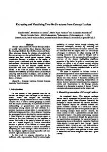
Fig. 1. Quad tree segmentation
(6)Tree crown shape optimization. The crown boundary is not smooth enough, so some cycling segmentation is done on image objects elements enveloping the treetop objects. Here the quad tree segmentation performs by recursively combining (merging) the image segments as leafs and regions to get more smooth canopy outline. By comparing the character of smaller image objects elements enveloping the treetop objects with the treetop objects , some smaller image objects elements will be combined into the ambient tree crown object.
4
Guang Deng1 , Zengyuan Li1 , Honggan Wu1 , Xu Zhang1
3 Research Area and Data The presented approach selects a research area for analyzing Quickbird satellite images in Populus×xiaohei plantation even stand at Xue JiaZhuang wood farm in Shanxi Province of China which location are presented in Fig. 1, because Populus is a very popular broadleaf and has important value in use. The research area’s east longitude is 112033″,north latitude is 39018″,its average year air temperature is 7℃;its average year precipitation is 400mm; its average year evaporation is larger than 2700mm . It is drought and the forest soil is bare. The dominant specie in research area is Populus×xiaohei which planted in April 1977 has 21.6 hm2 area. The terrain of research area is plain. The soil type of research area is meadow soil. By programming ordering, the Quickbird imagery covering the research area on 6 May 2004 was gained, which has pan band and multi spectrum bands. The quality of image is good and there is no cloud on the image. The geodetic coordinate of up left corner of the image is 635167.20m,4352983.20m and down right is 635664.60m,4352655.00m. The 30 sub compartment of Xue JiaZhuang wood farm corresponding the above Quickbird image with 501*344 pixels was selected for tree crown extraction. In the surveying table of 30 sub compartment, the value of canopy closure is 0.7.
Fig. 2. Regional map of research area
In May 2004, we surveyed this area. Considering the growth condition of the stand, we selected 3 kinds of plantation density stands, which is 2m × 5m ( 1000 trees/ha ) 、 4m × 5m ( 500 trees/ha ) 、 4m × 10m ( 250 trees/ha ) . In every plantation density, 3 standard sample plots were set up. In total, 9 standard sample plots were gained. The area of every standard sample is 900m2(30 m×30m). The standard samples of 2m×5m plantation density named A1,A2,A3, the standard samples of 4m×5m plantation density named B1,B2, B3, the standard samples of 4m×10m plantation density named C1,C2,C3. The location, tree height and tree diameter of all these trees were measured and these trees had been marked on the printed image photos. Using these truth data , the auto and semi auto tree crown recognition algorithm can be validated.
Automated Extracting Tree Crown From Quickbird Stand Image
5
Fig. 3. Location of research stand on Quickbird image
4 Implement and Results In the algorithm implemented period, there are some parameters must be selected cautiously. In Primary segmentation, the small value of segmentation scale must be selected. After testing from 3,5 and else values, we select 3 for segmentation scale, 0.3 for weightiness of shape and 0.7 for weightiness of compactness. In seed growing step, the mean ratio of near red band (NIR) of candidate image object element and seed is greater than 0.9 and lesser than 1.In the quad tree segmentation for crown shape optimization, the time of cycle is set 3. Table 1 shows the some key features and values of parameters used in this algorithm. Fig. 4 is the image of plot C1 and the Fig. 5 is the 3d view of its spectral values.
Fig. 4. Image of plot C1
Fig. 5. 3d View of plot C1’s spectral values
6
Guang Deng1 , Zengyuan Li1 , Honggan Wu1 , Xu Zhang1 Table 1. Features and values of parameters in this algorithm
Function of features Distinguish vegetation Treetop seeds
Features Mean NDVI Ratio of NIR
Value of parameters >0.38 Max
Image object window size
3
Seed grows conditions Mean ratio of NIR (0.9,1) Crown shape Optimization Cycle times