Bulletin of the Geological Society of Greece
Vol. 40, 2007
Geological-geophysical study for the disign of a hazardous waste landfill in Albania Beqiraj A.
Faculty of Geology and Mining Alikaj P. Faculty of Geology and Mining Lamaj M. Geological Survey of Albania Muceku Y. Geological Survey of Albania Çanga B. Faculty of Geology and Mining Leka G. Geological Survey of Albania http://dx.doi.org/10.12681/bgsg.17221
Copyright © 2018 A. Beqiraj, P. Alikaj, M. Lamaj, Y. Muceku, B. Çanga, G. Leka
To cite this article:
Beqiraj, A., Alikaj, P., Lamaj, M., Muceku, Y., Çanga, B., & Leka, G. (2007). Geological-geophysical study for the disign of a hazardous waste landfill in Albania. Bulletin of the Geological Society of Greece, 40(4), 1925-1933. doi:http://dx.doi.org/10.12681/bgsg.17221
http://epublishing.ekt.gr | e-Publisher: EKT | Downloaded at 05/06/2018 08:46:42 |
Δελτίο της Ελληνικής Γεωλογικής Εταιρίας τομ. ΧΧΧΧ, 2007 Πρακτικά 11 ο υ Διεθνούς Συνεδρίου, Αθήνα, Μάιος 2007
Bulletin of the Geological Society of Greece vol. XXXX, 2007 Proceedings of the 11* International Congress, Athens, May, 2007
GEOLOGICAL-GEOPHYSICAL STUDY FOR THE DESIGN OF A HAZARDOUS WASTE LANDFILL IN ALBANIA Beqiraj A.1, Alikaj P.1, Lamaj M.2, Muceku Y.2, Çanga Β.1, and Leka G.2 1
Faculty of Geology and Mining,
[email protected] Geological Survey of Albania
Abstract Industrial wastes in Albania belong to four main groups: i) wastes from the industrial hot spots, ii) wastes from the old chemical storages, Hi) wastes from mining and ore processing and iiii) wastes from present and future industries. The landfill for hazardous waste is intended as a facility to enable the clean-up of old mostly abandoned industrial sites (the hot spots and other sites), storages of obsolete chemicals and treat and dispose of hazardous waste presently generated in Albanian industry. The technical design of the landfill was anticipated by complex geological study including the geological, geophysical, geotechnical and hydrogeological surveys. All the above surveys aimed to find the best clay terrains with suitable geotechnical and hydrogeological features for the landfill design. Key words: hot spot, hydromonitoring, electrometry.
Περίληψη Τα βιομηχανικά απόβλητα στην Αλβανία διακρίνονται σε τέσσερις κύριες ομάδες: i) απόβλητα από βιομηχανικές περιοχές, ii) απόβλητα από παλαιότερους αποθηκευτικούς χώρους χημικών ουσιών, Hi) απόβλητα από μεταλλεία και επεξεργασία μεταλλευμάτων και iiii) απόβλητα από τις βιομηχανικές μονάδες που βρίσκονται σε λειτουργία. Οι χώροι ταφής για τα επικίνδυνα απόβλητα επιλέγονται για τον καθαρισμό των παλαιότερων συνήθως εγκαταλελειμμένων βιομηχανικών περιοχών, την αποθήκευση χημικών ουσιών που πλέον δεν χρησιμοποιούνται και την επεξεργασία και απομάκρυνση των επικίνδυνων αποβλήτων που παράγονται σήμερα από την αλβανική βιομηχανία. Ο τεχνικός σχεδιασμός των χώρων ταφής βασίζεται σε σύνθετη γεωλογική μελέτη, που περιλαμβάνει γεωλογικές, γεωφυσικές, γεωτεχνικές και υδρογεωλογικές έρευνες. Η παραπάνω μελέτη στοχεύει στην εύρεση των κατάλληλων αργιλικής σύστασης εκτάσεων, με γεωτεχνικά και υδρογεωλογικά χαρακτηριστικά που επιτρέπουν την )χιτουργία χώρων ταφής. Λέξεις κλειδιά: βιομηχανικές περιοχές, παρακολούθηση του υδάτινου δυναμικού, ήλεκτρομετρία.
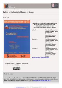
1. Introduction In Albania occur about nine main hot spots that represents historical hazardous waste of the former industry (Fig. 1). It was considered indispensable their accomodation in a landfill in order to
- 1925-
http://epublishing.ekt.gr | e-Publisher: EKT | Downloaded at 05/06/2018 08:46:42 |
minimize their negative environmental impact in the regions where they occur (Matache et al. 2004). This paper presents the first experience of the geological-geophysical studies for the design of a hazardeous landfill in Albania. The whole study consists of three phases, beginning with geological survey (first phase), followed by geological-geophysical study (second phase and, concluding with geotechnical study and hydromonitoring (third phase).
2. Methods The geological survey of the first phase aimed to find the mostly clayey zones which represent the geologically sutable areas for the landfill site because of their perfect impermeability. In fact, the most suitable terrains belong to Miocene-Pliocene clays which occur mainly in the Jonian zone and western Adriatic depression of Albania. At the end of this phase, ten sites were proposed. A more detailed geological-geophysical study was commited during the second phase that focused on three sites: Kutallia, Helmesi and Zharresi. The geophysical methods helped to clarify: i) the possible heterogeneities across the general geological structure (ERP method) and ii) the variation of the lithology with depth ( VES method) (Bray et al. 2006). The third phase was focused on the Zharresi site which was found to be more suitable from the geological, economic, technical and operational point of view. Finally, the soil investigation works and hydromonitoring of the ground water levels found that the clays of Zharresi site are suitable for the landfill design.
3. Results and Discussion 3.1. Phase 1. Geological survey The geological survey aimed to find the geologically sutable areas, that is, the mostly clayey zones (Hyseni 1995, Beqiraj et al. 2006). Because the landfill basement must be impermeable, two priority geological and hydrologeological terrains were considered: Miocene-Pliocene clay and Cretaeous - Paleogene flysch formations. The first type represents the highest priority because clays are i) practically water impermeable, ii) thick in section, iii) present in the low hill terrain and iiii) soft in digging and processing. At the end of this survey, 42 geologically suitable areas were identified, most of them Type I areas. Before the subsequent topographical study some of the areas were excluded because of very distant location from acceptable roads and therefore technically and logistically too difficult. 3.1.1. Topographical survey The possible areas resulting from the geological survey were studied in detail on maps 1:25.000 in order to find possible sites with the following criteria: i) area of 8 - 10 hectares of reasonable flat area for the landfill facility; ii) the site should not be in the plains, but somewhat elevated; iii) the site should not be crossed by any surface waters; iiii) the site should be reasonably close to existing acceptable road. Therefore the number of was not very large. Some. As a result of topographical screening, 70 possible sites were identified within the above 42 geologically suitable areas. The study followed by screening with basic (Environmental, Technical and operational, Geological and hydrogeological) criteria. 3.1.2.Geological criteria Between the geological criterias, the most principle ones were considered Lee and Jones-Lee (1996), A i) impermeable clay formation. Preferred is homogeneous clay (priority 1) acceptable is also flysch with impermeable clay (priority 2), the occurring depth of the layer should be at least 5 m, preferable more than 10 m; ii) the ground water table (maximum) should be at least 5 m below the surface in order to establish a landfill of 3 - 4 m depth; iii) the area should not be at fault areas, seismic impact zones and unstable areas; iiii) the area should not be in risk of flooding at any conditions.
- 1926-
http://epublishing.ekt.gr | e-Publisher: EKT | Downloaded at 05/06/2018 08:46:42 |
Applying the last criteria (geological criteria included), a lot of plains were excluded because they are mostly cultivated or are placed on the main aquifers. The result of the screening with the above listed criteria was approximately 20 sites which were inspected on site.
ADMINISTRATIVE MAP OF ALBANIA WITH HOT SPOTS AND ZHARRESI LANDFILL SITE
.* ""sHKodn*
\ S
LEZH»
•Γ ,KRL
Τ
. 30 1 25 1 20
« 15 * 10 g a. 5