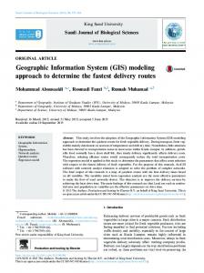
International Journal of Computer Application and Engineering Technology Volume 3-Issue1, Jan 2014.Pp. 199-206 www.ijcaet.net
Click Information System through GIS Data Browser Dr. Pradip Ashok Saymote Assistant Professor P.G. Diploma in Geoinformatics, Department of Geography Shivaji University, Kolhapur, INDIA.
[email protected] Abstract: There are number of applications like decision support system, analytical tools and representation applications are available for users which are making the things easier, systematic and simple. The 21st century is known as information technology age and it is been applied in various tasks. This paper also focusing on use of GIS software / GIS Data Browser to show the data about spatial feature where user has do click. To fulfill this task the data is generated for the all possible spatial features through primary survey and secondary sources. The generated database is synchronized with respective spatial entities. Finally these data is made available to user on their desktop for its use. Keywords: Information System, VIS, GIS, Data, Click.
1. INTRODUCTION
The roots of present click information system can trace long back. This is a part of land information system which is commonly termed as Geographical Information System. The land information systems that were initially developed were manual and paper based. LIS was primarily developed to serve the needs of ‘Western’ style land markets, centering on individual land rights. The emphasis was on accuracy and the security of data. The modern LIS-based cadastre continues to be parcel based (focuses on people and rights), whereas a GIS data system is able to focus on things associated with land: e.g. soil type, land use, energy network, forest cover etc. There are traditional uses where LIS/GIS technologies are used as tools with a ‘system’ of decision making and governance. There are numerous decision support system (DSS) applications that are emerging with separate technologies. There is also the multitude of databases that are emerging at the local, national and regional levels (Matt, 2010). This application is also same kind of attempt where database is generated on unique platform and linked to spatial feature. The information of feature will highlight on screen when user do click on a feature. Indians have been enthusiastically and rapidly adopting GIS and remote sensing technology over the past 15 to 20 years. The development and application of GIS technology is largely rooted in a logical positivist (scientific) epistemology that is widely accepted as legitimate aspect (Martin, Vasantha Kumaran and Joseph 2012). The click based information system is an attempt to display the attribute information of spatial feature. This application is prepared for village Savali and installed on the user’s desktop. The effective use of GIS browser is made to display the information and user will get the information on one click. 2. AIM AND OBJECTIVE
The main aim of this paper is to construct and demonstrate the functionality of click based village level information system through GIS software. Following are the specific objectives: To assemble the necessary datasets of VIS application To construct click based information system (Infosys) for village Savali in Sangli District
199
Fig g.1 Location n Map
Fig.2 Household H In nformation
200
3. STUDY AREA The application is developed for village Savali. This is a small village located at North-Eastern side of Sangli and Kupwad city, in Miraj tahsil of Sangli district, Maharashtra, India. It is located within coordinates of 16º 46’ 28” to 16º 53’ 45” North Latitude and 74º 31’ 08” to 74º 40’ 51” East Longitudes (Saymote, 2009). 4. DATABASE AND METHODOLOGY Data is the main aspect of an information system (Sharma. et. al.). In the development of information system both primary and secondary data is assembled systematically. The generated data is converted into Geodatabase which contains several records in the form of rows and columns. As supporting information some diagrams, maps and photographs are also added into database. It is observed that systematic representation using pictures are more effective than the traditional. The attribute data is arranged properly and then attached to spatial features. The GIS softwares have functionality to represent the data by identifier tool. Once the user is clicked on any spatial feature then attribute data is popup on the screen. If the attribute data is also containing the photograph then that will also appear and user will acquainted with desire information. 5. RESULT AND DISCUSSION Developing an information system and its database generation is practical task. This task is quite time consuming and require some customization. Due to some limitations the study is focusing on only representation aspects. This is an initial attempt to depict the information on single click. The scope of this study is quite huge and requires customization which is in process but mean while the functionality of identification tool is used here as click based information system. Actually the database is generated for all spatial features, but here few representative aspects are demonstrated. The outcome, snap shots are presented in below section and discussion is made. 5.1 HOUSEHOLD INFORMATION Household survey is carried out and data is collected through Questionnaire. The information about individual family, demographic details, educational status, etc. is collected. The Household information of village contains 3 main tables having 176 record sets of 10 coloumns. The family information for same household is collected which is having 803 record sets (Saymote, 2014). Same time the pictorial data like house photo is taken and added into database. This entire information is entered into Geodatabase where it is linked to respective spatial feature. Same procedure is applied for all spatial features present in the village. When user clicks on spatial feature its attribute information is displayed on the screen for the user. Fig.2 represents the household information screen about the respective house in the village. The user has clicked on the house which is having House ID as B_5. The name of family head is Dilip Tambade who is by occupation farmer and having age 40. He is a married person who is studied up to secondary level and his average monthly income is Rs 3000. This information is about the head of family same kind of information is available for all the members in the family. The information like name of family members, their education, occupation, work place, etc. is made available on screen. The spatial information of household which is an important aspect is also made available. The location of house, its ownership, house type, etc. details about this particular house is given. The selected house is an own house and located at farm. 201
Fig. 3 Non--Agriculturaal Land Parcel
Fig.4 Rooad Informaation Screen
202
Table 1: Road Detaiils Sr. No.. Category Length (iin Mtr.) 1 Main Roaads 23779 2 Other Impportant Roads 50338 3 Streets annd Galli 185440 Source: Computed C from m the generateed road netwoork.
Peercentage to Total T Roads 9.17 19.411 71.433
F Fig.5 Land Parcel P Inforrmation Screeens
Fig. 6 Pa ark & Garden in Savalii
203
Fig.77 Main Poweer Lines
ON AGRICU ULTURAL L LAND PA ARCELS 5.2 NO Shelter is considerred as a bassic need of human beinng. The studdy area is situated s on the t eastern a Thereffore the adjaacent land parcels p get importance i as a result many land edge off M.I.D.C. area. parcels are converrted into non-agricultu ural plots (Saymote, ( 2 2013). The informatioon of nona made available a foor the userss. The nonn-agriculturee plots are agriculttural (N.A.)) plots is also having mixed landduse i.e. som me plots arre containinng houses annd some arre in develooping stage s open laands. whereass some are still a surveyy number – 111. Thiss land parceel is quite big b in size Fig.3 reepresents thhe details about located at south-western area.. This parceel is again sub-divided into severaal plots. In photograph p h land is unconstruccted and around this plo ot some houuses are connstructed in it is seeen that the huge which ppeoples are staying. Likke this theree are many other land parcels p whicch are non-agriculural plots avvailable in thhe village. 5.3 RO OADS The roaads are verry much im mportant fro om the trannsportation perspective (Singh, Kewal K and Litoria 2009). Fig.6 representss the road condition off village. Thhere are variious roads available a in i grouped into 3 categgories. The first categoory is main n roads; second one is the villaage which is other im mportant rooads, follow wed by streeets and gallli. The maxximum roadds are local and galli roads w which are abbout 74% off the total rooads. The rooads in new habitat are not in goodd condition and in gauthan (haabitat) theyy are very narrow n so the t road is problem fo or all resideents. Some s placess it is availaable but nott functioningg properly. places sstreet lights are not avaailable and some The maain road of o village is i functioniing as the connecting g road to M.I.D.C. and a MirajPandharrpur state highway. h A a result most As m of vehhicles as well w as heavvy goods-veehicles are passingg through thiis road and road is scraatched and becomes b very bad conddition. 204
5.4 AGRICULTURAL LAND PARCEL Agriculture is the base of our economy and most of the land parcels are under agricultural use (Pathan, 2005). The land parcel (Fig.5) is base unit of the village which may contain different type of land use. The data related to land use is its second information but the dimension details and ownership records are the prime one. In this information system all these datasets is incorporated. If the user clicks on particular land parcel then system will display its information in pop-up. In ownership details it contains information like main owner then other owners like Bank or financial institute. If farmer has taken loan by mortgage then particular funding agency gets ownership rights of that land parcel. If land parcel is having some land in sharing then the ownership become common owner. These all details are displayed when user click on particular feature. The land use aspect contains information about the crops produced in that land parcel. The cropping data is also important which is made available on click. The database is generated for both Krarif and Rabi seasons of 10 years. At present the information is displayed for all entered years but the attempts are going on to show the particular details. The particular representation will be possible with programming and customization. Here year wise data gets displayed for the user and one can know about the crops taken in that particular land parcel over the time period. 5.5 OTHER ASPECTS There are many aspects available in village and this system is generated for almost all aspects present in the village. Due to limitation of space here some representative segments are incorporated. Fig.6 represents the information about park and gardens. As discussed earlier this village contains some non-agricultural land parcels. As per land development rules; while developing land parcels some portion of land must be kept for road, park, garden, etc. Due to new N.A. plans some park and gardens are available in the village. But these are in primary stage in terms of development and available facilities. Fig.7 is about the main electric power lines passing through village. These passing lines are 220KV high voltage lines as well as other distributaries of 66KV. Other than these some are local 11KV lines these are also captured as information. This electric line information will be further useful for the planning of electricity distribution and supply using GIS. 6. CONCLUSION Information system is nothing but systematic representation of data about the particular aspect. The information may stored in the form of tables i.e. row and columns, files and folders, facts and figures, etc. The statistical data is stored in the form of spreadsheet, pictorial data, documents, etc. and generally it is represented in particular format. This click base system is having functionality to display the data of an object after clicking particular object. This kind of facility is available in GIS browser but for that representation database generation is most important. There are number of ways to representation of data but click and display of data is most effective among all. Every one concerns about authentic information which is understandable. In this system the data is represented very simple and understanding format. The information about the topographic aspect of the village, population details, cropping data, 205
etc. are very much important aspects. These all are made available and user can access this information after one click. This system is developed for one small village and after studying its advantages and drawbacks further enhancement will be done. During initial days this task was carried out in GIS software but now days some GIS data browsers are also available. Using these browsers this kind of system can enhance further. But still there are some limitations in browser application and require customization. The attempts are going on to customize open source GIS browser and develop the click based information system which will be good application for the users. 7. REFERENCES [1]. Martin J. Bunch, Vasantha Kumaran T. and Joseph R. (2012). Using Geographic Information Systems (GIS) For Spatial Planning and Environmental Management in India: Critical Considerations, International Journal of Applied Science and Technology, Vol. 2 No. 2 pp.40-52. [2]. Matt McIntyre (2010). Review of Land Information Systems for Land Administration, Land-use Planning and Management, The Pacific Islands Forum Secretariat LMCM project is supported by AusAID and UNDP, pp. 4-48. [3]. Pathan, S.K. (2005). Role of geoinformatics in natural resources development: Retrospect and prospects, Indian Society of Geomatic Newsletter, Vol.10 & Vol.11, 2005. [4]. Saymote, P. A. (2009). Development of Village Information System with the help of Geoinformatics. M. Phil dissertation, Tilak Maharashtra University, Pune, Maharashtra. [5]. Saymote, P. A. (2013). Geo-Analysis of Landuse / Landcover change of Miraj Tahsil in Sangli District : Using Geoinformatics (Doctoral dissertation, Shivaji University, Kolhapur, MH.). [6]. Saymote, P. A. (2014). Develop a Village Information System (VIS) Application Using Visual Basic (VB) Programming, International Journal of Computer Technology & Applications, Vol 5 (3), pp.916-922 [7]. Singh, H., Kewal, K. and Litoria, P.K. (2009). Creation of a Village Information System of Moga district in Punjab using Geoinformatics, In proceeding of the National Conference on Recent Developments in Computing and its Applications, NCRDCA’09, August 12-13, 2009. Taken from http://www.researchgate.net/profile/Harpinder_Singh/publication/ [8]. Sharma, P.K., Bhatt, C.M., Verma, V. K., Litoria P.K. and Sood, Anil (2004) Socio-Economic and demographic profile of Muktsar district, Punjab, Project Report- Information Technology for Sustainable Agriculture in Punjab, PUNSEN/06/2004.
206