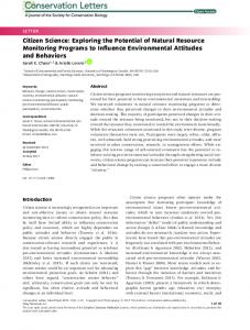
Nov 4, 2014 - The Google Earth⢠for Onsite and Dis- tance Education (GEODE) .... (a) A tablet screen showing an aerial map view of the iGIS app. Dots colored by lithology ... ramas (gigapans) and 360° âphoto sphereâ collections. Likewise ...
Eos, Vol. 95, No. 44, 4 November 2014
VOLUME 95
NUMBER 44
4 NOVEMBER 2014 EOS, TRANSACTIONS, AMERICAN GEOPHYSICAL UNION
PAGES 397–408
Crowdsourcing Digital Maps Using Citizen Geologists
with the added benefit that it is already in a modern, Geographic Information System (GIS) format.
PAGES 397–399
Most modern digital mapping methodologies utilize handheld tablets with integrated global positioning system (GPS) receivers and iOS, Android, or Windows apps to collect field data in standard comma‐separated values (.CSV) or GIS shape file (.SHP) formats. Base maps for field areas default to aerial imagery (e.g., Google Maps™ or Microsoft Bing Maps™) that is native to mobile devices. Alternatively, users can tile (e.g., via MapTiler) and upload their own base maps— useful for field areas with limited cell tower access. Field data are typically exported to a host computer and then imported into GIS software to build a digital geological map. The methodology used in the JMU case study derives from a 4‐day digital mapping exercise that each year focuses on a previously unmapped section of a mountain ridge in western Ireland (for details, see the additional supporting information provided in the online version of this article). Students use GPS‐enabled iPads and the associated iGIS app to collect geological data in the field (Figure 1). Point data are collected using a basic template with input fields for unit, strike, dip, dip direction, and notes. In addition, the app includes an input field that color codes data points by unit (Figure 2a). Students also record outcrop data and information in their field books to back up their digital data. However, with an active cell phone signal, the mappers could also periodically back up their field data to a cloud‐based storage system. Each evening, students export their iGIS data to a laptop computer running the mapping software ArcGIS. They “clean” their field data in ArcGIS to remove any spelling discrepancies and work on their maps by adding line‐ work for contacts and faults, and polygons for the areal extent of lithological units. Concurrently, students evaluate the day’s mapping and decide where to focus their efforts during the next day’s field session.
Crowdsourcing—“the act of taking a job traditionally performed by a designated agent [expert] and outsourcing it to an undefined, generally large group of people” [Howe, 2009]— has fundamentally changed and enhanced the collection and dissemination of data. Crowdsourcing has proven effective for rapid data collection, especially where in‐depth knowledge of a topic or discipline is not a necessity. But what if some basic knowledge were a necessity? Could the potential of crowdsourcing still be harnessed? Geoscientists, particularly those who create and use geological maps, are beginning to ask these questions. Geological mapping has traditionally depended on labor‐intensive field data collection by geoscience professionals. These professionals could benefit greatly from crowdsourcing—they could cover more area at finer scales. However, the crowd used to help with mapping would need some geological training. Although the general public may lack the necessary level of geological expertise, the 2000‐plus geoscience students who attend capstone field courses annually [Whitmeyer and Mogk, 2009] have the training and background to make crowdsourced field data collection a viable option.
Different Crowdsourcing Approaches Several projects have successfully utilized crowdsourcing to generate and analyze data. Examples include generating maps of the extent of wildfires [Goodchild and Glennon, 2010] and mapping the status of earthquake‐ impacted areas (as in the case of the 2011 Tohoku earthquake; see http://www.sinsai .info). The Google Earth™ for Onsite and Distance Education (GEODE) project is currently crowdsourcing instructional field locations (http://geode.net/mgmt). Crowdsourcing can also help scientists process mountains of data, including morphological classification of BY S. J. WHITMEYER AND D. G. DE PAOR
galaxies (the Galaxy Zoo project [Land et al., 2008]) and the collection of information on human genes (the Gene Wiki project [Huss et al., 2008]). Geoscientists have begun to explore crowdsourcing as an effective (and inexpensive) way to collect and organize field data. For example, the U.S. Geological Survey employs geo‐crowdsourcing with “Did You Feel It?” surveys for recent earthquakes and, from that information, creates community‐sourced maps of earthquake shaking intensity (see http:// pubs.usgs.gov/fs/fs030‐01/ ). Some crowdsourcing efforts have even directly targeted citizens with specific expertise. In 2000, GoldCorp, a gold production company, issued a challenge: It would open up its wealth of geological data in a region and offer $575,000 to whomever came up with the best locations and methods for finding gold. The GoldCorp Challenge resulted in successful gold targets utilizing a crowd consisting primarily of professional geologists and engineers (R. Tischer, He struck gold on the net (really), 2002, http://www.fastcompany.com/44917/ he‐struck‐gold‐net‐really).
Case Study: A Field Mapping Exercise in Ireland Building on the approach of tapping into a crowd with specific expertise, the James Madison University’s (JMU) field course in Ireland has developed a crowdsourcing exercise for geological mapping as a component of a digital mapping exercise [Johnston et al., 2005; De Paor and Whitmeyer, 2009]. Students collect outcrop data in the field using modern hardware (iPads) and software (iGIS). Later, in camp, students evaluate their field data in comparison with an aggregate of all student‐ collected data. This approach makes the assumption that the majority of students will collect accurate data; deviations from the group norm will highlight field locations that students should revisit to reevaluate data they collected. Ultimately, the composite data set produced by the students is accurate and robust enough to function as a highly detailed geological map,
© 2014. American Geophysical Union. All Rights Reserved.
Digital Mapping and Crowdsourcing Methodologies
Advantages of the Case Study’s Approach A distinct advantage of crowdsourced digital mapping over traditional independent
Eos, Vol. 95, No. 44, 4 November 2014 outcrop‐scale lithological and structural information. Over the course of several years, student data collection has facilitated the compilation of a new, data‐rich geological map of the mountain ridge (see Figure S2 in the additional supporting information found in the online version of this article). Existing geological maps of this region [Graham et al., 1989] are at much less detailed scales, and thus this exercise effectively equates to an authentic undergraduate research experience for the students [e.g., Burgin and Sadler, 2010].
Implications of Digital Mapping and Crowdsourcing
Fig. 1. A student uses a tablet to help create a digital geological map during the James Madison University field course to Ireland. mapping is the ability to centrally compile all student data into a composite master file. Field locations where students have conflicting outcrop data (Figure 1b)—often resulting from discrepancies in lithological characterization and/or orientation measurements—become apparent during evening meetings. Simple mistakes in compass readings or determination of dip direction are resolved by revisiting an outcrop and correcting the measurements. However, lithological variances often occur in areas of transitional contacts and thus require more thought on how best to define unit boundaries. Students are encouraged to resolve these conflicting interpretations through ongoing discussions with their peers. Each year, the area for the digital mapping project progresses to new sections of a mountain ridge, such that the current year’s digital data add to a growing database of
The concept of citizen science for field data collection is highly dependent on availability of mobile GPS‐ and GIS‐enabled equipment. A key recent development is the near‐ubiquity of iPhone, iPad, and Android mobile devices among the general public. Previously, handheld pocket PCs (e.g., the Trimble GeoExplorer series) and ruggedized PCs with integrated GPS receivers (e.g., ToughBook® or xPlore®) were the optimal systems for field data collection [Pavlis et al., 2010]. These systems have been rendered obsolete by smartphone and tablet apps that facilitate data collection in the field using intuitive touch screen apps. These modern devices are lightweight; have excellent battery life, stable operating systems, and more intuitive interfaces; and can be protected from the elements with an OtterBox® or a Ziploc® bag. GIS apps that use the industry standard formats for geospatial data facilitate seamless transfer of field data to a GIS‐based digital map on the user’s host computer. This approach is not dissimilar to traditional mapping techniques that use rough field slips for mapping in the field and clean office copies for final map preparation [e.g., De Paor and Whitmeyer, 2009]. Students who learned the rudiments of map creation in ArcGIS (or other GIS packages)
Fig. 2. (a) A tablet screen showing an aerial map view of the iGIS app. Dots colored by lithology represent data taken by a professional geologist at individual outcrops during the 4‐day digital mapping exercise. (b) Aggregate data collected by students during a single year of the digital mapping exercise (see Figure S2 in the online supplement for a composite map of 6 years of field data). Compare the data density with that in Figure 2a. White boxes highlight areas of conflicting data. (c) Geological map interpretation of student field data. Bold black lines are normal or oblique faults; thinner black lines are interpreted lithological contacts. © 2014. American Geophysical Union. All Rights Reserved.
had the most success with JMU’s digital exercise. These formats can be frustrating to the uninitiated. However, because knowledge of GIS is a valuable tool for today’s geoscientists, time invested in learning to use this software is likely well spent. Further, recent developments such as Google Maps Engine™ (https:// mapsengine.google.com) may reduce the steepness of the GIS learning curve [Ryan et al., 2013]. Perhaps the most significant advance in digital crowdsourcing methodologies for geological field mapping and data collection is the ability to pool data sets from many field geologists into a large aggregate database of outcrop information. Whereas field mapping by a single professional geologist (one of the authors) produced a field map defined by obvious cross‐strike and along‐strike traverses (Figure 1a), the aggregate map produced by less‐experienced students during the same 4‐day period is marked by a significant increase in data density (Figure 1b). The professional’s mapping strategy is efficient and presumably produced an accurate characterization of the outcrops visited. However, the data‐rich aggregate student map arguably shows the stratigraphic arrangement and structure of the field area in significantly greater detail. The aggregate student map includes areas of conflicting data (boxes in Figure 1b), which can be used as teachable moments to encourage students to reevaluate their lithological characterizations and measurements. In general, the accurate measurements overwhelm the errors, but when preparing a final geological map from aggregate data (Figure 1c), the less detailed—but perhaps more accurate—professional work can help resolve areas with conflicts in interpretation.
Crowdsourcing as an Educational Exercise JMU’s digital mapping exercise revealed that students can be challenged, and sometimes frustrated, by using digital hardware and software methods to create a geological map. Their initial impatience with learning how to use the equipment can be exacerbated by episodes of equipment failure that result in a loss of digital field data. Fortunately, the switch to using iPads for data collection virtually eliminated losses. Whereas most students with previous ArcGIS experience were comfortable with using the software to create their geological maps, the steep learning curve for ArcGIS often provoked frustration among students unfamiliar with this software. In general, students appreciated the exposure to digital field equipment and GIS software and consistently reported improvements in skill level and knowledge as well as in their attitudes toward the nature of science, based on the summative survey of this exercise (see Table S1). They were typically quite impressed when they saw the results produced by incorporating student field data from several years into a collective geological map of the mountain (Table S2).
Eos, Vol. 95, No. 44, 4 November 2014 The discussions that ensued among students as they evaluated their field data in comparison to aggregate group data spurred the types of higher‐order geological analyses that capstone field courses work to achieve [Mogk and Goodwin, 2012].
Future Possibilities Emerging digital technologies are creating new opportunities for crowdsourced geological mapping beyond the JMU case study described here. For example, citizen tourists are generating vast quantities of georeferenced cell phone imagery, and some advanced users are creating high‐resolution interactive gigapixel panoramas (gigapans) and 360° “photo sphere” collections. Likewise, Google has a vast trove of “Street View” images with geological value. In many cases, professional geologists could simply highlight and annotate such imagery without having to visit the physical locations. This not only could help scientists identify locations for future fieldwork but also could allow scientists to cover more ground than they could otherwise. In addition, augmented reality software (e.g., FreshAiR, http://www.playfreshair.com/ ), could create “realities” or virtual tours of landmarks that trigger content delivery on mobile devices based on physical proximity, similar to how museum visitors take tours by listening to information via headsets. Thus, field classes
could become asynchronous. Professional geologists could use this technology to transmit requests to citizens when they visit locations of geological interest—citizens could then upload pictures specific to a researcher’s area of study. During field exercises, teachers and professors also could give smartphone‐ based quizzes about mapping and landscape interpretation to students. With careful planning, opportunities for a wide range of geoscientific crowdsourced projects will only grow. Share your stories through http://geode.net/crowdsourcing.
References Burgin, S. R., and T. D. Sadler (2010), Creating links between students’ personal and global understandings of nature of science through research apprenticeships, J. Kirsehir Educ. Fac., 11, 97–111. De Paor, D. G., and S. J. Whitmeyer (2009), Innovations and redundancies in geoscience field courses: Past experiences and proposals for the future, Spec. Pap. Geol. Soc. Am., 461, 45 – 56. Goodchild, M. F., and J. A. Glennon (2010), Crowdsourcing geographic information for disaster response: A research frontier, Int. J. Digital Earth, 3, 231–241. Graham, J. R., B. E. Leake, and P. D. Ryan (1989), The Geology of South Mayo, Western Ireland, Scottish Acad. Press, Edinburgh. Howe, J. (2009), Crowdsourcing: Why the Power of the Crowd Is Driving the Future of Business, Random House, New York. Huss, J. W., C. Orozco, J. Goodale, C. Wu, S. Batalov, T. J. Vickers, F. Valafar, and A. I. Su (2008), A gene
© 2014. American Geophysical Union. All Rights Reserved.
wiki for community annotation of gene function, PLoS Biol., 6, e175, doi:10.1371/Journal.pbio. 0060175. Johnston, S., S. J. Whitmeyer, and D. G. De Paor (2005), New developments in digital mapping and visualization as part of a capstone field geology course, Geol. Soc. Am. Abstr. Programs, 37, 145. Land, K., et al. (2008), Galaxy Zoo: The large‐ scale spin statistics of spiral galaxies in the Sloan Digital Sky Survey, Mon. Not. R. Astron. Soc., 388, 1686 –1692. Mogk, D. W., and C. Goodwin (2012), Learning in the field: Synthesis of research on thinking and learning in the geosciences, Spec. Pap. Geol. Soc. Am., 486, 131–163. Pavlis, T. L., R. Langford, J. Hurtado, and L. Serpa (2010), Computer‐based data acquisition and visualization systems in field geology: Results from 12 years of experimentation and future potential, Geosphere, 6, 275 –294. Ryan, J. G., D. Thau, and D. G. De Paor (2013), Big geodata sets, Google Maps Engine, and Google Earth Engine, Geol. Soc. Am. Abstr. Programs, 45, 369. Whitmeyer, S. J., and D. W. Mogk (2009), Geoscience field education: A recent resurgence, Eos Trans. AGU, 90, 385 –386, doi:10.1029/2009EO430001.
— STEVEN J. WHITMEYER, Department of Geology and Environmental Science, James Madison University, Harrisonburg, Va.; email: whitmesj@jmu .edu; and DECLAN G. DE PAOR, Physics Department, Old Dominion University, Norfolk, Va.