GEOProcessing 2014 : The Sixth International Conference on Advanced Geographic Information Systems, Applications, and Services
Data Collection Architecture for Field Research in Heterogeneous Computational Environments
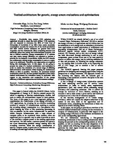
Henrique P. de F. Filho, Maristela Holanda, Bernardo Macêdo, Renata Nunes, Paulo Brener Department of Computer Science University of Brasilia Brasilia, Brazil
[email protected],
[email protected],
[email protected],
[email protected],
[email protected]
Abstract—The computational environment based on wireless communication made it possible to access information anywhere and at anytime, which is favorable for data collection in field research. Currently, most architecture for data collection are designed for a specific purpose, using specific technologies that are limited regarding data, network, synchronization and device type. This paper presents an architecture for field research data collection that works in heterogeneous computational environments and supports vector geographic data. This architecture was validated with a case study conducted at the Institute of Geosciences (IG) of the University of Brasilia (UNB). Keywords-Data collection; field research; architecture; heterogeneous computational environments; vector geographic data
I. INTRODUCTION The technological advances of the last decades associated with wireless technology communication are intended to allow access to information anywhere and at anytime, making a favorable environment for the development of computational systems, which are aiming at collecting data in field research [16]. One of the challenges in this environment is to assure the consistent state of the database involved in the system. There are databases in mobile devices and the central database [21]. Nowadays, most of the data collecting architectures work in homogeneous computational environments [16][18][21]. In other words, they use specific technologies concerning, for instance, data, network, synchronization, and device types, and they fulfill a specific data gathering need. In this context, this paper proposes an architecture for collecting data in a heterogeneous computational environment where information stored on each mobile device is replicated and correctly integrated into a central database. The proposed architecture not only collects conventional data, but also vector geographic data, because the demand for this type of data is high in geology and geoscience research, and spatial remote sensing. This paper is organized as follows: Section II presents other work related to this research study; Section III deals
Copyright (c) IARIA, 2014.
ISBN: 978-1-61208-326-1
Henrique Llacer Roig Institute of Geoscience University of Brasilia Brasilia, Brazil
[email protected]
with the main aspects of a system for mobile data collection; Section IV presents the proposed data collection architecture; Section V presents the case study; Section VI presents the conclusions. II. RELATED WORK A software suite that can be used for data collection in field research inserted in a mobile computational environment is available on the market. These software have architecture for data collection that caters to diverse contexts of field research, however, they are tied to specific technologies, which is a limitation of their use. Nokia Data Gathering solution and AuditMagic are examples of these software applications [3][16][18]. Nokia Data Gathering is a system that allows the collection of data on mobile devices and the transmission of results to real-time analysis, in accordance with the access to a network data communication. The system allows the creation and delivery of questionnaires for mobile phones and integration into a database using a pre-existing cellular network common [16][18]. With regards to this solution, a problem was identified: it is a closed architecture tool that only works for Nokia cell phone devices. AuditMatic has a set of solutions for developing instruments to collect field data associated analysis tools. However, this tool is also a package deal where you cannot make changes according to the needs of each research [3][16]. Most architectures for data collection in field research proposed by researchers meet only a single context of data collection, namely, the context in which the research is embedded. The goal of this paper is to propose an architecture that meets the needs of data collection of this research. An example is the architecture for collection and dissemination of weather data in the state of Piauí proposed by researchers from EMBRAPA (Brazilian Agricultural Research Corporation) and the Faculty of Technological Education of Teresina [21]. Another example is the system architecture for data collection in a mobile computing environment where Internet access is intermittent, which was validated in the research of Rural School Transportation, developed by the Centro
1
GEOProcessing 2014 : The Sixth International Conference on Advanced Geographic Information Systems, Applications, and Services
Interdisciplinar de Estudos em Transportes (CEFTRU/UNB) in partnership with the Fundo Nacional de Desenvolvimento da Educação (FNDE), whose objective is to evaluate the reality of school transport in rural Brazil. [16] This architecture has mechanisms for fault tolerance; however, it does not support geographic data and uses a specific technology that meets only the context of the collection in question. As previously stated, these architectures serve only these context specific collections using specifics technologies, specifics synchronization protocols that best fit the types of data to be synchronized, whether architectures can be used in other context collections or not. The architectures proposed by researchers, which have the same objective as the architecture proposed in this paper, do not support the collection of geographic data. Ji [23] presents an architecture that aims to collect georeferenced data. The communication between client and server is done via web Services using the technology of wireless networks. III. MOBILE DATA COLLECTING SYSTEM The Mobile Data Collection System (MDCS) allows the collection of remote geographic locations and the transmission of data to central locations - data storing repositories through a wireless network. It is a combination of a client application running on mobile devices, wireless network infrastructure and remotely accessible database servers [11]. Most of these systems share the same principles and guidelines for remote data collection. As shown in Figure 1, the process begins by developing the application with a form, which contains a set of questions to collect relevant data. Data collectors use these forms on the mobile device to collect real data in the field. It is possible to upload the data to a database in the central server [11].
Figure 1. Flow diagram of a MDCS. Adapted from [11].
One challenge in MDCS is the data synchronization. In mobile environments, synchronization may be defined as the act of establishing equivalence between collections of clients and server databases [4][6]. For this synchronization to occur data replication is necessary. Replication is the process in which transactions executed in a database are propagated synchronously or asynchronously to one or more databases in a serial manner,
Copyright (c) IARIA, 2014.
ISBN: 978-1-61208-326-1
i.e., this means that all transactions are replicated in the same order in which they were requested [20]. If this does not happen, there may be inconsistencies between the mobile unit and the server in a mobile environment. Spreading asynchronously refers to a way of storing and sending replication, i.e., the operations to be replicated from mobile units can be stored in a local database until they are propagated to the server at the time of synchronization, since sometimes the connection is impossible [20]. The replication may be partial or total. In partial replication only part of the data from a database is replicated to other databases, while in full replication all data is replicated from one database to another [8]. With full replication, at least one copy is available, and the reliability is increased, since the user does not depend solely on the data available at a single location. In cases where a fault occurs in the system, data replication is requested by the user [14]. A synchronization protocol defines the workflow for communication over a section of data synchronization when the mobile device is connected to the fixed network. It should support the identification of records, protocol commands common to the local database and network synchronization, and be able to support the identification and resolution of synchronization conflicts [17]. IV.
THE PROPOSED ARCHITECTURE
The goal of an architecture for data collection in field research that works on heterogeneous computational environments is to disassociate the specificities of each collection with the used technologies, providing an architecture that can be used in various contexts for data collection. Subsequently, in this study, for a data collection architecture to work in several different computational environments this architecture must take two aspects into account: interoperability and flexibility. Interoperability is required so that architecture is not dependent on specific technology, but covering the possibility of using several technologies. Flexibility is required in two directions: the first to meet the diverse dimensions that data collection in the field can have, i.e., fulfill the data collection involving one or more institutions. A specific data collection can store the collected data in a single database located in a specific place or multiple databases located in several different places. The second is to make the necessary changes needed to pass the architecture to suit the contexts of data collection different, i.e., that the architecture is susceptible to changes - it can be configurable and reconfigurable. An architecture for data collection in field research that supports vector geographic data must use a Data Base Management System (DBMS) with support for spatial data in both collection devices as the servers involved in collecting. Abstractly, the proposed architecture consists of three stages: the collection field, synchronization and storage, as shown in Figure 2. Each of these stages is described as follows.
2
GEOProcessing 2014 : The Sixth International Conference on Advanced Geographic Information Systems, Applications, and Services
The synchronization protocol is used in architecture that will lay down the interoperability and flexibility of the architecture (flexibility towards the possibility of change, to adapt to contexts of different data collection), so the protocol for the architecture should be characterized as interoperability, and should be a free protocol, i.e., not proprietary protocol.
Figure 2. Abstract architecture of the heterogeneous data collection system.
Data collection in the field occurs through a computer system in the researchers’ mobile devices. This computer system must have a user interface, a method of data validation and a persistence layer. The user interface is responsible for entering data into the system, the validation method is responsible for validating the data entered so that relevant data are not forgotten or recorded incorrectly and the persistence layer is responsible for storing the data in the database mobile devices. The persistence layer must necessarily store the data in a DBMS that supports spatial data. After collecting the data, there is a synchronization step, where the collected data is synchronized with the synchronization server. The objective of synchronization is to generate replicas, through a full replication of the collected information, to the server that synchronizes data with the database server involved in the core collection. This synchronization is specified in the next section. Finally, data servers are stored in the core data set involved in the collection via data backup. The possibility of having more than one server central database is taken into consideration in this architecture, given the possible dimensions of data collection, contributing to the architecture’s characteristic flexibility. When we have more than one server database replication, server data synchronization occurs for these servers, creating data redundancy, which prevents the architecture from having a single point of failure.
Copyright (c) IARIA, 2014.
ISBN: 978-1-61208-326-1
A. Synchronization Stage The proposed synchronization is divided into two stages: capturing Structured Query Language (SQL) [8] statements and the transfer of these instructions to the synchronization server. The capture module modifications are responsible for capturing the SQL database from the mobile device in the event of any change in the database. The transfer module modification plays a client role in a client-server architecture, synchronizing the changes to the SQL statement capture module with the synchronization server. 1) Capture Module Modifications The capture of these new SQL statements is by searching for data that have a flag with value 1. This flag determines if the data has been synchronized or not. If it is set as 1, then the data has not been synchronized yet; if it is set as 0, then the data has been synchronized. This search can occur in all tables of the database or only one table in the database that concentrates all the changes that have occurred; see Figure 3. The flag only changes to 0 when all modifications are finalized, i. e., when i