Urban Planning (ISSN: 2183-7635) 2016, Volume 1, Issue 2, Pages 101-113 Doi: 10.17645/up.v1i2.645 Article
Data-Driven Participation: Algorithms, Cities, Citizens, and Corporate Control Matthew Tenney * and Renee Sieber Department of Geography, McGill University, Montreal, H3A 0B9, Canada; E-Mails:
[email protected] (M.T.),
[email protected] (R.S.) * Corresponding author Submitted: 16 April 2016 | Accepted: 10 June 2016 | Published: 4 July 2016 Abstract In this paper, we critically explore the interplay of algorithms and civic participation in visions of a city governed by equation, sensor and tweet. We begin by discussing the rhetoric surrounding techno-enabled paths to participatory democracy. This leads to us interrogating how the city is impacted by a discourse that promises to harness social/human capital through data science. We move to a praxis level and examine the motivations of local planners to adopt and increasingly automate forms of VGI as a form of citizen engagement. We ground theory and praxis with a report on the uneven impacts of algorithmic civic participation underway in the Canadian city of Toronto. Keywords big data; civic engagement; data-driven; local government; participation; smart city; urban planning; VGI; volunteered geographic information Issue This article is part of the issue “Volunteered Geographic Information and the City”, edited by Andrew Hudson-Smith (University College London, UK), Choon-Piew Pow (National University of Singapore, Singapore), Jin-Kyu Jung (University of Washington, USA) and Wen Lin (Newcastle University, UK). © 2016 by the authors; licensee Cogitatio (Lisbon, Portugal). This article is licensed under a Creative Commons Attribution 4.0 International License (CC BY).
1. Introduction Governments, from the municipal to national levels, are transitioning from the now “old” to “new” way of administering services to and engaging with their publics (Schmidt & Cohen, 2013). Such changes to city planning and policy-formation are driven by big data, which is viewed as the datafication of socio-behavioral observations (Brabham, 2009). Many fields of geography and urban planning have shifted to big datasets that are rapidly increasing in availability and being accessed by software solutions with a promised ease-ofuse (Graham & Shelton, 2013). For this paper, we consider a specific type of big geographic data called volunteered geographic information (VGI). VGI is the “widespread engagement of large numbers of private citizens, often with little formal qualifications in the creation of geographic information” (Goodchild, 2007, p. 212).
Urban Planning, 2016, Volume 1, Issue 2, Pages 101-113
Goodchild (2007) argues that VGI, can broaden the numbers and types of people participating due to the ease of contributing. He further asserts that “citizens as sensors” could augment government datasets, datasets once considered the responsibility of expert-collection by the municipal and state governments. Today, VGI acts as “a predominant source of information about scores of geographic features (i.e., cities, towns, national parks, landmarks)” (Hecht & Gergle, 2010, p. 229). Simultaneously, social technologies and digital service providers are fundamentally altering the way in which we go about our daily lives (cf., Castells, 2009). The transformational force of these algorithmically encoded apps are impacting how we work, interact with one another, and are becoming the digital markers of public opinion (Croitoru, Crooks, Radzikowski, & Stefanidis, 2013; Kwan, 2016). Indeed, corporate providers of “smart city” solutions like IBM, Facebook, and
101
Cisco offer to bring a suite of monitoring and analytical data-services which furnish insights on the needs of citizens and answer the demands placed on cities (Maillet, 2012). Where once urban planners, geographers, and statisticians were responsible for extracting actionable insights from primary-data like national censuses, the heterogeneous nature and massive volumes of VGI has mandated the use of big data analytics like machine learning algorithms and data-driven approaches for knowledge discovery (Kitchin, Lauriault, & McArdle, 2015). It is important to remember that the collection of VGI is often instrumentally regulated through software and, as we argue, analysis. As Sieber and Haklay (2015, p. 2) note: “there are structural (software coded) mechanisms to dictate what and how information is collected”. Issues of assertiveness and accuracy were primary barriers to the use of VGI by planners and policy-makers, but these are increasingly being assuaged by hidden “software solutions” (Wiig, 2015). Municipal governments increasingly look to VGI from local residents to improve public participation in local government (civic participation). The combination of location-aware mobile devices and Internet connectivity allow for easy reporting of infrastructure problems or provision of feedback on events. Elwood (2008) speaks to the potential of VGI to expand engagement because of the spatial narratives enabled by the heterogeneous platforms. VGI also makes claim to increase transparency in government decision making via the medium of Internet technology. These claims have created a “web of expectations” where the democratic process can be extended to everyone (Johnson et al., 2015). Elwood and Lesczynski (2013, p. 559) are less sanguine. If anyone can use the app, then it might be concluded that everyone is using it. If they are not, then people may be blamed instead of structural digital divides or discriminations. Elwood and Lesczynski add that VGI is often presented “as easy or fast, emphasising how undemanding it will be to participate” (Elwood & Lesczynski, 2013, p. 559). Despite VGI being relatively new to both city interests and as a form of participation, it is often situated as a technological solution to the “messiness of democracy” (Baack, 2015). The way in which VGI becomes a form of civic participation is often not entirely “active and deliberative” unlike the way participation is commonly seen in approaches such as Public Participation Geographic Information Systems (PPGIS). With VGI, participation becomes a largely passive act through automated service of data collection and analysis. VGI also responds to the requirements of active participation (e.g., direct interaction at public hearings or citizen panels), which people seem increasingly unwilling to engage with on a municipal level (Clifford, 2013; Putnam, 1995). This passive participation enables a seemingly boundless information space where city officials could effortlessly scrape public opinion from citizens’ twitter feeds and Urban Planning, 2016, Volume 1, Issue 2, Pages 101-113
interactions across the city (MacEachren et al., 2011). These repurposed contributions present the public as data—without the need of “distracting” people from their daily lives in order to actively engage with political activities (Cardone et al., 2013, 2014). We argue that VGI enacts a form of passive civic participation that is attractive to cities, corporations, and busy citizens, while conveying a host of contradictions. We begin by discussing the rhetoric surrounding digitally enabled paths to participatory democracy in current and future cities. This leads us to interrogate how the city is impacted by a rhetoric of harnessing civic participation through data science. We move to a praxis level and examine the motivations to develop automated forms of citizen engagement. We ground theory and praxis with a report on the uneven impacts of algorithmic civic participation underway in the Canadian city of Toronto. 2. Civic Participation and Its Digital Enablers Civic participation is considered a cornerstone of democracy (Hoffman, 2012). It has promised to keep “community life vital and public institutions accountable” (Roberts, 2015, p. 3), to ensure “the have-not citizens…be deliberately included” in policy-formation (Arnstein, 1969, p. 216), and to have “citizens as coproducers of public services” (Whitaker, 1980, p. 240). Despite these benefits, effective implementation of civic participation remains difficult and the ultimate role it has in city operations remain in a state of ambivalence (Innes & Booher, 2004). Many commonly mentioned reasons for this apparent ambivalence on part of policy-makers range from it proving difficult for governments to assure citizens they are being heard (Rowe & Frewer, 2005), civic participation rarely appearing to influence decisions of public officials (Chess & Purcell, 1999), and civic participation generally failing to capture a sufficiently broad spectrum of the public opinion (Lowndes, Pratchett, & Stoker, 2001a, 2001b). Common participatory methods used in cities have been considered to antagonize participants, pitting individuals or interest groups against one another, and rendering the duties of city officials more difficult to accomplish (Innes & Booher, 1999). Such issues with the implementation of citizen-government engagement have left many institutionalized mechanisms of civic participation, like public hearings and citizen surveys, “to be nothing more than rituals designed to satisfy legal requirements” (Innes & Booher, 2004, p. 419). The purpose of participation is often positioned as a defining aspect of the concept itself. For example, Innes and Booher (2004) identify several purposes for civic participation. First, civic participation provides a mechanism to inform decision-makers, determining public preferences that play a part in decision outcomes. Second, participation seeks to improve deci102
sions by incorporating the “local knowledge” of citizens into decision processes. A third purpose of civic participation is to foster goals of social equity and justice. This position often manifests through the mechanism of political power dynamics and may require a redistribution of power to achieve those goals. A fourth purpose of participation focuses on legitimizing an outcome from policy or planning decisions. Having the public involved in the process (although not necessarily influencing an outcome) justifies a government’s decisions. Finally, participation is often legally mandated, making it “something planners and public officials do because the law requires it” (Innes & Booher, 1999, p. 218). Over the past few decades, local governments have looked to the “use of information and communication technologies (ICT) to foster citizen engagement” (Cegarra-Navarro, Garcia-Perez, & Moreno-Cegarra, 2014, p. 660). Their pervasiveness and de rigueur have caused technologies to evolve from being a tool for mass communication, to being seen as a digital window into the activities and perceptions of urban populations (Kavanaugh, Carroll, Rosson, Reese, & Zin, 2005). To Kingston (2007, p. 138) the opportunities presented by the Web 2.0 changed “how citizens can participate in the delivery and management of everyday services in their neighbourhood”. As our lives become more integrated with social technologies, we as citizens inexorably adopt the role of VGI producers. We produce our participation through VGI by our passive actions, and play into the discourse surrounding the “development of e-society as an effect of new technologies development (that) is connected with accessibility of data concerning planning issues” (Hanzl, 2007, p. 291). ICTs, including geospatial technologies and location-aware devices, can impact civic participation approaches to adapt to information age demands (Greco & Floridi, 2004). Similarities can be found with PPGIS, which concerns the use of spatial technologies to facilitate citizen influence on governance (Sieber, 2006). Like claims for other ICT and now with the Web 2.0, PPGIS has often positioned technology as an approach to empower people, while carrying unintended social implications (Sieber, 2006). Geographic information systems (GIS) provided a platform for dialogue between the local knowledge of a community and the knowledge of experts and officials, although not always evenly or accurately with all those involved (cf., Pickles, 1995). PPGIS processes involve public contributions of geographic information with established goals to map, build, and develop participants’ communities. PPGIS is considered a bottom-up approach (Jankowski, 2009), even though implementation of PPGIS is often more “top-down” and serves government interests. Like PPGIS, VGI may be created from “the bottom”; it is increasingly being adopted in “top-down” approaches motivated by corporate interests that complicate the usage of VGI for meaningful public participation (Portugali, 2011; Söderström, Paasche, & Klauser, 2014). Urban Planning, 2016, Volume 1, Issue 2, Pages 101-113
Carver (2001) provides an early commentary on the transition of PPGIS to online technologies. According to Carver, Evans, Kingston, and Turton (2001, p. 907), traditional means of participation in the planning process require prolonged engagement between city officials and the public. They note numerous barriers like: “It takes time, familiarity, and confidence with bureaucratic procedures, personal contacts in key places, money for campaigns, and private transport in order to attend meetings.” Trust in local knowledge, that is the non-expert opinions of citizens, poses key problems for the PPGIS adoption cycle in official capacities, while there are growing needs to interrogate the many social barriers and implications born from the GIS (i.e., technology) and participation merger (cf., Elwood, 2006; Sieber, 2006). 3. Data-Driven Participation Passive civic participation extracted, aggregated, and analyzed through algorithms posits a different approach to citizen-government relationships by using indirect interaction methods (i.e., asynchronous, automatic, and repurposed content). Participation becomes the product of harvested public opinion from VGI (e.g., sentiments and topics from the text of a tweet) that then would be used within municipal decision-making. Inherent in these methods of participation are techniques that can utilize unstructured data, behavior-analytical algorithms, and distributed computing infrastructures to collect, transform, and extract relevant social signals from massive datasets from a variety of sources. Predictive algorithms and big data software solutions are strongly associated with the spread of interactive web capabilities and mobile-sensor technologies (Beer, 2009). There is a presumed suitability of big data like VGI to represent the local knowledge and interests of a community, which is largely unconfirmed speculation (Lin, 2012). A rapidly growing level of availability for VGI datasets continues to propel these claims of access to local knowledge (Tulloch, 2014). The localness attributed to VGI is often seen as stemming from the ability to track our day-to-day interactions and movements through distributed sensor areas that are now found everywhere, from the GPS-enabled phones in our pocket, to the video cameras adorning cities’ transportation corridors, buildings, and streets. Coupled with a growing stockpile of VGI, the introduction of many “software solutions” has only augmented a widespread credence in using VGI as a form of participation in city operations (Lin, 2012). The futurist Duperrin (2014) makes a case for VGI as part of prospective citizen-government interaction models. He argues that a shift to digitally mediated forms of passive participation both suits the ongoing societal convergence with Internet technologies because these practices are preferred by citizens:
103
“It is not participation that wearies people, nor its lack of sense but its active nature. It requires time (without being sure to get anything in return) and attention. No one denies the advantages of information sharing but employees do not understand why it requires extra work and citizens are happy from the benefits they get from the use of collective data (even unconsciously) but won’t spend their life behind their screen to provide a predictive, analysing and proposition machine with ideas, feedbacks and experiences.” (Duperrin, 2014) An active, engaged citizen is the prescription of the day, but that prescription is increasingly difficult to fill. Four characteristics advance this approach to passive engagement and participation in governance matters through VGI, namely 1) removal of the requirement for deliberation and education on multiple political issues (Albrecht, 2006), 2) power of data-driven analysis to abduct relevance and context of inputs from disparate datasets (Provost & Fawcett, 2013), 3) ability to offer a qualitative representation of collective public opinion and documentation relative to its formulation, and 4) improvement of transparency in the democratic process by clearly documenting these processes (Afzalan & Evans-Cowley, 2015; Anderson, 2011). Enabling users to contribute their own content (i.e., VGI) also has altered the concept of expert. An expert is not necessarily the primary content “producer”, nor is the amateur (i.e., public or citizen), but merely a passive “user” (Bruns, 2008). Part of this “produsage” model allows users (i.e., amateurs) to contribute actively, transform, and even “analyze” all kinds of content for their own purpose (Bruns & Schmidt, 2011). The pervasiveness of easy-to-use technology is sometimes seen as having effectively removed the need for any form of expert facilitation (Turner, 2006). For example, planners, technicians, or scientist in most PPGIS projects retain a level of oversight on the collection to use of the spatial data. Seeger (2008, p. 200) notes that most VGI is deemed an ontologically different kind of data collection than that through facilitated public engagement “because of the way in which the collection of volunteered gathered information is shepherded by a facilitator, as part of a pre-established planning or design process.” With public participation increasingly seen through VGI, the planner and specialist may eventually have no part in what some consider an entirely user-driven process (Ali & Fahmy, 2013). In certain cases, communities have deliberately limited any outsider involvement or purposely regulated the sharing of their collective knowledge with officials who use Web 2.0 technologies. These sorts of “gatekeeper techniques”, although not totally unprecedented prior to the VGI, are increasingly worrying to officials as well as the decreasing influence public participation may have on a decision's outcome (Johnson & Sieber, 2013). Urban Planning, 2016, Volume 1, Issue 2, Pages 101-113
Recently, researchers have been investigating similar forms of gatekeeping as the pruning and restriction of information access are increasingly done by coded functions in computer software (i.e., algorithms) (Napoli, 2015). In other words, with the increasing reliance on data-driven participation, this sort of control (i.e., be it the production of VGI by citizens, or how or where it is used by city officials) is now being delegated to the coded decisions of algorithms and by the available “solutions” a particular software is capable of performing (Bozdag, 2013; Winter, 2015). Another major shift with Web 2.0 is that active participation methods hold less influence on a particular engagement method (e.g., random opinion survey cards versus citizen panels). Rather than the level of involvement by citizens, a data-driven model emphasizes numerous participants indicating or justifying that they exert influence over official decision-making (Craglia & Shanley, 2015). Many crowdsourcing and citizenscience projects like OpenStreetMaps are heralded as examples of an ever-present “crowd” that is always willing to engage and relevant to the needs of a particular city. The public is considered to be an omnipresent crowd and participation is the digital contribution that enables change in social, environmental, and political environments (Vesnic-Alujevic, 2012). It is also becoming clear that the level of influence exerted by datadriven participation will increasingly be evaluated in terms of how big a scale it achieves (Sieber & Tenney, n.d.). This is a scale arguably out of reach for any single municipal department, expert, or community of citizens to process without additional software analytics furnished by private companies (Bucher, 2012). Proponents claim that new civic tools facilitate direct citizen-to-government (C2G) connections, enhance citizen-to-citizen (C2C) interactions, and should eventually lead to an “automated democracy” (e.g., Cardone et al., 2013). That is, the ideals of directdemocracy (i.e., civic participation) are merging with data-driven methods of a “fourth paradigm in science” and are ushering in an era of governance by algorithm (Esty & Rushing, 2007). According to Esty & Rushing (2007, p. 14), this era uses: “Robust data collection and analysis to illuminate problems and enable policymaking that is more nimble, tailored, and experimental. Closes gaps in knowledge by harnessing new technologies to collect, analyze and disseminate key data. Focuses on results by setting quantitative, outcome-focused goals, measuring policy performance, and comparing results among peers. Develop systems to ensure data are used to guide policy priorities and solutions.” (Esty & Rushing, 2007, p.14) A common goal in numerous big data projects is to automate aspects of municipal operations (cf., Kitchin, 104
2013) that create a “recommendation system” for choices in governance. This is a form of data-driven participation, where the future of participation promotes an understanding of the city as a complex system. In this system, both physical and social operations can: 1) be reduced to the calculation of variables that represent actualities of human existence and lived geographies (Mattern, 2015), 2) the system can then be optimized through these derived indicators (i.e., data) and a series of algorithmic tweaks (Hollands, 2008), 3) that in turn will inform city officials and policyformation to better serves its public (Tang, 2015). It is not just the power of big data (or VGI) that offers many of these opportunities; the tools (i.e., the algorithms) used to collect, process, and analyze patterns and relationships purportedly inform policymaking. 4. Algorithms, Planning, and Governance One can simply define an algorithm as a set of procedural steps that solve a particular problem. However, all algorithms must have some form of input and output, “two openings that can be manipulated to help shed light on the algorithm's functioning” (Diakopoulos, 2015, p. 405). In practice, algorithms exist in complex realities where they are commonly hidden from sight (cf., Manovich, 2013). These procedures are also interconnected to such an extent that it becomes difficult to determine where one function ends and another begins. For example, it is rare to find an individual algorithm or procedure that stands alone without being used in tandem with another algorithm (e.g., a function used for the prioritization of some content without the content first undergoing algorithms of categorization and association). Further, many algorithms come with various levels of transparency and control over their parameters. Such cases are exemplified by proprietary and closed-source services when the actual code becomes buried inside larger software packages (e.g., IBM’s InfoSphere). In cases of closed-source or proprietary software, it is common to describe the inner-workings (i.e., the algorithms and impacts over their input to garner an output) as black boxes (Diakopoulos, 2014). “Deconstructing the black boxes of Big Data isn’t easy. Even if they were willing to expose their methods to the public, the modern Internet and banking sectors pose tough challenges to our understanding of those methods. The conclusions they come to— about the productivity of employees, or the relevance of websites, or the attractiveness of investments—are determined by complex formulas devised by legions of engineers and guarded by a phalanx of lawyers.” (Pasquale, 2015, p. 6) Algorithms are realized through computer code and software systems that guide a widening array of publicUrban Planning, 2016, Volume 1, Issue 2, Pages 101-113
private spheres, urban mobility, logistics, and service systems (Kwan, 2016). Kitchin and Dodge (2011, p. 246) argue that algorithms have permeated the seams of nearly every aspect of modern life, and have birthed an unintended yet “vital source of social power”. This has only recently become a topic for discussion in legal and public policy discourse. Such discourse often emphasizes adapting government operations to a form of algorithmic governance, which is a digital form of decision-making that relegates duties (and perhaps liability) of governments to computerized processes (Diakopoulos, 2016). Algorithmic usage varies in form and function depending on how the acted-upon data was created, collected, and eventually employed within urban planning contexts. The use of computational or algorithmic methods arose in various areas of city planning through spatial analytical functions of GIS. In the 1970s and 1980s, the use of positivistic techniques of spatial analysis like destination-allocation models relied on rational, objective perspectives on urban dynamics and planning policies (Lake, 1993). For example, Balling, Taber, Day, & Wilson (2000) developed mathematical optimization functions rendered through multiobjective genetic algorithms. This plan was thus a product of rules-based and automated heuristics from land-use zoning and policy variables to create the “optimal” layout for a city. Planning departments mediated their stance by utilizing “stakeholders”. This approach, common throughout the 1990s, envisaged urban form based on “the desired image of a city” amongst a consulted group of citizenry (Fainstein, 2000). As Fainstein (2000) details, this planning perspective stressed direct civic engagement and often would utilize web-based discussion portals or citizen feedback systems. In these cases, an algorithm for decision-making may be within the particular software or technology, but was seen as a social process where the “input” to planning processes aimed to coproduce an “output” of a planned city according to the desires of a citizen. Brown, Kelly, and Whitall (2014, p. 2) reviewed PPGIS methods of engagement with “amateur” citizens and “expert” planners in environmental assessment projects. They find that most of these projects lead to “better results for environmental quality and social objectives”. However, the identification and inclusion (or exclusion) of stakeholders in these PPGIS projects is problematic in many of the areas PPGIS was applied. Brown et al. (2014) describe the issue as PPGIS sampling bias, which tends to benefit the majority stakeholders. This further disenfranchises minority groups who are pushed to the periphery of influence or, at times, completely excluded. Big data (and by proxy VGI) claims to solve these sampling problems by harnessing massive datasets, which are situated as being representative of entire populations (Kitchin, 2014). VGI and big data algorithms are injected within the current planning era, are often called “new urbanism”. 105
Fainstein (2000) describes this as the culmination of both the “planned-city” and “desired-city” models that holds a strong emphasis on equity, that is, the “just-city model”. As we argue, the primacy of control in this data-driven realm of big data analytics is bestowed onto the algorithms that often act behind the scene, out of sight from both the citizen and the city official. Data-driven participation relies on the use of large volumes of citizen-contributed data harvested from various sources and sensors, which are integrated through Internet based services and the physical infrastructure of a city. This VGI stands as the datafication of human activities and social life where our movements, interactions, and opinions become coded through digital services and transubstantiated by an array of algorithmic treatments (Richter & Winter, 2011). It is rare that an end-user has total control over a VGI dataset from the collection to its use in any particular capacity (Budd & Adey, 2009). Rather, it is often argued the adopting data-driven approaches and computational methods remove the requirement of getting too involved with dealing with the “raw” VGI. According to Diakopoulos (2015, p. 401), the “intrinsic crux of algorithmic power: (is) autonomous decision-making”. “Regardless of an algorithm’s function, their application employs a transformative perspective to viewing the world of municipal operations that “problematize(s) public life, including how they necessitate the datafication of the world, create complex feedback loops with social data, or encourage the creation of calculated publics.” (Diakopoulos, 2015, p. 401) Many of the algorithms used for big data are seen as being predictive, acting in real-time, and learning from existing observations to better interpret future events (Winter, 2015). The decisions being made by software and algorithmic treatments of VGI fundamentally challenge old practices of decision making in urban planning and policy-formation by becoming condensed decision points fitting on a computer monitor. These new practices of political regulation become ensconced in the realm of what media mogul Tim O'Reilly has deemed “algorithmic-regulation”. To O’Reilly (2013, p. 300), using data-driven techniques for guiding decisionmaking at the municipal level delivers four unparalleled advantages over traditional means of engagement. They are: 1) creating a deep understanding of the desired outcome; 2) providing an ability to utilize realtime measurements to determine successes or failures when attempting to accomplish a determined outcome, 3) using “unbiased” algorithms or computer software that can both manage the volumes of realtime data and make needed adjustments based on new scenarios, and 4) utilizing periodic “deeper analyses” to further refine the functioning of these algorithms as a Urban Planning, 2016, Volume 1, Issue 2, Pages 101-113
means to ensure they are performing as expected. Visions of a city that operates on the back of algorithmic policy and planning regulation contradict theories of a city as an assemblage, which emphasize socialproduction by human and organizational dynamics. As Chandler (2015, p. 841) warns: “Unfortunately, what works for Google does not work so well for marginal and vulnerable people and communities that desperately need to transform their circumstances”. For Chandler (2015), big data does not empower those most in need social change, but instead can only assist in the management of what already exists. In other words, determining what exists, what becomes interrelated, and what will occur depends on the observable properties of available big data. Therefore, the algorithms trained from and unleashed upon the available observation space in VGI datasets do little to identify or benefit those communities that exist on the margins or are entirely excluded (i.e., the uneven digital divide and social inequity). Another issue regarding the use of or reliance on algorithmic-regulation stems from the control withdrawn from the citizens generating the data and from the city officials wishing to use VGI. The ability to interpret the meaning of VGI datasets is argued as transcending the cognitive capacities of any single human. These beyond-human barriers are seemingly tackled by software solutions that are modeled after (both in terms of our neural processes and trained by our very thoughts, activities, and normative behaviors observed from training datasets) human facilities. For example, the renowned IBM artificial intelligence (AI) software called “Watson AI” already are marketed to and used in municipal operations: “Watson is a lot like us. Watson can read and understand natural language and can draw conclusions from it. Whether it’s twitter feeds, websites, or traditional data sets, Watson can make sense of it and present it in a way that makes sense to you. Through your interactions with Watson, Watson learns, tracking feedback from you about its successes and failures and becoming smarter the more you interact with it. Watson can analyze huge amounts of data and reduce it down to critical decision points. For each conclusion Watson reaches, it provides a confidence level. Watson learns from us. The more we interact with Watson the “smarter” Watson gets.” (elementblue, n.d.-a) Such discourse suggests Watson surpasses our limited human-capacities (the very same it emulates) and enters a plane of infallible clarity for principled decisionmaking. Paradoxically, Watson is trained on our limited faculties, which means it will always be subject to “learn” from the available collections of knowledge that we contribute or can dataify. A prudent omission 106
regards the fact that what makes Watson and other similar systems “smarter” is the often irrational, illegible, or incorrect data that is represented through an uneven access to VGI. This VGI may have limited or no relevance to the conditions of a specific geographic context. Crampton et al. (2013) note that a preoccupation with “location” (i.e., the distinguishing characteristic of VGI from other forms of user-generated content) ignores the complexity of a mediated reality; greatly limits our observation space, thus missing the opinions of “others”; and ultimately reduces our ability to truly know a geographic locality: “Content is not produced solely by human users, but is the product of a complex, more-than-human assemblage, involving a diversity of actors, including automated content producers like Twitter spam robots.” (Crampton et al., 2013, p. 231) Early concern surrounding the use of VGI in municipal operations focused on quality aspects of the data and proxy measures like “credibility” and provenance to attest that any given contribution was fit for use. Per Elwood, Goodchild, and Sui (2012, p. 584), these forms of data “can be said to be asserted, in contrast to the authoritative products of traditional sources that derive their authority from their creation by highly trained experts.” In turn, this raises questions about the nature of truth and data quality aspects that VGI can have when used in “official capacities”. Stephens (2013) and Haklay (2010) note divisions between gender, race, and social class representation available in data from the Web 2.0, reinforcing the inequalities of social justice prevalent in modern society. Discrepancies in power, representation, and processes (i.e., in data collection, data quality, and effects of data analysis) found across web-enabled participation methods and crowd-sourced systems remain largely unknown, prompting the need for further research in these areas (boyd & Crawford, 2012). Graham, Hogan, Straumann, and Medhat (2014), advise: “It will now take much more sustained quantitative and qualitative inquiry into locally contingent challenges, barriers, inequalities, and deliberate exclusions for us to understand how to work toward more inclusive, more just, and more equitable representations and digital layers of our planet.” (Graham et al., 2014, p. 763) Whereas these aspects of uneven representation have also been longstanding issues in active participation, they are exacerbated by the “uncertainty” of transitioning to a form of data-driven participation (Kwan, 2016). This largely due to a limited ability to examine or explore such uneven processes that data undergoes, which are locked behind coded-doors (Diakopoulos, 2016). Institutional policy has begun to collectively Urban Planning, 2016, Volume 1, Issue 2, Pages 101-113
trust the “ghost in the machine” and it marginalizes concerns regarding the quality of VGI that is instrumentally corrected and cleaned. “Instruments are a critical source of knowledge. They are seen as more reliable than humans in VGI by relying on GPS signals that provide technological information about the location. The same is true with the embedded coordinate information in the header of digital photos taken by a cellphone. The information is captured automatically by machines of which uncertainty and precision can be quantified and therefore it is trustworthy.” (Sieber & Haklay, 2015, p. 2) Algorithmic procedures on VGI presume to act as corrective lenses for our ability to see the contours of the digital divide. Any remaining concerns seem to be negated by the promises of unparalleled insights furnished by the use of big data (boyd & Crawford, 2012). 5. Myopic Algorithms Guiding a (Non-)Responsive City in Canada Frictionless participation through technological innovation depends on software and algorithms to make sense of a deluge of social data. By using this data a city seemingly becomes “smart”, or “intelligent”, or “responsive” (Hollands, 2008). Endless supplies of fuzzy concepts like the “smart city” are rarely used consistently. There is neither a single template for framing the datafication of the city, the types and capacities of data and algorithms running through it, nor any examples that can be generalized from current practice (Albino, Berardi, & Dangelico, 2015). Instead, there is widely uneven reach to the role and implementation of algorithmic-regulation and “smart governance” when it comes to civic participation in municipal operations. There remains a strong connection to century-old cybernetic theories that place public trust in computational systems and mechanical controls of public administration. Goodspeed describes these machine systems as: “The fundamental unit of cybernetics (that) is the control loop used to monitor and control a specific system. The loop is made up of sensors to detect conditions, actuators that can make changes and an intelligent controller.” (Goodspeed, 2015, p. 81) The fundamental unit of the algorithmically-regulated city thus expands beyond the control loop. The complexity of these control-loops is obfuscated by a proprietary shroud of software solutions. Data-driven participation occurs through these algorithms and enables a city to become truly responsive to newly minted intelligent communities (Williams, Goodwin, & Cloke, 2014). An example of uneven reaches and control shift in 107
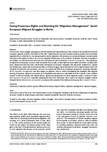
planning practices and citizen engagement is the “Intelligent Community” initiative within Canada’s largest city, Toronto. The Waterfront Toronto Corporation is an established public-steward that launched an “Intelligent Community” in 2013. This broad action plan was designed to enhance the lives of those who live and work in Toronto’s waterfront communities (Figure 1). By enlisting a series of private companies (e.g., IBM, Cisco, and Element Blue LLC), public investments have aimed for a cloud-based community platform “designed to use data to support smarter decision-making for waterfront residents and businesses about everything from daily commute to health and wellness, energy and water use” (www.newblueedge.ca). Facilitating the civic participation efforts of the Intelligent Community initiative is a hybrid system provided and operated by the private company Element
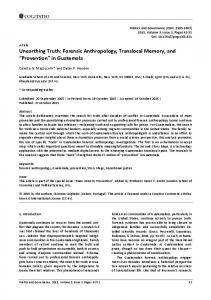
Blue LLC. Element Blue operates around the world as an IBM partner to provide various software solutions to government operations. The company’s flagship software solution is called CitizenReach, which is described as “a web, mobile, and tablet enabled public comment platform designed to effectively and efficiently facilitate the dialogue between citizens and government entities.” (elementblue, n.d.-b) CitizenReach claims to offer citizens an ability to voice their opinions and present an opened window for government entities to hear from them. Underneath the CitizenReach solution (Figure 2), is a system of components and algorithmic functions that can “integrate with unstructured data such as SMS, and major social media sources…(with) complete pre-processing (capture, analysis, validation) to this unstructured and incomplete data before it is forwarded to other systems” (elementblue, n.d.-b).
Figure 1.Map of Waterfront Toronto Communities. Source: Waterfront Toronto (n.d.-a).
Figure 2. The CitizenReach platform being deployed in Waterfront Toronto communities. Source: elementblue (n.d.-b). Urban Planning, 2016, Volume 1, Issue 2, Pages 101-113
108
The New Blue Edge project started in 2014 and was quickly supported through municipal funding. Despite considerable enthusiasm, the project has yet to progress much further than the development phase. In fact, many citizens living in the Waterfront community are unaware of the multimillion dollar contract that had been made between these corporate service providers and Waterfront Toronto, let alone informed as to any of the services they provide. Services of this software stating it can correctly identify the community members and other stakeholders to provide them a seamless “integration (that) deepens the previously passive web experience into an integrated, geo-aware, and interactive experience” (elementblue, n.d.-a). However, the rhetoric has seemingly yet to be practiced. From the onset of the New Blue Edge project, many Toronto citizens and planning officials were cut out of the loop as most of the project’s implementation was delegated to corporate control (Lorinc, 2013). After several years and over $1.2 billion dollars of public investment into the Waterfront Toronto initiatives, many of the proposed intelligent enablers have yet to leave the “development phase” (Starr, 2014; Verner, 2015). Much of the New Blue Edge community portal remains inoperable and it remains unclear whether companies are already harvesting VGI data to both citizens and planning officials that do not have access to the “behind the scenes”. This lack of control by citizens and municipalities over the data-driven participation efforts erodes the very notions of empowerment, transparency, and efficiency the project is argued to provide. Further, the abdication of already limited public resources through investment in private companies to collect and manipulate potentially-sensitive datasets being harvested could be perceived as encroaching on the privacy rights of citizens. It also limits the role of local planners and governments, and fuels a multi-billion dollar data-commodity market that aims to resell this valuable data to other private interests (Campbell & Carlson, 2002; Medway & Warnaby, 2014) 6. Conclusion We argue that data-driven forms of civic participation increasingly become the modern approach for municipalities to engage with citizens. Data-driven participation relies on the use of large volumes of data (i.e., VGI) that are handled through complex assemblages of computer software and algorithmic treatments. The promised capabilities of these tools include: 1) remove key aspects of deliberation and education that often seen as imperative to more active forms of civic participation, 2) bring the power of data-driven analysis to extract hidden insights from unruly datasets, 3) condense the complexity of urban life to consumable graphics on a screen, and 4) provide greater transparency in the democratic process via clear documentation. Urban Planning, 2016, Volume 1, Issue 2, Pages 101-113
As mentioned above, the purpose of civic participation is often conflated with its ontological definition. In the case of VGI, large amounts of citizen-contributed data are algorithmically harvested and repurposed, which render citizen-government relationships into passive forms of indirect interaction (i.e., asynchronous, automatic, and repurposed content). It has been further argued that the suitability of both VGI and big data analytics becomes a matter of concern because VGI “does not work so well for marginal and vulnerable people and communities that desperately need to transform their circumstances” (Chandler, 2015, p. 841). Data-driven participation consequently shifts from its primary purposes in cases such as PPGIS and active deliberation methods that seek to empower citizens and influence government decision-making. Instead, datafication of participation via VGI propels the integral process of democracy into data-market economies that are largely driven by corporate interests outside those held by government officials and citizens. Further, much of the “how” and “what” behind datadriven participation remains hidden in proprietary black boxes. Diminished access to the data constituting participation not only negates the promises of transparency commonly attached to the use of Internet technologies but also obfuscates who retains control and responsibility for outcomes of such approaches (i.e., removed from the citizens producing the data and planners wishing to use it and placed into the hands of private companies). Motivations for a data-driven participation seek to harness the participatory aspects of governance with data produced by this ubiquitous technology. However, the sheer volume of data suggests VGI can be harnessed only through the “intrinsic crux of algorithmic power” that will effectuate “autonomous decisionmaking” (Diakopoulos, 2015, p. 401). In addition to streamlining the participation process in cities, algorithmic procedures carried out on VGI supposedly assuage any concerns and generate a corrective lens to see the contours of the digital divide. Any remaining concerns are negated by the promises of unparalleled insights furnished by the use of big data (boyd & Crawford, 2012). We provide an initial accounting of a form of coded engagement by data-driven participation methods at the municipal level. Our suggestion is we should look beyond the discourse of technological solutions offered by corporate storytelling (Söderström et al., 2014). In addition to issues of privacy, which data-driven approaches to participation will certainly exacerbate, the black box algorithms may do little to address issues of quality surrounding VGI. We should also be concerned that these data-driven approaches will diminish the role of civic participation in municipal operations as they increasingly supplant more active forms of participation. As Elwood and Lesczynski (2013, p. 559) put it, 109
“it is imperative to examine whether these practices emerge alongside other more collective and presumably demanding modes of engagement and action, or whether they signal a decline in these modes of political and social practice”. That being said, there are ample opportunities for VGI to operate in participatory capacities within cities. Restraint should be practiced in adopting a technological solution to the “messiness of democracy” that operates behind coded-doors. Acknowledgments We are grateful for the support from the following funders: SSHRC grant 895-2012-1023 "How the geospatial web 2.0 is reshaping government-citizen interactions” and Mitacs Accelerate PhD fellowship co-funded by Esri Canada Inc. Conflict of Interests The authors declare no conflict of interests. References Afzalan, N., & Evans-Cowley, J. (2015). Planning and social media: Facebook for planning at the neighbourhood scale. Planning Practice & Research, 30(3), 270285. Albino, V., Berardi, U., & Dangelico, R. M. (2015). Smart cities: Definitions, dimensions, performance, and initiatives. Journal of Urban Technology, 22(1), 3-21. Albrecht, S. (2006). Whose voice is heard in online deliberation?: A study of participation and representation in political debates on the internet. Information, Communication & Society, 9(1), 62-82. Ali, S. R., & Fahmy, S. (2013). Gatekeeping and citizen journalism: The use of social media during the recent uprisings in Iran, Egypt, and Libya. Media, War & Conflict, 6(1), 55-69. Anderson, C. W. (2011). Deliberative, agonistic, and algorithmic audiences: Journalism’s vision of its public in an age of audience transparency. International Journal of Communication, 5(0), 19. Arnstein, S. R. (1969). A Ladder of Citizen Participation. Journal of the American Institute of Planners, 35(4), 216-224. Baack, S. (2015). Datafication and empowerment: How the open data movement re-articulates notions of democracy, participation, and journalism. Big Data & Society, 2(2), 1-11. Balling, R. J., Taber, J. T., Day, K., & Wilson, S. (2000). City planning with a multiobjective genetic algorithm and a pareto set scanner. In I. C. P. Parmee (Ed.), Evolutionary design and manufacture (pp. 237-247). London: Springer London. Beer, D. (2009). Power through the algorithm? Participatory web cultures and the technological unconscious. Urban Planning, 2016, Volume 1, Issue 2, Pages 101-113
New Media & Society, 11(6), 985-1002. boyd, d., & Crawford, K. (2012). Critical Questions for Big Data. Information, Communication & Society, 15(5), 662-679. Bozdag, E. (2013). Bias in algorithmic filtering and personalization. Ethics and Information Technology, 15(3), 209-227. Brabham, D. C. (2009). Crowdsourcing the public participation process for planning projects. Planning Theory, 8(3), 242-262. Brown, G., Kelly, M., & Whitall, D. (2014). Which “public”? Sampling effects in public participation GIS (PPGIS) and volunteered geographic information (VGI) systems for public lands management. Journal of Environmental Planning and Management, 57(2), 190-214. Bruns, A. (2008). Life beyond the public sphere: Towards a networked model for political deliberation. Information Polity, 13(1), 71-85. Bruns, A., & Schmidt, J.-H. (2011). Produsage: A closer look at continuing developments. New Review of Hypermedia and Multimedia, 17(1), 3-7. Bucher, T. (2012). Want to be on the top? Algorithmic power and the threat of invisibility on Facebook. New Media & Society, 14(7), 1164-1180. Budd, L., & Adey, P. (2009). The software-simulated airworld: Anticipatory code and affective aeromobilities. Environment and Planning A, 41(6), 1366-1385. Campbell, J. E., & Carlson, M. (2002). Panopticon.com: Online surveillance and the commodification of privacy. Journal of Broadcasting & Electronic Media, 46(4), 586-606. Cardone, G., Cirri, A., Corradi, A., Foschini, L., Ianniello, R., & Montanari, R. (2014). Crowdsensing in urban areas for city-scale mass gathering management: Geofencing and activity recognition. IEEE Sensors Journal, 14(12), 4185-4195. Cardone, G., Foschini, L., Bellavista, P., Corradi, A., Borcea, C., Talasila, M., & Curtmola, R. (2013). Fostering participaction in smart cities: A geo-social crowdsensing platform. IEEE Communications Magazine, 51(6), 112-119. Carver, S. (2001). Public participation using web-based GIS. Environment and Planning B: Planning and Design, 28(6), 803-804. Carver, S., Evans, A., Kingston, R., & Turton, I. (2001). Public participation, GIS, and cyberdemocracy: Evaluating on-line spatial decision support systems. Environment and Planning B: Planning and Design, 28(6), 907-921. Castells, M. (2009). The Rise of the network society: The information age: Economy, society, and culture (vol. 1, 2 edition). Chichester, UK and Malden, MA: WileyBlackwell. Cegarra-Navarro, J.-G., Garcia-Perez, A., & MorenoCegarra, J. L. (2014). Technology knowledge and governance: Empowering citizen engagement and 110
participation. Government Information Quarterly, 31(4), 660-668. Chandler, D. (2015). A world without causation: Big data and the coming of age of posthumanism. Millennium: Journal of International Studies, 43(3), 833-851. Chess, C., & Purcell, K. (1999). Public participation and the environment: Do we know what works? Environmental Science & Technology, 33(16), 2685-2692. Clifford, B. P. (2013). Rendering reform: Local authority planners and perceptions of public participation in Great Britain. Local Environment, 18(1), 110-131. Corbett, J. (2013). “I don’t come from anywhere”: Exploring the role of the geoweb and volunteered geographic information in rediscovering a sense of place in a dispersed aboriginal community. In D. Sui, S. Elwood, & M. Goodchild (Eds.), Crowdsourcing geographic knowledge (pp. 223-241). The Netherlands: Springer. Craglia, M., & Shanley, L. (2015). Data democracy: Increased supply of geospatial information and expanded participatory processes in the production of data. International Journal of Digital Earth, 8(9), 679693. Crampton, J. W., Graham, M., Poorthuis, A., Shelton, T., Stephens, M., Wilson, M. W., & Zook, M. (2013). Beyond the geotag: Situating “big data” and leveraging the potential of the geoweb. Cartography and Geographic Information Science, 40(2), 130-139. Croitoru, A., Crooks, A., Radzikowski, J., & Stefanidis, A. (2013). Geosocial gauge: A system prototype for knowledge discovery from social media. International Journal of Geographical Information Science, 27(12). Diakopoulos, N. (2014). Algorithmic accountability reporting: On the investigation of black boxes. Tow Center for Digital Journalism, Columbia University. Diakopoulos, N. (2015). Algorithmic accountability. Digital Journalism, 3(3), 398-415. Diakopoulos, N. (2016). Accountability in algorithmic decision making. Commun. ACM, 59(2), 56-62. Duperrin, B. (2014, July 1). The future of participation: Big data and connected objects. Duperrin. Retrieved from http://www.duperrin.com/english/2014/07/ 01/future-participation-big-data-connected-objects elementblue. (n.d.-a). Advanced Analytics: IBM Watson. elementblue. Retrieved from http://www.element blue.com/solutions/advanced-analytics elementblue. (n.d.-b). Citizen Reach. elementblue. Retrieved from www.elementblue.com/solutions/ citizen-reach Elwood, S. (2006). The devil is still in the data: Persistent spatial data handling challenges in grassroots GIS. In D. A. Riedl, P. W. Kainz, & P. G. A. Elmes (Eds.), Progress in Spatial Data Handling (pp. 1-16). Berlin: Springer Berlin Heidelberg. Elwood, S. (2008). Geographic Information Science: new geovisualization technologies-emerging questions Urban Planning, 2016, Volume 1, Issue 2, Pages 101-113
and linkages with GIScience research. Progress in Human Geography. Elwood, S., Goodchild, M. F., & Sui, D. Z. (2012). Researching volunteered geographic information: Spatial data, geographic research, and new social practice. Annals of the Association of American Geographers, 102(3), 571-590. Elwood, S., & Leszczynski, A. (2013). New spatial media, new knowledge politics. Transactions of the Institute of British Geographers, 38(4), 544-559. Esty, D., & Rushing, R. (2007). The promise of datadriven policymaking. Issues in Science and Technology, 23(4), 67. Fainstein, S. S. (2000). New directions in planning theory. Urban Affairs Review, 35(4), 451-478. Goodchild, M. F. (2007). Citizens as sensors: The world of volunteered geography. GeoJournal, 69(4), 211-221. Goodspeed, R. (2015). Smart cities: Moving beyond urban cybernetics to tackle wicked problems. Cambridge Journal of Regions, Economy and Society, 8(1), 79-92. Graham, M., Hogan, B., Straumann, R. K., & Medhat, A. (2014). Uneven geographies of user-generated information: Patterns of increasing informational poverty. Annals of the Association of American Geographers, 104(4), 746-764. Graham, M., & Shelton, T. (2013). Geography and the future of big data, big data and the future of geography. Dialogues in Human Geography, 3(3), 255-261. Greco, G. M., & Floridi, L. (2004). The tragedy of the digital commons. Ethics and Information Technology, 6(2), 73-81. Haklay, M. (2010). How good is volunteered geographical information? A comparative study of OpenStreetMap and ordnance survey datasets. Environment and Planning B: Planning and Design, 37(4), 682-703. Hanzl, M. (2007). Information technology as a tool for public participation in urban planning: A review of experiments and potentials. Design Studies, 28(3), 289-307. Hecht, B. J., & Gergle, D. (2010). On the “localness” of user-generated content. In Proceedings of the 2010 ACM Conference on Computer Supported Cooperative Work (pp. 229-232). New York, NY, USA: ACM. Hoffman, L. H. (2012). Participation or communication? An explication of political activity in the internet age. Journal of Information Technology & Politics, 9(3), 217-233. Hollands, R. G. (2008). Will the real smart city please stand up? City, 12(3), 303-320. Innes, J. E., & Booher, D. E. (1999). Consensus building and complex adaptive systems. Journal of the American Planning Association, 65(4), 412-423. Innes, J. E., & Booher, D. E. (2004). Reframing public participation: Strategies for the 21st century. Planning Theory & Practice, 5(4), 419-436. 111
Jankowski, P. (2009). Towards participatory geographic information systems for community-based environmental decision making. Journal of Environmental Management, 90(6), 1966-1971. Johnson, P. A., Corbett, J. M., Gore, C., Robinson, P., Allen, P., & Sixeber, R. (2015). A web of expectations: Evolving relationships in community participatory geoweb projects. ACME: An International E-Journal for Critical Geographies, 14(3), 827-848. Johnson, P. A., & Sieber, R. E. (2013). Situating the adoption of VGI by government. In D. Sui, S. Elwood, & M. Goodchild (Eds.), Crowdsourcing geographic knowledge (pp. 65-81). Dordrecht: Springer Netherlands. Kavanaugh, A., Carroll, J. M., Rosson, M. B., Reese, D. D., & Zin, T. T. (2005). Participating in civil society: The case of networked communities. Interacting with Computers, 17(1), 9-33. Kingston, R. (2007). Public participation in local policy decision-making: The role of web-based mapping. The Cartographic Journal, 44(2), 138-144. Kitchin, R. (2013). The real-time city? Big data and smart urbanism. GeoJournal, 79(1), 1-14. Kitchin, R. (2014). Big data, new epistemologies and paradigm shifts. Big Data & Society, 1(1), Kitchin, R., & Dodge, M. (2011). Code/space: Software and everyday life. Boston, MA: MIT Press. Kitchin, R., Lauriault, T. P., & McArdle, G. (2015). Knowing and governing cities through urban indicators, city benchmarking and real-time dashboards. Regional Studies, Regional Science, 2(1), 6-28. Kwan, M.-P. (2016). Algorithmic geographies: Big data, algorithmic uncertainty, and the production of geographic knowledge. Annals of the American Association of Geographers, 106(2), 1-9. Lake, R. W. (1993). Planning and applied geography: Positivism, ethics, and geographic information systems. Progress in Human Geography, 17(3), 404-413. Lin, W. (2012). When web 2.0 meets public participation GIS: Volunteered geographic information and spaces of participatory mapping in China. Crowdsourcing Geographic Knowledge: Volunteered Geographic Information (VGI) in Theory and Practice, 83-103. Lorinc, J. (2013, December 22). Waterfront Toronto hopes to build an innovation centre that will become a “living lab” plugged into the smart city movement. The Toronto Star. Retrieved from http://www.the star.com/news/insight/2013/12/22/smart_cities_hy pe_or_hope.html Lowndes, V., Pratchett, L., & Stoker, G. (2001a). Trends in public participation: Part 1, Local government perspectives. Public Administration, 79(1), 205-222. 3 Lowndes, V., Pratchett, L., & Stoker, G. (2001b). Trends in public participation: Part 2, citizens’ perspectives. Public Administration, 79(2), 445-455. 4 MacEachren, A. M., Jaiswal, A., Robinson, A. C., Pezanowski, S., Savelyev, A., Mitra, P., . . . Blanford, J. Urban Planning, 2016, Volume 1, Issue 2, Pages 101-113
(2011). SensePlace2: GeoTwitter analytics support for situational awareness. In 2011 IEEE Conference on Visual Analytics Science and Technology (VAST) (pp. 181-190). Providence, RI: IEEE. Maillet, V. (2012, January 25). Social media and the city: Social media is changing the conversation (Professional). IBM Commerce Blog. Retrieved from https://www.ibm.com/blogs/commerce/2012/01/pa rt-1-social-media-and-the-city-social-media-ischanging-the-conversation/ Manovich, L. (2013). Software takes command: Extending the language of new media. New York and London: Bloomsbury. Mattern, S. (2015, March). Mission control: A history of the urban dashboard. Places Journal. Retrieved from https://placesjournal.org/article/mission-control-ahistory-of-the-urban-dashboard/ Medway, D., & Warnaby, G. (2014). What’s in a name? Place branding and toponymic commodification. Environment and Planning A, 46(1), 153-167. Napoli, P. M. (2015). Social media and the public interest: Governance of news platforms in the realm of individual and algorithmic gatekeepers. Telecommunications Policy, 39(9), 751-760. O’Reilly, T. (2013). Open data and algorithmic regulation. In Brett Goldstein & Lauren Dyson (Eds.), Beyond transparency: Open data and the future of civic innovation (pp. 289-300). San Francisco, CA: Code for America Press. Pasquale, F. (2015). The black box society: The secret algorithms that control money and information. Cambridge, MA: Harvard University Press. Pickles, J. (1995). Ground truth: The social implications of geographic information systems. New York: Guilford Press. Portugali, P. D. J. (2011). CogCity (cognitive city): A topdown→bottom-up USM. In Complexity, Cognition and the City (pp. 335-349). Berlin: Springer Berlin Heidelberg. Provost, F., & Fawcett, T. (2013). Data science and its relationship to big data and data-driven decision making. Big Data, 1(1), 51-59. Putnam, R. D. (1995). Bowling alone: America's declining social capital. Journal of democracy, 6(1), 65-78. Richter, K.-F., & Winter, S. (2011). Citizens as database: Conscious ubiquity in data collection. In D. Pfoser, Y. Tao, K. Mouratidis, M. A. Nascimento, M. Mokbel, S. Shekhar, & Y. Huang (Eds.), Advances in spatial and temporal databases (pp. 445-448). Berlin: Springer Berlin Heidelberg. Roberts, N. C. (2015). The age of direct citizen participation. London: Routledge. Rowe, G., & Frewer, L. J. (2005). A typology of public engagement mechanisms. Science, Technology & Human Values, 30(2), 251-290. Schmidt, E., & Cohen, J. (2013). The new digital age: Transforming nations, businesses, and our lives. 112
Rushden, UK: Random House LLC. Seeger, C. J. (2008). The role of facilitated volunteered geographic information in the landscape planning and site design process. GeoJournal, 72(3-4), 199213. Sieber, R. (2006). Public participation geographic information systems: A literature review and framework. Annals of the Association of American Geographers, 96(3), 491-507. Sieber, R., & Haklay, M. (2015). The epistemology(s) of volunteered geographic information: A critique. Geo: Geography and Environment, 2(2), 122-136. 0 Sieber, R. & Tenney, M. (n.d.). Smaller and smaller data in the era of big data. In Thatcher, J., A. Shears, J. Eckert (Eds.), The geoweb and geography: (Re)thinking research in the advent of big data. Lincoln, NE: University of Nebraska Press. Söderström, O., Paasche, T., & Klauser, F. (2014). Smart cities as corporate storytelling. City, 18(3), 307-320. Starr, R. (2014, October 24). Building the pieces of a new blue edge: Corktown Common tops landform that moves vision of waterfront to reality. The Toronto Star. Retrieved from https://www.thestar.com/li fe/homes/2014/10/24/building_the_pieces_of_a_ne w_blue_edge.html Stephens, M. (2013). Gender and the geoweb: Divisions in the production of user-generated cartographic information. GeoJournal, 78(6), 981-996. Tang, A. (2015). Questioning smart urbanism: Is datadriven governance a panacea? Chicago Policy Re-
view. Retrieved from http://chicagopolicyreview.org/ 2015/11/02/questioning-smart-urbanism-is-datadriven-governance-a-panacea Tulloch, D. (2014). Crowdsourcing geographic knowledge: Volunteered geographic information (VGI) in theory and practice. International Journal of Geographical Information Science, 28(4), 847-849. Turner, A. (2006). Introduction to neogeography. Sebastopol, CA: O’Reilly. Verner, K. (2015). Building an intelligent community on Toronto’s new blue edge. Presented at the New Blue Edge, Waterfront Toronto, ON, Canada. Vesnic-Alujevic, L. (2012). Political participation and web 2.0 in Europe: A case study of Facebook. Public Relations Review, 38(3), 466-470. Whitaker, G. P. (1980). Coproduction: Citizen participation in service delivery. Public Administration Review, 40(3), 240-246. Waterfront Toronto. (n.d.). Explore projects. Waterfront Toronto. Retrieved from http://www.waterfronto ronto.ca/explore_projects Wiig, A. (2015). IBM’s smart city as techno-utopian policy mobility. City, 19(2-3), 258-273. Williams, A., Goodwin, M., & Cloke, P. (2014). Neoliberalism, big society, and progressive localism. Environment and Planning A, 46(12), 2798-2815. Winter, J. (2015). Algorithmic discrimination: Big data analytics and the future of the internet. In J. Winter & R. Ono (Eds.), The future internet (pp. 125-140). Cham: Springer International Publishing.
About the Authors Matthew Tenney is a PhD Candidate in the Department of Geography at McGill University. Matthew’s research on “Coded Engagement” takes a broad look at how society and technology are converging with transformative impacts on nearly every aspect of everyday life, as well as how these forces are redefining the practice and study of geography more generally.
Renee Sieber is an Associate Professor in the Department of Geography. Her interests lay in the use and value of information technology by marginalized communities, community based organizations, and social movement groups; public participation GIS/participatory GIS/participatory Geoweb; use of GIS in the environmental movement; development of e-commerce tools for use in marginalized communities.
Urban Planning, 2016, Volume 1, Issue 2, Pages 101-113
113