Presence 15 (3) Special Issue on Virtual Heritage
Enhancing Virtual Reality with Artificial Life: Reconstructing a Flooded European Mesolithic Landscape
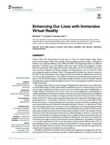
Eugene Ch’ng and Robert J. Stone Human Interface Technologies Team Department of Electronic, Electrical & Computer Engineering, School of Engineering The University of Birmingham, Edgbaston, B15 2TT, United Kingdom
[email protected] and
[email protected]
Abstract The fusion of Virtual Reality and Artificial Life technologies has opened up a valuable and effective technique for research in the field of dynamic archaeological reconstruction. This paper describes early evaluations of simulated vegetation and environmental models using decentralized Artificial Life entities. The results demonstrate a strong feasibility for the application of integrated VR and Artificial Life in solving a 10,000 year old mystery shrouding a submerged landscape in the Southern North Sea, off the east coast of the United Kingdom. Three experimental scenarios with dynamic, “artificial” vegetation are observed to grow, reproduce and react to virtual environmental parameters in a way that mimics their physical counterparts. Through further experimentation and refinement of the Artificial Life rules, plus the integration of additional knowledge from subject matter experts in related scientific fields, a credible reconstruction of the ancient and, today, inaccessible landscape may be within our reach.
1
Introduction
acquired seismic datasets from the Southern North Sea (Figure 1). Initial investigations revealed a large river valley from an ancient landscape dating back 10,000 to 7,000 years. At 600 meters wide with an observed length of 27.5km, the river valley displays a trend of North West to South West. This significant finding of archaeological value raises important questions regarding the migration of ancient hunter-gatherer populations from mainland Europe. These explorers may have tread upon the landscape or even populated the regions of the river valley just before the flooding of the North Sea that drove settlements away and wiped living organisms off the once thriving landscape.
Virtual Reality (VR) has been applied to many areas in the past to solve real-world problem domains. Over the past decade, as VR technology gained popularity in the domain of archaeology, networks of international organizations, notably the Virtual Heritage Network (VHN, 2000) have evolved to promote the use of VR for the education, interpretation, and preservation of cultural and natural heritage (as defined in (UNESCO, 2004)). Virtual Heritage sets out to “designate the use of computer-based interactive technologies to record, preserve, or recreate artifacts, sites and actors of historic, artistic, religious and cultural significance and to deliver the results openly to a global audience in such a way as to provide formative educational experiences through electronic manipulations of time and space” (Stone, 2000). Virtual Reality for Heritage is limited only by our imagination and effort in recreating worlds from the past and present that are either protected, such as Stonehenge (Stone, 1998), or inaccessible due to limitations of time and space such as the Shotton River Valley (named after a famous British geologist (Robson, 2004)). Recently the Petroleum Geo-Services (PGS, 2004)
The datasets originally gathered for oil prospecting were handed to the Institute of Archaeology and Antiquity at the University of Birmingham (UK) and, with the help of the high-end computing facilities, researchers were able to investigate the basic topography of the river valley in contours and 3D voxel volumes. The additional identification of ancient lakes and marshes prompted the initiation of the North Sea Visualization Project (NSVP) in collaboration with the School of Electrical, Electronic and Computer Engineering.
1
Presence 15 (3) Special Issue on Virtual Heritage
Reconstruction of this landscape requires different processes, including data conversion, virtual reconstructions, visualization and a multidisciplinary understanding of a range of details relating to climate, geological formations, flora and fauna specific to the Mesolithic period. Much of this initial groundwork has already been undertaken (Ch'ng, Stone & Arvanitis, 2004). The result is a collection of 3D digital renderings, animations, virtual interactive explorations and semi-immersive displays. To date, the reconstruction of the submerged Shotton River and the manual placement of 3D representations of lifeless vegetation have so far provided an acceptable, yet basic glimpse (to subject matter experts) of how the landscape (Figures 2 and 3) might have appeared 10,000 years ago.
Figure 1: Location of the Shotton River Valley The aim of NSVP is not only to visualize the Mesolithic landscape with vegetation positioned according to expert opinions from geologists, archaeologists and environmentalists, but also to impart software-based Artificial Life (ALife) properties and algorithms into the virtual vegetation in the hope that, by simulating localized and dispersed growth patterns, reproduction, adaptation and competition, it may be possible to obtain a credible interpretation of the landscape in order to determine settlement patterns of the ancient inhabitants. 2
Figure 2: Initial 3D Reconstruction of the Mesolithic Village
Virtual Reconstructions and High Quality Renderings
The Mesolithic period of Northern England is a much studied area. As early as 1913 (Reid, 1913), the experienced geologist Clement Reid laid down his perception of the North Sea plain as a landscape which was available for human inhabitants. This hypothesis has received support from the findings of recent excavations in a similar latitude to that of the Shotton River Valley, where Mesolithic dwellings have been uncovered in the Northumberland and Dunbar regions of the British Isles (Waddington, 2003). Continuing research (Clark, 1936; Wymer, 1991; Coles, 1998) in the field of archaeology have also attempted to highlight or visualize the North Sea plain both as a land corridor and as a place which once supported human life. However, previous attempts to visualize this environment have met with much difficulty, as pen-and-ink representations do not lend themselves well to meaningful exploration and interpretation in the way that today’s Virtual Reality and Computer Generated Imagery (CGI) can provide.
Figure 3: Initial 3D Reconstruction of the Shotton River Valley 3
The Role of Artificial Life in Virtual Heritage
The use of ALife techniques in virtual environments has provided a valuable and effective way for research within specific application areas (Luck & Aylett, 2000). Some researchers in the field of VR and CGI seek to progress beyond visually compelling but essentially empty virtual environments to incorporate other aspects of physical
2
Presence 15 (3) Special Issue on Virtual Heritage
eventually support the development of a historical representation of the ancient landscape based on abstract characteristics of vegetation behaviors.
reality that require intelligence or agents with characteristics of life (Luck & Aylett, 2000). ALife (Langton, 1989; Langton, 1995) is “the study of man-made systems that exhibit behaviors characteristic of natural living systems”. Such systems attempt to “synthesize lifelike behaviors within computers and other artificial media”. Rietman (Rietman, 1993) suggests that man-made systems that follow the biological stages of reproduction, metabolism, evolution, growth, selfrepair and adaptability can exhibit characteristics of life in nature. However, in practical implementations, not all ALife systems require the modeling of every aspect of biological life, but only that which is sufficient for problem solving. In the context of natural heritage, an example can be seen in Virtual Florida Everglades (DeLeon & Berry, 1998) where a virtual egret exhibiting foraging, patrolling, sleeping and fleeing behaviors based on simple rules was introduced. This added ‘life’ and a level of reality to an otherwise static landscape. ALife has also been used in the reconstruction of the swimming abilities of extinct animals in the ancient seas (Yoshiyuki, 1998). Others (Refsland et al., 1998) applied a theoretical approach towards creating a Virtual Great Barrier Reef consisting of autonomous artificial fish that behave according to environmental events and exhibit the authentic behaviors of a biological fish.
SeederEngine comprises three main modules, the Real-Time Rendering Engine, the ALife Engine, and the Seeder Manager which manages the environment and plants. The Environment Manager manages the initial settings of the Virtual Environment, such as the 3D terrain, temperatures, moisture, sunlight, and season, stored as an Ecosystem XML file. The Plant Manager manages the different species of plants with their 3D representation of the stages of growth from seed to maturity and characteristics of germination, growth, reproduction, competition and their adaptation to environmental factors. The Rendering Engine is integrated with the ALife engine, reflecting in real-time the state of growth of individual plants as they grow and compete for resources in their 3D representation. Figure 4 illustrates the interfaces of the system.
As taught by Christopher Langton, the ALife pioneer, life is “a property of the organization of matter” and “living organisms are nothing more than complex biochemical machines”. These concepts are important in the way which vegetation behaviors can be modeled. By identifying the objectives of using ALife in problem-solving for archaeology, and by studying the preferences and behavior of vegetation – abstracting its prominent characteristics – it becomes possible to synthesize plant growth and reproductive behaviors in order to endow an otherwise barren landscape with a living forest that thrives within the confines of a simulated virtual environment. 4
Figure 4. SeederEngine and Seeder Manager Interface The virtual environment in SeederEngine where the plants inhabit simulates environmental factors such as sunlight, moisture, temperature and its variation with altitude, soil type, nutrients, and levels of carbon dioxide present in the atmosphere. Each seasonal change in the virtual world is reflected by the variation in the environmental factors which simulates the climate in the Mesolithic settings. The interactive features in the system allow user-control of specific factors such as sunlight, moisture, temperature and water level (flooding/water logging). Each factor can also be disabled from affecting the environment to allow for a greater control during experiments. As the history of the landscape spans thousands of years, an adjustable timescale feature is included to speed up or slow down the processes for observations of the growing vegetation and its dispersal patterns.
SeederEngine: A VR and ALife Framework
The use of VR technology combined with knowledge of ALife has subsequently led to the development of the SeederEngine (Ch'ng, Stone & Arvanitis, 2005), a VR and Alife framework based on games engine technology. SeederEngine has the capability to integrate ALife behavioral components with the use of XML data describing the variable properties of life forms. The framework was built for the purpose of investigating and interpreting vegetation dispersal patterns within the vicinity of the Shotton River Valley. This VR test bed of artificial life may
5
Models of Vegetation-Based Artificial Life
Artificial vegetations are modeled based on the characteristics of their natural counterparts. A
3
Presence 15 (3) Special Issue on Virtual Heritage
accessible in the surroundings. Competition for space amongst plants is dependent on the size and form of the plants (tree, bushes and undergrowth) and the distances between them. The rules ascribed to the virtual plants define their establishment in age and their largeness in size to be advantageous in competition to ones that are smaller. The adaptation
decentralized approach (Resnick, 1994) was taken in modeling the ALife entities so that each organism has an equal opportunity in the struggle for existence in the simulated environment with an expectation that emergent behavior (Holland, 1998; Johnson, 2002) in terms of dispersal patterns in the landscape space will appear with their local interactions. The Plant Name Maximum Lifespan Plant Type Maximum Height Canopy Leaf Density Pollen Release Date Pollen End Date Seeding Month Seed Dormancy Period
Dryopteris filix-mas 3 Herbaceous Perennials 1 Meter 0.852/1.0 0.3/1.0 March May June 30 Days
Germination Days Germination Temperature Germination Moisture Preferred Sunlight Preferred Temperature Preferred Moisture Preferred Elevation Preferred Space Preferred CO2 Preferred Nutrient
30-90 Days 17-19°C 0.5/1.0 Upper: 0.69 Ideal: 0.56 Lower: 0.39 Upper: 30 Ideal: 20 Lower: 8 Upper: 0.62 Ideal: 0.47 Lower: 0.34 Upper: 5000 Ideal: 1000 Lower: 0 Upper: 0.98 Ideal: 0.84 Lower: 0.07 Upper: 0.26 Ideal: 0.14 Lower: 0.07 Upper: 0.32 Ideal: 0.21 Lower: 0.08
Table 1: Typical Vegetation Information in XML File
rules of a plant also differentiate trees from shrubs and herbs, in that the latter will be more tolerable to crowded situations. Figure 5 illustrates the simple rules for competition and accessibility of nutrients in appropriate scenarios:
ALife plant entity uses XML to describe the properties of growth, reproduction, adaptation, and seed germination. Each category of descriptors stores information regarding the plant’s maximum age, plant types such as evergreen, deciduous, annuals, biennials, and perennials, the rules of adaptation and their tolerance to environmental factors, reproductive functions and seed dispersal method, and the conditions for their seeds to germinate. A typical XML file contains the information in Table 1. Each vegetation ALife entity possesses sensors to sense the environment including the presence of other plants and react according to its preferences. This ability defines the behavior of the plant. Listing 1 depicts the rules in a plant life-cycle in the Alife implementation:
Figure 5: Scenarios of Competition among Plants for Sunlight, Space, and Nutrients In figure 5A, the smaller plant on the left are under full shade while the plant on the right receives partial sunlight. It is possible that plants under a forest canopy receive little to no sunlight. In figure 5B, the two groups of larger and smaller trees each compete with their neighbors for space. In this scenario, only overlapping plants compete with each other. Two groups of plants are depicted in figure 5C where the larger cluster naturally produces more nutrients than the smaller cluster in addition to a global nutrient level. The fitness of a plant is determined by the adaptability of a plant towards environmental factors and its competition with neighboring plants. The values gathered from sensing the environment and competition are measured by a tolerance function illustrated in Figure 6. Each plant has an upper, lower, and ideal preference towards each environmental condition including the values gathered from competition with neighboring plants. If the condition is within the ideal range, the plant retains its fitness. Conditions not within the ideal range will have its level of fitness decreased to the eventual termination of the plant.
Listing 1: 1. In the seed stage sense the environment for suitability of conditions for germination 2. While growing: 2.1. Increment age, interpolate size and change appearance: seed>seedling>young tree>mature tree>old tree 2.2. sense ecological changes in comparison with plant preferences 2.3. Compete with plants at proximity for sunlight, space, and nutrients 2.4. Sense seasonal changes for reproduction 3. If plant reaches maximum age or if fitness is depleted remove plant from the ecosystem
Competitions among plants are local and based on their size and their tolerance to sunlight, nutrients, and space. The density and canopy (collective leaves and branches) size of a plant will directly affect the level of sunlight received by plants smaller in sizes. Nutrients are global and are drawn from local positions as well as decaying plants that are
4
Presence 15 (3) Special Issue on Virtual Heritage
Grigson, 1981). Figure 7 is a representation of the fitness and location of different species of plants (red, green, blue, and yellow) in two-dimensional virtual space. T1-T4 are screenshots from variable time steps. Figure 6: A graphic representation of the tolerance function
At T1, the respective species begin to produce offspring. At T2, it is observed that parent plants and some offspring begin to die (turning pale) as a result of the environment. One species (a single plant in T1) did not leave offspring due to unfavorable conditions. The vegetation can be seen to “move” southward towards a more suitable climate. In T3, The global temperature was gradually increased and the plants began to migrate north due to the simulated effects of global warming.
6 Artificial Life Test Bed The simple rules explained in the previous section coupled with real botanical properties and preferences of plants have provided an ALife approach in synthesizing plant dispersal patterns and behaviors that are comparable to that of their natural counterpart. Three pilot experiments were conducted within the virtual environment based on the artificial
Figure 7: Vegetation Dispersal and Migration due to Global Warming A plant species exceeded its lifespan but did not leave progeny, which resulted in its extinction. In T4, the emerging patterns have reached a stable condition where the “face of nature remains uniform” as described by Darwin’s observations of life in The Origin of Species (Darwin, 1859).
life rules covered in the preceding section. In the first experiment, the topology of the virtual environment was defined as a landscape increasing in elevation towards the far (distant) plane. This implies that, towards the top of the landscape, the temperature decreases proportionally at 0.6°C per 100m in Mesolithic times (Simmons, Dimbleby &
5
Presence 15 (3) Special Issue on Virtual Heritage
Figure 8: Time Steps for Fern Reproduction (Small Virtual “Test Plot”)
onto the landscape with different age groups, ranging from seed/spores to fully mature plants. Figure 9 shows a selection of screenshots from variable time steps T1-T8. The figures showed difference in brightness due to the variation of sunlight and season. Environmental conditions were set to a typical four-season cycle as experienced within the British Isles.
In the second pilot experiment, ferns and their spores were released onto a small virtual environment (a virtual “test plot”) for observation (Figure 8). The ecosystem conditions were set to be favorable to the growth, reproduction, and germination of the fern species. T1 in Figure 6 is the initial setting where some of the vegetation can be observed. In T2, the growing ferns began reproducing with some of the spores being dispersed far from the parent via environmental factors such as wind conditions. Wind dispersal is a naturally-occurring phenomenon in which plant seeds are disseminated in such a way as to avoid the progenies competing with the parents for resources in later stages of their life. T3-T4 shows that some of the progenies have germinated due to favorable conditions from the soil, temperature, sunlight, and moisture.
Initial 3D representations of vegetation of different ages were placed in the landscape using the SeederEngine Manager before launching the engine for the experiment. Willows of different ages were situated around the landscape, two of which can be seen in T1. Ferns were scattered near the Willow trees. At T2, the Ferns did not leave offspring and were made extinct due to unfavorable conditions. The smaller sized Willow did not survive due to competition. Some of the Hazel seedlings can be observed as they germinate. Whilst some seedlings grew to become young trees (T3), others did not survive the environment and competition for space and sunlight from other plants (T4). A Hazel seedling which sprouted near the Willow in the foreground (T4) grew for some time (T5) but did not survive competition from the tree and died later. At T6, the trees have grown larger and more seedlings
A virtual landscape ten meters in width and length with a maximum height of two meters of elevation was established in the third pilot experiment. The size of the landscape was limited to this size for the purpose of simulating the competition among plants of different species and level of growth. Three species of plants (Willow, Hazel, and Fern), together with their properties and preferences, were individually described within XML and released
6
Presence 15 (3) Special Issue on Virtual Heritage
Figure 9: Competition and reproduction among plants of different species are seen to germinate. At T7, some seedlings have died whereas others germinated and lived to a certain height before dying off. At T8, the old willow tree in
the background expired as it reached its maximum lifespan leaving no offspring.
7
Presence 15 (3) Special Issue on Virtual Heritage
7
Discussion
reproduction could also be seen to work based on plant maturity and health with seasonal changes in the ecosystem. Seeds produced by the plants could also be noticed to germinate if the conditions were right. Once germinated, the seedlings began their struggle to survive, initiating a new cycle of artificial life.
This research explored the fusion of Virtual Reality and Artificial Life to solve a real-world problem domain, namely the Mesolithic reconstruction of the submerged Shotton River Valley. Whilst researchers in the distant past have attempted to visualize the appearance of the landscape by drawing upon known information and assembling the evidence from explorations, the visualization task has only recently become possible thanks to developments in computing hardware and accessible VR and ALife software and knowledge. Similarly, gathering largescale data from the ocean floor was an impossible task until tools capable of generating high-resolution seismic data were invented.
The simulation has so far demonstrated that the existence of the plants and their offspring corresponds to what Darwin (Darwin, 1859) described as “the whole economy of nature” where “a struggle for existence inevitably follows from the high rate at which all organic beings tend to increase… [and] as more individuals are produced than can possibly survive, there must be in every case be a struggle for existence, either one individual with another of the same species, or with the individuals of distinct species, or with the physical conditions of life.”
The onset of ALife research has only opened the door for computer graphics to progress beyond visually compelling but essentially empty environments to incorporate other aspects of physical reality that require characteristics of life. Furthermore, the ability to be able to visualize ALife will become an instrumental tool for researchers in their quest to solve problem domains in nature. In particular, the virtual reconstruction of living ancient landscapes that are inaccessible due to limitations of time and space will undoubtedly benefit from the simulation of flora and fauna in existence today. By exploiting the knowledge of researchers from the domains of geology, archaeology and botany, through the fusion of VR and ALife, the reconstruction of a credible historical representation of the Mesolithic Shotton River Valley is now well within our reach.
In this project, it has been shown that vegetation life can be modeled and synthesized in a virtual environment by generalizing and distilling their properties and behaviors into XML datasets and algorithms. By refining the rules through further studies of natural vegetation and their environments and by evaluating their life properties in variable scenarios, it may be possible to reproduce a realistic and comprehensive model of artificial vegetation for our problem domain. Close collaboration is under way with geo-archaeologists and environmentalists from the Institute of Archaeology and Antiquity at the University of Birmingham in defining properties for the environment and the artificial life-based vegetation for a formal study of the Shotton River Valley.
The approach adopted in the study reported here made use of decentralized ALife entities to model each plant based on a set of rules mimicking the behaviors of natural life before setting them in three different virtual ecosystems simulating environmental factors. In the three pilot experiments, different species of plants were observed to grow, reproduce, and react to the environment in a way that mimicked their physical counterparts. The growth of each plant was directly affected by the conditions of the environment and the presence of other plants. Ferns were observed to grow well in a compact site whereas shrubs and trees were better adapted to sparse surroundings. Matured plants, being established, appeared to be unaffected by smaller plants and the undergrowth, whereas young plants and seedlings were shown to be at a disadvantage in regard to sunlight and space unless they possessed excellent tolerance to shade and compact spaces. Experiments with environmental changes such as a global increase in temperature showed patterns of migration to cooler regions. In similar settings, those plants and seedlings unable to adapt to the changes became extinct. The rules of
Acknowledgements The authors would like to thank the University of Birmingham’s Institute of Archaeology and Antiquity for their contributions of the seismic datasets and valuable information with regard to the North Sea Visualization Project. Specific mention should be made of the valuable advice from the Director of the Institute, Professor Vince Gaffney.
8
Presence 15 (3) Special Issue on Virtual Heritage
References Ch'ng, E., Stone, R.J. & Arvanitis, T.N. (2004). The Shotton River and Mesolithic Dwellings: Recreating the Past from Geo-Seismic Data Sources. The 5th International Symposium on Virtual Reality, Archaeology and Cultural Heritage, VAST04: Interdisciplinarity or “The Best of Both Worlds”: The Grand Challenge for Cultural Heritage Informatics in the 21st Century, Brussels, Belgium, The Eurographics Association Ch'ng, E., Stone, R.J. & Arvanitis, T.N. (2005). A Virtual Reality Archaeological Framework for the Investigation and Interpretation of Ancient Landscapes. Internet and Multimedia Systems and Applications, EuroIMSA 2005, Grindelwald, Switzerland, IASTED Clark, J.G.D. (1936). The Mesolithic Settlement of Northern Europe, Cambridge University Press. Coles, B.J. (1998). Doggerland: a speculative survey. Proceedings of the Prehistoric Society 64 45-81. Darwin, C (1859). The oigin of species by means of natural selection. LONDON, JOHN MURRAY. DeLeon, V. & Berry, R. (1998). Virtual Florida Everglades. VSMM98 - Future Fusion: Application Realities for the Virtual Age, Gifu, Japan 458-463. Holland, J. H. (1998). Emergence from Chaos to order. Oxford, Oxford University Press. Johnson, S (2002). Emergence: The Connected Lives of Ants, Brains, Cities, and Software, Sribner. Langton, C.G., Ed. (1989). Artificial Life, Proceedings of an Interdisciplinary Workshop on the Synthesis and Simulation of Living Systems. Redwood City, Addison-Wesley Publishing. Langton, C.G., Ed. (1995). Artificial Life: An Overview. Cambridge, MIT Press. Luck, M. & Aylett, R. (2000). "Applying Artificial Intelligence to Virtual Reality: Intelligent Virtual Environments." Applied Artificial Intelligence 14: 3-32. Luck, M. & Aylett, R. (2000). "Guest Editorial: Intelligent Virtual Environments." Applied Artificial Intelligence 14: 1-2. PGS (2004). "Petroleum Geo-Services (PGS)." Refsland, S., Ojika, T., DeFanti, T., Johnson, A., Leigh, J., et al. (1998). Virtual Great Barrier Reef: A Theoretical approach towards an evolving, interactive VR environment using a distributed DOME and CAVE system. Virtual Worlds '98, Lecture Notes in Artificial Intelligence #1434, Paris, France, Springer Verlag 323-336. Reid, C. (1913). Submerged Forests. Cambridge, Cambridge University Press. Resnick, M. (1994). Turtles, Termites, and Traffic Jams: Explorations in Massively Parallel Microworlds. Cambridge, Massachusetts, MIT Press. Rietman, E. (1993). Creating Artificial Life: Self Organization. Blue Ridge Summit, PA, Windcrest Books/McGraw Hill. Robson, R. (2004). Scientists Reveal a Lost World Discovered Under the North Sea. Virtual Heritage Network. Simmons, I.G., Dimbleby, G.W. & Grigson, C. (1981). The Mesolithic. The Environment in British Prehistory. I. G. Simmons, Tooley, M.J. London, Gerald Duckworth & Co. Ltd: 82-124. Stone, R.J. (1998). "Virtual Stonehenge: Sunrise on the New Millenium." Presence: Teleoperators and Virtual Environments 7(3): 317-319. Stone, R.J. (2000). "Virtual Reality." World Heritage Review 13: 18-27. UNESCO (2004). UNESCO World Heritage, http://whc.unesco.org/. February, 2004. VHN (2000). Virtual Heritage Network, http://www.virtualheritage.net. Waddington, C. (2003). "Howick and East Barns." Current Archaeology XVI No. 9(189). Wymer, J. J. (1991). Mesolithic Britain. Princes Risborough, Shire Archaeology. Yoshiyuki, U., Saburo, H., Inaba, S., Kitaoka, M. (1998). Reconstruction of Extinct Animals in the Computer. Artificial Life VI: Proceedings of the Sixth International Conference on Artificial Life, The MIT Press, Cambridge
9