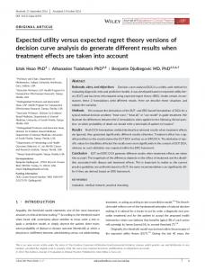
Measurements of turbulence and vegetation structure across a forest clearing
Ronald Queck Christian Bernhofer Anne Bienert Hans-Gerd Maas
Faculty Forest-, Geo- and Hydro Sciences – Institute of Hydrology and Meteorology & Institute of Photogrammetry and Remote Sensing
Challenge
Site & Setup
The turbulent flow around flux measurement sites and thus the exchange of energy and mass between atmosphere and land surface are affected by vegetation structure. The vegetation layers of forests act as storage for energy, and advective fluxes cause remarkable uncertainties in the measured fluxes. Calculating reliable fluxes depends on realistic wind fields and thus on the parameterisation of the vegetation in numerical models.
Fluxnet Station Tharandt
Ultrasonic measurements at 32 sensor positions in total placed on four towers and five 2 m stands, 16 thermocouples, radiation balance, thermal camera, 15 laser scanner recordings. Right Fig.: Laser scanner “Riegl LMS-Z 420i” at the top of the flux tower
Spruce stand: 120 years, 30 m Clearing:50 m × 90 m
Left Fig.: Ultrasonic anemometer, synchronous registration, storage of 20 Hz raw data from 5/2008 to 5/2009
Vegetation Model Method: Registration of the different scans in a single coordinate system and generation of a multi-scale voxel structure with attributes to derive the plant area density Voxel space: grid of cubic volumes V(x,y,z) with attributes of the point distribution
Measured points
Fig. below: Point cloud of ≈ 50×106 surface points combined from 15 scan positions, including 2 positions from the top of the towers
Numerical Model … Grid Resolution … Parameters: CD, z0, lm, …
l=3 PAD
Wind distribution 2008-2009
Aerial photograph: Staatsbetrieb Geobasisinformation und Vermessung Sachsen 2009
l=1
German map: http://www.stepmap.de
l=2
Observation / Validation Comparison of measurements and model results is only possible in very clear defined conditions. The figures in this box show the “Neutral case”: stability: -0.1< z/L < 0.1, wind speed: 3.9 m/s < u < 4.1 m/s, wind direction: 255° < WD < 285°, no surface wetness. Left Fig.: Power spectra of the horizontal wind speed
Wind
from selected measurement intervals (19 half hourly runs) made at reference point (42 m, red dot in the figure on the right) and results from a Large Eddy Simulation (LES, Schlegel et al. 2012) from the corresponding grid point (plus 5 grid points transversal to the wind direction). Right Fig.: Profiles of turbulent kinetic energy (TKE/m) and wind speed (u), both normalised by the wind speed at the reference point. Results are from the TurbEFA project, see references below straight thin l.: wind tunnel measurement straight thick l.: boundary layer model dashed thick l.: large eddy simulation dots with whiskers: measurements background: plant area distribution blue flags: wind distribution for the selected situations in 10° sectors
Streamlining? c)
Flux tower wind sector (255°-285°)
Shelter coefficient? small dots wind sector 255° to 285° (with regression line)
height in m
big light gray dots all wind directions
Figs.: Measurements of impulse absorption within the canopy indicate a variable drag coefficient
Fluxnet tower Site Tharandt
Application (next steps)
Parameterisation
Plant specific exponents for Surface density and Streamlining
n = 0.6
m = −0.8
Calculation of complete balances requires knowledge of advective fluxes over the boundaries of the control volume. Measurements within tall vegetation can provide few vertical profiles only and must be complemented by numerical models considering the canopy architecture.
Ronald Queck Institute of Hydrology and Meteorology
[email protected] http://tu-dresden.de/turbefa.
resolution 1 m³
Wind
Expected Outcome
Vertical advection
Combining meteorological measurements (wind, temperature etc.) with measurements of plant area density this study aims at the following:
-14 W/m²
Horizontal Advection -30 W/m²
Non-turbulent sensible heat fluxes
Turbulent buoyancy fluxes
Fig. above: Measured mean buoyancy fluxes (red arrows) under unstable conditions (note: only the divergence within the control volume contributes to the heat balance) and Non-turbulent sensible heat fluxes calculated from mean temperatures and wind speeds.
References Bienert A, Queck R, Schmidt A, Bernhofer C, Maas H-G (2010) Voxel space analysis of terrestrial laser scans in forests for wind field modelling. IAPRS XXXVIII, Part 5:92–97
Queck R, Bienert A, Harmansa S, Goldberg V, Maas H, Bernhofer C (2011) Wind fields in heterogeneous conifer canopies: Parameterisation of momentum absorption using highresolution 3D vegetation scans. Eur J Forest Res 130:165-176
Harmansa S, Goldberg V, Vowinkel B, Queck R, Bernhofer C (2012) Comparison of different closure schemes for an eddy diffusion model applied to a highly resolved forest clearing and an idealised forest edge. Meteorologische Zeitschrift, submitted
Schlegel F, Stiller J, Bienert A, Maas H-G, Queck R, Bernhofer C (2012) Large-Eddy Simulation of Inhomogeneous Canopy Flows Using High Resolution Terrestrial Laser Scanning Data. Boundary-Layer Meteorology 142:p,223–243
- investigation of the effect of inhomogeneities in canopy structure on exchange processes and quantification of the resulting uncertainties of flux measurements, - derivation of effective parameters for numerical models like drag coefficient, mixing length, displacement height and roughness length from the canopy structure, - validation of results from numerical models. This presentation aspires to make the dataset public and to invite modellers to further data analysis.
Acknowledgement This study was supported by the Deutschen Forschungsgemeinschaft DFG SPP 1276 MetStröm.
SPP 1276