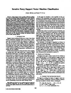
int. j. geographical information science, 2001, vol. 15, no. 1, 27± 42
Research Article Formalizing fuzzy objects from uncertain classi cation results TAO CHENG1 MARTIEN MOLENAAR2 and HUI LIN1 1 Joint
Laboratory for GeoInformation Science and Department of Geography, The Chinese University of Hong Kong, Shatin, NT, Hong Kong 2 International Institute for Aerospace Survey and Earth Sciences (ITC), P.O. Box 6, 7500AA Enschede, The Netherlands E-mail: tcheng@cuhk;
[email protected];
[email protected] (Received 23 August 1999; accepted 28 April 2000) Abstract. Concepts of fuzzy objects have been put forward by various authors (Burrough and Frank 1996) to represent objects with indeterminate boundaries. In most of these proposals the uncertainties in thematic aspects and the geometric aspects are treated separately. Furthermore little attention is paid to methods for object identi cation, whereas it is generally in this stage that the uncertainty aspects of objects become manifest. When objects are to be extracted from image data then the uncertainty of image classes will directly eŒect the uncertainty of the determination of the spatial extent of objects. Therefore a complete and formalized description of fuzzy objects is needed to integrate these two aspects and analyse their mutual eŒects. The syntax for fuzzy objects (Molenaar 1998), was developed as a generalization of the formal syntax model for conventional crisp objects by incorporating uncertainties. This provides the basic framework for the approach presented in this paper. However, the model still needs further development in order to represent objects for diŒerent application contexts. Moreover, the model needs to be tested in practice. This paper proposes three fuzzy object models to represent objects with fuzzy spatial extents for diŒerent situations. The Fuzzy-Fuzzy object (FF-object) model represents objects that have an uncertain thematic description and an uncertain spatial extent, these objects may spatially overlap each other. The Fuzzy-Crisp object (FC-object) model represents objects with an uncertain spatial extent but a determined thematic content and the Crisp-Fuzzy object (CF-object) model represents objects with a crisp boundary but uncertain content. The latter two models are suitable for representing fuzzy objects that are spatially disjoint. The procedure and criteria for identifying the conditional spatial extent and boundaries based upon fuzzy classi cation result are discussed and are formalized based upon the syntactic representation. The identi cation of objects by these models is illustrated by two cases: one from coastal geomorphology of Ameland, The Netherlands and one from land cover classi cation of Hong Kong.
1.
Introduction For many natural phenomena that are distributed gradually and continuously over space, there are no crisp boundaries that can be identi ed to diŒerentiate them, as is articulated by Leung (1988). For examples, the boundary between beach and foreshore, between woodland and grassland, and between urban and rural areas, may be gradual through a transition zone rather than a crisp boundary. Furthermore, International Journal of Geographical Information Science ISSN 1365-8816 print/ISSN 1362-3087 online © 2001 Taylor & Francis Ltd http://www.tandf.co.uk/journals DOI: 10.1080/13658810010004689
28
T . Cheng et al.
when we use a remote sensing image to extract objects of interest, the pixel signal is a confounding re ectance of sub-pixel elements. There are pixels that may contain sub-pixel objects, trans-pixel objects, boundary pixels and/or natural intergrades (Foody 1992, 1999, Gopal and Woodcock 1994, Fisher 1999). The mixture spectral information of sub-pixels will lead to uncertain classi cation and indeterminate boundaries. In such cases the spatial extents of objects should be identi ed rst then the boundaries of objects can be formed (Cheng and Molenaar 1999a). Therefore, the complexity of natural environments requires appropriate new methods to represent it in GIS, if only because in the past there has been a tendency to force reality into sharp objects and crisp classi cation. The concept of fuzzy objects have been put forward to represent objects with indeterminate boundaries (Burrough and Frank 1996, Goodchild and Jeansoulin 1998, Shi et al. 1999), although most authors discuss the uncertainties in remote sensing image classi cation (Foody 1992, 1999). How spatial objects are extracted from the fuzzy classi cation results is yet to be fully discussed and formalized. Further many authors model the uncertainties either of the thematic aspects (Robinson 1988, Burrough 1989, Usery 1996) or of the geometric aspects (Altman 1995, Brown 1998). For the integration of these two aspects a complete and formalized description of fuzzy objects is needed. The syntax for fuzzy objects (Molenaar 1998), which was developed by incorporating uncertainties into a formal syntax model for conventional crisp objects, provides the basic framework to achieve this aim. However, the model still needs further development in order to represent objects for diŒerent application contexts. Moreover, the model needs to be tested in practice. Therefore, the aim of this paper is not to discuss fuzzy classi cation, but to discuss the derivation of the fuzzy spatial extent of objects from uncertain classi cation results. This derivation eŒects the spatial relationships between fuzzy objects, and consequently constraints the interpretation of the fuzziness of their spatial extent with respect to their topological relationships. Three generic fuzzy object models are proposed to represent objects with fuzzy spatial extents for diŒerent situations. The criteria of identifying the conditional spatial extent and boundaries are discussed and formalized based upon the syntactic representation. There are two folds of meanings of ‘formalizing’ in our title. It means to derive (extract) fuzzy objects from uncertain classi cation results. It also implies to formalize the procedure of this derivation, the representation of the fuzzy objects and their topological relationship. The paper is organized as follows. Section 2 proposes three fuzzy object models for the objects with fuzzy spatial extent extracted from uncertain image classi cation results. The formalization of these fuzzy object models is explained in §3. The conditional spatial extents (and boundary zones) of objects will be formalized . The applications of these fuzzy object models are presented in §4, which contains two cases. Case 1 discusses the identi cation of coastal geomorphological landscape units in Ameland from height observations. Case two discusses the identi cation of land cover type in Hong Kong by using a Landsat TM image. The last section summarizes and discusses the major ndings of the paper and proposes the direction of further research. 2.
Three fuzzy object models We assume that after classi cation a membership vector is assigned to each grid cell; that consists of the elements 0 < MF [P,C ] < 1 (k 5 1, N). Here MF [P,C ] represents the membership of grid cell P belonging to object class C, and N is the total number of object class types.
Formalizing fuzzy objects
29
Spatial objects can be extracted from these classi cation results as image segments consisting of contiguous sets of pixels, or gridcells, belonging to one class. The objects of one class can then be represented as a layer of the raster, so that N layers of objects will be formed. A comparison of the N layer classi cation results with the conventional crisp classi cation shows that each layer consists of fuzzy regions. If each region represents the spatial extent of an object, the object is called a fuzzyfuzzy object (FF-Object), where the rst ‘fuzzy’ means that its spatial extent is fuzzy and the second ‘fuzzy’ means that its thematic interior is fuzzy, because it contains cells that have been assigned to the thematic class of the region with a certainty of less than 1 (see gure 1(a)). Then the traditional crisp object can be called crisp-crisp (CC-Object), which means that the boundary and the interior of the object are crisp. There are two ways of interpreting FF-objects when we discuss objects de ned in diŒerent contexts. In some applications, fuzzy spatial overlaps among objects are permitted. In this notation, objects are de ned in diŒerent contexts, one, for example in a soil map and the other in a land use map. Then it is quite possible that they overlap, i.e. their semantic de nition does in general not forbid their overlap. In this case, the cells in the overlap region may belong to multiple objects. In other applications, area objects are de ned as being spatially disjoint in space (in single context), i.e. they do not overlap such that each grid cell belongs in principle to one object. If the objects form a spatial partition then each cell should belong to exactly one object, as in the case study of §4, where foreshore, beach and foredune are considered to be spatially disjoint objects. Although the boundary between beach and foredune cannot be located very crisply, a speci c location should either belong to beach or foredune, but not to both. In this case it is necessary to combine the objects of diŒerent layers into one layer and to form a complete spatial partition of the area, which can be further diŒerentiated into two cases. The rst case is that a conditional boundary has to be set to de ne explicitly the spatial extent of objects and assign each grid cell exactly to one object; the second is that a clear boundary cannot be de ned, but that there are transition zones between the objects. In the transition zones, no decision is made about which object the grid cells might belong to. To diŒerentiate these two situations, we call objects in the rst view crisp-fuzzy objects (CF-Object, see gure 1(b)), which means that the conditional boundaries between objects are crisp but the interiors of the objects are fuzzy. We call objects in the second view fuzzy-crisp objects (FC-Object, see gure 1(c)), where fuzzy means that their spatial extents (transition zones) are fuzzy and crisp means that their interiors (cores) are certain. Figure 1 illustrates the three fuzzy object models. It can be seen that the FFobject has a fuzzy spatial extent and a fuzzy thematic interior, the FC-object has a crisp internal core but a fuzzy spatial extent (transition zone) and the CF-object has a crisp conditional boundary but a fuzzy interior. The Fuzzy-Fuzzy object (FFobject) model is useful to model fuzzy objects that spatially overlap each other, and the Fuzzy-Crisp object (FC-object) model and the Crisp-Fuzzy object (CF-object) model are suitable for modelling fuzzy objects that are spatially disjoint. 3.
Formalization of fuzzy object models Classi cation and segmentation are essential in extracting objects from eld observation data or from remote sensing images. To identify the spatial extent of objects, rst the grid cells have to be assigned to classes and then the raster/image has to be segmented into regions with grid cells of the same classes, which represent
30
T . Cheng et al.
Figure 1. Three fuzzy object models.
spatial extents of fuzzy objets (Cheng and Molenaar 1999a). The classi cation is uncertain in the sense that the membership function value varies per grid cell and is less than one. For this situation we rst discuss the criteria for assigning the grid cells to classes based upon their fuzzy classi cation results, then the criteria for segmentation. After identi cation of the regions that represent the spatial extent of objects, the boundaries of objects are formed automatically. Since the spatial extents (and their boundaries) of fuzzy objects are formed based upon prespeci ed criteria, they are called the conditional spatial extent and the conditional boundary in order to be diŒerentiated from crisp objects. For each fuzzy object model discussed in §2, diŒerent criteria should be applied. The formalization of the CF-object model has been discussed in (Cheng and Molenaar 1999a). Here we resume the formalization in a more generic framework by adding the other two fuzzy object models. 3.1. Assigning grid cells to classes In the following sections MF [P,C ] represents the membership function of grid cell P with respect to Class C, and D [P,C ] represents the decision function assigning P to a region of C. 3.1.1. Fuzzy-fuzzy object model Objects of the FF-type have an uncertain thematic content and an uncertain extent. It might even be so that because is not su cient evidence that the object really exist, i.e. the identi ed object might not be more than an artefact produced by the observational process and the procedures for information extraction. In this we always are uncertain about the assignment of a cell to the extent of an object, this uncertainty directly relates to the uncertainty of the assigned class so that we put D [P,C ] 5 MF[P,C ]. The domain of this function runs from 0 to 1, but in practice the value 1 will hardly occur in this case. So there will be hardly any cells that can be assigned de nitely to the extent of the object, whereas for the cells with
Formalizing fuzzy objects
31
a value 0 we know for sure that they do not belong to the object. Therefore, If (MF [P,C ] > 0) If (MF [P,C ] 5 0)
then let D [P,C ] 5 MF[P,C ] (means: P belongs to a region of C ); then let D [P,C ] 5 0 (means: P does not belong to a region of C ).
3.1.2. Fuzzy-crisp object model Objects of the FC-type have a de nite thematic content and there is no doubt about their existence. That means that each object will have a core area with cells for which D[P,C ] 5 1. Since the objects have been extracted in this case from classi ed image data, the assignments of cells to an object depends here on the uncertainty of the classi cation. Therefore, not all cells will be assigned to the object with absolute certainty. That means that there will be a transition zone around the core (or a boundary zone) where we nd cells with D[P,C ] 5 MF[P,C ] ×(0, 1). Outside this transition zone we nd the exterior of the object, i.e. cells that do not belong to the object so that D[P,C ] 5 0. Therefore, If (MF [P,C ] 5 1)
then let D[P,C ] 5 MF[P,C ] 5 1 (means: P belongs to the core of an object of C ); If (0 < MF[P,C ] < 1) then let D[P,C ] 5 MF[P,C ] (means: P belongs to the transition zone); If (MF [P,C ] 5 0) then let D[P,C ] 5 0 (means: P does not belong to an object of C ). 3.1.3. Crisp-fuzzy object model Let NM [P,C ] 5 1 Õ MF[P,C ] represent the ‘not-membership’, i.e. the certainty k k that P does not belong to class C ; and let XM [P,C ] express the membership that k k P belongs exclusively to C and not to any other classes C for any l Þ k, hence, it k l can be derived by applying minimum operations as (1) XM [P,C ] 5 MIN (MF [P,C ] ,MIN Þ (NM [P,C ])) k k l k l For this case we will assume that the classes are mutually exclusive, so that P can only belong to one class. This implies that there should be only one class for which the function XM [ ] has maximum value for P. If there are more classes with the same maximum values then additional evidence is required to be able to select a unique class. It can be represented as if XM [P,C ] 5 MAX l (XM[P,C ])(l 5 1, ..., N ) then let D [P,C ] 5 XM [P,C ] k c l k k otherwise D [P,C ] 5 0 (2) k if S MF[P,C ] < 1 then MAX i (XM[P,C ]) 5 MAX(MF[P,C ]) (i 5 1, ..., N ) and i= 1 , N i c i i if MF [P,C ] 5 MAX(MF [P,C ]) then D [P,C ] 5 MF [P,C ] . k i k k For example, let’s assume a grid cell has a membership vector for three classes C , C and C 1
2
3
GH 0.1
MF[P,C ] 5
0.6 0.2
Since S MF[P,C ] < 1, MF [P,C ] 5 MAX(MF [P,C ]) therefore D [P,C ] 5 0.6. 2 2 i= 1 ,3 i i This means that this cell is assigned to class C with certainty 0.6. For details of 2 the calculation procedure see Cheng (1999, p.59)
32
T . Cheng et al.
3.2. Segmentation After assigning the grid cells to classes, regions of diŒerent class types can be formed by segmentation. The regions represent the spatial extent of fuzzy objects. For fuzzy objects boundaries can only be speci ed under certain conditions. We will see in the following sections that these are generally related to certainty level of the assignment of cells to the object. The cells that ful l such a condition form a conditional spatial extent of an object. These should be clearly distinguished from the conventional spatial extent of crisp objects. After segmentation, the pixel-based information is transferred into object-based information. Let P ×S where S is a region of class type C and let Part[P ,S ]; D[P ,C ] . kl kl kl If a grid cell P is adjacent to P and D[P ,C ] Þ 0, then P ×S and we de ne ij kl ij ij Part[P ,S ] 5 D[P ,C ] as the membership function of P to S. ij ij ij If the two conditions are not satis ed, then P 1 S, i.e. Part[P ,S ] 5 0. ij ij If S represents the spatial extent of an object O of C, the relationship between P and O can be de ned as Part[P,O] 5 Part[P,S ] 5 D[P,C ].
(3)
Therefore the relationship between P and O for objects in the CF-object model can be written as Part[P,O] 5 D[P,C ] 5 XM [P,C ].
(4)
The relationship between P and O for objects in the FF-object model and the FC-object model can be written as Part[P,O ] 5 D[P,C ] 5 MF[P,C ] .
(5)
Equations 4 and 5 express the relationship between the uncertainty of the cell belonging to the spatial extent of an object and the uncertainty of a grid cell belonging to a class, i.e. the relationship of uncertainties between geometric and thematic aspects. This means that uncertainty is transferred from thematic aspects to geometric aspects of objects during segmentation. 3.3. Spatial extents and boundaries of fuzzy objects According to the syntax proposed by Molenaar (1998), the spatial extent of an object can be represented by faces belonging to the object, which is a set of grid cells in a raster/image. The boundary of an object consists of edges of the cells that have the object on one side only (Molenaar 1998). This subsection discusses the syntactic representation of the conditional spatial extents and boundaries for each fuzzy object model. 3.3.1. FF-object model According to the de nition of §3.1.1, the spatial extent of an FF-object O can be represented as Face(O) 5 Cell(O) 5 {P | Part [P,O ] > 0} (6) where Face(O) is the fuzzy spatial extent of O and is the set of faces belonging to O (in case the faces are grid cells this function can be replaced by Cell(O)). Let t be a threshold value for Part [P,O ] . Then a conditional function can be de ned: Part [P,O | t ] 5 1 if {P | Part [P,O ] > t}
Formalizing fuzzy objects
33
and a conditional object (i.e. and object with a conditional spatial extent) can be de ned by Face(O | t) 5 Cell(O | t) 5 {P | Part [P,O ] > t} The relationship between edges, faces and the conditional object can be de ned as L e [e,O | t ] 5 L e [e, f ] Ö Part [ f,O | t ] Ri [e,O | t ] 5 Ri [e, f ] Ö Part [ f,O | t ] . Where L e [e, f ] represents that an edge e has a face f on the left side, Ri [e, f ] represents that an edge e has a face f on the right side. L e [e, O | t ] represents that e has an object O on the left side under threshold value t, Ri [e,O | t ] represents that e has an object O on the right side under threshold value t ; they are crisp functions that take the value of either 1 or 0. Let B [e,O | t ] 5 L e [e,O | t ] 1 Ri [e,O | t ]. This function has a value 0 if the edge is not related to the conditional object, it has value 2 if the edge is inside the conditional object and it has a value 1 if it has the conditional object at only one side. Then the conditional boundary of O at certainty level t can be de ned as: ‚ O 5 {e | B[e,O | t] 5 1}. (7) t This means that a conditional boundary ‚ O is the boundary of a conditional object. t It consists of edges e that have the object on either the left or the right side. The boundary of FF-objects is a threshold-cut boundary, consisting of the edges of outermost grid cells of the object.
3.3.2. FC-object model The spatial extent of an FC-object (O) is the core of the object, which can be represented as: Face(O | 1) 5 Cell(O | 1) 5 {P | Part[P,O] 5 1}
(8)
Transition zones between FC-objects can be de ned as those cells that do not belong to any core of the FC-objects but do belong to the intersection of the transition zones. The transition zone between two FC-objects O and O comprise a b the cells that satisfy O ) 5 Cell(O O ) b a b (9) 5 {P | 0 < Part[P,O ] < 1 and 0 < Part[P,O ] < 1} a b The formulas can be generalized for cases where more than two objects intersect. Here we de ne the ‘confusion index’ (CI) for each grid cell as one minus the diŒerence between the maximal and second maximal membership values (Burrough 1996), Face(O
a
(10) CI 5 1 Õ (Max1(MF[P,C ]) Õ Max2(MF[P,C ])) (k, l 5 1, ..., N; k Þ l) k l where N is the total number of the class types, Max1 is a maximum operation among the membership function value vectors, and Max2 is an operation to nd the second largest value from the vectors. When the membership function values of adjacent grid cells are very similar, the zones of confusion divide regions with relatively homogenous membership values. In fact, these confusion zones indicate the presence of conditional boundaries; they are transition zones between FC-objects.
T . Cheng et al.
34
3.3.3. CF-object model The spatial extent of two CF-objects should consist of faces that satisfy (Cheng and Molenaar 1999a): Face(O ) 5 Cell(O ) 5 {P | Part [P,O ] > Part [P,O ]} and a a a b Face(O ) 5 Cell(O ) 5 {P | Part [P,O ] > Part [P,O ]}. (11) b b b a For CF-objects, the conditional boundary between two objects is the transition boundary between two classes. It consists of edges that have simultaneously the cells of O on the left side and the cells of O on the right side, or the cells of O on the right a b a side and the cells of O on the left side. Therefore, the edges of the boundary should satisfy b E 5 {e | B[e, f a ] 5 1 and B[e, f b ] 5 1 and f ×Face(O ) and f b ×Face(O )} a, b a a b (12) Then the transition boundary can be represented as ‚ (O ,O ) 5 {N ,E } and N 5 {n | n ×e, e ×E } a b a, b a, b a, b a, b
(13)
4. Applications of fuzzy object models 4.1. Fuzzy objects extracted f rom eld observation data For the sustainable use of coastal zones, Dutch coastal zones are monitored by yearly pro le measurement along the coastline. Height observations are made by laser scanning of the beach and dune area and echo sounding at the foreshore. These data are interpolated to form a full height raster of the test area. Experiments show that the uncertainty of the interpolated heights of the raster can be expressed by standard deviation (s 5 0.15 m) (Huising et al. 1996). The coastal geomorphological landscape units such as foreshore, beach and foredune are identi ed from these measurements and their changes are studied in order to predict the their future development (Cheng and Molenaar 1999b). However, the de nition of these landscape units varies from person to person, and from time to time. For example, one de nition of foreshore is the area above the closure depth and beneath the low water line (Reineck and Singh 1980). The value of closure depth may be Õ 6.0 m or Õ 8.0 m. Therefore, the de nition of the landscape units is fuzzy and we applied a trapezoidal membership function (Cheng et al. 1997) to describe them. Figure 2 shows the interpolated height values of the test area of Ameland. Based on this fuzzy object de nition, we classify the grid cells into classes of landscape units (Cheng et al. 1997). As shown in gure 3(a) (b) and (c), each pixel has three membership values to three classes of landscape units. Here we derive the objects for the three fuzzy object models.
Figure 2.
DEM of the test area of Ameland.
Formalizing fuzzy objects
35
Figure 3. Fuzzy classi cation results of Ameland (Cheng and Molenaar 1998). (a) Membership value of belonging to foreshore, ( b) Membership value of belonging to beach, (c) Membership value of belonging to foredune (darker means lower membership).
4.1.1. Modelling by fuzzy-fuzzy object model The modelling results by FF-object model are shown in gure 4. The edges of the outmost grid cells of each object are the conditional boundaries, with a threshold of 0.2. Figures 4(a), (b) and (c) each represents a layer with objects of one type. When these layers are overlaid, it is clear that these regions overlap. The fuzzy spatial extent of the objects is shown in gures 4(d to f ). 4.1.2. Modelling by fuzzy-crisp object model Figure 5 (a) represents the core of the FC-objects. These objects have been formed according to the rules of §3.1.2. Figure 4(b) represents the ‘confusion index (CI )’ as de ned in §3.3.2. According to the de nition of CI, the cells with values approximately equal to 1 represent transition zones among FC-objects. By combining gures 5(a) and 5(b), FC-objects are shown in gure 5(c). 4.1.3. Modelling by crisp-fuzzy object model The modelling results of the CF-object model are shown in gure 6. Figure 6(a) shows the spatial extent of CF-objects. Figure 6(b) represents the uncertainty of cells belonging to the objects. The transition boundaries among objects ( belonging to three classes) are shown in gure 6(c). 4.2. Fuzzy objects extracted f rom remote sensing images This subsection presents the case study of extracting land cover types of Hong Kong from TM images. The image was taken on 3 March, 1996. The size of the test window is 1865 (columns) Ö 1648 (rows). As argued in the introduction, there is a mixture of sub-pixels in images. The pixel signal is a confounding re ectance of sub-pixels. We apply the SMA (spectral mixture analysis) method (Peddle et al. 1999) to classify the image. The method is built on the fact that the IFOV of a pixel contains a number of individual surface components which together contribute to the overall pixel level radiance received by a remote detection instrument (Adams et al. 1993). In the case of linear mixing, the spectrum measured by the airborne or satellite sensor can be modelled as a set of pure spectra, each weighted by the areal proportion of material within the sensor IFOV. We considered four types of land cover for image classi cation, man-made objects, bare-hill, vegetation and water. Through SMA, we quantify the areal fraction of these four type components at subpixel scales and interpret the fraction of individual component (end-member) as surrogates for the fuzzy membership function value, which is shown in gure 7.
36
T . Cheng et al.
Figure 4. FF-Object modelling results of Ameland (Cheng 1999). (a) FF-objects belong to foreshore*, ( b) FF-objects belong to beach*, (c) FF-objects belong to foredune*, (d)–(f ) FF-objects of (a)–(c) with fuzziness respectively (*threshold 5 0.2, darker means greater uncertainty).
Figure 5. FC-Object modelling result of Ameland (Cheng 1999). (a) Cores of FC-objects, (B) Confusion index (CI), (C) FC-objects with fuzziness (darker means greater uncertainty).
Figure 6. CF-Object modelling result of Ameland (Cheng 1999). (a) CF-object Model, ( b) Certainty of cells belonging to objects, (c) Objects with uncertainty, (d) Conditional boundaries between regions (darker means greater uncertainty).
Figures 8–11 present the mapping results of FF-objects of four layers, which have fuzzy spatial extent and fuzzy boundaries. In all gures 8–11 (b, c, d, e and f ) represent the FF-objects at a-cuts (0.2, 0.4, 0.6, 0.8 and 1.0), respectively. Therefore gure ( f ) becomes the core of FC-objects. The result with changing areas at diŒerent
Formalizing fuzzy objects
37
Figure 7. SMA classi cation results of land cover of Hong Kong. (a) End-member fraction of man-made objects, ( b) end-member fraction of bare-hill, (c) end-member fraction of vegetation, (d) end-member fraction of water (darker means lower end-membership).
Figure 8. FF-objects belonging to class type of man-made object.
threshold values shows that the composite of material is diŒerent from place to place, even when the material may belong to the same class, e.g. water, soil or vegetation. For example, the purity of water (compared with the sample areas) is increasing with the threshold. We might postulate the salty or mineral material to
38
T . Cheng et al.
Figure 9. FF-objects belonging to class type of bare-hill.
Figure 10. FF-objects belonging to class type of vegetation.
be diŒerent at these ve threshold levels, and would therefore consider further eld tests. When we combine gure f in four layers, the cores of FC-objects are formed, which is shown in gure 12. The CF-objects are shown in gure 13. 5.
Discussion and conclusions Conventionally, the determination of the spatial extent of objects is generally approached through the boundaries or more precisely through the position of the boundary points. The analysis of the geometric uncertainty of the objects is therefore
Formalizing fuzzy objects
39
Figure 11. FF-objects belonging to class type of water.
often based on accuracy models for the coordinates of these points. However, when there is no crisp boundary between objects, the fuzzy spatial extent of objects should be identi ed rst and the conditional boundaries can then be formed. In such cases, the geometric uncertainty is not only a matter of coordinate accuracy, but also a problem of object de nition. The uncertainty of measurement and object de nition will be combined in thematic classi cation. The uncertainty of thematic classi cation will be converted to the geometric aspects (fuzzy spatial extent and conditional boundaries) of the objects during their formation (Cheng and Molennar 1999a). This paper discussed the derivation of fuzzy objects from fuzzy classi cation results based upon three fuzzy object models. These three models represent objects with fuzzy spatial extents for diŒerent situations. The FF-object has a fuzzy spatial extent and a fuzzy thematic interior, the FC-object has a crisp internal core but a fuzzy spatial extent (transition zone) and the CF-object has a crisp conditional boundary but a fuzzy interior. The FF-object model is useful for modelling fuzzy objects that spatially overlap each other and the FC-object model and CF-object model are suitable for modelling fuzzy objects that are spatially disjoint. These three fuzzy object models, their spatial extent and conditional boundaries (transition zones) are formalized based upon syntactic schema. In our approach, the topologic relationships between fuzzy objects (overlap or adjacency) form the basis for assigning pixels to regions and to objects. Here ‘overlap’ is interpreted as the intersection of the spatial extent of objects, i.e. the intersection of their face sets. This is the basic relationship that can be detected when analysing the relationships of fuzzy spatial objects extracted from image data. ‘Adjacency’ is primarily a relationship between the geometric elements, i.e. the faces and cells. This relationship can be detected between objects only when the intersection of their spatial extents is reinterpreted after imposing semantic constraints. These constraints should state that the objects are by de nition spatially exclusive as in single valued maps (Molenaar 1989, 1998). So our approach shows that topologic relationships
40
T . Cheng et al.
Figure 12. Cores of FC-objects.
Figure 13. CF-objects of land cover.
between objects can not be found by geometric operation only. The full semantics of the objects, combining their geometric and thematic data, should be taken into consideration. The cases presented in this article illustrated that. This is diŒerent from other algebraic models (Clementini and Di Felice, 1996, Cohn and Gotts 1996), which are generally based purely on the geometric relationships of fuzzy regions. Furthermore, in our approach the representation of FF-object is apparently similar to the fully-fuzzy area concept proposed by Foody (1999). The fully-fuzzy area is, however, still a direct representation of fuzzy classi cation result. This means that thematic data is represented per cell (or pixel), the information has not been aggregated to an object level so that the uncertainty of spatial extent of objects did not play a role in his analysis. Although we use a raster-based approach for implementation, the model can also be implemented for vector data since the syntactic schema is a uni ed representation for both the raster and the vector approachs (Molenaar 1998, Cheng 1999). The only diŒerence between these two approaches is that the spatial extent of an object
Formalizing fuzzy objects
41
is made up of faces, with no preset geometric shape in the vector approach but as rectangular grid cells in the raster approach. For both cases it is required that a face should have homogeneous thematic content or membership value. Two cases were applied to illustrate the practical usefulness of these models. We use these two cases since they represent two typical ways to extract objects, e.g. eld sampling and image classi cation (Cheng 1999). The experimental results revel that the proposed fuzzy object models are suitable for these two methods of object extraction. These case studies provide examples for practical applications of the fuzzy object models. It is believed that these fuzzy object models can also be applied to other natural environmental and even in social-economic studies, in which objects have fuzzy spatial extent due to their physical characteristics or due to vague de nition of the objects of interest. However, the contiguity of the spatial extent Face(O) and the connectivity of Face(O | T hreshold) (Threshold ×[ 0,1 ]) needs further analysis. If the threshold is higher, the connectivity of the faces belonging to an object will change so that beyond a certain threshold value islands may occur in the regions of an object. How to handle this situation needs further investigation. Acknowledgments We are grateful to Marieke Eleveld for preparing the height data for the Ameland case and Liangpei Zhang for the image processing of the Hong Kong case. We also thank Theo Boulous for the stimulating discussions we had about several issue of this paper. We also thank three anonymous referees for their suggestive comments on an earlier version of the manuscript. The Survey Department of the DirectorateGeneral for Public Works and Water Management of the Dutch Ministry of Transport, Public Works and Water Management kindly made the data for the Ameland case available. The research for this paper is a continuity of a PhD project of the rst author funded by the International Institute for Aeropsace Survey and Earth Sciences (ITC). Her research is currently supported by grants from Research Grant Council of Hong Kong Special Administrative Region Government (Project No. CUHK 4334/98E and CUHK 4132/99H). References Adams, J. B., Smith, M. O., and Gillespie, A. R., 1993, Image spectroscopy: interpretation based on spectral mixture analysis. In T opics in Remote Sensing IV : Remote Geochemical Analysis, edited by C. M. Pieters and P. A. J. Englert (Cambridge: Cambridge University Press), pp. 145–166. Altman, D., 1994, Fuzzy set theoretic approaches for handling imprecision in spatial analysis. International Journal of Geographical Information Systems, 8, 271–289. Brown, D. G., 1998, Classi cation and boundary vagueness in mapping presettlement forest types. International Journal of Geographical Information Science, 12, 105–129. Burrough, P. A., 1989, Fuzzy mathematical methods for soil survey and land evaluation. Journal of Soil Science, 40, 477–492. Burrough, P. A., 1996, Natural objects with indeterminate boundaries. In Geographic Objects with Indeterminate Boundaries, edited by P. A. Burrough and A. U. Frank (London: Taylor & Francis), pp. 3–28. Burrough, P. A., and Frank, A. U., 1996, Geographic Objects with Indeterminate Boundaries (London: Taylor & Francis).
42
Formalizing fuzzy objects
Cheng, T., 1999, A Process-Oriented Data Model for Fuzzy Spatial Objects, Ph.D. Thesis, Wageningen/ITC, Enschede. Cheng, T., and Molenaar, M., 1998, The identi cation and monitoring of objects with fuzzy spatial extent. International Archives of Photogrammetry and Remote Sensing (ISPRS), 32, 207–212. Cheng, T., and Molenaar, M., 1999a, Objects with fuzzy spatial extent. Photogrammetric Engineering and Remote Sensing, 65, 797–801. Cheng, T., and Molenaar, M., 1999b, Diachronic analysis of fuzzy objects. GeoInformatica, 3, 337–356. Cheng, T., Molenaar, M., and Bouloucos, T., 1997, Identi cation of fuzzy objects from eld observation data. In Spatial Information T heory: A T heoretical Basis for GIS, L ecture Notes in Computer Sciences, edited by S. C. Hirtle and A. U. Frank (Berlin: SpringVerlag), 1329, pp. 241–259. Clementini, E., and Di Felice, P., 1996, An algebraic model for spatial objects with indeterminate boundaries. In Geographic Objects with Indeterminate Boundaries, edited by P. A. Burrough and A. U. Frank (London: Taylor & Francis), pp. 155–170. Cohn, A. G., and Gotts, N. M., 1996, The ‘egg-yolk’ representation of regions with indeterminate boundaries. In Geographic Objects with Indeterminate Boundaries, edited by P. A. Burrough and A. U. Frank (London: Taylor & Francis), pp. 171–188. Fisher, P., 1999, Lecture notes of the workshop ‘Empirical Issues of Uncertainty’. In the International Symposium on Spatial Data Quality’99, Hong Kong Polytechnic University, Hong Kong, 18–20 July, published by Department of Land Surveying and Geo-Informatics, The Hong Kong Polytechnic University, Hong Kong, p. 625. Foody, G. M., 1992, A fuzzy set approach to the representation of vegetation continua from remotely sensed data: An example from lowland health. Photogrammetric Engineering and Remote Sensing, 58, 221–225. Foody, G. M., 1999, The continuum of classi cation fuzziness in thematic mapping. Photogrammetric Engineering and Remote Sensing, 65, 443–451. Goodchild, M. F., and Jeansoulin, R., (editors), 1998, Data Quality in Geographic Information —From Error to Uncertainty (Paris: Hermes). Gopal, S., and Woodcock, C., 1994, Theory and methods for accuracy assessment of thematic maps using fuzzy sets. Photogrammetric Engineering and Remote Sensing, 60, 181–188. Huising, E. J., Jordans, R. W. L., Spruijt, F. M., Vaessen, E. M. J., Wicherson, R. J., Zomerdijk, J. F., and van Persie, M., 1996, Framework Digital Elevation Models Dutch Coast—Various Techniques for Topographic Measurement Tested on a common Site, The Netherlands Remote Sensing Board (BCRS) Programme Bureau, Rijkswaterstaat Survey Department, Delft. Leung, Y., 1988, Spatial Analysis and Planning Under Imprecision (Amsterdam; New York: North Holland). Molenaar, M., 1989, Single valued vector maps—a concept in GIS. GeoInformations systeme, 2, 18–26. Molenaar, M., 1998, An Introduction to the T heory of Spatial Object Modelling (London: Taylor & Francis). Peddle, D. R., Hall, F. G., and LeDrew, E. F., 1999, Spectral mixture analysis and geometricoptical re ectance modelling of boreal forest biophysical structure. Remote Sensing of Environment, 67, 288–297. Reineck, H. E., and Singh, I. B., 1980, Depositional Sedimentary Environments,Second edition (Berlin: Springer Verlag). Robison, V. B., 1988, Some implications of fuzzy set theory applied to geographic databases. Computers, Environment and Urban Systems, 12, 89–98. Shi, W., Goodchild, M. F., and Fisher, P., (editors), 1999, Proceedings of the International Symposium on Spatial Data Quality’99, Hong Kong Polytechnic University, Hong Kong, 18–20 July, published by Department of Land Surveying and Geo-Informatics, The Hong Kong Polytechnic University, Hong Kong. Usery, E. L., 1996, A conceptual framework and fuzzy set implementation for geographic feature. In Geographic Objects with Indeterminate Boundaries, edited by P. A. Burrough and A. U. Frank (London: Taylor & Francis), pp. 71–85.