J Vector Borne Dis 46, March 2009, pp. 72–74
Short Research Communications
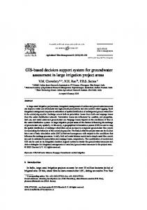
Geographical information system (GIS) in decision support to control malaria – a case study of Koraput district in Orissa, India Annjaan Daasha, Aruna Srivastavab, B.N. Nagpalb, Rekha Saxenab & Sanjeev Kumar Guptab aApeejay
School of Management, Dwarka, New Delhi; bNational Institute of Malaria Research, Dwarka, New Delhi, India
Key words GIS – malaria – Orissa – thematic maps
Vector-borne diseases such as malaria cause tremendous public health burden globally. Malaria is endemic in >100 countries and ~40% of the world’s population is at malaria risk1. Malaria is a local and focal disease. Besides ecological parameters which influence the disease there are some important local factors such as socioeconomic, socio-cultural and behaviour patterns of the community which play a major role in disease transmission. If these parameters are to be used effectively for decision-making, they must be well organized and managed. This goal can be accomplished by compilation of generated dataset and its integration within spatial infrastructure (SI) and introducing a geographical information system (GIS) for analysis and management. GIS is a set of strategies and tools capable of integrating, storing, editing, analyzing and displaying geographicallyreferenced information from various sources. Building spatial infrastructure (SI) is the first step towards setting geographic information system for use in decision making. Building SI for geographic information use is becoming an important concept these days as built-in spatial analysis tools provide excellent means for visualization and analysis of data, revealing trends, dependencies and inter-relationships leading to identification of high risk areas with underlying risk factors which help in decision making and utilising the limited resources in a cost effective manner for disease control.
Malaria is a major public health problem in India and its cases are around 1.5 million in a year. In tribal states, malaria problem is difficult to tackle because of vast tracts of forest with large tribal settlements. In India, there are more than 533 tribes, comprising 8% of the total population contribute 30% of total malaria cases, 60% of total Plasmodium falciparum cases and 50% of malaria deaths in the country2,3. Malaria situation in Orissa, a tribal dominated state is grim as Pf cases constituted 87% of total malaria cases during 2007 with 221 reported deaths4. A GIS based study was carried out in Koraput district of Orissa for identification of risk factors based on ecological parameters for decision support in formulation of appropriate control strategies. The district is situated at 17°4’ to 20°7’ N latitude and 81°24’ to 84°2’ E longitude covering an area of 8379 km2 and is highly malarious with predominance of tribal population. The district has been divided into 14 blocks (PHCs). During 2007, ~18000 malaria cases (97% Pf cases) and 30 deaths due to malaria were reported from this district. The dataset specific to the study was derived from remote sensing (IRS-1D/ LISS III), topographic maps (1:50,000), surveys, ground-truth and epidemiological data from the district. This information was used to develop primary spatial infrastructure in collaboration with Orissa Remote Sensing Application Cen-
DAASH ET AL: GIS & MALARIA
73
Fig. 1: Thematic layers of geomorphology, landuse, soil type, waterbodies and drainage network of Koraput district, Orissa
Fig. 2: Thematic layers of forest and settlement of Koraput district, Orissa
74
J VECTOR BORNE DIS 46, MARCH 2009
tre, Bhubaneswar. The thematic layers developed were: PHC map, geomorphological parameters, landuse, soil type, water bodies and drainage network (Fig. 1). Landuse map was further used to derive other thematic layers like forest cover and settlement (Fig. 2). The analysis was done within Arc/View GIS to describe primary risk factors within PHC. Epidemiological data collected from district malaria office were linked to the PHC map to prepare malaria API map. Thematic maps of ecological parameters were overlaid on malaria API map to identify the parameters responsible for malaria incidence in each PHC. It has been observed that the Laxmipur PHC with highest malaria incidence (30–40 API) has the highest forest cover, large network of streams, a number of valleys and mining activities. Similarly, the other high malaria transmission PHCs (20–30 API), namely Boipariguda, Kundra, Kotpada, Boriguma, Dasamantpur, Pottangi and Narayanpatna, also have large forest cover, network of streams and valleys. In low malaria transmission PHCs, namely Lamtaput and Nandapur (0–10 API), there was less forest cover and good drainage network. Malaria in a few pockets in these two PHCs was mainly due to the presence of water reservoirs. In Semlinguda, Jeypore and Koraput PHCs, medium receptivity of malaria was observed as ecological and geomorphological factors that were correlated with high malaria were also of moderate occurrence. GIS predicted maps for the distribution of Anopheles minimus (Diptera: Culicidae) have shown that some parts of Boipariguda and Lamtaput PHCs are favourable for An. minimus prevalence5 and these areas recorded highest SPR too. The GIS based studies have earlier been successfully
Correspondig author:
implemented in India to explain malaria epidemiology in different ecotypes by identifying risk factors leading to complete reconciliation of cause and effect relationships6,7. The current study clearly identifies the risk factors associated with high malaria transmission in different PHCs of Koraput and focused intervention based on these factors may be initiated in these areas to control malaria transmission in the tribal district. References 1.
World malaria report 2008. Geneva: World Health organization. Available from: http://www. who.int/malaria/ wmr2008.pdf.
2.
Tribal malaria. ICMR Bull 2004; 34(1): 1–10. Available from: http://icmr.nic.in/BUJAN04.pdf.
3.
Singh N, Mishra AK, Shukla MM, Chand SK. Forest malaria in Chhindwara, Madhya Pradesh (central India). A case study in ethnic tribal community. Am J Trop Med Hyg 2003; 68: 602–7.
4.
Malaria situation in India. Delhi: National Vector Borne Disease Control Programme, Ministry of Health and Family Welfare, Govt. of India. Available from: http:// www.nvbdcp.gov.in/Doc/malaria1.pdf.
5.
Srivastava A, Nagpal BN, Saxena R , Dev V, Subbarao SK. Precision mosquito survey using GIS: prediction of habitat for An. minimus–a foothill vector of malaria in India. Int J Geograph Inf Sci 2005; 19(1): 91–7.
6.
Srivastava A, Nagpal BN, Saxena R, Eapen A, Ravindran KJ, Subbarao SK, Rajamanikam C, Palanisamy M, Kalra NL, Appavoo NC. GIS based malaria information system for urban malaria scheme in India. Comp Meth Program Biomed 2003; 71: 63–75.
7.
Srivastava A, Nagpal BN, Saxena R, Sharma VP. Geographical information system as a tool to study malaria receptivity in Nadiad Taluka, Kheda district, Gujarat, India. Southeast Asian J Trop Med Pub Health 1999; 30: 4.
Dr B.N. Nagpal, Scientist ‘E’, National Institute of Malaria Research, Sector 8, Dwarka, New Delhi–110077, India. E-mail:
[email protected]
Received: 7 November 2008
Accepted in revised form: 28 December 2008