Psychological Research (2007) 71:240–251 DOI 10.1007/s00426-006-0080-4
O RI G I NAL ART I C LE
Humans do not switch between path knowledge and landmarks when learning a new environment Patrick Foo · Andrew Duchon · William H. Warren Jr. · Michael J. Tarr
Received: 24 July 2005 / Accepted: 15 March 2006 / Published online: 7 September 2006 © Springer-Verlag 2006
Abstract Using a metric shortcut paradigm, we have found that like honeybees (Dyer in Animal Behaviour 41:239–246, 1991), humans do not seem to build a metric “cognitive map” from path integration. Instead, observers take novel shortcuts based on visual landmarks whenever they are available and reliable (Foo, Warren, Duchon, & Tarr in Journal of Experimental Psychology-Learning Memory and Cognition 31(2): 195–215, 2005). In the present experiment we examine whether humans, like ants (Wolf & Wehner in Journal of Experimental Biology 203:857–868, 2000), Wrst use survey-type path knowledge, built up from path integration, and then subsequently shift to reliance on landmarks. In our study participants walked in an immersive virtual environment while head position and orientation were recorded. During training, participants learned two legs of a triangle with feedback: paths from Home to Red and Home to Blue. A conWguration of colored posts surrounded the Red location. To test reliance on landmarks, these posts were covertly translated, rotated, or left unchanged during six probe trials. These probe trials were interspersed during the training procedure to measure changes over learning. Dependence on visual landmarks was immediate and sustained during training, and no signiWcant learning eVects were observed other than a decrease in hesitaP. Foo (&) Department of Psychology, One University Heights, University of North Carolina at Asheville, Asheville, NC 28804, USA e-mail:
[email protected] A. Duchon · W. H. Warren Jr. · M. J. Tarr Department of Cognitive and Linguistic Sciences, Brown University, Providence, RI, USA
123
tion time. Our results suggest that while humans have at least two distinct navigational strategies available to them, unlike ants, a computationally-simpler landmark strategy dominates during novel shortcut navigation.
General introduction The ability to perform goal-directed travel in order to Wnd food, shelter, a mate, or other resources is an adaptive skill for any mobile organism. As one travels through new environments (e.g., large-scale urban environments, see Appleyard, 1969, 1970; Lee, 1962, 1970; e.g., large-scale urban environments, see Lynch, 1960), one must learn the locations of diVerent objects and develop some knowledge of that space. Previous studies of both animals and humans postulate that information about environmental locations (e.g., distances, bearings) is assembled into a single, cartographic-like representation, often referred to as a “cognitive map” (Gallistel, 1990; O’Keefe & Nadel, 1978; Thinus-Blanc, 1987; Tolman, 1948). Cognitive maps may preserve the properties of many diVerent geometries, but Gallistel (1990) defends its strictest form, a metric cognitive map. However, using a shortcut paradigm, we found that much like honeybees (Dyer, 1991), humans do not seem to build a metric cognitive map for navigation from path integration, but rather rely on computationallysimpler landmark navigation strategies whenever possible (Foo et al., 2005). In the present experiment we extend these Wnding by asking if humans, like ants (Wolf & Wehner, 2000), precede their reliance on landmarks with an initial dependence on survey-type path knowledge, built up from path integration, when learning to navigate in a new environment.
Psychological Research (2007) 71:240–251
Navigation strategies and spatial knowledge Regardless of the speciWc navigating agent, be it a human, a desert ant or a robot, one may classify navigation strategies into a taxonomy based upon their cognitive processing and memory requirements (Trullier, Wiener, Berthoz, & Meyer, 1997). The ability to successfully travel toward or away from a perceptible goal (locomotor guidance) is the most basic skill, for it can be performed “on-line” without memory (see also Nadel, 1990). In contrast, landmark navigation is the ability to orient in reference to an object or vista of a remembered scene. The capacity to update distance and direction traveled from proprioception, vestibular, or visual information is path integration. This strategy requires storing in memory at a minimum a single homing vector, or possibly a more complete record of the traversed trajectory. More complex is route-based navigation, which involves remembering a speciWc sequence of items (e.g., homing vectors, landmarks, junctions, turns), thus supporting an accurate retracing of one’s path. Finally, these routes and locations are combined into a survey or map-based knowledge of the environment that can be further ranked from “weak” to “strong” by the underlying geometries of the spatial structure. Thus these cognitive maps can be classiWed from topological to projective, aYne, and Euclidean (Gallistel, 1990; Suppes, Krantz, Luce, & Tversky, 1989). Over the years it has been claimed that both animals and humans possess a survey knowledge of their environment, that is, a cognitive map that “... encompasses the geometric relations among points by means of metric position vectors so that any such relation is in principle recoverable” (see Gallistel, 1990, pp. 103). This “strong” Euclidean cognitive map would preserve the properties of collinearity, parallelism, metric angles and distances—much like man-made cartographic atlases that embed traveled routes into a metric geographic coordinate frame (Thinus-Blanc, 1987; Tolman, 1948; Wang & Spelke, 2002). One of the diagnostic behaviors suggesting the use of a cognitive map is the ability to complete novel shortcuts between learned places and routes (Bennett, 1996). That is, given a familiar environment, can the organism navigate along a never-before-used route from one location to another? The novel shortcut test is the standard paradigm for testing the existence of a cognitive map (Bennett, 1996; Gallistel, 1990; Thinus-Blanc, 1987; Tolman, 1948). Typically this experiment involves training a foraging animal along two routes from home to two separate food targets (e.g., A and B). The food targets thus form
241
two legs of a triangle with the home location at the apex. As the trained animals leave home en route to one food location (e.g., A), they are captured and displaced to the other food location (e.g., B). If the animals are able to take a novel shortcut from their displaced location directly to the Wrst feeder (from B directly to A, akin to performing vector subtraction), this is taken as evidence that they have learned the metric locations of the feeding sites by combining distance and direction information from the learned routes. Gallistel (1990) argued that humans, nonhuman primates, dogs, rodents, and even insects (Gould, 1986; Gould & Gould, 1982; Landau, Spelke, & Gleitman, 1984; Maier, 1932; Menzel, 1973; Tolman, 1948) demonstrate the possession of a metric cognitive map through their ability to perform novel shortcuts. However, four main criticisms can be leveled at these studies, since subsequent authors have not been able to replicate these Wndings (see e.g., Bennett, 1996; Dyer, 1991; Dyer, Berry, & Richard, 1993; Menzel, Chittka, Eichmuller, Peitsch, & Knoll, 1990; Wehner, Bleuler, Nievergelt, & Shah, 1990). First, the testing environments were not truly novel (Ciancia, 1991; Menzel, 1973). Second, distal landmarks may have been available (e.g., vision of distal trees, wind-borne scents, or celestial compass information (Chapuis, 1982; Dyer, 1991; Dyer et al., 1993; Menzel et al., 1990; Wehner et al., 1990). Third, some test conditions have allowed simpler navigational strategies such as path integration to be used, which may have supported metric shortcut behavior (Bennett, 1996; Chapuis, 1982; Chase, 1983; Gillner & Mallot, 1998; Maguire, Frackowiak, & Frith, 1997; Maier, 1932; Péruch, Giraudo, & Garling, 1989). Finally, in some cases experimenter encouragement and feedback were given to the subject during the test trials (Landau et al., 1984). In order to avoid these criticisms, we used immersive Virtual Reality (Tarr & Warren, 2002) to investigate whether humans could integrate trained routes into a comprehensive cognitive map of their environment (Foo et al., 2005). In our “metric shortcut” paradigm, participants practiced walking two legs of a triangle conWguration and the angle between them (Home–Red target, Home–Blue target, and the opposite directions). Once the participants reached a predetermined high level of performance, they were tested on their ability to perform both these practiced legs and a novel shortcut (Blue–Red and the reverse). If our participants combined their path knowledge into a metric map, they should have been able to accurately complete the shortcut. On the other hand, if their learned map was of lesser geometry (e.g., topologic), we predicted less accurate and more variable
123
242
responses. Finally, if they failed to construct any sort of map, we expected highly inaccurate and imprecise responses. We found that in the absence of any stable visual landmarks, participants were able to reproduce the practiced legs albeit with variability consistent with demonstrated path integration abilities (Kearns, Warren, Duchon, & Tarr, 2002; Klatzky et al., 1990; Loomis et al., 1993; Péruch, May, & Wartenberg, 1997; Riecke, van Veen, & BülthoV, 2002). However, they were not able to accurately navigate the novel shortcut between the triangle endpoints. Reproduced shortcut paths demonstrated a relatively accurate mean orientation (consistent with a topologic knowledge of the triangle conWguration), but large orientation variability. This imprecise orientation, coupled with a signiWcant undershooting of distance, resulted in Wnal position errors that encompassed half of the total shortcut distance (Foo et al., 2005). In sharp contrast to these results, when a forest of potential landmarks was provided in the Virtual Reality (VR) environment, participants successfully reproduced practiced legs and the novel shortcut between the Red and Blue targets. Perturbation experiments using small clusters of landmarks provided direct evidence that participants were following these visual landmarks exclusively, whether they appeared at the beginning, middle, or end of a shortcut route, ignoring them and falling back on simultaneously acquired path knowledge only when perturbations were detected (Foo et al., 2005). Participants appeared to use landmarks to reWne initial orientation estimates acquired through path integration (Collett, Collett, & Wehner, 2001; Collett & Graham, 2004; Etienne, Boulens, Maurer, Rowe, & Siegrist, 2000; Etienne, Maurer, Boulens, Levy, & Rowe, 2004), and home in on shortcut target positions thereby achieving apparently metric behavior via the computationally-simpler landmark navigation strategy (Bennett, 1996; Chapuis, 1982; Hamilton, Driscoll, & Sutherland, 2002; Waller, Loomis, Golledge, & Beall, 2000; Wang & Spelke, 2002). Thus humans do not appear to build up “strong” metric spatial maps of their environment that support successful navigation; rather they depend on the computationally-simpler landmark navigation when reliable. The complete reliance on available landmarks during shortcuts is consistent with experimental evidence from rodents and honeybees (Dyer, 1991; Dyer et al., 1993; Etienne et al., 2000, 2004; Menzel et al., 1990; Wehner et al., 1990) and desert ants (Collett et al., 2001), but lies in contrast to previous experiments demonstrating that humans (and rodents, see Teroni,
123
Psychological Research (2007) 71:240–251
Portenier, & Etienne, 1987) will split the diVerence between target locations speciWed by path integration and visual landmarks if they are put in conXict (Aginsky, 2001; Kearns et al., 2002). Several factors may be responsible for this discrepancy in results. The walking task in the Wrst experiment (Aginsky, 2001; see also Teroni et al., 1987) may have been so simple that path integration was suYcient to provide strong navigational information: participants repeatedly exited a virtual tunnel and made a single turn to a target. In the second experiment (Kearns et al., 2002) participants walked a complex triangle completion task, but the landmarks employed were located far from target locations (global landmarks), denoting only general azimuth (and not speciWc positional) information. Finally, in both of these experiments, participants were not given a period of training prior to testing (Foo et al., 2005). Moreover, since humans encode both path integration and visual landmarks simultaneously (Foo et al., 2005), it is possible that during a more diYcult metric shortcut task and in the presence of highly salient local landmarks that indicate both positional and azimuth information, humans may alternate navigational strategies as they learn a new environment. Desert ants, for example, have been observed to ignore changes in local landmark positions (e.g., small cylinders located close to a home nest) when these manipulations occur early in learning. However, after repeated exposures these same ants will veer oV course in the direction of the shifted landmarks (Wolf & Wehner, 2000). Will humans react in a similar manner? We extend our earlier Wndings by examining whether humans switch between relying on path knowledge to relying on visual landmarks when learning a metric shortcut task in a novel environment.
Method Participants Twenty-four naive adults (12 men and 12 woman) aged 19–25 years were paid to participate in this experiment. Participants were students at Brown University, and signed informed consent waivers in accordance with the ethical standards of the American Psychological Association (APA). Apparatus This experiment was conducted in the Virtual Environment and Navigation Laboratory (VENLab) at Brown
Psychological Research (2007) 71:240–251
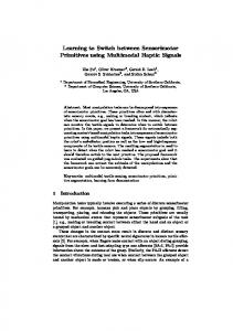
University—one of the largest immersive VR spaces in the world. The VENLab consists of a dual sonic/inertial Intersense IS-900 VET tracking system, a tethered Kaiser Electro-Optics Proview 80 head mounted display (HMD), and a 12 m £ 12 m walking area. The IS900 system provides six-degrees-of-freedom tracking of participants’ head position and orientation (1.5 mm and 0.05° accuracy) at 60 Hz. The Kaiser HMD provides a full stereoscopic display with a 60° horizontal (H) £ 40° vertical (V) Weld of view (FOV), and VGA resolution (640H x 480V) for each eye. HMD images are refreshed at 60 Hz, but participants’ position and orientation data are down-sampled at half that rate for analysis. A black plastic baZe blocks out extraneous light, and earphones introduce a low volume acoustic white noise to mask external orientation cues, and increase immersion into the virtual world. Displays Virtual environments were generated on a Silicon Graphics (SGI) Onyx2 with an InWnite Reality Engine, using World Tool Kit software from Sense8. Participants were placed in a virtual “desert” world. The desert surface was a circular 100.0 m diameter ground plane, textured with a multiscale random grey pattern containing a small cluster of randomly positioned colored posts (seven right quadrangular prisms 2.0 m high and 0.1 m wide randomly placed within a 4 m radius circle) located near the Red target position (see Fig. 1a) in order to isolate potential eVects of landmarks at the beginning or end of a shortcut route. The cluster of seven colored posts was oVset by 1 m (by moving the centroid of the encompassing circle) from
a
243
the Red target so that its center could not act as a simple cue for target location (see also Fig. 1b). The same random conWguration of posts was repeated for all participants. Procedure Participants were asked to learn to accurately and precisely walk two 8.0 m legs (Home to Red target, and Home to Blue target), of a triangle and the 73° angle between them (see Fig. 1b). Participants were told they would be tested on their ability to walk to “diVerent locations they had learned.” To assess dependence on landmarks, participants were asked to perform the 9.5 m shortcut (in both directions: Red to Blue and vice versa) in probe trials that were interleaved with training trials as learning progressed. Participants were not informed that the landmarks could shift. Exit interviews conWrmed that none of the participants reported detecting such a shift. Familiarization trial Participants were randomly assigned to control, translation, or rotation groups within each direction condition, and were given a single familiarization trial (consisting of the two legs of the triangle path and the angle between) as follows. Participants began training with the Home–Red leg because our previous experiments revealed no eVect of presentation order (Foo et al., 2005). Participants began training at Home, and were shown the Red target position (marked by a 5.0 m tall by 0.1 m wide red cylinder) and asked to walk to it. Next, the red cylinder was removed, and participants returned
b Blue Target Novel Shortcut Practiced Leg (8.0 m)
(9.5 m) 73 deg
Home
Practiced Leg (8.0 m)
Fig. 1 Displays used in this experiment. Participants navigated in a virtual desert environment (a) where a small cluster of colored posts provided potential visual landmarks. A representative participant is included for scale. b Metric shortcut test. Participants practiced walking the triangle legs (Home–Red, Home–Blue)
Red Target
and the angle between them during training with feedback. Six test trials were interspersed within these 16 training trials where participants walked the novel shortcut (dotted line) between the Red and Blue endpoints, thus testing their metric navigation ability as learning progressed
123
244
to the Home location where a yellow cylinder of the same dimensions was now visible. When they reached Home, the experimenter explicitly oriented participants (“you are now at Home, with Red directly behind you”). Next the yellow marker at Home was removed, the Blue target cylinder positioned, and participants were instructed to turn in place until they faced the Blue target location. Thus, proprioceptive, vestibular, and visual information was made available to participants that would support a 2D survey representation of the environment. Participants then walked to Blue and back, repeating the same walking procedure as in the Home– Red leg. In this way, participants were familiarized to each segment of the triangle task by a color-coded cylinder, although at any one time only a single target cylinder (Red, Home, or Blue) was visible. First training trial Following the familiarization trial, all participants began their Wrst training trial. Participants were Wrst explicitly oriented (“you are now at Home, with Blue directly behind you”), and were asked to walk to the remembered position of the Red target, which was now unmarked. Once participants had stopped walking and verbally reported when they believed they had reached the target location, the (Red) target post appeared in its true location, and the participant corrected any error by walking to it. They then continued this training-with-feedback procedure for the Home, Blue, and Home positions, thus completing their Wrst training trial of both triangle legs. First testing trial To assess the interplay of survey knowledge and landmark strategies, participants were asked to walk the novel metric shortcut at points during the learning process, beginning after the Wrst training trial. It was critical that participants never walked the complete triangle because this would have allowed them to complete the shortcut using continuous path integration rather than remembered knowledge of learned locations. Therefore, a wheelchair was used to transport participants (without displays and via a confusing, looping route to discourage continuous updating by participants) to the initial location of each test trial. To insure that each test trial was begun in a known location and orientation, the participant was then led by guided walking to the start position (with HMD displays turned on) and explicitly oriented by the experimenter. For example, for the Red–Blue shortcut, the participant was Wrst blindly wheeled to Home, the displays were turned on, and the
123
Psychological Research (2007) 71:240–251
participant walked with guidance to the Red target location. The participant was oriented (e.g., “you are now at Red, with Home directly behind you”) and instructed to walk directly to a remembered target location (e.g., Blue) in the physical room. In addition, participants were instructed to walk without looking behind them and without backtracking along a previously learned route (e.g., walking Red–Home–Blue as in Chapuis, 1982). When they reported that they had reached the target location, participants were returned to the wheelchair, the display was turned oV, and they were wheeled to the initial location for the next trial. Subsequent training and test trials Following the Wrst pair of training and test trials, participants completed another training (with feedback) trial and were retested. Two training trials were then administered back-to-back and another test trial given. Each participant completed 16 total training trials; with six probe trials following the 1st, 2nd, 4th, 8th, 11th, and 16th training trial. In previous experiments, 16 trials was the amount of training required by participants to consistently and accurately (within 1 m) learn to navigate the endpoints of this triangle task (Foo et al., 2005). This procedure yielded 6 test trials for each participant, for a total of 144 trials. Landmark manipulations during test trials To assess the dependence on landmarks during the development of survey knowledge, participants were asked to walk the novel metric shortcut as landmarks were either covertly translated (by 1.0 m away from the Red–Home–Blue vertex, in a direction orthogonal to the Red–Blue shortcut path, see Fig. 2a), rotated (35° counterclockwise about the Red target; Fig. 2b), or left unchanged for comparison. Analyses Participants’ paths were evaluated in reference to an ideal path deWned as the most direct, straight path between start and target positions. Five diVerent measures quantiWed participant performance. At the beginning of each test trial we recorded the angular diVerence between ideal path and the participants’ paths at the point they left a 1 m circle about the start position, the (a) signed initial orientation error. This error was calculated using an egocentric reference frame, and was deWned as positive if participants overturned in the direction of the Home vertex, and negative if they underturned regardless of whether they
Psychological Research (2007) 71:240–251
a
245
b
Translated 1.0 m
Rotated 35.0 deg CCW
Fig. 2 Schematic of landmark manipulations. During test trials, the cluster of colored posts was translated (a), rotated (b), or remained constant (as in Fig. 1b) relative to original training locations. Also illustrated are the triangle conWguration changes
(dashed lines) that would result if participants relied on visual landmarks to guide their navigation (referred to as landmark paths in text)
were at Red or Blue or if the turn in question was clockwise or counterclockwise. The time it took for the participant to leave that initial 1 m circle was deWned as the (b) look time. As the participant completed his or her travel, the magnitude of the response vector that connected the participant’s start and Wnal positions constituted his or her (c) path length. (d) The signed Wnal orientation error was deWned as the angular diVerence between the ideal path vector and the response vector. (e) Finally, the Wnal position error was computed as the Euclidean distance between the participant’s Wnal position and the actual target position. For the three linear dependent measures of look time, path length, and Wnal position error, a 2 (direction: toward or away from landmarks) £ 3 (landmark: control, translate, rotate) £ 6 (repeated learning trials) mixed design Analyses of variance (ANOVA) was performed, with a type I error rate set at 0.05. These same analyses were performed on the SD’s (of each participant) of look time, path length, and Wnal position error. In contrast, the two angular dependent measures (initial and Wnal orientation error) were analyzed with multiple sample Watson-Williams tests for circular data (Batschelet, 1981). The Watson-Williams test is recommended for angular measures like direction because they are cyclic (e.g., the direction East can be described as 90°, ¡270°, 90 + 360°, etc), and thus behave quite diVerently from linear variables. Furthermore, while the Watson-Williams is a two sample test, there do not exist (to our knowledge) analogous circular tests to an n-way mixed ANOVA (Batschelet, 1981). Therefore, we employ the Watson-Williams test, running each main eVect and interaction separately. The angular deviation (AD) of signed orientation, which is analogous to a standard deviation, was computed for each participant, and this variability was compared across conditions using the Watson-Williams test as well.
Reanalysis of ideal path An additional set of analyses was performed in order to assess whether participants followed (shifted) visual landmarks during probe trials. These particular results are reported under the label “in Landmark Path.” In this analysis, participant responses are computed with respect to an ideal path determined by the position of the landmarks, rather than the original location of the target in the physical (real) room.
Results Complete walking responses of all participants traveling the shortcut are illustrated in Figs. 3 and 4. In both Wgures, the three landmark conditions (a) control, (b) translated, and (c) rotated are shown, as participants walked either away from (Fig. 3), or toward (Fig. 4) potential landmarks. Walking responses are shown collapsed across all learning trials since none of the participants demonstrated a switch from a reliance on path integration to visual landmarks when learning this shortcut task. Rather, all participants appear to depend on landmarks immediately and consistently throughout the learning process. When participants travel away from potential landmarks (in the Red to Blue direction), they are unable to accurately complete the shortcut (see Fig. 3a–c). Participants initially appear to rely on landmarks for mean target orientation (especially evident in the rotated landmark condition Fig. 3c). However, as soon as they leave the (Red) start position, participants demonstrate a lack of bearing corrections, and their trajectories diverge, leading to increasing position errors characteristic of path integration (Foo et al., 2005; Fujita, Loomis, Klatzky, & Golledge, 1990; Kearns et al., 2002; Klatzky et al., 1990; Loomis et al.,
123
246
Psychological Research (2007) 71:240–251
a
b
c
1000
1000
1000
900
900
900
800
800
800
700
700
700
600
600
600
500
500
500
400
400
400
300
300
300
200
200
200
100
100
100
0
0
-100 -100
0
-100 0
100 200 300 400 500 600 700 800 900 1000
-100 0
100 200 300 400 500 600 700 800 900 1000
Fig. 3 Response paths of all participants navigating the Red– Blue shortcut (see Wlled arrow) during a control, b translated, and c rotated conditions. The colored posts surrounding the Red Target are not shown for clarity. When landmarks surrounded start positions, participants appeared to rely on them for target orien-
-100
-100 0
tation. As participants traveled to remembered target locations, signiWcant undershooting coupled with a lack of orientation corrections resulted in large Wnal position errors: participants were not able to successfully complete novel shortcuts in this direction
a
b
c
1000
1000
1000
900
900
900
800
800
800
700
700
700
600
600
600
500
500
500
400
400
400
300
300
300
200
200
200
100
100
100
0
0
0
-100
-100
-100
-100
0
100 200 300 400 500 600 700 800 900 1000
-100
0
100 200 300 400 500 600 700 800 900 1000
100 200 300 400 500 600 700 800 900 1000
-100
0
100 200 300 400 500 600 700 800 900 1000
Fig. 4 Response paths of all participants navigating the Blue– Red shortcut during the same a control, b translated, and c rotated conditions. As in the previous Wgure, the landmarks are not shown, but a Wlled arrow indicates travel direction. Participants
successfully complete the shortcut by apparently homing in on the cluster of landmarks. As noted in the text, participants relied on landmarks immediately after the Wrst training trial
1993). By contrast, when participants attempt the novel shortcut in the opposite Blue–Red direction, they accurately walk the correct route with signiWcantly higher precision than their counterparts in all three conditions (see Fig. 4a–c). Participants appear to focus on the cluster of landmarks to estimate initial target bearing, path length, and Wnal target position with a high degree of precision and accuracy. These results are consistent with Wndings that landmarks about a target location act as powerful navigational beacons for human navigators (Foo et al., 2005; Spetch et al., 1997; Waller et al., 2000; Wang & Spelke, 2002). Quantitative results for each dependent measure are summarized in Tables 1 and 2, and we describe them in detail here.
main eVect of look time (F(5,90) = 3.87, P < 0.003) revealed that participants hesitated longer before walking their Wrst test trial as compared to all subsequent attempts (see Table 1). This main eVect across learning for mean look times was not observed in participant SD’s, F = 1.59.
Learning results No signiWcant diVerences were observed across the response measures of initial or Wnal orientation error, path length, or Wnal position error (all P’s > 0.05) across repeated learning trials. However, a signiWcant
123
Initial orientation A signiWcant direction of travel by landmark condition interaction was observed between signed orientation error means, F(5,142) = 16.46, P < 0.01. Post-hoc tests revealed that participants accurately estimated target Table 1 Look time means and standard deviations for participants across learning trials Look time (s)
Trial 1
Trial 2
Trial 4
Trial 8
Trial 11
Trial 16
M SD
6.95 6.87
4.79 3.09
4.03 2.26
4.42 1.87
4.08 1.95
4.07 2.43
Psychological Research (2007) 71:240–251
247
bearing in all conditions except those participants traveling away from landmarks that were visually rotated (see Table 2). When these data were analyzed with respect to visually shifted target positions (re: landmark path), the signiWcant interaction disappeared, but the main eVect of direction of travel remained, suggesting that participants accurately followed the visual position of landmarks near the target position, F(1,142) = 6.09, P < 0.01. Analysis of angular deviations of orientation error values demonstrated that participants traveling toward landmarks were signiWcantly more precise than their counterparts walking in the opposite direction, although rotating landmarks during test trials resulted in a signiWcant interaction of initial bearing performance above and beyond this travel direction eVect, F(5,22) = 5.55, P < 0.01. Landmark path analysis of angular deviations of orientation errors conWrms only the main eVect of shortcut walking direction, F(1,22) = 21.09, P < 0.01. Table 2 Means and standard/angular deviations for participants across all conditions Control Signed initial orientation error (°) Away from M 3.11 landmarks AD 19.15 Toward M ¡3.37 landmarks AD 3.76
Translated
Rotated
¡1.59 15.11 2.21 4.39
39.64 23.16 ¡5.55 10.57
Signed initial orientation error (°) in landmark path Away from M 3.11 4.48 landmarks AD 19.15 27.84 Toward M ¡3.37 ¡3.89 landmarks AD 3.76 4.82
3.87 26.01 ¡5.55 14.27
Path length (cm) Away from landmarks Toward landmarks
M SD M SD
762.14 99.76 932.20 30.07
650.13 74.03 894.64 47.95
711.63 114.52 915.31 44.15
273.11 177.41 35.24 15.90
409.77 125.87 108.96 20.85
438.79 191.93 43.10 20.76
Final position error (cm) in landmark path Away from M 273.11 413.89 landmarks SD 177.41 115.26 Toward M 35.24 49.90 landmarks SD 15.90 27.43
527.59 303.70 43.10 20.76
Signed Wnal orientation error (°) Away from M ¡3.40 landmarks AD 16.12 Toward M 1.09 landmarks AD 0.42
29.44 25.58 ¡1.55 0.54
Final position error (cm) Away from M landmarks SD Toward M landmarks SD
¡5.29 16.81 0.22 0.75
Signed Wnal orientation error (°) in landmark path Away from M ¡3.40 0.78 landmarks AD 16.12 23.12 Toward M 1.09 6.29 landmarks AD 0.42 1.89
¡6.29 29.43 ¡2.67 1.56
Path length Did participants travel the correct distance to the target? Participants walking towards the cluster of landmarks more accurately walked the required 950 cm shortcut distance during test trials, while those traveling in the Red–Blue target direction signiWcantly undershot target distance, F(1,18) = 203.87, P < 0.001. In addition, a landmark condition main eVect was observed, F(2,18) = 8.98, P < 0.002, whereupon control trials were more accurate than rotated and translated landmark trials, respectively. Analysis of the SD’s of path length revealed a main eVect of travel direction commensurate to the ANOVA of mean path length values. Participants traveling the shortcut toward landmarks were signiWcantly less variable in their path length than those traveling away from them, F(1,18) = 40.68, P < 0.001. Final position and orientation How well did participants navigate to remembered target locations? A signiWcant direction of travel by landmark interaction for Wnal position error, F(2,18) = 4.72, P < 0.023, revealed that traveling away from landmarks resulted in larger mean position errors during translated and rotated trials versus controls, and that collectively these three groups were signiWcantly less accurate than all participants walking in the opposite direction (towards the landmarks). Post-hoc tests conWrmed that no signiWcant diVerences were found between the landmark conditions of these latter participants. Analysis of Wnal position SD’s demonstrated that participants traveling the shortcut toward landmarks were signiWcantly more precise than those traveling away from them, F(1,18) = 25.95, P < 0.001. Mean signed Wnal orientation error results provided further evidence that landmarks surrounding a target act as powerful navigation beacons during shortcuts. Participants traveling towards landmarks demonstrated signiWcantly more accurate performance than their counterparts, F(5,142) = 12.26, P < 0.01. In addition, performance deWciencies were observed in the Red–Blue travel direction between rotated versus the other two landmark conditions. Analysis of the precision of Wnal orientation errors produced the same pattern of results, F(5,22) = 15.10, P < 0.01. Reanalysis of ideal path The analysis of Wnal orientation and position with regard to shifted landmark positions suggests that participants are indeed following the shifted visual landmarks during
123
248
test trials. When participants erred in their Wnal position and orientation performance during perturbed trials, they erred in the direction of shifted visual landmark positions. An analysis with respect to these shifted visual positions did not reveal any signiWcant diVerences of mean signed Wnal orientation error, F = 1.43, although the signiWcant Direction £ Landmark interaction seen in the original analysis of AD’s remained, F(5,22) = 14.78, P < 0.01. In contrast to these Wnal bearing results, participants were not as successful at determining Wnal position based on visual landmarks. A signiWcant main eVect of travel direction conWrms that landmarks about a target may act as powerful beacons improving mean Wnal position performance (F(1,18) = 156.16, P < 0.001), and variability (SD results: F(1,18) = 67.28, P < 0.001). When landmarks were translated or rotated, an additional signiWcant main eVect of landmark condition was observed regardless of travel direction, F(2,18) = 6.77, P < 0.006.
Discussion The purpose of this experiment was to extend earlier results (Foo et al., 2005) by evaluating the interplay of path knowledge and visual landmarks during learning of a novel metric shortcut. Participants were observed to hesitate longer, presumably in order to orient themselves (M » 7 s), before walking their initial test trials versus all subsequent trials (M » 4 s). No other signiWcant learning eVects were in evidence across any recorded dependent measures. Unlike desert ant behavior (Wolf & Wehner, 2000), humans do not appear to switch from a reliance on path knowledge to local visual landmarks while learning new environments. Instead, our results are consistent with humans utilizing landmarks to reWne path integration information from the very Wrst learning trial (Collett et al., 2001; Collett & Graham, 2004; Etienne et al., 2000; Etienne et al., 2004; Foo et al., 2005; Fujita, Klatzky, Loomis, & Golledge, 1993; Kearns et al., 2002; Loomis et al., 1993; Péruch et al., 1997; Riecke et al., 2002). When landmarks surround the start position, participants appeared to rely on them for improving their estimates of initial orientation. However, once they walk past landmarks, participants cannot use them for bearing corrections, resulting in ever-increasing position errors characteristic of path integration (Aginsky, 2001; Hamilton et al., 2002; Teroni et al., 1987; Waller et al., 2000). Participants’ imprecise bearing, coupled with the tendency to undershoot (by »25%) the required path length results in unsuccessful shortcut
123
Psychological Research (2007) 71:240–251
performance (Wnal position errors »40% of shortcut length) consistent with previous results (see also Foo et al., 2005). It should be noted that under perception of distance in VR (Thompson et al. 2004) does not appear to be responsible for the undershooting of path length in this experiment. In the Foo et al. (2005) experiment participants also undershot the distance when asked to reproduce the Red–Blue or Blue–Red shortcut in the same triangle layout sans landmarks (the “Desert” world). However, these same participants accurately navigated to the three vertices (by successfully reproducing paths they had practiced for a number of trials equivalent to the present experiment) of an identical triangle layout in the Desert world. When participants attempt a novel shortcut in the opposite direction, local landmarks surrounding the target position serve as navigational beacons during the entire walking response. Navigators accurately complete the shortcut and exhibit signiWcantly higher accuracy and precision across all spatial dependent measures here: initial and Wnal target bearing, path length, and Wnal target position (Foo et al., 2005; Spetch et al., 1997; Waller et al., 2000). Converging direct evidence of landmark reliance is provided as participants consistently and completely follow visual landmarks that are covertly translated or rotated. These data support the conclusion that the entire conWguration of landmarks served as a navigational aid, but it is beyond the scope of the present data to conclude which particular properties of the landmark cluster (e.g., color, speciWc post position, proximity to a target location, etc.) attracted participants. Moreover, we observed individual diVerences in walking trajectories. It should be noted the participants’ instructions did not constrain a particular route as they navigated to each target. As previously discussed, posts were placed in a random cluster, though post locations remained identical for all participants. Regardless of this consistency of landmark positions, participants traveling away from the landmarks (in the Red–Blue direction) demonstrated individual variation in how they navigated through the posts. For example, although all participants appeared to consistently avoid colliding with a post positioned approximately collinear with the translated Red–Blue path (see Fig. 3b), some veered left, and others right. Similar individual diVerences were observed in the opposite walking direction towards the visual landmark cluster. One participant consistently approached the Red Target location by walking to the right of a particular post (instead of to the left as others did), such that his or her Wnal approach suggests a matching of a remembered proximal image, along the practiced Home–Red route (Fig. 4c). For the rest of the participants, and for
Psychological Research (2007) 71:240–251
this particular participant during the majority of the walking responses, short-cut navigation appears to be based upon the distal conWguration of landmarks instead (Bisch-Knaden & Wehner, 2003a, b). However, this small individual variation in response paths does not diminish our overall Wnding of an immediate reliance on landmarks (Lehrer & Collett, 1994) for navigation in a novel environment. Although it has been observed that mammals will make repeated trips to locations in an naturalistic environment, as if they were testing the precision of landmarks, before searching for food (Eilam, Dank, & Maurer, 2003; Whishaw & Brooks, 1999), single-trial learning has been observed in foraging insects when the spatial context is appropriate. Foraging ants (Bisch-Knaden & Wehner, 2003b) and honeybees (Foo et al., 2005) appear to acquire and use landmark memories after a single exposure when those landmarks occur near the home nest. The authors propose since foraging insects never know if their food searches will be successful, it is less advantageous to remember landmarks associated with a particular outbound route. Furthermore, even during trips to a previously successful feeding source, when diVerent routes are taken, richer food sources may be serendipitously discovered. Regardless of the outbound path, when the animal has found food, its primary goal is to return home as quickly and eYciently as possible (e.g., to avoid dying of dehydration for the desert ant), and landmarks on the homebound path are remembered even after a single trial (Bennett, 1996; Trullier et al., 1997). For the human participants in our experiment, the only explicit goal is to quickly and eYciently travel the shortcut between two known positions, and visual landmarks may provide the most reliable and robust information to complete that goal, promoting their immediate use. The goal of this experiment was to assess the “natural” use of path knowledge and local landmarks. It is tempting to point to the fact that path integration is normally less reliable and noisier than visual landmarks, and that local landmarks were utilized in the current familiarization trials, suggesting a logical reason for participants to favor the more reliable information source. Small rodents and humans, for example, have been observed to switch to path integration when visual landmarks were noticeably displaced (Etienne, Teroni, Hurni, & Portenier, 1990; Foo et al., 2005; Teroni et al., 1987). Furthermore, the magnitude of landmark displacements may have been below the threshold of detection by path integration (AD »20°, see Kearns et al., 2002). However, in present experiments (Foo, Harrison, Duchon, Warren, & Tarr, 2006), even when local landmarks are shifted by an amount greater than the
249
reported accuracy and precision of path integration (i.e., 28°), participants still follow landmarks unless explicitly informed of their lack of reliability. Our results provide further direct evidence that humans use landmarks to successfully complete novel shortcuts, as opposed to constructing a single, accurate, metric survey knowledge of the environment (Dyer, 1991; Morris, Garrud, Rawlins, & O’Keefe, 1982; Wang & Spelke, 2002). Thus, apparently metric behavior is achieved via computationally-simpler navigation strategies (Bennett, 1996; Trullier et al., 1997). It appears that while humans simultaneously acquire both coarse, path integration-based survey knowledge (path knowledge) and landmark-based information while navigating, during novel shortcuts local visual landmarks dominate. Acknowledgments This research was supported by the National Science Foundation (LIS IRI 9720327; 0214383). The authors would like to thank Amanda Forte, Nick Beem, and Jonathan Ring for help in collecting data.
References Aginsky, V. (2001). How visual landmarks are selected during small-scale navigation. Providence: Brown University. Appleyard, D. (1969). Why buildings are known: A predictive tool for architects and planners. Environment and Behavior, 1, 131–156. Appleyard, D. (1970). Styles and methods of structuring a city. Environment and Behavior, 2, 100–117. Batschelet, E. (1981). Circular statistics in biology. London: Academic Press. Bennett, A. T. D. (1996). Do animals have cognitive maps? Journal of Experimental Biology, 199(1), 219–224. Bisch-Knaden, S., & Wehner, R. (2003a). Landmark memories are more robust when acquired at the nest site than en route: Experiments in desert ants. Naturwissenschaften, 90(3), 127– 130. Bisch-Knaden, S., & Wehner, R. (2003b). Local vectors in desert ants: context-dependent landmark learning during outbound and homebound runs. Journal of Comparative Physiology. A. Neuroethology, Sensory, Neural, and Behavioral Physiology, 189(3), 181–187. Chapuis, N. (1982). Mechanisms of spatial-behavior in a returning task in dogs. Annee Psychologique, 82(1), 75–100. Chase, W. G. (1983). Spatial representation of taxi drivers. In D. Rogers, & J. A. Sloboda (Eds.), The acquisition of symbolic skill (pp. 391–405). New York: Plenum. Ciancia, F. (1991). Tolman and Honzik (1930) revisited, or the mazes of psychology. The Psychological Record, 41, 461–472. Collett, T. S., & Graham, P. (2004). Animal navigation: Path integration, visual landmarks and cognitive maps. Current Biology, 14(12), R475–R477. Collett, T. S., Collett, M., & Wehner, R. (2001). The guidance of desert ants by extended landmarks. Journal of Experimental Biology, 204(9), 1635–1639. Dyer, F. C. (1991). Bees acquire route-based memories but not cognitive maps in a familiar landscape. Animal Behaviour, 41, 239–246.
123
250 Dyer, F. C., Berry, N. A., & Richard, A. S. (1993). Honey bee spatial memory: use of route-based memories after displacement. Animal Behaviour, 45, 1028–1030. Eilam, D., Dank, M., & Maurer, R. (2003). Voles scale locomotion to the size of the open-Weld by adjusting the distance between stops: a possible link to path integration. Behavioural Brain Research, 141(1), 73–81. Etienne, A. S., Teroni, E., Hurni, C., & Portenier, V. (1990). The eVect of a single light cue on homing behavior of the goldenhamster. Animal Behaviour, 39, 17–41. Etienne, A. S., Boulens, V., Maurer, R., Rowe, T., & Siegrist, C. (2000). A brief view of known landmarks reorientates path integration in hamsters. Naturwissenschaften, 87(11), 494– 498. Etienne, A. S., Maurer, R., Boulens, V., Levy, A., & Rowe, T. (2004). Resetting the path integrator: a basic condition for route-based navigation. Journal Of Experimental Biology, 207(9), 1491–1508. Foo, P., Warren, W. H., Duchon, A., & Tarr, M. J. (2005). Do humans integrate routes into a cognitive map? Map- versus landmark-based navigation of novel shortcuts. Journal of Experimental Psychology-Learning Memory and Cognition, 31(2), 195–215. Foo, P., Harrison, M. C., Duchon, A. P., Warren, W. H. J., & Tarr, M. J. (2006). Humans follow perturbed landmarks during continuous path integration unless explicitly told to ignore them (in preparation). Fujita, N., Loomis, J. M., Klatzky, R. L., & Golledge, R. G. (1990). A minimal representation for dead-reckoning navigation—updating the homing vector. Geographical Analysis, 22(4), 326–335. Fujita, N., Klatzky, R. L., Loomis, J. M., & Golledge, R. G. (1993). The encoding-error model of pathway completion without vision. Geographical Analysis, 25(4), 295–314. Gallistel, C. R. (1990). The organization of learning. Cambridge, MA: The MIT Press. Gillner, S., & Mallot, H. A. (1998). Navigation and acquisition of spatial knowledge in a virtual maze. Journal of Cognitive Neuroscience, 10(4), 445–463. Gould, J. L. (1986). The locale map of honey bees: Do insects have cognitive maps? Science, 232(4752), 861–863. Gould J. L., & Gould, C. G. (1982). The insect mind: Physics or metaphysics? In D. R. GriYn (Ed.) Animal mind–human mind (pp. 269–298). Berlin Heidelberg New York: Springer. Hamilton, D. A., Driscoll, I., & Sutherland, R. J. (2002). Human place learning in a virtual Morris water task: Some important constraints on the Xexibility of place navigation. Behavioral Brain Research, 1(2), 159–170. Kearns, M. J., Warren, W. H., Duchon, A. P., & Tarr, M. J. (2002). Path integration from optic Xow and body senses in a homing task. Perception, 31(3), 349–374. Klatzky, R. L., Loomis, J., Golledge, R., Cicinelli, J. G., Doherty, S., & Pellegrino, J. W. (1990). Acquisition of route and survey knowledge in the absence of vision. Journal of Motor Behavior, 22(1), 19–43. Landau, B., Spelke, E., & Gleitman, H. (1984). Spatial knowledge in a young blind child. Cognition, 16(3), 225–260. Lee, T. (1962). “Brennan’s law” of shopping behaviour. Psychological Reports, 11, 662. Lee, T. (1970). Urban neighborhood as a socio-spatial schema. Ekistics; An Introduction to the Science of Human Settlements, 177, 241–267. Lehrer, M., & Collett, T. S. (1994). Approaching and departing bees learn diVerent cues to the distance of a landmark. Journal of Comparative Physiology A-Sensory Neural and Behavioral Physiology, 175, 171–177.
123
Psychological Research (2007) 71:240–251 Loomis, J. M., Klatzky, R. L., Golledge, R. G., Cicinelli, J. G., Pellegrino, J. W., & Fry, P. A. (1993). Nonvisual navigation by blind and sighted: Assessment of path integration ability. Journal of Experimental Psychology-General, 122(1), 73–91. Lynch, K. (1960). The image of the city. Cambridge, MA: MIT Press. Maguire, E. A., Frackowiak, R. S., & Frith, C. D. (1997). Recalling routes around london: Activation of the right hippocampus in taxi drivers. Journal of Neuroscience, 17(18), 7103– 7110. Maier, N. R. F. (1932). A study of orientation in the rat. Journal of Comparative Psychology, 14(3), 387–399. Menzel, E. W. (1973). Chimpanzee spatial memory organization. Science, 182, 943–945. Menzel, R., Chittka, L., Eichmuller, S., Peitsch, D., & Knoll, P. (1990). Dominance of celestial cues over landmarks disproves map-like orientation in honey bees. Zeitschrift fur Naturforschung C, 45, 723–726. Morris, R. G., Garrud, P., Rawlins, J. N., & O'Keefe, J. (1982). Place navigation impaired in rats with hippocampal lesions. Nature, 297(5868), 681–683. Nadel, L. (1990). Varieties of spatial cognition—psychobiological considerations. Annals of the New York Academy of Sciences, 608, 613–636. O'Keefe, J., & Nadel, L. (1978). The hippocampus as a cognitive map. Oxford: Oxford University Press. Péruch, P., Giraudo, M. D., & Garling, T. (1989). Distance cognition by taxi drivers and the general public. Journal of Environmental Psychology, 9(3), 233–239. Péruch, P., May, M., & Wartenberg, F. (1997). Homing in virtual environments: EVects of Weld of view and path layout. Perception, 26(3), 301–311. Riecke, B. E., van Veen, H., & BülthoV, H. H. (2002). Visual homing is possible without landmarks: A path integration study in virtual reality. Presence-Teleoperators And Virtual Environments, 11(5), 443–473. Spetch, M. L., Cheng, K., MacDonald, S. E., Linkenhoker, B. A., Kelly, D. M., & Doerkson, S. R. (1997). Use of landmark conWguration in pigeons and humans.2. Generality across search tasks. Journal of Comparative Psychology, 111(1), 14– 24. Suppes, P., Krantz, D. M., Luce, R. D., & Tversky, A. (1989). Foundations of measurement: Geometrical, threshold, and probabilistic representations (Vol. 2). San Diego: Academic Press, Inc. Harcourt Brace Jovanovich Publishers. Tarr, M. J., & Warren, W. H. (2002). Virtual reality in behavioral neuroscience and beyond. Nature Neuroscience, 5(Suppl), 1089–1092. Teroni, E., Portenier, V., & Etienne, A. S. (1987). Spatial orientation of the golden-hamster in conditions of conXicting location-based and route-based information. Behavioral Ecology And Sociobiology, 20(6), 389–397. Thinus-Blanc, C. (1987). The cognitive map concept and its consequences. In P. Ellen, & C. Thinus-Blanc, (Eds.), Cognitive processes in animal and man (pp. 1–19). The Hague: Martinus NijhoV, N.A.T.O A.S.I. series. Thompson, W. B., Willemsen, P., Gooch, A. A., Creem-Regehr, S. H., Loomis, J. M., & Beall, A. C. (2004). Does the quality of the computer graphics matter when judging distances in virtually immersive environments? Presence: Teleoperators & Virtual Environments, 13(5), 560–571. Tolman E. C. (1948). Cognitive maps in rats and men. The Psychological Review, 55(4), 189–208. Trullier O., Wiener S. I., Berthoz A., & Meyer, J. A. (1997). Biologically-based artiWcial navigation systems: Review and prospects. Progress in Neurobiology, 51, 483–544.
Psychological Research (2007) 71:240–251 Waller, D., Loomis, J., Golledge, R., & Beall, A. C. (2000). Place learning in humans: The role of distance and direction information. Spatial Cognition and Computation, 2, 333–354. Wang, R. F., & Spelke, E. S. (2002). Human spatial representation: insights from animals. Trends in Cognitive Sciences, 6(9), 376–382. Wehner, R., Bleuler, S., Nievergelt, C., & Shah, D. (1990). Bees navigate by using vectors and routes rather than maps. Naturwissenschaften, 77, 479–482.
251 Whishaw, I. Q., & Brooks, B. L. (1999). Calibrating space: Exploration is important for allothetic and idiothetic navigation. Hippocampus, 9(6), 659–667. Wolf, H., & Wehner, R. (2000). Pinpointing food sources: Olfactory and anemotactic orientation in desert ants, Cataglyphis fortis. Journal of Experimental Biology, 203, 857–868.
123