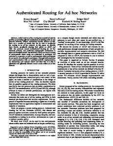
IEEE JOURNAL ON SELECTED AREAS IN COMMUNICATIONS, VOL. 23, NO. 4, APRIL 2005
851
Information-Directed Routing in Ad Hoc Sensor Networks Juan Liu, Feng Zhao, and Dragan Petrovic
Abstract—In a sensor network, data routing is tightly coupled to the needs of a sensing task, and hence the application semantics. This paper introduces the novel idea of information-directed routing, in which routing is formulated as a joint optimization of data transport and information aggregation. The routing objective is to minimize communication cost, while maximizing information gain, differing from routing considerations for more general ad hoc networks. The paper uses the concrete problem of locating and tracking possibly moving signal sources as an example of information generation process, and considers two common information extraction patterns in a sensor network: routing a user query from an arbitrary entry node to the vicinity of signal sources and back, or to a prespecified exit node, maximizing information accumulated along the path. We derive information constraints from realistic signal models, and present several routing algorithms that find near-optimal solutions for the joint optimization problem. Simulation results have demonstrated that information-directed routing is a significant improvement over a previously reported greedy algorithm, as measured by sensing quality such as localization and tracking accuracy and communication quality such as success rate in routing around sensor holes. Index Terms—Ad hoc network, information, routing, sensor network, target localization.
I. INTRODUCTION
T
HE PRIMARY task of a sensor network is sensing, that is, to collect information from a physical environment in order to answer a set of user queries or support other decision-making functions. Typical high-level information processing tasks for a sensor network include detection, tracking, or classification of physical phenomena of interest such as people, vehicles, fires, and seismic events. Routing in a sensor network is not just about getting data from one point to another in the network. It must be optimized with respect to both data transport and information gathering. In other words, the routing structure must match the way the physical information is generated and aggregated by the network.
Manuscript received December 15, 2003; revised July 31, 2004. This work was supported in part by the Defense Advanced Research Projects Agency (DARPA) Sensor Information Technology (SensIT) Program under Contract F30602-00-C-0139. This paper was presented in part at the Second ACM MobiCom Sensor Networks and Applications Workshop (WSNA), San Diego, CA, September 19, 2003. J. Liu is with Palo Alto Research Center, Palo Alto, CA 94304 USA (e-mail:
[email protected]). F. Zhao is with Microsoft Research, Redmond, WA 98052 USA (e-mail:
[email protected]). D. Petrovic is with the Department of Electrical Engineering and Computer Science, University of California, Berkeley, Berkeley, CA 94720 USA (e-mail:
[email protected]). Digital Object Identifier 10.1109/JSAC.2005.843563
Routing algorithms for a sensor network must be aware of the sensor network constraints and application requirements. A sensor network is subject to a unique set of resource constraints such as limited on-board battery power and limited network communication bandwidth. In a typical sensor network, each sensor node operates untethered and has a microprocessor and limited amount of memory for signal processing and task scheduling. Each node also is equipped with one or more of acoustic microphone arrays, video or still cameras, IR, seismic, or magnetic sensing devices. Sensor nodes within each other’s radio range communicate wirelessly. The tasks for a sensor network can be varied, depending on the nature of signal sources and how the information is used. For example, tracking a moving signal source may require the routing algorithm to combine information sequentially along a path, while querying the average temperature over an extended region may use a tree structure to aggregate the data from the region. A broad class of sensor network problems can be characterized as collaborative signal and information processing problems. In such problems, a number of sensor nodes may possess useful information for a sensing task. The goal is to define and manage dynamic groups of such nodes, maximizing information extracted, while keeping resource usage to a minimum. A number of approaches along this line have been reported in the literature (see, for example, [1]–[3]). As these approaches have demonstrated, a routing decision each local node makes during the information gathering process depends on the data generation model of the signal sources. This blurring of the abstraction barrier between applications and data transport is characteristic of resource-constrained sensor networks. The key is for routing algorithms to handle and exploit constraints from data generation and applications in a principled way. Routing for ad hoc networks is a well-studied problem. Graph-based algorithms such as Dijkstra or Bellman–Ford type algorithms are commonly used to determine optimal paths. Examples include optimized link state routing (OLSR) [4], destination sequenced distance vector (DSDV) [5], and ad hoc on-demand distance vector routing (AODV) [6] protocols. Of recent interest is the topic of energy-aware routing in wireless or sensor networks. Methods have been proposed, for examples, in [7] and [8], to plan paths minimizing the chance of node energy depletion. GPSR [9] routes data around a network hole, using a stateless protocol over a planar subgraph of the network topology. Geocasting [10] routes data to a geographically defined region. However, none of the above ad hoc routing algorithms consider information gathering and aggregation while routing data to a node or region, which is a major concern for sensor networks. Moreover, as will be discussed later in the
0733-8716/$20.00 © 2005 IEEE
852
IEEE JOURNAL ON SELECTED AREAS IN COMMUNICATIONS, VOL. 23, NO. 4, APRIL 2005
paper, path dependency of the information aggregation problem for a sensor network renders shortest path algorithms, the basis for most of the ad hoc routing protocols, inapplicable. The work closest to what is reported here is directed diffusion routing protocol for sensor networks [11]. Directed diffusion is a type of publish-and-subscribe that sets up network paths between data source nodes and data sink nodes. It floods the network with data interest, and uses network parameters such as latency to autonomously reinforce good paths. It is an elegant way to route data based on low-level data attributes, rather than node addresses, thus bringing routing closer to the application semantics. However, directed diffusion does not necessarily set up routing structures that are optimized for information gathering and aggregation, which is the primary focus of this paper. By considering the information content of the data packets, we argue that routing in a sensor network can be more than just a message-transporting mechanism. For example, it can contribute to successive message refinement as in a tracking application. Constrained anisotropic diffusion routing (CADR) [12] considers both routing and data aggregation. However, the algorithm is greedy, and may suffer from getting trapped at local minima when network holes are present. This paper generalizes CADR. The contributions of this paper are twofold. 1) The paper formulates a routing problem for a class of sensor network applications as a joint optimization of data transport and information aggregation, and presents a number of near-optimal algorithms for finding good quality routing paths. This builds on our earlier work on collaborative signal processing [1], [3], [12], and generalizes CADR to handle large sensor holes and more general query routing scenarios: routing a user query from an arbitrary entry node to the vicinity of signal sources and back, or to a prespecified exit node, maximizing information accumulated along the path. 2) As a concrete instantiation of the general information-directed routing, the paper derives a set of information models for realistic signal and sensing modalities, using a canonical problem for a sensor network—locating and tracking moving signal sources—as the information generation process. This is significant because performance evaluation of our routing algorithm depends crucially on meaningful data generation models. The information utility of individual sensors can be estimated without the need to communicate sensor data. Simulation results are presented to validate the routing algorithms using measures such as localization and tracking error, and to demonstrate the benefits of exploiting the tradeoff between routing efficiency and information maximization. Despite the fact that in this paper, we focus on target tracking for illustration, it should be noted that the concept of information-directed routing is more generally applicable. The notion of information utility is common to a broad class of sensing problems. We assume each node is aware of its own position, for example, using a Global Positioning System (GPS) device or other
location services, and has knowledge about its local neighborhood, including node positions, link quality, and one-hop communication cost. Such knowledge can be established through local message exchange between neighbors during network initialization and discovery. With these assumptions, the routing algorithms described here can be regarded as a form of source-initiated on-demand routing. The rest of the paper is organized as follows. Section II introduces target tracking as a canonical problem for sensor networks and the associated data generation model. Section III derives the information models and discusses the property of state dependency in information aggregation. Section IV introduces the general formulation of information-directed routing and approximations to information constraints. Sections V and VI develop near-optimal solution to information-directed routing for two common information extraction scenarios. Section VII presents simulation results, demonstrating the benefit of information-directed routing. Section VIII discusses possible extensions of the current algorithmic embodiment. II. TRACKING AS A CANONICAL PROBLEM FOR SENSOR NETWORKS As an example of data generation processes in a sensor network, consider tracking a point signal source, or target, in a two–dimensional (2-D) region. The goal of tracking is to estimate target location based on a set of measurements , indexed by time , and collected by a set of nodes. To accomplish this, we use a statistical framework of sequential Bayesian filtering, a generalization of the wellknown Kalman filtering [3]. For conciseness, we only briefly review the key concepts here. At time , one has some rough prior knowledge (called belief) about where the target is, usu. ally in the form of a probability density function , a new measurement is collected. Sequential At time Bayesian filtering incorporates the measurement and updates the belief to via Bayesian inference
(1) The integral represents how prior belief is propagated to the current time step via the target dynamics . The updated belief is the posterior of target location after observing all . The method repeats as time the measurements up to time advances. For more details about sequential Bayesian filtering in target tracking, please refer to our prior work [3]. In sequential Bayesian filtering, sensor information is aggregated incrementally. Sensors along a routing path can contribute to target tracking via their measurements. To illustrate the aggregation of information, we consider a simple sensor network example consisting of four sensors, A, B, C, and D, as shown in Fig. 1. Belief about the target location is shown using grayscale grids. Brighter grid means that the target is more likely to be at the grid location. We assume a very weak initial belief, uniform over the entire sensor field, knowing only that the target is somewhere in the region. Fig. 2(a)–(d) shows how information
LIU et al.: INFORMATION-DIRECTED ROUTING IN AD HOC SENSOR NETWORKS
853
TABLE I INFORMATION AGGREGATION IN THE SENSOR NETWORK PICTURED FIG. 1. IN THE SECOND COLUMN, INFORMATION IS MEASURED USING MUTUAL INFORMATION DEFINED IN (2)
IN
III. MODELS OF INFORMATION Fig. 1. Sample sensor network layout: Sensors are marked by squares, with labels A, B, C, and D. Arrows represent the order in which sensor data is to be combined. The target is marked by “ .”
8
We introduce information models to formalize the intuition developed in Section II. To quantify the contribution expected of individual sensors, we consider mutual information [3], a measure with a root in information theory and commonly used for characterizing the performance of data compression, classification, and estimation algorithms. As will become clear shortly, this measure of information contribution can be estimated without having to first communicate the sensor data. The mutual information between two random variables and with a joint probability density function is defined as
where is the Kullback–Leibler divergence [13] between two distributions. It indicates how much information conveys about . From a data compression perspective, it measures the savings in bits of encoding if is already known. Under the sequential Bayesian filtering method (1), the information contribution of sensor with measurement is (2)
Fig. 2. Progressive update of target position as sensor data is aggregated along the path ABCD. (a)–(d) plot the resulting belief after each update.
about the target location is updated as sensor data is combined . At each step, the active in the order of sensor node, marked with a diamond, applies its measurement to update the belief. The localization accuracy is improved over time: the belief becomes more compact and its centroid moves closer to the true target location. To measure the tracking performance, we consider two quantities: 1) the mean-squared error (MSE) and 2) the size of the belief state. The MSE describes the tracking accuracy, and the belief size reflects uncertainty in the estimate. In this paper, the belief size is calculated as the number of cells with likelihood value exceeding 0.005. Table I lists the MSE and belief size values after each step. They generally decrease as the path is traversed, indicating that more information about the target position has been accumulated along the path.
Intuitively, it indicates how much information conveys given the current belief. It can about the target location also be interpreted as Kullback–Leibler divergence between and , the belief after and before applying the new measurement , respectively reflects the expected amount of changes in [3]. Hence, the posterior belief brought upon by sensor . Larger change means more information. Other information metrics, such as the Mahalanobis distance [12], have also been proposed. They are computationally simpler to evaluate and are often good approximations. It is worth pointing out that information, which measures how much a sensor may contribute to the estimation, is an expected quantity rather than an observation. For example, in (2), the is an expectation over all possible mutual information and, hence, can be computed bemeasurements fore is actually observed. In a sensor network, a sensor may have local knowledge about its neighborhood such as the location and sensing modality of neighboring nodes. Based on such knowledge alone, the sensor can compute the information contribution from each of its neighbors. It is unnecessary for the neighboring nodes to take measurements and communicate
854
IEEE JOURNAL ON SELECTED AREAS IN COMMUNICATIONS, VOL. 23, NO. 4, APRIL 2005
back to the sensor. In our previous work [3], we provide a detailed algorithm describing how mutual information is evaluated based on knowledge local to the leader sensor. With little modification, this evaluation method can be extended to other information metrics. A. State Dependency In general, the information contribution of each sensor is state-dependent. The information metric of (2) depends . Revisiting the sensor network on the belief state example in Fig. 2, we compute the information contribution for each sensor, and list the values in Table I. Note that sensors A and D are very similar and physically close by. Despite such similarity, the information values differ significantly (0.67 for A and 0.07 for D). Visually, as can be observed from Fig. 2, sensor A brings significant changes to the initial uniform belief. In contrast, sensor D hardly causes any changes. The reason for the difference is that A applies to a uniform belief state, while D applies to a compact belief as shown in Fig. 2(c). State-dependency is an important property of sensor data aggregation, regardless of specific choices of information metric. Intuitively, how much new information a sensor can bring depends on what is already known. Note that in sensor networks, sensor measurements are often correlated. Hence, a sensor’s measurement is not “entirely new,” it could be just repeating what its neighbors have already reported. In the previous example, sensor D is highly redundant with sensor A. Such redundancy shows up in the belief state and, thus, should be discounted. IV. INFORMATION-DIRECTED ROUTING With the intuition developed in Section II and the information models presented in Section III, we formulate the informato tion-directed routing problem. We use a graph describe the sensor network structure. is a collection of vertices corresponding to sensor nodes. is a collection of edges corresponding to internode connectivities. Associated with an and is a communication cost edge between two nodes . The information-directed routing problem can be formulated as finding a path minimizing the total cost (3) The first term measures the communication cost. The second is , representing the the negative information – . Under this total contribution from the sensors formulation, routing is to find a path with maximum information gain at moderate communication cost. The regularization parameter controls the balance. In a network where shortest path is desired, is set to zero. For applications where information aggregation is of primary concern and communication cost is relatively low, should be set to a high value. The formulation (3) can also be interpreted as maximizing information gain under a communication cost constraint. In this case, is a Lagrange multiplier [14] whose value is determined by the constraint.
Fig. 3. Routing scenarios. (a) Routing from a query proxy to the high activity region and back. The co-centric ellipses represent iso-contours of an information field, which is maximal at the center. The goal of routing is to maximally aggregate information along a path while keeping the cost minimal. (b) Routing from a query proxy to an exit node, maximizing information gain along the path.
When the information gain is additive, i.e., (4) the path-finding problem can be simplified considerably. It can be converted to the equivalent problem of finding the shortest has the same set of vertices and path in a modified graph . edges as , but has a modified cost associated with each edge. Dijkstra’s or Bellman–Ford type of algorithms can be used to find optimal paths. However, in sensor networks, the additivity condition (4) does not hold, due to the state-dependency property of information. For example, suppose sensors and have information value and with respect to a given belief state. After applying sensor ’s measurement, the belief state has changed, hence, is obsolete and needs to be re-computed based on the new state. The information contribution and cannot be added together to account for the total contribution. The state-dependency property sets the information directed routing problem apart from traditional routing problems. Strictly speaking, the modified graph is not static. The edge cost depends on previously visited nodes and the signal source. Standard shortest-path algorithms are no longer applicable. Instead, a path-finding algorithm has to search through possible paths, leading to combinatorial explosion. To mitigate this problem, two strategies may be useful. We can restrict the search for optimal paths to be within a small region of the sensor network, or we can apply heuristics to approximate the cost (3). Though information is not strictly additive, the sum of individual information can often be considered as a reasonable approximation in cases where the belief state varies slowly. In of particular, one can show that, with mutual information as the information metric (2), the former is an upper bound of the latter. In the rest of this paper, we consider two source-initiated on-demand routing scenarios. These two scenarios are common in ad hoc sensor networks. The first one is illustrated in Fig. 3(a). The user issues a query from an arbitrary peripheral sensor node, which we call a query proxy node, requesting the sensor network to collect information about a phenomenon of interest. The query proxy has to figure out where such information can be collected and routes the query toward the high information content
LIU et al.: INFORMATION-DIRECTED ROUTING IN AD HOC SENSOR NETWORKS
855
TABLE II ALGORITHM FOR MIN-HOP ROUTING AT EACH NODE
Fig. 4. Routing in the presence of sensor holes. A through G are sensor nodes. All edges have unit communication cost. The dashed lines plot target trajectory. (a) Target is moving from X to Y. (b) Target is bouncing back and forth between X and Y.
region. This differs from routing in communication networks where the destination is often known a priori to the sender. Here, the destination is unknown and is dynamically determined by the routing state and physical phenomenon. We will discuss this routing problem in more details in Section V. The second routing scenario is pictured in Fig. 3(b). The user, for example, an police officer, may issue a query to a query proxy, asking the sensor network to collect information and report to an extraction or exit node, for example, a police station, where the information can be extracted for further processing. In this scenario, the query proxy and exit nodes may be far away from the high information content region. A path taking a detour toward the high information region may be preferable than the shortest path. This routing problem is discussed in Section VI. V. ROUTING A QUERY TO WHERE INFORMATION IS In target tracking applications, it is important to be able to initiate a query from an arbitrary entry node to find out the current status of a target, as illustrated in Fig. 3(a). Ideally, the entry point node (query proxy node) would like to contact the nodes in the vicinity of the target, or the high information content region. Due to the distributed nature of ad hoc sensor networks, the query proxy may not be aware of existence and whereabouts of the high information content region. Hence, it must find out which node in its local neighborhood may have better information, and then relay the query to that node. The relay process is similar to routing with gradient in the information field, only that the information field is dynamic and not directly observable. During the relay, the intermediate nodes incorporate their measurements to refine the target estimate. Previous approaches such as CADR [1] address the routing problem with a greedy relay strategy. Due to the greedy nature, the relay may get trapped near sensor holes. Fig. 4(a) provides a simple example. Here, we use the inverse of Euclidean distance between a sensor and the target to measure sensor’s information contribution (assuming these information values are given by an “oracle”). The problem with greedy search is independent of the choice of information measure. Consider the case that the target moves from X to Y along a straight line [see Fig. 4(a)]. At time , node A is the leader, and can relay the information to its neighbor B or C. The relay goes to B since it has a higher information value. By the same criteria, B then relays back to A. The relay keeps bouncing between A and B, while the target moves away. The path never gets to nodes E, F, or G, who may become informative as the target moves closer to Y. The culprit
in this case is the “sensor hole” the target went through. The greedy algorithm fails due to its lack of knowledge beyond the immediate neighborhood. To route around holes in ad hoc networks, Karp and Kung [9] has proposed a greedy perimeter stateless routing (GPSR) method. Once the greedy routing gets stuck, it switches to the mode of following the perimeter of a hole. While this method guarantees successful routing in static planar graphs, it is not applicable to our scenario. One difficulty lies in detecting whether the greedy search is trapped, since the target state is not observable. Fig. 4(b) shows a counter example: observing the path alternating between A and B does not necessarily imply that the search is stuck. It may well be that the target itself is oscillating between points X and Y. In this case, the alternating path between A and B is desirable. We resort to an information-directed multiple step look-ahead approach. We search for a path with maximum information aghops. gregation among the family of paths with less than should be large enough and compaThe look-ahead horizon rable to the diameter of sensor holes, yet not too large to make the computational cost prohibitive. For example, in simulations or 4 discussed in Section VII, with a 4 2 sensor hole, works well. More generally, for static sensor networks, the sensors can explore their local area in the network discovery phase and store in cache the information about inhomogeneity. This is done, for example, in [15]. Later in the path planning phase, such information will be helpful in selecting the value for . Here, we describe a suboptimal path-finding algorithm called the min-hop algorithm, which can be implemented distributedly. Table II shows the algorithm on each node. A node wakes up upon receiving a query-routing request, which consists of the , ) of time, state, and path, respectively. In tuple ( , target tracking, the state is the belief . The active node incorporates a new measurement, plans the next move with a -step look-ahead horizon, and relays on, until the path meets a prespecified length . To plan the path, the active node first
856
IEEE JOURNAL ON SELECTED AREAS IN COMMUNICATIONS, VOL. 23, NO. 4, APRIL 2005
Fig. 5. Conversion of M -hop local graph. (a) A local M -hop neighborhood of the current leader A, with information gain labeled at each node. (b) Converted graph that can be solved by a shortest-path algorithm.
selects the destination as the node with the highest information value within its -hop neighborhood. It compares minimum hop paths from the active node to the destination, and selects the path with maximum information aggregation, measured as , where is the information metric such as (2). The algorithm routes the query one hop down the selected path, and the path-finding procedure repeats. To find a minimum hop path with maximum accumulated information, we perform the following conversion on the graph G and turn it into a shortest-path problem. The conversion is designed as follows: for each node , we assign to each edge going , where is some large number into the node the cost of and is the information value at node . Fig. 5 shows an example of local neighborhood before and after the conversion. The information value of each node is marked next to the node in Fig. 5(a). The cost of edges are marked in Fig. 5(b). It is easy to show that the path with maximum information accumulation in the original graph is the shortest path in the converted graph. The path is then found efficiently using Dijkstra’s algorithm, . The with the computational complexity overhead here is the computation of information contribution. at each planning step. The complexity is With the min-hop algorithm, we revisit the examples in Fig. 4. . If the target is traveling in a straight Let the search depth line as in Fig. 4(a), starting from A, the path will bounce between A and B for a while, but as the target gets close to G, G will replace B as the most informative sensor in A’s neighborhood, and the path will extend to G via ACDG. On the other hand, if the target is traveling as in Fig. 4(b), then B is always the most informative sensor in A’s neighborhood, and vice versa. The min-hop algorithm selects the path alternating between A and B. VI. ROUTING A QUERY TO AN EXIT NODE In the scenario pictured in Fig. 3(b), the goal is to route a query from the query proxy to the exit point and accumulate as much information as possible along the way, so that one can extract a good estimate about the target state at the exit node, and yet keep the total communication cost close to some prespeciis treated as a soft confied amount . Here, the total cost straint, which is a “hypothetical” cost that the routing algorithm controls the tradeoff between aims to achieve.1 The value of 1An alternative formulation of treating C as a hard constraint which must be satisfied strictly. However, finding an optimal path under this hard constraint will require global knowledge about the sensor network and, thus, is inapplicable to ad hoc sensor networks.
the communication cost and information aggregation. Low value favors shortest path, and high allows longer paths with more effective information aggregation. For this task, we consider an A* heuristic search which is commonly used for problems such as constraint satisfaction and motion planning [16]. The basic A* is a best first search, where the merit of a node is assessed as the sum of the actual cost paid to reach it from the query proxy, and the estimated cost to pay in order to get to the exit node (often known as the “cost-to-go”). , and iteratively expands the It keeps a moving frontier of nodes on the frontier until the exit is reached. The resulting path is guaranteed to be optimal if the estimated never exceeds the true cost-to-go, i.e., is admissible. The well-known Dijkstra’s algorithm can be considered as a special case of A* with esti, which is always an underestimate. The mated cost-to-go complexity of A* search depends on the choice of . Conservative takes longer to find an optimal solution. An optimistic estimate searches faster, yet an overly optimistic estimate (not admissible) may miss the optimal solution. For details analysis of A* complexity, refer to [16]. For real-time path-finding, we use an variation of the A* method, namely, the real-time A* (RTA*) search. It restricts search to small local region and makes real-time moves before the entire path is planned. Only local information is used in the RTA* search, hence, it can be implemented distributedly and is suitable for ad hoc networks. It guarantees to find a path if it exists, but as a price to pay for real-time operations, the solution may lose the optimality of the baseline A* search and may be suboptimal. The selected path may exhibit backtrack behavior. RTA* search is recursive. Given an estimated cost-to-go, the active node selects the best move (with some look-ahead horizon). The algorithm repeats until the exit node is reached. The key to implementing a RTA* algorithm is defining a suitable heuristic to estimate the cost-to-go . The total cost (as in (3)) comprises a communication cost term and an information aggregation term. The estimation of communication cost is straightforward. One can use standard metric such as Euclidean distance. The estimation of information contribution is more complicated. One has to estimate the information contribution of sensors lying ahead, based on the currently available information alone without further querying or communication. Here, we describe an estimation method. Suppose we have planned the path , and is now at . To further reach the exist node , the , where remaining path length is upper bounded by is the communication cost already paid. Thus, the locus of as one focus point all feasible paths forms an ellipse with and the current node as the other. Fig. 6 shows such an ellipse. and , and We denote its extrema along the major axis as and . Within the ellipse extrema along the minor axis as there are infinitely many paths satisfying the length constraint. Some path may be complicated and hard to describe, such as the thick curly path in the figure. Rather than estimate for all possible paths, we sample four paths as representatives. • Path 1: the concatenation of two line segments: and . . • Path 2: . • Path 3: . • Path 4:
LIU et al.: INFORMATION-DIRECTED ROUTING IN AD HOC SENSOR NETWORKS
857
Fig. 6. Node v is the current node; v is the exit node. The ellipse covers satisfying communication cost constraint. all possible paths from v to v The thick curve represent one sample path.
TABLE III FUNCTION TO ESTIMATE INFORMATION-TO-GO
Fig. 7. Examples of simulated sensor layout. (a) Homogeneous. (b) With a sensor hole. The points marked with a dot denote amplitude sensors, ant the points marked with a “x” denote the DOA sensors.
For each path, the information is computed via numerical integral, which samples the path at an interval inversely proporto , the information tional to the sensor density. From lying ahead is estimated as the maximum among the four paths, as an approximation to the admissible heuristic estimate. The computational complexity of estimating information is proportional to the number of sampling paths (four in this case), times the number of integral intervals. On average, we have about ten samples along each path. Hence, the overall complexity is about 40 times the computation of . The estimation of information contribution is summarized in Table III. If the remaining path length allowance is smaller than the Euclidean distance between to , the ellipse cannot be constructed. In this case, the estimation algorithm returns zero information. At this point, the forward search degenerates into a shortest-path problem based on the commuis nication cost alone. Furthermore, if the initial allowance zero to start with, then the algorithm returns the shortest path from the querier to the exit. VII. EXPERIMENTAL RESULTS Simulations were carried out to validate and characterize the performance of the proposed routing algorithms. We simulate . Two types of sena sensor field of dimension 225 375 sors are used for target tracking: acoustic amplitude sensors and direction-of-arrival (DOA) sensors. The acoustic amplitude sensors output sound amplitude measured at each microphone, and
estimate the distance to a target based on the physics of sound attenuation. The DOA sensors are small microphone arrays. Using beam-forming techniques, they determine the direction where sound comes from, i.e., the bearing of the target. The detailed description of these two types of sensors can be found in [3]. Sensor layout is generated as follows: first generate a uniform grid of 15 rows and 6 columns to evenly cover the region, then perturb the grid points with independent Gaussian noise of . The resulted sensor layout is plotted in Fig. 7(a). To test the routing performance in the presence of sensor holes, we remove the uniform grid points in rows 5 and 6 and columns 2–5 before adding perturbation. The resulting sensor network is shown in Fig. 7(b). The sensor network consists of 70% amplitude sensors and 30% DOA sensors, randomly spread over the sensor region. Each sensor can directly communicate to neighbors within a 50 m radius. The routing algorithms are evaluated in terms of the efficiency of communication expenditure and the effectiveness of information aggregation in support of target tracking. We measure tracking performance using MSE and belief size. Besides these numerical measures, characteristics of selected path are also of interest. We pay attention to noticeable features such as whether the path successfully gets around holes, where it ends, and how it takes detour to accumulate information. A. Query Routing Using a Min-Hop Algorithm Here, we present the simulation results for routing a query from an arbitrary query proxy node to high information content region. Target may be stationary or moving. 1) Stationary Target: A stationary target is simulated at location (125, 200). We use the sensor closest to the lower left corner (0,0) as the query proxy node. Starting from the proxy node, we would like to progressively estimate the target location and shoot the query toward it. In simulation, we allow a path length of 20 hops and examine the performance at the end of the path. The sensor network is inhomogeneous with a sensor hole, as shown in Fig. 7(b).
858
IEEE JOURNAL ON SELECTED AREAS IN COMMUNICATIONS, VOL. 23, NO. 4, APRIL 2005
TABLE IV SIMULATION RESULTS: ROUTING A QUERY TO TARGET VICINITY USING THE GREEDY CADR AND THE MIN-HOP ALGORITHM = 2, 3, AND 4 WITH LOOKAHEAD HORIZON
M
For this routing task, we compare the min-hop algorithm , 3, and 4 with the greedy using a look-ahead horizon CADR algorithm. Each method is simulated with 100 independent runs. The results are summarized and reported in Table IV. As discussed in Section V, some paths may get stuck and fail to route around the sensor hole. If the path has an ending point with -coordinate below 100, we consider that as a “stuck” situation. Compared with the greedy CADR algorithm, the min-hop algorithm significantly improves the tracking performance. For example, with a three-step look-ahead, the min-hop algorithm successfully routes around the sensor hole in 92 runs; only 8 runs are stuck at the sensor hole. By contrast, the CADR fails in , 80 runs. Tracking performance is also improved: with the min-hop algorithm reduces the square root of MSE by a factor of 4, and reduces the belief size by a factor of 3. The tracking performance comparison suggests that the min-hop algorithm aggregates information more effectively than the greedy CADR. Table IV also lists the average distance between the path ending point and the true target. This distance indicates the capability of the routing algorithm to route a path to the vicinity of the target. The greedy CADR performs poorly here: the ending point is on average very far (108.91 m) from the true target location. The min-hop algorithm routes the path to much , the ending point is closer positions. For example, with approximately 33 m from the target. The overall computational complexity of path planning is roughly proportional to the size -hop neighborhood. In our simulation, the average of the neighborhood size is 6.2 for , 20.2 for , and 39.2 . for In general, the overall performance improves with the increase of the look-ahead horizon , but the improvement is nonuniform. It is most prominent for small , and marginal as increases. This is consistent with our intuition. The value of should be selected based on the knowledge of network inhomogeneity such as sensor hole size. In our simulated sensor layout, the sensor hole is roughly the size of a two row by four column grid. Hence, three-hop path is often sufficient to get to to the side and further traverse around it. Further increasing 4 brings little gain in performance. Fig. 8 visualizes the paths produced by the greedy CADR and applied to the same sensor the min-hop algorithm with network. The greedy algorithm path is plotted in Fig. 8(a). The path gets stuck and spends most of hops (17 hops out of 20) bouncing between two nodes on the lower side of the sensor hole. The ending point, marked with a little square, is far away from the target. For comparison, the min-hop path is plotted
M
Fig. 8. Query routing path produced by (a) the greedy CADR algorithm and (b) the min-hop algorithm with = 3. The target is located at (125, 200), roughly in the middle of the sensor field. It is marked with a “ .” The selected paths are marked with solid lines. The nodes where the paths end are marked with a square.
8
TABLE V TRACKING PERFORMANCE TO ROUTE A QUERY TO HIGH INFORMATION REGION WITH A MOVING TARGET. THE NUMBERS ARE AVERAGED OVER 100 RUNS AND ALL TIME STEPS
in Fig. 8(b). The path manages to get around the sensor hole, and ends at a node slightly above the true target location. The tracking performance is also much improved. The target location estimate is more accurate and has higher confidence. 2) Moving Target: In tracking applications, target is often nonstationary. In principle, moving target can be considered as an extension of the stationary target case; the target can be considered as approximately stationary within a short time interval. With target moving, routing a query towards the high information content region is essentially routing a path to follow the target. Here, we simulate a target moving along the straight line (the center line of the sensor field along the vertical m/s. The query enters at the node dimension) with speed closest to the initial target position (125, 0). , 3, and 4) with We compare the min-hop algorithm ( the greedy CADR, with 100 independent runs for each. The performance is summarized in Table V. Similar as in the stationary case, routing algorithms may get stuck at sensor holes. While the routing is stuck, the target estimate keeps worsening due to weaker signals. In simulation, a track is considered lost if by the time the vehicle reaches the upper side of the sensor field ), the estimate of target location of the last five steps is ( on average more than 60 m away from the true target location. We report the number of “lost” runs, and the statistics (MSE and belief size) for the good runs, averaged over all runs and all
LIU et al.: INFORMATION-DIRECTED ROUTING IN AD HOC SENSOR NETWORKS
859
TABLE VI INFORMATION-DIRECTED ROUTING USING RTA* FORWARD SEARCH: RESULTS WITH DIFFERENT HYPOTHETICAL PATH LENGTH CONSTRAINTS
deteriorates, the estimated belief state provides little guidance to routing.
M
Fig. 9. Routing query toward a moving target: Path produced by the min-hop = 3. The snapshots are at the end of 30, 60, and 90 hops. method with The target (marked with a “ ”) is at location (125, 105), (125, 210), and (125, 315), respectively. The selected path is marked with solid lines.
8
Fig. 10. Routing query toward a moving target: Path produced by the greedy CADR method. Simulation setting is the same as in Fig. 9.
time steps. Here, we observe similar characteristics as in the stationary case. With the greedy algorithm, most of the runs lost the target (93 out of 100). With increasing look-ahead horizon , the percentage of lost runs is reduced significantly. Among the good runs, the tracking performance improves with the increase , the square root of the MSE is of . For example, with only 1/2 of that obtained by the greedy algorithm. From these results, we can see that the min-hop algorithm with a modest or 3) is much more robust against look-ahead horizon ( the presence of sensor holes. Fig. 9 shows several snapshots of the routing path using the greedy algorithm. In all runs, the final path is 100-hop long. The figure shows the progressive path development after 30, 60, and 90 hops. Similar as in the stationary target case, the min-hop algorithm routes around sensor holes. The snapshots indicates that the path mainly follows the target movement, but occasionally reaches out to nearby sensors to aggregate information. The belief states follows the target fairly closely. For comparison, the path produced by the greedy CADR is plotted in Fig. 10. The path failed to get around the sensor hole within 30 hops and is stuck ever since. The belief state failed to track the target. As the target moves away, the signal is too weak to correct the belief, hence, the belief eventually missed the target completely. The failure is caused by the feedback between belief estimation and query routing: as the routing failed to aggregate information, the estimate can be poor; and as the estimation accuracy
B. Query Routing Using Forward Search The forward search routing from the query proxy to the exit node is tested with a stationary target at (125, 200). The selection of query proxy and exit node can be arbitrary. We select the query proxy node as the node closest to the lower left corner (0,0), and the exit node as the node closest to the upper left corner (0, 375). Forward search is performed on a homogeneous sensor network [as in Fig. 7(a)] to route query between these two nodes. Recall from Section VI that the information-directed routing problem is essentially a tradeoff between the communication expense and information aggregation, with the balance controlled by the hypothetical path length constraint . We vary the allowance ; for each value , 100 independent runs are simulated. The numerical results are listed in Table VI. We use the shortest path as a benchmark for comparison (the left most point in the figures). The average number of hops increases with the divided hypothetical allowance . It is the same order as by the radio range of 50 m, but about 35%—50% larger. The margin accounts for the fact that sensors are not dense enough, and communication over the maximum radio range may not always be feasible. From Table VI, we can see that both the MSE and belief size decreases with path length. Compared with the shortest path, the information-directed routes take a little bit of detour, but improve the tracking performance considerably. On average, the square root of MSE is cut to half with a 30% longer path. In sensor network practice, based on the application specifics, one can choose an efficient tradeoff at an affordable communication expense. Fig. 11 visualizes selected paths with different length. The shortest path is shown in Fig. 11(a). It has ten hops and mostly follows a vertical line from the query proxy to the exit node. The belief state is fairly big, and cannot localize the target. Fig. 11(b) shows a longer path of 12 hops. Starting from the proxy, the path bends toward the target direction in attempt to accumulate information. The tracking performance is vastly better than the shortest path. Fig. 11(c) shows a path of 21 hops. The tracking accuracy is further improved, but the improvement is less prominent. The caption of Fig. 11 lists the detailed numerical results for comparison. VIII. DISCUSSION We have demonstrated the benefits of information-directed routing that jointly optimizes for maximal information gain and minimal communication cost. In the simulation study, we
860
IEEE JOURNAL ON SELECTED AREAS IN COMMUNICATIONS, VOL. 23, NO. 4, APRIL 2005
Fig. 11. Routing query from the proxy to exit node. (a) Shortest path: ten hops, sqrt(MSE) = 43:18, belief size = 1176. (b) 12-hop path selected by the RTA* algorithm, sqrt(MSE) = 3:70, belief size = 91. (c) 21-hop path selected by the RTA* algorithm, sqrt(MSE) = 2:46, belief size = 105.
classification error. The specific form of information model may vary; the basic structure of the routing algorithms stay the same. We presented the routing algorithms for scenarios with a single stimulus. The algorithms can be generalized to handle multiple stimuli, using a spanning tree such as Steiner tree [17]. While computing an exact Steiner tree is very expensive, approximate algorithms exist. For example, a greedy Steiner factor worse than tree algorithm produces a tree that is no the optimal tree [18], [19], where is the number of leaves in the tree. Generalizing the algorithms described in this paper to handle dynamically moving stimuli while maintaining good approximations to the optimal routing tree remains as a future research topic.
REFERENCES have shown that the min-hop algorithm, compared with the previous greedy algorithm, is 4–11 times more likely to succeed in routing a message around sensor holes with a three-step look-ahead, and at the same time produces 2–4 times less error in tracking a signal source. This significant improvement is obtained at the cost of additional computation at each decision node to search the graph of its -hop neighborhood. However, the complexity of our algorithm grows only quadratically with the number of nodes in the neighborhood. Choosing an appropriate neighborhood size will allow us to obtain a sufficient amount of information at only a modest cost. Knowledge about network structure or application plays an important role in assisting the information-directed routing algorithms such as the selection of . In a homogeneous network, greedy routing algorithms such as CADR provide satisfactory results at a low computational cost. In the presence of holes in the network, a multistep look-ahead routing algorithms such as the min-hop algorithm may be necessary. These algorithms search a local neighborhood beyond the immediate one-hop neighbors in the network. Additional knowledge about the network, such as sensor node density in a region, can be used to estimate information gain ahead in the forward search algorithm RTA*. The parameter or structure of a network, for example, node density or network holes, may be discovered and mapped out during the initialization phase. If such knowledge is made available, then online routing algorithms can use either a greedy or a multistep search and switch as appropriate to minimize the overhead. Likewise, knowing the distribution of physical stimuli can help plan data aggregation and routing accordingly. In general, a priori knowledge about a network or application should be exploited whenever possible to assist routing in a sensor network. If such a priori knowledge is not available, one may resort to an online iterative probing strategy to explore the network inhomogeneity. While we presented information-directed routing using in the context of localization and tracking problems, the general idea of using information to guide routing applies to other problems as well. For example, in monitoring and detection problems, information may be defined as reduction of uncertainty in the hypothesis test of target presence. In classification problems, information may relate to how sensor measurement affects the overall
[1] F. Zhao, J. Shin, and J. Reich, “Information-driven dynamic sensor collaboration,” ., vol. 19, no. 2, pp. 61–72, Mar. 2002. [2] R. Brooks, C. Griffin, and D. Friedlander, “Self-organized distributed sensor network entity tracking,” Int. J. High-Performance Comput. Appl., vol. 16, no. 3, pp. 207–219, 2002. [3] J. Liu, J. E. Reich, and F. Zhao, “Collaborative in-network processing for target tracking,” EURASIP, J. Appl. Signal Process., vol. 2003, pp. 378–391, Mar. 2003. [4] T. Clausen, G. Hansen, L. Christensen, and G. Behrmann, “The optimized link state routing protocol, evaluation through experiments and simulation,” in Proc. IEEE Symp. Wireless Pers. Mobile Commun., 2001. [5] C. E. Perkins and P. Bhagwat, “Highly dynamic destination-sequenced distance-vector routing (DSDV) for mobile computers,” Comput. Commun. Rev., pp. 234–244, 1994. [6] C. E. Perkins and E. M. Royer, “Ad-hoc on-demand distance vector routing,” in Proc. 2nd IEEE Workshop Mobile Comput. Syst. Appl., Feb. 1999, pp. 90–100. [7] Q. Li, J. Aslam, and D. Rus, “Online power-aware routing in wireless ad hoc networks,” presented at the MobiCom, Rome, Italy, Jul. 2001. [8] R. C. Shah and J. M. Rabaey, “Energy aware routing for low energy ad hoc sensor networks,” in Proc. IEEE Wireless Commun. Netw. Conf., Orlando, FL, Mar. 2001, pp. 350–355. [9] B. Karp and H. T. Kung, “Greedy perimeter stateless routing for wireless networks,” in Proc. MobiCom, Boston, MA, Aug. 2000, pp. 243–254. [10] Y.-B. Ko and N. H. Vaidya, “Geocasting in mobile ad hoc networks: Location-based multicast algorithms,” in Proc. IEEE Workshop Mobile Comput. Syst. Appl., New Orleans, LA, Feb. 1999, pp. 101–110. [11] C. Intanagonwiwat, R. Govindan, and D. Estrin, “Directed diffusion: A scalable and robust communication paradigm for sensor networks,” presented at the MobiCom 2000, Boston, MA, Aug. 2000. [12] M. Chu, H. Haussecker, and F. Zhao, “Scalable information-driven sensor querying and routing for ad hoc heterogeneous sensor networks,” Int. J. High-Performance Comput. Appl., vol. 16, no. 3, pp. 293–313, 2002. [13] T. M. Cover and J. A. Thomas, Elements of Information Theory. New York: Wiley, 1991. [14] D. P. Bertsekas, Nonlinear Programming. Belmont, MA: Athena Scientific, 1995. [15] Q. Huang, C. Lu, and G.-C. Roman, “Mobicast: Just-in-time multicast for sensor networks under spatiotemporal constraints,” in Proc. Inf. Process. Sensor Netw. (IPSN), Apr. 2003, pp. 442–457. [16] R. Korf, “Real-time heuristic search,” Artif. Intell., vol. 42, pp. 189–211, 1990. [17] E. J. Cockayne and D. G. Schiller, “Computation of Steiner minimal trees,” in Proc. Combinatorics (Conf. Combinatorial Math.), D. J. A. Welsh and D. R. Woodall, Eds., Southend-on-Sea, Essex, U.K., 1972, pp. 53–71. [18] M. Imase and B. M. Waxman, “Dynamic Steiner tree problem,” SIAM J. Discrete Math., vol. 4, pp. 369–384, 1991. [19] N. Alon and Y. Azar, “On-line Steiner trees in the Euclidean plane,” Discrete Comput. Geom., vol. 10, pp. 113–121, 1993.
LIU et al.: INFORMATION-DIRECTED ROUTING IN AD HOC SENSOR NETWORKS
Juan Liu received the B.E. degree in electronic engineering from Tsinghua University, Beijing, China, in 1995, and the M.S. and Ph.D. degrees in electrical engineering from the University of Illinois at Urbana–Champaign, Urbana, in 1998 and 2001, respectively. In September 2001, she joined Palo Alto Research Center, Palto Alto, CA, as a Research Scientist, working in the embedded collaborative computing area. Her research interests include signal processing, statistical modeling, detection and estimation, network routing, and their applications to distributed sensor network problems.
Feng Zhao received the Ph.D. degree in electrical engineering and computer science from the Massachusetts Institute of Technology (MIT), Cambridge. He is a Senior Researcher at Microsoft Research, Redmond, VA, where he manages the Networked Embedded Computing Group. He has taught at Stanford University and Ohio State University. He was a Principal Scientist at Xerox PARC and directed PARC’s sensor network research effort. He recently coauthored Wireless Sensor Networks: An Information Processing Approach, (San Mateo, CA: Morgan Kaufmann). His current interest is in developing algorithms and software for interconnected devices such as wireless sensor networks. He is well-known for his work in networked embedded systems, distributed algorithms, and artificial intelligence. Dr. Zhao is serving as the Editor-In-Chief of ACM Transactions on Sensor Networks.
861
Dragan Petrovic was born in Nis, SerbiaMontenegro, in 1979. He received the B.S. degree in computer engineering (highest honors) from the University of Illinois at Urbana–Champaign, Urbana, in 1999 and the M.S. degree in electrical engineering from the University of California, Berkeley, in 2001. He is currently working towards the Ph.D. degree at the University of California under the supervision of Profs. K. Ramchandran and J. Rabaey. His research interests include compression, routing, and reliable data transfer in sensor networks, as well as error control coding.