Integration of GRID approaches into the Geographic Web Service Domain Dhruba Raj GHIMIRE, Nepal Ingo SIMONIS, Germany Andreas WYTZISK, The Netherlands
Key words: Web Services, GI Services, Grid Technology, Agent-based Technologies
SUMMARY Within the geographic data processing domain, a broad range of problems exists that are not or only insufficiently solvable using existing local computational resources. With the continuous set up of international spatial data infrastructures, the problem of intensive data exchange grows. Whereas network capacities have reached enormous scales in the industrial countries, the exchange of large XML encoded geographic data sets is still an obstacle in large parts of Asia, Africa, and South- and Central America. Today, more and more complex chains are used to extract valid information out of raw data sets. Workflow description languages are under development allowing a dynamic set up of complex chains, implying multiple steps of data accessing, data processing, and data visualization. Each step causes network traffic. If we measure the distance a single date has to cover before being delivered to the final user in number of geographically dispersed Web Services, it could be certified that it extends continuously. The Grid provides an approach for sharing geographically and organizationally dispersed heterogeneous computational resources. Grid technology has been used in many disciplines, although very few exist in the geographic domain. Merged with agent-based technologies Grid services can dynamically move within a network and perform their tasks at those locations where the best performance is guaranteed respectively the network traffic can be minimized. This paper will describe how the three approaches, standardized Web-based GeoInformation Services, agent-based services and Grid could be integrated.
TS7.4; TS 7 - SDI and Web Services Dhruba Raj Ghimire, Ingo Simonis, Andreas Wytzisk Integration of GRID approaches into the Geographic Web Service Domain From Pharaohs to Geoinformatics FIG Working Week 2005 and GSDI-8 Cairo, Egypt April 16-21, 2005
1/9
Integration of GRID approaches into the Geographic Web Service Domain Dhruba Raj GHIMIRE, Nepal Ingo SIMONIS, Germany Andreas WYTZISK, The Netherlands
1. INTRODUCTION Within the geographic data processing domain, a broad range of problems exists that are not or only insufficiently solvable using existing local computational resources. With the continuous set up of international spatial data infrastructures, the problem of intensive data exchange grows. Whereas network capacities have reached enormous scales in the industrial countries, the exchange of large XML encoded geographic data sets is still an obstacle in large parts of Asia, Africa, and South- and Central America. Mapping Services have predominated spatial data infrastructures until recently. With very few raw data providing services, only relatively small images had been exchanged over the web, accumulated on a single web mapping machine and presented to the user. Today, we notice a shift from the WMS-biased SDI towards more general types that include additional data providing or data processing services. Small chains are used to solve more complex problems than providing a digital map over the internet. Geographic data has to be transformed, georeferenced, or geo-located – all possibly performed by different web services. Though rather short at the moment, the development of powerful workflow description languages will allow setting up much more complex chains, addressing the entire dataflow from data investigation, data acquisition, data processing until data representation. Each step causes network traffic. If we compare the distance each single date will have to cover in number of geographically dispersed Web Services, it could be certified that it will extend continuously. The Grid provides an approach for sharing geographically and organizationally dispersed heterogeneous computational resources. Grid technology has been used in many disciplines, although very few exist in the geographic domain. Merged with agent-based technologies, Grid services can dynamically move within a network and perform their tasks at those locations where the best performance is guaranteed; respectively the network traffic can be minimized. This paper will describe how the three approaches, standardized web-based GeoInformation Services, Agent-Based Services and Grid Technology could be integrated. 2. CORE TECHNOLOGIES 2.1 GI Services The advances in Information Technology (IT) and the concept of demand driven information delivery are transforming traditional Geographic Information Systems from monolithic, centralized solutions to distributed Geographic Information Services (GI Services) TS7.4; TS 7 - SDI and Web Services Dhruba Raj Ghimire, Ingo Simonis, Andreas Wytzisk Integration of GRID approaches into the Geographic Web Service Domain From Pharaohs to Geoinformatics FIG Working Week 2005 and GSDI-8 Cairo, Egypt April 16-21, 2005
2/9
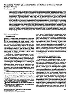
environments. GI Services provide means for geospatial data discovery, access and processing and can be composed to complex applications (Peng & Tsou 2003) by following the publish-find-bind paradigm (also called service trading, see Figure 1). Due to the natural distribution of geospatial data acquisition, processing knowledge and associated computational resources, such an approach clearly meets the needs of geo-information providers and consumers, who often have to rely on geographically widely scattered processing facilities. For example, the multi-discipline nature of global change research requires the integrated analysis of large volumes of multi-source data from multiple data centers. This requires sharing of both data and computing powers among data centers. To ensure a seamless connectivity of various geospatial data and processing resources, standardization organizations like the Open Geospatial Consortium Inc. (OGC, http://www.opengesospatial.org) and the International Organization for Standardization (ISO, http://www.iso.org) are providing a framework of interoperable GI Services with distinct GIfunctionalities.
Figure 1 Service Trading
A GI Service is defined as a spatially enabled service, which encloses distinct GIfunctionalities, i.e., it is a kind of service dealing with the geographic information, such as geographic information retrieval, analysis etc. Moreover, GI Services are modular geospatial applications, which are self-contained and self-describing. Like all service-like applications, they can be published, located and invoked over a network, usually the web. Currently, GI Services are bound to static IP addresses. Registered at web catalog services, all types of GI services can be invoked auto- or semi automatically. What has to be done manually is setting up the service on a specific computational node. Dependent on the current use, this may lead to severe performance problems due to heavy network load. (Gokhale & Schmidt 1996; Yang & de Veciana 2004). 2.2 The Grid The origin of the concept has been initiated in the early 90’s. Efforts were started to deploy several Gigabit testbeds such as Aurora, Blanca, Casa, Nectar, and Vistanet (Lyster et al. 1992; Bermann et al. 2003) projects to link supercomputing sites across the USA. At that time, the approach was known as metasystem and metacomputing. The success of these testbeds inspired the Information Wide Area Year (I-WAY) experiment in early 1995 (Stevens et al. 1996) to integrate existing high bandwidth networks (Roure et al. 2003). These TS7.4; TS 7 - SDI and Web Services Dhruba Raj Ghimire, Ingo Simonis, Andreas Wytzisk Integration of GRID approaches into the Geographic Web Service Domain From Pharaohs to Geoinformatics FIG Working Week 2005 and GSDI-8 Cairo, Egypt April 16-21, 2005
3/9
experiments motivated some important application driven projects such as the National Technology Grid, which coined in 1997 the term Grid (Stevens et al. 1997). The Grid is not only a computing paradigm for providing computational resources but also a distributed computing infrastructure that supports flexible, secure, coordinated resource sharing and problem solving in dynamic, multi-institutional virtual organizations. The Grid was initially motivated on sharing geographically distributed high-end computational power, resources and persistent infrastructure for advanced science and engineering research and applications and emerged with the vision of sharing computing resources like content on the Web (Foster et al. 2001). The Grid offers a number of functionalities like exploiting underutilized resources (processing, storage, communications, software, licenses, etc.), parallel CPU capacity, resource balancing, reliability, and management of components such as scheduling, reservation, and scavenging distribution of single tasks on different machines (Ferreira et al. 2003). Maturing Grid computing techniques offer a sound basis to dynamically distribute processing tasks within a networked environment. Currently, the Grid community is actively developing fundamental mechanisms for the interaction of any kind of resources through a Service Oriented Architecture (SOA) approach (Globle & Roure 2002) to virtualize and unify resources, services, and information. The Open Grid Services Architecture (OGSA) represents the evolution towards a Grid system architecture based on Web services concepts and technologies (http://www.globus.org/ogsa) and defines a Grid Service as “a Web Service that provides a set of well-defined interfaces and that follows specific conventions. The interfaces address discovery, dynamic service creation, lifetime management, notification, and manageability whereas the conventions address naming and upgradeability” (Foster et al. 2002). Like Web Services, Grid Services are described by the Grid Web Service Description Language (GWSDL) – an extended WSDL file to support extra features in Grid services. Grid Services use Universal Description Discovery and Integration (UDDI) registries for service discovery and the Simple Object Access Protocol (SOAP) for inter-service communication. 2.3 Mobile Agents The characteristics of dynamic and open environments often require a certain degree of autonomy to enable components to respond dynamically to changing general conditions. Mobile agents meet these objectives and offer a complementary approach to Web Service and Grid technologies. An agent can be defined as an encapsulated computer system that is situated in some environment and capable to flexibly and autonomously act in that environment in order to meet its design objectives (Wooldridge & Jennings 1999). Likewise, a mobile agent is an autonomous software entity, which has the ability to interrupt execution and move the code and state of the agent to a new node or location in the network (Eichelkraut 2002). There are several standardization efforts, which support the setup and the interoperability of mobile agents. In particular, the Foundation for Intelligent Physical Agents (FIPA, http://www.fipa.org) provides an abstract agent architecture as well as software standards TS7.4; TS 7 - SDI and Web Services Dhruba Raj Ghimire, Ingo Simonis, Andreas Wytzisk Integration of GRID approaches into the Geographic Web Service Domain From Pharaohs to Geoinformatics FIG Working Week 2005 and GSDI-8 Cairo, Egypt April 16-21, 2005
4/9
which primarily focus on a semantically meaningful message exchange between agents in heterogeneous environments. Another popular standardization effort is the OMG Mobile Agent System Interoperability Facility (MASIF) (Milojicic et al. 1998) that addresses the interface-level of mobile agents systems. 3. GRID-BASED MOBILE GEO-SERVICES It is common to all of the three approaches Grid computing, Autonomic computing, and Web services to address common problems of distributed computing by defining an open distributed computing paradigm, dealing with heterogeneous platforms, protocols and applications (Seki 2003). If large datasets have to be transferred, a major shortcoming of distributed environments comes into play, i.e. network bandwidth starts to play a critical role regarding the design and delivery of information products. Though new – mostly binary exchange formats try to reduce the amount of data being exchanged, the problem will have to be solved differently. In this context, one of the fundamental problems the GI – or better SDI – community is facing today is, that current Geo-Service Architectures determine significant performance problems when large datasets have to be accessed and subsequently processed in distributed computing environments. A fundamental reason for that is the limitation of GI Services to remain statically at fixed computing nodes. The flexible relocation of GI Services to speed up the overall processing time by eliminating costly network traffic is not supported.
Figure 2 Standards compliamt wrapping of Grid-enabled GI Services TS7.4; TS 7 - SDI and Web Services Dhruba Raj Ghimire, Ingo Simonis, Andreas Wytzisk Integration of GRID approaches into the Geographic Web Service Domain From Pharaohs to Geoinformatics FIG Working Week 2005 and GSDI-8 Cairo, Egypt April 16-21, 2005
5/9
To overcome similar problems in general information and communication technology, research is converging the concepts of Grid computing and Mobile Agent technology, where Grid computing provides a robust infrastructure and mobile agents provide autonomous flexible behavior (Foster at al. 2004). To address the shortcomings of static services, a Gridbased Mobile Geo-Service is proposed. On a specification and implementation level such an approach requires two major steps: - Integration of Mobile Agents into the Open Grid Service Architecture (OGSA): The integration of agent technology and the Grid enables Grid Services to act as mobile agents and to the move from one node to another (Cao, 2004). Those Mobile Grid Services are extensions of regular Grid services, which can be defined as intelligent code wandering between Grid nodes to accomplish certain tasks, access native Grid functionalities at any time and any place and provide certain services to external requestors (Zhang et al. 2004). - Integration of Geo Services into OGSA: To integrate OGC/ISO compliant GI Services into OGSA, according GI Service specifications have to be ported to SOAP, WSDL and UDDI encodings. Once GI Services are compliant to these standards they can easily integrated in an OGSA environment respectively transformed to Mobile Grid Services. To ensure interoperability with existing GI Service standards, Grid-enabled GI Services should be wrapped by standards compliant facades, which provide extended service metadata to support Grid-specific functionalities (e.g. target node determination). Figure 2 illustrates this approach.
4. CONCLUSION AND OUTLOOK This papers summarizes recent developments in the GI Web service, the Grid, and the Mobile Agents domain. It strongly argues to integrate those current threads in order to solve one of the growing problems of spatial data infrastructures: Extended use of bandwidth due to large geographic data sets. As a first step, the GI community has to overcome its adherence to the HTTP POST and GET communication patterns. Like demanded at various other points (e.g. the current discussion about quality of service aspects, (see Simonis and Sliwinski 2005)), the evolution towards a SOAP based communication is a necessary and urgent step that would pave the road for a number of important performance issues.
REFERENCES BERMAN, F., FOX, G., AND HEY, T. (Eds.) (2003): "Grid Computing: Making the Global Infrastructure a Reality”. JohnWiley & Sons, Ltd., pp. 9–50. CAO, J.(2004): Grid service movements in arms. C & C Research Laboratories, NBC Europe Ltd, Germany.
TS7.4; TS 7 - SDI and Web Services Dhruba Raj Ghimire, Ingo Simonis, Andreas Wytzisk Integration of GRID approaches into the Geographic Web Service Domain From Pharaohs to Geoinformatics FIG Working Week 2005 and GSDI-8 Cairo, Egypt April 16-21, 2005
6/9
EICHELKRAUT, C. (2002): An architecture for real-time mobile agent systems. Science Applications International Corporation, October 10th 2002. FOSTER, I., KESSELMAN, C., TUECKE, S. (2001): The anatomy of the grid. Enabling scalable virtual organizations. International Journal of Supercomputer Applications Vol. 15, No. 3, pp. 200ff. FOSTER, I., KESSELMAN, C., NICK, J. M., STEVEN, T. (2002): Grid services for distributed system integration. The New Net, IEEE Computer Vol. 35, Issue 6, pp. 37–46. FOSTER, I., JENNINGS, N. R., KESSELMAN, C. (2004): Brain meets brawn: Why grid and agents need each other. Proceedings of the 3rd International Conference on Autonomous Agents and Multi-Agent Systems (AAMAS 2004), July 19th – 23rd 2004, New York City, pp.8–15. FERREIRA, L., BERSTIS, V., ARMSTRONG, J., KENDZIERSKI, M., NEUKOETTER, A., MASANOBUTAKAGI, BING-WO, R., AMIR, A., MURAKAWA, R., HERNANDEZ, O., MAGOWAN, J., BIEBERSTEIN, N. (2003): Introduction to grid computing with globus. International business machines corporation, red book, International Business Machines Corporation (IBM), September 2003. GOBLE, C., DE ROURE, D. (2002): The grid: an application of the semantic web. SIGMOD Record Volume 31, Issue 4, pp. 65–70. GOKHALE, A., SCHMIDT, D. C. (1996): Measuring the performance of communication middleware on high-speed networks. Proceedings of SIGCOMM ’96, ACM, San Francisco, August 28-30th, 1996, pp. 306–317. LYSTER, P., BERGMAN, L., LI, P., STANFILL, D., CRIPPE, B., BLOM, R., OKAYA, D. (1992): CASA Gigabit Supercomputing Network: CALCRUST Three-Dimensional RealTime Multi-Dataset Rendering. In Proc. Supercomputing’92, Minneapolis. MILOJICIC, D., BREUGST, M., BUSSE, I., CAMPBELL, J., COVACI, S., FRIEDMAN, B., KOSAKA, K., LANGE, D., ONO, K., OSHIMA, M., THAM, C., IRDHAGRISWARAN, S., WHITE, J. (1998): MASIF: The OMG Mobile Agent System Interoperability Facility. In: Proceedings of the International Workshop on Mobile Agents (MA’98), September 1998, Stuttgart. PENG, Z.-R., TSOU, M.-H. (2003): Internet GIS Distributed Geographic Information Services for the Internet and Wireless Networks. John Wiley and Sons Inc. Hoboken, New Jersey. ROURE, D. D., BAKER, M. A., JENNINGS, N. R., SHADBOLT, N. R. (2003): The evolution of the grid. In: Grid computing - making the global infrastructure a reality , F. Berman, G. Fox, and A. Hey, Eds., John Wiley and Sons Ltd, pp. 65–100. TS7.4; TS 7 - SDI and Web Services Dhruba Raj Ghimire, Ingo Simonis, Andreas Wytzisk Integration of GRID approaches into the Geographic Web Service Domain From Pharaohs to Geoinformatics FIG Working Week 2005 and GSDI-8 Cairo, Egypt April 16-21, 2005
7/9
SEKI, T. (2003): Grid computing: The next evolution with OGSA. Symposium on HEP Data Grid. March 10th-11th, 2003. Seminar Hall at Yongokan, High Energy Accelerator Research Organization, Japan. SIMONIS, I., SLIWINSKI, A. (2005): Quality of Service in a Global SDI. Proceedings of the FIG Working Week 2005 and GSDI 8 conference, Kairo, Egypt. STEVENS, R., WOODWARD, P., DEFANTI, T., CATLETT, C. (1996): Overview of the i-way: Wide area visual supercomputing. The International Journal of Supercomputing Applications and High Performance Computing, Vol. 10, No. 2. STEVENS, R., WOODWARD, P., DEFANTI, T., CATLETT, C. (1997): From the i-way to the national technology grid. Communication of the ACM Vol. 40, Issue 11, pp. 50–60. WOOLDRIDGE, M., JENNINGS, N. R. (1999): Software engineering with agents: Pitfalls and pratfalls. IEEE Internet Computing Vol. 3, No. 3, pp. 20– 27. YANG, S. J., DE VECIANA, G. (2004): Enhancing both network and user performance for networks supporting best effort traffic. IEEE/ACM Transactions on Networking Vol.12, No. 2, pp. 349–360. ZHANG, W., ZHANG, J., MA, D., WANG, B., CHEN, Y. (2004): Key technique research on grid mobile service. In: Proceedings of the 2nd International Conference on Information Technology for Application (ICITA 2004). January 9th – 11th 2004. Harbin, China, pp. 144– 148. BIOGRAPHICAL NOTES Dhruba Raj Ghimire is a statistics officer at the Central Bureau of Statistics in Kathmandu, Nepal. He holds a master degree in statistics from the Tribhuvan University in Kathmandu and is about to finish his master degree programme at the ITC in the Netherlands. Ingo Simonis is an assistant professor (rep.) at the Institute of Geoinformatics at the University of Muenster, Germany. He holds a master degree in ecology and is currently working on his dissertation, issuing automated service chaining and knowledge description in a Web service environment. He is leading the Sensor Web Enablement Working Group and the Architecture Task Force of the open source initiative 52north (http://www.52north.org) and chairs the University Working Group of the Open Geospatial Consortium (http://www.opengeospatial.com). Dr. Andreas Wytzisk is an assistant professor at the Department for Geo-Information Processing of the International Institute for Geo-Information Science and Earth Observation in Enschede, The Netherlands. He holds a Ph.D. in Geoinformatics and co-founded the TS7.4; TS 7 - SDI and Web Services Dhruba Raj Ghimire, Ingo Simonis, Andreas Wytzisk Integration of GRID approaches into the Geographic Web Service Domain From Pharaohs to Geoinformatics FIG Working Week 2005 and GSDI-8 Cairo, Egypt April 16-21, 2005
8/9
pro_Plant company for agricultural and environmental informatics in 1996. His recent research focuses on the next generation spatial data infrastructures.
CONTACTS Dhruba Raj Ghimire Central Bureau of Statistics His Majesty's Government of Nepal P.O. Box: 10429 Thapathali Kathmandu Nepal Tel. 977-01-4499092 Fax 977-01-4227720 Email:
[email protected] Ingo Simonis Institute for Geoinformatics University of Muenster Robert-Koch-Str. 26-28 48149 Muenster GERMANY Tel. +49 251 83 30057 Fax + 49 251 83 39763 Email:
[email protected] Web site: http://www.ingosimonis.de Dr. Andreas Wytzisk Department for Geo-Information Processing International Institute for Geo-Information Science and Earth Observation P.O. Box 6 7500 AA Enschede The Netherlands Tel.+31 (0)53 4874 525 Fax +31 (0)53 4874 335 Email:
[email protected]
TS7.4; TS 7 - SDI and Web Services Dhruba Raj Ghimire, Ingo Simonis, Andreas Wytzisk Integration of GRID approaches into the Geographic Web Service Domain From Pharaohs to Geoinformatics FIG Working Week 2005 and GSDI-8 Cairo, Egypt April 16-21, 2005
9/9