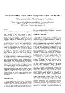
ISMAR 77- INTERNATIONAL INTERNATIONA SYMPOSIUM M ON MANAGED AQUIFER RECHARGE ABU DHABI, OCTO OBER 9 9--13, 2010
Artificial recharge of the aquifer system of C Central Veneto (Italy): modelling and forced infiltration experiments th hrough dismissed quarries , G Passadore1, M G. M. Monego2, L. L Altissim mo3, A A. Sottani4, M M. Putti5, A. A Rinaldo1,6 ((1)) Dipartimento p di Ingegneria g g Idraulica,, Marittima,, Ambientale e Geotecnica e Centro Internazionale di Idro ologia g "Dino Tonini",, Università di Padova,, via Loredan 20,, 35131 Padova,, Italia (
[email protected]); (p @ p ); ((2)) Autorità di Bacino dell’Alto Adriatico,, Dorsoduro 3593,, 30123 Venezia,, Italia ((3)) Centro Idrico di Novoledo, via Palladio 128, 36030 Villaverla (Vicenza), ( ) Italia; (4) Sinergeo s.r.l., Contrà del Po ozzetto 4, 36100 Vicenza, Italia; (5) Dipartimento di Metodi e Modelli Matematici per le Scienze Ap pplicate, Università di Padova, via Trieste 63, 35121 Padova, Italia; (6) Laboratory of Ecohydrology ECHO/IEE/ENAC, Ecole Polytechnique e Fédérale Lausanne, Station 2, GR C1 575, CH-1015 Lausanne (CH).
KEYWORDS
AREA OF STUDY
regional g groundwater model, g g geological g model, aquifer q recharge, g p permeability, y p piezometric head.
The Central Veneto (Italy) is the place of a great groundwater d t reservoir i which hi h is i exploited l it d for f domestic, industrial and agricultural g use. The area of interest is situated in the piedmont plain and is delimited on the west from the Lessini mountains and the Berici hills, hills on the north from Asiago tableland and from Grappa mountains t i and d on the th south th from f th town the t off P d Padova. Th The area is i characterized h t i d by b the th presence of areally distributed springs which are situated in correspondence p to the transition from unconfined aquifer, q , in the north of the area,, to the confined aquifers, in the south. The water abundance and the shallow water table are the causes of the great number of private wells, wells in particular for domestic use. use The reduction d ti off the th groundwater d t piezometric i t i head h d is i observed b d in i severall public bli and d private i wells ll which have been monitored for years. The water extraction exceeds the recharge g resulting g in a continuous co t uous dec decrease ease o of g groundwater ou d ate levels. e es In particular, particular the fourty fourty-year year monitoring of an unconfined well shows a negative trend characterized by a loss of 1,20 1 20 meter in 40 years ( 3 cm/year). (-3 cm/year)
ABSTRACT For the last fourty y yyears,, the layered y aquifer q system y of Central Veneto ((Italy) y) has been subject j to intense pressure by an increasing demand of water resources for domestic and private uses. Significant reductions of groundwater heads in various confined aquifers have been reported and observed through a dense network of wells. wells We report about a 3D detailed regional groundwater model, model developed on a large scale model (3000 km2) k 2) originated i i t d from f d t il d studies detailed t di off the th hydrogeological h d l i l system. t A Among it purposes, it was its f foreseen t estimate to ti t quantitatively tit ti l the th effects ff t on the th aquifer if systems t off experiments i t off artificial tifi i l recharge (for example, by using existing dismissed quarries located within the zone where unconfined aquifers q are operating). p g) The three-dimensional flow model of the aquifer q systems y has been validated on the basis of a large g experimental dataset, concerning groundwater flow and hydraulic permeability (and transmissivity) of aquifers from an array of pumping tests. tests A three three-dimensional dimensional structural geological model of the system has been built by means of suitable geological sections and stratigraphies. stratigraphies The flow simulations are performed using a tetrahedral finite elements code and the model is calibrated on the b i off observational basis b ti l piezometric i t i heads. h d T investigate To i ti t the th infiltration i filt ti capacity it off soils il and d the th artificial tifi i l recharge h potential t ti l in i the th unconfinedfi d aquifer area, experimentations of artificial recharge have been carried out in two square basins realized in a old q quarryy at Montecchio Precalcino ((Vicenza), ) located in the transition zone ((from unconfined aquifer q to confined aquifers) q ) characterized byy the p presence of sand and clayy layers y mixed with gravels. Our field studies and the ensuing modeling exercise show a recharge potential of 10 10-5 5 m3/s for m2, and overall point at suitable compensation measures for possible further withdrawals – a matter of sure interest towards a sustainable management of water resources in the region. region
EXPERIMENTAL TEST ON AN ARTIFICIAL RECHARGE SYSTEM In order to have beneficial f effects ff ( (increase in piezometric levels)) both in the unconfined f and confined f system, the artificial groundwater recharge should be realized to the north of the beginning of the low permeabilityy lenses,, that is in correspondence p p of the unconfined aquifer. q In this area we have identified different sites suitable for recharge (for their specific characteristics: closeness to rivers, hydrogeologic parameters etc.). parameters, etc ) The selected abandoned quarries are located in the unconfined aquifer or, or at least, least in correspondence of the beginning of the first low permeability lens, lens that has a depth f from th terrain the t i off 40 m and d a thickness thi k off about b t 4 m. The Th experimental set up, located in one of these quarries in the upper alluvial plain, consists of two recharge g basins equipped q pp with p piezometers,, hydrometers y and a p pluviometer. The basin is feeded by an irrigation channel, provided with a water grating to reduce the presence of waste and consequently the turbidity. turbidity
The experimental Th i l tests yielded i ld d the h following results: 100.000 100 000 m³ of infiltrated water, water with ith a positive iti t d observed trend b d in i the h phreatic h i levels; l l the infiltration rate grows with the level of water in the basin; the raising of the water water-table table in correspondence of the center of the east recharge basin (piezometer P3) is of about 12 cm, att most; t the effects of recharge spread all over the aquifer, aquifer with a ray of about 300 m from the center of th basin; the b i
Figure g 3: water level and piezometric p level in correspondence p of the 2 basins
the infiltration rate estimated in the tests is about 20-25 20 25 m3/(s /(s•km km2) in the smaller basin, and 7 7-9 9 m3/(s /(s•km km2) in the bigger one. one Th The B t Brenta C Consortium ti f for i i ti irrigation h has activated ti t d a different diff t experience of groundwater recharge, g with an innovative method: the forest areas of infiltration. This method permits to obtain biomass from plants and trees The infiltration rate estimated trees. in the forest areas is about 14-37 14 37 Figure 4: forest area of infiltration m3/(s•km /( k 2). )
CONCLUSIONS The implemented 3D flow model has allowed to improve the understanding of the regional groundwater system and of its hydrogeological properties; it permits to analyze the interaction between the unconfined aquifer and the multiaquifer system and to simulate the effects of artificial recharge in the piezometric levels of aquifers. aquifers So the model, model with all its details, details is deemed of central importance for the management of water ater resources reso rces in the area area. The flow flo model has sho shown n that the relevant rele ant reduction red ction of groundwater d t heads, h d caused d by b the th increasing i i d demand d off water t for f domestic d ti and d private i t use, can be b reversed through artificial recharge of aquifers. The efficiency of system in recharging the regional aquifer q strictly y depends p on the p presence of low p permeabilityy lenses, so, before p planning, g it's important p to know in detail the g geological g structure of the chosen site,, with investigation g ((borehole testing, g, p pumping p g tests and geophysical methods) and, once realized the recharge system, to organize recurrent reworking and cleaning of the bottom of the basin. basin
Figure 1: area of study
Figure 2: fourty-year fourty year monitoring of un unconfined well
3D FLOW MODEL: SIMULATIONS OF THE EFFECTS OF ARTIFICIAL RECHARGE The geo-structural model has been created and validated using g several g geologic g sections and well stratigraphies g p and piezometers. The details of the available sections and the p large number of stratigraphies has allowed for the reconstruction of the appearance of the low permeability lenses (pinch out), out) a necessary condition for the accurate simulation of the transition area. area This particular characteristics h t i ti h has required i d the th use off an unstructured t t d mesh h formed f d by b tetrahedral h d l elements. l Th mesh The h is i originated from the 3D geo-structural model and has been created using g software LAGRIT ((developed p byy Los Alamos Figure g 5: geo-structural g model National a o a Laboratory). abo a o y) The flow simulations are p performed using a tetrahedral finite element code. code The domain of the flow model covers almost 3000 km2. The unconfined aquifer has been divided into 60 geologic regions (for example paleoriverbed of the Astico stream, stream area of springs, i th draining the d i i and d the th dispersing di i tract t t off the th Brenta B t river): i ) the h hydraulic h d li permeability bili is i assigned i d and d kept k constant in each geologic region. These regions have been projected p j downward to the rock basement to allow their definition for the entire multiaquifer q system. y In the water ate balance we consider the following components: 1) the net infiltration of the rain (rain from which the evapotranspiration and superficial fluxes have been subtracted) 2) the water discharge dispersed by rivers and subtracted), Figure 6: boundary conditions and domain 3) by b irrigation i i ti channels, h l 4) the th water t discharge di h springing i i 6 LOW PERMEABILITY LENSES out off the h springs i and d 5)) the h water flux fl springing i i or 7 AQUIFERS (1 UNCONFINED AND 6 CONFINED) pumping out of a great number of private and public wells. Model calibration has been obtained byy comparing p g the model results with the average g annual levels observed in 2007 The best simulation, 2007. simulation at the present time, time presents deviations from real piezometric heads, heads as for the unconfined aquifer, aquifer of about ±5 meters in the area of 250.000 NODES interest with large regions in which the deviation is lower 1.400.000 TETRAHEDRAL interest, ELEMENTS th than ±2 meters. t Gi Given th size the i off the th domain, d i thi this Fi Figure 7 7: th three di dimensional i l computational t ti l mesh h calibration lib i is i considered id d as satisfactory. i f The area of interest is characterized byy the presence p ese ce o of a large a ge number u be o of qua quarries es that a ca can be used to recharge the aquifers. aquifers The calibrated flow model has been used to evaluate the effects of projects of artificial recharge through 3 quarries which are suitable for infiltration of water. water Using the results lt obtained bt i d from f th experimental the i t l tests, t t the th water flux fl off 1,2 1 2 m3/s / has h b been equally ll divided di id d between the 3 sites. The maximum growth of piezometric heads is of about 5 meters,, in p correspondence co espo de ce o of the es sites es o of recharge; ec a ge; the eg growth o in the area of interest is of about 1 1-2 2 meters. meters Note that the positive effect propagates into all the aquifers. aquifers REFERENCES De Marsily, G. (1986), Quantitative Hydrogeology Hydrogeology-Groundwater Groundwater Hydrology for Engineers, Academic Press. Inc., London. Sottani, N., Pretto, L., Viero, C. and Marcolongo, B. (1982), Gli acquiferi nella pianura a nord di Vicenza, Tipolitografica Sociale Artegrafica Cittadella di Padova. H Herrera, I (1970) Theory I.(1970), Th off multiple lti l leaky l k aquifers if W t Resources Water R R Research, h 6, 6 185-193. 185 193 Cordes,, C.,, Putti,, M. ((2001), ), Accuracyy of Galerkin finite elements for g groundwater flow simulations in two and three-dimensional triangulations, g , Internal Journal for numerical methods in engineering, 52, 371-387. Bear J. Bear, J (1979), (1979) Hydraulic of Groundwater, Groundwater McGraw Hill Inc. Inc Lagrit g Manual ((2006), ) Los Alamos National Laboratory; y http://lagrit.lanl.gov. p g g C. T. Kelley (1995), Iterative Methods for Linear and Nonlinear Equations, SIAM, Philadelphia. C Paniconi, C. Paniconi S. S Ferraris, Ferraris M. M Putti, Putti G. G Pini, Pini G. G Gambolati (1994), (1994) Three-Dimensional Three Dimensional Numerical Codes for Simulating Groundwater Contamination; FLOW3D, FLOW3D Flow in Saturated and Unsaturated Porous Media. Proc. Envirosoft 94, P. Zannetti ed., CMP, Southampton, UK, 149-156. Dal Prà, A., Mezzalira, G., Niceforo, U. (2010), Esperienze di ricarica della falda con aree forestali di infiltrazione. L’acqua 2/2010. Bredehoeft J. Bredehoeft, J D. D 2005. 2005 The conceptualization model problem - surprise. surprise Hydrogeology Journal 13, 13 no. no 1:37-46. 1:37-46 Consiglio Nazionale delle Ricerche, Regione del Veneto, ULSS n.5 e ULSS n.19. 1988. Difesa degli acquiferi dell'alta pianura Veneta: stato di inquinamento e vulnerabilità delle acque sotterranee del bacino del Brenta. Venezia. Passadore G., Passadore, G M. M Monego, Monego L. L Altissimo, Altissimo A.. A Sottani, Sottani M. M Putti e A. A Rinaldo. Rinaldo 2010. 2010 General 3D groundwater flow model of the Central Valley, Valley Veneto (Italy): pinch pinch-out out of aquitards and the robustness of conceptual models., Ground Water, in review, 2010.