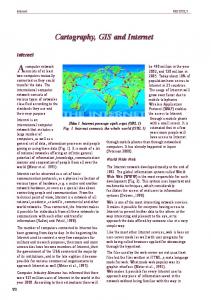
GIS application development is introduced as the collection of spatio-temporal ... allowing GIS developers to provide access to geo-information and processing ...
Internet GIS Application Framework for Location-Based Services Development Dragan Stojanovic, Slobodanka Djordjevic-Kajan Faculty of Electronic Engineering, University of Nis Beogradska 14, 18000 Nis,Yugoslavia Email: {dragans, sdjordjevic}@elfak.ni.ac.yu
Abstract Support of Internet GIS application framework for design and development of location based services is described in this paper. Definition, main characteristics and functions of location-based services are presented and the Internet GIS as their core component is described through overview of possible architectures and development methodologies. The iSTOMM - a framework for Internet GIS application development is introduced as the collection of spatio-temporal data modeling and management tools and techniques for design and development of location-based services. The power of spatio-temporal concepts incorporated within 3-tier information systems architecture of iSTOMM have been verified through development of Yellow pages service, and remains under further refinement and improvement through development of more sophisticated location based services.
1. Introduction The Internet and Web, on the turn of the Millennium, are tremendously changing every aspect of our lives. Communication with business partners, commerce transactions, buying and selling goods and services, sharing and exchanging ideas and information, learning, software development, and many others everyday business and leisure activities we are forced to conduct using specialized Internet/Web based information systems popularly named: e-business, e-commerce, e-learning, emedicine, e-everything, etc. The open infrastructure, the open and public standards and the decentralised architecture are responsible for such success and penetration of Internet and Web technology in human everyday life and business. The exponential Internet growth and the global connectivity reached in the last few years have had a great impact on the requirements of contemporary and next-generation information systems. Fundamental characteristics include efficient data access, delivery over the Web, heterogeneity, and interoperability. The primary focus of Internet/Web use for mass distribution and presentation of public information has moved to distribution of software services over intranet, extranet and Internet [1]. Next-generation information systems are going to be assembled of specialised Web services (components) that are self-contained, self-describing, modular applications that can be published, located and invoked across the Web using wide spectrum of Web-enabled stationary (desktops, workstations, Web TV) and mobile devices (PDAs, mobile phones, laptops, handheld computers, etc.). The Internet/Web technology wave has also reached the Geographic Information Systems (GIS) research and development sector. The integration of GIS and Internet technologies is allowing GIS developers to provide access to geo-information and processing without burdening end users with complicated and expensive software and dedicated hardware. The recent convergence of multiple information and communication technologies including Internet, wireless communications, mobile position determination, portable Internet-enabled devices and GIS has
given rise to a new class of location based applications and services. Location based services deliver geographic information and geo-processing power between mobile and/or static users via the Internet and/or wireless network. Development of GIS, as integral components of location-based services remains the complex task so the availability of Internet GIS application framework is crucial to achieve greater scalability, reliability and fast-time-to-market. The rest of the paper is organised as follows. Section 2 reviews main concepts and architecture of location-based services and their main component - Internet GIS. Section 3 presents Internet GIS application framework, giving the overview of spatio-temporal object model it is based on and describing its architecture and functional components. Section 4 presents location based service for Yellow pages, developed on top of Internet GIS application framework. Section 5 concludes this paper and gives an overview of future research.
2. Internet GIS and Location Based Services Over the last few years the GIS research and development sector has undertaken a paradigm shift away from the pure desktop GIS solutions which has to be used only by experts giving results, often on paper, to non-experts. Now, through the introduction of Internet or intranet/extranet-based GIS systems, it is possible for any person to use some kind of GIS and mapping system. Only minimal browser technology enable users to zoom into their data, explore and analyse it and produce a report that can be pasted into any office application environment. Tomorrow's (or even today's) GIS software "scene" will increasingly consist of data manipulation and spatial analysis tools designed as Web-based components or applications, operating on geo-data in a distributed, Internet/Webbased environment [2]. With the emergence of Internet/Web the design and development of contemporary and nextgeneration information systems face new challenges, opportunities and requirements. The first generation of Internet information systems was considered mostly static in nature, providing users with poor and limited interactive view of information from databases, generated by Web servers. The contemporary architecture of information systems is now distributed over multiple tiers (usually: client, application and data server tiers), and assembled of application components that are self-contained, self-describing, modular applications (services). Such components can be published, located and invoked across the Web using computing devices of all sizes: from mainframes to PDAs and mobile phones [3]. In accordance with it, there are two basic approaches to development and deployment of GIS or any other complex, data-driven application on the Internet: as server-side or client-side applications [4]. In a server-side Internet GIS application, a Web browser is used to generate server requests and display the results. An Internet GIS server usually combines a standard Web (HTTP) server and a GIS application server, and the GIS databases and functionality reside completely on the server(s). Within server-side GIS application user’s interaction in Web browser represents the request which is transferred to a Web server. The Web server passes the request to a GIS application server, which runs GIS application software, generates a map graphic, converts the graphic to Web format, wraps the image in HTML and sends it back to the Web server, which then returns the response to the client as a standard Web page. Server-side applications can comply with Internet standards, because the entire complex and proprietary software, as well as the GIS databases reside on a server that's administered by the deploying organization. Disadvantages of server-side solutions are primarily associated with poor performance and limited user interface and interaction.
The future belongs to client-side, 3-tiers Internet GIS applications, especially for intranet and extranet solutions dedicated to provide full GIS analysis and management support to specific users within business, government or public utility sectors. In client-side Internet GIS, the client is enhanced to support GIS operations, while the middle tier, representing by application server, is populated with application logic (figure 1). In such systems either a substantial amount of GIS functionality is moved to the client, or only the user interface is enhanced slightly to enable specific user interaction. Depending on the degree of functionality possessed by the client, the OpenGIS has developed a model to classify different types of Internet GISs according to their portrayal service built within clients with various "thickness" [5]: § Thin clients (only raster images JPG and PNG) § Medium clients (graphic primitives WebCGM and SVG) § Thick clients (data in the form of simple features XML/GML, processed at the client side) Client-side solutions typically are implemented by augmenting the Web browser with Java applets, ActiveX components or plug-ins. However, some client-side solutions require users to install a complete client application. The primary advantages of client-side solutions are the abilities to enhance user interfaces, improve performance and implement advanced solutions using both raster and vector data. Inte rnet GIS client Web browser (ActiveX, plug- in, Java applet) or GIS application
GIS data
Inte rnet GIS server Web server
Client side programs and data (HTML, applets…)
GIS application server
GIS data (DBMS, files, etc.)
Figure 1. Client-side Internet GIS architecture (3-tiers) The main problems associated with client-side solutions relate to distributing software and data. Distributing software (Java, ActiveX or any other type) is still problematic because of portability and platform incompatibilities. Considering distribution of geo-data and geo-services, ISO TC 211 [6] and OpenGIS [5,7] are working on open standards for interoperability within geo-information infrastructure, which have to be foundation of contemporary Internet based GISs. Their standardisation activities and initiatives require consensus on geo-information aspects related to: geometric model, description of geo-data sets and geo-services, access and query of metadata and return of query results, selecting of geo-data and formatting (and transferring) geo-data sets' results. The recent convergence of network computing and wireless telecommunications with Internetbased spatial technologies is giving rise to a new class of location-based applications and services. Location based services represent Internet GIS applications which, according to location of the user (or some requested location), deliver geo-data and geo-processing from the GIS servers across Internet/Web for using on wide spectrum of Web-enabled stationary and mobile devices [8]. The value of location based services is in giving assistance to stationary and mobile users in day-to-day situations such as giving the shortest route from their location to the nearest place of interest or sending emergency service to their current location in the case of accident. The truth power of location based services lays in delivering GIS functionality and location-based information across
fixed and mobile Internet-based networks, to be used by anyone, anywhere, at any time and on any device. Location is central to how people organize and relate to their world. Knowing the location of people, objects, and phenomena at any time within end-user applications that are aware of the position of a user, and delivered through a wide range of devices via the Internet and wireless network, bring invaluable benefits to business, consumer and government sectors. According to OpenGIS - OpenLS [9], location represents a position in space and time that can be measured and whose coordinates can be derived in a particular spatial and temporal reference system. However, at the current state of location based services technology, the temporal aspect of geographic location is mainly neglected, or only partially integrated within recent research, development and standardisation initiatives and solutions. That omission is inherited from a GIS community that hasn't still explored and established the full potentials of managing temporal aspect of geoinformation [11]. The architecture of location based services consists of three main parts (figure 2) [9]: § Positioning of mobile terminals based on either GSM/GPRS/UTMS mobile communication systems, or GPS/GLONASS/Galileo satellite positioning systems. § Wireless communication network based on GSM/GPRS/UTMS. § Internet/Web GIS that provides spatio-temporal data and services over Web. GPS / GLONASS/ Galileo positioning GSM / GPRS / UMTS positioning
Stationary user
Location application service clients Mobile user
Location application services GIS
Wireless-IP Platform
GIS (Location) application server
Internet or Intranet
Gateway Services
Network Management Positioning server (GMLC)
Network services Control
Location Information GIS (Location) Information Server
Location Data Sources (DBMS, Files,…)
DSL & Cable
PSTN
Figure 2. Location based services concept and architecture (adapted from [7]) GIS (Location) Information Server provides access to location data sources distributed over Internet, which possess different structure (DBMS, files, etc.) and are stored in different, proprietary or open formats (SHP, MIF, XML, GML, GIF, PNG, etc). Location application services represent
application components integrated within GIS (Location) Application Servers that operate on location content and provide value-added services to two main group of clients: wireless and wired. Gateway Services enable integration of existing wireless-IP platforms maintained by mobile communication operators with Location Application Servers and Location Service Clients. Such clients operate either on fixed (desktop) or mobile terminals and interface directly with users/customers, and depending on processing and graphic capabilities of targeted device possess various levels of functionality and interactivity ("thickness"). Three generations of location based services is identified [10]. First generation services were limited to stationary desktop computers with wired connection to Internet/Web and represent currently mature Internet/Web GIS applications. They require the user to manually input his/her location (or location of interest) in the form of a place name, street address, postal code, telephone number and geographic coordinates and appropriate temporal information. Second generation location services, which are available today, have the ability to determine rough locations typically at the postal code level. Using a device such as the PalmVII to access the PalmNet data network, a mobile user can find restaurants or gas stations in order of proximity or travel directions. Third generation location services are more location aware, taking advantage of more precise positional information and have the capability to initiate services proactively based on location. These trigger mode services can notify the user of relevant events or conditions without the active participation of the user such as traffic alerts that meet the user's preset preferences. Three types of triggers could be identified: § Object triggers notify the user of the mobile device when entering within a predefined distance of a facility. § Object-temporal triggers add the dimension of time. § Affinity triggers allow one mobile device to know of the location of another mobile device. Although considerable attention within location based service technology has been placed to its constituent technologies, like wireless Web, mobile Internet-enabled devices and mobile positioning, the heart of the whole system represents Internet-enabled GIS technology. Internet GIS within location based services provides access to spatio-temporal information and GIS components dedicated to its processing based on the location of user, or locations of mobile or static features which are of interest to the user. The Internet GIS technology behind these services will empower an increasingly diverse range of applications, putting even more valuable information and processing in the hands of mobile and stationary users wherever and whenever it is needed. But, to design and develop an Internet GIS application, to deploy it over multiple tiers within wired/wireless Internet-based network and to provide and sell it to the end user as valuable location based service, the developer must be supported by appropriate Internet GIS application framework during all phases of development process.
3. iSTOMM - Internet GIS application framework The ARGONAUT project at the Computer Graphics and GIS Lab, University of Nis, aims to develop a suite of spatio-temporal data modeling and management technologies and tools integrated within temporal GIS application framework - STOMM (Spatio-Temporal Object Modeling and Management) [11]. STOMM is based on an object-oriented spatio-temporal data model and is intended to support all stages of development process, from conceptual design through to implementation, of a temporal GIS application. The STOMM data model was developed according to specifications and standards developed within ISO/TC 211 [6, 12] and OpenGIS [7] related to modeling and processing of geographic information. STOMM presents the successor of SPATEMP
system [13], but based on a new, STOMM data model, extended with more functionality in spatiotemporal domain consistently with ongoing standardization and redesigned and redeveloped according to component-based development approach. Based on this general framework, two architecture-oriented application frameworks, for desktop and internet-based temporal GIS applications (dSTOMM and iSTOMM respectively) have been implemented and have already found valued, commercial purposes [16]. The primary purpose of iSTOMM framework is to add significant GIS functionality to location based services developed around it. It provides a wide variety of spatio-temporal services, which operate on spatio-temporal information arisen from different information sources through Internet infrastructure and mobile terminal positions. iSTOMM framework also provides support for displaying results of such operations to the mobile or stationary Web terminals, in the form of maps, reports and messages and/or triggering specific alerts and events. 3.1 STOMM data model STOMM data model supports all important concepts found in object-oriented modeling theory and paradigm, and can been used at conceptual and logical modeling levels. It is based on extensible spatial and temporal class hierarchies. The basis of STOMM modeling framework is GeographicObject class for modeling geographic features. The GeographicObject class represents some entity or phenomenon of the real world, so it must have an actual or potential position in space, which is represented by SpatialObject class, and time, which is represented by TemporalObject class. STOMM data model enables user to design a temporal GIS application by defining application specific classes representing the real-world entities (cities, forests, railways, telecom cables) through inheritance of GeographicObject class or some of its subclasses already designed for specific application domain. Spatial properties of geographic features are expressed by their geometry, topology and cartographic presentation. In STOMM data model, spatial properties are specified through SpatialObject class (figure 3). GeographicObject
+spatial property
SpatialObject
Figure 3. GeographicObject class and its spatial property - SpatialObject class The geometric description of a SpatialObject is defined through Geometry class (figure 4). Considering Geometry class hierarchy, we have decided to accept standardization work pursued within OpenGIS Consortium, concerning simple features and their geometries [7] and ISO/TC 211 work on spatial schema [6]. We have based our work on high correspondence between those specifications relating to geometric properties of geographic features, differentiated mainly in the level of abstraction. Our decision has also been supported by recent adoption of OpenGIS Simple Feature Specification, by ISO/TC 211 in the form of Draft International Standard [12]. Geometry classes contain appropriate descriptions of specific geometry through attributes (collection of points represented different geometric primitives), as well as appropriate class methods representing geometric and topological operations and relations. Coordinate values of geometric classes have real world meaning within spatial referencing framework that has been provided through SpatialReferenceSystem class associated to Geometry class. Cartography 1..n
SpatialObject
1..n Geometry
Figure 4. Cartographic presentation of spatial objects - Cartography class
Cartographic presentation of spatial objects and visualization of spatial objects' properties are defined through Cartography class (figure 4). Thus, a clear separation between geometry and its cartographic presentation has been defined. Cartography class contain attributes (symbols, font, line width, colour, etc.) and operations that determine how properties of a given spatial object (geometry and topology) are represented in terms of different parameters (scale, graphics output, output media…). Operations defined in the SpatialObject class for expressing topological relations, direction relations and metric operators, define a foundation for definition and specification of spatial part of spatio-temporal query language STOQL [14]. Temporal properties of features modeled within STOMM data model are incorporated using TemporalObject class. TimeStamp class hierarchy defines primitive temporal classes which can be used for timestamping: instant (Instant class), period (Period class), and homogenous (MultiInstant and MultiPeriod classes) and heterogeneous (TimeStampCollection class) collections of time stamps (figure 5). TimeStamp class is associated to TemporalReferenceSytem class, which defines time type (UTC, GPS or arbitrary time), and an offset from UTC time in hours and minutes. The TemporalObject class includes operations for specifying temporal topology (before, after, during, meet, contain, etc.) and temporal metrics (duration, union, intersection, difference, etc.) as defined in [11, 15]. These operations represent the basis for definition and specification of temporal part of spatio-temporal query language STOQL. TemporalObject
1..n TimeStamp 0..n
TemporalReferenceSystem
n
Instant
Period
TimeStampCollection
MultiInstant
MultiPeriod
Figure 5. TemporalObject class and TimeStamp class hierarchy The Evolution class is defined and associated to TemporalObject class (figure 6). Thus every instance of specific temporal class, i.e. class inherited from TemporalObject class has the reference to the appropriate Evolution class' object. An instance of Evolution class relates to an ordered set of instances of TemporalObject class (its application specific subclasses) and those are the versions of the same temporal object. The Evolution class, through its operations, provides evidence of temporal object changes, records temporal object's lifespan, and provides reference to previous, next, first, last, or the current version of a temporal object, as well as the versions valid at the specific time stamp. Evolution
TemporalObject 1
1..* {ordered}
Figure 6. Evolution and TemporalObject classes
Classes of objects that are considered as temporal must be defined through inheritance of the TemporalObject class. So, the methodology of temporal object modeling proposed here corresponds to object timestamping by valid time. But, any attribute of such temporal class, which possesses temporal behavior different from the rest of the class, could be modeled as a single attribute of a separate class inherited from TemporalObject class. Thus, the temporal part of STOMM data model can be considered as object-attribute timestamping. Geographic features whose thematic (non-spatial) properties are changed through time are modeled as a TGeographicObject class through multiple inheritance from classes TemporalObject and GeographicObject (figure 7). Class TGeographicObject represents geographic features whose thematic properties undergo changes through time, but whose spatial properties, specified in SpatialObject class, are not changeable. TemporalObject
GeographicObject
TGeographicObject
Figure 7. TGeographicObject class In order to define spatial properties of geographic features, which are changed thorough time the SpatioTemporalObject class is defined within STOMM data model, through inheritance of SpatialObject class and TemporalObject class (figure 8). The SpatioTemporalObject class defines spatio-temporal operations as an extended set of spatial operations defined in SpatialObject class, with temporal information added in the list of operations' parameters. The topological and direction operations can be twofold. One type of operations returns a boolean value indicating whether there exists or not specific spatial relation at specific timestamp between spatio-temporal objects. The other type returns the set of time intervals indicating that during these intervals spatio-temporal objects satisfied specified relations. Metric operators simply specifies value of metric characteristics (length, area, etc.) of spatio-temporal object at specified time instant, or a set of values for time period or timestamp collection. GeographicObject
+spatial property TemporalObject
SpatialObject
SpatioTemporalObject
Figure 8. Modeling changes of spatial properties - SpatioTemporalObject class Thus, within STOMM data model, four different types of geographic features can be modeled according to their behavior in time, i.e. whether their spatial and/or thematic properties are changed in time.
3.2 iSTOMM architecture and components The iSTOMM architecture is compliant with the ISO/ODP 10746 guidelines for open distributed systems, and adheres (as well as generic STOMM) to the standardisation work within OpenGIS and ISO/TC 211, related to spatial data and services interoperability. Development of iSTOMM is based on up-to-date Internet information technologies such as: Java, XML/GML, CORBA, etc. iSTOMM application framework supports 3-tier Internet GIS architecture (figure 9), consisting of: § Spatio-temporal information server; § Spatio-temporal application server and application components; § Spatio-temporal service client components. iSTOMM clie nt
(standalone or within Web browser)
iSTOMM GUI co mponents (CORBA & JavaBeans objects) iSTOMM-based application client (CORBA & JavaBeans) Internet intranet extranet
IIOP/ RMI
XML, GML, HTML, VRML, WML (HTTP/WAP)
We b server
iSTOMM application server iSTOMM-based application co mponents (CORBA, EJB)
iSTOMM application components (CORBA, EJB objects) Query language (iSTOQL)
Visualisation & S-T analysis, reasoning animation (iSTOVAM) & data min ing )
Data conversion from/to STOMM to/from XM L, GML, VRM L, etc.
iSTOMM Kernel (Data management & integration) Object-oriented implementation of STOMM data model (CORBA, EJB) Recordset/Resultset ODBC/JDBC
Intranet Internet
iSTOMM spatio-temporal information server STOMM data model
STOMM Extension (user-defined classes)
Information & application resources (DBMSs, GIS, ERP, CRM, other IS,…)
(Object-) relat ional DBM S (Oracle, MS Access, SQL Server, mSQL,…)
Figure 9. iSTOMM architecture and components The figure also shows appropriate information and distributed component technologies used for implementation of iSTOMM components and communications between different components and tiers. iSTOMM information server is based on implementation of STOMM data model within commercial, relational, object-relational and object-oriented DBMS (Oracle 8i, SQL Server, MS
Access, etc.). iSTOMM application server consists of GIS application components, developed on CORBA and EJB distributed component platforms, that represent building blocks of user (application developer)-defined temporal GIS application. The main component of the iSTOMM application server is iSTOMM kernel, which provides spatio-temporal object management and integration, including mechanisms for updating, indexing, mediation & wrapping between different data models, etc. iSTOMM application components represent software components for advanced manipulation of spatio-temporal objects, such as: § Processing of spatio-temporal-thematic queries, visually specified according to various spatial, thematic and temporal criteria through visual spatio-temporal, object-oriented query language iSTOQL; § Visualisation and animation of spatio-temporal objects through iSTOVAM (iSTO Visualization and Animation Manager); § Conversion of spatio-temporal object from/to STOMM object format to/from XML/GML or specific proprietary spatial data formats; § Spatio-temporal analysis, reasoning and data mining (only generic support to appropriate, userdefined components); iSTOMM application server provides architecture extensibility enabling integration of user-defined application components into its general architecture. Also mentioned components can be customised, extended or replaced as long as the new components reside on the iSTOMM Kernel. iSTOMM client contains GUI components providing access to iSTOMM application server functionality, developed on JavaBeans and CORBA technology. Such components are integrated with user-defined location based service client, executing within Web browser on mobile or stationary user terminal or as a standalone application. The main purpose of iSTOMM application framework represents design and development of location based services for business, customer and government sector. Currently, two locationbased services based on iSTOMM are under development, and are intended for: § Yellow pages directories; § Vehicle navigation, tracking and guidance, which particularly exploits the full value of iSTOMM temporal dimension.
4. Development of iSTOMM based "Yellow pages" service The implementation of iSTOMM we've primarily based on contemporary, object-relational DBMSs such as Oracle8i, which provides built in support for spatial data management, as well as specification of user-defined data types. Also, by using JDBC/ODBC standards the access to other commercially available DBMSs is provided. Implementation of iSTOMM application components is based on Java programming language, as well as CORBA and EJB distributed computing platforms. iSTOMM client GUI components are implemented either as CORBA clients or JavaBeans components. As the proof of the concepts built in iSTOMM application framework, we've developed a prototype location based service for Yellow pages for city of Nis and its surrounding. Due to limited mobile communication infrastructure that is provided by Yugoslav mobile operators, and unavailability of mobile positioning services within their centers, we base our location based service on wired Internet access. The Yellow pages application is based on geographic and thematic data collected within GinisWeb prototype [17] representing city streets and street numbers, as well as different types of business and public organisations (schools, bus and train stations, faculties, cultural
institutions and city government institutions). The background for vector-type graphical information and visual context for user are provided through mosaic of GIF images of Nis City plan. Collected spatial and thematic data about Nis places of interest is stored and organised within Oracle8i database, using Oracle8i Spatial and interMedia, by implementation of STOMM data model as Oracle database schema. Since the usage of services is limited to stationary Internet GIS client within desktop Web browser, the user’s location can not be specified by the known location of user's mobile terminal, which could be determined by a mobile positioning server. The hypothetical location of user or the location where he/she intend to be are specified within Yellow pages client in the form of some kind of location determination information. Such location information includes street address and number, telephone number, closest well-known city object, or geographic coordinates (included for easy integration and usage of future GPS or GSM based mobile positioning services), and is specified as input parameters to the services. Depending on the service needed, the users must also specify request parameters for the business, government or public organisation they are seeking. User request can be twofold: in the form of the type and/or nature of the closest organisation that he/she is attempting to find or as name, phone number, or some other unique and known identifier of such organisation. Next, a search for the desired business is executed by the iSTOQL component against the iSTOMM Information Server that contains geographic and thematic content for Yellow Pages. This server returns the location of the business that best matches the criteria specified in the request. Using the appropriate location service client executing within Web browser, the location of the business is then displayed on a map, relative to the hypothetical or desirable user location. The user can determine and display the best and/or shortest route to the business, government or public object of interest, or display particular thematic information connected to that organisation, such as opening hours, telephone or fax numbers, and so on. With the provision of mobile positioning services by mobile operators and wider usage of mobile Internet-enabled computing devices, the iSTOMM based Yellow pages service will be easily extended to the wireless domain.
5. Conclusions and future work Our further research goals are to enable and improve integration and chaining of iSTOMM-based location based services with Web services, location-based or not, available through Web infrastructure, in order to give much more value to the single service. To achieve this goal iSTOMM based location service components must be designed and developed as self-contained, self-describing, modular application components that can be published, located and invoked across the Web through SOAP protocol. Such Web services based on spatio-temporal information must be described using WSDL, and advertised within UDDI [18], of course when such standards become mature enough. Thus, the future developments of iSTOMM application framework intend to enable intelligent integration of administrative, business, transport, cultural, leisure, information and application services (Web services), as well as appropriate e-commerce-based services for purchasing, booking and payment of previous ones, all through standard interfaces and service catalogs. Further developments will also remain to follow standardisation guidelines and achievements of OpenGIS and ISO/TC211, as well as initiatives of OpenLS, MAGIC, LIF and other international or industry standardisation organizations dedicated to location based services. And, of course, many useful location based Web services based on iSTOMM framework are going to be developed, deployed and provided for public access in the near future.
References [1] Dreyfus P., "The Second Wave: Netscape on Usability in the Service-Based Internet", IEEE Internet Computing, Vol. 2, No. 2, Mart-April 1998, pp. 36-40. [2] Lake R., "The hitchhiker's guide to the new Web mapping", GeoEurope, Vol. 10, No. 2, pp. 3235, February 2001. [3] Barr R., "The ever-widening Web", GeoEurope, Vol. 8, No. 3, April 1999, pp. 18-19. [4] Gifford F., "Internet GIS Architecture: Client v Server - which side is Right for You?", Mapping Awareness, Vol. 13, No. 7, August 1999, pp. 40-42. [5] OpenGIS Web Map Server Interface Implementation Specification, Revision 1.0.0, OpenGIS Project Document 00-028, 19 April 2000. [6] ISO/TC 211 - Geographic Information / Geomatics, 19100 series of standards, 2000/2001, http://www.statkart.no/isotc211 [7] OpenGIS Simple Features Specification, Open GIS Consortium, Inc., OpenGIS Project Document 99-049, 1999. http://www.opengis.org [8] Koeppel I., "What are Location Services? - From a GIS Perspective", Java Location Services, Januar 2001, http://www.geojava.com/ [9] OpenGIS - A Request for Technology - In Support of an Open Location Services (OpenLS™) Testbed, 27.10.2000., http://www.openls.org/rft/index.htm [10] Gravitate, Inc.,"Gravitate Platform for Location-Precise Services", White Paper, Oktobar 2000. http://www.grvt8.com/doc/whitepaper.pdf [11] Stojanovic D., Djorðeviæ-Kajan S., Stojanovic Z., "Modeling and Management of SpatioTemporal Objects Within Temporal GIS Application Framework", accepted for International Database Engineering and Applications Symposium - IDEAS 2001, to be held in Grenoble, France, 16-18 July 2001. [12] ISO 19125 (DIS) - Geographic information. Simple feature access, ISO/TC 211 Geographic Information/Geomatics - N1002, October 2000. [13] Stojanovic D., Djordjevic-Kajan S., Stojanovic Z, "Spatio-Temporal Data Management System: a Kernel for Temporal GIS Applications", IASTED Applied Informatics '99 Conference, 15-18.2.1999. Innsbruck, Austria. [14] Stojanovic Z., Djordjevic-Kajan S., Stojanovic D., "Visual Query and Analysis Tool of the Object-Relational GIS Framework", 2000 Conference on Information and Knowledge Management (CIKM 2000), Washington D.C, pp. 328-335, 2000. [15] Stojanovic D., Djordjevic-Kajan S., Mitrovic A., Stojanovic Z., "Cartographic Visualization and Animation of Dynamic Geographic Processes and Phenomena", 19th ICA/ACI 1999 Conference, Ottawa, Canada, 14-21 August1999. [16] Stojanovic D., Djordjevic-Kajan S., Stojanovic Z., "Exploiting Temporal GIS and SpatioTemporal Data to Enhance Telecom Network Planning and Development", accepted for 3rd International Conference on Enterprise Information Systems - ICEIS 2001, to be held in Setubal, Portugal, 7-10 July 2001. [17] Stojanovic A., Stoimenov L., Dimitrijevic A., Djordjevic-Kajan S., "GinisWeb - the Tool for GIS Applications Development Based on Web", 10th Mediterranean Electrotechnical Conference, MeleCon 2000, Vol. I, pp. 331-333., May 2000. [18] Tidwell D., "Tutorial: Web services -- the Web's next revolution", IBM developerWorks, May 2001. http://www-106.ibm.com/developerworks/webservices/