Linaria: an information system to implement GLOCHAMORE project and promote conversion of information into knowledge in Sierra Nevada Biosphere Reserve BONET GARCÍA, F. J.; PÉREZ-LUQUE, A.J., PÉREZ-PÉREZ, R. Laboratorio de ecología. Centro Andaluz de Medio Ambiente. University of Granada-Junta de Andalucía.
[email protected]
Sierra Nevada Global Change g Observatoryy is a long g term monitoring gp program g whose main aims are to assess the effects of global change in this LTER site. The basic objective is to ensure the collection of necessary information to identify as early as possible the impacts of global change, and design management actions that minimize them. The data generated by this set of methodologies must be transformed into useful knowledge for adaptive management of natural resources. The key issues are the integration and analysis of monitoring data by an information management system, and the transfer of current scientific knowledge to societyy and the natural resource managers through effective dissemination.
Bibliography manager
Wiki
that are managed using tools from web 2.0
Sierra Nevada is an isolated high mountain (reaching 3482 m. a. s. l.) located in Southern Spain. It’s considered the most important biodiversity hotspot in the Western Mediterranean region. Some p information: descriptive - 2100 vascular plant (25 % and 20 % of Spain and Europe flora) - 80 vegetal endemic species - 2000 km2 -Biosphere Reserve (UNESCO) - Natural and National Park -61 municipalities - 90.000 inhabitants
SPAIN Sierra Nevada
No systematic analyses, that create
Ecological metadata language (EML)
Pressure, response and state indicators
A scientific workflow management system
Wisdom
Systematic analyses run through
Knowledge
that is properly documented using two international metadata standards
Raw data in each of these spatial entities monitoring methods are applied to obtain
that creates
that is converted into useful knowledge through two different routes
Queryable information that are stored in relational databases, g obtaining
Reports, slides, videos, id etc. t
Inspire p directive (ISO 19115)
I f Information ti
>
Information is analyzed and converted in useful knowledge by means of different techniques (niche modeling, spatial analysis, regression, etc.). These algorithms are calculated using a workflow management software whose nucleus is called Kepler (https://kepler-project.org/)
>
This useful knowledge is expressed as a set of indicators. We have followed the state-pressureresponse paradigm in the design of this indicator system. Results are shown in a web portal where managers and scientist can browse the indicators and download raw data.
Municipality
Data
MODIS pixel Juniper cuadrat
>
Meteo station
We are using mobile devices (PDAs, smartphones, etc.) to facilitate the upload of raw data to those normalized databases.
Real world
>
Diatomea Plecoptera l Phytoplancton
Plant phenology Carbon flux Meteo information
Time series length
Physical-chemical water condition
Land use change Forest pests
Reptiles
Forest regeneration
GLORIA
Trout
Spanish ibex
Humid grasslands
Juniper i communities
Metadata are data about data. Using metadata, we are able to document the raw data by means of labeling. Metadata allows to answer some important questions about data: who created them?, How are arranged?, When were collected?, etc. This is the URL that we use to harvest the metadata in EML format: http://apps.iecolab.es/linaria/panel/harvestlist?adm inistracion=ceamaneros
Ecological state of streams
Protocol complexity
50 years
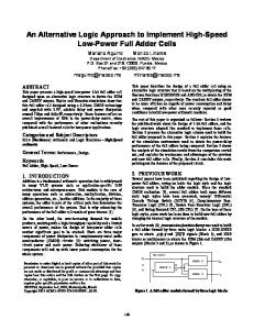
have created a monitoring program with more than 30 protocols whose > We methodology have been validated scientifically and collect information for more than 100 environmental variables that are surrogates of ecosystem functions. This figure shows the monitoring protocols. The size shows the length of the temporal series, the colour shows the thematic field, and the position in the x axis i shows h the th complexity l it off th the methodology th d l used. d
Publication date Information conttained in ecological data
Dispersant birds Air pollution Snow cover Wild boar Volume of monitoring flow Lepidoptera Amphibia
Raw data are stored in relational databases that are managed by PostgreSQL. The use of this databases allows us to stablish spatial and alphanumerical relationships between the different data packages. Standarized Query Language (SQL) significantly improves the way information is accessed.
Maintaining the useful information if we use databases
Specific details General details
Retirement or change in researcher’s career Researcher’s death Loss of useful information in the case of not using database or metadata (Mitchener et al. 1997)
Time