Linking Spatial-Temporal Points, Connecting Human and Digital Nodes: the ArcheoSITAR Project Framework En reliant points spatio‐temporels, en connectant nœuds humains et numériques : le cadre du projet ArcheoSITAR Mirella Serlorenzi1, Giorgia Leoni2, Ilaria Jovine2, Andrea De Tommasi3 1
Director of the ArcheoSITAR Project, Director of the National Museum of Crypta Balbi in Rome,
[email protected] 2 SITAR Office staff member,
[email protected],
[email protected] 3 ArcheoSITAR Project system design workgroup member,
[email protected] RÉSUMÉ. La Conférence JIAP 2016 a été l'occasion pour le groupe de travail du Projet ArcheoSITAR, de présenter aux collègues français et européens les programmes de la nouvelle phase, en cours, d’amélioration méthodologique et technologique de la plate-forme web collaborative SITAR, à partir des résultats obtenus au cours des huit premières années de mise en œuvre du projet (2008-2016). À partir du paradigme originaire du SIG institutionnel de la Superintendance Spéciale pour le Colisée et la Zone Archéologique Centrale de Rome – l’institut territorial du Ministère italien du Patrimoine Culturel et du Tourisme, en charge du recensement, de la protection, de l’étude et de la promotion du patrimoine archéologique de Rome –, la plateforme web SITAR est en train d’évoluer vers un système avancé et participatif d’organisation de la connaissance, au bénéfice de la communauté scientifique et des citoyens. En conséquence, la mise en œuvre actuelle du projet prend aussi en considération de nouvelles approches de en Recherche et Développement concernant la gestion des connaissances archéologiques, l’Archéologie Publique, les Cultural Commons, l’Open et Citizen Science, et la diversité culturelle, la Digital Social Innovation, et la Recherche et l’Innovation Responsable. Dans ce contexte, le groupe de travail accorde une attention particulière I) à certaines tendances intéressantes d’accès par les utilisateurs aux données en ligne et aux connaissances géo-référencées – tendances qu’il faut encore mieux observer dans le domaine archéologique pour comprendre les besoins réels d’information et les habitudes des utilisateurs - et II) aux demandes d’accès réel, répandu et publique à ces connaissances, surtout à travers des outils coopératifs tels que, entre autres, les applications fondées sur les Open et Linked Data, les archives en Open Data et en Open Access, les Digital Libraries et bientôt, également les Collective Awareness Platforms. Deux événements fondamentaux ont marqué le projet en termes d’évolution du concept et de finalités primaires (partage des connaissances scientifiques, construction des réseaux de recherche archéologique, engagement du public, ouverture et exhaustivité des données et de la connaissance): dans un premier temps, en 2013, la 3e Conférence annuelle SITAR, qui a officiellement lancé la plate-forme web SITAR sur le Réseau Italien de la Recherche et de l’Éducation; puis en 2015, la 4e Conférence annuelle SITAR (Penser en Réseau, Penser au Réseau pour la Recherche, la Sauvegarde et la Promotion du Patrimoine Culturel, ) qui a effectivement poussé le projet vers sa mission avancée de développement d’un nouveau lieu social pour les interactions humaines et professionnelles, pour le secteur archéologique et le contexte social et territorial complexe de Rome. En considérant ces étapes franchies au cours de la première période de mise en œuvre du projet, ainsi que d’autres expériences stimulantes, telles que le projet européen FP7 ARIADNE et d'autres actions de coopération avec les instituts du Ministère Italien du Patrimoine Culturel et du Tourisme, le Conseil National des Recherches, et certaines Universités italiennes, le groupe de travail du SITAR est en train de développer des composantes plus étendues et performantes pour la plate-forme, tels que le nouveau web Archaeological Information System, en les dotant aussi de procédures coopératives permettant aux utilisateurs d’accéder, utiliser, co-créer, partager et élaborer la connaissance archéologique publique et, par conséquence, de les soutenir dans le développement de leur propre « attitude collaborative ». Dans l’ensemble, ces améliorations conduisent le projet ArcheoSITAR, à partir de l’effort originaire, purement archéologique et technologique, du Linking Spatial-Temporal Points, vers la perspective socio-économique plus persistante du Connecting Human and Digital Nodes, soit de l’Archéologie Publique, du territoire de Rome. ABSTRACT. The JIAP 2016 Conference has given the opportunity to the ArcheoSITAR Project workgroup to illustrate to French and European Colleagues the plans for the new ongoing season of methodological and technological © 2017 ISTE OpenScience – Published by ISTE Ltd. London, UK – openscience.fr
Page | 1
enhancement of the SITAR web collaborative platform, starting from results achieved during the first eight years of implementation path (2008-2016). Moving from the former specific paradigm of institutional GIS of the Special Superintendence for the Colosseum and the Central Archaeological Area of Rome - the territorial institute of the Italian Ministry for Cultural Heritage and Tourism, in charge of the census, protection, study and promotion of the archaeological heritage of Rome, the SITAR web platform is currently evolving towards an advanced and participatory knowledge organization system, for the benefit of both the scientific and citizen community. Consequently, the project implementation is being undertaken also considering new research & development approaches to archaeological knowledge management, Public Archaeology, Cultural Commons, Open and Citizen Science, and Cultural Diversity, Digital Social Innovation, and Responsible Research and Innovation. In this sense, the ArcheoSITAR Project workgroup is paying a particular attention I) to some interesting trends in users’ accessing on-line georeferenced data and knowledge - still to be better observed in the archaeological domain, to understand actual users’ informational needs and habits - and II) to requests for a real, ubiquitous and public access to that knowledge, above all by mean of cooperative tools, such as, among the others, Open and Linked Data applications, Open Data and Open Access repositories, Digital Libraries and, soon, also Collective Awareness Platforms. Two fundamental events have characterized the project in terms of evolving concept and primary scopes (scientific knowledge sharing, archaeological research network building, public engagement, data and knowledge openness and completeness): firstly, in 2013, the third annual SITAR Conference, that has officially launched the SITAR web platform on the Italian National Research and Education Network; later, in 2015, the fourth annual SITAR Conference, entitled Thinking in Network, Thinking of the Network for Research, Safeguard and Promotion of the Cultural Heritage, that has actually boosted the project towards its advanced mission of developing a new social place of human and professional interactions, for the archaeological sector and for the complex social and territorial context of Rome. Considering these milestones achieved during the first period of project implementation, as well as some other stimulating experiences, such as, among the others, the FP7 European ARIADNE Project and some cooperation actions with institutes of the Italian Ministry for Cultural Heritage and Tourism, the Italian National Research Council, and some Italian Universities, the SITAR workgroup is currently developing more extended and performing core components for the platform, such as the new web Archaeological Information System, also by supplying them with cooperative procedures to allow users to access, use, co-create, share and elaborate public archaeological knowledge and, therefore, to support them in developing their own collaborative attitude. Altogether, these enhancing features are bringing the ArcheoSITAR Project from the former, pure archaeological and technological effort of Linking Spatial-Temporal Points, towards the more persistent, socio-economic perspective of Connecting Human and Digital Nodes, of both the Public Archaeology and the territory of Rome. MOTS-CLÉS. Connaissance archéologique, Archéologie Publique, Digital Social Innovation, SIG, Rome, plateforme collaborative. KEYWORDS. Archaeological Knowledge, Public Archaeology, Digital Social Innovation, GIS, Rome.
Introduction
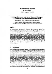
The JIAP 2016 Conference has given the opportunity to the ArcheoSITAR Project workgroup to illustrate to French and European Colleagues the plans for the new ongoing season of methodological and technological enhancement of the SITAR web collaborative platform (in brief, the SITAR), starting from results achieved during the first eight years of implementation path (Serlorenzi & al 2015). Metaphorically similar to bricks giving form both to structures and architectural appearance of the Institut d’Art et d’Archéologie in Paris (the JIAP 2016 Conference beautiful venue), packs of metadata, information and documents assembled through the SITAR informational and technological architecture, constitute a new semantical structure and digital appearance of the complex archaeological knowledge of Rome and its metropolitan territory. It is a very rich informational heritage that, since the 2008, the Special Superintendence for the Colosseum and the Central Archaeological Area of Rome (SSCol) is integrating, re-organizing, publishing, interpolating and disseminating to build, indeed, a solid, innovative and dynamic cultural architecture for both local and global community of the Public Archaeology, throughout the SITAR platform (http://archeositarproject.it/), as soon as possible available also for other languages’ users (fig.1).
© 2017 ISTE OpenScience – Published by ISTE Ltd. London, UK – openscience.fr
Page | 2
Figure F 1. Th he ArcheoSITAR Project web porttal (credit: MiBACT M - SS SCol - ArchheoSITAR Project, P 2016)
Allso the sam me title of this t paper recalls r the transition process th he SITAR iis currently y involved in, to widely extend scopes off this pilot initiative of Italian Ministry for Culturral Heritag ge and Touurism BACT), annd to movve from th he former implemen ntation mo odel towarrds: I) an n advancedd and (MiB particcipatory kknowledge organizatiion system m for Rom me and II) new apprroaches to o archaeoloogical know wledge mannagement, Public and d Commun ity Archaeeology (Ricchardson & Almansa--Sánchez 2015), 2 Cultu ural Comm mons (Canntone, Mottta & Maarrelli 2014 4), Open and Citizeen Sciencee, and Cuultural Diversity (Pozzzo & Virgilli 2016), Digital D Sociial Innovattion (Bellin ni & al. 20 16 : 3-7), and a Responnsible t sense, the formeer scope off the projecct can Research and Innovation (Rome Deeclaration 2014). In this be traanslated inn the first part p of the paper titlee, Linking Spatial-Tem S mporal Po ints, and in n the meanntime, the laatter can bee identifiedd with the middle m part rt of it, Con nnecting Human H and Digital No odes. Within W the Italian Public P Arcchaeology domain, the Arch heoSITAR Project implementation frameework aim ms to repressent a paradigmatic eexperience to realize an innovattive bridgee to intercoonnect thosee two theooretical, meethodologiical and teechnological fields, by b giving access to all users to an archaaeological knowledgee progressiively re-orgganized an nd collaboratively upddated, and to supportt them in deeveloping nnew, persoonalized ap pproaches to complex interrelaationships bbetween past, presennt and next future of thhe urban annd territoriial social ennvironmen nt. 1. Th he ArcheoSITAR pro oject fram mework, at a glance:: from the concept tto first res sults
Th he concept of the projject refers primarily tto: – bottom-up b approach:: the projecct is an innitiative enttirely prom moted, selff-funded an nd implem mented in-hou use by the S SSCol, acccording to its i role of tterritorial institute i off the MiBA ACT and acccountabiliity for the cen nsus, proteection, studdy and pro omotion off the archaeeological heritage h off Rome, an nd disseminnation of the relevant innformational heritage;
© 2017 7 ISTE OpenScie ence – Publishe ed by ISTE Ltd. London, UK – o openscience.fr
Pag ge | 3
– sustainabil s lity: since the beginn ning, SSCool has ann nually gran nted to its project in nternal finaancial resourrces, to deeal with continuous c technologgical development, and a data collation and a elaborration activities; – open o knowledge: the project aim ms to addreess some critical need ds, particullarly: I) thee SSCol arrchive data digitization and system matization, II) the reealization of o the first Digital Arrchaeologiical Cadastre of Rome metropolittan territorry, and III) the dissem mination off archaeological know wledge via a web plattform, nt users an easy and ubiquitous u access to iit; to gran – cooperatio c n and coollaboration: any innnovation effort hass been orriented to create a new collabo orative plaace for botth scientific and citizzen commu unity, everr paying atttention to users’ diff fferent inform mational needs and to individuall vs cooperrative appro oaches to knowledge k creation and sharingg. Th he SITAR platform is i being im mplementedd also con nsidering so ome intereesting last years’ trennds in userss’ accessinng on-line georeferen nced data aand knowlledge (See & al. 20116). Some of these trends t have still to be better observed in th he archaeollogical dom main, to un nderstand aactual users’ informational hose digitaal cultural resources, as it has bbeen underrtaken for some needss and habiits as prosuumers of th adjaccent researcch domainns, e.g. thro ough analyysis of culttural types in Smart C Cities paraadigm (Canntone, Motta & Marreelli 2014), big data in n social meedia-based d learning environmen e nts (Mancaa, Caviglioone & Raffaaghelli 20116), and reelationships between Authoritative and Volunteered V d Geograp phic Inform mation for sp patial plannning (Masssa & Cam mpagna 20116). An earrly idea off these phennomena is offered allso by popu ular web annalytics iff focused on o some bbasic topic searches regarding Digital Cu ultural Herritage (DCH H) themes (fig.2, 3).
Figu ure 2. A scrreenshot fro om Google Trends com mparing, forr all the Worrld, some toopic searche es regarding g CH domain, be etween 1/1/2 /2008 and 30/06/2016, the time co orresponding g to the ArccheoSITAR Project firsst implemen ntation perio od (credit: G Google Tren nds, 2016; Authors’ A elaaboration)
Th he realizattion of thhe SITAR has beenn entrusted to the internal w workgroup p composeed by archaaeologists, both SSCool officers and professsionals, GIS G expertss, archivistss and inforrmaticians.. Two are th he main taask areas thhe workgro oup is dealling with: I) design, developmeent and intteroperabillity of the SITAR S connceptual annd data mo odel, alongg with the implementation andd optimization of the logic and applicative a e architectuure; netwo orking andd dedicated d digital in nfrastructur ure; projectt dissemination; projeect fundingg and goverrnance; and II) data ccollation, digitization d n and re-orrganization n within thee web platfo orm, startinng from sccientific and d administtrative arch hives of SS SCol and soome other public p archhives’ resou urces relevaant to the archaeolog a y of Romee. © 2017 7 ISTE OpenScie ence – Publishe ed by ISTE Ltd. London, UK – o openscience.fr
Pag ge | 4
Figure F 3. A screensho ot from Goog gle Trends comparing, for Italy an nd its regionns, some top pic searche es rega arding CH d domain, betw ween 1/1/20 008 and 30//06/2016 (c credit: Goog gle Trends, 22016; Autho ors’ elabora ation)
Ab bout the foormer task area, one of the corre results is represented by thee SITAR model m deveeloped upon n some funndamental classes an nd semantiical relatio onships (Seerlorenzi & De Tom mmasi 2011), as schem matized in figure 4. This T modeel, continuoously evolv ving, is quite smart, eenough rob bust and fuurther exten nsible to hhost spatiallized data regarding archaeolog gical and administrat a ative metad data, and digital d documents relaated to them m, and it is based on ttop of the following primary cooncepts and d corresponnding classes:
© 2017 7 ISTE OpenScie ence – Publishe ed by ISTE Ltd. London, UK – o openscience.fr
Pag ge | 5
– Information I n Source class: c scien ntific, methhodologicaal, administtrative andd temporal data relevaant to each archaeologi a ical researrch, preven ntive archaaeology inttervention, geophysiccal and geo ological suurvey, territorrial study, monographh research on a singlee monument, restorattion interveention, and d similar; – Archaeolog A gical Partiition class: the scienttific description of eaach archaeeological sttructural finnding and sttratigraphicc macro-evvidence, allways idenntified by the binom mial of chroonologicall and functional criteriaa, even if ooften very fragmentar f ry in terms of their sp patial and descriptive d extent; – Analytical A Partition class: th he scientiffic descrip ption of primary ffunctional parts of each archaeeological m monument or o complex x, always iddentified by b the binomial of chrronologicaal and functional criteriaa; – Archaeolog A gical Unitt class: th he digital representaation - or in other terms l’in nstaurationn, by paraph hrasing thee thought of Landivaar & al. (22015) - off each arch haeologicaal monumeent or com mplex, conven ntionally identified through the logicaal compossition of many fraggmentary Archaeoloogical Partitio ons and/orr describedd through its own A Analytical Partitions that, in thhis sense, characteriz c ze the same Archaeolog A gical Unit as a a topogrraphic indiividual and d unique orriginal archhaeologicall context; – Protection P Decree claass: legal acts a issued in last 110 0 years by the t State, aaccording to t differentt laws and prractices, to punctuallyy preserve monument m ts, complex xes and porrtions of teerritory and d landscapee; – Stratigraph S hic Unit class: c desccriptions oof well-kn nown docu umentationn entities related r to each archaeeological exxcavation and/or a buillding analyysis; – Digital D Obj bject class: digital do ocuments (aas file/URI, plus mettadata, pluus a use liccense) regaarding one orr many SIT TAR inform mational en ntities; – User U class:: users regiistered in the t web plaatform and d provided with differ erent roles and a data edditing permisssions.
Fig gure 4. The e SITAR conceptual an nd data mod del (credit: MiBACT M - SSCol S - Arch cheoSITAR Project, 2016)
© 2017 7 ISTE OpenScie ence – Publishe ed by ISTE Ltd. London, UK – o openscience.fr
Pag ge | 6
Figure 5. The spattial and tem mporal coverrage of the ArcheoSITA AR Project territorial da ata bank (cre edit: MiBAC CT - SSCol - ArcheoSIT TAR Projecct, 2016; Go oogle Map, 2016, 2 for thhe bottom lo ocalization box) b
Ab bout the seecond task area of thee SITAR w workgroup, the digitization andd data entry y activitiess have been continuouusly carriedd out durin ng the firstt eight yearrs of project and theyy are curreently continuing b day. Att present, thhe growth of the SIT TAR data bank b can be b estimateed as abou ut 10 Gb off new day by data and docum ments for month, m furtthermore juust referrin ng to the so ole internaal pool of 10 1 archaeoologist SITAR offfers to ussers a richh data ban nk that caan be operaators. Connsequently,, as of today, the S summ marized as follows (fi fig.6): – the t spatial coverage correspond ds to the m most part of o the Citiees of Romee and Fium micino (witth the primarry airport aarea, near and within n which thhe remains of ancientt roman haarbours aree localizedd); the total interested i m than 1500 1 squaare kilometers, with an amounnt of 5500 0 kilometeers of area is more contem mporary rooad networrk and abo out 61% ((in 2006; data d still to t be officcially updaated) of noot yet urbaniized areas, just to citee some of most m relevaant infrastrructural feaatures; – the t temporral coveragge refers, on o the one hand, to th he chronollogical exttent of arch haeological data availab ble within SSCol arcchives and spanning ffrom Paleo olithic to co ontemporaary age; on n the other hand, it corrresponds too the temporal extentt of indexeed archaeo ological ressearches annd interven ntions, currrently spanniing betweeen 1860 andd 2016; – features f allready mappped: the SITAR S geoodatabase, growing day by daay, contains about: 14.000 archaeeological fe features, 4.500 record ds of interrventions and a 40.000 0 related ddocuments with metaadata, meanw while otherr 100.000 digital obj bjects are bbeing prog gressively processed;; along wiith those leegacy data, the Cadastrre of Archeeological Units U is groowing up and a some thousands t of descripttive recordds and archaeeological reeconstructiive plans of monumennts and sites are expeected to bee published d in next months m throug gh the webb platform;; furthermo ore, the SIITAR data bank conttains also about 730 0 protectionn acts issued as regarrds the hiistorical center c andd the mettropolitan territory of Rome,, with rellevant administrative doocuments.
© 2017 7 ISTE OpenScie ence – Publishe ed by ISTE Ltd. London, UK – o openscience.fr
Pag ge | 7
Figure 6. The e ArcheoSITAR Projecct implemen ntation path between 22008 and 20 016 BACT - SSC Col - Archeo oSITAR Pro oject, 2016)) (credit: MiB
2. To owards the e first dec cade of Arc cheoSITA AR Project: the imple ementatio on path
Th he implemeentation paath and priimary outccomes of th he project can be reccalled throu ugh the figgure 5 and its fundameental steps have been n the follow wing: – 2008 2 - halff of 2009: establishm e ent of bothh the system m design workgroup w and the SIITAR Dataa Lab, the lattter dedicatted to archiive documeents selectiion and dig gitization; design d andd tuning of the SITAR R data model; beginningg of data enntry activitties to popuulate both the geodatabase and the file sysstem; 2 releaase of botth the firstt archaeoloogical web bGIS and the SITAR R Archeolo ogical Herritage – 2010: Protecction web m map; the first fi annuall SITAR Coonference (Rome, Occtober 201 0) illustratted the firsst two years of o project iimplementation, to pu ublic organnizations, researchers r s, academiccs and finaal users; – 2011 2 - 2012: more visibility, accessibility and perforrmance of the SITAR R platform achieved by b the dedicaated, high pperformancce and opttical fiber-bbased conn nection to the GARR R-X, the Naational Ressearch and Educationn Netwoork (NRE EN) maanaged in n Italy by thee Conso ortium GARR G nd annual SITAR Conference C (Rome, N November 2011) gavve the (http:///www.garrr.it/b/eng/);; the secon audien nce an updaated about the third year y of projject implem mentation; – 2013: 2 the tthird annuaal SITAR Conference (Rome, in i May) offficially lau aunched thee SITAR on o the Italian n NREN, alllowing thee enhancem ment of thee primary scope s of th he project, Linking Sp patial-Temp mporal Pointss, in view oof a new annd actual in nteroperabiility with other o publicc informatiive systemss; – 2014: 2 the A ArcheoSITAR Projecct joined ID DEM, the Italian instiitutional feederation su upporting users’ u digitall identity ffor researcch, academ mic and edducational sectors (h http://www w.idem.garrr.it/); the SSCol S Identitty Provideer activatedd in view of the fedderation off SITAR web w appliccations am mong the IDEM I resourrces; – 2014 2 - 2015: releaseed the firsst SITAR Digital Arrchive and d the web portal; the fourth annual a SITAR R Conferennce (Romee, October 2015), enttitled Thin nking in Neetwork, Thhinking of the t Networrk for Researrch, Safeguuard and Promotion P of the Cuultural Herritage (Rom me, Octobeer 2015), actually a booosted the prroject towaards its addvanced sccope in thhe Italian Public P Arcchaeology,, Connecting Humann and Digita al Nodes; iimproved digital inffrastructuree, with geeodatabase,, web appplications and a file syystem © 2017 7 ISTE OpenScie ence – Publishe ed by ISTE Ltd. London, UK – o openscience.fr
Pag ge | 8
moved to virtual servers onto the NREN, to make SITAR web tools more performing and accessible, and data better safeguarded; – first half of 2016: conceptual mapping undertaken between SITAR model and the well-known CIDOC-CRM conceptual framework (http://new.cidoc-crm.org/), within the context of the European ARIADNE Project, as reported below; it started the development of the new web Archaeological Information System (webAIS) (Serlorenzi & al. 2015) and the Digital Library, as an evolution of the Digital Archive, both expected to be fully accessible at the end of 2016, also through IDEM federation. On the background of this rather long path, it can be noticed the reference to two important initiatives in which the SITAR workgroup has participated: I) between 2007 and 2010, works of two MiBACT Committees that set out the basic guidelines for a National Archaeological Information System (Serlorenzi & al 2015 : 18); II) from 2013 up today, the ARIADNE Project, being almost completed, within which a research consortium of many European cultural institutions (MiBACT included), research bodies, academies and companies, has intensively worked to implement the first Advanced Research Infrastructure for Archaeological Database Networking in Europe (Niccolucci 2014). 3. Between human and technological interoperability
To better perform its tasks, the SITAR workgroup is constantly involved in promoting and developing relationships with other équipes of Cultural Heritage, ICT, urban and territorial planning sectors, specifically about the interoperability between archaeological and historical information systems, both European and national. This institutional and research & development network has given birth up today to some specific cooperation initiatives, respectively with: – the Italian National Research Council, specifically the Department of Social Sciences, Humanities and Cultural Heritage (http://www.dsu.cnr.it/), to carry out the digitization of the archive of the National Museum of the Early Middle Age in Rome, and to publish it also through the Science and Technology Digital Library (http://stdl.cnr.it/), a web platform the CNR is implementing for Open Science and Open Knowledge promotion, on the benefit of many cultural and research organizations, and final users; – the Consortium GARR to enhance the digital infrastructure supporting the SITAR platform and to integrate SITAR web tools with other IDEM federated resources; – the Central Institute for Unified Catalogue and Libraries (ICCU) of the MiBACT, within the Italian workgroup participating in the mentioned ARIADNE Project, in order I) to supply the European research consortium with some archaeological open dataset and, in the same direction, II) to conceptually map - with the support of the Department of Computer Science of the University of Verona - the SITAR model, the CIDOC-CRM framework and its recent specification CRM-Archaeo (http://new.cidoc-crm.org/crmarchaeo/), the latter dedicated to the formalization of archaeological excavation data and information; technical documents and first test datasets in RDF format are going to be published on the SITAR web portal; – the Department of Humanities, History and Archaeology, and the same one of Computer Science of the University of Verona, to develop a new common databank open schema that could be suitable for all Italian cities and regions, and their archaeological heritage, starting from the SITAR model transposed into a new semantical specification, according to the GeoUML formalization standard; similarly to the mapping SITAR - CIDOC-CRM, the relevant technical documents are going to be published on the SITAR web portal; – the State Central Archive of Rome to completely digitize the so-called Archive Gatti, containing a rich amount of data produced and collected, during a long time of archaeological excavations in Rome (end of XIX century - 1930s), by Giuseppe, Edoardo e Guglielmo Gatti, as archaeologist officers in charge of documenting and safeguarding the huge archaeological heritage emerging in those decades © 2017 ISTE OpenScience – Published by ISTE Ltd. London, UK – openscience.fr
Page | 9
due to City rapid evolutions, also on the benefit of the completion of the archaeological map of Rome (Serlorenzi & al. 2015). Other institutional cooperation initiatives are going on to enrich the informational heritage progressively re-integrated, published and made accessible through the SITAR, such as official interchange of OGC-compliant web services. This is the recent case regarding WMS of the SIG of Rome in the XVIII century, based upon the well-known map La Nuova Topografia di Roma printed in 1748 by Giambattista Nolli, and analyzed, digitized and transposed into a webGIS by the CROMA research center of the University of Roma Tre (Lelo & Travaglini 2013). Vice versa, the CROMA SIG platform is going to publish all primary SITAR WMS, in the sign of a real interoperability both between projects’ team and systems. 4. Ideas and development plans for the new season of the ArcheoSITAR Project
Reflecting on the next future of the project and recalling the real sense of Connecting Human and Digital Nodes, it is enough clear that ongoing innovation efforts should be focused on contributing to build new roads to better connect Public Archaeology, Cultural Commons, Open and Citizen Science, Cultural Diversity and Digital Social Innovation, that one could represent in a community ideal map as some adjacent, not yet fully communicating urban squares. These new social places, among many others within which the Social Innovation is expressing itself (Bellini et al. 2016; Pozzo & Virgili 2016), could be effectively interconnected also through archaeological knowledge domain, furthermore representing a boulevard directly/indirectly linking these social squares, on the one hand, and research & development initiatives, being the latter similar to urban city blocks of this ideal scenario. The ArcheoSITAR Project is moving towards the actual completion of its public collaborative platform, enhancing some cooperative procedures already implemented and integrating some new ones, specifically oriented to crowdsourcing and prosuming of new data and knowledge by users. In this sense, it results fundamental to issue, share and continuously optimize some methodological tools to support users in their different access, use end enrichment of the SITAR, starting from the first SITAR Guidelines recently issued to improve production, collation and transferring of new field research data into the SITAR data bank. Following this approach, the workgroup is preparing also guidelines for user-created resources uploading, sharing and disseminating through SITAR platform, including specific open licenses, as soon as possible available also in multilingual version. The extension of the conceptual and data model represents an important task within this new ongoing season of innovation, to better address completeness and openness in data collation and dissemination, and, as soon as possible, also peer-reviewing processes of them. The new following classes have been dedicated to the systematization, sharing, publishing and updating of new usercreated digital resources (fig.7): – collection class allows all users logged-in the platform to I) make multiple upload of digital resources and metadata referenced to one or many official informative entities, and II) freely share them with other users, ever maintaining those resources well distinguished from official ones, on the benefit of both the SSCol and final users; – event class allows all logged-in users to describe different kinds of events of archaeological interest, such as an entire research work and its progress, or programs and resources of conferences, and so on, ever by uploading public on-line and/or user’ own local resources; both collections and events may recall other collections and events, with the aim to create supplementary metadata and semantical extension of knowledge regarding each archaeological context described and shared; – user pool class allows all logged-in users to create and manage different users’ groups, acting and discussing around one or many SITAR informational entities and/or related user-created resources, © 2017 ISTE OpenScience – Published by ISTE Ltd. London, UK – openscience.fr
Page | 10
identiffication annd description of mo onuments aand compleexes, archaeological events, orr single arrchive docum ments.
Fig gure 7. The e crowdsourrcing-orientted SITAR extended e co onceptual aand data mo odel (credit: MiB BACT - SSC Col - Archeo oSITAR Pro oject, 2016))
An nother veryy importannt innovatio on effort reegards the optimizatiion of the w web appliccation dediicated both to data editing annd dissemination. E Ever keepiing in mind the usser-centereed approacch of heoSITAR Project, thhe system design d worrkgroup is dealing with ergonom mics and usability u of user Arch interffaces, startting from the webA AIS (http://w webais.arccheositarpro oject.it/). W Within thaat applicatiion, a new technologgical paraddigm based d on GeooServer, Jaava Spring g and Opeen Layers, and on some w offer to users a new and d more friiendly inspirations to most poppular web mapping pplatform, will s edit and recom mbine SITA AR data, up pon differeent public base b map layers l envirronment too explore, share, (fig.8 8). Other ppromising features f arre those onnes orienteed to the co ooperative creation of o new datta and know wledge, uppon the offficial SITA AR data bbank, such h as the Archaeolog A gical Unit hypothesiis 2.0 proceedure, alreeady impleemented in n 2013 andd now bein ng improveed to allow w all loggeed-in userss to I) cooperate in m mapping and a identiffying new w Archaeological Un nits, startiing from official SIITAR haeologicall Partitions, and II) crreate new ppersonalizeed hypotheesis of the original ex xtension off each Arch archaaeological context. In I this sen nse, the neew webAIIS is orien nted to noot be simp ply «un énnième “supp port” d’infformation et de com mmunicatioon», but raather «un “matériau” “ ” nouveau […] ayannt une “poteentialité” […] créaative totalle […], un “dispo ositif de désignatioon” […], un disppositif d’insstauration»», by paraaphrasing above-menntioned th hought of Landivar & al. (2015) abouut the impliications in trying to «cartograph « hier l’ontollogie d’un territoire sur le web»».
© 2017 7 ISTE OpenScie ence – Publishe ed by ISTE Ltd. London, UK – o openscience.fr
Pag ge | 11
Figure 8. The currentt webAIS us ser interface e and the evolving e new w one, with the triple way w to log-in (credit: MiB BACT - SSC Col - Archeo oSITAR Pro oject, 2016))
Sim milar enhaancements are interestting the othher web ap pplication, such as: – the t Stratigrraphic Uniit module (http://moddus.archeossitarprojectt.it/); – the t Archaeeological Heritage H Prrotection ennvironmen nt (http://webais.archeeositarproject.it/tutelaa/), to manag ge and publlish protecttion acts an nd relevantt dataset; – the t Digitall Library, based on the Apachhe Jackrabb bit framew work and ssupplied bo oth with tyypical functio ons of uplload/downnload, editiing data/m metadata, liicensing and a digital rights maanagementt, and similarr, and moree advancedd tagging and a cooperaative tools; – the t Knowlledge Mannagement System S moodule, for engaging publics iin new diigital resouurces, collecttions and events creeation, and d to allow users to access a arch haeologicall knowledge re-orgaanized within n the SITA AR platform m, share it and perssonally elaaborate new w knowleddge packs upon it, on o the benefit of the enttire, growinng SITAR communitty. 5. Co ooperative e vs collab borative approache es in SITAR R
Ab bout know wledge creaation and sh haring, a ddouble paraadigm is un nderpinninng the SITA AR conceppt: the cooperative appproach andd the colla aborative attitude. By B paraphrrasing to tthe incisive definitioons of t the cooperative andd collaboraative interaactive learnning offereed by Panitz (1999), we may reefer them to ble scopes ccharacterizzing our pro oject: I) to implemen nt the Digittal Archaeoological Caadastre of Rome R doub and maintain m it through a really coo operative ennvironmen nt; II) to deevelop the SITAR pu ublic platfoorm as a new w social place withinn which users u cannoot only shaare, dissem minate and enhance knowledge k e, but, above all, theyy have to be b supported in deveeloping thaat collaborrative persoonal attitu ude, indeedd, that onal lifestyyle where individualls are Panittz clearly defined ass «a philossophy of iinteraction and perso respo onsible forr their actiions, inclu uding learnning and reespect the abilities aand contrib butions off their peerss». In otherr words: thhe building g of a longg-term com mmon memo ory, on thee benefit off archaeoloogical know wledge trannsmission, can be dirrected by ppublic culttural organ nizations, bbut it shoulld be constantly based d on open and coopeerative apprroaches; m meanwhile, the collab borative atttitude has to t be stimuulated in ussers to hellp them inn improvin ng a personnalized rellationship to both acccess, and d individuaal and collective elabooration of knowledgee, within thheir own «interpretat « tive or knoowledge co ommunities», to he words oof Brufee, cited c by Paanitz himseelf. use th © 2017 7 ISTE OpenScie ence – Publishe ed by ISTE Ltd. London, UK – o openscience.fr
Pag ge | 12
Open conclusions
Considering all mentioned conceptual references and innovation topics of the ArcheoSITAR Project, the idea is to develop in next times a more extended and performing collaborative system, possibly within the framework of Collective Awareness Platform for Sustainability and Social Innovation (Bellini et al. 2016), about which the European Community has recently launched a new specific call. Specifically, next efforts will be focused on implementing a first geo-CAPS for Public Archeology, hoping to possibly share its realization path within new possible institutional partnerships. Regarding all these themes, the ArcheoSITAR workgroup is continuing to expand these perspectives of research and development, willing to contribute, also through the archaeological discipline, to Responsible Research and Social Innovation processes going on in Rome and in Italy. Acknowledgments
The Authors are very grateful to the Organizational and Scientific Committees of JIAP 2016, for the opportunity given to the ArcheoSITAR workgroup to share and disseminate this MiBACT - SSCol project at another important European Conference and, then, through the relevant Proceedings. References (for all references the last access is 21 October 2016) Bellini, F., Passani, A., Klitsi, M., Vanobberghen, W. (eds.) 2016. Exploring impacts of Collective Awareness Platforms for Sustainability and Social Innovation. Roma, Eurokleis Press. https://www.researchgate.net/publication/305767069 Cantone, F., Motta, E., Marrelli, M. 2014. «The smart city as an evolutionary network promoting cultural commons: the Or.C.He.S.T.R.A. project and Naples antique center case study», Archeologia e Calcolatori, 25: 207-222. http://soi.cnr.it/archcalc/indice/PDF25/11_Cantone_et_al.pdf Landivar, D., Monnin, A., Ramillien, E. 2015. «Cartographier l’ontologie d’un territoire sur le web», Netcom Networks and Communication Studies 29-3/4 - 2015 : 297-324. http://netcom.revues.org/2104/ Lelo, K., Travaglini, C.M. 2013. «Rome in the 18th century: a GIS application in the field of urban history», Historická Geografie, 39 (2) : 33-53. https://www.researchgate.net/publication/259399379 Massa, P., Campagna, M. 2016. «Integrating Authoritative and Volunteered Geographic Information for spatial planning», in : Capineri, C., Haklay, M., Huang, H., Antoniou, V., Kettunen, J., Ostermann, F., Purves, R. (eds.), European Handbook of Crowdsourced Geographic Information. London: Ubiquity Press : 401-418. DOI: http://dx.doi.org/10.5334/bax.ac Manca, S., Caviglione, L., Raffaghelli, J.E. 2016. «Big data for social media learning analytics: potentials and challenges», Journal of e-Learning and Knowledge Society, 12, 2 : 27-39. https://www.researchgate.net/publication/303494674 Niccolucci, F. (ed.) 2014. ARIADNE. The Way Forward to Digital Archaeology in Europe. Firenze, ARIADNE Research Consortium. http://www.ariadne-infrastructure.eu/Media/Files/Ariadne-Booklet-The-Way-Forward-to-DigitalArchaeology-in-Europe Panitz., T. 1999. «Collaborative versus Cooperative Learning: A Comparison of the Two Concepts Which Will Help Us Understand the Underlying Nature of Interactive Learning», [on-line opinion paper] ERIC Institute of Educational Science - eric.ed.gov. http://eric.ed.gov/?id=ED448443 Pozzo, R., Virgili, V. 2016. «Governing Cultural Diversity. Common goods, shared experiences, spaces for exchange», Economia della Cultura, 1/2016 : 41-48. DOI: 10.1446/84035 Richardson, L.J., Almansa-Sánchez, J. 2015. «Do you even know what public archaeology is? Trends, theory, practice, ethics», World Archaeology, 47-2 : 194-211. DOI: 10.1080/00438243.2015.1017599 Rome Declaration on Responsible Research and Innovation in Europe, 21 November 2014. Document published within the Conference “Science, Innovation and Society: achieving Responsible Research and Innovation”, Rome, 19-21 November 2014. https://ec.europa.eu/digital-single-market/en/news/rome-declaration-responsible-research-andinnovation-europe © 2017 ISTE OpenScience – Published by ISTE Ltd. London, UK – openscience.fr
Page | 13
See, L., Mooney, P., Foody, G., Bastin, L., Comber, A., Estima, J., Fritz, S., Kerle, N., Jiang, B., Laakso, M., Liu, H.Y., Milčinski, G., Nikšič, M., Painho, M., Pődör, A., Olteanu‐Raimond, A.M., Rutzinger, M. 2016. «Crowdsourcing, Citizen Science or Volunteered Geographic Information? The Current State of Crowdsourced Geographic Information», ISPRS International Journal of Geo‐Information, 2016, 5 (5). DOI: 10.3390/ijgi5050055 Serlorenzi, M., De Tommasi, A. 2011. «SITAR - Sistema Informativo Territoriale Archeologico di Roma. A repository of archaeological data for conservation of cultural heritage and town planning», in : Börner, W., Uhlirz, S. (eds.), 15th International Conference on Cultural Heritage and New Technologies, 15-17 November, 2010. Proceedings. Wien, Museen der Stadt Wien Stadtarchäologie: 272-282. http://www.chnt.at/wpcontent/uploads/eBook_WS15_Part3_Sessions1.pdf Serlorenzi, M., Jovine, I., Leoni, G., De Tommasi, A., Varavallo, A. 2015. «A retrospective on GIS and AIS platforms for Public Archaeology in Italy. Searching backward for roots and looking onwards for new methodological road-maps», in : Giligny, F., Djindjian, F., Costa, L., Moscati, P. e Robert, S. (eds.), CAA2014. 21st Century Archaeology. Concepts, methods and tools. Proceedings of the 42nd Annual Conference on Computer Applications and Quantitative Methods in Archaeology, Paris, 22-25 April 2014. Oxford, Archeopress : 17-28. http://archaeopress.com/ArchaeopressShop/Public/download.asp?id={5CACE285-4C48-41AE-809EE98B65C9E4CD}
© 2017 ISTE OpenScience – Published by ISTE Ltd. London, UK – openscience.fr
Page | 14