Forest vegetation of Vindhyan range located in the north of G.B. Pant Sagar (dam) has been subjected to ... and Sidhi district and towards north from. G.B. Pant ...
Photonirvachak Journal of the Indian Society of Remote Sensing, Vol. 20, No. 1, 1992
Mapping of Tropical Dry Deciduous Forest and Landuse in Part of Vindhyan Range Using Satellite Remote Sensing D N PANT, K K DAS and P S ROY Indian Institute of Remote Sensing, Dehra Dun - 248 001
ABSTRACT Forest vegetation of Vindhyan range located in the north of G.B. Pant Sagar (dam) has been subjected to degradation due to high biotic pressure caused by the installation of thermal power plants, coal mining, heavy earle grazing etc. In the present study Landsat TM FCC of 1:250,000 scale was visually analysed with respect to forest vegetation types, crown density and structure along with other landuse/land cover classes. Except Shorea robusta (Sal) and Lagerstroemia parviflora (Lendia) all forest vegetation types show higher percentage of degradation and under-stocked condition with re.speet to their areal extent under study. Overall classification accuracy of the forest types has been found to be 88.94%. This indicates that for obtaining reliable mapping accuracy in dry deciduous areas, satellite remote sensing data of appropriate season is essential.
Introduction
Tropical deciduous forests play a key role in Indian environment as they occupy maximum proportion of the total forest area (Champion & Seth, 1986). These forests have been degraded heavily during the past few decades because of increasing population pressure. The effect is felt more as growth of these forests is slow and regeneration is poor. Information with respect to these forests, their type, quality and distribution, is of prime need for adopting conservation measures, eco-balance and plan(Reed. 22 June '91; in fmal form 28 March '92)
ning-cum-management aspect. Forest vegetation of Vindhyan range located in the north of G.B. Pant Sagar has been subjected to heavy degradation due to high biotic pressure. Number of studies have been conducted with respect to the mapping of wet, moist and semi-moist condition of forest vegetation in different parts of our country using Landsat data (Roy et al., 1985; Unni, 1983; Pant & Roy, 1990). Experiences in mapping of tropical dry deciduous forests have also been gained using digital analysis
10
D.N. Pant, K.K. Das and P.$. Roy
technique of remote sensing data (Tiwari, 1990; Jha, 1990). Dry deciduous forest vegetation of tropical, semi-arid and arid zones has unique phenological, structural and site characteristics. The continuous change in phenology of plant community bring about a unique spectral characteristics. Remotely sensed data in the form of different colours and tones do notrespond/ exhibit the density and type of forest vegetation in its correct form because of the exposure of dry bare soils and rock outcrops amidst deciduous vegetation. But, when the data of correct season is interpreted after intensive ground observations with respect to the assessment of site quality for each forest vegetation type, remote sensing technology provides results under acceptable limits of accuracy. The present study area falls under the tropical dry deciduous forest belt. It has been observed that intensive mining activities, cattle grazing, thermal power plants and their flying ash pollution have brought most of the forest cover under different stages of degradation. The study highlights the utility of space remote sensing technique in obtaining spatial information of tropical deciduous forest vegetation with respect to type, density, species composition alongwith other land use practices responsible for its degradation through visual interpretation of 1:250,000 scale Landsat TM false colour composite.
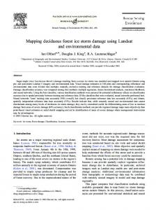
Study Area Area lies in between the geo-coordinates 2406 ' N to 24029 ' N and 82~ ' E to 83" 1' E and located in parts of Sonbhadra and Sidhi district and towards north from G.B. Pant Sagar (Fig. 1). It is fully covered by Anpara range of Renukoot Forest Division and partly by Pipri and Obra ranges of Renukoot and Obra Forest Division. Li-
thology of the area is described under Vindhyan sandstone and granite with gravelly soil of reddish colour. The average annual maximum and minimum temperature for the district as a whole are 37~ and 20~ respectively. The climate prevailing in the area can be divided into three distinct seasons viz., dry summer (March/ April to June), rainy season (July to September) and winter season (October to February/March). The average annual rainfall is about I000 ram. The overall climatic condition of the area is tropical to semi-arid. Material and Methods Landsat TM (Path-row: 142-043 dated 28.11.85) false colour composite (FCC; bands 2, 3, 4) scene on a scale of 1: 250,000 was used as basic data for the preparation of forest vegetation map of study area. Winter season data has been used since almost all the forest vegetation types of study area are in full foliage condition. Since the terrain is not rugged, effect of hill shadow is not severe. Before carrying out the detailed visual interpretation work, ground truth was collected for each of the forest types and landuse classes for the purpose of determining criteria for their identification on the imagery and the preparation of interpretation key (Table t). Identification and delineation of all the forest vegetation types and other landuse/land cover features was done following the standard visual interpretation technique (Bowden & Pruitt, 1983). Interpreted details were transferred to a base map (1:250,000) prepared from Survey of India topographical sheet with the help of Kargle Reflecting Projector. Area of each of the mapping unit was calculated on fairly drawn map using digital planimeter. These areal estimates are shown in a tabular form
Mapping of Tropical Dry Deciduous Forest ....
11
Fig. 1 cL )
,,.
r
LOCATION
,"'~
..,_f
~t
INDIA
/. "~.
J J'"~..~..1
~ U.P. ""..-, ~...J "~ C"~.. Jr-_
k,
9-J
"~_
MAP
t, ~' r]'---,. :"'
.r
:~ ~"9
r "M. ~./'%
/
'~ ~.".,~
//~',,,,\\/-,v \,
\
/
/
\
~" ..6 f
~.
,~ 'J'"
9
,,J:
("J
.J
."---.~
9
"'t..~
/~' 'l
j ,=
0.~o"
~-'.-..4; DISTRICT
.~,o,, OISTRICT
".~"~ " .,.....~...,~
"
"~ )
9 Mirzapur
. 9
..~....~
-
.j
0"
[
,., . ~ . - ' ~
SID"!
MIRZAPUR
~. ~ ~
~
~
~
~ , . ~[,,.j.
(
~ River
~'-DISTR I CT
SONBHADRAf
"-..-.._..~.:I-i?-"; ISTUDYAREAl
. f
.. r#
12
D.N. Pant, K.K. Das and P.S. Roy Table 1. Identification Criteria of Forest Vegetation/Landuse Categories of Vindhyan Range on 1:250,000 scale Landsat TM Imagery dated 28.11.1985.
Sl. Vegetation No.
Tone
Texture
Pattern/Location
1. Sal >40%
Dark red
Fine & medium Undulating moist areas near streams
2. Salai >40%
Brownish medium red
Medium
Hill tops, ridges spurs, & elevated lands
3. Salai 10%
Brownish light red
Coarse
Poor sites
4. Lendia >40%
Brownish red
Medium & t'me Undulating land, gentle slope near Rihand river and Dam
5. Sal mixed >40%
Dark red
Coarse
Transitional zones
6. Sal mixed 10%
Red
Rough
Transitional zones
7. Khair mixed Hardwickia >40%
Medium maroon
Coarse
Undulating dissected lands
8. Khair mixed Hardwickia 10%
Light maroon
Rough
Sloppy rugged areas
9. Misc. & mixed >40%
Red, dark red
Medium
Mostly on slopes near Rilumd fiver
10. Misc. & mixed 10%
Red, medium red
Coarse
Steep slopes and mostly transitional zones
11. ~ r , ded & Scrub
Light brown & medium maroon
Coarse rough
Poor sites encroaohment by cultivation
Any Other Information
Mostly in dry stiff sandy areas Dry stoney areas near cultivation Occurring gregariously 9 in deep new soils
Gentle slopes eroded al'eas
Highly eroded/ dissected areas
Light brown tone because of shrub other than Tendu, medium dark maroon tone because of the preponderance of Tendu shrub along with black boulders.
Mapping of Tropical Dry Deciduous Forest ....
13
S1. Vegetation No.
Tone
Texture
Pattern~Location
Any Other Information
12. Plantation
Red, light red
Fine
Linear and rectangular pattern
Mostly amidst degraded forest
13. Cultivation
Dull white, light brown
Fine
Mostly in valleys and end points of hills
14. Thermal power Ashy black plants
Smooth
Definite pattern
15. Mining
Black & white
Smooth
Amidst forest area
16. Water bodies
Sky blue
Smooth
Linear & irregular pattern
(Table 2). Methodology is given in a flow chart (Fig. 3). Accuracy of map was computed by ground observations for which 50 points were randomly selected on the interpreted map. The number of sample points determined for each strata on the basis of confidence level of accuracy of interpretation viz., the strata or mapping unit, which was considered 100% correct with respect to its. delineation from rest of the mapping units, was not allotted any sample poiat for accuracy e s t i m a t i o n . Mining areas, thermal power plants and water bodies, which were quite distinct on the basis of their tonal value, fall under this category. The accuracy estimation has been done with 95 % confidence limit (Table 3). Results and Discussion
Fig. 2 represents the forest vegetation analysis and landuse map of the area. The mapping units were identified on Landsat imagery on the basis of their image elements (Table 1) and the ground truth information. The forest types, which have
Black tone because of open coal mining and white tone for the debri on the sides
been analysed and depicted on the map, are described briefly as under on the basis of r e m o t e s e n s i n g data s u p p l e m e n t e d by ground parameters.
Shorea robusta (Sal) Areas where the proportion of Sal is more than 60% have been classified under this category. It occurs gregariously with dense crown cover (density > 4 0 % ) and poorly d e v e l o p e d understorey. The main associates of Sal under this category are Terminalia tomentosa, Diospyros melanoxylon, Buchanania lanjan and Terminalia bellerica. The understorey and groundflora of Sal consists of Woodfordia fruticosa, Carissa opaca, Lantana camera, Halicteres isora etc. The total forest area under this category has been estimated as 19.9 sq. km or 1.22% of total forest area under study.
Shorea robusta (Sal) Mixed This category includes mixed composi-
14
D.N. Pant, K.K. D u and P.S. Roy
FIG. No 3: STEPS FOR FORESTVEGETATIONAND LANDUSE/LAND COVER MAPPING USING REMOTE SENSING TECHNIQUE 't.ANDSAT TM FCC
I
"
,H,OUNTE.D WITH TRACING FIL.H,
1
CoLI.ECTI()N OFANCILLARYI INFORMATIONS
'DELINE"ATION OF FEATURESONTHE BASIS .OFIMAGE ELEMENTS
I
i
i
:TRANSFERENCE OFSTRATIFIED FEATURESON THE BASEMAP PREPARED FROM SOl TOPO SHEETUSINGKARGLREFLECTING PROJECTOR
l
'COLLECTION OF GR.OUNDTRUTHS FROM EACH OF THE STRATIFIED DETAI LES
IDETERMINA ' TION OF'IDENTI"" 1 ]FICATION CRITARIAFOR lEACH MAPPINGUNITANDPRE {PARATIONOFINTERPRETATIONKEY
DETAILEDVISUALINTERPRETATION ~ ONTHE BASISOFGROUNDTRUTH ]NFORMATIONSAND,!,MAGEELEMENTS LDRAWING OFFINALH A P ~ I C GROUND VERIFICATION FOR ACCURACY ESTIMATION RANDOMELY
SELECTED
AREA
I
ALCULATION]
Mapping of Tropical Dry Deciduous Forest ....
15
Table 2. Area of Vegetation Classes and Landuse Mapped using Remote Sensing Data
1.
Forest Land >40%
i)
$al
ii) iu) iv) v)
Sel mixed $alai Lendia Khair mixed Hardwickia Miscellaneous Degraded & Scrub Plantation
vi)
vii) viiii)
10%
1.22 3.70 .2.38 1.48 0.49 5.27 -
2.04 8.40 5.78 6.23
b
T~I
15.54
m
m
~
m
m
21.45
m
m
Total Sq. ion
Percent
19.9
1.22
93.3 175.1 23.9 143.2 186.9 275.6 6.6
5.74 10.78 1.48 8.81 11.50 16.96 0.41
924.5
56.90
m
2.
N o n - F o r ~ t Land
i)
Cultivation & Habitation Mining Thermal Power Plants Water bodice
437.6 30.6 3.2 229.1
26.93 1.88 0.20 14.09
Total
700.S
43.10
ii) iu) iv)
tion of Sal and miscellaneous species, the proportion of miscellaneous species is more than 40%. It constitutes the density classes >40% and 10%. Among the miscellaneous species, the main associates of Sal are
Anogeissus latifolia, Terminalia tomenrosa, Pterocarpus marsupium, Lagerstroemia parviflora, and Terminalia bellerica. The area under this forest has been estimated as 93.3 sq. km or 5.74% of the total forest area under study.
Boswellia serrata (Salai) Salai forests have all the age groups viz., young, middle aged and mature with poor to dense crown cover (density > 10% to 40%) and have gregarious appearance particularly on suitable sites. Areas having a proportion of more than 60% Salai have been categorised under this class. Tree species associated with Salai are
Lannea coromandelica, DiospyrDs melanoxylon, Chloroxylon sweitenia,
16
D.N. Pant, K.K. Das and P.S. Roy
Fia. 2
FOREST V E G E T A T I O N / L A N D
USE M A P OF VINDHYAN A R E A
( BASED ON VISUAL INTERPRATATION OF LANDSAT TM FC C~ SCALE I: 250 sOOO)
K,,,.~
?
p
,mK,,.
24"
240
,
)
2 4.
A
~
J
,
W
~1~'
';~ ""
~'-" 24 a
o3"i,"" L
FORE ST LAND Sol ~ Soloi Lendio
~ ~
Sol mixed
~
Khoir mixedHordwlcklo Miscellaneous
~ ~
E
G
E
N
D
FOREST LAND Oegr~
Densityolasses ' Class .Code Closed forest40% I Open t~ 10%to40% 2 Codification with in the Mapping units Forest type Density class
& Scrub
Plantation NON FOREST LAND Cultivation& Habitation ThermalPowerPlant Mining water bodies
~-~
Mapping of Tropical Dry Deciduous Forest ....
17
Table 3. Accuracy Matrix (%) of Forest Map and Ground Check Classes in the Map
rO
1
2
3
4
5
6
7
8
9
I
I00
0
0
0
0
0
0
0
0
2
0
83.3
0
0
0
0
0
0
16.7
3
0
0
95.5
0
0
4.5
0
0
0
4
0
0
0
100
0
0
0
0
0
5
0
0
0
0
84.3
15.7
0
0
0
6
0
0
19
0
0
81
0
0
0
7
0
0
0
0
0
0
87.5
0
12.5
8
0
0
0
0
10
0
10
80
0
9
0
0
0
0
0
0
11.1
0
88.9
o -S e~ o
.8
1. Sal 2. Salai 3. Lendia 4. Sal mixed 5. Khair mixed Hardwickia 6. Miscellaneotm 7. Degraded & Scrub 8. Plantation 9. Cultivation & Habitation Overall accuracy of classification: 88.94%
Lagerstroemia parviflora etc. The total
Adina cordifolia. The area under this
area under this forest has been estimated as 175.1 sq. km or 10.78% of total forest area under study.
category has been estimated as 23.9 sq. km or 1.48 % of total forest area under study.
Lagerstroemia parviflora (Lendia)
Acacia catechu (Khair) Mixed Hardwickia
This type df forest is limited and confined to the undulating terrain formed by the new moist soils on the N-E Coast of G.B. Pant Sagar. It occurs mostly as dense and gregarious. The main associate of this forest is
Such forests have been subjected to heavy biotic interference with respect to browsing, lopping and polarding because of their better fodder value. Soils derived specially from shale and
18
D.N. Pant, K.K. Das and P.S. Roy
phyllite with clayey texture support such a forest. Area where the proportion of Hardwickia binata and Acacia catechu is more than 60%, have been classified under this category. It constitutes the density classes > 40% and < 40% to > 10%. The main associates of such forest are Diospyros melanoxy-
degradation of native vegetation, and ii) inherent shruby and bushy growth of forest vegetation. The trees are p r e s e n t in less n u m b e r s ( d e n s i t y < 10%) and invariably exhibit bushy g r o w t h . The total area u n d e r this category has been estimated as 275.6 sq. km or 16.96% of the study area.
Ion, Acacia nilotica, Butea monosperma, Anogeissus latifolia, and Lagerstroemia parviflora. The total area
Plantation
under this category has been estimated as 143.2 sq. km or 8.81% of the total forest area under study. Miscellaneous Such type of forests lack exclusive dominance of species and consist of a number of species which are evenly represented and occupy comparatively drier zones than Sal and Sal mixed forests. This category constitutes the density classes > 4 0 % and < 4 0 % to > 10%. I m p o r t a n t species o f this forest type are Anogeissus' latifolia,
Lannea coromandelica, Lagerstroemia parviflora, Diospyros melanoxylon, Terminalia tomentosa, Terminalia bellerica, Boswellia serrata, Shorea robusta and 5)/zygium cuminii. Understorey is well developed by the association of tree species Zizyphus nummu-
laria, Woodfordia fruticosa, Acacia catechu, Helicteres isora, Nyctanthes arbortristis. The total area under this category has been estimated as 186.9 sq. km or 11.50% of total forest area under study. Degraded and Scrub Forests This kind of vegetation cover seems to be due to two reasons: i) e x t r e m e
Many of the plantation patches could not be mapped because of scale constraint. In some cases the pattern of plantation has vanished because of s i m i l a r spectral r e f l e c t a n c e to the s u r r o u n d i n g s and intermixing with natural vegetation. Because of these reasons accuracy percentage of plantation has been assessed as 80%. In addition to the above vegetation t y p e s , the l a n d u s e and land cover classes viz., cultivation and habitation, mining areas, thermal power stations and water bodies have also been identified and mapped on the basis of their typical spectral characteristics mentioned in Table 1. Dry deciduous forest vegetation has been classified and mapped with respect to its broad density classes and structure alongwith the major landuse/land cover categories using visual interpretation technique of small scale (1:500,000) IRS-1A simulated data. Their mapping for integrated land resources survey for potential landuse planning has been used in the study carried out in parts of Rajasthan (Anonymous, 1986). Vegetation classification has been carried out with respect to different forest types under the subgroups of "Tropical Dry Deciduous Forest" and "Tropical
Mapping of Tropical Dry Deciduous Forest ....
Thorn Forest" (Champion & Seth, 1968) in Sariska National Park and surroundings using digital analysis technique of Landsat MSS data (Tewari et al., 1990). The overall classification accuracy had~been estimated in that study as 89.37%. But the study does not include the crown density of forest vegetation which is most essential parameter for the National Park environment. In the present study, analysis and mapping of dry deciduous forest vegetation with respect to its type, density and composition alongwith the important landuse practices, which have a direct impact towards its degradation, provide valuable information for its planning, conservation and management aspects. It has been assessed that the understocked (density