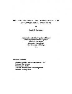
... seaway during Tilje times; the yellow area indicates the Halten Terrace (based on inhouse data; Dorè 1991; Smith et al. 1994). Trondheim. Kristiansund. V E.
Multi-Scale Characterization and Modeling of Heterolithic Tidal Systems, Offshore Mid-Norway Allard W. Martinius Philip S. Ringrose Arve Næss Statoil Research Centre 7005 Trondheim Norway Renjun Wen Geomodeling Research Corp. 30, 840-6th Avenue SW Calgary T2P 3E5 Canada
Abstract The Lower Jurassic Tilje Formation on the Halten Terrace, offshore mid-Norway, forms an important reservoir in a number of hydrocarbon fields. A high volume fraction (80 percent) of the formation is heterolithic in nature, showing various styles of sandstone-mudstone intercalated bedding at several scales. The depositional model is based on a general facies classification scheme applicable to all fields. The stratigraphic interval discussed was deposited in a narrow basin during overall rising relative sea level as a tide/wave-dominated, mud-rich delta with well-developed prodelta, delta-front, and estuarine-type distributarychannel facies. The main heterolithic deposits are found in the prodelta, delta-front, and distal parts of the estuarinetype distributary-channel-mouth areas, whereas relatively “clean” facies occur in medial areas of these distributaries. Lithofacies associations are modeled in 3D using stochastic, object-based methods, and the heterolithic architecture at the lithofacies scale is modeled using a process-based sedimentary architecture tool. Multiple data sources (core, log, and outcrop-analogs) are used to establish a data-rich procedure for estimating the effective reservoir properties within a step-wise upscaling procedure. Our results show the importance of integrating multiscale data with good sedimentary models to accurately estimate reservoir properties in these heterolithic formations. We derive effective property functions (for example kv/kh) for different facies and identify important reservoir flow units using flow simulations of stochastic realizations. GCSSEPM Foundation 19th Annual Research Conference Advanced Reservoir Characterization, December 5–8, 1999
Introduction Tide-dominated reservoir systems have generally received less attention than fluvial and shallow marine siliciclastic systems. Tide-dominated reservoir systems are characteristically heterolithic and very heterogeneous and present several new challenges for reservoir characterization and field development. We have begun to address these challenges in relation to field studies in the Halten Terrace area, offshore mid-Norway. This study focuses on the Tilje Formation of Heidrun field, more specifically on a stratigraphic interval (base Tilje to top Tilje 2), which represents a progradational succession formed during overall sea-level rise and subsequently flooding. The sedimentary facies of the Tilje Formation are classified into 12 lithofacies associations, based on core observations and consistent facies descriptions in 25 wells from 10 hydrocarbon fields on the Halten Terrace. In addition, each lithofacies was characterized by its own unique trace fossil assemblage and ichnofabric. The use of the terms flaser and wavy bedding conforms with Reineck and Wunderlich (1968), Terwindt (1981), and Terwindt and Breusers (1982). The classified sedimentary facies are analyzed in terms of their petrophysical character, using core and wireline data, to reveal their inherently heterogeneous nature. Multi-scale 3D modeling studies are used to transfer this detailed sedimentological and petrophysical characterization into reservoir models that can be used in flow impact studies, and a general approach to reservoir characterization of heterolithic tidal systems is developed. 193
Martinius et al.
Sedimentology of Lower Jurassic Tilje Formation
existed, and data from higher paleolatitudes suggest the existence of climatic intervals typified by cool polar conditions, possibly with some polar ice (Hallam 1994).
Stratigraphic Setting Conceptual Depositional Model The upper Pliensbachian Tilje Formation (Dalland et al. 1988) subcrops in a region known as the Halten Terrace located offshore mid-Norway. The unit occurs in a NNE– SSW-oriented belt approximately 470 km long and 150 km wide (Fig. 1) and exhibits an average thickness of 140 m. The Tilje Formation was formed in a subsection of the narrow N-S-oriented Halten-Trøndelag Basin, which was connected at the time of deposition to both the Boreal Ocean in the north and the Tethys Ocean in the south (Doré 1991). The subsection of the Halten-Trøndelag Basin in which the Tilje Formation was deposited can be characterized as a late-stage pre-rift basin (cf. Nøttvedt et al. 1995) in which subsidence was caused mainly by thermal sagging and sediment compaction and formed during the opening of the mid-Atlantic rift system. The fossil rift underlying the basin formed during the Triassic as part of the proto-Atlantic ocean. The inferred paleolatitude of the Halten Terrace was between 49° and 53° north (Doré 1991; Smith et al. 1994). Mid- to low-paleolatitudinal temperature and precipitation data indicate that the Early Jurassic climate was warm with rather equable global conditions. Strong seasonal temperature contrasts probably 22°00´
20°00´
18°00´
8°00´
10°00´
12°00´
The interval described in this paper encompasses two stratigraphic zones (Zone 2 and 3) within the Heidrun oilfield (Fig. 2). The conceptual depositional model for these intervals (Martinius et al. 1999) involves a mixed wave/ tide-dominated, mud-rich delta composed of three zones: (1) a lower delta plain intersected by relatively wide and shallow, funnel-shaped, estuarine-type distributary channels, (2) a delta front, and (3) a prodelta area. The model (Fig. 3) envisages that after initial relative base-level fall and incision the distal parts of distributaries were partly filled first with homogeneous channel deposits and subsequently with seaward-derived marine sand during ongoing relative sea-level rise. During the last stages of relative sea-level rise and filling of accommodation space, a local relative shallowing occurred, associated with the progressively shallower water depths in the distributary and decreasing tidal prism. This favored progradation of heterolithic meandering tidal channels of somewhat more proximal areas of the distributary. Finally, ongoing relative sea-level rise overtopped the distributary, and the system was drowned.
14°00´
75°
L O F
S
I N 68°00´
T
B
O
A N
EN
E
R
IN
D
L M
J
A
O
E E N
S VE
T
ID
G
E
B
B
BA
SI
N
BREMSTEIN FAULT CO N O R MP LE D L A X
SU
SKLINNA RIDGE
HELLAND HANSEN ARCH
N
D
R
H
E
L
G
E
L
A
N
A
S
T
F
67°00´
IN
D
66°00´
LEGEND : A
65°00´
A : Sedimentary bedrock B B : Mainly basement Halten Terrace Marginal marine to alluvial plain Area of erosion
64°00´
Uncertain area of erosion and / or marginal marine deposition Tide and / or wavedominated marginal to shallow marine
Trondheim Kristiansund
Shallow marine 63°00´
4°00´
6°00´
8°00´
0
194
10°00´
200 km
12°00´
Sediment transport direction
Figure 1. Paleogeographic setting of the early Pliensbachien seaway during Tilje times; the yellow area indicates the Halten Terrace (based on inhouse data; Dorè 1991; Smith et al. 1994).
Multi-Scale Characterization and Modeling of Heterolithic Tidal Systems, Offshore Mid-Norway NNW
SSE
A
B
C
400 m
1290 m
2530 m
D
E
F
1411 m
G
2566 m
2061 m
Zone 1 Zone 2
Zone 3 Zone 3 Zone 4
0
15 m
Lithofacies
1.1
1.2
2.1
2.2
3
4.1
Lithofacies
4.2
8
9.1
9.2
10
11
Cored well section 0
2000 m
Non-cored well section
Figure 2. Stratigraphic cross section through a part of the Heidrun field covering the studied interval. 1.1 = distal lower shoreface facies; 1.2 = distal lower shoreface hummocks; 2.1 = transgressive facies type 1; 2.2 = transgressive facies type 2; 3 = prodelta heterolithic facies; 4.1 = front lobe facies type 1; 4.2 = front lobe facies type 2; 8 = shoal facies type 2 (mouth bar); 9.1 = shoal facies type 1; 9.2 = heterolithic tidal channel facies type 1; 10 = heterolithic tidal channel facies type 2; 11 = sand-dominated tidal channel facies type 2 (clean channel facies).
SHALLOW SHELF OF TILJE SEAWAY TIDAL PROPAGATION PRODELTA DISTAL DELTA FRONT
ESTUARINE DISTRIBUTARY CHANNELS LOWER DELTA PLAIN TIDAL LIMIT
0
TIDAL LIMIT
Figure 3. Sketch of the conceptual depositional model for a mud-rich, mixed wave/tide-dominated delta during transgression as proposed for the studied stratigraphic interval of the Tilje Formation.
7 km
INTER-ESTUARINE-DISTRIBUTARY SHOALS WITH INTERTIDAL TOP SUBMERGED COMPOUND BARS OF DELTA FRONT WITH SUPERPOSED DUNES DELTA FRONT LOBE SUBMERGED TIDAL CHANNEL
195
Martinius et al.
Lower Delta Plain The lower delta plain was formed by several wide and relatively shallow funnel-shaped, estuarine-type distributaries separated by interdistributary areas. Most parts of the distributaries were mixed wave and tide dominated, with (depending on local conditions) the influence of fluvially driven sediment input. Only the uppermost reaches of the distributaries were mixed tide and fluvial dominated. The upward-shallowing and gradually drowned estuarine-type distributary exhibits a characteristic vertical facies succession typified by: 1. Erosive, high-energy, cross-stratified tidal channel facies at the base. These are characterized by distinctive small- and large-scale upward-fining cycles, with rare occurrences of a thin quartz and mudstone pebble lag (hereafter termed clean channel facies). In their upper parts, the cycles are moderately well sorted and fine to medium grained, and the successions become increasingly heterolithic toward the top. The largescale upward-fining cycles are interpreted to have formed by migration of low-sinuosity or straight tidal channels; mudstone clasts were introduced by erosion of channel banks. The small-scale upward-fining cycles may have resulted from waning flows within the channels in combination with lateral channel migration, causing preservation of heterolithic channel-bank deposits. 2. Flaser-bedded and dominantly ripple-laminated wellsorted sandstones in the middle interval (hereafter termed shoal facies). These were formed as mid-channel accretionary bars and channel banks and compose approximately 60 percent of the estuarine-type distributary fill. 3. Highly regular, wavy-bedded heterolithics at the top. These are composed of fine- to coarse-grained sandstone layers (6 mm thick on average), regularly alternating with thick mudstone layers (4 mm thick on average) with sharp boundaries. These deposits are interpreted as point bars formed by lateral accretion of meandering tidal channels. In a 2D cross-section, the incisive nature of the estuarine-type distributary basal contact is evident (Fig. 2, midzone 3 between wells E and G), as is its large width (as much as approximately 7 km) and relatively shallow depth (as much as 14 m). The succession has analogies with the Dutch Oosterschelde (Boersma and Terwindt 1981; van den Berg 1982) and estuarine deposits of the Willapa Bay (Clifton 1983). The lower delta plain interdistributary areas were formed in shallow water environments and (near) emergent areas that may have vegetated large, stationary compound bars. 196
Delta Front The narrow delta-front area is interpreted to have been formed by heterolithic distributary bars (hereafter termed mouth-bar facies) of which the external shape was modified by the combined effect of wave energy and strong tidal and longshore currents. They are typified by alternating mudstone and sandstone layers at the base, which are relatively thin, are poorly sorted, and exhibit irregular bed thicknesses; sandstones are rarely flaser bedded. The basal interval passes upward into a wave-influenced, but tidedominated, interval with mudstone layers that are on average only 1 mm thick, whereas wave-rippled sand layers are on average several millimeters thick. These bars generally formed when coarse sediment supply was sufficient but not abundant. They were associated with numerous bifurcated channel thalwegs that formed the delta-front extension of the distributaries and were filled with heterolithic and abandonment facies forming “muddy troughs” between the bars. Closer to the mouths of distributaries, they occurred as actively migrating compound bars formed by aggradation of migrating dunes. Prodelta The narrow prodelta area is characterized by two facies associations. The more distal parts of the prodelta are typified by well-developed wavy bedding with approximately equal thicknesses of thin, finely laminated mudstone and siltstone to very fine grained sandstone layers, causing a distinct layering (hereafter termed heterolith facies). Deposition occurred through alternating periods of relatively rapid and slow deposition from suspension, occasionally disrupted by small gravity flows leaving medium-grained sandstone layers as much as 5 cm thick. In the more proximal parts of the prodelta, facies are typified by abundant, relatively thick and regularly spaced mudstone layers with a variable thickness formed by amalgamation of several slack-water mud depositional phases. An upward-coarsening grain-size profile is common. Unlike the distal prodelta facies, no strictly regular interbedding of thin mudstone and sandstone layers is encountered. In areas relatively close to the mouth of a distributary and associated with the outcoming flow, deposition occurred as lowrelief heterolithic prodelta bars (or distal delta front bars) (hereafter termed front lobe facies; Fig. 4). Deposition was possibly punctuated by discharge of sediment during periods of increased run-off. In general, deposition in the prodelta area was controlled by buoyant plumes generated in the proximal parts of the delta, which were possibly controlled by seasonal climatic variations and the mudrich character of the sediment load.
M
LITHOFACIES
8
S A N D 4 3 2 1
0.45
NPHI
-0.15
1.95 280.00
RHOB DT
40.00
2.95
CORE PHOTOGRAPH
C
C L AY
SILT
GRAIN SIZE AND SEDIMENTARY STRUCTURES Ø F
KLHEST GR
20.00 0.10 130.00
VF
50.00
CALI
CORE DEPTH
8.00 10000.00
METER MD/RKB
Multi-Scale Characterization and Modeling of Heterolithic Tidal Systems, Offshore Mid-Norway
2680 2680
4.2
2685
3
2690
2695
2700 2700
4.2 10 4.2
4.1
2705
1.1
2710 2710
Figure 4. Example of a detailed lithological log: front lobe facies in a nearby well (2 km west from well D). Cali = caliper (bore hole width in inches); KLHEST = horizontal estimated permeability (mD); GR = gamma ray (API); NPHI = neutron/porosity (fraction); RHOB = bulk density (grams/cc); DT = sonic (msec./foot); MD/RKB = measured depth/rotary kelly bushing.
Lower Shoreface
Summary
On the shallow shelf, depositional processes resulted in intensely bioturbated, very fine grained muddy siltstones (hereafter termed offshore-all facies) and well-sorted, commonly amalgamated hummocky cross-stratified sandstone beds (hereafter termed hummock facies). Lowenergy conditions during deposition prevailed, but these were interrupted both by small gravity flows and episodic storm events. Deposition probably occurred above storm wave base and below fair-weather wave base, on a lower shoreface. Sand is interpreted to have been derived by erosion of nearby lower delta plain and delta-front deposits through seaward-returning high-energy wind-driven currents. The narrow shape of the Tilje seaway is envisaged to have enhanced the direction of these flows parallel or somewhat oblique to the bathymetric contours of the basin (cf. Duke 1990). Upward-coarsening cycles in the muddy bioturbated siltstones are interpreted to reflect autocyclic switching of delta lobes.
We observe a reservoir architecture characterized by prodelta facies at the base, followed by homogeneous channel sandstones and heterogeneous, upward-shoaling distributary facies, and finally laterally extensive, but minor prodelta facies, and thick lower shoreface (non-reservoir) facies at the top. The interpreted depositional setting involves drowning of an estuarine-type distributary during a relative sea-level rise and subsequent abandonment. The main heterolithic facies with importance for reservoir fluid flow are encountered in (a) the prodelta with irregular wavy bedding of front lobes (Fig. 4), (b) the estuarine-type distributaries with flaser-bedded shoals and (c) distal delta distributaries with the homogeneous to heterolithic channel facies. These facies types form the focus of the petrophysical and reservoir modeling work.
197
Martinius et al.
General Petrophysical Character of Heterolithic Tidal Facies
A second problem is that in well intervals without core it is difficult to use the log-based estimates to characterize the petrophysical properties of each identified rock type because of this fine-scale variability below the resolution of the logging tools. Here we will not consider the actual basis for the log-based petrophysical estimators in these facies, but we will use data collected over common intervals to compare log-based estimates with permeability data from core plugs and minipermeameter measurements. Horizontal Permeability Data In well D, the core plugs are sampled at 0.3-m intervals, with several sampling gaps. The log has been digitized at a 0.15-m interval (with no sampling gaps). In principle, the core plug measurement (KAH) can be considered as a more accurate, direct measurement of horizontal permeability, kh, whereas the log-based permeability is an estimate (KLHEST) that relies on calibration from density, resistivity, and neutron logs. Thus, we are comparing a better sampled/less accurate dataset with a poorer sampled/more accurate dataset. The two measures also have a different volume support: about 0.15 m for the log data and 0.05 m for the core plug data. 198
2270
log-based kh
2275
2280
Offshore all
Depth (m)
2285
core plug kh 2290
Shoal
2295 0
200
400
600
800
Clean channel
The underlying problem with tidal facies is that even after they have been clearly differentiated in terms of stratigraphy, facies associations, and lithofacies, they are still internally petrophysically variable and heterogeneous. Log-calculated and core-measured permeability data (Fig. 5) illustrate this. The clean channel facies has a significantly higher permeability than the offshore-all facies, but both facies have strongly fluctuating profiles related to their inherently heterolithic nature. The clean sandstones (defined by having relatively little mudstone) still have significant silty/muddy laminae, and the offshore mudstones do contain sandier components. Thus, the first problem is the estimation of a representative (or average?) property for rock units that have a high degree of smallscale variability.
Well D Zone 2
2265
Front lobe
Petrophysical Properties of Tilje Lithologies
1000
Permeability (mD) Figure 5. Example of permeability data in Well D, Zone 2. Note high variability within each identified facies type.
Comparison between the distributions of each type of data (Fig. 6) shows that the match is generally quite good, implying that the log-based estimator is reasonably accurate. The distributions are approximately log-normal but also multi-modal, indicating that they contain multiple sedimentological populations. In fact, the (weak) bimodal character in the Zone 2 data corresponds to the offshore mud facies (lower peak) and the sandier facies (upper peak); however, the core data mainly relate to the sandy channel facies, making the representation of the muddy facies in the data weak. The core plug data tend to capture the tails of the (inferred) distributions; they appear to capture a lower tail in Zone 2 and an upper tail in Zone 3. The main reason for this is that the log-based estimator is an upscaled/averaged measure at the 15-cm scale, whereas the coreplugs (despite being an insufficient sample, as discussed below) have a certain probability of sampling the low- and high-permeability layers in these lithologies. In statistical terms there is a problem with sampling and data support. To make this assessment we use the coefficient of variation, Cv, and the N-zero (N0) method (after Hurst and Rosvoll 1990, Jensen et al. 1997). The coefficient of variation, Cv, is a normalized standard deviation:
Multi-Scale Characterization and Modeling of Heterolithic Tidal Systems, Offshore Mid-Norway
0.3
Zone 2 KLHEST Zone 2 KAH
Frequency
0.25 0.2 0.15 0.1 0.05
10000
31 62 10 00 0
10 0
1000
10 00
100
32
10
10
3. 2
1
1
0. 32
0. 1
0.1
31 6
0
Permeability, k (mD)
0.25
Frequency
0.2
Zone 3 KLHEST Zone 3 KAH
0.15 0.1 0.05
10000
31 62 10 00 0
1000
10 00
10 0
31 6
100
32
10
10
3. 2
1
1
0.1
0. 32
0. 1
0
Permeability, k (mD) Figure 6. Example permeability distributions, comparing core-plug (KAH) and wireline log-based (KLHEST) estimates of horizontal permeability, for Zone 2 (A) and Zone 3 (B).
Var ( k ) σ(k) Cv = ---------------------- and can be estimated by ----------E(k)
k
where Var(k) and E(k) are the variance and expectation of k, and σ(k) and k are the standard deviation and mean of the sample population.
Corbett and Jensen (1992) proposed a simple classification of Cv values using a wide range of petroleum reservoir heterogeneity data to infer that •
Cv 1 implies very heterogeneous. 199
Martinius et al.
The N0 measure gives an estimate of the sample number required to give an estimate of the true mean with a 20 percent tolerance: N0 = (10 Cv)2. If the actual sample number is significantly less than N0, then a clear inference can be made that the sample is statistically insufficient. Estimates of Cv and N0 are given in Table 1. Note that the Cv for each zone is in the range 0.8 to 2.0 (that is, heterogeneous to very heterogeneous). The core plug dataset has a very insufficient sample number in each zone, and only in Zone 2 are the wireline (KLHEST) data sufficiently sampled to estimate the mean +20 percent. Extending these arguments, one can infer that on average the log-based estimator has an accuracy of about +40 percent and the plug data has an accuracy of +70 percent. By
subdividing a zone into facies associations, the estimates are improved (shown in Table 1 for Zone 2). The Cv values for each facies association in Zone 2 are now in the “heterogeneous” range (rather than very heterogeneous), and the sample number is nearly sufficient in each case. Thus, we can see that the use of an average permeability value to represent the horizontal permeability of a zone has a significant error associated with it, and that even at the stratigraphic zone level the zones are “very heterogeneous” internally. By subdivision to a facies-level classification the situation is improved, and we can derive statistically representative measures, but individual facies are still internally heterogeneous.
Table 1a. Statistics of log (horizontal estimated permeability, mD, KLHEST) and core-plug permeability (mD, KAH) for two zones in Well D. Well D
Zone 1 (all)
Zone 2 (all)
Zone 2 (by facies)
Wireline KLHEST
Coreplug KAH
Wireline KLHEST
Coreplug KAH
Offshore all
Clean channel
Front lobe
49
17
204
25
72
41
79
Mean (linear)
52.12
128.8
144.39
115.53
64.88
218.26
198.64
StDev (linear)
45.74
45.74
161.73
126.26
56.77
166.8
190.99
Cv
0.88
1.12
0.88
1.88
0.96
No
77
125
77
58
92
1.61
2.19
2.04
0.45
0.41
0.55
40.76
155.03
110.70
N
Mean (log10)
1.58
1.76
1.86
StDev (log10)
0.33
0.62
0.56
LogMean (mD)
38.41
57.06
72.69
0.77
48.52
Table 1b. Statistics of measured kv/kh ratios for Well D (Zones 1, 2 and 3). Well D
Offshore all
Heterolith
Front lobe
Shoal
Clean channel
Heterochannel
Hummocks
Mean
0.796
0.076
0.049
0.923
0.146
0.074
0.417
Min
0.365
0.0055
0.049
0.923
0.001
0.00008
0.404
2
6
1
1
9
4
2
N
Vertical Permeability Data The correct estimation of vertical permeability, kv, from core plug data poses an even greater challenge. Vertical plugs are more widely spaced (typically at intervals of 1-4 m), and the thin laminae that control vertical permeability are difficult to sample. Where core plug pairs have 200
been sampled at the same depth location, a direct measurement of kv/kh ratio is possible (but note that plugs may still sample different laminae). Table 1 also shows statistics for these data. The mean ratio varies from nearly 1, to as low as 0.05, but the limited data include values down to 1/ 10,000, indicating that very significant anisotropy is present. The “true” kv/kh ratio for any particular lithofa-
Multi-Scale Characterization and Modeling of Heterolithic Tidal Systems, Offshore Mid-Norway
cies is a function of scale and is best estimated using an explicit permeability model, as discussed below. However, these data provide an important basis for model estimates of kv/kh. Minipermeameter Data Grids of minipermeameter data have been collected to study the detailed small-scale petrophysical properties of bedding in different lithofacies. Figure 7 shows an example of these data, illustrating how the structure and permeability contrasts are clearly captured by this technique. In this example, the heterolithic sandstone contains very high quality 2- to 4-cm-thick, continuous, >1 Darcy sandstone layers interbedded with finely laminated, silty, and muddy sandstone layers with permeabilities as low as 1 mD. The thin lower permeability layers are more continuous than the permeability map would suggest because of the resolution/detection limits of the minipermeameter (2mm-spaced data points with 2-mm-inner-diameter probe tip). We have used this type of data to derive distributions of lamina-scale permeability for use in the modeling work discussed in the following section.
Figure 7. Permeability distribution from the minipermeameter study of the effects of lamination. Example shows inclined heterolithic bedding within front lobe facies.
Modeling Studies We have adopted a multi-scale approach to the modeling of this type of reservoir system. Firstly, we model submeter scale bedding architecture using a process-orientated mathematical model. This is used both to understand the nature of the small-scale bedding architecture in 3D and to calculate the effective flow properties in the facies architecture models. Secondly, the 3D heterogeneity at the level of the facies association is modeled using the objectbased (Storm) geostatistical package (Holden et al. 1998). Finally, the Storm geostatistical models are upscaled and evaluated using reservoir flow simulators (Eclipse, Frontsim). Figure 8 shows an example of a small-scale 3D model of wavy bedding. The model mimics tidal sedimentation processes by “deposition” of sinusoidal topographic surfaces that are migrated and eroded in a series of timesteps determined by bi-directional flood/ebb sand/mud depositional events (Wen et al. 1998). The resulting bedding cube is then populated with porosity and permeability values using classical Gaussian-field geostatistical methods. Wavy bedding is characteristic of the delta-front and prodelta depositional setting and the heterolith and front lobe facies. The example shown is a high-mudstone-content (56 percent) wavy bed, in which the mean sandstone permeability is set at 100 md and the mean mud permeability is set at 0.01 md. The effective permeability for three orthogonal flow directions has been calculated and indicates significant anisotropy both in the bedding plane
Figure 8. Modeled permeability cube (1 m × 1 m × 10 cm) for wavy-bedded facies with 56 percent mud fraction. Calculated effective permeabilities for three orthogonal directions are indicated. 201
Martinius et al.
(x,y) and vertically. The modeled kv/kh is 0.006. This compares well with the available kv/kh measurements for the heterolithic and front lobe facies (Table 1), which range between 0.0055 and 0.076. This model result is part of a suite of models with varying bedding character, mudstone/ sandstone fractions, and porosity/permeability properties. Model results may also be compared with the detailed analysis of rock cubes from outcrop analogs (Jackson et al., this volume). In practice, we use “type-curve” functional relationships, calculated using these models, to represent lithofacies-scale properties in the reservoir-scale models (Ringrose et al. 1999). The functional relationships give kh = f(NTGb, BED, ksand, kmud) and kv = f(NTGb, BED, ksand, kmud) where NTGb is the net-to-gross at the bedding scale BED is the bed model type (flaser, wavy, lenticular) ksand, kmud are the estimated mean k at the bedding scale. These functional relationships give a sound and explicit basis for integrating the (incomplete) coreplug and minipermeameter data on bed-scale properties with the “upscaled” wireline log data and reservoir-scale geostatistical models.
Multiple geostatistical models of the reservoir architecture have been generated using advanced object-based modeling methods: general marked point process, ellipsoidal objects (Storm GMPP module) conditioned to well observations and intensity trend functions based on the conceptual stratigraphic model. (We were not able to condition to seismic data owing to seismic data quality, but we hope to add seismic conditioning constraints in the near future.) Figure 9 shows an example of these models in which only the good reservoir facies objects (shoals and channels) are visualized. We have assessed the flow impact of key reservoir variables in these models using the streamline flow simulator, Frontsim. The reservoir variables considered were object size and volume fraction of the shoal and channel facies and kh and kv/kh of both foreground (shoal/channel) and background (other) facies. An example streamline map for one realization is shown in Figure 10, where flow concentration in certain connected pathways through hybrid shoal/channel flow units can be seen. The complete geostatistical flow analysis is reported elsewhere (Brandsæter et al. 1999). In summary, the study confirmed the large influence of the tidal architectural features on reservoir flow and identified the importance of certain coupled parameters, in particular the connectivity of shoal and channel bodies and the interaction of heterolith facies petrophysics (kv/kh) with shoal facies geometry. These statistical experiments thus provide clear guidelines for future reservoir characterization studies that focus on connectivity studies and kv/kh scaling laws for heterolithic facies.
Figure 9. Reservoir model (2.4 km × 4.5 km × 19 m) for Zone 3 showing the distribution of shoal and channel-sandstone bodies in one realization. 202
Multi-Scale Characterization and Modeling of Heterolithic Tidal Systems, Offshore Mid-Norway
Figure 10. Example streamline flow simulation for Zone 3, illustrating flow concentration in certain connected pathways through hybrid shoal/channel flow units. Injection well is labeled I8.1 and producer well is labeled PA.46.
Conclusions The conceptual depositional model for the Tilje interval described here is dominated by facies from the lower delta plain, delta-front, and prodelta depositional settings. The important reservoir facies (that is lithofacies associations) identified within this system are • Clean and heterolithic channel facies • Shoal facies • Mouth bar facies • Front lobe facies • Heterolith facies • Hummock facies Of these, the channel and shoal facies have the best reservoir quality and are generally the most important reservoir facies, but the other facies represent a large volume fraction and have good reservoir-quality sandstones interbedded with high mudstone/siltstone components. Because of their inherently heterogeneous nature at the small scale, the characterization of these facies is difficult. However, using statistically based models of heterogeneity at the lithofacies and facies-association scale, functional relationships can be established to represent and upscale
flow behavior. The horizontal to vertical permeability ratio, kv/kh, is an important variable because it is generally very low and difficult to measure. Using a process-based bedding model we have quantified this variable. At the reservoir (facies association) scale, we have used streamline flow simulations of multiple geostatistical realizations to identify the flow units in these complex systems. The connectivity of shoal and channel facies and the kv/kh ratio are found to be the most critical parameters.
Acknowledgments We thank I. Kaas (Statoil) for contributing to the facies classification scheme and M. Åmark (Statoil) to the paleogeography, F.K. Berg (NTNU) and A. Sharif (Smedvig Technologies) for contributing model results using the TBED program, U. Lægreid (Smedvig Technologies) and H.T. Wist (NTNU) for model results using the Storm program, I. Brandsæter (Statoil) for calculations using Frontsim, and D.A. Leith (Statoil) for Heidrun data support. Constructive reviews by T.F. Hentz and L.J. Wood improved the quality of the manuscript. The paper is published with permission from Statoil.
203
Martinius et al.
References Boersma, J.R., and J.H.J. Terwindt, 1981, Neap-spring tide sequences of intertidal shoal deposits in a mesotidal estuary: Sedimentology, v. 28, p. 151-170. Brandsæter, I., A. Næss, H.T. Wist, O. Lia, P.S. Ringrose, and A.W. Martinius, 1999, Ranking of stochastic realisations of a complex tidal reservoir using connectivity and streamline simulation criteria (abs.): European Association of Geoscientists and Engineers/Society of Petroleum Engineers International Symposium on Petroleum Geostatistics, Toulouse, France. Corbett, P.W.M., and L.J. Jensen, 1992, Variation of reservoir statistics according to sample spacing and measurement type for some intervals in the Lower Brent Group: The Log Analyst, v. 33, p. 22-41. Clifton, H.E., 1983, Discrimination between subtidal and intertidal facies in Pleistocene deposits, Willapa Bay, Washington: Journal of Sedimentary Petrology, v. 53, p. 353-369. Dalland, A., D. Worsley, and K. Afstad, 1988, A lithostratigraphic scheme for the Mesozoic and Cenozoic succession offshore mid- and northern Norway: Norwegian Petroleum Directorate Bulletin 4, p. 1-65. Doré, A.G., 1991, The structural foundation and evolution of Mesozoic seaways between Europe and the Arctic: Palaeogeography Palaeoclimatology Palaeoecology, v. 87, p. 441-492. Duke, W.L., 1990, Geostrophic circulation or shallow marine turbidity currents? The dilemma of paleoflow patterns in storminfluenced prograding shoreline systems: Journal of Sedimentary Petrology, v. 60, p. 870-883. Hallam, A., 1994, Jurassic climates as inferred from the sedimentary and fossil record, in Allen, J.R.L., B.J. Haskins, B.W. Sellwood, R.A. Spicer, and P.J. Valdes, eds., Palaeoclimates and their Modelling: with Special Reference to the Mesozoic Era: The Royal Society, Chapman, London, p. 79-88. Holden, L., R. Hauge, Ø. Skare, and A. Skorstad, 1998, Modeling of fluvial reservoirs with object models: Mathematical Geology, v. 30, p. 473-496. Hurst, A., and K. Rosvoll, 1990, Permeability variations in sandstones and their relationship to sedimentary structures, in Lake, L.W., H.B. Caroll, Jr., and T.C. Wesson, eds., Reservoir Characterization-II: Academic Press, San Diego, p. 166-196. Jackson, M. D., S. Yoshida, H.D. Johnson, A. H. Muggeridge, A. Næss, and P. Ringrose, (this volume), Three-Dimensional Reconstruction, Flow Simulation, and Upscaling of Complex 204
Bedform-Scale Sedimentary Structures within Tidal Sandstone Reservoirs. Jensen, J.L., L.W. Lake, P.W.M. Corbett, and D.J. Goggin, 1997, Statistics for petroleum engineers and geoscientists: Prentice Hall, 390 p. Martinius, A.W., I. Kaas, A. Næss, G. Helgesen, J.M. Kjærefjord, and D.A. Leith, 1999, Sedimentology of the Lower Jurassic Tilje Formation (offshore mid-Norway): A two-stage model of a ‘drowning’ wave/tide- and progradational tide/fluvialdominated mud-rich deltaic system, in Martinsen, O.J., and T. Dreyer, eds., Spec. Publ. Norwegian Petroleum Society, 9, in press. Nøttvedt, A., R.H. Gabrielsen, and R.J. Steel, 1995, Tectonostratigraphy and sedimentary architecture of rift basins, with reference to the northern North Sea: Marine and Petroleum Geology, v. 12, p. 881-901. Reineck, H.E., and F. Wunderlich, 1968, Classification and origin of flaser and lenticular bedding: Sedimentology, v. 11, p. 99-104. Ringrose, P.S., A. Sharif, P.K. Munkerud, A. Næss, 1999, Multiscale assessment of gas/oil displacements in a thinly-layered (tidal) reservoir system: Extended abstract for 61st EAGE Conference, Helsinki, 7-11 June 1999. Smith, A.G., D.G. Smith, and B.M. Funnell, 1994, Atlas of Mesozoic and Cenozoic coastlines: Cambridge University Press, Cambridge, 99 p. Terwindt, J.H.J., 1981, Origin and sequences of sedimentary structures in inshore mesotidal deposits of the North Sea, in Nio, S.D., R.T.E. Schüttenhelm, and Tj.C.E. van Weering, eds., Holocene Marine Sedimentation in the North Sea Basin: International Association of Sedimentologists Special Publication, v. 5, p. 4-26. Terwindt, J.H.J., and H.N.C. Breusers, 1982, Flume experiments on the origin of flaser bedding: Discussion: Sedimentology, v. 29, p. 903-907. van den Berg, J.H., 1982, Migration of large-scale bedforms and preservation of cross-bedded sets in highly accretional parts of tidal channels in the Oosterschelde, S.W. Netherlands: Geologie en Mijnbouw, v. 61, p. 253-263. Wen, R.-J., A.W. Martinius, A. Næss, and P.S. Ringrose, 1998, Three-dimensional simulation of small-scale heterogeneity in tidal deposits—A process-based stochastic method, in Buccianti, A., G. Nardi, and R. Potenza, eds., Proceedings of the 4th Annual Conference International Association of Mathematical Geology, Ischia, p. 129-134.