XXXVIII IAH Congress Groundwater Quality Sustainability Krakow, 12–17 September 2010
Extended Abstracts
Editors: Andrzej Zuber Jarosław Kania Ewa Kmiecik
University of Silesia Press 2010
abstract id:
168
topic: 1
Groundwater quality sustainability 1.4 Groundwater quality and agriculture title:
Hydrochemical and isotopic characteristics of water resources in the Banana Plain (Mungo Division) Cameroon
author(s): Andrew A. Ako Kumamoto University, Japan,
[email protected] Jun Shimada Kumamoto University, Japan,
[email protected] Ichiyanagi Kimpei Kumamoto University, Japan,
[email protected] Koike Katsuaki Kumamoto University, Japan,
[email protected] Hosono Takahiro Kumamoto University, Japan,
[email protected] Glory E. E. Takem Hydrological Research Centre Yaounde, Cameroon,
[email protected] Irwan Iskandar Kumamoto University, Japan,
[email protected] keywords: hydrochemistry, Banana Plain, Cameroon, isotopes, water resources
Krakow, Poland 2010
1. Groundwater quality sustainability
INTRODUCTION The availability of reliable and substantial water resources and the fertility of volcanic soils have brought about since ancient times the intense settlement and agricultural exploitation of the lower flanks of volcanoes. The enhanced anthropogenic pressure has substantially increased the demand for water. The consequence has been a greater exploitation of surface and ground water resources in these areas for drinking, domestic and agricultural purposes. Industrial cultivation of banana in Cameroon, is concentrated on the foot slopes of Mount Cameroon on volcanic ash, phonolites and basalts at Buea, Molyko and the Tiko sedimentary (South West Region) and also the volcanic plains on the Kupe-Maneguba foot-slopes at Mbanga, Njombe, and Penja and Loum (Tombel graben-Mungo Division) in the Littoral Region called the Banana Plain (Sama-Lang, 2004). The development of plantation agriculture and the fertility of the soils in the Banana plain (for traditional and modern agriculture) have created a pole of attraction for laborers from Cameroon and beyond. The towns of Mbanga, Njombe, Penja and Loum are all flourishing because of plantation agriculture. Mbanga town has a population of about 140,000 and covers a surface area of about 544km2 (population density of 257 inhabitants/km2) while Njombe and Penja are populated by about 50,800 inhabitants with a surface area of about 260km2 (195 inhabitants/km2) (Mbanga Municipal Council, 2008). The populations of these towns have witnessed rapid increases between 1987 and 2006 (the population of Njombe and Penja increased from 33,000 to 50,000 while that of Loum went from 67,000 to 110, 000 inhabitants) (GTZ, 2008). The rapid increase in population in the Banana Plain was not accompanied by the development of basic infrastructure (water supply and sanitation). Less than 10% of the population is connected to the potable water network of CAMWATER (national potable water utility) and less than 5 % have adequate sanitation facilities. The local populations therefore fetch their drinking water from wells, springs, streams and boreholes and evacuate their wastes (excreta) in poorly constructed pit toilets or in local streams. Consequently, this region has recorded a series of cholera epidemics in the last years (222 cases in 2004, 1112 cases in 2005, 255 cases in 2006) (GTZ 2008). Groundwater is an important source of drinking water supply in this region because Tangui Mineral Water Company that is one of the most prominent suppliers of bottled mineral water (from borehole) in the country and the Central African Sub region is located in Mbanga. There are also many springs (which serve as water source for irrigation in the agro-industrial farms), boreholes and wells from which the local people fetch their drinking water and for other domestic purposes. Engome (2006) studied the effects of saline water intrusion on the physicchemical quality of groundwater quality in the Mungo Basin and noted that the physicochemical parameters tend to increase during the dry season. She also noted high feacal coliform counts in surface water resources during the rainy season indicative of probable high levels of pollution of groundwater sources during the dry season. Hence, evaluation of groundwater quality in the Banana Plain which is in the head water region of the Mungo Basin is not only necessary but imperative. Endeley et al. (2001) carried out a preliminary hydrogeochemical baseline study of water resources around Mt. Cameroon. No systematic hydrogeochemical studies have been carried out on the water resources in the Banana Plain of the Mungo Division.
XXXVIII IAH Congress
1.4. Groundwater quality and agriculture
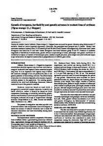
The present study was carried out to evaluate chemical and isotopic characteristics of surface and groundwater of the Banana Plain in order to: evaluate the major ion chemistry, geochemical processes controlling water composition; trace the origin of groundwater and to explore the suitability of the waters for potable, domestic, and irrigation uses. STUDY AREA, SAMPLING AND ANALYTICAL METHODS The Banana Plain of the Mungo Division extends from N and E between 45 and 520m altitude , 70km north east of Douala, economic capital of Cameroon (Figure 1). The climate is of the Banana Plain is equatorial type influenced by monsoon during summer (July to September) during the rainy season with maximum rainfall in September with about 175-200 rainfall days per year . There are two distinct seasons, a dry season from November to June and rainy season from July to October. Annual average rainfall is 3000mm, annual relative humidity, 78% and annual average temperature is C CARBAP, 2009).
Figure 1. Location of study area and sampling points within its topography and drainage.
Geologically, the Banana Plain is part of a graben (Tombel Graben) located between the stratovolcanoes of Mt Cameroon and Mt Manengouba (Nkouathio et al., part of the N E Cameroon Volcanic Line (Dueruelle et al., 2007). Groundwater occurrence in the Banana Plain is controlled mainly by the development of secondary porosity, e.g., fractures, faults and joints. Principally, recharge to the aquifers is by direct percolation of rainfall along the foothills of the volcanic cones. Minor or indirect recharge also occurs mainly in the rainy season when fractures or mega joints intercept ephemeral stream courses. These channels act as conduits that allow water to recharge the aquifer (GEOBASE, 2008). Sampling campaign was undertaken in April 2009 during which 23 water samples were collected (Figure 1). Samples included 8 wells, 6 springs, 4 streams, 1 lake, 2 boreholes, and two rainfall events. Physical parameters like pH,
Krakow, Poland 2010
1. Groundwater quality sustainability
electrical conductivity (EC), water temperature, Oxygen Reduction Potential (ORP) and Dissolved Oxygen (DO) of sampled water sources were measured in the field. Laboratory analyses for major ions (using ion chromatography) and stable environmental isotopes (by mass spectrometer, ThermoQuest Finnigen H/Device for Hydrogen and Finnigen mat Delta S for Oxygen) were carried out at the Isotope Hydrology Laboratory of Kumamoto University while dissolved silica (by ICP Spectrometer) was analyzed at the Kyushu Agriculture Institute, Kumamoto. RESULTS AND DISCUSSIONS Univariate overview of physical, hydrochemical and isotopic parameters measured in the water resources of the Banana Plain indicates that water resources in the Banana plain are generally fresh (TDS, 21.28 493.48mg/l). Fresh waters have Total Dissolved Solids (TDS) < 600 mg/l sufficiently dilute to be potable (Davis and DeWiest 1966; Freeze and Cherry 1979). Water temperatures vary from C to C with a mean of 28.8 C. Low temperatures suggest quick infiltration and rather shallow flow-paths. Furthermore, it negates any possibility of magmatic heating, as suggested at other volcanic areas (Rose et al.1996). The pH values are in the range 5.0 7.86 with a mean value of 6.52, indicating that the waters are generally acidic to slightly alkaline. pH of most samples is (74%) lower than or equal 6. This acidity is probably related to the hydrolysis of silicates and the reaction in the ground with humic acids resulting from the decomposition of organic matter in the infiltration zones. Alkalinity, the essential anion component of water, shows a large range of values (9.8 377.7 mg/l). This attests that mineralization is acquired in the unsaturated zone. On the Piper s diagram (Figure 2) (Piper 1944) with defined chemical zones, it is evident that about 80% of the waters had a Ca-Mg-Na/HCO3 composition and 20% Ca-Mg/ HCO3-Cl type.
Figure 2. Piper diagram showing water types in study area.
XXXVIII IAH Congress
1.4. Groundwater quality and agriculture
Since most of the chemical parameters were not normally distributed, correlations between major ions were carried out using Spearman s correlation analysis The results are shown in Table 1. High positive correlations were found amongst the cations (r=0.84 was found between Ca2+ and Mg2+, Na+ and K+, r = 0.87 between Mg2+and Na+, r= 0.8 between Ca2+ and K+, r = 0.81 between Mg2+ and K+). Table 1. Spearman rank correlation coefficients of major ions concentration in the water resources of the Banana Plain. Mg Na K HCO3 SO4 Cl NO3 pH TDS SiO2
Ca 0.84 0.78 0.8 0.76 0.81 0.64 0.24 0.38* 0.93 0.56
Mg
Na
K
HCO3
SO4
Cl
NO3
pH
TDS
0.87 0.81 0.64 0.71 0.76 0.56 0.4 0.87 0.73
0.84 0.57 0.6 0.56 0.42* 0.28 0.77 0.58
0.66 0.61 0.6 0.39* 0.32 0.76 0.49
0.78 0.32* -0.61 0.58 0.88 0.59
0.46* 0.18 0.43* 0.84 0.64
0.82 0.1 0.66 0.38*
-0.11 0.28 0.22
0.48* 0.54
0.66
*Number of sample (N) = 21 and r = 0.3 significant at 1 % and 5%.
Amongst the anions, high positive correlations exist between SO42- and HCO3- (r = 0.78), r = 0.82 between NO3- and Cl-. Since the correlation coefficient between the cation and anion pairs is positively high, it can also be deduced that most of the water samples (minus the rain samples) originate from a common source. Very high positive correlations exist between Total Dissolved Solids (TDS) and Ca2+ , Mg2+ and HCO3- , respectively r=0.93, 0.87 and 0.88. The correlation between TDS and SO42- (r=0.84) is also high and significant (r=0.3) at 1% level. On the other hand, correlations between other ions and TDS and among themselves though positive are significantly low suggesting that TDS is derived mainly from Ca2+, Mg2+ and HCO3-. Chemical composition of water indicates that there is a very weak mineralization in the whole Banana Plain. The most common water type is the calcic and sodic bicarbonate type. The most abundant cation changes according to the sectors of aquifer, which reflects the variety of the mineralogical groups subjected to alteration (Ketchemen et al., 2007). The relative weakness of the ions of meteoric origin such as chloride suggests that the evaporating process does not affect mineralization. These results show that infiltration is relatively fast in the whole area. Nitrate concentrations of water samples are in the range 0.19-39.26mg/l with 10 of the 23 samples (43.5%) having Nitrate concentrations greater than 10mg/l , exceeding the WHO (2004) drinking water limit. Demlie et al. (2007) illustrate that a positive correlation of NO3 and Cl-, is a diagnostic indicator of anthropogenic activity. In this study, correlation matrix (Table 1) show a strong positive correlation between NO3- and Cl- (R = 0.82) and is a diagnostic indicator of anthropogenic activity on water quality. Relationships between aqueous inorganic solutes can reveal the source of solutes and the mechanisms that generated the observed composition of both surface and groundwater (Fantong et al. 2008). Sodium/ chloride ratio in the waters is relatively high (0.9-23.4) compared to the seawater ratio of 0.86 (Moller and Detler, 1990). The high Na/Cl ratios are probably controlled by water-rock interaction, most likely by feldspar weathering. Weathering of silicate rocks in the region is one of the important processes responsible for the higher concentration of Na in
Krakow, Poland 2010
1. Groundwater quality sustainability
waters of this area. If silicate weathering is a probable source of sodium, the water samples would have HCO3 as the most abundant anion (Rogers, 1989). This is because of the reaction of the feldspar minerals with the carbonic acid in the presence of water, which releases HCO 3 (Elango et al. 2003). HCO3 is the dominant anion in waters of this area. Hence, silicate weathering partially explains the presence of sodium ions in the surface and ground waters of the region. The D and 18O values of the investigated waters vary from to for 18O and from 2 to for H. The interpretation of these data in terms of both origin and recharge mechanisms of groundwaters is generally based upon the comparison of 18O and 2H in groundwater and rainwater which is the dominant source of recharge for most continental hydrogeological systems. Figure 3 shows a plot of 2H versus 18O for all the investigated waters. The global meteoric water line GMWL is also given as reference The conventional D versus 18O diagram shows that the springs, shallow and deep groundwaters plot close to the Global Meteoric Water Line of Craig (1961) indicating their meteoric origin. These groundwaters may thus be derived from direct infiltration of local precipitation, in good agreement with the d-excess values close to 10 (Table 1). The lake water sample is located below the GMWL with a content of stable isotopes testifying enrichment by evaporation. The deep groundwater This sample sample is also close to the GMWL but more depleted with 18O content at seems to correspond to a recharge carried out under climatic conditions different from the shallow wells and springs (humid climatic conditions than at present). The flat topography of the study area does not make it possible to consider it as the result of the altitude effect. The major part of water samples seem to derive from the infiltration of local precipitation, with significant contribution of another type of water in the deeper part of the aquifer. 30.0 y = 8x + 10
shallow groundwater
Rain lake
20.0
springs deep groundwater Liniowy (GMWL) 10.0
H-2(‰)
-6.0
0.0
-5.0
-4.0
-3.0
-2.0
-1.0
0.0
1.0
2.0
3.0
-10.0
-20.0
-30.0 O-18(‰)
Figure 3. Plot of
2
H versus
O for waters in the Banana Plain.
18
To assess the suitability for drinking and public health, the hydrochemical parameters of the waters of the study area were compared with the prescribed specification of the World Health Organization (WHO) (2004). Generally the waters are within the WHO guideline limits of the various major ions for drinking water quality. The pH of the waters in this area is slightly acidic to basic (5 7.86) but generally within the WHO (2004) guideline limits (6.5 8.5) for drinking water. The EC and concentration of TDS are within the desirable limits of S cm and mg/l, respectively. Nitrates have undesirable effects when present in drinking water. High concentrations of nitrates can cause methanemoglobinaemia, gastric cancer, goiter, birth malfor-
XXXVIII IAH Congress
1.4. Groundwater quality and agriculture
mations and hypertension (Majumdar and Gupta 2000). 43.5% of water samples have Nitrate concentrations greater than 10mg/l, the WHO (2004) limit. EC and sodium concentration are very important in classifying irrigation water. Sodium percentage (%Na) in the study area ranges between 7.4 and 52.7% (rain samples, 7.4-34.0%; surface waters, 35.5-49.6% and ground waters, 14.2-50.9%). A high sodium percent causes deflocculation and impairment of the tilth and permeability of soils (Karanth 1987) . As per the guideline value, maximum sodium of 60% is recommended for irrigation water. Thus these waters are all suitable for irrigation. The sodium or alkali hazard in the use of water for irrigation is determined by the absolute and relative concentration of cations and is expressed in terms of sodium adsorption ratio (SAR). If water used for irrigation is high in sodium and low in calcium, the cation-exchange complex may become saturated with sodium. This can destroy the soil structure due to dispersion of clay particles. The calculated values of SAR in the study area are 0.003 0.048 in rain samples, 0.23-0.52 in surface water and 0.22 1.77 in groundwater with an average value of 0.403. Guideline values for SAR vary between 0 and 2.0 hence the waters in the study area are suitable for irrigation. CONCLUSIONS Water resources in the Banana Plain of the Mungo Division are under severe pressure from increasing population growth and agro-industrial activities. The chemical composition of surface and groundwater is strongly influenced by rock water interaction, dissolution and deposition of silicate minerals, ion exchange and anthropogenic contribution from domestic sources and agro- industries. Weathering of silicate minerals control the major ions such calcium, magnesium, potassium and as sodium in surface and groundwater in this area. 18O and 2H data for water from the Banana Plain indicate that groundwaters have been recharged by meteoric water without significantly affected by evaporative processes either during or after the recharge. It seems therefore likely that the infiltration is fast and direct. The quality assessment shows that in general, the waters are suitable for potable and domestic purposes. However, high values of NO3 at some sites make them unsafe for drinking. The assessment of the waters for irrigation use shows that the waters are of good quality. ACKNOWLEDGEMENTS This write up constitutes part of data generated during the Ph.D study of the corresponding author, who is supported by Monbukagakusho scholarship from MEXT (The Japanese Ministry of Education, Science, Sports and Culture). Material support was also provided by Grant-in-aid for scientific research No.21-606 from SASAGAWA Foundation, Japan. REREFERENCES CARBAP (African Research Centre for Banana and Plantains), 2009: Climatic data for Mbanga, Njombe, Penja and Loum. Njombe-Cameroon: CARBAP. Craig H., 1961: Isotopic variations in meteoric waters. Science, 133:1702 1703. Davis S. N., DeWiest R. J. M., 1966: Hydrogeology (463 pp) New York: Wiley.
Krakow, Poland 2010
1. Groundwater quality sustainability
Demlie M., Wohnlich S., Wisotzky F., Gizaw B., 2007: Groundwater recharge, flow and hydrogeochemical evolution in a complex volcanic aquifer system, central Ethiopia. Journal of Hydrogeology, J 15: pp. 1169 1181. Déruelle B., Ngounouno I., Demaiffe D., 2007: The Cameroon Hot Line (CHL): a unique example of active alkaline intraplate structure in both oceanic and continental lithospheres. Comptes Rendus Geosciences, 339(9): pp. 589 600. Elango L., Kannan R., Senthil Kumar M., 2003: Major ion chemistry and identification of hydrogeochemical processes of groundwater in a part of Kancheepuram district, Tamil Nadu, India. Journal of Environmental Geosciences, 10(4): pp. 157 166. Endeley R. E., Ayonghe S. N., Tchuenteu F., 2001: A Preliminary Hydrogeological Baseline Study of Water Sources around Mount Cameroon. Journal of the Cameroon Academy of Sciences, Vol.1 No.3. Engome R.W., 2006: Saline water intrusion into the coastal aquifers of the Mungo Basin,Cameroon: Effects on the physic-chemical and microbial quality of water resources. MSc Thesis, University of Buea. Fantong W. Y., Satake H., Ayonghe S. N., Aka F. T., Asai K., 2008: Hydrogeochemical controls and usability of groundwater in the semi-arid Mayo Tsanaga River Basin: Far north province, Cameroon. Journal of Environmental Earth Sciences, DOI 10.1007/s00254-008-1629-x. Freeze A.R., Cherry J.A.Q., 1979: Groundwater. Englewood Ciffs, New Jersey: Prentice-Hall. GEOBASE, 2008: Etude evaluation de la reserve de pouzzolane de la carriere Cimencam de Djoungo Arrondissement de Mombo, Departement du Moungo. BP 1507 Douala-Cameroun GEOBASE SARL, Ingenieurs, Conseils. GTZ, 2008: Projet pour l Amelioration de l acces a l eau potable et de l assainissement de base dans les trios communes rurales de Manjo, Loum et Penja/Njombe, Province de LittoralCameroun. Douala-Cameroon: German Technical Coorperation. Karanth K. R., 1987: Groundwater assessment, development and management. New Delhi: TataMcGraw-Hill. Ketchemen-Tandia B., Ntamak-nida M. J., Boum-nkot S., Wonkam C., Emvoutou H., Ebonji Seth C., Aranyossy J. F., 2007: First results of the isotopic study (18O, 2H, 3H) of the Douala quaternary aquifer (Cameroon) (21 25 May 2007). Proceedings of an International Symposium on Advances in Isotope Hydrology and its role in Sustainable Water Resources Management organized by the International Atomic Energy Agency, Vienna. Majumdar D. & Gupta N., 2000: Nitrate pollution of groundwater and associated human health disorders. Indian Journal of Environmental Health, 42: pp. 28 39. Mbanga Rural Council, 2008: Monographie de la Commune de Mbanga. Mbanga Rural Council. Moller Detler., 1990: The Na/Cl ratio rainwater and sea salt chloride cycle (pp.254 262). Tellus. Nkouathio D G Ménard J.J., Wandji P., Bardintzeff J.M., 2002: The Tombel graben (West Cameroon): a recent monogenetic volcanic field of the Cameroon Line. Journal of African Earth Sciences, 35: pp. 285 300.
XXXVIII IAH Congress
1.4. Groundwater quality and agriculture
Piper A.M., 1944: A graphic procedure in the geochemical interpretation of water analyses. American Geophysical Union Transcript 25: pp. 914 923. Rogers R.J., 1989: Geochemical comparison of groundwater in areas of New England, New York, and Pennsylvania. Groundwater, 27(5): pp. 690 712. Rose T. P., Davisson M. L., Criss R. E., 1996: Isotope hydrology of voluminous cold springs in fractured rock from an active volcanic region, northeastern California. Journal of Hydrology 179, pp. 207-236. Sama-Lang P., 2004: Soil and water conservation in banana production between Mount Cameroon and Bambutus Mountain (pg 1). ISCO 2004 - 13th International Soil Conservation Organization Conference Brisbane, July 2004 Conserving Soil and Water for Society: Sharing Solutions Paper No. 210. WHO, 2004: Guidelines for Drinking Water Quality. Geneva: WHO.
Krakow, Poland 2010
International Association of Hydrogeologists
AGH University of Science and Technology
2-vol. set + CD ISSN 0208-6336 ISBN 978-83-226-1979-0