The Bittern Field:
Topographic Control of an Eocene-aged “channel fill” Turbidite Reservoir in the U.K. Central North Sea
by Dominic McCormick (Shell Exploration & Production UK) & Markus Leishman (Amerada Hess Corporation)
Block 28/5a-4 No Cromarty sand
Block 28/5 Depositional edge of Cromarty Sst
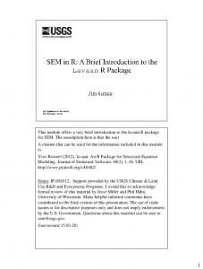
Line 648 south to north to west of Bittern Field, showing two Andrew-Forties channel complexes and the topographically infilling Cromarty sands between (yellow outline).
56°57’N
29/1
1° 06’ E
Light Blue Lobe (“early” Lower Cromarty)
Purple Lobe (Lowermost Cromarty)
Bittern Field OWC 0
S
N
50
Compaction-related faulting at top Balder commonly seen over sand-rich channel systems
Seismic Line 648
DCB
BT-B3
BT-B2
Top Cromarty
29/1b-5
29/1b-6 BT-B1
DCA BT-A1
BT-A3 29/1a-8 BT-A2
29/1b-2
Top Balder
29/1a-7
Top Forties Top Mid Andrew
28/5a-3
Top Chalk
N
Forties-Andrew Channel Complexes
B3
100
0
B2
Dark Blue Lobe (Lowermost 50 Cromarty) Red Lobe 0 (“Uppermost” Cromarty) 1° 00’ E
1 km
29/1b29/1b-5
B1
29/1b/6
56°52’ N
Upper and Lower Cromarty Isochores not shown
Line of section
0
1
A3
29/1a29/1a-8
1 km
A2 29/1a29/1a-7
A1 2
Bittern area, isochore map of seismic lobes Graben Boundary Fault
28/5a-3
Field Location Formation
Member
Reservoir Sub-Division
29/1a
Sele Upper Lowermost
Cromarty isochore suggests a funnel shaped channel system.
Salt swell?
Orange Marker
Lower
29/1c
29/1b
29/1b-5 discovery well
Balder
Cromarty
28/5a
Biostrat/Marker
Ochre Marker
Offset stacking causing lateral channel migration
Southern Forties / Andrew channel system
29/1a-7 29/1b-B3
Cromarty infill
Well sticks shown in their projected westwards positions
Northern Forties / Andrew channel system
Lower Sele Dark Green Marker
Forties
Contours in 20ft increments, brighter colours are thicker intervals
Lista “Middle Andrew”
Sketch interpretation of seismic line 648, showing the stratigraphic relationships of the Late Paleocene- Early Eocene depositional elements
Maureen ( denotes seismic marker)
Ekofisk
Bittern Field Stratigraphic Nomenclature
Top Cromarty to Base Cromarty Sand Isochore
29/1b-5 Bittern discovery well, reservoir interval
Sele
Upper Cromarty
28/5a
N:G = .96
GOC
Orange Marker
Lower
Ave Por = 34%
Cromarty
N:G = 85%
Lowermost Cromarty
- Topographic lows caused by Andrew were back-filled by Forties sands
Top Reservoir Ave Por = 35%,
Ave Por = 34%, N:G = 92%
29/1b
29/1a
29/1b-5 discovery well Salt swell?
Ochre Marker
OWC Base Reservoir Lower Sele Forties Sand
Conclusions - Salt-induced high appears to have bifurcated Andrew system
N Scale 0
1
2km
29/1c
Halokenesis immediately east of current Bittern Field caused bifurcation of easterly flowing Andrew deposition system. By Late Paleocene times, two distinct FortiesAndrew channel complexes were active across Blocks 28/5 and 29/1 Contours in 20ft increments. Brighter colour are thicker intervals.
Base Cromarty sand to Top Mid-Andrew Isochore
- Differential compaction of Forties sediments resulted in two West-East positive features by end-Paleocene times - Cromarty sands were laid down as a series of lobate deposits, progressively infilling the “channel-form” feature between the two older highs - The Bittern structure has been caused by an interplay of uplift on the Graben Boundary fault and later salt movement
AUTHORS:
Dominic McCormick Shell Exploration and Production (UK) Ltd (
[email protected]) Markus Leishman Amerada Hess Corporation (
[email protected]) Trefor Jones
Consultant (Retired)
Bittern Field Operator is Shell Exploration and Production (UK) Ltd Partners are Shell Exploration and Production (U.K.) Ltd, Exxon Mobil International Ltd, Amerada Hess Ltd, Petro-Canada U.K. Ltd, Paladin Resources Plc.