atmosphere Article
Possible Causes for Spatial and Temporal Variation of Warm Season Precipitation in Xinjiang from 1960–2014 Shikai Song 1,2,3 , Jianli Ding 2 , Zhaolei Zong 1,3, *, Aixia Yang 2 and Geping Luo 1,3 1 2 3
*
State Key Laboratory of Desert and Oasis Ecology, Xinjiang Institute of Ecology and Geography, Chinese Academy of Sciences, Urumqi 830011, China;
[email protected] (S.S.);
[email protected] (G.L.) College of Resource and Environment Sciences, Xinjiang University, Urumqi 830046, China;
[email protected] (J.D.);
[email protected] (A.Y.) University of Chinese Academy of Sciences, Beijing 100049, China Correspondence:
[email protected]; Tel.: +86-991-788-5336; Fax: +86-991-788-5320
Academic Editor: Robert W. Talbot Received: 14 December 2016; Accepted: 16 January 2017; Published: 20 January 2017
Abstract: In this work, rain totals from 1960–2014, obtained during the warm season (May to October) from 52 meteorological stations, over Xinjiang, China were classified as either light, moderate, or heavy rain in two sub-regions (northern and southern). Spatial and temporal trends for rain amounts and days for the three rain classes were determined. All light, moderate, and heavy rain amounts displayed increasing trends over the two sub-regions. Furthermore, heavy rain amounts contributed the most to changes in total rain amounts. Light rain days in northern Xinjiang significantly decreased, in contrast to increasing light rain days in southern Xinjiang and moderate and heavy rain days within two sub-regions. Results obtained from correlation and relative weights analyses implied that lower-tropospheric specific humidity was the main factor responsible for light rain day trends in Xinjiang. Increasing temperatures were not found to have a significant effect. Keywords: rain amounts; rain days; light rain; specific humidity; temperature
1. Introduction In Xinjiang, the most arid region in China, precipitation is a critical water source for both human livelihoods and ecosystems. Tremendous significance has been imparted to the study of precipitation variations. In recent decades, global mean annual precipitation has exhibited increasing trends that are thought to be related to global warming [1–4]. In the context of global warming, a good understanding of precipitation variations over Xinjiang is essential for hydrology, climatology, and ecology research. In recent years, a significant increasing trend in annual precipitation, with rates of 0.4–0.5 mm·year−1 across Xinjiang, have been documented [5–9]. Furthermore, studies have noted variations in extreme precipitation that may lead to local flooding over short periods of time, resulting in tremendous economic loss. In general, extreme precipitation is defined as annual total precipitation with daily precipitation > 95th percentile, named P95, which is one of the thirteen extreme precipitation indices introduced by the ETCCDI (the Expert Team on Climate Change Detection and Indices) [10,11]. Recent research indicates that extreme precipitation in Xinjiang also exhibits increasing trends [12–16], consistent with regional and global studies [17–19]. Global warming has been projected to lead to large increases in extreme precipitation [20–24]. Such increases are based on the Clausius-Clapeyron (C-C) equation that roughly describes a 7% increase in atmospheric moisture storage potential per degree Kelvin [2,18,25–27]. To date, few studies have explored changes in light precipitation over Xinjiang. Light precipitation requires additional time to soak into soils, leaving less water for surface runoff [2], and this Atmosphere 2017, 8, 20; doi:10.3390/atmos8010020
www.mdpi.com/journal/atmosphere
Atmosphere 2017, 8, 20
2 of 11
characteristic of light precipitation is important for abating droughts in the arid region of Xinjiang. In the past, studies have focused on decreasing light precipitation days over eastern China [28–33]. Of all of the potential Atmosphere 2017, 8, 20causes for decreases in light precipitation, an increase in lower-tropospheric 2 of 11 temperatures is considered to be the main factor. Lower-tropospheric temperature increases the To date, few studies have explored changes in light precipitation over Xinjiang. Light dew-point temperature, causes a rise in the condensation height of precipitable clouds, and reduces precipitation requires additional time to soak into soils, leaving less water for surface runoff [2], and cloudiness, atmospheric stability, isand strengthens upward motion [28,29,32,34]. thisweakens characteristic of light precipitation important for abating droughts in the arid region ofA study by the past, studies have focused onboth decreasing light precipitationwarming days over eastern China humidity Wu et al. Xinjiang. [33] for In eastern China indicated that lower-tropospheric and specific [28–33]. Of all of the potential causes for decreases in light precipitation, an increase were responsible for variations in light rain days during the warm season. The main factorininfluencing lower-tropospheric temperatures is considered to be the main factor. Lower-tropospheric the trendtemperature for light rain days over Xinjiang is still unknown. increases the dew-point temperature, causes a rise in the condensation height of For precipitable the purpose of this study, cloudiness, in order weakens to comprehensively analyze for classified clouds, and reduces atmospheric stability, and trends strengthens upward motion [28,29,32,34]. A study by light Wu etrain, al. [33] for eastern China precipitation amounts and days, especially precipitation was indicated dividedthat intoboth three classes: lower-tropospheric warming and specific humidity were responsible for variations in light rain days light, moderate, and heavy precipitation. Additionally, to be consistent with previous studies that during the warm season. The main factor influencing the trend for light rain days over Xinjiang is have analyzed factors for changes in rain amounts and types during summer, this work only analyzed still unknown. the features of halfstudy, of theinyear the summer season, referred to as the Forrain the during purpose the of this ordercontaining to comprehensively analyze trends also for classified precipitation days, especially light rain, precipitation was divided into three classes: ‘warm season’, fromamounts May toand October. moderate, Additionally, consistent with previous that into three The light, objectives of and thisheavy studyprecipitation. were, as follows: (1) to tobedivide summer rain instudies Xinjiang have analyzed factors for changes in rain amounts and types during summer, this work only classes; (2) to detect spatial and temporal variations in summer rain amounts and days for the three analyzed the features of rain during the half of the year containing the summer season, also referred classes; (3) tothe calculate the contributions of light, moderate, and heavy rain to changes in total rain to as ‘warm season’, from May to October. of this were, follows: (1) divide summer rain in Xinjiang into three amounts; andThe (4)objectives to explore thestudy causes foraschanges in to light rain over Xinjiang. 2.
classes; (2) to detect spatial and temporal variations in summer rain amounts and days for the three classes; to calculate the contributions of light, moderate, and heavy rain to changes in total rain Material and(3) Methods amounts; and (4) to explore the causes for changes in light rain over Xinjiang.
2.1. Study Area
2. Material and methods
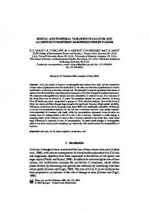
Xinjiang is located in northwest China between 34◦ N–48◦ N and 73◦ E–96◦ E and comprises an 2.1. Study Area area of 1.66 × 10⁶ km2 . The topography of Xinjiang is shaped by three mountain ranges (the Altai Xinjiang is located in northwest China between 34° N–48° N and 73° E–96° E and comprises an Mountains, the TianShan Mountains, and the Kunlun Mountains) and two basins (the Junggar Basin area of 1.66 × 10⁶ km2. The topography of Xinjiang is shaped by three mountain ranges (the Altai and the Tarim Basin) with altitudes ranging −Mountains) 154 m andand 7260 Xinjiang is divided Mountains, the TianShan Mountains, and thefrom Kunlun twom. basins (the Junggar Basin into two sub-regions, Xinjiang southern 1), by the TianShan Mountains. Climate and northern the Tarim Basin) with and altitudes rangingXinjiang from −154 (Figure m and 7,260 m. Xinjiang is divided into two sub-regions, northern Xinjiang andwith southern Xinjiang (Figure 1), by the of TianShan Mountains. in the region is typically continental, mean annual precipitation 155 mm and mean annual Climate in the region is typically continental, with mean annual precipitation of 155 mm and mean temperatures ranging from less than 10–13 ◦ C. annual temperatures ranging from less than 10–13 °C.
1. The geographical distribution theweather 52 weather stations in Xinjiang,asaswell wellasasthe thesub-regions Figure 1. Figure The geographical distribution of theof52 stations in Xinjiang, sub-regions (northern and southern Xinjiang). (northern and southern Xinjiang).
2.2. Data Daily precipitation data from 1960–2014 was obtained from the China Meteorological Administration (CMA) (http://data.cma.cn/). These data were examined prior to the release from the
Atmosphere 2017, 8, 20
3 of 11
CMA in order to ensure consistent observation and standardized instrumentation. According to the method introduced by Zhai et al. [35], stations with too many missing values were deleted. A year is considered to be missing if data for more than 5% of the days in the year (18 days) are missing. A station was retained only if it had more than 45 years of intact data. Then data from 52 meteorological stations were selected. Station distribution is provided in Figure 1. Lower-tropospheric specific humidity (SH) and temperature, required for analyzing the factors influencing rain changes in Xinjiang, were obtained from the ERA-Interim. The ERA-Interim is the latest global atmospheric reanalysis produced by the European Centre for Medium-Range Weather Forecasts (ECMWF) [36,37]. Due to the high accuracy and good suitability of ERA-Interim data for China, this dataset has been utilized in the past for studying scientific issues in meteorology and climatology over China [38,39]. SH and temperature from the ERA-Interim are available monthly from 1979–2015 at 16 pressure levels (from 1000 to 500 hPa), with a spatial resolution of 0.75◦ × 0.75◦ . All of the data used for this work were obtained for the warm season that includes May to October. In Xinjiang, rain that occurs during the warm season contributes to approximately 72.6% of the annual precipitation. 2.3. Methodology The definition of precipitation intensity is key when determining spatial and temporal variations for classified precipitation. For this study, the method introduced by Song et al. [40] was employed for classifying precipitation. Daily precipitation at each station from 1960–2014 was first sorted from smallest to largest. The sums for precipitation amounts were then equally divided into three fractions and two threshold values were determined. Precipitation less than the first threshold was defined as light precipitation, precipitation greater than the first threshold and less than the second threshold was defined as moderate precipitation, and precipitation greater than the second threshold was defined as heavy precipitation [40]. The approach can be used to determine different thresholds in dissimilar regions. However, many studies have used fixed threshold values for classifying precipitation. For example, the widely used China Meteorological Administration standards divide daily precipitation into five groups: light (0.1–10 mm per day), moderate (10–25 mm), heavy (25–50 mm), storm (50–100 mm), and downpour (>100 mm). Such a fixed threshold approach may not be suitable for the Xinjiang region because annual average precipitation in this region can vary dramatically from the TianShan Mountains to the Tarim Basin. Lower-tropospheric elements (specific humidity and temperature) from the surface to 500 hPa were averaged according to the mass-weighted average equation: e=
500
500
ps
ps
∑ e ∆p/∑ ∆p
(1)
where e indicates lower-tropospheric elements. The relative weights calculation method ‘rlw’ in the R package ‘yhat’ was employed for comparing influencing factors in regards to light rain day changes. The relative weights approach can eliminate correlations between independent variables [41,42]. The Mann-Kendall test was employed to test the significance of trends (at the 95% confidence interval). Trend rates were calculated using the Sen-Thiel method. In addition, we have tested and found no auto-correlation in the series of trend. 3. Results and Discussion 3.1. Spatial and Temporal Variations for Classified Summer Rain Amounts From 1960 to 2014, daily rain from 52 stations in Xinjiang was classified as either light, moderate, or heavy rain based on the method proposed by Song et al. [40]. Spatial and temporal trends for rain amounts in these three groups were determined using the Mann-Kendall test and Sen-Thiel method.
Atmosphere 2017, 8, 20 Atmosphere 2017, 8, 20
4 of 11 4 of 11
trends for rain amounts in these three groups were determined using the Mann-Kendall test and Sen-Thiel method. As shown in Figure 2, total rain amounts for the 49 stations exhibited increasing trends ranging As shown in Figure 2, total rain amounts for the 49 stations exhibited increasing trends ranging from 0.1 to to 2 mm per per year,year, and and werewere statistically significant (p < 0.05) 17 stations. Only three stations from 0.1 2 mm statistically significant (p