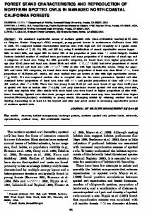
PREDICTING FOREST STAND CHARACTERISTICS WITH DETECTION OF INDIVIDUAL TREE Doo-Ahn Kwak, Ph.D. Student Woo-Kyun Lee, Professor Division of Environmental Science and Ecological Engineering Korea University, Seoul 136-701, South Korea
[email protected] [email protected] Jun-Hak Lee, Ph.D. Student Department of Environmental Science, Policy and Management University of California, Berkeley, 225 Mulford Hall, Berkeley, CA 94720
[email protected]
ABSTRACT In South Korea, forest inventory information has been essential with respect to land management because 70% of South Korea is composed of forests. Therefore, accurate forest information such as tree counts, height, DBH, and volume are critical for forest management. While such data traditionally have required labor intensive and time consuming field measurement, new technologies such as remote sensing have supplemented and supplanted some of these field measurements. Although different types of sensors have been used to extract forest information, Light Detection and Ranging (LiDAR) has been used recently to extract surface information because LiDAR can acquire shape characteristics of objects by geo-registered 3D-points at high accuracy. In this study, Digital Elevation Model (DEM) and Digital Surface Model (DSM) were produced from LiDAR and the numbers of individual trees for the stands are estimated by counting the segmented polygons created with the watershed segmentation method. The heights of individual trees were measured by the maximum elevation of the Digital Canopy Model (DCM) in each segmented crown. The DBHs were estimated with the tree heights from LiDAR data using the DBH-height function from field measurement data. And the biomass of trees was calculated with the tree height from LiDAR and the DBH form the model by the tree height. The estimated forest characteristics were compared with those obtained from field measurements for the accuracy assessment. This study is conducted to evaluate the possibility of LiDAR data to extract forest characteristics from identifying and measuring individual trees.
INTRODUCTION In South Korea, forest inventory information has been essential with respect to land management because about 70% of South Korea is composed of forests. Therefore, detail forest information such as tree counts, tree height, crown base height, diameter at breast height (DBH) and biomass are critical for planning national land use and carrying out quantitative analysis of forest. But the traditional way to investigate such parameters involves large-scale, labor intensive forest inventories, often incorporating complex sampling schemes and extrapolation efforts (Avery and Burkhart, 1994; Shivers and Borders, 1996). Moreover existing methods are time consuming, subjective, and more applicable to smaller areas (Avery and Burkhart, 1994). Alternative approaches to forest inventory therefore have fostered intense research with the advent of new remote sensing technologies, specifically light detection and ranging (LiDAR) (Lefsky et al., 2002). The LiDAR system has the potential for measuring both the vertical and horizontal structure of forested areas effectively with high precision (Holmgren et al., 2003). Applications in forestry have mainly focused on measurement of tree height, sub-canopy topography, and the vertical distribution of intercepted surfaces in forested areas. In addition, the development of LiDAR with an increased measuring frequency has made it possible to efficiently detect and measure individual trees on the ground (Heurich et al., 2004). These measured characteristics were extended to the modeling of above-ground biomass, stem counts, and crown widths (Dubayah and Drake, 2000; Lefsky et al., 2002) because LiDAR can be typically used to automatically generate a digital canopy model (DCM) that can describe the outer contour of the tree crowns (Holmgren et al., 2004). And Digital aerial photograph, which is taken simultaneously with the LiDAR, can be used to calculate the biomass of trees by tree species since individual tree species is MAPPS/ASPRS 2006 Fall Conference November 6 – 10, 2006 * San Antonio, Texas
identified and the forest type map. For the classification of tree species, we used the segment based classification representative of real world objects in order to remove the salt and pepper effect so often found with pixel based classification (Van Aardt, 2004). In spite of such merits, the application of LiDAR for the forest inventory is rarely performed in South Korea while it has been used to estimate air pollution (Cha et al., 1998) and to evaluate plans for city development (Lee et al., 2003). So this study proposed the usefulness of LiDAR and digital photograph for the extraction of forest information in South Korea. In addition, for the verification of data we presented the accuracy of variables to relevant to tree parameters: tree height, crown base height, diameter at breast height and biomass.
STUDY AREA AND MATERIALS Study Area The study area used is located in Mt. Yumyeong, the upper left 127°29′0.19380″E, 37°36′16.43433″N and down right 127°30′1.10″E, 37°35′42.94″N, in Central Korea (Figure 1). A total of approximately 80ha of private forests were selected for this study and the main tree species are Pinus koraiensis (Korean Pine), Larix leptolepis (Japanese Larch) and Quercus spp.(Oaks). These stands were selected in the way that the composition of tree species was simple and the location of the individual trees had the distance from each other sufficiently. The stands have been used for the comparison of remote sensing data sources such as LiDAR and digital aerial photograph.
Materials LiDAR system and digital aerial photograph. The post-processing system was used to calculate the position of the reflecting object, the slant range, and scanning angle. The position of the reflecting object was derived from the first (High Vegetation Return) and last (Ground Return) returns. In this study, ALTM 3070 of OptechTM, which is a kind of small footprint LiDAR and DC 4K02 camera of EmergeTM were used for the acquisition of the LiDAR data and digital aerial photograph and flights were performed on 28th April 2004. The test area was measured from an altitude of 1,500m in nominal sampling density of about 1.8 points per square meter and the radiometric resolution, the scan frequency and the scan width were 12bits, 70Hz, and ±25° respectively. The digital aerial photograph was taken with the LiDAR data simultaneously. The spatial resolution was 20cm and it had a red, green and blue band except an infrared band. Ground Data. The sample sites were composed of 15plots which of each area was 100m2 (10m×10m) per 1 plot (Table 1) and 5plots a species. In total plots, 135 trees of which species were each Pinus koraiensis (47), Larix leptolepis (45) and Quercus spp.(43), were measured including tree parameters such as the tree height, crown base height and diameter at breast height (DBH). The positions of the individual trees were acquired at the breast height of the individual trees using GPS Pathfinder Pro XR® manufactured by Trimble™. Ground data was measured in October 2004 although laser data was acquired in April 2004.
Methods Classification of LiDAR data. The LiDAR data was processed by using Optech’s REALM software by LaserMap Image Plus. This software classifies the LiDAR data using a proprietary algorithm into four classes, which includes ground last returns, ground first returns, vegetation last returns, and vegetation first returns. But the ground last return class is the most robust while the other three classes are scattered throughout a vertical profile as opposed to being stratified according to a range of elevations with returns in each class mutually exclusive from one another (Lim et al., 2001). So LiDAR returns from each of the four classes produced by the REALM software were reclassified using TerraScan software of Terrasolid™, which runs on top of Microstation series of Bentley™. As a result, ground returns were divided into the Ground Return (GR) reflected on the ground and the Low Vegetation Return (LVR) on the lowest vegetation as fallen leaves and the grass. And vegetation returns were classified into the Medium Vegetation Return (MVR) reflected near the beginning of the crown and the High Vegetation Return (HVR) around the top of the vegetation (Figure 1).
MAPPS/ASPRS 2006 Fall Conference November 6 – 10, 2006 * San Antonio, Texas
Figure 1. Structure of the LiDAR. Derivation of digital canopy model (DCM). The DCM was computed as the difference between the digital surface model (DSM), representing the tops of the crowns, from the HVR and the digital terrain model (DTM), representing the ground area, from the GR with each 30cm pixel (Figure 2a). Each height of individual trees wa s determined by the highest elevation values of the DCM in segmented polygons that were proved to be the cro wns of individual trees. Moreover it is possible that the crown base heights can be estimated with the DSMMVR made of MVRs and the DTM because they are clustered around the edge of tree crown that we can assume to be a crown base height of an individual tree (Figure 1). So the digital crown base model (DCBM) was estimated a s the difference between the DSMMVR and the DTM (Figure 2b) as well as the DCM. The positions of crown bas e heights could be determined as the positions corresponding to the heights of individual trees.
Figure 2. Production of the tree heights and crown base heights. Crown delineation. In this study, for 15 chosen stand individual tree segmentations were carried out with D CM image created from LiDAR data using ArcGIS 9.0 and MATLAB 7.0. The crown delineation was performe d on the DCM using the watershed segment method for detecting the number of individual trees. Watersheds ca n be delineated from the DTM using the output from the flow direction function as the input to the watershed or basin functions. Both of these functions use a grid of the flow direction to determine the contributing area. The DCM was converted to a grayscale image which of darkness was decreased with increasing the elevation. The g rayscaled DCM can be explained as a 3 dimensional surface, where each pixel represents the elevation of the co rresponding point on the surface. The watershed segmentation could find the crown of individual tree and the ed ge of each crown in the grayscale image.
Figure 3. Digital Canopy Model (DCM) and segmented image for crown delineation. Tree height and crown base height. Individual tree heights were extracted from the digital canopy model u sing the highest elevation of the each segmented polygon of tree. The location of the individual trees was deter mined as the location corresponding to the highest value of the segments. The tree height (h) is the maximum va MAPPS/ASPRS 2006 Fall Conference November 6 – 10, 2006 * San Antonio, Texas
lue of the tree height within a segmented polygon h = max(hi )
(1)
where hi is individual tree height of the corresponding segment polygons (Hyyppä et al., 2001). The crown base heights could be estimated from Medium Vegetation Return (MVR) because they were clustered near the edge of tree crown and their range was coincident with the general crown base height as 1.1~9.9m. So the crown base heights were measured with LiDAR data as the method similar to the DCM. The crown base heights could be estimated from the digital crown base model (DCBM) produced as the difference between the DSMMVR and the DTM. The locations of the crown base heights were estimated on the DBCM corresponding to each tree height of DCM. Estimation of DBH. The DBHs of the individual trees by LiDAR data could be computed indirectly using t he DBH-Height function estimated with the DBHs and tree heights surveyed at the selected stands (Sit et al., 19 94). The DBH by LiDAR could be estimated as the tree height by LiDAR was input instead of the field surveye d. As the first step the parameters of each function (Table 1) selected to find the most suitable one were calculat ed using nonlinear regression analysis with the DBHs and tree heights of individual trees obtained at each stand by SAS 9.0 program.
No 1
Table 1. DBH-Height Functions (Sit et al., 1994) Function Name Equation Combined Exponential and Power Function
DBH = a ⋅ H b ⋅ c H
2
Power Function
DBH = a ⋅ H b
3
Exponential Function Ⅰ
DBH = a ⋅ eb⋅ H
4
Exponential Function Ⅱ
DBH = ea −b⋅ H
5
Exponential Function Ⅲ
DBH = a ⋅ eb / H
6
Exponential Function Ⅳ DBH : Diameter at Breast Height(m), H : Height of tree(cm), a, b, c : Parameters
DBH = a ⋅ b H
The accuracy assessment of the parameters for each function was validated with the Fitness Index. n
FI = 1 −
∑ (Y − Yˆ )
2
i
/(Yi − Y )
(2)
i =1
Estimation of biomass. The LiDAR of the remote sensing technologies offers a possible avenue for estimation of aboveground biomass, which is derived from tree heights, stem counts, and crown diameters (Van Aardt, 2004). The individual tree based biomass by the LiDAR can be calculated with only tree height and diameter at breast height (DBH) of individual tree (Kim et al., 1998). Biomass = a ⋅ D 2 ⋅ H
(3)
Where a is the parameter of which value is different characteristically by each tree species, D is the diameter at breast height (DBH) and H is the tree height. Therefore the biomass of the single tree by the LiDAR could be es timated with DBH and tree height obtained by DCM and the value of a parameter represented at Table 2.
Parameter a
Table 2. a values for three tree species Pinus koraiensis Larix leptolepis Quercus spp. 0.024250 0.026211 0.026849
The biomass calculated on an individual tree basis can be expanded to per-hectare and whole study area values for each segment using equation. Since field plot data intended for the validation of the accuracy were used on a per-segment basis, the biomass of the plot by each tree species was expanded to a per-hectare basis for each segment.
MAPPS/ASPRS 2006 Fall Conference November 6 – 10, 2006 * San Antonio, Texas
n
Biomass per hectare =
∑a⋅ D
2 i
⋅ Hi
i =1
(4)
m
∑ PA
j
j =1
where n is the number of the trees observed by tree species, PA is an area of a plot by tree species and m is the total number of the plots by tree species. The biomass per hectare estimates also was tallied to derive total biomass for the entire test area. Total biomass could be computed by the area of each tree species, which was calculated from the segmented imagery obtained by classifying the digital aerial photograph. Classification of tree species. The tree species was classified in order to produce a forest type map for computing the biomass of the study area using the digital aerial photograph acquired with LiDAR data simultaneously. In this study, the digital aerial photograph was segmented using the region growing method and the segment imagery was classified using the maximum likelihood method. The algorithm used for the classification was based on eCognition 4.0 program by Definiens Company.
RESULT AND DISCUSSION Number of Detected Individual Trees The number of individual trees was could be counted for the identified crowns to be looked upon as each individual tree. The heights of the individual trees were determined as the highest elevation in segmented polygons of the DCM. The count of the individual trees by the number of crowns included some errors, which were to find more individual trees than the actual number of individual trees as field. The number of LiDAR-derived individual trees was overestimated than the number of field-measured individual trees more than 16%. The reason for the overestimation in the number of detected trees was that an individual tree was split into two segments since the tree crown contained considerable height variations.
Accuracy Assessment of Tree Heights The average of the difference between field and LiDAR measured tree height was –0.09m for all trees, 0.36m for Pinus koraiensis, –0.54m for Larix leptolepis and –0.13m for Quercus spp.. The standard deviation of the difference between field and LiDAR measured tree height was –0.05m for all trees and the value of each tree species was 0.14m, –0.11m and 0.06m in the order of Pinus koraiensis, Larix leptolepis and Quercus spp.. The RMSE was –0.01m for all trees and 0.02m, –0.02m and 0.01m respectively. The coefficient of determination was 0.79 for all trees and the respective tree was 0.80, 0.78 and 0.75 (Figure 4). Accuracy of the tree heights in the coniferous (Pinus koraiensis and Larix leptolepis) was higher than the deciduous (Quercus spp.). The reason for the difference is judged erroneously by the fact that it is possible for the deciduous tree height to be estimated as the false elevation value of another polygon around the polygon corresponding to actual tree crown since the deciduous tree has the possibility to be divided into two or more segments due to the ellipsoid shape not the cone such the coniferous. 30
30
25
25
25
20
20
20
20
15
5
5
5
0
0
0
5
10
15 20 o b s e rv e d ( m )
(a) All trees
25
30
10
10
10
0
15
15
15
10
p re d ic t d ( m )
p re d ic t e d ( m )
p re d i c t e d ( m )
p re d i c t e d ( m )
30
25
30
0
5
10
15 20 o b s e rv e d ( m )
25
30
5 0
0
5
10
15 20 o b s e rv e d ( m )
25
(b) Pinus koraiensis (c) Larix leptolepis Figure 4. Accuracy assessment of tree height.
30
0
5
10
15 20 o b s e rv e d ( m )
25
30
(d) Quercus spp.
Accuracy Assessment of Crown Base Heights The mean of difference between the field and LiDAR measured crown base heights was –0.12m for overall trees, –0.40m for Pinus koraiensis, –0.71m for Larix leptolepis and 0.16m for Quercus spp.. The standard deviation of the difference between the field and LiDAR measured crown base heights was –0.10m for total trees, MAPPS/ASPRS 2006 Fall Conference November 6 – 10, 2006 * San Antonio, Texas
0.11m for Pinus koraiensis, 0.50m for Larix leptolepis and –0.25m for Quercus spp.. The RMSE for the field data and LiDAR was calculated as –0.01m overall, 0.01m for Pinus koraiensis, 0.07m for Larix leptolepis and –0.04 for Quercus spp.. The coefficient of determination was 0.74 for all trees, 0.73 for Pinus koraiensis, 0.78 for Larix leptolepis and 0.68 for Quercus spp. (Figure 5). The accuracy of the crown base heights for the Quercus spp. was lower than the other trees. That is why the stem form of Quercus spp. is crooked than the other species. So it has the possibility that the crown base heights of Quercus spp. were estimated as the wrong cell values selected around the actual crown base heights on the DSMMVP since the crown base heights were calculated by the DSMMVP with the same positions of the tree height on the DCM.
10
10
10
10
5
0
0
5
10 o b s e rv e d ( m )
0
15
(a) All trees
5
5
0
0
5
10 o b s e rv e d ( m )
p re d ic t e d ( m )
15
p re d i c t e d ( m )
15
p re d ic t e d ( m )
15
p re d ic t e d ( m )
15
15
0
5
10 o b s e rv e d ( m )
5
0
15
0
(b) Pinus koraiensis (c) Larix leptolepis Figure 5. Accuracy assessment of crown base height.
5
10 o b s e rv e d ( m )
15
(d) Quercus spp.
Assessment of Diameter at Breast Height (DBH) The Exponential Function Ⅵ among the six functions (Table 2) was adopted as the most suitable for calculating the DBHs of all three tree species. The fitness indices of the Exponential Function Ⅵs were 0.99 for Pinus koraiensis, 0.99 for Larix leptolepis and 0.98 for Quercus spp. After the estimation of DBH-Height function, Accuracy assessment of the DBH by the height of LiDAR could be verified with the DBH by field data. The average of difference between the field and LiDAR measured DBH was –0.37cm for all trees, 1.00cm for Pinus koraiensis, –0.11cm for Larix leptolepis and –0.15cm for Quercus spp. The standard deviation of the difference between the field and LiDAR derived DBH was 0.17cm for total trees, 0.19cm for Pinus koraiensis, –0.03cm for Larix leptolepis and –0.30cm for Quercus spp. The RMSE between the field data and LiDAR was 0.02cm overall, 0.33cm for Pinus koraiensis, 0.00cm for Larix leptolepis and –0.04cm for Quercus spp.. In addition, the coefficient of determination in this study was 0.62 for all trees, 0.67 for Pinus koraiensis, 0.66 for Larix leptolepis and 0.62 for Quercus spp. respectively (Figure 6). The DBHs of deciduous trees from the tree heights by LiDAR were estimated as lower accuracy than the coniferous trees. The reason for lower values of the deciduous trees is that the tree heights affect the DBH values because the DBHs of all trees were calculated using the DBH-Height function by tree height, the deciduous lower and the coniferous higher, through LiDAR. 50
50
40
40
40
40
30
30
30
30
0
0
10
20 30 o b s e rv e d ( c m )
(a) All trees
40
50
20
20
10
10 0
p re d ic t e d ( c m )
p re d ic t e d ( c m )
20
20
p re d ic t e d ( c m )
50
p re d i c t e d ( c m )
50
10
10
0
10
20 30 o b s e rv e d ( c m )
40
50
0
0
0
10
20 30 o b s e rv e d ( c m )
40
50
(b) Pinus koraiensis (c) Larix leptolepis Figure 6. Accuracy assessment of diameter at breast height.
0
10
20 30 o b s e rv e d ( c m )
40
50
(d) Quercus spp.
Accuracy Assessment of Biomass The average of the difference between field and LiDAR measured the biomass of individual trees was –14.95kg for all trees, 32.7kg for Pinus koraiensis, –31.21kg for Larix leptolepis and –48.92kg for Quercus spp.. The result of comparison has shown that the individual tree biomass estimated by LiDAR is on mean value only 14.95kg less than the measured value in the field. The standard deviation of the difference between field and LiDAR measured biomass was –16.22kg for all trees and the value of each tree species 15.00kg, –3.16kg and –50.43kg in the order of Pinus koraiensis, Larix leptolepis and Quercus spp.. The RMSE was –2.42kg overall, 2.24kg for Pinus koraiensis, –0.47kg for Larix leptolepis and –7.52kg for Quercus spp.. The coefficient of determination was 0.72 for all trees and each tree was 0.78, 0.82 and 0.71 respectively (Figure 7). Especially, DBH can be mentioned as affecting the accuracy with the impure value not measured DBH directly from LiDAR. So the biomass by LiDAR MAPPS/ASPRS 2006 Fall Conference November 6 – 10, 2006 * San Antonio, Texas
may not be clearer than field measurement. 900
900
900
900
600
300
0
0
300
600 900 o b s e rv e d ( k g )
(a) All trees
1200
600
300
0
0
300
600 900 o b s e rv e d ( k g )
1200
p re d ic t e d ( k g )
1200
p re d i c t e d ( k g )
1200
p re d i c t e d ( k g )
1200
p re d ic t e d ( k g )
1200
600
300
0
0
300
600 900 o b s e rv e d ( k g )
600
300
0
1200
(b) Pinus koraiensis (c) Larix leptolepis Figure 7. Accuracy assessment of tree biomass.
0
300
600 900 o b s e rv e d ( k g )
1200
(d) Quercus spp.
Classification of Tree Species using Digital Aerial Photograph The study area could be classified into the non forest area (Non Forest), Pinus koraiensis stands (PK), Larix leptolepis stands (PL) and Quercus spp. stands (Q) (Figure 8). The results of the verification for the segment ba sed classification with the maximum likelihood have shown as the error matrix of Table 3. The accuracy of the s egment based classification was 76.8% for overall accuracy and 0.72 for a kappa value. As a result, Quercus sp p. occupied the broadest area of three species as 36.74ha, Pinus koraiensis was 33.02ha and Larix leptolepis wa s the smallest area as 10.36ha.
Reference
Table 3. Error matrix of the segment based classification of digital aerial photograph. Classified Classification PK PL Q Non Forest Row Total User's Accuracy PK 8 1 1 0 10 0.8000 PL 3 7 0 0 10 0.7000 Q 0 0 9 1 10 0.9000 Non Forest 10 1 2 27 40 0.6750 Column Total 21 9 12 28 70 Overall accuracy : 0.7688 Producer's accuracy 0.3810 0.7778 0.7500 0.9643 PK : Pinus koraiensis, PL : Larix leptolepis Q : Quercus spp. Non Forest : The area except forest Table 4. Biomass of test area. Tree species
Figure 8. Digital forest type map.
Area (ha)
Ton/ha
Total (ton)
observed
predicted
observed
predicted
P. koraiensis
33.02
386.55
355.79
12,763.88
11,748.19
L. leptolepis
10.36
347.95
376.04
3,604.76
3,895.77
Quercus spp.
36.74
327.47
369.54
12,031.25
13,576.90
Estimating Biomass of Test Area by Tree Species The biomass of study area by tree species could be estimated with the biomass per hectare since the area according to tree species was calculated by the digital aerial photograph. The biomass per hectare could be computed by the number of individual tree in total plots and whole plot size by tree species (Table 4). The amount of biomass per hectare for total Pinus koraiensis stands was predicted as 355.79ton/ha, Larix leptolepis as 376.04ton/ha and Quercus spp. as 369.54ton/ha using the tree heights and DBHs by LiDAR. The reason for the highest value estimated of Larix leptolepis despite the smallest area is that the number of individual trees was detected more than the other trees in the same plot size, in that the highest stand density. But the total biomass of test area was calculated as 11,748.19ton for Pinus koraiensis, 3,895.77ton for Larix leptolepis and 13,576.90ton for Quercus spp. according to the area size of each tree species.
MAPPS/ASPRS 2006 Fall Conference November 6 – 10, 2006 * San Antonio, Texas
CONCLUSION We found that LiDAR (small footprint LiDAR) can be used to predict the tree parameters such as the number of trees, tree height, diameter at breast height, crown base height and biomass in the forest area of South Korea. For Pinus koraiensis, Larix leptolepis and Quercus spp., individual tree height could be estimated directly from the digital canopy model (DCM). And the crown base height was also measured directly from the digital surface model by medium vegetation return (DSMMVR). But if the edge of the crown is overlapped too much with the crown of neighbor trees, it can be occurred that the crown base height estimated by LiDAR is higher than the field measured data. So in the future research it is necessary to analyze the discrete returns of small footprint LiDAR for profile of the crown base height as the shape of the full wave form of large footprint LiDAR which has the continuous wave form characteristically according to the vertical structure of trees. And we estimated the DBH and the biomass by tree species with high R2 comparatively. Additionally we showed that the digital aerial photograph classified by tree species could be used to compute the biomass for the test area with an overall accuracy (77%) and a kappa value (72%). The combination of LiDAR data and the digital aerial photograph can be very useful for describing biodiversity and monitoring changes in biodiversity. The remaining tasks are to explore the generality of the application to different forest ecosystems like the mixed forest area and to raise the accuracy of the tree parameters for deciduous trees.
ACKNOWLEDGEMENT This work was supported by the Korea Research Foundation Grant funded by the Korean Government (MOEHRD) (KRF-2005-213-F00001).
REFERENCE Aplin, P., Atkinson, P.M., Curran, P.J. CURRAN (1999). Per-field classification of land use using the forthcoming very fine spatial resolution satellite sensors: Problems and potential solutions. In Advances in remote sensing and GIS analysis, eds. P.M. Atkinson and N.J. Tate, 219-39. New York: John Wiley & Sons. Avery, T.E., and Burkhart, H.E. (1994). Forest Measurements. 4th Edition. McGraw-Hill, Boston, USA. 408p. Baltsavias, E.P., 1999. Airborne laser scanning: Basic relations and formulas. ISPRS Journal of Photogrammetry and Remote Sensing, 54:199~214. Cha, H. K., Lee, J. M., Lee, Y. J., Cha, B. H., Song, G. S., Kim, D. H., Lee, K. S., Yang, K. H., Yoon, S. C., Won, J. K., Lee, S. M., Rostov, A. P. (1999). Technology of measuring equipment for air pollution, Ministry of Environment Republic of Korea, pp.17~28. Cho, H. K., Lee, W. K., Lee, S. H. (2003). Mapping of vegetation cover using segment based classification of IKONOS imagery, The Korean Journal of Ecology, 26(2):75~81. Dubayah, R. O., Drake, J. B. (2000). Lidar remote sensing for forestry. Journal of Forestry 98(6): 44~46. ESRI (2001). ArcDoc in ARC/INFO Help. Gonzalez, R. C., Woods, R. E., Eddins, S. L. (2004). Digital image processing using MATLAB, Prentice-Hall Publisher, New Jersey, pp.455~459. Holmgren, J., Persson, Å. (2004). Identifying species of individual trees using airborne laser scanner, Remote Sensing of Environment, 90(4):415~423. Hyyppä., Kelle, O., Lehikoinen, M., Inkinen, M. (2001). A segmentation-based method to retrieve stem volume estimates from 3-D tree height models produced by laser scanners. IEEE Transactions on Geoscience and Remote Sensing, 39(5):969~975. Kavaya M.J. (1999). LiDAR Tutorial, URL:http://www.ghcc.msfc.nasa.gov/sparcle/sparcle_tutorial.html, SPAce Readiness Coherent Lidar Experiment, NASA (last date accessed: 7 June 2006). Kim, K.H., Kim, Y.S., Kim, C.S., Baek, E.S., Son, Y.M., Song, J.H., Lee, K.S., Lee, K.H., Lee, J.K., Jeong, Y.K., Jeong, J.H., Joo, R.W. (1998). The plan for decreasing the green house gas in the forest. Korea Forest Research Institute. Volume 143:3~25. Lee, G. S., Gho, D.G., Cho, K. S. (2003). The Evaluation of architectural density on urban district using airborne laser scanning data, The Korean Association of Geographic Information Studies, 6(3):95~106. Lefsky M.A., W.B. Cohen, G.G. Parker, and Harding, D.J. (2002). Lidar remote sensing for ecosystem studies. Bioscience 52 (1): 19~30. MAPPS/ASPRS 2006 Fall Conference November 6 – 10, 2006 * San Antonio, Texas
Lim, K., P. Treitz, A. Groot, and B. St-Onge (2001). Estimation of individual tree heights using LIDAR remote sensing. Proceedings of the Twenty-Third Annual Canadian Symposium on Remote Sensing, Quebec, QC, August 20-24, 2001. Shivers, B.D., and Borders, B.E. (1996). Sampling techniques for forest resource inventory. John Wiley and Sons, Inc. New York, USA. 356p. Sit, V., Poulin-Costello, M. (1994). Catalogue of Curves for Curve Fitting, Forest Science Research Branch Ministry of Forests in Canada, Victoria, B.C, pp.30~59. Song, Y. K., Moon, D. Y., Baek, T. K. (2005). Update of Digital Map using CCD Image, Proceeding of 12th The Korean Association of Geographic Information Studies workshop, 13~14 May 2005, Dong-Eui University, Busan, South Korea. pp.73~86. Van Aardt, J.A.N (2004), An object-oriented approach to forest volume and aboveground biomass modeling usi ng small-footprint LiDAR data for segmentation, estimation and classification, Ph.D. dissertation, Virg inia Polytechnic Institute and State University, Blacksburg, Virginia, pp.1~22.
MAPPS/ASPRS 2006 Fall Conference November 6 – 10, 2006 * San Antonio, Texas