2010 Second International Conference on Advanced Geographic Information Systems, Applications, and Services
Proposal for a Web Processing Services (WPS) Application Profile for 3D Processing Analysis Sandra Lanig
Alexander Zipf
Department of Geography University of Bonn Bonn, Germany
[email protected]
Department of Geography University of Heidelberg Heidelberg, Germany
[email protected]
(WPS) 1.0.0 interface specification, which has been approved as official OpenGIS® Implementation Standard in June 2007 [1]. The WPS standard defines a generic web service interface to more or less complex pre-programmed data processing operations or models. Nevertheless, the WPS standard is completely open and allows the retrieval of arbitrary general non-geo or geoprocessing functionality in diverse granularity. For ensuring fully-automated interoperability, the standard defines “WPS Profiles” that enables optimization of interoperable client user interface behavior, as well as the semantically-driven service discovery (publish/find/bind paradigm) and orchestration.
Abstract — Based on the service specification of the Open Geospatial Consortium (OGC), the OGC Web Processing Service (WPS) 1.0.0 standard provides distributed spatial data processing analyses for arbitrary geoprocessing functionalities using a standardized web service-based interface. Additionally, the standard offers the ability to define and use so-called WPS Profiles in a recyclable way for semantically-driven interoperable processing. Typically, the geoprocessing interface is used for 2-dimesional (2D) spatial data processing. In this paper we focus on 3-dimensional (3D) data. Therefore we group and classify conventional 3D geoprocessing functions and define both 3D generic-basic WPS Profiles and 3D domain-specific WPS Application Profiles for 3D city models and show how profiles could be structured in 3D domain and how the profile mechanism may be optimized or extended in the future WPS 2.0 standard for more sophisticated geoprocessing.
Currently, SDIs and particularly the most WPS implementations covering primarily 2-dimensional (2D) spatial data processing. However, the extension in the 3rd dimension increases in meaning in different Geographic Information (GI) sciences like urban planning, hydrology, climate or noise modeling as well as public authorities or other users of 3dimensional (3D) city models. The OGC is aware of this open gap in 3D processing and provides different services e.g. the discussion paper of the Web3DService (W3DS), which is a portrayal service for 3D geodata, merging different types (layers) of 3D data in one scene graph and serving a complete 3D scene [2]. Additionally, there is a need for offering preprocessing functionalities for 3-dimensional data and city models via web-based geoprocessing services for 3D data that enables more sophisticated applications.
Keywords - 3D Geoprocessing; 3D Spatial Analysis; Web Processing Service; 3D WPS Profile; Spatial Data Infrastructures
I.
INTRODUCTION
The Open Geospatial Consortium (OGC) is leading the development of standards and interface specifications for geospatial and location based services to guarantee interoperability of data and services across a distributed network. Based on Service Oriented Architectures (SOA) the OGC deals with web services that are organized in Spatial Data Infrastructures (SDIs). SDIs primarily support visualization, sharing, access and discovery of distributed geospatial data. Those standard OGC web services (OWS) are the Web Map Service (WMS) for visualization, the Web Feature Service (WFS) and the Web Coverage Service (WCS) for vector and raster data access, and the Catalogue Service for the Web (CSW) for spatial data search. However, genuine geospatial processing and analysis functionalities are missing to these SDI building blocks, which represents the core of Geographic Information Systems (GIS). While the trend goes to decentralized web services, the geospatial data processing should also be available through a standardized web service. This issue was addressed by the OGC Web Processing Service 978-0-7695-3951-5/10 $26.00 © 2010 IEEE DOI 10.1109/GEOProcessing.2010.25
The paper presents a proposal for a generic and a specialist WPS Application Profile for 3D geospatial analysis and focus on the use of 3D geoprocessing functionalities in the context of urban and environmental research. Therefore we first give an overview about existing classifications of GIS functions and a short introduction how to provide and define standardized geoprocessing functionality (Section 2). In Section 3, we classify 3D GIS-analysis operations and discuss the open questions regarding the interoperability between 3D spatial services and processing. Based on this classification we define in Section 4 the 3D WPS Application Profile and talk about a generic WPS profile as well as a domain specific profile. The use case in Section 5 demonstrates a domain specific profile for 117
called local (the value of a location in the output map is computed from the values of the same location in one or more input maps), focal (the value of a location in the output map is computed from the values of the neighborhood of the same location in the input map), and global (the value of a location in the output map is computed from the values of a spatial neighborhood of the same location in an input map) functions. These functions apply a first-order function to all elements of map, according to different spatial restrictions.
3D terrain generalization in 3D city models. Finally the paper ends with a summary and an outlook to further activities. II.
BACKGROUND
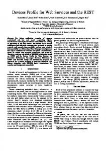
The elementary purpose of geoprocessing is to manipulate geospatial data using GIS operations and allow the automation of GIS tasks in workflows. Typically geoprocessing takes an input dataset, performs a geoprocessing operation (e.g. feature overlay, selection and analysis, topology and raster processing or data conversion etc.) on that dataset, and returns the result of the operation as an output dataset. There are several different GIS software vendors and scientific GI specialists and only few existing meaningful taxonomies of GIS analysis operations. The following subsections will shortly introduce to state-of-theart GIS analysis taxonomies and the WPS interface specification. A. GIS Analysis Classification – Related Work The lack of taxonomy for analytical and modeling functionality is known as a major deficiency. Additionally using GIS, it is necessary to string-together different fundamental GIS operations to produce complex processes in many applications. In this context the question arises, which GIS operations are explained as elementary operations and how can these GIS operations be classified. Due to the variety of the requirements and different data models there is so far no consistent and generally accepted definition. An appropriate classification should be first consistent, which means that every function should be able to assign to exclusively one class and second universal, which means that it is independent of the underlying data structure. A lot of research work has been done to group GIS functions. In the following we give a short overview of the most fundamental classifications.
Figure 1: Universal GIS operations [Albrecht, 1996].
Albrecht [5] defines 20 universal GIS operations that allow building all but the most exotic GIS applications (see Figure 1). The classification is created from the user´s perspective and grouped into six top classes of analytical GIS operations. These groups are search, location analysis, terrain analysis, distribution and neighborhood, spatial analysis and measurement. The presented taxonomies give a short overview over the most important classifications. There are a lot of more classification models for 2-dimensional data [see 6, 7, 8, 9]. In the following we focus on 3D classification.
From a GIS-oriented perspective, Goodchild [3] distinguished between seven fundamental and generic types of spatial analysis operations. These classes concerns operations which require access only to attributes or only to locational information of one class of objects or to both attributes and locational information of one class of objects, operations which create object-pairs from one or more classes of objects, operations which analyze attributes of object-pairs, operations which require access to attributes and locational information for more than one class of objects or object-pairs, and operations which create a new class from one or more existing classes of objects.
B. Web-based Geoprocessing – WPS Profiling The goal of the OGC Web Processing Service (WPS) interface is to act as a framework for a diversity of algorithms and add any kind of geoprocessing functionalities within a SOA. Therefore the concept of OGC Geoprocessing is rather generic. The WPS “provides client access across a network to preprogrammed calculations and/or computation models that operate on spatially referenced data.” [1]. This allows developing geospatial processes in arbitrary granularity. The specification defines three mandatory operations performed by a WPS. The GetCapabilities operation, which is common to any type of OWS, returns a brief service metadata XML document describing the resource of the specific server implementation, and gives a short
Tomlin´s map algebra [4] classifies data processing activities into three types of higher order functions mostly concerned with raster calculations. The categories are
118
Universal SDIs include generic GIS analysis such as buffer, interpolation, conversion, and so on. Contrary to this, professional SDIs provide specified analysis processes and semantics to a particular information community. In this paper we focus on 3D analysis operation. In the next section we try to define a WPS application profile for the 3D analysis domain.
description of each process offered by the WPS instance. The DescribeProcess operation returns a detailed description of a process including its required input- and output-parameter. Finally the Execute operation runs the offered process based on the information in the DescribeProcess response document. As any OWS, the WPS communicates via HTTP GET and POST using messaging based on an OGC-specific XML-encoding. The data input and output can be simple literal values (LiteralData), BoundingBox data structure or ComplexValue and ComplexValueReference that indicates complex data sets such as GML (Geography Markup Language) encoded fragments and raster, vector or other (large) data files. Additionally the WPS implementation standard specifies how to use WPS with SOAP and WSDL standards.
III.
CLASSIFICATION OF 3D GIS-ANALYSIS OPERATION
According to the ISO Standard 19107 `Geographic Information – Spatial Schema´, 3-dimensional data (so called solids) is defined over the quantity of its boundary surfaces (Boundary Representation, B-Rep). The standard defines a range of basic geoprocessing functions like creating a centroid, a buffer, and calculates the volume of a solid. Raper [10] classifies generic spatial query and analysis functions in 3D modeling and their effectiveness under different data structures into six spatial functions. The taxonomy of 3D spatial functions are visualization (translate, rotate, scale, reflect), transformation (shear), selection (AND, OR, XOR, NOT), inter-relationships (metric, topological), characterization (volume, surface area, centre of mass, orientation), and modeling (building). Kim et al. [11] classify operations based on their functionality into geometric, spatio-relational and geometry-generating analysis always focusing on 3D geographic analysis.
For ensuring fully-automated interoperability, the WPS standard defines “WPS Profiles”. According to the OGC “…to achieve interoperability, each process must be specified in a separate document, which might be called an Application Profile of this specification. … The WPS specification by itself allows service developers to reuse significant amounts of code in the development of web interfaces, while at the same time facilitating ease of understanding among web application developers. However, fully-automated interoperability can be achieved only through using standardized profiles. While it is possible to write a generic client for WPS, the use of a profile enables optimization of interoperable client user interface behaviour, as well as the publish/find/bind paradigm. To achieve high interoperability, each process shall be specified in an Application Profile of this specification…” [1].
TABLE I.
A “WPS Application Profile” describes how WPS shall be configured to serve an OGC WPS process. These Application Profile should use an URN in the OGC namespace that uniquely identify the process (mandatory), a reference response to a DescribeProcess request for that process (mandatory), a human-readable document that describes the process and its implementation (optional, but recommended), and a WSDL description for that process (optional). According to the WPS standard, “Geospatial infrastructure can establish a geospatial processing web by specifying a repository that contains a semantically defined hierarchy of processes, each identified by a URN. A WPS Application Profile can define each unique process within the repository, and each WPS instance can refer to that URN” [1, p7].
10 CATEGORIES FOR 3D TERRAIN ANALYSIS FUNCTIONS.
Terrain Analysis Category
Description - Terrain based on 3D point clouds (e.g. LiDAR data) or raster data
Interpolation
Surface interpolation functions create a continuous (or prediction) surface from sampled point values.
Manipulation
Features can be added or erased on terrain surface.
Transformation
Setting 2D objects to a base height and extruding objects as well as extracting footprints and nodes.
Conversion
Converts a data model and format.
Network/ Flow Analysis
Network analysis on 3D objects (e.g. routing, watersheds …). Erase details as well as create and adjust Level Of Generalisation Detail (LOD). Statistical Analysis for analyzing spatial Spatial/ distributions, patterns, processes, and Statistics Analysis relationships. Locational/ Analyze terrain morphology and determine Geometric Analysis patterns such as slope, aspect or contours.
To guarantee semantically-driven interoperability in different domains we distinguish between generic or universal SDIs and specific professional SDIs for other scientists for example in hydrology and flood modeling.
Topological Analysis
Surface operations derived from the 9-intersection model.
Validy Checking
Testing validity of geometry and topology features.
So far only few approaches of researchs exists that adress the range of topics of the classification of 3D GIS operations. The existing 3D classification proposals were
119
faced to each other, and evaluated, regarding the use in the different application domains. Based on the evaluation of the literature we create a list with typical 3-dimensional analysis operations, which are presented in classical GIS programs and directly or indirectly correlate with 3D analysis functionalities like urban and environmental modeling. In the next step a determination occurs between GIS processing operations for 2.5/3D terrain data and 3D features.
IV.
OGC WPS – 3D BASIC GEOPROCESSING PROFILE
Numerous WPS implementations implement basic GIS functionalities like the buffer operation. Theses essential WPS services may be required in many GI domains. For such processes it is recommended to develop and provide a globallystandardized basic WPS application profile. In [12] a general classification of 3D operations was made. Furthermore it became obvious that it is indispensable to distinguish between basic respectively generic geoprocessing functionality and domain specific respectively specialist geoprocessing functionality. As an example we emphasizes on multi-scale terrain representations based on generalization operations in Triangulated Irregular Networks (TINs). Generalization implies how to automatically derive terrain data suitable for any smaller-scale representation from the terrain at the largest scale [13]. The scale of spatial data means the level of abstraction. The resolution of the terrain means the Level Of Detail (LOD). Therefore we distinguish between metric and visual multi-scale representation. Latter called also view-dependent LOD. In general the LOD-algorithm works with operations such as collapse or removal of vertex or edge of a TIN. TABLE II.
Figure 2. The structure of the URN namespace for generic 3D analysis processing.
In the following we focus on the classification of terrain data. Table 1 shows the 10 top-categories for classifying 3D terrain analysis operations. Typical upper classes for the 2.5/3D terrain operation taxonomy are interpolation, manipulation, transformation, conversion, network/flow analysis, generalisation, spatial/statistical analysis, locational/geometric analysis, topological analysis, and validy checking. These top-categories can be further subdivided into several basic terrain-processing operations e.g. locational analysis includes slope or contouring. We evaluate typical terrain analysis functions and group the basic sub-analysis terrain operations into the correspondent top-categories. The classification takes place independently of the data structure. Based on this taxonomy the definition of the WPS URN takes place in the OGC namespace and some probable WPS profiles for 2.5/3D terrain processing analysis are recommended (see Figure 2).
EXAMPLE – SELECTED GENERIC WPS APPLICATION PROFILE FOR TIN GENERALIZATION.
Table 2 shows the description of a generic WPS Application Profile for TIN generalization and how the WPS shall be configured to serve a process. Therefore we define a common URN root to urn:ogc:def:wpsProfile:* and add the specific ProcessIdentifier (ID) to uniquely define the generalization operation via generalization:tin:GeneralizationMethod. The template GenerlizationMethod should be replaced by the several feature elimination function vertexRemoval, vertexPairCollapse, vertexClustering, edgeCollapse, edgeHalfCollapse, traingleRemoval and triangleCollapse (see Figure 3). Additionally the process description defines
In the following Sections we focus to define the taxonomy of an elementary basic (Section IV) as well as a domain-specific, specialist (Section V) GIS processing profile to create, modify, and analyze 2.5/3D terrain data in a semantically-interoperable standardized way.
120
these layers are treated with a penalty factor so that they remain recognizable.
the data input and output as well as the data type, the cardinality and the detailed description of the process. The input of the generalization process is a GML-encoded TIN, the selected generalization method and the maximum error tolerance in meter.
Figure 4 shows the workflow of the pre-processing chain for the LOD 0 – region model for 3D city models via sequence diagram. The client requests the domain specific WPS for 3D city models (WPS Application Profile urn:3DLOD0CityModel) that generates fully-automatically a regional model of LOD 0 and which includes a generalized terrain with the integrated land use layers in arbitrary LODs. Therefore the 3DLOD0CityModel WPS uses generic, basic WPS profiles like the WPS Triangulation Profile (urn:3DLOD0CityModel:Triangulation). Because of visualization, the result of the 3D geoprocessing shown in Figure 5 is stored as VRML file.
Figure 3. The structure of the URN namespace for selected 3D TIN generalization processing.
V.
USE CASE – DOMAIN SPECIFIC PROFILE WITHIN 3D CITY MODELS
In this section a domain specific WPS Application Profile for 3D city models is presented. Quite a lot of municipalities are already building up city models that have potential for various applications like urban planning, disaster management or noise simulation. However, integrating 3D geodata in SDIs is still in its infancy. There are yet many open questions regarding the interoperability between 3D spatial services. The basis for all virtual landscapes and therefore for all 3D city model is the terrain or Digital Elevation Model (DEM) in LOD 0.
Figure 4: Generalization of terrain models in 3D city models.
VI.
CONCLUSION & OUTLOOK
In this paper we give a short overview of existing mainstream taxonomies in 2D and 3D GIS operation. Further it is presented how profiling works, what requirements are necessary, and how far the OGC WPS 1.0.0 standard gives the basic conditions for WPS Profiles. We distinguish between basic geoprocessing profiles, and a domain specific application profiles. In order to be able to use the generic basic processes on several, specialized domains and processes meaningfully, a classification and a categorization must be occur. Therefore, we give a proposal how to structure typical 3D analysis operations, and transfer these in a WPS Application Profile based on the WPS 1.0.0 standard. We implement both a generic, basic WPS Profile for 3D processing as well as a domain specific WPS Application Profile for generating a 3D city model in LOD 0.
In order to reduce the geometrical complexity to visualize the multiresolution terrain model efficiently an iterative generalization of edge aggregation by vertex pair collapse in dependence of the surface topography using quadric error metrics takes place. The TIN capture all morphological features as best as possible and stores the surface geometry efficiently. The LOD generation is based on a mesh simplification algorithm, which removes elements of the original TIN that have a low significance until a certain maximum error value is reached [14]. The result is a collection of quadratic surface tiles of different accuracy and size that can be put together in order to build a complete terrain. In case of 3D city models, the DEM contains additional spatial information integrated as 2D land use layers of manifold topics that include e.g. land cover, administrative areas, infrastructure etc. Therefore the 2D polygons layers are cut into the TIN via polygon-in-mesh integration and accordingly dyed. The borders between
The officially OGC WPS standard provides the basic requirements for real geoprocessing functionalities. Therefore the OGC adopted the IT mainstream by supporting SOAP and WSDL. The idea behind the “WPS Profiles”, to ensuring fully-automated interoperability for more sophisticated processing models provided by an easy accessible interface is shooting down by the rather
121
generic definition of WPS Profiles. There are still some open questions to clarify. How should each namespace be structured? Is this possible for basic or generic as well as for specialist application profiles? How looks the hierarchical structure or taxonomy of a generic process? The currently defined WPS Application Profile is a simple way to achieve interoperability via standardising process and Input/Output value names and data types. But the mechanisms, and the namespace structure for the URNs is still to be clearly defined. Currently the OGC Standard Working Group (SWG) works on WPS2.0 that hopefully clarifies the WPS Profile black box.
[3]
Presently, there are numerous WPS implementations, which attend to the 2D range. However enormous requirements of 3D processing operations exits in different application domains, e.g. disaster management. Future work will concern the integration of established expert knowledge and the development of domain-specific 3D WPS Application Profiles for sophisticated, interoperable web-based geoprocessing.
[8]
[4] [5]
[6]
[7]
[9]
[10] [11]
[12]
REFERENCES [1] [2]
Schut, P. “OpenGIS Web Processing Service,” Version 1.0.0. OGC 05-007r7, 2007. Basanow, J., Neis, P., Neubauer, S., Schilling, A. and Zipf, A. Towards 3D Spatial Data Infrastructures (3D-SDI) based on Open Standards - experiences, results and future issues. In: Workshop on 3D Geo-Information (3D GeoInfo07). Delft, Netherlands, 2007.
[13] [14]
Goodchild, M.F. A spatial analytical perspective on geographical information systems. International Journal of Geographical Information Science 1(4), 327–334, 1987. Tomlin, C.D. Geographic Information Systems & Cartographic Modeling. Englewood Cliffs, 1990. Albrecht, J. Universal Gis-Operations. A Task-Oriented Systematization of Data Structure-Independent GIS Functionality Leading Towards a Geographic Modeling Language. ISPA. University of Vechta, 1996. Burrough, P.A. Development of intelligent geographical information systems. International Journal of Geographical Information Science 6(1), 1–11, 1992. Egenhofer, M., Clementini, E., Di Felice, P. Topological relations between regions with holes. International Journal of Geographical Information Science 8(2), 129–144, 1994. Egenhofer, M.J., Herring, J.R.: A Mathematical Framework for the Definition of Topological Relationships. In: Proc. of 4th Intern. Symp. on SDH. Zurich, pp. 803–813, 1990. Egenhofer, M.J., Herring, J.R.: Categorizing Binary Topological Relations Between Regions, Lines, and Points in Geographic Databases. In: Egenhofer, M.J., Mark, D.M., Herring, J. (eds.) The 9Intersection: Formalism And Its Use For Natural-Language Spatial Predicates. Technical Report 941, NCGIA, 1992. Raper, J. Multidimensional Geographic Information Science. London, New York, 2000. Kim, K.H., Lee, K., Lee, J.H.: 3D Geographical Analysis within JAVA/VRML-based GIS: Lantern Operation, 1998. http://www.geocomputation.org/1998/31/gc_31.htm Göbel, R. and Zipf, A. “How to define 3D Geoprocessing Operations for the OGC Web Processing Service. (WPS)? Towards a Classification of 3D Operations,” International Workshop on Computational Geoinformatics. Perugia, Italy, 2008. Li, X., Hodgson, M.E.: Vector Fields Data Model and Operations. GIScience and Remote Sensing 41(1), 1–24, 2004. Heckbert, P.S., Garland, M.: Survey of Polygonal Surface Simplification Algorithms, 1997, http://graphics.cs.uiuc.edu/~garland/papers/simp.pdf
Figure 5: Sequence diagram of the domain specific WPS Application Profile for 3D City Models of LOD 0.
122