Pak. J. Bot., 40(3): 1081-1090, 2008.
RELATIONSHIP BETWEEN SOIL CHARACTERISTICS AND HALOPHYTIC VEGETATION IN COASTAL REGION OF NORTH CHINA WEI-QIANG LI1, LIU XIAO-JING1*, M. AJMAL KHAN2 AND BILQUEES GUL3 1
Center for Agricultural Resources Research, Institute of Genetics and Developmental Biology, Chinese Academy of Science, Shijiazhuang, Hebei, 050021. P.R. China, Email:
[email protected] 2 Institute of Sustainable Halophyte Utilization, University of Karachi, Karachi-75270, Pakistan E-mail:
[email protected] 3 Department of Botany, University of Karachi, Karachi-75270, Pakistan E-mail:
[email protected] Abstract Plant-soil relationship of saline coastal plain of north China was studied. Principle component analysis (PCA) and cluster analysis were used to generate a hypothesis that the distribution pattern of halophytic vegetation was influenced by the variation in soil properties. The hypothesis was tested by canonical correlation analysis (CCA). PCA results showed that salinity, pH, moisture and available nitrogen were the major soil factors responsible for variations in the pattern of vegetation. For vegetation, primarily richness, cover, plant height, and biomass, were the main factors. The results of cluster analysis were consistent with field investigation, and CCA showed results similar to PCA. Canonical correlation coefficient between soil parameters and vegetation factors was 0.731. The relationship of soil salinity with vegetation biomass, and that of soil salinity with available nitrogen were both negative. Biomass was the main vegetation factor in indicating soil salinity.
Introduction About 950 million hectares of land in the world are saline (Wang, 1993) and not suitable for growing conventional crops. However, these degraded areas have a huge potential to serve as crop and pasture resources. Chemical methods to reduce soil and water salinity are both expensive and time intensive (Bui & Henderson, 2003). Hence other methods have to be devised to use the lands economically, and halophytes might permit such utilization, if the areas are properly characterized. The use of halophytes as indicators of soil physical and chemical properties could be an effective and useful method to facilitate the transfer of information about these lands from laboratories to extension agents, and ultimately to end users (Bui & Henderson, 2003; Piernik, 2003). Soil-vegetation relationship of saline localities have been documented in Australia (Bui & Henderson, 2003; Crowley, 1994), China (Li, 1993; Toth et al., 1995), Egypt (Serag & Khedr, 2001; Abd El-Ghani & Amer, 2003; Abd El-Ghani & El-Sawaf, 2005), USA (Ungar, 1976; Skougard & Brotherson, 1979; Gul et al., 2001; Omer, 2004), Iran (Jafari et al., 2003; 2004), Italy (Silvestri et al., 2005) and Spain (Rogel et al., 2001). Results generally indicated that the salinity gradient, moisture and available nutrient in soil are the important factors in controlling the distribution of vegetation (Rogel et al., 2001). The distribution of halophytic vegetation is related to inter-specific and intra-specific competition, grazing and management (Lenssen et al., 2004; Marc et al., 2003). Land and water management is critical in order to reclaim saline-sodic soils (Qadir & Oster, 2004), and vegetative bioremediation or restoration of saline land through re-vegetation is a new strategy for the management of saline-sodic soils (Barrett-Lennard, 2002; Qadir & Oster, 2004). This management could be even more useful because a number of halophytes *
Corresponding author E-mail:
[email protected]
1082
WEI-QIANG LI ET AL.,
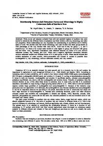
could be utilized as crops for food, fiber, pot herb, edible oil, fiber materials, traditional medicines etc., (Glenn et al., 1999; Zhao et al., 2002). Therefore, it is necessary to investigate the plant-soil relationship using the cultivation of halophytic crops. Considerable research has been done on soil-vegetation relationship in saline soils of China but the work has been mainly confined to inland areas like Songnen plain and Xinjiang (Pan et al., 1998; Yan et al., 2001; Li & Yang, 2004; Xin et al., 1999; Qu & Guo, 2003). Studies identifying the major environmental factors associated with vegetation patterns in coastal salt marshes are scarce (Li, 1993; Wu et al., 1994; Wang et al., 1994; Hu & Wang, 1997; Toth et al., 1995; Liu et al., 2003). Many of the studies on coastal salt marshes are just descriptive documentation of species and their classification. Recently, multivariate analyses including PCA (principle component analysis), CCA (canonical correlation analysis) and cluster analysis, have been used for analyzing soilvegetation relationship (Ukpong, 1994; Feoli et al., 2002.). Therefore, it was considered worthwhile to study the relationship between soil characteristics and halophytic vegetation in coastal saline soil of north China using multivariate analyses. The present study aims to describe the composition and distribution of plant species in a coastal salt marsh in north China and explores the relationship between halophytic vegetation and soil factors. Materials and Methods Study area: The salt marshes studied are located in Haixing County of the west coastal Plain of Bohai Gulf of China, East Plain of north China (Fig. 1), which occupies an area of 8 577 Km2. The site studied is a 1 Km2 natural saline soil area (38°11’30’’ N; 117°39’34’’ E) on the supra tidal coastal plain. Freshwater shortage is a serious problem in the area. The only fresh water resource is rainfall or deep ground water at 400 m depth, which is unrechargeable and was formed 20 000 years ago. More than 90% of shallow ground water is saline. Being characterized by monsoon-type climate, the rainfall in the area is highly variable. The mean annual precipitation is 500-600 mm. Of this 80% is received between June and September. The mean annual temperature is 12.1oC. Salt content of the surface soil is 0.3-1.2%. The depth to groundwater is 0.5-1.5 m, and salty water that is not suitable for irrigation is extensively distributed in the area (Hu & Wang, 1997). The diversity of halophytic species in these marshes is low, and includes Suaeda salsa, Nitraria sibirica, Aeluropus littoralis, Phragmites australis, Limonium bicolor, Imperata cylindrica etc. (Zhao et al., 2002). Sampling methods and chemical analysis: The 1 Km transverse transect of halophyte community was marked basing on the typical characters of the halophytic vegetation in the area with little change in micro-topography. As the vegetation type changed in transect, one quadrant was marked for each type of vegetation. A total of 33 quadrants were investigated, in the autumn of 2004. Each quadrant was 5m x 5m in size and divided into three homogeneous sub-quadrats (one m x one m for each) along the diagonal line of each quadrat for vegetation survey and sampling. The species were identified and relative frequency, plant height and canopy cover of each species were determined. Plant samples were collected from an area of one m x one m for biomass measurement. All plant samples were oven dried at 70oC for 48 hours for dry mass determination. The samples were wet-ashed and analyzed for Ca2+, Mg2+, K+ and Na+ using a HITACHI-170-10 atomic absorption spectrometer (Yu & Wang, 1988).
SOIL CHARACTERISTICS AND HALOPHYTIC VEGETATION IN NORTH CHINA
1083
Fig. 1. Location of the study area in north China.
Fig. 2. The dendrogram result of cluster analysis of 33 plots using squared Euclidean Distance.
1084
WEI-QIANG LI ET AL.,
Five soil cores (3.6 cm in diameter and 30 cm in depth) were taken from the root zone of each plot (sub-quadrat, hereafter called plot), and the soil separated from each soil core was prepared for analysis including soil moisture, salt content, pH value and available nitrogen content. Each soil sample was divided into two parts, one part was used for determining soil water content by weight loss after oven-drying at 105oC to constant weight, and the other part was air-dried, thoroughly mixed, and passed through a two mm sieve to remove gravel and boulder. The weight of gravel in each soil sample was determined and expressed as a percentage of the total weight of the sampled soil. The soil portion less than two mm in size was kept for chemical analysis. Electrical conductivity (EC) and soil reaction (pH) were evaluated in 1:5 (by weight) soil-water extract using conductivity meter and a glass electrode pH-meter, respectively. Soluble calcium and magnesium were determined by titration with EDTA, soluble chlorine by titration with AgNO3, and soluble carbonate and bicarbonate by titration with H2SO4 using methylorange and phenolphthalein, respectively. Soil salt content was determined by adding all the ions together. Available nitrogen content was determined by NaOH extraction method (Yu & Wang, 1988). Data analysis: Two data matrices representing soil and vegetation characteristics were constructed and the SAS system for windows (Ver. 6.0) and SPSS for windows (Ver. 11.5) software package were used for multivariate statistical analysis (PCA, cluster analysis and CCA) (Hong & Hou, 2001; Lu, 2002). In order to find the main factors affecting the classification of soil and vegetation, PCA and cluster analysis (Q type) were used. Principal components were considered useful if their cumulative percentage of variance approached 80%. Cluster analysis was attempted to identify relatively homogeneous groups of cases based on selected characteristics (principal components), using an algorithm that starts with each case in a separate cluster and combines clusters until only one is left. Based on the component capacity coefficient values of PCA, representative factors of different groups were selected for cluster analysis using Ward’s cluster method (Hong & Hou, 2001). Squared Euclidean Distance was used in the proximities procedure. Main soil characters and plant characters were used for cluster analysis with SPSS software package. CCA was used to analyse the relationship between the soil and vegetation variables. It provides a simple picture of complex relationship between soil and vegetation variables Results Principal component analysis: PCA was performed for soil and vegetation analysis in 33 plots in order to determine soil parameters controlling the distribution of vegetation. Nine plant species and 10 soil factors were used in the analysis. The first four principal components (PC1, PC2, PC3 and PC4) of soil factors together accounted for 85% of the total variance in data set (Table 1) with their individual contribution being 51%, 15%, 10%, 9%, respectively. PCA screened out four components for vegetation factors and their percentage variance values were 34%, 20%, 16%, 11%. The components cumulative percentage reached 80% (Table 1). The first principal component for soil was total salt content, followed by pH value, soil moisture and available soil nitrogen. For vegetation, the first principal component was richness followed by coverage, plant height and biomass.
SOIL CHARACTERISTICS AND HALOPHYTIC VEGETATION IN NORTH CHINA
1085
WEI-QIANG LI ET AL.,
1086
Cluster analysis: Based on the results of PCA, soil salt content, pH, soil moisture and available nitrogen were used to represent soil characters, while richness, cover, height and biomass were used to represent vegetation characters for cluster analysis (Fig. 2). Plots 10, 21, 25 and 28 were bare, and they were first classified out in the process of cluster analysis and were not shown in Fig. 2. The remaining 29 plots were classified into five groups according to Squared Euclidean Distance (=ten). The theoretical classification corroborated the results of vegetation investigation. Each group differed from the other in terms of vegetation and environment characters (Table 2). Names of communities were taken from the name of one or two species that dominated in the patches or occurred in typical combination. The vegetation types were categorized as follows: (1) bare soil with extremely high salt content and low available nitrogen; (2) A. littoralis and S. salsa community with high salt content and low water content and moderate available nitrogen; (3) S. salsa and A. littoralis community with moderate soil salt content and rich vegetation and moderate available nitrogen; (4) P. australis and A. littoralis community located in lower positions with low salt content and high water content and high available nitrogen; (5) I. cylindrica and S. viridis community with low soil salt content and low water content and high available nitrogen; (6) and farmland with low soil salt content and low water content and low available nitrogen. One-way ANOVA analysis showed that the cluster results were significantly (p