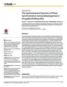
MARINE ECOLOGY PROGRESS SERIES Mar Ecol Prog Ser
Vol. 373: 173–186, 2008 doi: 10.3354/meps07666
Published December 23
OPEN ACCESS
Resolving fine-scale spatio-temporal dynamics in the harbour porpoise Phocoena phocoena Henrik Skov1,*, Frank Thomsen2, 3 2
1 DHI — Water · Environment · Health, Agern Alle 5, Hørsholm 2970, Denmark Biologisch-landschaftsökologische Arbeitsgemeinschaft, Gotenstraße 4, 20097 Hamburg, Germany
3
Present address: Centre for Environment, Fisheries and Aquaculture Science, Lowestoft Laboratory, Pakefield Road, Lowestoft, Suffolk NR33 0HT, UK
ABSTRACT: With the development of human activities in offshore shelf waters, the harbour porpoise Phocoena phocoena has become a focal species in relation to management of human activities and marine habitat conservation efforts. In this study, acoustic and visual time series of harbour porpoise occurrence were analysed from the Horns Reef area, eastern North Sea, aiming at resolving periodicity, spatial scale of aggregation and habitat drivers in porpoises. A total of 51 fine-scale surveys and 474 d of hydrophone deployment at 2 stations were analysed by partial least squares regression and spatial modelling in relation to synoptic (spatio-temporal) data derived from a local, high-resolution hydrodynamic model. Small-scale changes in local currents reflecting upwelling driven by the interaction of the semi-diurnal tidal currents with the steep slopes of the bank were the main habitat driver identified from the acoustic as well as the survey data. Spatial modelling based on selected key predictor variables showed the distribution of harbour porpoises to alternate between 2 upwelling cells depending on the direction of tidal currents. The size of upwelling cells was less than 10 km, matching the small-scale spatial structure of survey data as revealed by geostatistical analysis. The findings may have great implications for the design of future protected areas for harbour porpoises, and they indicate that the overlap between areas of concentration of the species and areas targeted by fisheries and the offshore wind industry could be avoided without major changes to current management practices. KEY WORDS: Fine-scale habitat · Harbour porpoise · Phocoena phocoena · Dynamic habitat modelling · Marine habitat conservation · Marine management · Offshore wind farms · Fisheries Resale or republication not permitted without written consent of the publisher
INTRODUCTION With the development of human activities in offshore shelf waters, the harbour porpoise Phocoena phocoena has become a focal species in relation to management of human activities and conservation efforts. This is highlighted through the implementation of the Agreement on the Conservation of Small Cetaceans of the Baltic and North Seas (ASCOBANS) and Annex 2 to the European Union (EU) Habitats Directive (EU Habitats Directive 1992). Although fisheries bycatch is still regarded as potentially the most significant threat to harbour porpoises (HELCOM Habitat 2004), concern has been raised towards disturbance by sub-sea noise emissions related to offshore construction works, such as wind energy installations (Nedwell & Howell 2004,
Madsen et al. 2006, Thomsen et al. 2006a, Tougaard et al. 2006). According to Annex 2 of the EU Habitats Directive, EU member states are obliged to designate marine protected areas (MPAs) that provide physical and biological features essential to the life and reproduction of harbour porpoises. However, our understanding of distribution patterns of harbour porpoises in EU waters is incomplete, and most surveys covering the species have been undertaken with the purpose to generate unbiased population estimates rather than estimates of the distribution (Hammond et al. 2002). In addition, acoustic monitoring is yet too premature to establish local area use as a basis for prioritising MPAs. As a result, for many areas such as shallow waters in proximity to the coast, which are targeted by the offshore wind industry, the pheno-
*Email:
[email protected]
© Inter-Research 2008 · www.int-res.com
174
Mar Ecol Prog Ser 373: 173–186, 2008
logy and population density of harbour porpoises have not been fully established. As a consequence, the implementation of the EU Habitats Directive has been incomplete for harbour porpoises. A side effect of the expansion of human activities in offshore waters has been the development of acoustic and visual monitoring programs that have provided new information about the spatial and temporal variability of harbour porpoises in smaller areas of shallow shelf waters of northwestern Europe (Scheidat et al. 2003, Thomsen et al. 2006b, Tougaard et al. 2006). We analysed the harbour porpoise monitoring data collected during 2002 to 2005, in relation to the construction of the Horns Reef 1 Offshore Wind Farm (Fig. 1), western Denmark, to discern habitat use characteristics. Although visual and acoustic recordings of harbour porpoises may give some insight into local spatio-temporal dynamics, the use of such data without coupling to dynamic oceanographic variables is
deemed to be very constrained. Modelling of reliable habitat suitability to marine animals often requires the availability of synoptic, dynamic variables (DoniolValcroze et al. 2005, Skov et al. 2005). However, the derivation of synoptic dynamic data on driving habitat parameters such as currents and hydrographic structures are often very difficult to obtain; the description of key habitat features typically stem from correlations with static parameters such as water depth and distance to land (Skov et al. 2003, MacLeod & Zuur 2005, Tougaard et al. 2005). Another key constraint has been the difficulty to sample the occurrence of porpoises at sufficiently high spatial and temporal resolution. Survey data are generally large scale and mean values averaged over entire survey campaigns potentially cover many hydrographic scenarios, while porpoise click detectors only gather information within very small ranges (~400 m, www.chelonia.co.uk; Villadsgaard et al. 2006). In this study we explored the use of
Fig. 1. Study area at Horns Reef. Location of small and mesoscale hydrographical processes and main topographical structures found in the Horns Reef area. Upwelling sites (as indicated by the hydrodynamic model) are indicated by lilac raster for north- and south-flowing tidal currents, respectively (main direction of semidiurnal tide is indicated by arrows)
175
Skov & Thomsen: Fine scale spatio-temporal dynamics of harbour porpoises
synoptic, high-resolution, hydrodynamic modelling data to derive potential dynamic habitat parameters for harbour porpoises in the Horns Reef area, which could be used to generate an improved understanding of the dynamics of harbour porpoises reflected in survey and acoustics data. We assess the implications of the results for the implementation of the EU Habitats Directive and for the sustainable development of offshore wind and other offshore industries targeting shallow shelf environments.
MATERIALS AND METHODS Study area. The Horns Reef area is a shallow reef system with depths of less than 10 m and consisting of a mixture of gravely and sandy sediments. It can be divided into an outer and an inner reef separated by a deeper channel. The outer reef is a terminal moraine ridge, while the inner reef consists mainly of deposited material (Leth 2003). Several shallow bank areas are found within the reef system including VovVov and Tuxen located in the western and central parts and Munk and Vyl located in the eastern parts (Fig. 1). The Horns Reef area is strongly influenced by waves and large tidal fluctuations. The mean tidal range varies between 1.5 and 0.5 m (Edelvang et al. 1999). Hydrodynamic modelling. We constructed a local 3D hydrodynamic model for the Horns Reef area covering the entire period between 2002 and 2005 at a temporal resolution of 1 h. The model was set up using DHI’s model system MIKE 3 (www.dhigroup.com/ Software/Marine/MIKE3.aspx), which is a fully dynamic, barotropic and baroclinic 3D model. We used a finite difference grid, in which the hydrodynamic conditions are described in quadratic elements. The size of elements varied horizontally from 500 m in the core model area to 1500 m in the surrounding boundary area, which extended southwards to the North Frisian Islands. The vertical resolution was 2 m except for the surface layer, which had a depth of 5 m to take into account the tidal amplitude. The model parameters are given in Table 1. The hydrodynamic model, which was georeferenced to WGS84, UTM Zone 32, calculated the water levels (relative DVR90 datum), currents (3 components), temperature and salinity at half-hour intervals. The mete-
orologic forcings for the model were delivered from Vejr2 (www.vejr2.dk) at a resolution of 0.15° and a temporal resolution of 1 h. The following data were interpolated at 1500 m resolution and taken from the sea surface: air pressure (hPa), air temperature (°C) and air speed and direction (10 min means, m s–1, radians). The model had 2 open boundaries, which were forced with salinity, temperature and water levels derived from DHI’s operational waterforecast service for the North Sea (www.waterforecast.com). To obtain precise distributions of density differences, time series data from 7 sources of major freshwater discharges into the area were included. For the 3 German rivers, Elbe, Weser and Ems, the actual daily discharge rates from the Bundesanstalt für Gewässerkunde were used (www.bafg.de). For the 4 Danish freshwater sources, climatic discharge data were used. Survey data. Between April 1999 and December 2005, a total of 51 dedicated ship-based line-transect surveys for harbour porpoises were carried out during the biological monitoring of the Horns Reef 1 Offshore Wind Farm. Details of the survey methodology operated during the targeted harbour porpoise surveys are given in Tougaard et al. (2003). In addition, several non-dedicated surveys were undertaken during the monitoring period by means of ships of opportunity. Data from 4 surveys were selected for this analysis based on the following criteria: (1) the sample sizes were sufficiently large to allow fine-scale temporal resolution of analyses (>100 individuals observed during each 2 d survey), (2) they overlapped temporally with the model data and (3) they reflected different largescale hydrodynamic scenarios covering the entire longitudinal range of the large-scale density front in the northern German Bight (see ‘Results – Hydrodynamic modelling’ for details of the oscillation range of the density front). The surveys were: 28 July 2002, 8 August 2002, 6–7 August 2003 and 20–21 August 2005. The harbour porpoises were recorded using standard line-transect methods during calm weather conditions (Beaufort wave height < 3) along a minimum of 10 east –west transect lines covering approximately 400 km (Fig. 2). Additional survey lines were surveyed to the north of Horns Reef when weather permitted. The distance between the 7 transect lines in the southern part was 2.5 km, while the distance between the lines in the northern part was 5 km. Due to the
Table 1. Specifications for the hydrodynamic model Area
Horizontal resolution (m)
Germany Bight Horns Reef
1500 500
Longitude and latitude; angle
East –west range (km)
North–south range (km)
6° 33’ 23’’ E, 52° 56’ 60’’ N; 1.951° 6° 51’ 03’’ E, 55° 05’ 10’’ N; 1.763°
232.5 120.5
364.5 81.5
Vertical range: maxiVertical mum depth (m) resolution (m) 48 36
2 2
176
Mar Ecol Prog Ser 373: 173–186, 2008
Fig. 2. Seasonal distribution of survey effort obtained during 51 surveys from 1999 to 2005 as well as during non-dedicated surveys. Each dot represents the central position of each transect segment (2 time minutes). The seasons are: winter (Dec–Feb), spring (Mar–May), summer (Jun–Aug) and autumn (Sep–Nov). The 10 m (dashed) and 20 m (solid line) depth contours are indicated
draught of the survey ships the shallowest parts of the reef were not crossed during the transects. Maps showing the seasonal variation of the survey effort are given in Fig. 2. Three observers ran observations simultaneously; 2 observers used binoculars to improve detection of porpoises ahead of the survey ship, while the 3rd observer made recordings. All data were collected at a spatial resolution between 450 and 650 m. All 3 observers searched an area of 500 m within a 180° search radius in front of the ship and used angle boards and distance calipers to determine distances and angles to first sightings. Acoustic time series. Data were recorded with automated porpoise click detectors (T-PODs, Chelonia Marine Research). A detailed description of the T-PODs and the T-POD software, including a manual for data acquisition and analysis, can be found at www. chelonia.co.uk/about_the_tpod.htm (see also Thomsen et al. 2005). The TPOD is a self-contained and fully automated system for the detection of echolocation clicks from harbour porpoises and other odontocetes. It is programmable via specialized software. The T-POD consists of a hydrophone, an analogue click detector, a digital timer and a duration logger. Sonar clicks from porpoises are detected by the comparison of the outputs of 2 band-pass filters. One filter is set to the peak spectral frequency of clicks of harbour porpoises (130 kHz; Au et al. 1999, Villadsgaard et al. 2006). The other filter is set away from the centre frequency at around 90 kHz. The software filters out boat sonar and echo sounders by analysing intervals between clicks. The T-POD hardware settings can be re-configured 6 times each minute. In each of these 6 ‘scans’ the T-POD logs for 9.3 s using the selected values for high and low filters and 3 additional parameters (details in Thomsen et al. 2005). The hydrophone of the T-POD is omni-directional in the horizontal plane and has a detection range for porpoise clicks of around 300 to 500 m (Villadsgaard et al. 2006, N. Tregenza pers.
Skov & Thomsen: Fine scale spatio-temporal dynamics of harbour porpoises
comm.). There are different versions of T-PODs (V1– V4), such that running time depends on voltage input, memory and settings, and is usually about 60 d. Data can be downloaded from the T-POD to a computer via a parallel or USB port. Through an algorithm, the T-POD software automatically identifies click trains (clusters of clicks) in different classes according to their probability of coming from porpoises (CET HI to DOUBTFUL; details in Thomsen et al. 2005). The collection and pre-processing of the acoustic data was originally conducted within the framework of the monitoring studies related to the Horns Reef 1 Wind Farm. A detailed description of the methodology can be found in Tougaard et al. (2003, 2005, 2006). For the purpose of this analysis we used data collected from T-PODs deployed during 2002 to 2005 at 2 stations, located in the western and eastern parts of the reef (termed Horns Reef 1 and 7, respectively; Fig. 3). In the course of the analysis it became evident that different manufacturer versions of the T-POD had a strong influence on the data (Skov & Thomsen 2006). Therefore, it was decided to run the analysis based on data recorded by T-PODs of only one version (V1) for
177
which the largest amount of data was available. The devices also exhibited similar sensitivities (N. Tregenza pers. comm.). A total of 170 data-days were used from Horns Reef 1 (from March 2002 to March 2004) and 304 data-days were used from Horns Reef 7 (from March 2002 to August 2005) with 2 different T-PODs used at each station. We selected the parameters ‘waiting times’ and ‘daily click frequency’ as indicators of acoustic activity based on extraction of 2 classes of click trains with a high certainty of being from porpoises (CET-HI, CETLO; Tougaard et al. 2005). Daily click frequency is the proportion of minutes with clicks per day; waiting times are the number of minutes in a silent period lasting more than 10 min; thus, lower waiting times compared with another T-POD recording indicate a higher presence of porpoises. We first transformed the 2 indicators to arrive at a normal distribution (daily frequencies = arcsine; waiting times and encounter durations = log[y]; see also Tougaard et al. [2005] for a detailed description of the transformation process. Each time series (= periods of successive logging days per pod per station) was then tested with a Durbin–Watson test for serial autocorrelation. Time series of daily click frequencies were found to be autocorrelated. To correct for this, every time series was modelled using an auto-regressive moving average (ARMA, 1, 0, 1) process, resulting in non-autocorrelated residuals (Box & Jenkins 1970). To preserve the original differences across deployments, the mean of each time series was added to the residuals. This resulted in time series of daily frequencies that were not autocorrelated, but still showed the trends of the original data. An example of this procedure can be found in Fig. 4. It can be seen that the series of the transformed data is highly autocorrelated whereas the residual series derived after the ARMA modelling is not. Statistical analysis. To assess the determination of the most relevant physical oceanographic features to use for an exploratory analysis of potential habitat drivers, we carried out a geostatistical analysis of the sampled encounter rates. The empirical and experimental variograms were used to evaluate the scale (spatial scale) of potential topographic and dynamic habitat features, and we used this information to process the hydrodynamic variables into Fig. 3. Position of stationary hydrophones (T-PODs, dots), the 10 m (dashed line) and 20 m (solid line) depth contours are indicated. Shading represents bathymetry potential habitat parameters and to (see Fig. 1) stratify the analysis into time periods
178
Mar Ecol Prog Ser 373: 173–186, 2008
lying responses of the species from factors underlying the levels of the predictor variables extracted from cross-product matrices involving both the predictor and response variables. As the distributional properties of the estimates from the PLS regression are not known, no assessment of significance has been made and, therefore, the PLS re0 10 20 30 40 50 60 70 gression has been used solely for exDays ploratory analyses. Based on the results, a Time Series B. Station 7. T–POD 282. 10.03.05–13.05.05 – residuals smaller number of parameters or combination of parameters were selected on the basis 0.2 0.15 of the relative size of the scaled regression 0.1 coefficients and used for habitat modelling. 0.05 Based on the results of the geostatistical 0 analysis we chose to stratify the analysis by –0.05 semi-diurnal tidal phase and collated mean –0.1 values of hydrodynamic variables and 0 10 20 30 40 50 60 70 encounter rates in a raster GIS environment Days (Idrisi Version Kilimanjaro, ArcGIS v9.1) using UTM32 N projection with WGS84 Time Series B Time Series A datum at a spatial resolution of 500 m. The Lag AutoCorr Lag AutoCorr acoustic time series were linked to spatio1.0000 0 0 1.0000 temporally synoptic hydrodynamic data by 1 0.4337 1 –0.0147 choosing the model grid located at the clos0.3450 2 2 0.0468 est position to the stationary hydrophone. 0.1634 3 3 –0.1275 0.2024 4 4 0.0228 The initial versions of the PLS model 0.2097 5 5 0.1194 included more than 200 variables, the origi6 0.1329 6 0.0728 nal variables and their cross-products and 0.0038 7 7 –0.0312 8 –0.1724 8 –0.2687 2nd and 3rd order polynomials, while the 9 –0.0533 9 0.0173 final version was limited to the variables that 10 –0.1001 10 –0.0837 best reflected the distinct auto-correlation 11 –0.0262 11 0.0209 scale of the harbour porpoise survey data 12 –0.0923 12 –0.1407 13 –0.0145 13 –0.0392 and showed the largest regression coeffi14 0.0906 14 0.0680 cients. Fig. 4. Time series of daily click frequencies and the residual series from a Stn 7 A total of 23 original potential habitat varideployment in 2005. The autocorrelation graph is shown below, indicating ables were computed by post-processing of Lag 1 and Lag 2 autocorrelation (left graph) for the transformed frequencies the Horns Reef hydrodynamic model data and no autocorrelation in the residuals (right graph). Black horizontal line (top and local bathymetry data (Table 2). Rather panels): mean values. Pair of black vertical lines (bottom panels): confidence than a standard presence–absence analytilimits of the ARMA 1, 0,1 model fit for serial autocorrelation cal design we chose to use a presence-only design for the visual data to take account of the potenreflecting the identified key processes. The acoustic tial bias in the sampled zero counts and lower range of time series of click frequencies and waiting times of densities introduced by the variable weather condiharbour porpoises were summarized into daily mean tions encountered during the monitoring programme. values for Stns 1 and 7 (Fig. 4). The key environmental We used the predictive presence-only model, ecologidrivers behind the spatio-temporal dynamics of harcal niche factor analysis (ENFA, Hirzel et al. 2002), for bour porpoises were explored by combined factorial making spatial predictions of habitat suitability for harand polynomial model designs in partial least squares bour porpoises. ENFA has been successfully applied to (PLS) regression (Naes & Martens 1985, Geladi & presence-only data in terrestrial (Hirzel et al. 2002, Kowalski 1986). PLS regression is an extension of the Zimmermann 2004) and marine ecology (Leverette multiple linear regression model and allows for the 2004). The modelled habitat suitability in ENFA shows determination of complex responses in species data 2 key aspects of the investigated species’ habitat: marto collinear physical data. In relation to the goal of ginality and specialization. The principle of the analythis analysis, PLS regression is especially useful as it sis is the mathematical comparison between the envienables the prediction of environmental factors under0.5 0.45 0.4 0.35 0.3 0.25 0.2 0.15 0.1
8
0.
4
0.
0
–0 .4
–0 .8
8
4
0.
0.
0
–0 .4
–0 .8
Click frequency
Click frequency
Time Series A. Station 7. T–POD 282. 10.03.05–13.05.05 – transformed
179
Skov & Thomsen: Fine scale spatio-temporal dynamics of harbour porpoises
Table 2. Original dynamic and topographic variables included in the statistical analyses as potential habitat variables Parameter
Description
Stability of the water column U V Relative vorticity W
Richardson numbera, Ri =
D S T Wa ΔU ΔV ΔW ΔSurface density ΔSurface salinity ΔSurface temperature Bathymetry Bottom relief Northern aspect of sea floor Eastern aspect of sea floor
gβ (∂u / ∂z )2
On-shore current vector at the surface (m/s) Long-shore current vector at the surface (m/s) dV/dx – dU/dy Vertical (upward) current vector at the surface Density at the surface (kg m– 3) Salinity at the surface (‰) Temperature at the surface (°C) Water level (m) Gradient in U Gradient in V Gradient in W Gradient in surface density Gradient in surface salinity Gradient in surface temperature Negative depth values Bathymetry gradient Sine of the direction of the maximum slope Cosine of the direction of the maximum slope F = (n – 1) / (c – 1)
Bottom complexity (F ) calculated for 5 × 5 kernelb Distance to shallow areas Euclidean distance in m (< 8 m water depth) Distance to shallow area at Euclidean distance in m Søren Jessens Sand (< 8 m water depth) Distance to shallow area on Euclidean distance in m Horns Reef (< 8 m water depth)
defined as the absolute difference between the global mean (m G) and the species mean (m S), divided by 1.96 standard deviations (σG) of the global distribution M =
( mG − mS ) (1.96σ G )
(1)
Habitat specialization is defined as the ratio of the standard deviation of the global distribution to that of the species distribution. For harbour porpoises, ENFA was applied to the tidal phase scenarios of each of the 4 selected surveys using BioMapper v3 2005 (University of Lausanne). The initial version of the habitat model included all 23 variables, yet in the final version we limited the variables to those with a clear effect on habitat marginality (coefficient > 0.1 for any of the first 3 factors).
RESULTS Hydrodynamic modelling
The results of the local hydrodynamic model show that the hydrography of Horns Reef can be characterised as a frontal complex determined both by the large-scale convergence between a In formula g is the acceleration of gravity, β is a representative of vertical North Sea water masses and estuarine stability (commonly ∂θ/∂z, where θ is potential temperature), and ∂u/∂z is a water masses from the south, and by characteristic vertical shear of the wind b small-scale fronts and upwelling cren = number of different classes present in the kernel, c = number of cells ated by interactions between the semidiurnal tidal currents and the steep ronmental space represented by the species distributopography (Fig. 1). The salinity range of the area tion and the global distribution in the Horns Reef area spans from 30 ‰ to > 34 ‰. (Hirzel et al. 2002). Like principal component analysis, The large-scale frontal system is mainly driven by ENFA summarizes environmental data into a few wind and current conditions in the North Sea and uncorrelated factors representing all environmental inflow rates of freshwater from the Elbe and other parameters while retaining most of the information. large rivers in Germany (Dippner 1993). The mean Habitat marginality can be defined as the direction in position of the estuarine front at the latitude of Blåthe multivariate environmental space on which the vandshuk is located at the western tip of Horns Reef species habitat differs the most from the available con(Skov & Prins 2001). However, the location of the front ditions in the Horns Reef area; therefore, this paramemay vary over a longitudinal range of up to 50 km ter is useful for making inferences about the relative between different climatic scenarios, which have a importance of key habitat drivers. Habitat marginality typical oscillation rhythm of more than 1 d (Fig. 1). (M ) is computed by drawing a straight line between Many other characteristics that separate the North Sea the centroids of the ellipsoids of the global distribution from the estuarine water masses follow the large-scale (environmental space displayed by the whole study dynamics, including transparency of the water due to area) and the species distribution (environmental concentrations of suspended sediments in the water space displayed by the species observations) and is column, chlorophyll a, nutrients and other anthro-
180
Mar Ecol Prog Ser 373: 173–186, 2008
pogenic discharges. The estuarine water mass moves erratically in a northern direction towards Skagerrak in what is known as the Jutland Coastal Current (Lee 1980). Despite the tidal currents, rough waves (mean wave height, 1 to 1.5 m, Edelvang et al. 1999) and constant mixing of the water, the whole area is moderately stratified due to the large input of fresh water from the rivers flowing into the German Bight. The tidal currents at Horns Reef essentially alternate between NNE and SSW directions with a mean water velocity of 0.5 to 0.7 m s–1. Water velocities of 0.7 m s–1 up to 1.5 m s–1 are not unusual at Horns Reef (Edelvang et al. 1999). The interaction between the steep topography of the reef and the tidal currents create small upwelling cells with a radius of less than 10 km (Fig. 1). During the south-flowing tide an upwelling cell is typically located at the northern slope of the outer reef, where the tidal current is forced through the channel in Slugen. During the north-flowing tide, upwelling cells are typically located at the southern edges of the shallowest parts of the outer reef and at the southern slope of the inner reef at Søren Jessens Sand (Fig. 1).
Survey data Harbour porpoises were sighted throughout the study area on Horns Reef, and even large aggregations were encountered during one or more of the 51 surveys in almost any part of the area (Fig. 5). However, the geostatistical analyses of the porpoise survey data showed a prominent shift in the autocorrelation structure at the spatial distance of just less than 10 km, thus indicating processes controlling aggregations of porpoises related to topographic–hydrographic structures of less than 10 km (Fig. 6). Accordingly, postprocessing of the hydrodynamic data was carried out with the aim to generate variables reflecting smallscale physical features like fronts between water masses, topographic variability and upwelling rather than variables reflecting coarse-scale physical regimes like the reef structure, the density front or water masses (Table 2). The PLS analysis of environmental drivers behind the spatial dynamics of the harbour porpoise at Horns Reef stressed the importance of dynamic, small-scale structures and processes reflected by the interactions between hydrodynamic features and fine-scale topography (Table 3). The results for both scenarios (northand south-flowing tidal currents) unambiguously showed that topographic variables only played a minor role as habitat drivers. Between the 2 scenarios the nature of the coupling between harbour porpoise sightings and interactions of hydrodynamic and topographic variables changed slightly. Large coefficients
Fig. 5. Harbour porpoise sightings obtained during all seasonal surveys. Only sightings from the dedicated surveys are included in the graphic. The 10 m (dotted line) and 20 m (solid line) depth contours are indicated
during north-flowing tidal currents were mainly related to hydrodynamics at large distances from land (as indicated by interactions between ‘distance Jessen’ and dynamic parameters), both horizontal and vertical
181
Skov & Thomsen: Fine scale spatio-temporal dynamics of harbour porpoises
Table 3. Main environmental drivers behind the spatial dynamics of the harbour porpoise during the selected surveys as determined by the results of the PLS regression analysis. Regression coefficients are shown for the 3 most important factors for northward and southward tidal currents. Tidal currents are noted as flowing either northward (N) or southward (S)
22 20 18 16 14
Date and tidal current
12
28 July 2002 S S S N N N
10 8
Encounter rates 6–7 August 2003, N-flowing tide
6
2
0
0 16
00
00 14
12
00
0
0 00
00 80
10
00 60
00 40
00
0
0
Coefficient
V 2 × Bottom slope ΔU × Bottom slope ΔW × W 2 U2 × V2 Distance Jessen × ΔU Distance Jessen × W
0.35 0.34 0.33 0.36 0.32 0.23
V3 ΔW 2 ΔW × Distance Horns Reef ΔU × ΔV Distance Horns Reef × Bottom slope Distance Jessen × W
0.32 0.3 0.24 0.31 0.3 0.28
8 August 2002
20
Variogram
4
Factor
140
S S S N N N
6–7 August 2003 S S S N N N
120 100 80
ΔV U2 × V2 Distance Jessen × Bottom slope V3 V2 ΔV × U 2
0.22 0.14 0.14 0.43 0.3 0.3
20–21 August 2005 S S S N N N
Encounter rates 20–21 August 2005, N-flowing tide
60 40
V3 Bottom slope2 ΔW × V 2 Distance Jessen × W U 2 × Distance Horns Reef V2 × W
0.36 0.29 0.27 0.28 0.15 0.14
20
16
00
0
0 00 14
12
00
0
0 00 10
00 80
00 60
00 40
00 20
0
0
Lag distance (m) Fig. 6. Spherical model fits to experimental variograms showing autocorrelation of survey data (encounter rates) for 2 surveys (north-flowing tide)
current velocities as well as horizontal fronts. During south-flowing tidal currents the dynamic parameters and their interactions with topography seemed to play an important role throughout the Horns Reef area (as indicated by interactions between slope and dynamic parameters). The spatial modelling results corroborated the results of the PLS analysis and gave indications of the location of areas of high habitat suitability in relation to mapped areas of small-scale hydrographic processes (Fig. 7). Following the results of the PLS analysis it was
clear that topographic variables alone were unlikely to summarise the main habitat features for the species. The modelled habitat suitability and habitat marginality for harbour porpoises evaluated for different frontal scenarios and evaluated for south-flowing and northflowing tidal phases displayed discrete areas of concentrated use and obvious variability in the general pattern of habitat use, despite the influence of Horns Reef on the distribution during both tidal phases (Table 4, Fig. 7). During south-flowing tidal currents high marginality values were related to areas with low salinity and high complex and slope values (Table 4). This is reflected in the modelled areas of high habitat suitability at the northeastern slope of Horns Reef as well as at the eastern slope, areas that closely overlap the modelled location of the upwelling cells during south-flowing tide (Fig. 7). During north-flowing tidal currents high marginality values were related mostly to areas with high long-shore and vertical current velocities (Table 4), which was reflected by the modelled areas of high habitat suitability at the southwestern
182
Mar Ecol Prog Ser 373: 173–186, 2008
Fig. 7. Modelled habitat suitability for both tidal current scenarios. Plots of sightings of harbour porpoises made during the 2 tidal phases are shown below the model results
Skov & Thomsen: Fine scale spatio-temporal dynamics of harbour porpoises
183
Table 4. Example of results of the ecological niche factor analysis for observations of harbour porpoises during northflowing tide (North; 6–7 August 2003) and south-flowing tide (South; 28 July 2002). Coefficient values for the marginality factor are given. Positive or negative values mean that porpoises prefer locations with higher or lower values, respectively, than average for the modelled area Variable
Marginality North South
Distance Søren Jessens Sand Distance Horns Reef Eastern aspect of seafloor Northern aspect of seafloor Bathymetry Complexity of seafloor Slope of seafloor Salinity Onshore current velocity Long-shore current velocity Vertical current velocity
0.206 –0.613 –0.285 –0.058 0.165 0.235 0.219 0.002 –0.148 0.349 0.458
0.161 –0.498 0.156 0.025 0.221 0.509 0.397 –0.412 –0.055 0.209 –0.135
slope (Fig. 7). The southwestern slope area during north-flowing tidal current seems to be the main habitat for porpoises at Horns Reef, and the area is almost identical to the modelled location of the upwelling cell during north-flowing tide (Fig. 7).
Acoustic time series The analyses of key drivers behind the variability of acoustic activity in harbour porpoises at Stns 1 and 7 at Horns Reef demonstrated the existence of several trends in the responses of the acoustic indices click frequencies and waiting times to the environmental parameters (Fig. 8). Overall, the major responses were related to parameters, especially higher order levels and interactions between dynamic parameters, that represent short-term (hours) processes, specifically currents and winds. At both stations, both acoustic indicators showed almost the same responses with waiting times giving the clearest results (Fig. 8). Short waiting times (negative regression coefficients) showed the strongest responses to vertical current velocities in combination with winds (long-shore as well as onshore velocities). Negative responses can be associated with currents and no response with winds alone. Looking at the daily click frequency at Stn 1, there were positive responses to winds and vertical current velocities and to onshore currents if accompanied by strong winds or vertical current velocities. There were negative responses to strong currents, with and without high water levels, vertical current velocities and winds (Fig. 8). Similar responses in daily click frequencies were seen for Stn 7.
Fig. 8. Results of PLS regression analysis for acoustic data shown for waiting times. The graph shows scaled regression coefficients for each potential habitat variable (listed as column number); the most significant variables are labelled. No. of components: 10
DISCUSSION The interactive use of hydrodynamic models with acoustical and survey data gave promising results in relation to resolving the spatio-temporal variability of harbour porpoises in a relatively small area of the North Sea. Despite the fact that porpoises were sighted throughout the study area both analyses of scale dependencies and correlations with model data pointed to the importance of tidal-driven upwelling, and hence, the presence of quarter-diurnal dynamics in the occur-
184
Mar Ecol Prog Ser 373: 173–186, 2008
rence of harbour porpoises at Horns Reef. The results of the exploratory analyses provided measures for interpreting the use of the Horns Reef area by harbour porpoises on a long-term basis. The statistical analysis of responses in acoustic data gave strong indications that vertical velocities and, hence, local upwelling is a main driver for acoustic activity of this species at Horns Reef. Our analysis was restricted to average daily values, however, and finer temporal resolution of the acoustics data might have given more insights into the coupling between upwelling and acoustic activity. We were also forced to choose only a subset of the original data, since different versions of the T-POD varied greatly in sensitivity making comparisons between results obtained by different versions difficult (Tougaard et al. 2005, Skov & Thomsen 2006; for a recent review on T-POD variability see also Leeney & Tregenza 2006). Future studies using large and uniform data sets and a finer temporal resolution should explore the interactions between acoustics and hydrodynamic variables further. The statistical tests of the habitat associations of the surveyed harbour porpoises were also made on the basis of a subset of the available surveys. Analysis of the response of harbour porpoises to dynamic variables during all 51 surveys was not possible, yet it might have given stronger documentation of described habitat dynamics. However, we are confident that the indication of topography-steered upwelling as the main habitat driver is not an artefact of choosing a narrow range of meso-scale hydrographic scenarios, as the selected surveys covered scenarios with the location of the density front ranging from west of the outer Horns Reef to the eastern part of the inner Horns Reef. It is unlikely that the described oscillations of harbour porpoise concentrations in response to the direction of semi-diurnal tidal currents could take place accidentally across the entire range of density frontal situations. Our finding that complex interactions between tidaldriven hydrodynamics and bathymetry seem to constitute a key habitat driver for harbour porpoises is supported by the combined remote sensing, satellite telemetry and survey study of the species’ local biological oceanography in the Bay of Fundy, Canada (Johnston et al. 2005). In the Bay of Fundy, harbour porpoises seem to forage on aggregations of prey linked to regions of enhanced relative vorticity, like island and headland wakes. Unfortunately, comparable studies in other parts of the North Sea are not yet available. However, several studies have indicated the presence of a north–south gradient in porpoise densities along the German Wadden Sea (Benke et al. 1998, Sonntag et al. 1999). Furthermore, it has been suggested that harbour porpoises in the German Bight area are associated with the estuarine frontal system of
the area in the same way as documented for piscivorous birds (Skov & Prins 2001). These results comprise a step towards a more dynamic understanding of the distribution of harbour porpoises in response to temporal and spatial variability of their habitat, knowledge that may subsequently lead to improved predictions and interpretations of survey data of this and possibly other cetacean species. The results clearly show the importance of being able to resolve short-term and small-scale variability of the occurrence of the species. Further studies will show whether these characteristics are only applicable to Horns Reef, or whether distributions of the harbour porpoise need to be averaged over different temporal or spatial scales as presented here. Furthermore, the results stress the need for using dense spatio-temporal grids as a basis for mapping distribution patterns of harbour porpoises and the importance of available concurrent data on current velocities and directions. Our results correspond well with other studies concluding that dynamic rather than static variables are the key drivers of cetacean distributional dynamics (Doniol-Valcroze et al. 2005, Skov et al. 2005). Derivation of essential habitats for harbour porpoises and other small cetaceans also depends on integration of data on prey distribution and feeding habits. In the Horns Reef area, no knowledge exists on prey preferences of harbour porpoises, and neither the visual survey data nor the acoustic activity indices can be used to provide information on their feeding behaviour. However, sand eels (Ammodytidae), which constitute an important prey item for the species in the western North Sea (Martin 1996), are locally abundant (Jensen et al. 2006). Field studies and model results in relation to wind farm constructions at Horns Reef have indicated movements of sand eels from benthic sandy ‘buried’ habitats on top of the bank to pelagic feeding habitats at the slopes of the bank (Jensen et al. 2006). Although no direct links have been made between the field data on sand eels and harbour porpoises in the area, it is likely that the oscillations of porpoises reflect local feeding aggregations of sand eels. The importance of the topographically controlled hydrodynamic structures as fine-scale habitat drivers for the harbour porpoise may be a widespread phenomenon and may be interpreted in light of their visual, acoustic and locomotive constraints in perception of prey. The visual senses and acoustic sonar of harbour porpoises do not generally allow for an immediate perception of the extraordinary heterogeneity found within the shallow shelf environments in which they live (McNamara 1982). Feeding at predictable frontal structures with enhanced availability of prey may, therefore, constitute a means for this species to limit the effect of their
Skov & Thomsen: Fine scale spatio-temporal dynamics of harbour porpoises
185
dict gradients in habitat use more accurately in relaperceptual constraints by reducing the main area tion to the affected sites. Thus, the possibility now within which to search for food patches. Combined exists to reduce interference between human activities studies on the local dynamics of harbour porpoises, and key feeding sites, and thereby reduce the risk of prey and hydrodynamics are needed to resolve these habitat displacement, injury and mortality, by identifyquestions. ing boundaries of high-density areas more precisely. Harbour porpoises are seen throughout the year in Within the scale of aggregations in harbour porpoises the area of Horns Reef, yet there are indications of less of less than 10 km, considerable potential may exist for frequent observations of large numbers of harbour porsuccessful mitigation and strategic planning of offpoises during the winter months and lower acoustic shore activities in relation to habitats of harbour poractivity. Although the harbour porpoise can be seen in poises and other small cetaceans. large numbers throughout the year, it is considered Analyses of time series on harbour porpoises from most likely that the area is used by porpoises from a other shallow benthic areas will prove whether the large regional population using wider areas of the findings from Horns Reef can be used as general North Sea for feeding, as indicated by satellite tracking guidelines for habitat conservation and management (Teilmann et al. 2003). Population estimates of harbour of human activities in these environments. porpoises for the Horns Reef area indicate that the number of porpoises using the area during a specific (short) period of time is between 500 and 1000 (Skov et Acknowledgements. The acoustic and visual data on which al. 2002, Tougaard et al. 2003). This relatively high the analyses were based have been collected in relation to the abundance of harbour porpoises is also illustrated by biological monitoring programme for the Horns Reef I Offthe fact that more than 100 individuals were sighted shore Wind Farm (Vattenfall). We are grateful to the field during half of the ship-based monitoring surveys. teams from the National Environmental Research Institute, Ornis Consult, Orbicon and DHI Water & Environment According to Article 4.11 of the EU Habitats Direcresponsible for the collection of these data. Most notably we tive, areas of essential habitat need to be protected for thank J. Teilmann and J. Tougaard for their previous conwide-ranging species, such as the harbour porpoise tributions. The analyses formed part of an environmental (EU Habitats Directive 1992). So far, Germany is the impact assessment for the Horns Reef 2 Wind Farm planned by DONG Energy (DONG Energy 2006, Skov & Thomsen only member state that has designated areas under 2006). We are grateful to R. Mundry for statistical advice and the Habitats Directive specifically for this species. The W. Piper for technical assistance and comments on an earlier obstacles for designation of habitat conservation areas version of the paper. for this species by most member countries, including Denmark, are probably both political/jurisdictional and methodological. Our results indicate that the size LITERATURE CITED of areas used intensively by harbour porpoises at offshore banks might be smaller than previously esti- ➤ Au WWL, Kastelein RA, Rippe T, Schooneman NM (1999) Transmission beam pattern and echolocation signals of a mated. Further studies will show whether the impleharbor porpoise (Phocoena phocoena). J Acoust Soc Am mentation of the EU Habitats Directive for this species 106:3699–3705 Benke H, Siebert U, Lick R, Bandomir B, Weiss R (1998) The can be made with only moderate political and juriscurrent status of harbour porpoises (Phocoena phocoena) dictional consequences. in German waters. Arch Fish Mar Res 46:97–123 Still, identification of suitable areas in relation to the Box G, Jenkins G (1970) Time series analysis: forecasting and EU Habitats Directive may require a combination of control. Holden-Day, San Francisco, CA more traditional methods applied during aerial or ➤ Dippner JW (1993) A frontal-resolving model for the German Bight. Cont Shelf Res 13:49–66 ship-based surveys (Hammond et al. 2002) and more Doniol-Valcroze T, Berteaux D, Sears R (2005) Multivariate sophisticated methods like the one described here. The analysis of habitat selection by Rorqual whales in the Gulf use of dynamic high-resolution models such as that of St. Lawrence, Quebec, Canada. Proc 16th Biennial Conf applied for Horns Reef could be a useful tool if applied Biol Mar Mammals, December 2005, San Diego, CA Edelvang K, Møller AL, Steenberg CM, Zorn R, Hansen EA, for predicting areas of suitable habitat, which could Mangor K (1999) Environmental impact assessment of become the target of field efforts to survey and map hydrography. Horns Rev Wind Power Plant. Danish the exact distribution and numbers of harbour porHydraulic Institute, Hørsholm, Denmark poises. EU Habitats Directive (1992) Council directive 92/43/EEC of The documentation of fine-scale habitat use by har21 May 1992 on the conservation of natural habitats and of wild fauna and flora. Official Journal of the European bour porpoises may also introduce new solutions to Communities No. L206, 22–07–1992 sustainable management of fisheries, offshore wind Geladi P, Kowalski B (1986) Partial least-squares regression: a ➤ farms and other human activities in areas of high tutorial. Anal Chim Acta 185:1–17 abundance of porpoises. With the application of fineHELCOM Habitat (2004) Minutes of the 6th meeting of the Helsinki Commission Working Group on Biodiversity and scale, dynamic habitat models it is now possible to pre-
186
➤
➤
➤ ➤
➤
➤
Mar Ecol Prog Ser 373: 173–186, 2008
Nature Protection, May, 2004, St Petersburg. Helsinki Commission, Helsinki Hammond PS, Berggren P, Benke H, Borchers DL and others (2002) Abundance of harbour porpoise and other cetaceans in the North Sea and adjacent waters. J Appl Ecol 39:361–376 Hirzel AH, Hausser J, Chessel D, Perrin N (2002) Ecologicalniche factor analysis: how to compute habitat-suitability maps without absence data? Ecology 83:2027–2036 Jensen B, Klaustrup M, Skov H (2006) EIA report fish. Horns Rev 2 Offshore Wind Farm. Report to DONG Energy. Bio/Consult AS, DHI Water & Environment, Krog Consult, CarlBro AS, Virum Johnston DW, Westgate AJ, Read AJ (2005) Effects of finescale oceanographic features on the distribution and movements of harbour porpoises Phocoena phocoena in the Bay of Fundy. Mar Ecol Prog Ser 295:279–293 Lee AJ (1980) North Sea: physical oceanography. The sea and the sea bed in motion. In: Banner FT, Collins MB, Massie KS (eds) The North-West European Shelf seas, the sea bed and the sea in motion. II. Physical and chemical Oceanography, and physical resourses. Elsevier oceanography series 24B. Elsevier, Amsterdam, p 467–493 Leeney RH, Tregenza NJC (2006) Static acoustic monitoring of odontocetes. Eur Cetacean Soc Newsl 46(Spec Issue): Leth JO (2003) Blåvandshuk — Horns Rev området — et nyt Skagen? Geologi — Nyt fra GEUS: 4/03 Leverette TL (2004) Predicting suitable habitat for deep water corals in the Pacific and Atlantic continental margins of North America. MSc thesis, Dalhousie University, Halifax MacLeod CD, Zuur AF (2005) Habitat utilisation by Blainville’s beaked whales off Great Abaco, Northern Bahamas, in relation to seabed topography. Mar Biol 147:1–11 Madsen PT, Wahlberg M, Tougaard J, Lucke K, Tyack PL (2006) Wind turbine underwater noise and marine mammals: implications of current knowledge and data needs. Mar Ecol Prog Ser 309:279–295 Martin AR (1996) The diet of harbour porpoises (Phocoena phocoena) in British waters. International Whaling Commission, SC/47/SM48, Cambridge McNamara J (1982) Optimal patch use in a stochastic environment. Theor Pop Biol 21:269–288 Naes T, Martens H (1985) Comparison of prediction methods for multicollinear data. Commun Stat Simulat Comput 14: 545–576 Nedwell L, Howell D (2004) A review of offshore windfarm related underwater noise sources. SubAcoustics Report No. 544 R 0308, COWRIE, London Scheidat M, Gilles A, Lehnert K, Siebert U (2003) Erfassung von Meeressäugertieren in der deutschen AWZ der Nordsee. Endbericht für das Bundesamt für Naturschutz. F+E Vorhaben FKZ: 802 85 250 Skov H, Prins E (2001) The impact of estuarine fronts on the dispersal of piscivorous birds in the German Bight. Mar Ecol Prog Ser 214:279–287 Skov H, Thomsen F (2006) EIA report marine mammals. Editorial responsibility: Otto Kinne, Oldendorf/Luhe, Germany
➤
➤
➤
Horns Rev 2 Offshore Wind Farm. Report to DONG Energy. Bio/Consult AS, DHI Water & Environment, Biola, Arhus, Denmark Skov H, Teilmann J, Henriksen OD, Carstensen J (2002) Investigations of harbour porpoises at the planned site for wind turbines at Horns Reef. Technical report to Techwise A/S. Ornis Consult A/S, Copenhagen Skov H, Durinck J, Bloch D (2003) Habitat characteristics of the shelf distribution of the harbour porpoise (Phocoena phocoena) in the waters around the Faroe Islands during summer. NAMMCO Sci Publ 5:31–40 Skov H, Gunnlaugsson T, Horne J, Nøttestad L and others (2005) Small-scale variability of cetaceans associated with oceanographic and topographic features along the MidAtlantic Ridge. Proc 16th Biennial Conf Biol Mar Mammals, December 2005, San Diego, CA Sonntag RP, Benke H, Hiby AR, Lick R, Adelung D (1999) Identification of the first harbour porpoise (Phocoena phocoena) calving ground in the North Sea. J Sea Res 41:225–232 Teilmann J, Dietz R, Larsen F, Desportes G, Geertsen B (2003) Seasonal migrations and population structure of harbour porpoises (Phocoena phocoena) in the North Sea and inner Danish waters based on satellite telemetry. Annu Meet Eur Cetacean Soc, Tenerife Thomsen F, Van Elk N, Brock V, Piper W (2005) On the performance of automated porpoise-click-detectors in experiments with captive harbour porpoises (Phocoena phocoena). J Acoust Soc Am 118:37–40 Thomsen F, Lüdemann K, Kafemann R, Piper W (2006a) Effects of offshore wind farm noise on marine mammals and fish. Report for COWRIE, London. Available at: www. offshorewindfarms.co.uk Thomsen F, Laczny M, Piper W (2006b) A recovery of harbour porpoises in the southern North Sea? A case study off Eastern Frisia, Germany. Helgol Mar Res 60:189–195 Tougaard J, Carstensen J, Henriksen OD, Skov H, Teilmann J (2003) Short-term effects of the construction of wind turbines on harbour porpoises at Horns Reef. Hedeselskabet. Technical report to Techwise A/S, HME/362–02662, Roskilde, Denmark Tougaard J, Carstensen J, Wisz MS, Teilmann J, Bech NI, Skov H, Henriksen OD (2005) Harbour porpoises on Horns Reef — effects of the Horns Reef Wind Farm. Annual status report 2004 to Elsam Engineering A/S, NERI, Roskilde, Denmark Tougaard J, Carstensen J, Wisz MS, Teilmann J, Bech NI, Skov H (2006) Harbour porpoises on Horns Reef — effects of the Horns Reef Wind Farm. Final report to Elsam Engineering A/S. NERI Technical Report, Roskilde, Denmark Villadsgaard A, Wahlberg M, Tougaard J (2006) Echolocation signals of wild harbour porpoises, Phocoena phocoena. J Exp Biol 210:56–64 Zimmermann F (2004) Conservation of the Eurasian lynx (Lynx lynx) in a fragmented landscape — habitat models, dispersal and potential distribution. PhD thesis, University of Lausanne Submitted: January 17, 2007; Accepted: July 25, 2008 Proofs received from author(s): December 8, 2008