SB-Plan: Simulation-based support for resource allocation and mission planning Pontus Svenson, FOI Ledningssystem
[email protected] Christian Mårtenson, FOI Ledningssystem
[email protected] 0. Abstract In future as well as in current military operations, it is important to allocate resources (sensors, weapons, personnel) to various tasks as good as possible. In the service-oriented architecture of the network-based defence, many requests for, e.g., sensor coverage will be made by commanders in the field. Choices must be made regarding which of these to fulfill, since we only have access to a limited number of resources. In order to facilitate this process, it is necessary to have policies and methodologies that determine who controls which resource at what time and under what circumstances. It is also necessary to have planning tools that help the responsible commander choose between different allocations. In this paper, we describe ongoing research on such a tool that uses simulation of possible futures in order to help commanders make their choices. A simple prototype which uses Monte Carlo simulation of equivalence classes of futures to evaluate different sensor allocation schemes was demonstrated in November 2005 and will be described here. We will also discuss how so-called mixed-initiative interaction can be utilized to improve the result. Mixed-initiative interaction is a relatively new paradigm where the emphasis is placed on the collaborative work between the human operator and the computer system. Since it is unlikely that a completely automatic system for resource allocation is feasible (or desirable), we believe that mixed-initiative interaction will be an important component of all future planning systems. Simulation-based planning is not restricted to only allocation of sensor resources. When faced with multiple requests for other resources (for example, soldiers), it is important for the responsible commander to be able to quickly evaluate the merits of granting the various requests. Today, this evaluation is done completely by humans discussing. We believe that systems such as SB-Plan could be a useful tool to aid the human decisionmaking in these cases. 1. Introduction Sensor allocation and management [9] is one of the most important problems in a future network-based defence (NBD). In order to obtain adequate common operational pictures, sensor actions must be coordinated and planned so that fusion of their observations provides the maximal possible amount of information regarding the enemy. In addition to this importance for the future NDB, manual sensor allocation is an important problem facing commanders today. In this paper, we describe on-going research on high-level planning systems that can help both today’s and tomorrow’s commanders. Sensor management is a part of level 4 information fusion [4], which aims to utilize sensor resources so that an as good as possible situation assessment is obtained. Our vision for how simulation-based planning systems should be used by a human can be characterized as being “level 5 fusion” [3], where a human is explicitly added to the fusion system and allowed to control it. An efficient sensor management system will consist of three parts.
CIMI2006. Copyright Försvarets materielverk and the Author(s)2006.
1. Commanders and analysts must have high-level planning tools available that help them decide which areas of the battlefield that they need information on. Such methods could be fully or semi-automatic, perhaps simulating futures and fusion systems in order to determine areas of interest [6]. They could also rely on mixedinitiative interaction [2], where the computer acts as a ``discussion partner' 'for the commander, helping them to describe their plans and intentions and determining what sensor coverage to request. 2. Sensor platforms must also be able to optimize their paths and sensor parameters so that they can perform the tasks assigned to them. This requires sophisticated low-level platform optimization methods that determine, e.g., flight paths so that the risk of loss is minimized and fuel consumption tolerable. 3. Finally, there must be a system that links the requests of the commanders to the services provided by the platforms and determines which requests are possible to fulfill. This system will act as a bridge between the commanders and the platforms [5,8]. The support systems needed for these different stages differ in both the response-time needed and the degree to which microscopic details of, e.g., sensor and platform characteristics need to be taken into account as well as the need for user interaction. In the systems used for high-level planning, there is an urgent need for fast response in order to facilitate experimenting and mixed-initiative interaction. Such systems should aid humans in the same way as they are now aided by paper and pencil. These planning systems could also be combined with impact analysis modules to allow for simulation of both enemy and own behaviour. Since it is likely that commanders will want to explore many different future courses of actions, it is important that the system generates the sensor coverage needs for each alternative quickly. However, high-level planning systems such as those described above can also be used today. In international operations today, Swedish forces have access to sensor resources but little if any applications are available to help commanders determine where to place them and how to use them. By equipping commanders with simple “what if”-tools such as those described in this paper, the sensor usage could become more effective. Such tools could also be used to plan deployment of other types of resources, ranging from patrols of soldiers to logistics (e.g., where to put up a field hospital for the civilians). 2. Simulation-based planning Simulation-based planning (SB-plan) is conceptually very similar to the way that commanders plan today. In order to determine how a sensor should be placed or how a unit should reach its objective, an analyst does a mental simulation of what they believe are the most likely outcomes of choosing different courses of action. In an antagonistic setting, this will include trying to get inside the opponent’s mind and determine what they will do in response to our moves. Today, such simulations are performed inside officer’s minds, or using a map and some markers. Instead, computer tools should be used. Computer tools for drawing on virtual maps are of course already available, but an SBplan system should also allow the computer to help the officers doing the analysis, as mentioned in the preceding section. For officers in a FHQ, it is very important to be able to quickly plan future courses of actions and to do such planning on several levels at the same time. It would also be useful to be able to plan actions that involve two or more different services jointly with the staffs
CIMI2006. Copyright Försvarets materielverk and the Author(s)2006.
of the executing units. Simple computer tools such as SB-plan could be useful for these purposes too. Several extensions to the current tool are needed in order to achieve this. In addition to implementing more advanced ways for distributed collaboration between users, the tools also need to be able to check that plans proposed by one of the collaborators are feasible. For instance, the tool could access a terrain database and determine whether it is possible for a unit to travel a certain distance in a certain time. 3. Mixed-initiative interaction for SB-plan It is unlikely that the full effects of a simulation based approach for planning tools can be achieved within a fully automatic system. There are several reasons that motivate this statement. First, although many relevant elements of a situation, such as terrain, infrastructure and vehicle behaviors, can be modeled in detail, some types of information are not likely to be available in electronic form. For example, the ability to foresee consequences of political or symbolical actions is often restricted to the minds of experienced commanders. Second, situations not encountered before may involve new types of elements, which the system might not be able to handle since it was not designed for it. Third, the size of the planning problem and the complexity of the involved models put limits on what is feasible to calculate. Such problems can be alleviated by knowledgeable directions from human operators. Today, the interfaces to most planning applications have poor support for efficient human-machine collaboration. The basic idea implemented in them is often the same: A human operator initiates the planning process by giving some input values to the tool. The tool then evaluates all aspects of the given situation in one large “batch” step. When presented with the results, the operator can choose either to accept the solution or to reconfigure the input parameters and do another loop. We believe that this procedure can be done more efficiently by exploiting techniques of Mixed-Initiative Interaction [2]. Mixed-Initiative Interaction refers to principles for collaboration, where the participating agents (humans or machines) interact on more equal terms. As in all good collaborations, the focus of the agents should be on doing what they do best. However, it should also be possible to monitor and, if necessary, interrupt and help the co-agents. This process can lead to repeated shifts in initiative, hence the name mixed-initiative. What would a simulation based mixed initiative planning tool be like? On the surface there would be no immediate change. The human commander is still trying to solve a given problem with computerized assistance. However, on top of the application there is an “intelligent” software agent, responsible for communication with the user. Suppose that the user chooses between a number of approaches to how the resources in a planning problem should be deployed on a high level of detail. While exploring the different plans, the user sketches them on the computer. The software agent monitors the user’s activities and when possible evaluates the feasibility of the proposed high-level plans. If a plan is not consistent or violates some constraint the user is informed, and if possibly also presented with suggestions on how to deal with the problems. When a solution that satisfies the overall demands of the user is found, the initiative is handed over to the software agent to work out the details. Now the roles are interchanged. As the computer performs the computations intermediate results are presented on the screen for the user to inspect. If a particular solution is judged to be particularly good or bad, the user can choose to give feedback in order to guide the direction of the computations. This makes it possible to discard a plan early, if initial results are found to be unsatisfactory. Overall, the mixed-initiative approach has the potential to lead to better results faster.
CIMI2006. Copyright Försvarets materielverk and the Author(s)2006.
Additionally, the dynamic and more integrated nature of the collaboration may have positive effects on the user’s understanding and trust in the results. 4. Two examples In this section we will give two examples of how a tool for simulated-based planning might look like.
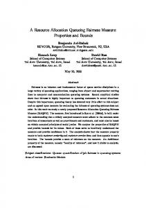
Figure 1. Example of “0’th level” simulation-based planning system for sensor management. The enemy (red square at top right) is believed to be moving either south or south-west. The positions and field of views for several sensor platforms (dark stars inside blue circles) are shown.
Figure 1 shows an example of what a very simple simulation-based tool could look like. The enemy is positioned at the top right of the map, and we are unsure whether they are moving south or south-west (indicated by the two red arrows). In the situation depicted, there are two fixed sensors, one inside Visby and the other placed in the top of the figure. The commander must now determine how to move the two UAV’s so that they can be sure which of the two alternative paths the enemy has chosen. In the system that was used at the Swedish Armed Forces exercise “demo 05 höst”, it was not possible to test different ways of using the sensors. In an implemented SB-plan system, it would be possible for the commander to move the sensors around and see how the fields of views change. In the most simple version of the system (“0’th level” SB-plan), the user would have to manually move both the sensors and the enemy objects. Even such a simple system would, we believe, make a measurable improvement in the quality of the planning process. The next most advanced system would enable the user to input a path for the sensor platforms and the enemy objects to follow, and allow the user to see a movie of the movements. Improvements that can be added to this include automatically generating the future enemy movements, and using this to calculate how good different possible sensor plans are to.
CIMI2006. Copyright Försvarets materielverk and the Author(s)2006.
In a simpler scenario, we have developed such a system. Based on the sensor management module of the FOI information fusion demonstrator IFD03 [1] and the concept of equivalence classes of futures [6,8], a demonstration was performed in conjunction with a number of other FOI projects in November 2005. The scenario used in the demonstration depicted an MOOTW (Military Operations Other Than War) situation, where Swedish forces under UN command must prevent a group from inciting riots at a war-memorial inside an ethnic enclave. In one part of the scenario, it was necessary to locate and track a number of vehicles believed to contain rioters. For this purpose, an UAV and six ground sensor networks were available. We developed a simple program that allowed a user to input possible starting places for the vehicles as well as the place where we believed the caravan was headed. The program then generated a number of possible placements of the ground sensor networks. For each of these possible placements, several simulations of the enemy’s future movements were performed. In each simulation, we measured the “fitness”, i.e., the degree to which we were able to track the vehicles. By comparing the fitness of different sensor plans, the program was able to select the best possible of the (randomly) generated sensor placements. The result is shown in figure 2 below.
Figure 2. This figure shows the user interface of the prototype demonstrated in November 2005. The blue circles mark where ground sensor networks should be dropped by the UAV. The small red circles denote areas indicated as interesting by an earlier flight of a UAV equipped with a Synthetic Aperture Radar-sensor. In addition to dropping the ground sensor networks, the UAV also needs to inspect these sites. The dotted blue line is the flight path of the UAV, as calculated by a simple pathoptimization routine.
5. Future work There remains much work to be done in this area. The prototype mentioned last in section 4 is too dependent on the specific scenario used to be immediately useful for general sensor planning purposes. A system such as that described in figure 1 should be implemented. By concentrating on the man-machine interaction part and building a “level 0” collaboration tool as described in section 4, a tool that is directly useful could be built. This should later be extended with more advanced mixed-initiative interaction capabilities, which allow it to alert the users if the plan that they are working on is infeasible. CIMI2006. Copyright Försvarets materielverk and the Author(s)2006.
This would be particularly useful in a system for intra-level planning. Such a system should also allow commanders at different levels to see the maps and units at different resolutions. By alerting a high-level planner when it is unlikely that a lower-level unit will be able to achieve its goal and perhaps suggesting alternative courses of actions, it should be possible to speed up the collaborative planning process significantly. As mentioned above, the tool should also try to evaluate different plans. In this way, users can benefit from the high computational speed of the computer and concentrate on the parts of the interaction process which requires human intuition. (It is of course necessary to be sure that the tool’s evaluations are correct.) An even more advanced version of SB-plan would include true mixed-initiative interaction, where the computer also calculates the best possible courses of actions. Building such a system requires a significant research investment, and also probably requires the other systems described above to be built first. Those systems could be built today, if the necessary resources are provided. We would also like to extend the ideas presented here to deal with logistics. It is also possible to use simulation-based planning for psychological operations (propaganda): by simulating, for example, the effects on the population of providing food or entertainment at different places, the best place could be determined. 6. Summary and Conclusions In summary, we presented a framework for sensor and resource management based on simulations. The area of mixed-initiative interaction was briefly presented, and some different possible implementations of SB-plan were discussed. A prototype which was used for a demonstration last year was briefly described, and several suggestions for future work were given. We believe that by combining simulations of enemy behaviour with mixed-initiative interaction, tools that would greatly benefit the planning processes of an FHQ could be built. The most advanced versions of these tools require a significant research effort to achieve, but the more modest variants can be built today. 7. References [1] Ahlberg, S., Hörling, P., Jöred, K., Mårtenson, C., Neider, G. Schubert, J., Sidenbladh, H., Svenson, P., Svensson, P., Undén, K. och Walter, J. (2004), “The IFD03 Information Fusion Demonstrator -- requirements, methodology, design, and experiences”, FOI-R--1413—SE. [2] Allen, J (1999), “Mixed initiative interaction”, IEEE Intelligent Systems, 14:14. [3] Blasch, E.P. and Plano, S (2002), “JDL level 5 fusion model ”user refinement” issues and applications in group tracking”. In Signal Processing, Sensor Fusion, and Target Recognition XI, volume 4729 of SPIE, page 270,. [4] Hall, D.L. and Llinas, J (2001), editors. Handbook of Multisensor Data Fusion. CRC Press, Boca Raton, FL. [5] Johansson, R and Suzic, R (2004). “Bridging the gap between information need and information acquisition”, In Proceedings of the 7th International Conference on Information Fusion, pages 1202–1209.
CIMI2006. Copyright Försvarets materielverk and the Author(s)2006.
[6] Mårtenson, C and Svenson, P (2005), “Evaluating sensor allocations using equivalence classes of multitarget paths”, In Proc 8th International Conference on Information Fusion. [7] Suzic, R and Johansson, R (2004), “Realization of a bridge between high-level information need and sensor management using a common DBN”, In The 2004IEEE International Conference on Information Reuse and Integration (IEEE IRI-2004). [8] Svenson, P (2005), “Equivalence classes of future paths for sensor allocation and threat analysis”, In Signal and Data Processing of Small Targets, volume 5913 of Proceedings of SPIE, pages 363–9. [9] Xiong, N and Svensson, P (2002), “Multi-sensor management for information fusion: issues and approaches”, Information Fusion 3(2), 163-186. 8. Biographies Dr Pontus Svenson is a member of the information fusion research group at the Swedish Defence Research Agency (FOI). His research interests include network analysis, data and text mining, random sets, sensor and resource management, and information operations. He has a PhD in theoretical physics from Chalmers University of Technology. Mr. Christian Mårtenson is a member of the information fusion research group at the Swedish Defence Research Agency (FOI). His research interests include network analysis, sensor and resource management, semantics management and information operations. He has a M.Sc. in theoretical physics from Lund University. 9. Acknowledgements We thank Mikael Brännström for help producing figure 1 and Johan Walter for assistance in implementing the prototype depicted in figure 2.
CIMI2006. Copyright Försvarets materielverk and the Author(s)2006.