45th Lunar and Planetary Science Conference (2014)
2911.pdf
STRUCTURALLY CONTROLLED SUBSURFACE FLUID FLOW AS A MECHANISM FOR THE FORMATION OF RECURRING SLOPE LINEAE. J. Watkins1, L. Ojha2, M. Chojnacki3, R. Reith1, and A. Yin1, 1University of California, Los Angeles, Department of Earth and Space Sciences, 595 Charles E. Young Dr., Los Angeles, CA 90095,
[email protected], 2Georgia Institute of Technology, Atlanta, GA 30332. 3Lunar and Planetary Laboratory, University of Arizona, Tucson, AZ 85721.
Introduction: Recurring slope lineae (RSL) are seasonal, narrow (0.5 to 5 m), low albedo features that originate at the base of cliff-forming bedrock outcrops and extend downward on steep (25° to 40°), equatorfacing, mid-latitude and equatorial rocky slopes of Mars [1,2,3]. They exhibit progressive growth in the downslope direction during warm seasons, diverting around topographic obstacles, and fade during cold seasons [1,4]. The geologic environments associated with slopes containing RSL are diverse, yet all appear to be sites marked by significant geological activity, including “fresh” impact craters, active mass wasting sites, massifs, spurs and ridges [1,3]. These RSLbearing slopes are also associated with numerous small channels and bright fans [1,2,3]. Based on their seasonal growth and strong dependency on latitude and slope aspect, RSL formation has been largely attributed to the seepage and downslope transport of a saltbearing (briny), water-based liquid through permeable regolith near the surface. Seepage of this liquid is interpreted to wet and thus darken the RSL surface, and evaporate once seasonal flow ceases [1,2,3,4,5]. However, the source of the putative water, and an active recharge mechanism to maintain this source over even short geological timescales, are not currently understood [1,2,3,4]. Subsurface groundwater or thawed regional ice layers are possible sources for the liquid required to create a sufficient hydraulic head to initiate and maintain fluid flow to the surface [2,6]. The absorption of atmospheric water vapor by hygroscopic salts (deliquescence) has also been previously proposed [2,4,6]. Here, we test a fault-controlled brine flow hypothesis for the formation of RSL, in which preexisting
structural inhomogeneities, including faults, fractures, and joints, act as conduits for subsurface fluid migration, supporting groundwater exploitation of routes of increased permeability. Geologic investigation and morphological mapping of slope surfaces in confirmed RSL locations in all geologic environments, as well as locations that do not contain RSL despite exhibiting favorable conditions for their formation, is performed in order to analyze and quantify the correlation between RSL and faults on a global scale. Understanding the geologic context for RSL source regions will enable us to better constrain RSL formation mechanisms, and provide insight into the role of water and the potential presence of habitable conditions on present-day Mars. Data and Methods: Observations of morphological features are made using high resolution (30 cm/pixel) data from the High Resolution Imaging Science Experiment (HiRISE) instrument [7] onboard Mars Reconnaissance Orbiter (MRO). Continued survey and monitoring of HiRISE images has led to a total of 13 fully confirmed RSL sites in the southern midlatitudes, 1 in a northern mid-latitude, and 12 in the tropics, including several in Valles Marineris (Fig. 1) [2, 3]. Within this set of locations, faults are observed to be prominent features in RSL source regions, indicated by morphological expressions including separation, truncation and offset of marker beds, linear features bounding rocky outcrops, sub-parallel lineaments and risers, and the presence of knickpoints, drainage path convergence at the interpreted fault traces, and triangular facets. Terrestrial impact crater fault morphologies are used for comparison as well. Fault traces are mapped in detail using high resolution DTMs created from HiRISE stereo pairs and MOLA elevation data. Results: Analysis of slope surfaces at confirmed RSL sites reveals a prevalence of faults in both southern midlatitude (e.g.
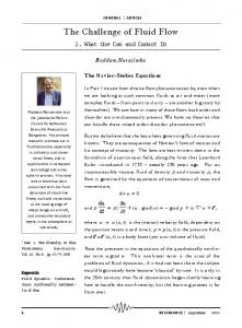
Figure 1. Global distribution of confirmed recurring slope lineae (RSL) sites (black diamonds) on MOLA altimetry updated by McEwen et al. (2014) [2].
45th Lunar and Planetary Science Conference (2014)
2911.pdf
Figure 2. Stretched zoom-ins of example RSL source regions in (A) Corozal crater (HiRISE image PSP_006261_1410), (B) a crater in Melas Chasma in Valles Marineris (ESP_031059_1685), and (C) Palikir crater (ESP_022689_1380). Yellow arrows show RSL locations; red lines and arrows indicate spatially correlated fault traces. Corozal and Palikir Craters), and equatorial (e.g. Melas Chasma) locations. Further investigation of these locations exhibits a common association of RSL with a unique highly-incised geologic unit, as well as a distinct spatial correlation between RSL source regions and fault-related morphology (Fig. 2). Of the 139 total RSL mapped in Corozal crater, 81% are within 50 m of a fault and 93% are within 100 m. Of the 143 total RSL mapped in Palikir crater, 80% are within 50 m of a fault and 94% are within 100 m. Further analysis of the correlation between RSL source regions and faults within a reasonable distance upslope, in all confirmed locations, will enable a more accurate quantification of this relationship. Discussion: The observed spatial correlation between RSL sites and faults suggests that preexisting structures may exert a control on RSL formation by providing pathways for groundwater migration. Fluid flow is commonly associated with fault traces on Earth, forming springs, streams, waterfalls, and sag ponds. Brittle fault zones can act as conduits or barriers that enhance or impede fluid flow to the surface (e.g. Carboneras fault zone, SE Spain; Canyon Lake Gorge, TX) [8]. A network of subsidiary structures (e.g. minor faults and fractures) in the damage zone yields higher porosity and permeability, whereas grain-size reduction and mineral precipitation in fault gouge yields lower porosity and permeability. Fluid flow is enhanced in the vertical direction through fractured lenses; horizontal flow is controlled by fault gouge thickness [8]. Analysis of the structural setting of the Haughton Crater terrestrial analog has also exposed zones of intense, impact-generated fault systems around the rim and central uplift that would have acted as pathways for subsequent fluid migration, as indicated by pervasive calcite vein networks lining these highly fractured zones [9]. Additionally, fluid flow along preexisting fractures and joints has been identified as a mechanism by which subsurface fluids migrated through layered
deposits in western Candor Chasma, Valles Marineris [10]. Thus, we propose a combined barrier-conduit fault zone model [11] for RSL formation. Within this model, in warm seasons, frozen subsurface brine thaws and ponds along a preexisting structural inhomogeneity acting as a barrier. Water flow is enhanced in the vertical direction due to the higher porosity and permeability of conduit damage zone fractures, until it reaches the surface due to hydraulic pressure, forming RSL. Conclusions: Analysis of RSL geologic settings reveals a distinct spatial relationship between craterrelated RSL sites and morphology indicative of multiple styles of brittle deformation. These observations help to constrain plausible RSL formation mechanisms. Specifically, they are consistent with the proposed model attributing RSL formation to faults acting as conduits for subsurface groundwater migration, supporting exploitation of routes of increased permeability. This model does not require an absorbed atmospheric water vapor source in most locations, with implications for the sustained presence of subsurface groundwater and/or ice in regions on Mars where RSL form. Acknowledgements: We thank the HiRISE team for providing high resolution images and DTMs. References: [1] McEwen et al. (2011) Science, 333, 740-743. [2] McEwen et al. (2014) Nat. Geosci., 7, 53-58. [3] Ojha et al. (2014) Icarus, in press. [4] Chevrier, V.F. and Rivera-Valentin, E.G. (2012) GRL, 39, L21202. [5] Levy, J. (201) Icarus, 219, 1-4. [6] McEwen et al. (2011) EPSC-DPS, 1368. [7] Faulkner, D.R. and Rutter, E.H. (2001) Geology, 29, 503-506. [8] Osinski, G.R. et al. (2005) Meteoritics & Planet. Sci., 40, 1859-1877. [9] Okubo, C.H. and McEwen, A.S. (2007) Science, 315, 983-985. [10] Caine, J.S. and Forster, C.B. (1996) Geology, 24, 1025-1028. [7] McEwen et al. (2007) JGR, 112, E05S02.