Technological Developments within 3D Location-based Services Siyka Zlatanova and Edward Verbree Section GIS-technology Delft University of Technology Delft, The Netherlands
[email protected];
[email protected]
Abstract Location Based Services (LBS) are gaining much importance for all kind of human activities ranging from tourist navigation to support of rescue teams in disaster management. LBS have been developed as an independent from GIS stream for wireless services, but nowadays about 80% of all supplied data is spatially related, i.e. they are presented in a form of 2D map (raster of vector). LBS is becoming a special kind of GIS. In this paper we analyse the state-of-the-art of technology toward 3D LBS. We consider four important aspects of LBS namely standards, positioning, visualisation and geo-DBMS, which we believe will largely contribute to a breakthrough 3D LBS. These are addressed in detail. A final discussion elaborates on urgent topics for research.
1. Introduction The OpenGIS Consortium (OGC) defines Location-based Services as ‘any application service that exploits the position of a mobile terminal’. Given this definition, LBS can be regarded as a special kind of GIS, with the restriction that all kind of information query and retrieval is more or less related to the known position of the user in the field. Most LBS-applications are limited to 2D, both for the input of the location-component (a site on the surface of the Earth) as for the feedback of the information query from the GIS-server to the mobile-client with standard 2D-maps. But the third dimension is affordable, as many GIS-packages and geo-DBMS offer support for 3D-data storage, 3D-queries and 3D-visualisations. In conjunction with the improvements of the hardware of the mobile terminals, high-speed connections, 3D-positioning and the need for 3D-perspective of the user in the terrain, we believe that 3D will be the next step within LBS. In this paper, we concentrate on the available technology and systems and analyse the possibilities LBS to step into the third dimension. The paper is organised in sections as follows: Section 2 discusses the work of OGC toward standardisation of developments in LBS. Section 3 summarises the progress in mobile devices. Section 4 discusses current possibilities for 3D positioning. Section 5 concentrates on the stateof-the art in 3D visualisation on mobile devices. Section 6 discusses some aspects of 3D GIS related to the support of 3D models. Section 7 concludes on the needed 3D developments toward 3D LBS.
2. 3D within the OpenGIS Implementation Specification for Location Services The OpenGIS Consortium (OGC) has intensively worked on Implementation specification for Location Services. In June, OGC members voted to adopt the OpenGIS(R) Location Services (OpenLS(TM)) Implementation Specification, and the OpenGIS Web Map Context Implementation Specification (http://www.opengis.org/techno/implementation.htm).The Web Map Context Documents Specification describes how to save a map view comprised of many different layers from many distributed Web map servers. The primary objective of the Specifications is defining access to the core services and the Abstract Data Types (ADT) that are part of the GeoMobility Server (Figure 1). Besides the core services and ADT, the GeoMobilty Server should be able to provide a location (by connecting to the Gateway Mobility locations Center) and appropriate content (such as maps, routes, addresses, points of interest, traffic, etc.) on the same server or other databases via the Internet. It might be possible that other supporting functions for personalization, context management, billing, logging, etc. will be provided by the server. The OpenGIS Consortium currently mentions six core services:
• • • • • •
Directory service: to access directory with location information like the Yellow and White pages; Gateway service: to fetch a position of a mobile terminal; Geocoder service: transform a description of a location (an address) to a normalized description of the location (an coordinate); Reverse geo-coder service; Route service: give travel routes, and Presentation service (including route display, map display and route description display).
Currently, the OpenLS specifications consider visualisation of raster images as a base map (i.e. the rendering is done at the server and the mobile unit obtain PGN image in a predefined scale). The Abstract Data Types (ADTs) are usually obtained as outputs from core services. To date OpenLS has Address ADT, Position ADT, Route ADT, Point Of Interest ADT and Map ADT. Location ADT is a complex type that can be considered as a semantic tree that includes Point, PositionADT, Address ADT and POI ADT. The services have to able for all classes of mobile devices like phones and Personal Digital Assistants (PDA’s). The core services and the ATD are defined with XML for Location Services (XLS). XLS is practically the format for data exchange between an application and the Mobility server. XLS will use a description of geometries (point, line, polygon) according to the SFS of OGS. Theoretically this means that 3D geometry will be also possible to send to the mobile devices. Figure 1 gives an example how the mobile user will request and receive information. The request should contain the type of the user device (according to a list with well-known devices) and a number of parameters specifying the range and type of requested information. Note that localisation of mobile users is also a task of the Mobility Server. It has to request the position of the mobile unit from the Gateway Mobile Location Center (GMLC) if not provided another way (determined by GPS or given manually by the user).
Figure 1: The role of Geo-Mobility Server: request-response scenario
3. Mobile devices The concept ‘mobile device’ is quite vague, due to the board range of equipment and the integration of functionality within these tools. Cellular phones, Personal Digital Assistants (PDA), Digital Cameras and even GPS-devices can be extended or are upgraded and renamed (i.e. Smart Phone) to indicate the functionality better. Cellular phones are becoming more and more versatile for accessing network services. A cellular phone can be used as a terminal itself or it can be used together with palmtop or handheld computer devices to
access network data services. As a display, mobile phones have some limitations. As long as the mobile phones are tiny, practical and easy to carry in your pocket, the resolution of the display has its limitations in use. The handheld computer industry has been very active in the past few years, and a lot of devices are available on the market. Some are oriented to be used as personal organisers, while others are more powerful and programmable computing devices. A common characteristic is the ability to synchronise data in the mobile device with a desktop PC, calendar appointments, task lists and e-mail messages. The major difference between palmtop and handled is the keyboard. While palmtops use a stylus (pen-based) and virtual keyboards as the input method, the handheld devices are more like tiny computers connected to physical keyboard (but also touch screen and pen-based interface). Several different combinations of the devices specified above are also possible: • A cellular phones with built-in GPS like the Benefon Esc! NT2002 (http://www.benefon.com); • A PDA with integrated GPS technology like the Palm iQue 3600 (http://www.garmin.com) or • A palmtop computer with embedded cellular communications features like the Palm Tungsten/W (http://www.palm.com).
4. 3D Positioning Global positioning devices are able to offer the easiest way and a relatively accurate way of 3D positioning of the user. Apart from the most used GPS-NAVSTAR network of satellites, Galileo is to be considered in near future. The receivers are getting rapidly portable, cheaper and more convenient for general use and implementation in handheld devices than ever. For example, Motorola launched a GPS chip (November 2002), sufficiently small (49 square millimetres) and cheap to be implemented in any consumer-electronics device such as cell phones and notebook computers. It is this development Steve Wozniak (co-founder of Apple) to announce a new business that will focus on designing wireless products for tracking just about anything by aiming to make Global Positioning System (GPS) devices cheap, plentiful and indispensable to businesses and individuals. (http://www.businesswire.com/cgibin/f_headline.cgi?bw.012302/220230088) Despite the progress, still there are many drawbacks and difficulties in using global positioning for LBS. One main problem is the disturbed satellite availability, particularly due to urban canyons in cities or in forest areas. The other problem is the capture of location information from the GPS and sending this to the LBS server. These are two distinct problems with partial solutions offered by a variety of hardware platforms and operating systems. The positioning within mobile networks (using only the information related to the base network transmitter) is very attractive but very inaccurate and practically not applicable even for LBS. In urban areas, it may occur even that a mobile phone is connected to a transmitter in a cell different from the cell the mobile unit is (thus the accuracy may go down to kilometres). The only advantage, compared to GPS positioning, is the possibility of working inside buildings. A variety of solutions to increase the accuracy already exist. For example, the Cell Global Identity and Time Advance Positioning Method (CGI-TA) CGI identifies within which network cell the mobile client is located with the help of supplementary information (e.g. postal code information, street, town names). Further, the accuracy is improved by using the timing advance (TA) information that defines the time taken for information to reach the mobile device from a base transceiver station. The TA parameter provides an estimate of distance from the receiver accurate to about 500 metres. Since, no directional information is employed, the user could be located anywhere in a circular band (or a section of a circular band) around the base station (Figure 2, right). This approach has the potential to achieve accuracies of around 100 metres on the ground. The major advantage is that it can be employed on existing GSM and GPRS network infrastructures. Other approaches implement localisation possibilities within the mobile unit using the signal from at least three network transmitters. Still the accuracy cannot be increased more that 50 m. Hybrid solutions attempt to overcome individual problems of GPS and network solutions. For example SnapTrack (www.snaptrack.com) a US firm offering commercial network assisted GPS solutions. SnapTrack's Personal Location Technology™ is based on a thin-client Wireless Assisted GPS™ system
and may be incorporated into cellular phones, pagers, personal digital assistants, and other wireless devices. The user sends the appropriate location and receives from the server-assisted data (e.g. GPS almanac and other data) to speed up the initialisation of the GPS receiver. While traditional GPS receivers may take several minutes to provide a location fix, SnapTrack's system generally locates callers within a few seconds. The system allows very faint GPS signals to be detected thus providing GPS coverage in areas that are formerly GPS black spots. This is done by sharing many of the tasks performed by the handheld GPS across a distributed system of clients and servers.
Figure 2: Urban Canyon (left) and CGI-TA Solution (right)
Due to weak GPS signals and limited precision of GSM network solutions, hybrid solutions offer a better potential for positioning mobile clients outdoors. Both technologies are in a period of change and increased precision is expected from both techniques. Neither of both techniques is however appropriate for indoor positioning. Wireless LANs (WLANs) are seen as a possibility to track mobile users in closed spaces as buildings and tunnels. There are several standards already available (e.g. IEEE 802.11 and HyperLAN) and many areas are covered with such networks (e.g. harbour Rotterdam). The advantage of such network is the high bandwidth (11-54 Mbps) compared to GPRS (70kbs) and UTMS (1Mps) and disadvantages are the security and the relatively limited area (about 300m). The first systems for localisation using WLANS are already available. Ekahau Positioning Engine (www.ekahau.com) is one solution available for 802.11 and HiperLAN2. The engine runs on a standalone server and gives the x,y-position and the floor of the mobile unit. The positioning is based on a priory accomplished calibration map created by collecting sample points of the area. Each sample point contains received signal intensity and related map coordinates (for the current floor). The accuracy achieved by such positioning is up to 1m. The implementation is Java and practically able to run on any platform. Apparently, in the future a range of solutions, from GPS, networks (GPRS WLAN, etc.) has to be used to be able to track mobile devices indoors and outdoors. Integrated solutions are likely to become standard to cater for the anticipated demand for location sensitive information. In this respect, it is critical to agree on standards for communication. Two important organizations in communication domain are: Open Mobile Alliance (OMA) (http://www.openmobilealliance.org/index.html) with more that 300 companies are committed to preparing open standards for interoperable mobile standards. The consortium will stimulate the adoption of new services (enhanced mobile information, entertainment services). The particular focus in the last year was on the specification OMA Client provisioning (that further simplifies the configuring of a mobile units) and OMA Billing Framework (related to recording services). Further OMA has created two new groups to identify the user requirements for M-commerce market (MCommerce) and to allow networking in games (Mobile Gaming). The Third Generation Partnership Program (3GPP) (http://www.3gpp.org/) concentrates on air interfaces. The original scope of 3GPP is to develop globally applicable Technical Specifications and Technical Reports for a 3rd Generation Mobile System based on evolved GSM core networks and the radio access technologies that they support. This scope was subsequently amended to include the maintenance and development of the GSM Technical Specifications and Technical Reports including evolved radio access technologies (e.g. GPRS) and Enhanced Data rates for GSM Evolution (EDGE)).
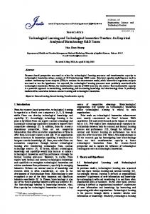
5. 3D Mobile visualisation One of the most critical aspects is the provision of 3D graphics on mobile devices. The 3D capabilities of mobile devices are largely restricted in several aspects: dedicated 3D hardware chip, floating point units (floating point calculations are done by the software), hardware division circuits (for integer division), memory bandwidth (3D rendering needs large amounts of texture to be read from the memory) and CPU speed (Jacobs, 2003). Besides, the visibility scene management algorithms have to be adapted for the low-resolution screens of mobile devices. Breakthrough in 3D rendering on mobile devices are observed in several directions. Industry unite their efforts to improve the performance of mobile hardware. QUALCOMM CDMA Technologies (www.cdmatech.com/) announced a powerful CPU single chip solution (MSM7xxx) for 3G handheld multimedia devices. Among all the improvements such as processing speed (300MHz to 1GHz), a low power consumption, large-format, high-resolution Quarter Video Graphics Array, the chip offers a high-speed 2D and 3D graphics rendering. A number of companies offer already 3D rendering engines for mobile devices mostly in the form of games and entertainment software. For example (Figure 3), Superscape-Swerve (www.superscape.com), HI Corporation (www.hicorp.co.jp), Xen Games (www.xengames.com/) and Fathammer Inc. (www.fathammer.com/). The navigation software TomTom (running on Windows CE) is another example of 3D visualisation, i.e. a ‘3D birds eye’ view of a navigated route. Most of the 3D visualisation tools/games are available simultaneously for different OS. Still, the efforts are toward developing 3D games. 3D gaming on mobile phones is for some countries (e.g. Japan, using the rendering engine of Hi Corporation) already a standard item ranging from car racing to fishing and taking care of personal virtual pets. The Mascot Software engine is embedded into more than 10 million handset in Japan (Donelan 2003).
Figure 3: Swerve (Superscape), Mascot Capsule (Hi-Corporation), XenGames, X-Forge (Fathammer), TomTom.
Companies sign agreements on collaborations toward integrating hardware core functionality and 3D graphics functionality. For example, ARM (www.arm.com), the provider of 16/32 embedded RISK microprocessors together with Imagination Technologies (www.imgtec.com), a international licensing company for 2D and 3D graphics and Superscape have agreed (April, 2003) on collaboration to develop 3D solutions for mobile devices. The idea is to combine the core microprocessor and graphics function of ARM with the software solutions of Superscape. A similar cooperation is established recently (July 2003) between Hi Corporation and Motorola (www.motorola.com). Hi Corporation will make Mascot Capsule Engine available to Motorola’s Convergence i.250 customers and i.MX and i.SmartPhone applications.. Standards for visualisation of 3D graphics on mobile devices are already available or under developments. OpenGL ES, based on OpenGL (the mostly adopted cross-platform graphics API) is already available for downloading at (www.khronos.org/opengles/). The South Korea Telecom already announced (June, 2003) their choice of OpenGL ES as its standard graphics API for 3D applications. The Java Specification Request 184 (JSR 184) focusing scalable, small-footprint, interactive 3D API (based on J2ME technology) is ready and announced for public comments (www.jcp.org/aboutJava/communityprocess/review/jsr184). New consortiums are founded to define standards and specifications for developing a mobile hardware. For example, the Mobile Industry Processor Interface (MIPI) is a very new initiative (ARM, Nokia, STMicroelectronics and Texas Instruments Inc., July 2003) that aims at defining and promoting microprocessors, peripherals and software interfaces. Some of the target functionality is large graphics (from black& white display at 96x64 to 16-bit colours and 320x240 display), power and memory (from
little processing power to 3D graphics acceleration and floating point units). This standard aims at resolving issues like building and maintaining scene hierarchy and selecting viewpoints. To decrease the size of the application, increases of the amount of processing in native code versus e.g. Java code is assumed.
6. 3D GIS GeoDBMS, GIS, CAD and VR systems host already huge amounts of spatial data as many of them are 3D. All the systems attempt to extend their functionality by offering integrated maintenance of spatial and attribute data, spatial analyses, topology layers and 3D visualisation and navigation. Several important developments are observed in this area: DBMS manage spatial data, progress of 3D visualisation and appreciation of topology in LBS. With the support of spatial data types by DBMS (Oracle Spatial, PostGIS, Informix), GIS, CAD and VR vendors (ESRI, Bentley, AutoDesk) have the opportunity to organise their data seamless, integrated data structures. These developments hit the role and the nature of GIS from application-oriented, desktop system toward multi-purpose and distributed. (Oosterom et al 2002, Zlatanova et al 2002). The developments toward the third dimension are also significant. 3D object can be maintained (using spatial data types supported by DBMS) and visualised in different front ends (Stoter and Zlatanova 2003). The understanding of the role played by topology in LBA is increasing. The word is often about locationbased applications where all spatial relationships are maintained directly in the database itself, without the need for any specialised GIS application. Such a solution will provide integrated dynamic topology and spatial analysis from any wireless handheld device.
7. The future of 3D LBS Bearing in mind the technology review, we can conclude that 3D LBS may possible for realisation in the coming several years. Still a large amount of issues (3D LBS standards, 3D positioning, 3D visualisation and 3D geo-DBMS) needs a special attention: • OGC accepted Implementation Specifications for Locations Services, but specialisation for output of 3D geo-information is not considered yet. • 3D localisation is possible in various ways but it mostly based on GPS. To be able to position user in dense urban areas or indoors, alternative approaches (based on communication networks, WLANs, or others) are urgently needed. • Mobile devices are ready for 3D visualisation but currently the vendor efforts are mostly toward designing games. • Management of 3D objects is also possible, although not standardised. The main problem remains 3D topology as a major requirement for a 3D navigation. Intensive research is needed to extend the role of GeoMobility in several general directions: • Evolving of all components into the third dimension: 3D GeoMobility Server, 3D protocols (perhaps XLS based on SFS), 3D rendering on mobile • Core services have to be available for 3D cases as well. This will effect the Gateway service (3D position of mobile device), the Geocoder service (transform a description of a location 3D coordinates), the Route service (give travel 3D routes, e.g. in a building) and the Presentation service (3D route or 3D map display). • GeoMobility Sever has to be further extended to switch between different networks (e.g. UTMS, WLAN). Furthermore, the GeoMobility server should be aware of the used network and adapt the request/response protocol according to the bandwidth. • A sort of intelligence has to be incorporated in the GeoMobilily Server, e.g. awareness of the status of the mobile terminal (memory, graphic display, battery, etc.) or awareness about the level of urgency. This is especially critical for 3D routing, bearing in mind the larger amounts of data compared to 2D. Depending on the status, it may be to ‘expensive’ to generate 3D routing, e.g. a simple text routing might be a better solution. The Server has to be able to decide on the type of data. • 3D visualisation on mobile devices is still hardly explored area, which requires much more investigations. An important aspect is the correct impact on the user. For the preparation of 3D outputs, similar principles as for the design of conventional maps are valid, i.e. the shown objects shall be represented in a geometrically correct way and at the right position. Furthermore, the visualisation used as communication instrument demands an adequate
•
degree of readability (Kray et al 2003). An important issues to be addressed are: geometric resolution, utilisation of textures, priority for visualisation of objects and their characteristics, size of the important objects, etc. Input/update of 3D graphics information and sending back to the original data host source. This issue is closely related to maintenance of data consistency and data integrity.
References: Donelan, J., 2003, Graphics to go, Computer Graphics World, April 2003, available at: http://cgw.pennnet.com/Articles/Article_Display.cfm?Section=Articles&Subsection=Display&ARTICLE _ID=171451 Jacobs, S. 2003, 3D rendering on Mobile Devices, Xen Games, available at: http://www.developers.orange.com/docs/2003/02/24/ (last accessed, August 2003) OGC, 1999, OpenGIS Simple Features Specification for SQL. Revision 1.1, OpenGIS Project Document 99-049 Oosterom, P.J.M. van, J.E. Stoter, C.W. Quak and S. Zlatanova, 2002, The Balance Between Geometry and Topology. In: Advances in Spatial Data Handling, 10th International Symposium on Spatial Data Handling, Dianne Richardson and Peter van Oosterom (eds.), ISBN 3-540-43802-5, Springer-Verlag, Berlin, 2002, pp. 209-224 Kray, Ch., Ch. Elting, K. Laaksoand V. Coors, 2003, Presenting route instructions on mobile devices, IUI'03, January 12-15, 2003, Miami, Florida, USA, 9p. Rakkolainen, I, Vainio, T. A. 2001, A 3D City info for Mobile Users, Computers & Graphics, Special Issues on Multimedia Appliances, Vol 25 No.4 Elsevier 2001, pp. 619-6125 Stoter, J.E. and S. Zlatanova, Visualisation and editing of 3D objects organised in a DBMS, EUROSDR workshop: Rendering and visualisation, January 2003, Enschede, the Netherlands, 16 p. Zlatanova, S., A.A. Rahman and M.Pilouk, 2002, Trends in 3D GIS development, in: Journal of Geospatial Engineering, Vol.4, No.2, pp. 1-10