THE APPLICATION OF GIS IN MARITIME BOUNDARY DELIMITATION A case study on the Indonesia-East Timor Maritime Boundary Delimitation I Made Andi Arsana Department of Geodetic Engineering Gadjah Mada University, INDONESIA
[email protected]
Chris Rizos School of Surveying & SIS University of New South Wales, AUSTRALIA
[email protected]
Clive Schofield Centre for Maritime Policy University of Wollongong, AUSTRALIA
[email protected] ABSTRACT The Democratic Republic of Timor-Leste (East Timor) attained independence on 20 May 2002, marking its separation from Indonesia. As a newly independent country, East Timor is faced with a number of significant international opportunities, together with some obligations that it must fulfil, including the delimitation of its international boundaries. Similarly, for Indonesia, with 10 maritime neighbours, the delimitation of maritime boundaries is a significant challenge. This paper describes a preliminary study on the delimitation of the Indonesia – East Timor maritime boundary, with a focus on technical aspects. Geospatial data has been obtained from the Indonesian government and processed with the assistance of a specialised Geographic Information Systems (GIS) application: CARIS LOTS™. The main tasks are to simulate the maritime claims of Indonesia and East Timor, to identify overlapping claims and to delimit theoretical maritime boundaries between the two states. The United Nations Convention on the Law of the Sea 1982, LOSC, provides the main legal reference point, along with relevant state practice and jurisprudence. Potential delimitation lines were calculated in a geodetically robust manner. Three major locations for maritime boundaries were identified as requiring delimitation. These are in the Ombai Strait, the Wetar Strait and in the Timor Sea. A number of alternative potential boundary alignments have also been examined and analysed for the three locations, in the context of future maritime boundary negotiations between the two States. However, the results presented are not the final boundaries that Indonesia and East Timor are bound to accept. Ultimately it is for the governments of Indonesia and East Timor to negotiate an equitable solution that will satisfy both parties. However, it is hoped that this study will contribute towards achieving that goal. 1
Keywords: maritime boundaries, delimitation, geographic information system, United Nations Convention on the Law of the Sea 1.
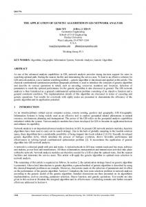
Introduction The Democratic Republic of Timor-Leste (hereinafter referred to as East Timor) attained independence on 20 May 2002 from Indonesia. As a newly independent country East Timor is faced with a number of international opportunities and obligations to fulfil – including the delimitation of international boundaries. It is the case that most of the maritime boundaries around the world are not yet completely delimited. However, defining the boundaries is important as they provide jurisdictional clarity and certainty (Prescott and Schofield 2005: 216-218). This can have multifaceted benefits, for instance in facilitating the sustainable and effective management of the ocean environment and enhancing maritime security. Perhaps of most pressing importance for a developing country, agreement on the limits of maritime jurisdiction serves to secure coastal state rights to access and manage marine resources, both living and non-living. Three maritime areas around Timor Island are of interest with regard to potential resource management and security concerns: Ombai Strait, Wetar Strait and Timor Sea. Figure 1 shows Timor Island where two different countries are situated: Indonesia and East Timor, together with the three maritime areas of interest.
Figure 1 Map of Timor Island showing Indonesia and East Timor. (http://www.lib.utexas.edu/maps/middle_east_and_asia/east_timor_pol_03.jpg) Indonesia and East Timor are obliged to negotiate in good faith to establish their international boundaries, both on land and at sea. This means that all parties should follow the agreed procedures and conduct all phases “in a spirit of fairness and effectiveness” (United Nations, 2000: 72). The two states are not, however, obliged to reach agreement through such negotiations. Ultimately, the key objective is to achieve an equitable solution, acceptable to both parties, ideally achieved through negotiations undertaken in good faith and with mutual respect.International land boundaries between Indonesia and East Timor are being negotiated based on treaties from the colonial era, and have subsequently been subject to joint technical surveys in 2002 and 2003. One of the significant achievements with regards to the land boundary is a provisional agreement signed by Indonesia and East Timor on 8 April 2005. However, agreement on final delimitation and subsequent demarcation of the land boundary has not yet been wholly achieved and it is 2
understood that some of the most contentious parts of the boundary remain unresolved. These include the four termini of the land boundary on the coast that, crucially, will serve as the starting points of the maritime boundaries proceeding offshore. Without those termini agreed to, Indonesia and East Timor cannot start discussions on maritime boundaries. With regard to maritime limits, Deeley (2001: 22) stated that no negotiations have been made to establish the maritime boundary between Indonesia and East Timor or between their colonial predecessors (The Netherlands and Portugal). Consequently, no convention, or treaty had been concluded between The Netherlands and Portugal, or Indonesia and East Timor, concerning maritime boundary delimitation. The present paper aims to provide a critical study of the maritime boundary delimitation issues between Indonesia and East Timor. At present, this task has not yet been the subject of negotiation and can be regarded as a current and urgent matter to be resolved between the two states. For coastal states like Indonesia and East Timor, claims to maritime zones of jurisdiction are important in terms of security, access to and management of resources, ocean management (Schofield, 2003: 3). Once such claims have been made, the definition of maritime boundaries becomes highly desirable. As argued by the International Boundary Research Unit (hereinafter referred to as IBRU), that “governments across the world agree that clearly-defined maritime boundaries are essential for good international relations and effective ocean management”. In a similar vein, boundary delimitation can provide an attractive way for a newly independent state, such as East Timor, to assert its sovereignty and sovereign rights. This paper aims to provide a critical study of the maritime boundary delimitation issues between Indonesia and East Timor with a focus on technical aspects. At present, this task has not yet been the subject of negotiation and can be regarded as a current and urgent matter to be resolved between the two states. Delimitation also eliminates zones of overlapping maritime claims which can cause competition and conflict between neighbouring states, thereby removing a significant potential source of friction and dispute in international relations (Schofield 2005a: 101-102). Geospatial data has been obtained from the Indonesian government and processed with the assistance of a specialised Geographic Information Systems (GIS) application: CARIS LOTS™ (Law Of The Sea). The main tasks described in this paper are the simulation of the maritime claims of Indonesia and East Timor, identification of overlapping claims and delimitation of the maritime boundaries between the two states. The United Nations Convention on the Law of the Sea 1982, LOSC, provides the main legal reference point, along with relevant state practices and jurisprudence. Potential delimitation lines were calculated in a geodetically robust manner. 2.
Data Management and Software This section outlines the key issues relating to the type of data and the data collection process required for the analysis undertaken in the current research. It represents precisely the kind of information gathering exercise faced by any coastal state prior to undertaking the delimitation of its maritime boundaries. Data collected for this research is based on technical considerations states should take into account before proceeding with maritime boundary delimitation. Prescott and Schofield (2005: 305-326) describe the practical considerations in maritime boundary delimitation, including preliminary issues, preparing for maritime boundary delimitation, the negotiations themselves and the drafting of the final treaty. The core data collected and analysed includes conventions, treaties and legal documents, the authorative nautical chart of Timor Island and the surrounding area, sufficient-scaled topographical map of Timor Island, geological and geomorphological data, demographic data of Timor Island and other subsidiary information, physical geographic data of Timor Island and the surrounding area, and coordinates of the existing basepoints and baselines of Timor Island. Much of the material was collected from Indonesian government institutions, including the Indonesian National Coordinating Agency for Surveys and Mapping (Badan Koordinasi Survey dan Pemetaan Nasional – Bakosurtanal), and the Hydro-Oceanographic Office of Indonesian Navy (Dinas Hidro-Oseanografi – Dishidros). Digital nautical charts obtained from Bakosurtanal are EEZ Charts of the Indonesian Archipelago, or Peta Zone Ekonomi Exclusif Wilayah Negara Kepulauan Indonesia. Being in Adobe Illustrator format and therefore not recognised within the processing software, CARIS LOTS™, they are therefore not ready for analysis. They were converted to a particular format and were geo-registered so that the coordinate system is appropriate to represent the “real world”. These digital charts cover Timor Island, the surrounding area, including Alor Archipelago, Pulau Wetar, and Pulau Sermata, and small islets, such as Pulau Kisar, Pulau Leti, Pulau Moa, Pulau Lakor, and Pulau Meatimiarang. They are in the scale of 1:1,000,000 and are divided into two files, each covering a 3
different area. They use the WGS 1984 as datum and are depicted in the Mercator Projection System. These are joint products of Bakosurtanal and Dishidros published in 1999. Collected data was processed with the assistance of Geographic Information System (GIS) technology. CARIS LOTS v4.0 was used as the facilitating GIS software to simulate maritime claims, identify overlapping claims and finally to generate potential maritime boundaries between Indonesia and East Timor. The School of Surveying and Spatial Information Systems, University of New South Wales, in Sydney, Australia, provided the software and licence. CARIS LOTS™ is one of the recent products of CARIS Canada, which has been developing geomatics tools for 26 years. Sutherland and Nichols (2002: 6-7) explain that “CARIS LOTS™ is a geographic information application, based on CARIS GIS. It is designed to aid in the delineation and delimitation of marine boundaries as required by the United Nations Convention on Law of the Sea (the LOSC).” Carleton and Schofield (2002: 40) give some additional information on CARIS LOTS™, describing it as a specially designed GIS, which visualizes the interpretation of the LOSC Article 76 for definition of the outer limit of the continental shelf. The present research focuses on those particular features of CARIS LOTS™ related to the outer limits and boundaries functions for delimitation of maritime zones. This is one of the three stand-alone products of CARIS LOTS™, known as LOTS Limit and Boundaries. CARIS Canada claims that LOTS Limits & Boundaries includes all geodetic tools and data necessary for specialists in law of the sea applications to work within the EEZ. Since the early 1980s, CARIS LOTS™ has been used by many organizations around the world to generate maritime boundaries. For example, the UKHO has been using CARIS LOTS™ for about six years, assessing the quality and ability of the software as a tool for assisting with generating maritime boundaries. According to UKHO, CARIS LOTS™ makes this process significantly easier, providing an acceptable level of accuracy while expertly handling the complicated geodetic calculations related to marine boundary delimitation (Gent, 2001). The same author also highlights another important issue, namely “how to build trust within the CARIS LOTS™ user?” While it is clear, according to Gent (2001), that CARIS LOTS™ is capable of assisting experts to efficiently generate maritime boundaries, users also need to be convinced of the ability of the CARIS LOTS™ software. It has been shown that using GIS in maritime boundary delimitations significantly enhances efficiency, thus saving both money and time (Gent, 2001). According to the same author, GIS can be a powerful tool as long as users understand its limitations as well as its advantages. To some extent, however, GIS is only an assisting tool, based on mathematical procedures. Results necessarily depend on the quality of the input data. Incomplete or inaccurate data will never produce good results, or “garbage in garbage out” (GIGO), as is emphasised by Gent (2001: 3). GIS is also still costly, considering both the price of the software and the expense of training personnel in its use. Regardless of how useful GIS is in assisting people to generate maritime boundaries, it will never “turn amateurs into experts” (Gent, 2001: 5). Like all other technology, it too has its limits. 3.
GIS and Maritime Boundary Delimitation The Environmental Systems Research Institute (ESRI), Redlands, California, define a GIS as “an organized collection of computer hardware, software, geographic data, and personnel designed to efficiently capture, store, update, manipulate, analyse, and display all forms of geographically referenced information” . At the time of its early development in the 1970s and 1980s, GIS largely dealt with the management of landbased geospatial data (Carleton and Schofield, 2002: 39). Since then, GIS has been widely used in many fields, such as surveying, environmental management, tourism, urban planning, taxation, location based services and health. GIS has now entered the field of maritime boundary delimitations and is integral to the process of delimiting and managing maritime boundaries (Hirst and Robertson, 2003). Australia has been using GIS to maintain its data on maritime boundaries for many years, in a system known as the Australian Maritime Boundary Information System (AMBIS). This system is used to store the data rather than to actually generate the maritime boundaries. However, GIS is also important in resolving the issue of lack of knowledge on maritime boundaries and limits by enhancing the visualization of marine boundaries that do exist. Furthermore, GIS can be used to illustrate problem areas and offer alternative solutions (Sutherland and Nichols, 2002: 6). GIS was initially used in the 1970s to calculate geodetically robust maritime boundary delimitation lines. Unfortunately, there were only limited advances until the mid-1980s, when software such as 4
DELMAR was created (DELimitation of MARitime Boundaries ). DELMAR was developed by Geodesist Galo Carrera of Geometrix, with funding provide by the Canadian government. According to Carleton and Schofield (2002: 40) DELMAR enables the computation of maritime areas, determination of offshore limits and computation of equidistant/median lines. These same authors also assert that even though the development of GIS software has produced many innovative solutions, the requirement for geodetic calculations still had to be satisfied in separate programs and coordinate results then imported into the GIS. Palmer and Pruett (1999) conducted research into the application of GIS for maritime boundary delimitation. Their paper, presented at the 19th Annual ESRI International User Conference in San Diego, California, describes the GIS approach to maritime boundary management. The authors consider maritime boundaries as spatial data that can be manipulated within a GIS. Three requirements for this are spatial information (where), attribute data (what) and spatial relationship of each feature (neighbourhood). According to the same authors, “these conditions are met by the declarations of the coastal state in applying for recognition of its jurisdiction”. Basic features enabling GIS manipulation of the data are the points (basepoints, geographic features serving as points such as island, turning point of baseline, etc.), line (baselines), and polygon (e.g. islands, mainland, etc.). These features are accompanied by their attributes, and finally GIS relates the feature to neighbouring features. Basic universal operations in GIS have been used to define basepoints (plotting), generate baselines (drawing), define maritime zones (envelope of arcs, buffering) and delimit maritime boundaries (distance computation and plotting). As the need for defining maritime boundaries has increased, commercial software has likewise become more readily available. For example, the Department of Geomatics at the University of Melbourne, Australia, on behalf of AUSLIG (now Geoscience Australia), has developed software for maritime boundary delimitation. This is commonly known as MarZone, which is an abbreviation of Maritime Zone boundary. Collier et al. (2002: 77) state that MarZone is a maritime boundary delimitation software, which can satisfy requirements of and meet the technical specifications for maritime boundary delimitation. Defining arcs on the surface of the reference ellipsoid by a locus of points equidistant from the circle centre, calculating the intersection point between such arcs, offsetting lines from straight baselines defined as geodesics, intersecting geodesics with arcs and computing geodesic azimuths and distances over very long lines (up to 350 nm) are all included. The authors confirmed that the emphasis in the MarZone design is on the development of “an efficient and robust solution based on strict implementation of the relevant UNCLOS provisions and a rigorous geodetic methodology.” (Collier et al., 2002: 77-78). Geoscience Australia uses this software to rigorously compute Australia’s maritime boundaries, which are then integrated within the Australian Maritime Boundaries Information System (AMBIS). According to Hirst (2005, personal communication via email) of Geoscience Australia, AMBIS is going to be modified into another software/data system known as the Australian Maritime Space Information System (AMSIS), which will contain more general information pertaining to maritime matters, rather than only that relating to boundaries. Indonesia is another country now assessing the possibility of developing an integrated system for managing its land and maritime boundaries. Sobar Sutisna, Head of the Centre for Administrative Boundary Mapping of Bakosurtanal, touched upon this idea in his seminar paper presentation in Yogyakarta, Indonesia, on 3 May 2005. According to Sutisna (2005), the new system will be referred to as ILMBIS, standing for Indonesian Land and Maritime Boundary Information System. However, this is a very preliminary idea, which will need considerable further development. 4.
Methodology A literature review has been undertaken to explore cases and developments in maritime boundary delimitation. In delimiting maritime boundaries, several different methods and approaches have been adopted. Some popular methods include equidistance line, parallels and meridians, parallel line, and natural boundaries (natural prolongation, and thalweg)1. Among those approaches demonstrated either by third parties such as the International Court of Justice or state practises, there is a trend to implement an approach called the two-stage approach, and has been used in several recent maritime boundary delimitation cases. This approach requires the drawing of a strict or robust equidistance or median line between the states in question as the provisional line. After drawing the provisional boundary line, relevant factors are then considered to assess whether the line needs to be shifted to achieve an equitable solution. 1
See for example Evans (1989), Legault and Hankey (1993), IHO (1993), United Nations (2000), Prescott and Schofield (2005), and IHO (2006). 5
5.
Indonesia-East Timor Maritime Boundary Delimitation Maritime boundary delimitation between Indonesia and East Timor includes several steps. The steps are designation of basepoints and baseline descriptions, assessing claims of each State and potential overlapping claims, creating robust equidistance lines, shifting robust equidistance lines by considering relevant factors and finally the generation of potential final boundaries between Indonesia and East Timor. a.
Designation of basepoints and baseline description Defining basepoints and the baseline is essential before delimiting maritime boundaries, because the baseline will be the reference from which the delimitation line is measured, especially when the equidistance method is employed. Indonesia, in this case, has defined basepoints and baselines across the Indonesian Archipelago. Coordinates of basepoints and baselines are listed in a Government Regulation issued in 2002, PP No. 38/2002. Unfortunately, the basepoints and baselines listed in PP No. 38/2002 do not completely cover the entire Indonesian Archipelago. On the other hand, no legal product has been promulgated by East Timor to specify its basepoints and baselines. Therefore, new basepoints and baselines must be defined, especially at the border area between Indonesia and East Timor for this study. Thus, the maritime boundary delimitation will consider both existing basepoints as well as some new basepoints. To define new basepoints and baselines for Indonesia, it is appropriate to consider the basepoints and baselines that Indonesia had prior to the integration of East Timor as one of the Indonesia’s provinces in 1976, listed in the Law No. 4/Prp/1960. Additionally, it is worth considering some potential basepoints proposed by Bakosurtanal (2005)2 and LPPM ITB (2002). Figure 2 and 3 depict the configuration of basepoints proposed by Bakosurtanal and LPPM ITB, respectively.
Figure 2 Basepoint configuration proposed by Bakosurtanal
2
Data obtained from the Centre for Administrative Boundary Mapping, Bakosurtanal, through Mr. Eko Artanto. 6
Figure 3 Basepoint configuration proposed by LPPM ITB
b.
The assessment of maritime jurisdiction and potential overlapping claims From the geographical setting and distance measurement from normal baseline, Indonesia and East Timor need to delimit maritime boundary lines in three different areas. These three locations are to the north of the Oecussi Enclave (Ombai Strait), north of Timor Island (Wetar Strait), and south of Timor Island (Timor Sea). The maritime zones involved at each location must be clearly defined. Three maritime zones have been identified, relevant to this study including territorial sea, EEZ and continental shelf. As the contiguous zone is part of the EEZ, along with the EEZ this too has been recognized. By defining the zones, it will also be clear whether each maritime zone is an adjacent or opposite one. For the Ombai Strait, three considerations need to be taken into account including the Enclave of Oecussi, the termini of Noel Besi and Noel Meto, and Pulau Batek. Oecussi is geographically located in the western part of Timor Island, approximately seventy km west of East Timor proper. Oecussi encompasses an area of about 2,700 sq. km (Bano and Rees, 2002). Its population is approximately 58,521, which equates to about 6.3 percent of the total population of East Timor (UNFPA Census East Timor, 2004). The existence of Oecussi enclaved within West Timor, save for its north-facing coast, means that there are two land boundary termini on the coast, located at Noel Besi to the west and Noel Meto to the east. These two termini will serve as the starting points of maritime boundaries between Oecussi and Indonesia’s West Timor. After observing the location of the two termini in the 1904 Treaty between the Netherlands and Portugal, and also considering an analysis carried out by Prescott (2000), LPPM ITB (2002), and Murphy (2002), it has been identified that the location of Noel Meto is 09° 20’ 09.7” S and 124° 02’ 39.1” E, while Noel Besi lies at the position of 09° 10’ 27.1” S, 124° 28’ 33.2” E. Another important phenomenon in Ombai Strait is the existence of Batek Island (Pulau Batek), whose sovereignty was disputed by Indonesia and East Timor. Pulau Batek, located near Kupang regency in east Nusa Tenggara, became a contentious issue after the East Timor government claimed, at the beginning of 2004, that Pulau Batek was part of the Oecussi Enclave. However, after much debate in August 2004 East Timor finally acknowledged Indonesian sovereignty over Pulau Batek, after reviewing several documents and maps proving that the island is within Indonesian territory. However, this does not resolve the potentially contentious issue of Pulau Batek’s role in the delimitation of an adjacent maritime boundary between Indonesian West Timor and East Timorese Oecussi. Figure 4 shows Ombai Strait and its surrounding features.
7
Figure 4 The Ombai Strait
Maritime boundary delimitation in the Wetar Strait includes two important considerations: the Indonesian archipelagic baseline ‘cutting off’ some of Pulau Atauro’s entitlement and the location of the land boundary terminus on the coast at Mota Biku (see Figure 5). Pulau Atauro is part of East Timor and is mentioned in its constitution. Pulau Atauro is identified as being nearer to Indonesia than to East Timor proper. Its closest geodetic distance to Indonesia’s Pulau Liran is approximately 7 nm (13 km) while its closest geodetic distance to the Timor mainland is about 13 nm (23 km). Pulau Atauro is recorded as being about 140 sq. km or around 750 times larger than Pulau Batek. The population of Pulau Atauro is about 7,500 (UN, 2001). However, other sources indicate that this has increased to around 8000 (Atauro Island, 2006). Being an island that meets the qualification defined in Article 121 of the LOSC, Pulau Atauro can be incorporated as part of East Timor’s baseline system. It is therefore entitled to generate its own maritime zones. These include territorial sea, EEZ and continental shelf. This means that the island will significantly contribute to the maritime area that East Timor can secure. Therefore, Pulau Atauro will also be an influencing factor on the final maritime boundary between Indonesia and East Timor. Another important consideration is the terminus of Mota Biku that will be serving as the starting point of maritime boundary line, which is the prolongation of land boundary terminated in Mota Biku. After observing the location of Mota Biku terminus in Article V of the 1904 Treaty between the Netherlands and Portugal, and also considering the analysis done by Prescott (2000), LPPM TB (2002), and Murphy (2002), it has been identified that the Mota Biku Termini lies in position 09° 57’ 23.0” S and 124° 56’ 58.4” E.
Figure 5 The Wetar Strait 8
Among the three boundary locations, the Timor Sea seems to be the most complicated area. This is because there exist some earlier boundary agreements to take into consideration In addition, four small islands close to Timor Island, including Pulau Leti, Pulau Moa, Pulau Lakor (of Indonesia) and Pulau Jaco (of East Timor), also need to be taken into account. There will be two lateral boundary lines in the Timor Sea: the western segment departing from the land boundary terminus of Mota Masin and the eastern segment departing from a point between Pulau Jaco and Pulau Leti. After observing the location of Mota Biku terminus in Article V of the 1904 Treaty between the Netherlands and Portugal, and also considering the analysis done by Prescott (2000), LPPM TB (2002), and Murphy (2002), it has been identified that the Mota Biku Termini lies in position 09° 27’ 41.4” S and 125° 05’ 18.1” E. Figure 6 depicts the existing maritime boundaries in the Timor Sea, as well as relevant features to consider for maritime boundary delimitation between Indonesia and East Timor.
Figure 6 The Timor Sea
c.
Robust equidistance line State practice, together with jurisprudence from several court judgments on maritime boundary cases, indicates that the delimitation of maritime boundaries is usually initiated by the generation of a provisional equidistance line which are attractive largely for reasons of certainty, both in calculation and in practice. In many cases the provisional equidistance line forms the basis of the final boundary line, modified one way or another in light of relevant circumstances. The present analysis follows the same strategy, drawing robust equidistance lines at the three different locations. This applies to both the adjacent and the opposite cases. The generation of a provisional line will follow the method of generation of a strict equidistant line. Any features influencing the generation will be considered as equal in terms of importance and value. Technically, the generation of robust equidistance line was achieved with the assistance of CARIS LOTS ™. d.
Equidistance line shift and potentially final boundary line This step analyses factors that influence the robust equidistance line as a provisional line. By critically considering the relevant factors, it is possible to shift the provisional line from its original position. The line can be shifted either closer to or further away from either Indonesia or East Timor. Defining and analysing relevant factors will be the most important part of this step. This is because the final position of the maritime boundary line will depend on a number of factors and the comprehensive analysis of these factors. 9
Obviously, geographic aspects will be the most important ones to take into account. They will be considered by assigning different weight/effect to special features such as small islands and giving different weight proportionally to, for example, the length of coastlines. However, other factors such as natural resource deposits, respective economic situations of the parties in question, together with demographic conditions will also be assessed to see whether they may significantly shift the robust equidistance line. However, this is the most uncertain part of the research and ultimately it is up to the authorities of the two negotiating States to make the final analysis. 6.
Results and Discussion In this paper some options have been assessed for the maritime boundary between Indonesia and East Timor. The different options were obtained by implementing different types of baselines for Indonesia (normal and straight baselines) and weightings assigned to particular geographical features, such as small islands, that arguably have a disproportionate influence the potential delimitation line. With regard to the type of baseline applied, Indonesia is entitled to implement archipelagic baselines as it is an archipelagic State. However, as previously mentioned, Indonesia has not fully completed the definition of its archipelagic basepoints/baselines in the area where maritime boundary delimitation between Indonesia and East Timor is required. This research assessed the possibility of using normal baselines for Indonesia, theoretical archipelagic baselines and existing baselines as listed in PP No. 38/2002, while normal baselines are employed for East Timor. a.
Options in the Ombai Strait With regard to the Ombai Strait, the provisional line generated uses the theoretical Indonesian archipelagic baselines connecting Pulau Pantar, Pulau Batek and Noel Besi, but these are not assigned full effect. The two lateral segments, departing from the termini of Noel Besi and Noel Meto, use normal baselines for Indonesia and East Timor. Meanwhile, the opposite boundary line between Oecussi and Indonesia’s Pulau Pantar, Pulau Treweg and Pulau Alor use the theoretical archipelagic baseline for Indonesia, connecting Pulau Pantar, and Tanjung Sibelah at Pulau Alor. Unlike the options described in the report issued by LPPM ITB (2002), this analysis considers Pulau Batek a part of Indonesia. Consequently, only options treating Pulau Batek under Indonesian sovereignty are described. As earlier explained, this is because the East Timorese authorities have already recognized Pulau Batek as part of West Timor, Indonesia. Figure 7 shows the options in Ombai Strait.
Figure 7 Options in the Ombai Strait 10
The effect given to Pulau Batek will be the key issue regarding the final western lateral line. As Pulau Batek is a relatively small, unpopulated island, East Timor is highly likely to argue that it should not be given full effect. However, if Pulau Batek were considered a fully-fledged island rather than a ‘rock’ (according to Article 121 of the LOSC) it would be entitled to claim a full suite of maritime zones. This would then provide a strong argument for Indonesia’s stating it be given a full effect. However, even if regarded as a fully-fledged island under Article 121 of the LOSC, modern international law, as evident in some cases, tends not to allow a small island to have a disproportionate effect that may then result in inequitable maritime boundaries. As highlighted by Lowe et al. (2002), this was the situation in the Western Approaches case (1977) between France and the United Kingdom, where the United Kingdom’s Scilly Isles were given half effect by the arbitral tribunal. Another instance is the Tunisia/Libya case (1982) by the ICJ, in which the Tunisian Kerkennah islands were similarly given half effect. Line A shown in the Figure 7 is the line by giving full effect to Pulau Batek and line B is the line with half effect given to the island. Line C is the one constructed by ignoring Pulau Batek except within a 12-nm territorial sea, where it is accorded full effect and thus is semi-enclaved. In terms of the maritime area Indonesia and East Timor may secure, options B and C are not significantly different. However, the shape of the two maritime areas obviously differs. This has implications for subsequent maritime management. For option C, Pulau Batek secures a pocket of territorial sea with East Timor’s EEZ extending to the northeast of the island, beyond Pulau Batek’s territorial sea. On the other hand, if option B is chosen, the line will head to the north and slightly east without a semi-enclaving effect for Pulau Batek. Considering the potential complications of maritime boundary delimitation and the subsequent administration caused by each option, along with the question of equitability for Indonesia and East Timor, option B – that is, affording Pulau Batek a half-effect – is viewed as a plausible option that Indonesia and East Timor may seriously consider. For the eastern lateral boundary and the opposite one, there is no such complication. It seems that there is only one feasible option for the eastern lateral boundary, with no geographical features to be taken into consideration (such as islands, LTEs, rocks and so on). In addition, the use of normal baselines for both Indonesia and East Timor will not result in many different options. For the opposite segment, the median line seems to be the most equitable solution for both countries. The difference between the application of Indonesia’s theoretical archipelagic baselines, or ignoring them in favour of normal baselines, appears to be negligible. There do not seem to be any special considerations that act as reasons for shifting the potential delimitation line from the median line either, as there are no special features relating to Indonesia (Pulau Pantar, Pulau Treweg and Pulau Alor) or East Timor (Oecussi). b.
Options in the Wetar Strait Concerning delimitation options in the Wetar Strait, the definition of equidistance lines is influenced by the selection of basepoints for Indonesia, while East Timor uses the basepoints along its normal baseline. Figure 8 shows the options in Wetar Strait by simulating Indonesian archipelagic baseline with one of its segment connecting Tg. Manamoni to Pulau Reong to the northwest of Pulau Wetar. If the baseline segment was ignored, East Timor’s maritime claim may fall within Indonesian waters beyond the baseline segment. This is undoubtedly problematic and is not an option Indonesia can accept. To deal with this, the baseline segment needs to be considered so that East Timor’s outer maritime claim does not go beyond indonesia’s baseline. Line a-b is a median line between Pulau Atauro and Indonesia’s baseline segment connecting T. Manamoni and Pulau Reong, by giving half effect to Indonesia’s baseline segment. Figure 8 suggests that East Timor’s potential maritime area beyond line a-b (area A) is conceded to Indonesia and that East Timor be given the area B and C as compensation. Area A is measured about 300 sq. km while area B and C are 100 sq. km and 200 sq. km respectively. Therefore, the area traded off between Indonesia and East Timor is equivalent – an area compensated solution. However, as also highlighted by LPPM ITB (2002: 7-4 – 7-5), the size of the area traded off is not the only issue. Both sides should also be seriously concerned with the economic and security factors involved in these options.
11
Figure 8 Option in the Wetar Strait
c.
Options in the Timor Strait The western lateral boundary in the Timor Sea is relatively straightforward. The line departs from the Mota Masin land boundary terminus on the coast southward, using the normal baseline for East Timor and the archipelagic baseline for Indonesia. The equidistance line seems to be an acceptable method for producing an equitable solution for both Indonesia and East Timor. To an extent, the argument proposed by Antunes (2003), suggesting the use of a “corridor solution” to avoid East Timor from being squeezed, is considered to have some merit, but it is not considered convincing enough to suggest departure from the equidistance line proposed here. While East Timor’s coastal front has been calculated at around 140 nautical miles, each lateral line of equidistance only narrows by around 10 nautical miles where they intersect with a median line drawn from the opposite Australian coast in the central Timor Sea, approximately 120 nautical miles apart (Prescott, 1999: 80). In addition, to define the perpendicular line from the general direction of the coast is often problematic. This is due to the exercise being very much dependent on the scale of the chart and the coastlines under consideration. Figure 9 depicts the western lateral boundary in the Timor Sea.
Figure 9 Option for the eastern segment of the Timor Sea 12
A more serious complication occurs with regard to the eastern segment. Some small islands have the potential to significantly influence the location of the boundary line. As stated earlier, Pulau Jaco and Pulau Leti both seem to need particular consideration. According to the Law of the Sea, relatively small islands should not be allowed to have a disproportionate and inequitable effect upon maritime boundaries (Lowe et al., 2002). It is suggested that Indonesia’s Pulau Leti be not given full effect when delimiting the maritime boundary, while giving Pulau Jaco less than full effect is also worth considering. Therefore, the options for boundary lines in the Timor Sea (eastern segment) will actually depend on the effect/weight that is finally assigned to both Pulau Leti and Pulau Jaco. Figure 10 shows two different lines for options. Line A is with zero effect to Pulau Jaco and half effect to Pulau Leti, while line B is with half effect to Pulau Jaco and zero effect to Pulau Leti. Provided that Pulau Leti is significantly larger than Pulau Jaco, which is the case, it is contended that greater weight should be assigned to Pulau Leti, thus favouring line A as a potential delimitation line in this area. After exploring some different variations, it is found that ultimately there is relatively little difference between the various lines, in terms of a result. It is also obvious that lines obtained by giving partial effect to Pulau Leti do not create a major divergence. Apparently, this is due to the presence of the other Indonesian islands to the east of Pulau Leti. This factor therefore needs to be anticipated by both Indonesia and East Timor. For instance, East Timor might claim that the islands to the east of Pulau Leti (i.e. Pulau Moa. Moa, Lakor and Meatimiarang) should also be discounted – in order for East Timor to avoid being ‘squeezed’. In any case, although the parties involved in the negotiations may consider discounting islands to the east of Pulau Leti, it is not viewed, in this analysis, as equitable.
Figure 10 Option for the western segment of the Timor Sea
By combining the above results, Figure 11 depicts the combined maritime boundaries in the Timor Sea. 13
Figure 11 Combined option
The preferred potential delimitation option in the Ombai Strait is based on the first alternative, where the choices of boundaries are very much influenced by the effect given to Pulau Batek. Giving half effect to Pulau Batek is the option recommended in this result. In the Wetar Strait, the boundary line to the north of Pulau Atauro seems to be reasonably complicated. This is because of the existence of the Indonesian archipelagic baseline segment which potentially cut-offs Pulau Atauro’s territorial sea. To overcome this, Indonesia may implement archipelagic baselines with a segment connecting Pulau Reong and Tanjung Manamoni. In addition, certain maritime areas may need to be traded off. In the Timor Sea, two lateral boundaries are assessed. The western segment seems to be less complicated than the eastern one, as the existing geographical features in the area are considered irrelevant for any shift in the equidistance line. Meanwhile, some options are possible for the eastern segment. The alternatives for the eastern segment are influenced by the combination of effects given to Pulau Jaco and Pulau Leti. Giving half effect to Pulau Leti and zero to Pulau Jaco is recommended in this case. It is worth stressing that in reality the final course of the maritime boundary is subject to negotiations between Indonesia and East Timor. The solution proposed here, whilst it lacks official character, can, hopefully, be treated as an initial comparative study. 7.
Conclusions and Suggestions
a. 1.
Concluding remarks Three possible locations for maritime boundaries between Indonesia and East Timor have been identified. The first of these is in the Ombai Strait, between East Timor’s enclave of Oecussi and Indonesia’s Pulau Pantar, Pulau Treweg and half of Pulau Alor. The second is in the Wetar Strait, between the eastern half of Timor Island and Indonesia’s Pulau Alor, Pulau Liran, and Pulau Wetar. The third one is in the Timor Sea, where, in the maritime area to the south of Timor Island, two segments of boundaries need to be delimited. They are the western segment, which is an adjacent boundary between the western half and eastern half of Timor Island; plus an eastern segment, which departs from a point between East Timor’s Pulau Jaco and Indonesia’ Pulau Leti southward. To delimit the maritime boundaries, a two-stage approach has been proposed. The first step is to generate the strict equidistance lines and then shift the lines to achieve what is considered to represent
2.
14
3.
4.
5.
6.
b. 1. 2. 3. 4. 5. 6.
7.
8.
a more equitable solution overall. This method has been accepted as an effective approach, and has used by various States as well as the ICJ to delimit maritime boundaries. In the Ombai Strait, the effect given to Pulau Batek will have the most significant influence when considering options for maritime boundaries. Giving half effect to Pulau Batek seems to be a preferable solution for both Indonesia and East Timor. However, other options, such as giving Pulau Batek nil effect or full effect, have also been analysed. In the Wetar Strait, the existence of East Timor’s Pulau Atauro, which lies closer to Indonesia than to the mainland of East Timor, requires an ‘innovative’ solution, because a segment of the baseline could possibly cut off East Timor’s territorial sea. One alternative is to implement an archipelagic baseline for Indonesia connecting Pulau Reong, Tanjung Manamoni at Pulau Alor and drawing a line between the segment and Pulau Atauro (see Figure 8). This is done by trading off the maritime area in order to achieve an area compensated solution. In the Timor Sea, the delimitation of the western segment is relatively straightforward. It is concluded in this study that there are no special circumstances that would justify any shift in the boundary line from the position of the equidistance line. By contrast, the options in the eastern segment are significantly more problematic. They are very much influenced by the effect/weight given to two small islands – East Timor’s Pulau Jaco and Indonesia’s Pulau Leti. The recommended alternative for the eastern segment in the Timor Sea is to give zero effect to Pulau Jaco and half effect to Pulau Leti. Greater effect is given to Pulau Leti because it is comparatively larger than Pulau Jaco. It is clear that a number of potential boundary situations exist between East Timor and Indonesia. In this context, it is useful to recall the maxim in negotiations that “nothing is agreed until everything is agreed” (Prescott and Schofield 2005: 325). Therefore, there is great scope for both flexibility and compromise in seeking a pragmatic boundary solution that fulfils each State’s key objectives. Ultimately, however, it is up to the two governments concerned, and whether or not they have the political will and determination required to reach a mutually acceptable compromise position – one that each can regard as an equitable result. Suggestions Establishing maritime boundaries between Indonesia and East Timor needs to be given a high priority, in order to prevent boundary uncertainty. Each party needs to establish a dedicated and well-coordinated task force to deal with the issue of maritime boundary delimitation, from preparation through to execution. This has already been at least partially achieved by both countries. Each side should carry out studies to comprehensively analyse all scientific, legal, political social aspects before proceeding with negotiations. Again, there are indications that these preparations are underway. Maritime boundaries have to be negotiated in good faith to achieve an equitable solution for both sides. Scientific analysis conducted by independent parties should be treated as positive input, although recommendations may not necessarily be adopted. It is the responsibility of the governments of Indonesia and East Timor to agree on a final solution. Ideally, both governments should conduct consultations at the local level, in order to accommodate the aspirations of their people, who will be directly affected by the maritime boundary delimitations. Any agreement reached should cause no, or minimal, harm to the needs and rights of these people, likely to be traditional fishers, many of whom have been living in the area for a long time. In several instances this has been the case long before the emergence of either State in question. As an archipelagic State, Indonesia has potential boundaries to negotiate with ten of its neighbours. Some of these are already well-established. Several others remain either undelimited or only partially delimited. While there is scope for further research on Indonesia’s outstanding maritime boundaries, it is essential to remember that establishment of boundaries is not the end point of this process. Maintenance and management are also important, and ongoing,tasks to be undertaken. The parties also have a responsibility under the LOSC to give “due publicity” to baseline claims (Article 16) and boundary agreements (Articles 75 and 84 for the EEZ and continental shelf respectively), and to deposit a copy of the relevant geographical coordinates (specifying geodetic datum) orncharts of scale (or scales) adequate for ascertaining their position with the SecretaryGeneral of the United Nations. 15
9.
Future work also includes the integration of the existing boundaries into an information system. This information (regarding maritime boundaries, the importance of boundaries and their impact on society) should then be made accessible to the public. This is especially critical for those people living in border areas, who will need to be both better educated and more aware of the actual consequences of boundary delimitation. Finally, by signing the LOSC, a State is obliged to respect and to follow the rules related to ocean management. This, therefore, requires a State to prepare its national systems, including the legal processes, ensuring that law enforcement in these matters is conducted properly and appropriately.
8. Bibliography Antunes, N.S.M. (2003). Towards the Conceptualisation of Maritime Delimitation. Martinus Nijhoff Publishers, Leiden/Boston. Bano, A, and Rees, E. (2002). The Oecussi-Ambeno Enclave – What does the future hold for this neglected territory? Indonesia Inside, July - September. Retrieved on 12 May 2005 at 2 pm from http://www.insideindonesia.org/edit71/Oecussi.htm Carleton C. and Schofield, C. (2002). Developments in the Technical Determination of Maritime Space: Delimitation, Dispute Resolution, Geographical Information Systems and the Role of the Technical Expert, Maritime Briefing, Vol. 3, No.4, International Boundaries Research Unit, Durham, United Kingdom. Collier, P.A., Murphy, B.A., Leahy, F.J. and Mitchell, D.J. (2002). The Automated Delimitation of Maritime Boundaries : An Australian Perspective. International Hydrographic Review, Vol. 3, No. 1, 68-80. Deeley, N. (2001). The International Boundary of East Timor. Boundary and Territory Briefing, Vol. 3 No. 5, International Boundary Research Unit, Durham, United Kingdom. Hirst, B. and Robertson, D. (2003). GIS, Charts and the LOSC – Can they live together? Proceeding of the 2003 ABLOS Tutorials & Conference "Addressing Difficult Issues in UNCLOS" 28-30 October, International Hydrographic Bureau, Monaco. Retrieved on 3 July 2004 at 2 pm from http://www.gmat.unsw.edu.au/ablos/ABLOS03Folder/PAPER3-3.PDF Lowe, V., Carleton, C., and Ward, C., (2002). In The Matter of East Timor's Maritime Boundaries Opinion. Retrieved on 30 August 2004 at 9.30 am from http://www.petrotimor.com/lglop.html. LPPM ITB (2002). Laporan Akhir Pengkajian Awal Delimitasi Batas Laut Indonesia-Timor Leste (A Final Report of the Preliminary Study on the Maritime Boundary Delimitation between Indonesia and Timor Leste), Bandung, Indonesia. Palmer, Harold D. and Pruett, L. (1999). GIS Applications in Maritime Boundary Delimitation. Proceeding of ESRI User Conference, 26–30 July. Retrieved on 10 October 2004 at 4 pm from http://gis.esri.com/library/userconf/proc99/proceed/papers/pap938/p938.htm
Prescott, J.R.V. (1999). The Question of East Timor’s Maritime Boundaries. Boundary and Security Bulletin, Vol.7, No.4, 72-81. Prescott, V. (2000). East Timor’s Potential Maritime Boundaries, The Maritime Dimensions of Independent East Timor. In Rothwell, D., and Tsamenyi, M. (eds) The Maritime Dimensions of Independent East Timor, Wollongong papers on Maritime Policy No.8, 79-105 Prescott, V. and Schofield, C. (2005). The Maritime Political Boundaries of the World, Second Edition, Martinus Nijhoff Publishers. Schofield, C. (2003). Maritime Zones and Jurisdiction. Proceeding of the 2003 ABLOS Tutorials & Conference "Addressing Difficult Issues in UNCLOS" 28-30 October. International Hydrographic Bureau, Monaco. Retrieved on 17 September 2004 at 5.30 pm from http://www.gmat.unsw.edu.au/ablos/ABLOS03Folder/SESSION3.PDF Schofield, C.H. (2005). Cooperative Mechanisms in Disputed Areas. In Cozens, P. and Mossop, J. (eds), Capacity Building for Maritime Security Cooperation in the Asia-Pacific, Centre for Strategic Studies: New Zealand, Wellington. Sutherland, M. and Nichols, S. (2002). Marine Boundary Delimitation for Ocean Governance, Proceeding of FIG XXII International Congress. Washington, DC, USA, 19-26 April. Retrieved on 18 November 2004 at 7 pm from http://www.fig.net/pub/fig_2002/Js12/JS12_sutherland_nichols.pdf. United Nations (2000). Handbook on the Delimitation of Maritime Boundaries, United Nations, New York. 204 pp. 16