Mar 1, 2012 - diverse, abundant ground cover and sparse midstory ( James et al. ..... James F.C., C.A. Hess, B.C. Kicklighter and R.A. Thum. 2001. Ecosystem.
RESEARCH ARTICLE
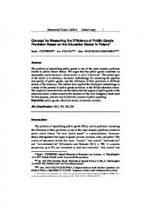
The Dynamic Reference Concept: Measuring Restoration Success in a Rapidly Changing No-Analogue Future John K. Hiers, Robert J. Mitchell, Analie Barnett, Jeffrey R. Walters, Michelle Mack, Brett Williams, and Rob Sutter ABSTRACT The “past as prologue” approach to ecological restoration is increasingly problematic due to global climate change, invasive species, and human perturbations that are outside of evolutionary boundaries, all of which argue for new conceptual approaches to restoration. We present the dynamic reference concept, an approach that quantitatively incorporates the temporal and spatial variation of reference ecosystems such that targets reflect ecological dynamism. Success is measured by simultaneously quantifying changes in reference and restoration sites over time. To illustrate the practical application of this concept, we present a case study of longleaf pine (Pinus palustris) restoration on Eglin Air Force Base, Florida, USA. We use Mahalanobis distance with non-metric multidimensional scaling ordination to quantify the dynamic nature of reference plots and the extent to which restoration sites move toward them. Reference ecosystems were first defined by expert judgment and ecological models including maximum entropy. We then further refined restoration targets through data analysis using Mahalanobis distance to determine plots that were within the 90% confidence region of initial benchmark species composition. Species composition of benchmark sites was more resilient than restoration sites, i.e., changing less with a natural disturbance regime of frequent fire. Restoration sites with higher fire frequency moved more rapidly towards the reference conditions than sites with fewer fires. By quantifying the “moving target” of reference ecosystems while simultaneously measuring change of restoration sites, this application of the dynamic reference concept offers promise to manage for reference conditions that are achievable in a world where change is the norm. Keywords: disturbance, Dynamic Reference Concept, longleaf pine, no-analog future, reference conditions, restoration.
T
he human imprint on nature has increased in both scope and magnitude, until today there are few if any terrestrial landscapes or aquatic ecosystems undisturbed. The fundamental alteration of ecosystems often diminishes their ability to sustain native biota or deliver ecosystem services (Seastedt et al. 2008). Within this milieu, ecological restoration operates, attempting to move ecosystems from a degraded condition toward a more fully functional reference condition (Hobbs and Cramer 2008). Not only is re-establishment of ecosystem function a challenge to Ecological Restoration Vol. 30, No. 1, 2012 ISSN 1522-4740 E-ISSN 1543-4079 ©2012 by the Board of Regents of the University of Wisconsin System.
restoration, but pervasive anthropogenic impacts increase the difficulty of defining appropriate target reference conditions against which restoration success is measured. Defining reference ecosystems and how their change through time is integrated into restoration currently challenges both concept and practice ( Jackson and Hobbs 2009). Ecosystem change has increasingly resulted in novel biotic assemblages (due to both exotic species invasion and native species extirpation), which are responding to no-analogue climates, atmospheric deposition of nutrients, and disturbance regimes that are outside of historical precedence (Seastedt et al. 2008, Jackson and Hobbs 2009). Defining reference conditions is a challenge in the contemporary landscape, and recent March 2012
papers call for new thinking to address this challenge (Cramer and Hobbs 2008, Clewell 2009, Suding and Hobbs 2009). Few examples provide alternative concepts and guidance for restoration (Seastedt et al. 2008). The recent development of ecological models with biotic and abiotic thresholds and feedbacks has been suggested to provide more rigorous guidance for restoration efforts (Suding and Hobbs 2009). Novel ecosystems resulting from environmental change, however, challenge even these new ecological models and necessitate additional forward-looking thinking (Suding and Hobbs 2009). Moreover, the dynamics of community and species characteristics will drive conservation managers to look toward the future rather than the past
ECOLOGICAL RESTORATION
30:1
� 27
in setting restoration targets and devising restoration strategies (Schlaepfer et al. 2011). To address these challenges we propose an approach termed the dynamic reference concept, where ecological change of both reference conditions and restored sites are measured simultaneously and are statistically evaluated. Our approach focuses on the dynamic future of the best available sites as the target for restoration success (consistent with Clewell 2009), rather than a historical precedence or a fixed range of variation (Figure 1). We illustrate the application of this concept in 3 steps: defining reference conditions, refining the range of variation included in reference conditions, and examining change through time to measure restoration success. We use multivariate statistical methods that measure ecosystem trajectories to quantify the dynamics of restored sites and their recovery relative to a moving target.
The Past is No Longer Prologue Restoration efforts in the “New World” commonly have defined the desired target as a historical state, typically thought to exist prior to European settlement (McCann 1999). This retrospective view assumes that these ecosystems reflected species assemblages that evolved in response to natural climate and disturbance regimes. Presumably, these more natural ecosystems represent a sustainable state where diversity, stability, and resilience are maximized ( Jackson et al. 1995). Yet defining restoration goals based on past condition has illuminated some inherent problems. Assessing the impact of indigenous people in this retrospective “pristine” paradigm has proven conceptually difficult. While indigenous peoples’ impact may have varied widely in time and place, evidence also suggests that many terrestrial and even aquatic ecosystems were substantively altered by indigenous people (Bird et al. 2008). 28
�
March 2012
Simply integrating human indigenous influence to understand variation in the historical landscape is, however, insufficient to guide future restoration targets. Examples of minimally altered ecosystems in the contemporary landscape are increasingly rare. As a consequence, reliance on the few available examples of native ecosystems often constrains the understanding of ecological variation, particularly where dominant land uses have altered the landscape. Furthermore, the paleo-record establishes incontrovertible evidence that ecosystems have been in a constant state of flux and that the range of variation that exists depends on the portion of the paleo-record considered ( Jackson and Hobbs 2009). Therefore, incorporating variation in ideas of reference has been problematic. Lastly, characteristics of past ecosystems simply may not be attainable or may not have the resilience to be sustained in the future. Human-induced climate change alone will have both direct as well as cascading impacts on natural environments (Hobbs et al. 2006). Changes in rainfall patterns and the frequency of extreme weather events will intensify regional droughts, alter biogeochemical cycling, change the use of prescribed fire, and significantly influence the occurrence of wildfire (Westerling et al. 2006). Such changes challenge restoration of natural environments as these ecosystems respond to various perturbations with altered competitive structures and changes in species immigration and extinctions (Seastedt et al. 2008).
The Dynamic Reference Concept: A Longleaf Pine Case Study We present the dynamic reference concept, an approach that seeks to quantitatively incorporate the temporal and spatial variation of benchmark ecosystems such that restoration targets reflect ecological dynamism. Success is measured by simultaneously
ECOLOGICAL RESTORATION
30:1
quantifying change of both reference and restoration sites over time. Measuring restoration trajectories towards a dynamic target is problematic, particularly in a variable no-analogue future. Our application of the dynamic reference concept addresses this concern by monitoring both the effects of pervasive agents of anthropogenic stressors, such as climate change, as well as ecological disturbances, such as fire and wind. Variability within and among reference sites provides a domain of targets from which restoration success is measured. Application of the dynamic reference concept can be functionally divided into 3 steps: 1) defining attainable restoration targets; 2) statistically refining reference conditions; and 3) measuring change within both the reference sites and the trajectory of the landscape being restored. The dynamic reference concept emphasizes managing both variation and change as a direct consequence of these key ecological processes. A component of this approach is incorporation of variation in the range of desirable ecosystem characteristics (Clewell 2009). The goal is to determine the full range of these conditions to better define a spatially and temporally dynamic target rather than a static or singular optimum state. Reference sites then represent the best available habitat in terms of conservation of native biota and ecosystem function, and their dynamism over time reveals a range of appropriate reference targets (Palmer et al. 2004). We illustrate the application of this concept at Eglin Air Force Base (AFB) in the Florida Panhandle, USA, which is the largest remaining tract of longleaf pine (Pinus palustris) in a single ownership. More specifically, we use data from the long-term ecological monitoring program from xeric longleaf pine communities at Eglin to move the general concept to practical application. We include both previously published data (2001–2006) from Hiers and colleagues (2007) as well as data collected in subsequent years (2007–2010) using the same methods. The dynamic
Figure 1. Conceptual model of the dynamic reference concept illustrating movement of restoration sites towards a changing set of reference conditions. The dashed line surrounds a full range of desired ecological conditions. This approach monitors the ecological change in reference conditions to quantify what targets of restoration are realistic and achievable over time in response to both anthropogenic and natural disturbance.
reference concept involves managing for change rather than specified states, and long-term monitoring data are ideal for its illustration. Anthropogenic influences, climate change, disturbance regimes, altered biogeochemical cycles, and the extirpation and immigration of species are general drivers of ecological change. Additionally, specific key drivers in longleaf ecosystems include: 1) fire regime, which has dramatic effects on understory and midstory vegetation (Hiers et al. 2007); 2) wind, notably in the form of hurricanes, which creates openings in the canopy (Platt and Rathbun 1993); and 3) a soilmoisture gradient running from mesic flatwoods to xeric sandhill habitats (Kirkman et al. 2001). These specific drivers interact to increase ecological heterogeneity and result in the highest recorded species richness and endemic species in the sub-tropics (Walker and Peet 1984, Peet and Allard 1993, Kirkman et al. 2001).
In longleaf ecosystems, reference sites are often defined as those which provide high quality habitat for the endangered red-cockaded woodpecker (Picoides borealis) (USFWS 2003). This is instructive because the red-cockaded woodpecker management prescription is often viewed as enlightened in that it represents an ecosystem rather than single-speciesbased approach to habitat restoration. This prescription is intended to restore habitat to historic conditions, specifically open, old-growth multiple cohort stands of longleaf pine with a diverse, abundant ground cover and sparse midstory ( James et al. 2001). The limitations of these guidelines result from an under-representation of ecological variation in both time and space (Hiers et al. 2007). Also, application of the guidelines is typically geared toward producing a uniform optimum state, or at best a narrow range of variability, rather than a range of states that reflect temporally March 2012
varying effects of key ecosystem drivers. The historic range of variation is problematic because the range of variation varies proportionally with the historical time frame. In addition, the historic range of variation does not necessarily reflect the future conditions that are likely to be seen due to climate change and other ecosystem drivers. The dynamic reference concept provides a general approach that can be applied to a wide range of ecosystems and restoration goals by more fully incorporating temporal and spatial variation in the establishment of reference conditions. Defining Benchmark Conditions Given the uncertainty in identifying the range of variation in sites that could be used to characterize benchmark ecosystems, we employed multiple methods to define reference targets (White and Walker 1997). Fortunately, Eglin AFB is a relatively large landscape (188,000 ha) with many
ECOLOGICAL RESTORATION
30:1
� 29
Figure 2. Predicted potential distribution of reference or high quality sandhills across Eglin Air Force Base from a) Eglin’s 2009 ecological condition model, and b) MaxEnt species distribution model trained on 10 randomly sampled points from within existing reference sandhills plots.
potentially suitable reference sites that owe their existence to an atypical land-use history, including the lack of conversion to agriculture, extensive turpentining as a substitute to clearcutting, and a sustained frequent fire regime due to active military test areas. To define restoration targets and their range in conditions, we integrated 3 approaches: 1) expert identification of specific reference sites; 2) a spatiallyexplicit and expert-based landscape model to identify areas with structural and compositional conditions representative of benchmark sites; and 3) a species distribution model. Expert judgment is commonly used to identify reference sites and is employed to determine salient characteristics of target ecosystems, to identify suites of indicators that 30
�
March 2012
define reference states, or to delineate reference sites in the field (White and Walker 1997, Suding and Hobbs 2009). Notwithstanding its frequent use, expert judgment has several significant drawbacks because the method is subject to bias and disagreement (White and Walker 1997) and may be largely anecdotally-based. These shortcomings of expert judgment, however, can be ameliorated, in part, by the inclusion of multiple experts and various surveys. We utilized 3 separate surveys of reference sites that included field surveys and expert workshops (Florida Natural Areas Inventory, The Nature Conservancy, and Eglin AFB natural resource managers) to define the initial population of potential restoration targets.
ECOLOGICAL RESTORATION
30:1
A second complementary approach implemented at Eglin involved using expert judgment to build a landscapelevel, spatially explicit tool termed the Ecological Condition Model (Wiens et al. 2009). Expert-driven workshops were used to classify the landscape into 4 tiers of ecological condition through the identification and weighting of 8 criteria derived from remotely-sensed imagery (Figure 2a). Although the model inputs and their weights were subjective, the output represented an objective application of those criteria across the landscape. For more details on the Ecological Condition Model, and incorporating ecological processes into the definition of reference sites, see Wiens and others (2009). Eglin’s model includes drivers of ecological change over time, such as fire regime
Figure 2. Predicted potential distribution of reference or high quality sandhills across Eglin Air Force Base from a) Eglin’s 2009 ecological condition model, and b) MaxEnt species distribution model trained on 10 randomly sampled points from within existing reference sandhills plots.
and canopy disturbances. Ecological condition modeling may be particularly useful for identifying the best available sites in areas with few known benchmark sites. Using the spatiallyexplicit Ecological Condition Model in conjunction with multiple groups of experts to identify reference sites can help minimize bias of one particular group or expert and create a more robust range of potential reference sites. Finally, to identify reference areas that might have been missed by previous efforts we used MaxEnt (version 3.3.0) (Phillips et al. 2006, Phillips and Dudık 2008), one of the best performing species distribution models for presence-only data (Elith et al. 2006). MaxEnt uses a machine learning approach to estimate a species’
potential geographic distribution by determining the distribution of maximum entropy (i.e., closest to uniform) with the constraint that the expected value of each predictor variable, including its transformation and/ or interactions, matches its empirical average (Phillips et al. 2006). The outputs include a spatially explicit logistic suitability grid that provides an estimate of the probability of species’ presence (Phillips and Dudik 2008) as well as response curves that depict the relationship between each variable and the probability of occurrence. At Eglin AFB, we explored the novel use of MaxEnt to predict the relative suitability of the landscape for a target community. That is, we treated reference sites for the longleaf sandhills community as the target species in March 2012
MaxEnt. We randomly selected 10 points within 33 previously identified 1-ha reference sites as training points for MaxEnt. The predictor variables were the same spatially-explicit variables used in the Ecological Condition Model described above. We ran MaxEnt with the default parameters and 1,000 maximum iterations (for details, see Phillips et al. 2006). Due to MaxEnt’s sensitivity to the area selected for the background sample (Elith et al. 2011), we used a mask to exclude locations where longleaf does not occur on Eglin AFB, such as areas with unsuitable soils and cleared lands. The final model had an area under the receiver operating characteristic curve (AUC) of 0.949 and a 79% predictive accuracy rate for the reference sites. We used the MaxEnt threshold
ECOLOGICAL RESTORATION
30:1
� 31
Figure 3. Three-dimensional NMDS ordination with a priori vegetation group assignments and a 90% confidence ellipsoid (CE) in gray at: a) initial sample; and b) change vectors from initial to last sample.
32
�
March 2012
ECOLOGICAL RESTORATION
30:1
of 10 percentile training presence to classify the logistic suitability output into a binary grid of areas likely and unlikely to contain reference conditions (Figure 2b). This relatively conservative threshold approach identifies the logistic suitability values at which 90% of the training locations were predicted to be reference sites. As Figure 2b illustrates, many areas outside of the initial reference sites were predicted by MaxEnt to contain high quality longleaf sandhills. In addition, the MaxEnt response curves provided a better understanding of the relationship between the predictor variables and the target community than the expert-driven Ecological Condition Model. Refining Restoration Targets We defined restoration targets using multiple methods, nonetheless refining what is or what continues to be a reference condition is an iterative process that necessitates long-term monitoring and statistical analysis of variation in ecological communities (Lindenmayer and Likens 2009). To address the refinement of benchmark conditions, we adopted a multivariate framework to quantify changes in reference conditions over time and in response to management actions. Multivariate statistical tools have long been used by community ecologists to assess species compositional patterns and their relationships to the environment (Legendre and Legendre 1998, McCune and Grace 2002). Restoration ecologists have also recognized the value of these techniques to examine the effectiveness of adaptive management efforts (Reynoldson et al. 1997, Falk et al. 2006). The multivariate framework used at Eglin is designed for natural resource management programs in which species data are collected at multiple time steps and in response to management actions. It requires that reference conditions for the focal community have been defined. We used non-metric multidimensional scaling (NMDS) ordination to perform an indirect
ordination of the community data matrix. NMDS is a distance-based ordination technique that is particularly appropriate for ecological analyses as it is nonparametric and can be used with a variety of relativizations and distance measures (McCune and Grace 2002). We then applied Mahalanobis distance (MD), a distance measure, to examine the distance between reference and restoration plots in NMDS space to identify plots that fall within and outside a 90% confidence ellipsoid of reference conditions in terms of species composition (Figure 3a). MD is a scale-independent distance measure that considers the covariance structure among variables and is often used to calculate the distance of a point from the mean or centroid of a distribution, compare the distance between 2 distributions, and identify multivariate outliers (Legendre and Legendre 1998). If multivariate normality exists, the squared MD approximates a chi-square distribution with p degrees of freedom, where p represents the number of variables or dimensionality of the data. Further, the MD equation is that of a p-dimensional ellipse that can be illustrated graphically with the construction of a probability ellipsoid in ordination space. Reference plots with MD values that fall outside a particular chi-square confidence level can be flagged as potential outliers and re-evaluated in the field to determine if a particular management action has dramatically changed the plot trajectory. To illustrate its utility, the multivariate framework was applied to vegetation monitoring data collected at Eglin AFB from 2001 to 2009. Since 2001, Eglin’s monitoring program has collected data for understory, midstory, and overstory vegetation in 200 1-ha sandhills monitoring plots distributed across the base (Hiers et al. 2007). The plots are sampled by Eglin natural resources staff after management treatments and on a rotating basis so that all plots are sampled a minimum of once every 5 yr. We March 2012
calculated density values for understory, midstory, and overstory species to serve as the response variables in the NMDS analyses. We created a community matrix of 194 samples by 148 species based on data collected at the first sample date, with plots displayed in the 3-dimensional NMDS ordination at the time of first sampling (Figure 3a). We used MD analysis of the 3 NMDS axis scores to calculate the distance between each reference plot as well as the distance between each restoration plot and the centroid of reference conditions. For each restoration plot, the resultant MD indicates how different the species composition is from that of the a priori reference plots. For the reference plots, the MD values were converted to chi-square probabilities to identify potential outliers at _ = .10. Two initial reference plots fell outside the 90% confidence ellipsoid for the first sample time period and were identified as outliers (Figure 3a). Moreover, 14 plots not included in the subjective process of reference identification fell within the MD 90% confidence ellipsoid at the first sample. These plots have vegetation composition and structure within the range of variation (90% confidence interval) of reference sites and represent potential reference sites overlooked by identification methods based on expert opinion. This refinement process is critical for evaluating bias inherent in expert judgment used in the definition step because an assumption of MD analysis is that reference conditions are adequately represented by the centroid of all reference plots in ordination space which will depend upon the designated reference plots included in the analysis. Measuring the Dynamics of Restoration Targets and Restoration Sites The multivariate framework can also be used to measure the effectiveness of adaptive management efforts by quantifying change over time and in
ECOLOGICAL RESTORATION
30:1
� 33
response to management actions. To examine the change in species composition from the first time period to the last, we excluded intermediate monitoring data to create a reduced community matrix of 338 samples and 155 species. The location of plots at the first and last sample in the 3-dimensional NMDS ordination is illustrated in Figure 3b. For each sample time (first and last), we used MD analysis of the 3 NMDS axis scores to calculate the distance between each reference plot and the distance between each restoration plot and the centroid of reference conditions. Both the reference and restoration plots moved in species composition space over time (Figure 3b). The ancillary variable most strongly correlated with the ordination was the number of fires since plot establishment (r²= 0.3292, p