ance, computer-graphics, virtual reality, communication, and vi- sual inspection for example ... cal building reconstruction was extensively addressed by the sci-.
International Archives of the Photogrammetry, Remote Sensing and Spatial Information Sciences, Volume XXXVIII-1/C22, 2011 ISPRS Zurich 2011 Workshop, 14-16 September 2011, Zurich, Switzerland
THREE-DIMENSIONAL BUILDING RECONSTRUCTION USING IMAGES OBTAINED BY UNMANNED AERIAL VEHICLES Cornelius Wefelscheid, Ronny H¨ansch, Olaf Hellwich Computer Vision and Remote Sensing Berlin University of Technology Sekr. FR3-1, Franklinstr. 28/29, D-10587, Berlin, Germany (cornelius.wefelscheid, r.haensch, olaf.hellwich)@tu-berlin.de
KEY WORDS: UAVs, Photogrammetry, 3D Reconstruction, Sensor Orientation
ABSTRACT: Unmanned Aerial Vehicles (UAVs) offer several new possibilities in a wide range of applications. One example is the 3D reconstruction of buildings. In former times this was either restricted by earthbound vehicles to the reconstruction of facades or by air-borne sensors to generate only very coarse building models. This paper describes an approach for fully automatic image-based 3D reconstruction of buildings using UAVs. UAVs are able to observe the whole 3D scene and to capture images of the object of interest from completely different perspectives. The platform used by this work is a Falcon 8 octocopter from Ascending Technologies. A slightly modified high-resolution consumer camera serves as sensor for data acquisition. The final 3D reconstruction is computed offline after image acquisition and follows a reconstruction process originally developed for image sequences obtained by earthbound vehicles. The performance of the described method is evaluated on benchmark datasets showing that the achieved accuracy is high and even comparable with Light Detection and Ranging (LIDAR). Additionally, the results of the application of the complete processing-chain starting at image acquisition and ending in a dense surface-mesh are presented and discussed. 1
INTRODUCTION
erator (F¨ostner and G¨ulch, 1987) and described by SIFT (Lowe, 2004). Due to the low precision of the on-board GPS and IMU, the trajectory of the camera is computed only from images. For the best accuracy, an optimal set of images in the sense of viewing angle and number of matches is selected for path estimation. An additional loop closure detection lead to robust and precise results. Bundle adjustment is applied as a final optimization step (Lourakis and Argyros, 2009). After path estimation, a dense point cloud is computed with a robust multi-view stereopsis approach (Furukawa and Ponce, 2010). Finally, a Poisson surface reconstruction method (Kazhdan et al., 2006) fits a polyhedral mesh into the complete point cloud.
The automatic generation of accurate three-dimensional models is useful for a wide range of applications including robot guidance, computer-graphics, virtual reality, communication, and visual inspection for example during industrial quality assessment. Especially the three-dimensional reconstruction of buildings is important due to its potential for the usage of 3D city models in city planning, damage assessment, monument conservation, architecture, and digital tourism. Earthbound vehicles only move on the ground. Images captured by them can be used for the reconstruction of facades. The roof or concave structures cannot be imaged with reasonable effort. In contrast, conventional air-borne sensors are not able to model details at the facade. They help to determine the coarse shape of a building, but cannot model the whole building with a high degree of detail. UAVs combine the advantages of earthbound and air-borne sensors. They can exploit the whole three-dimensional space as long as it is free of obstacles. They allow for different imaging positions and therefore enable the acquisition of the whole object.
The described processing-chain computes all results fully automatically. Even image capturing is done automatically by the UAV for a precomputed path. The proposed method achieves precise results on different benchmark datasets. Furthermore, the capabilities of the whole processing chain are exemplary illustrated by reconstructing a building from UAV image data. 2
RELATED WORK
Due to the large impact of three-dimensional building models and the high cost of generating them manually, the task of automatical building reconstruction was extensively addressed by the scientific community.
This paper proposes a complete and automatic processing chain, beginning with acquiring images over feature tracking, path estimation, and resulting in a dense three-dimensional surface model. The Falcon 8 octocopter from Ascending Technologies is utilized as flight platform in this work. A high resolution consumer camera with a prime lens is used as imaging sensor. In the special case of gathering 3D information with a UAV of less than 5Kg heavy laser-scanning sensors cannot be employed and a lightweight camera is the only possibility.
A lot of approaches concentrate on LIDAR, because this acquisition technique leads to dense and accurate point clouds (eg. (Luo and Gavrilova, 2006, Arefi et al., 2008)). In (Kada and McKinley, 2009) a cell decomposition approach is used to assemble individual building parts from a library of standard shapes in order to fit the model to the measured LIDAR data. In contrast, (Becker and Haala, 2009) use a grammar based method and mobile LIDAR for facade reconstruction. Rules and elements of the facade grammar are derived automatically from data parts of high quality and used for building parts, where the data is not sufficiently dense or accurate to enable a good reconstruction.
The final 3D reconstruction is computed offline after image acquisition and follows the reconstruction process originally developed for image sequences obtained by earthbound vehicles. Interest points within all images are found with the F¨orstner op-
183
International Archives of the Photogrammetry, Remote Sensing and Spatial Information Sciences, Volume XXXVIII-1/C22, 2011 ISPRS Zurich 2011 Workshop, 14-16 September 2011, Zurich, Switzerland
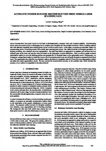
The Falcon 8 shown in Fig. 1(a) is used in this work. Eight rotors allow a safe landing even in the case of a serious failure of one motor during the flight. The weight of the UAV alone is 1.5 kg with an additional payload of 500 g. The maximal flight time is approximately 20 minutes, depending on the actual payload. Several sensors such as GPS, IMU, height sensor and compass are readily mounted on board to facilitate a stable and easy controllable flight.
While air-borne data provide outline and shape of building roofs, ground based views are suitable for facade reconstruction. UAVs are theoretically able to capture data from all viewing positions. However, due to weight constraints it is not possible to mount a LIDAR sensor on a modern UAV. Merging of point clouds from different data sources is possible, but non-trivial especially if they are obtained by such different viewing positions as for groundbased and air-borne sensors. Even if LIDAR data is used for building reconstruction, optical images will still be needed for coloring and texturing the derived building models.
Due to the included ground control software the used UAV is able to fly a fixed path using predefined GPS waypoints. However, law restrictions in Germany do not allow a fully automated flight. The user either has to steer the UAV manually or at least must be able to interrupt an automated flight at any time. Both can be accomplished by the remote control shown in Fig. 1(b).
Image-based reconstruction methods offer a couple of advantages compared to LIDAR. Lasers are heavy and expensive, while lightweight high-resolution cameras are of considerably lower cost. Another reason for using cameras is the ease of acquiring image data. While a LIDAR system has to be operated by experts, image acquisition with cameras can be carried out by laymen. During data recording with a LIDAR sensor, the different positions are precisely measured in order to merge the submaps to a global reconstruction afterwards. In the case of a structure from motion approach, this task is part of the reconstruction toolchain and automatically solved by the computer. Recent image-based reconstruction methods lead to robust and accurate 3D models that are comparable to those of LIDAR approaches (Strecha et al., 2008).
A high-resolution consumer camera from Panasonic (Lumix GF1) is used for image acquisition. The camera weighs only 285 g and therefore fulfills the payload constraint. It provides images of an resolution of 12.1 Megapixel with a 20 mm prime lens. 4
The usage of UAVs enables image acquisition of objects from viewing positions, which are impossible to take up by earthbound vehicles. The flight path might be planned in advance with the flight control software. This shortens the flight time as well as the overall time in the field. This is important, since the time of operation is much stronger restricted for UAVs than for earthbound vehicles.
Different structure from motion approaches have been presented in the past. A quite popular approach, which works on internet photo collections such as flickr (Agarwal et al., 2009), is described in (Snavely et al., 2007). This method was accelerated by (Frahm et al., 2010) to deal with the same amount of images on a single computer. All approaches are mainly based on iteratively applying bundle adjustment. Within this work the number of necessary bundle adjustments is limited. Additionally, a new strategy to detect loop closures is presented. This approach achieves similar accuracy by lower computational costs. Nevertheless, the main focus is not on the calculation period, but the accuracy of the reconstruction. 3
DATA ACQUISITION
The flight control software receives a set of waypoints. One waypoint is described by a vector consisting of GPS coordinates (only taken for 2D positioning), height, horizontal orientation angle, and a vertical camera angle. Images of the scene are acquired with a pre-calibrated high resolution digital camera (see Section 3). The high resolution leads to a more accurate path estimation as well as a precise 3D reconstruction which is comparable to LIDAR systems (e.g. (Strecha et al., 2008)).
HARDWARE
If the flight path is predefined, the images either will be taken at the waypoints or the continuous shooting mode of the camera will be utilized for a more dense image sequence. In the latter case, images are gathered with a frame rate of up to three images per second. 5 (a) Falcon 8 octocopter from Ascending Technologies
THREE-DIMENSIONAL BUILDING RECONSTRUCTION
This section provides an overview over the processing chain used by this work to estimate a three-dimensional building model from previously acquired images. The subsequent subsection discusses the individual parts of the processing chain (shown in Fig. 2) in more detail. Once image capturing is completed for a scene, the processing of the acquired data is performed completely offline. As explained in Section 5.1, a first step locates interest points in each image and generates one description per point in terms of characteristics of a small pixel neighborhood. This description is used to find interest points within the other images, which correspond to the same point of the 3D scene.
(b) Remote control device for human interaction
Figure 1: Hardware used for this work.
184
International Archives of the Photogrammetry, Remote Sensing and Spatial Information Sciences, Volume XXXVIII-1/C22, 2011 ISPRS Zurich 2011 Workshop, 14-16 September 2011, Zurich, Switzerland
Additionally, the ratio between the smallest and second smallest euclidean distance (the outlier distance (Brown et al., 2005)) has to be less than a threshold R (Eq.2):
Feature Description Feature Matching Loop Closure
g ~m D 1
Path Estimation Dense Reconstruction g ~m D = 2
Surface Fitting
(1)
~ g ∈D g D j
g ~f −D ~m ||2 ||D i 1