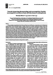
Diffuse Pollution Conference Dublin 2003
ECSA 7 Mixing/Modelling:
TOWARDS INTEGRATING LAND-BASED INFORMATION FOR WATERSHED MODELLING IN A COASTAL AREA VIA GIS A. Tanik*, D.Z. Seker**, M. Gurel*, K. Yuceil*, I. Karagoz*, A. Erturk*, A. Ekdal* *ITU, Istanbul Technical University, Faculty of Civil Eng’g, Dpt. of Environmental Eng’g 34469, Maslak, IstanbulTurkey,
[email protected],
[email protected],
[email protected],
[email protected];
[email protected],
[email protected] **ITU, Istanbul Technical University, Faculty of Civil Eng’g, Dpt. of Photogrammetry and Geodesy, 34469, Maslak, Istanbul- Turkey,
[email protected]
ABSTRACT Integrated watershed management has become to be recognized universally as an important holistic approach to natural resources management, which seeks to promote the concept of sustainability. The present paper was initiated as part of an ongoing study on ecological modelling and management of one of the most sensitive coastal areas located at the southwest of Turkey. Watershed Modelling System 6.1 (WMS) software was used to delineate the watershed boundaries. The GIS software ArcGIS 8.2, is used for visualization of data and information for land assessment. In the study, the methodology for building the resource inventory is described in data collection and gathering steps, which cover supply and processing of data sets and thematic maps of all environmental aspects demonstrated on different layers. Land-based information is then supported by soil data gathering studies via forming layers indicating major soil classes, soil types, soil sub-groups, land cover, and other soil characteristics. These maps are overlaid to form a ‘Land Data Evaluation Table’, where selected soil sampling stations are used as cross-reference to data acquired. Soil samples are also collected to undergo further analysis which is ongoing. Bearing in mind that land assessment is the process of predicting the use potential of land on the basis of its attributes, this study will act as a guideline for those who want to initiate a land assessment study, which is an essential part of the integrated watershed management efforts. Keywords : GIS, Koycegiz Lake/Dalyan Lagoon, Land assessment, Soil Char acteristics, Watershed Modelling.
INTRODUCTION In recent years there has been an increasing recognition for the need of a new approach to the management of land and water resources, aimed at the control of degradation, long-term, sustainable utilization of natural resources, and the maintenance of the quality of the natural environment. Such an approach, called integrated watershed management, involves the adoption of a coherent management system for land and water which can ameliorate the adverse impacts of either natural disasters or human-made activities, and help to achieve the sustainable use of natural resources within a watershed. Accordingly, integrated watershed management targets the coordinated use and management of land and water to ensure minimal impact to water yield and environmental quality. The first step on the pathway towards making decisions on the distribution, utilization and protection of natural resources, is to define the boundaries of the watershed of concern. The present condition in the watershed must then be address to enlighten aspects such as topography, soil properties, land-use distribution, climatic conditions, human activities prevailing on agricultural and industrial zones, demographic status and beneficial uses of both land and water. Thereby waste load allocations must be put forth so as to proceed on selecting and deciding on the protective measures to be taken at the area to further protect it from pollution. Recent developments in computer science accelerated the presentation and mapping of the available data. As of today, delineating watershed boundaries and incorporating spatial data to manage, analyse and answer spatial questions in the watershed is easier by using modelling software and distinctive characteristics of geographical information systems (GIS) as a tool (Burrough and McDonell, 1996; Garbrecht et al., 2001). Besides presenting the current situation, such applications will give chances to modellers to apply watershed related models and make it achievable to estimate the long term environmental impacts of any suggested amendment on land-use distribution and/or human activities. These practices, aided with detailed site surveys and field data collection, would hence, fulfil the main target of managing the watershed in a sustainable manner. In this study, delineation of the selected watershed will be mentioned together with the guidelines of integrating land-based information to GIS towards the purpose of land assessment. Land assessment is a key element in land-use planning and an essential feature of watershed management. It is the process of predicting the use of potential of land on the basis of its attributes (ESCAP-UN, 1997). A comprehensive inventory is necessary to determine the quality characteristics of existing land resources. Such a resource inventory would require an integrated collection of data relating to topography and landform, geology and geomorphology, soil types and characteristics, climate, hydrology, vegetation, wildlife and existing land uses. Besides, a soil survey is of central importance, because almost all patterns of land utilization depend on the soil as a medium for plant growth or as an engineering material. GIS is the most suitable technology to ease the undertaking of the inventory study as well as the presentation of the data. In this paper, emphasis will be given to the guidelines of soil data collection and presenting the findings in visualized forms through the aid of GIS in order to lead to land assessment of the area of concern. GIS is a very effective and useful tool for land assessment studies, (Paningbatan, 2001) and its
6-122
Diffuse Pollution Conference Dublin 2003
ECSA 7 Mixing/Modelling:
procedure would require improvement and storage of scattered data by, establishing spatial access to point data by association with mapping units, gathering of different data types, data update and validation.
DESCRIPTION OF THE WATERSHED AND THE METHODOLOGY FOR BUILDING RESOURCE INVENTORY The watershed of Koycegiz Lake/Dalyan Lagoon, with an approximate surface area of 1200 km2 , is situated at the southwest of Turkey, where the Lake joins the Lagoon and the Lagoon joins the Mediterranean Sea. Part of the area has been declared as a Special protection Area and is one of the sensitive and vulnerable coastal regions of the country in terms of endangered and endemic species. Caretta-caretta sea turtles utilize the area as their nesting and breeding sites. The watershed hosts a population of almost 45000 capita mainly dealing with agriculture, tourism and fishery, but there is no significant industrial activity in the region. The location of the watershed in Turkey is presented on the map in Figure 1, which was produced by 3D digital elevation model (DEM) (Gonenc et al., 2002).
Figure 1. Location of the watershed in Turkey and its 3D plan view The methodology used to build the resource inventory, requires that data should be gathered over a topographical base map and that, thematic maps should be used to indicate hydrodynamics of aquatic environment, geologic and geomorphologic conditions, vegetation and land-use, socio-economic data like administrative boundaries and population, soil structure involving soil classes, soil types, sub-soil groups and other characteristics, and finally climatic and meteorological data being the most important external factor that affects the fate and behaviour of the watershed. Data collection comprises mainly processing elevation data, acquiring digital thematic maps, and delineation of watershed boundaries. The elevation data which has a scale of 1:25 000, is taken from the Turkish Armed Forces General Command of Mapping (TAFGCM), which had developed these digital maps using photogrammetry techniques. Most of the data mentioned above, which are crucial for land assessment and hydrological modelling (Seker et. al., 2002), are provided within the thematic maps received from the National Information Centre (NIC) of the General Directorate of Rural Affairs of the Turkish Republic (TRGDRA). These maps are based on UTM (Universal Transverse Mercator) coordinate system. The layer for watershed boundaries was initially delineated on an analogue map. In the study, this analogue map was digitized and furthermore, the produced digital map was then verified via Watershed Modelling System 6.1 (WMS) developed by US Army and Brigham Young University, UK (Akbulut, 2002). This software with extensive capabilities for watershed delineation and runoff modelling, better suits for applications in small watersheds and accomplishes its process at quite a high accuracy. Gathering of data consists of three steps. The overall flow diagram of the GIS methodology is given in Figure 2. Step 1 involves the integration, manipulation and transformation of elevation data, sub-basin boundaries and coastlines. Since the significance of storing updated environmental data in a reliable and user-friendly platform, became inevitable, ArcGIS was preferred for this purpose because of its solely complete and integrated system for geographical data creation, management, integration and analysis. Thus within Step 2, the data developed in the precedent step are then converted to ArcGIS file format. Finally, in order to enable queries via the GIS environment, in Step 3, attribute tables are prepared for all map layers. The output of the mapping and visualization process on the watershed and its sub-basins is presented in Figure 3. Even though the vast majority of the entire watershed was covered, some portion of the area could not be visualized, partly due to the lack of funding and technical problems aroused during integration of data and partly due to military confidentiality.
GATHERING THE RESOURCE TOWARDS LAND ASSESSMENT
INVENTORY
–
LAND-BASED
INFORMATION
The gathering of resource inventory initiated with the topography of the watershed. This layer is important in determining the appropriate irrigation method and efficiency, run-off characteristics as well as erosion and flood risks. Climatic and meteorological data layer is significant, as these aspects drive irrigated agriculture. This layer also supplies information on
6-123
Diffuse Pollution Conference Dublin 2003
ECSA 7 Mixing/Modelling:
soil-water balance, erosion risk and limiting conditions for plantation. The data sets for precipitation, evaporation, air and soil temperature, and humidity are required by almost every study related to watershed modelling, planning and management application, whereas more specific data such as wind speed and direction, cloudiness, and solar radiation, would be necessary for discharge plume modelling, agricultural practices, and plankton growth, respectively.
Figure 2. Flow diagram of the GIS methodology
Figure 3. Mapping and visualization of the watershed
Natural monuments and human-made infrastructure characteristics of the watershed must also be known to better understand the land and water properties. Such a survey will act as a guide during development of a management strategy. One of these layers presents the rivers and streams in the watershed, which was received from TRGDRA-NIC and originally produced by the State Hydraulic Works of Turkish Republic (TRSHW). The map has a scale of 1:100000 and is delimited by the administrative boundaries of Mugla, the province in which the entirety of the watershed resides. The major earthquake history and the significant mining zones of the area are similarly provided in province-based thematic maps. Both maps are gained from the General Directorate of Mineral Research and Exploration of the Turkish Republic (TRGDMRE). The hot springs, which are characteristic to the watershed, are introduced to the GIS database as point data. They are aligned alongside the Lagoon within a close distance to its banks. Seawater intrusion to the Lagoon occurs seasonally due to its hydrodynamic characteristics; therefore the location of the springs is important (Gurel, 2000; Erturk, 2002). The road map of Mugla is also added to t he GIS database. If it is regarded necessary to develop a new land-use plan due to a detailed survey on the watershed, road maps would be considerable because of their significance to human-driven functions. The socio-demographic data is another layer that shows the current status of population distribution in the watershed. There exist no populated cities in the watershed, but two larger towns, Koycegiz and Dalyan. Almost 75% of the population resides in the Koycegiz Lake sub-basin, whereas the rest lives in the Dalyan Lagoon sub-basin. Villages and other settlements in the region are widely scattered across available agricultural land covers and are provided in a separate layer. The coordinates of villages are obtained from the TAFGCM and then transformed to UTM Coordinate System so as to integrate this layer with the rest of thematic maps. As forests and agricultural areas cover nearly 85% of the total area, non-point source pollutant loads are very significant in the watershed. No detailed investigation on the forest areas has been conducted so far, however, fertilizers and pesticides applications are examined annually on monthly intervals for the year 1998 (Karak, 2000; Guvensoy, 2000). This information is gathered from each agricultural village authority in the watershed and numerically introduced into the GIS as point data attributed to each village. The nutrient loadings arising from agricultural areas are recorded in tabular format and presented in charts for each village. These attribute tables provide calculated figures for residual monthly loads after the reduction by crop uptake and other various reactions are also presented on village basis. 15 of the most significant pesticides applied in the watershed are also listed in the GIS together with the basic physical, chemical and biological characteristics of each.
IMPLEMENTATION OF SOIL SURVEY The purposes for which land evaluation surveys are undertaken and the techniques used for this purpose vary widely according to national or local requirements. At watershed scale, such surveys are conducted in developing countries as a basis for major land-use change. In this study, an alternative approach is aimed for the assessment of not only the capability of land for various land-use purposes, but also of the suitability of land for specific land-use purposes. This approach used in developing countries is also appropriate for watershed management applications (ESCAP-UN, 1997). Soil surveys are mainly used to analyze soil fertility, drainage and erosion condit ions, and irrigation and fertilization
6-124
Diffuse Pollution Conference Dublin 2003
ECSA 7 Mixing/Modelling:
requirements. In this study, land capability classification, soil types, soil sub-groups, land-use and other soil characteristics are studied and presented via different thematic maps. Land capability classification is a method of land evaluation, which indicates the specified potential use of land. Such classification is usually presented as a thematic map with standard legends for land capability classes. There are eight standard major classes (I to VIII) universally accepted, ranking land-use potential on a “best” (I) to “worst” (VIII) basis for specified categories of agricultural uses. The land classification map for the watershed is shown in Figure 4a. All the referred classes may be observed in the area. Class I indicates land suitable for regular cultivation where no special conservation measures are necessary, Class II refers to land suitable for regular cultivation requiring simple soil conservation measures, Class III states the land suitable for regular cult ivation requiring intensive soil conservation measures, Class IV addresses land suitable for grazing and occasional cultivation requiring some erosion control measures, Class V points out land suitable for grazing and occasional cultivation requiring intensive soil conservation works, Class VI reflects land suitable for only grazing, Class VII presents land that is steep, infertile, or has shallow soils, and finally Class VIII describes land which should not be cultivated, and grazed (Frevert et al., 1993). Within each of these classes, sub-classes may also be used to indicate the nature of the land-use constraints. United States Department of Agriculture (USDA), uses the following sub-class categories; e: erosion hazard, w: excess water problems, s: soil root zone limitations (such as shallowness and stoniness), and c: climatic constraints. Figure 4b presents the international soil sub-groups classification standard used in this study. Soil types of the watershed are provided as a separate layer in the GIS. Lime-free brown soils are dominant in the area. This soil type is characterized by its high clay content and sometimes by stony clay texture with pebbles. The dominant plantation on such soil type is grass and bushes. The second major type of soil in the watershed is Mediterranean redbrown soils, which are typically observed within regions with dry climate conditions. The red-brown soils are mainly composed of hard limestone, granites, and rocks. Other soil characteristics that are gathered separately are demonstrated in Figure 4c. The figure indicates the drainage characteristics and fertility capability of different soil types observed in the watershed. Since the land-based pollutant loads may drastically vary with respect to recent land-use and its distribution as well as the variety of soil types, a comparison of soil types and land-use is made in the study by overlaying the two maps as shown in Figure 4d.
(a) (b) Figure 4. Land-use capability classification (a), sub-soil groups of the watershed (b)
LAND ASSESSMENT OF THE WATERSHED Mapping and visualization stage must be supported by field analysis in order to validate the gathered data including the soil maps, as well as to determine more information on the physical and chemical properties of soil. Thereby, such additional data, apart from enabling a better land evaluation, could be utilized as input data to, for instance, hydrological modelling studies. The number of sampling stations required for this purpose, are optimized so as to minimize the costs but to attain a broad representation of the watershed. This optimization was achieved by overlaying the five soil maps referred. As a result of the theoretical study on superimposed maps and site visits, 20 representative sampling points were then defined and located as indicated in Figure 4d. Soil samples from each station were taken for the ongoing analysis by the Menemen Research Institute of TRGDRA.
6-125
Diffuse Pollution Conference Dublin 2003
ECSA 7 Mixing/Modelling:
“Land Data Evaluation Table” is then prepared by overlaying the five soil maps and further queries are done based on these reference stations. Such an approach is a process for assessing the relative suitability of indicated areas of land for actual land uses. However, it should always be considered in order to achieve a proper land assessment it is utterly vital to maintain thematic maps that are up -to-date and authenticated by field investigations and a representatively fine resolution soil monitoring system. Thus, the comparative analysis initiated in this study and summarized in Table 1, should be interpreted as a guideline towards a complete land assessment procedure. On the other hand, the information provided in Table 1 is still a good example for how the land-based information should be gathered to develop a strong basis for rational decision-making regarding the best land uses for the area under investigation.
Figure 4 (c): Other soil characterstics
17 1
9
20
6 19
14
16
5
15 10 18
8
4
13
7
Forests - Brown Without Lime
12 3
2
11
Forests - Red-brown Mediterrenean Forests - Red-yellow Podsolic Meadows - Colluvial Meadows - Brown Without Lime Meadows - Red-brown Mediterrenean Olives - Colluvial Olives - Brown Without Lime
Seasonal Non-Irrigated Agriculture - Alluvial
Citrus Fruits - Colluvial
Seasonal Non-Irrigated Agriculture - Brown Without Lime
Citrus Fruits - Brown Without Lime
Seasonal Non-Irrigated Agriculture - Colluvial
Citrus Fruits - Alluvial
Well-Irrigated Agriculture - Red-brown Mediterrenean
Poor-Irrigated Agriculture - Alluvial
Well-Irrigated Agriculture - Brown Without Lime
Pastures - Alluvial
Well-Irrigated Agriculture - Colluvial
Pastures - Red-brown Mediterrenean
Well-Irrigated Agriculture - Alluvial
Forests - Colluvial
Pastures - Hydromorphic
Forests - Alluvial
Pastures - Brown Without Lime
Soil Types vs Land-Use and Sampling Points
Figure 4 (d): overlaid maps of soil classes and land-use and Sampling Points
6-126
Diffuse Pollution Conference Dublin 2003
ECSA 7 Mixing/Modelling:
Table 1. Land evaluation table of the watershed
1
Soil Classes I
2
II
3
VII
Alluvial
4
VII
5
I
Lime-free Brown Colluvial
6
II
7
VII
8
I
9
VI
10
VII
11
II
12
VII
Colluvial
13
VII
14
III
Mediterranean Red-Brown Alluvial
15
V
Hydromorphic
Pasture
16
V
Colluvial
Citrus
17
II
Forest
18
VII
Lime-free Brown Alluvial
19
VI
Alluvial
Olive
20
VII
Lime-free Brown
Forest
No
Soil Types Lime-free Brown Colluvial
Mediterranean Red-Brown Hydromorphic Colluvial Lime-free Brown Mediterranean Red-Brown Colluvial
Land Cover
Soil Sub-groups
Other Soil Characteristics
Forest Well-irrigated Agriculture Pasture
Data is validated on site. Wetness Erosion-Shallow Root Region
Forest Well-irrigated Agriculture Forest Pasture Well-irrigated Agriculture Forest Pasture Well-irrigated Agriculture Well-irrigated Agriculture Forest Citrus
Forest
Data Validation Remarks
Erosion-Shallow Root Region Wetness-Shallow Root Region Shallow Root Region-Erosion Erosion-Shallow Root Region Wetness Wetness-Shallow Root Region
Insufficient Drainage Stony
Citrus fruits are dominant, but they are also applicable for this soil type. Data is validated on site.
Stony
Data is validated on site.
Salty, Alkaline Stony Stony Insufficient Drainage Salty, Alkaline
The sample is taken from a corn field surrounded by citrus fruits. The sampling is in a narrow meadow zone, downhill to huge woods. The wetlands allow raising cotton which necessitates well irrigation. The area hosts citrus fruits, which are also applicable for this soil type. Data is validated on site. Meadows which are also expectable on this soil type, exist in the area. Data is validated on site. Data is validated on site. Data is validated on site.
Shallow Root Region Wetness-Shallow Root Region Shallow Root Region-Erosion Shallow Root Region Erosion-Shallow Root Region Shallow Root Region-Erosion Erosion-Shallow Root Region
Data is validated on site. Slight Salty, Alkaline Slight Salty, Alkaline Stony
There are also citrus fruit gardens in the area due to the nutrient-rich delta. Data is validated on site.
Stony
There exists a wheat plantation in the midst of forests. Data is validated on site.
Stony Stony
Data is validated on site.
Rarely narrow wheat and dough fields exist in this sloping forested area.
The watershed selected as the focus of the study is one of the sensitive regions of the country and part of it has been declared as a Special Protection Area, thus, there appear almost no significant discrepancies in the land data evaluation table. However, some of the land portions may have alternative uses, which will further be discussed by the soil engineers and experts, after the termination of soil analysis. Results of the field analysis will be accessed in GIS in accordance with classified ranges of each parameter so as to make spatial distribution analysis. Through handling such studies, new maps will be derived. Once the appropriate set of land characteristics are determined, the next step in the land suitability assessment process must be economic and social analysis. Such a process would be subject to a collaborative work among experts and professionals from various disciplines such as landholders, personnel from related agencies, consultants, etc. It is important to note that this process should be an iterative one, involving refinement and feedback. Close contact should be maintained between the resource survey and the land-use. At the end of this process, the land suitability classification can be finalized and be brought to the attention of decision-makers.
CONCLUSIONS AND RECOMMENDATIONS The major output of this study is to show the guidelines of how land-based information can be gathered and integrated with GIS so as to give rise to land assessment. Besides, it also emphasizes the data that would be required for watershed modelling, planning and management studies. The GIS database actually acts as a basis for future model applications and is, as of today, known to be the most of efficient tool for modelling studies. This could also be justified with the trends of engineering software technology, which lead to penetrate into the GIS platform more and more widely in the recent years. The data gathering and modelling capabilities of GIS software packages are of very substantial potential value for integrated watershed management practices.
6-127
Diffuse Pollution Conference Dublin 2003
ECSA 7 Mixing/Modelling:
ACKNOWLEDGEMENTS The authors would like to thank The Scientific and Technical Research Council of Turkey for supporting the study through Project ¹ YDABCAG 100.Y.047 and to ITU Research Fund. The authors would also like to express their appreciation of the guidance and collaborative effort by, Menemen Research Institute, Ankara Soil and Fertilizer Research Centre, State Meteorology Works and all the local authorities in the town of Koycegiz and Province of Mugla.
REFERENCES Akbulut N. (2002). WMS Applications and Running the Rational Method in WMS. Senior thesis, Department of Environmental Engineering, Istanbul Technical University, Istanbul, Turkey. Burrough, P.A. and McDonell, R.A. (1996). Principles of GIS’s. Oxford University, New York. Erturk A. (2002). Hydraulic modelling of Koycegiz- Dalyan Lagoon System. MSc thesis, Institute of Science and Technology, Istanbul Technical University, Istanbul, Turkey. ESCAP-UN (1997). Guidelines and Manual on Land-use Planning and Practices in Watershed Management and Disaster Reduction. ST/ESCAP/1781, Economic and Social Commission for Asia and the Pacific. Frevert, R., Schwab, G. Edminster, T. and Barnes, K. (1993). Soil and Water Conservation Engineering. Wiley, 4th edition. Garbrecht, J., Ogden, F.L., DeBarry, P.A. and Maidment, D.R. (2001). GIS and distributed watershed models I: Data coverages and sources. Journal of Hydrologic Engineering, 6(6), 506-514. Gonenc, I.E. et al., 2002. Modelling and planning of Koycegiz/Dalyan Lagoon and its watershed, Vol. I and 2, Istanbul Technical University Research Fund (in Turkish). Gurel M. (2000). Nutrient Dynamics in Coastal Lagoons: Dalyan Lagoon Case Study. PhD thesis, Institute of Science and Technology, Istanbul Technical University, Istanbul, Turkey. Guvensoy G. (2000). Fate of Pesticides on Soil and Their Impact on Water Environment. MSc thesis, Institute of Science and Technology, Istanbul Technical University, Istanbul, Turkey. Karak P. (2000). Investigation of Nutrient Behaviour in Land-based Sources of Pollutants. MSc thesis, Institute of Science and Technology, Istanbul Technical University, Istanbul, Turkey. Paningbatan E. P. (2001). Geographic information system - assisted dynamic modelling of soil erosion and hydrologic processes at a watershed scale. 84(4), 338-393. Seker, D., Tanik, A., Gurel, M., Erturk, A., Ekdal, A. and Gonenc, I.E. (2002). Using GIS for sustainable management of environmentally protected areas. In: Proceedings of Appropriate Environmental and Solid Waste Management and Technologies for Developing Countries, Vol. 4, Istanbul, Turkey, pp. 2445- 2452.
6-128