Hindawi Publishing Corporation e Scientific World Journal Volume 2014, Article ID 814538, 7 pages http://dx.doi.org/10.1155/2014/814538
Research Article User Localization in Complex Environments by Multimodal Combination of GPS, WiFi, RFID, and Pedometer Technologies Trung-Kien Dao, Hung-Long Nguyen, Thanh-Thuy Pham, Eric Castelli, Viet-Tung Nguyen, and Dinh-Van Nguyen MICA Institute (HUST-CNRS/UMI 2954-INP Grenoble), Hanoi University of Science and Technology, Hanoi, Vietnam Correspondence should be addressed to Trung-Kien Dao;
[email protected] Received 30 January 2014; Accepted 17 March 2014; Published 31 March 2014 Academic Editors: Y. Pan and J. H. Park Copyright © 2014 Trung-Kien Dao et al. This is an open access article distributed under the Creative Commons Attribution License, which permits unrestricted use, distribution, and reproduction in any medium, provided the original work is properly cited. Many user localization technologies and methods have been proposed for either indoor or outdoor environments. However, each technology has its own drawbacks. Recently, many researches and designs have been proposed to build a combination of multiple localization technologies system which can provide higher precision results and solve the limitation in each localization technology alone. In this paper, a conceptual design of a general localization platform using combination of multiple localization technologies is introduced. The combination is realized by dividing spaces into grid points. To demonstrate this platform, a system with GPS, RFID, WiFi, and pedometer technologies is established. Experiment results show that the accuracy and availability are improved in comparison with each technology individually.
1. Introduction For the last few years, the definition of intelligent environments has been introduced [1] and many researches have been following this direction. One of the top priority researches considers location-based services (LBS), in which localization technologies play an indispensable role. Many user localization technologies and methods have been proposed for either indoor or outdoor environments. Under specified circumstances and requirements from applications, independent technologies were proposed and optimized [2, 3]. Among the most used technologies are GPS, RFID, other methods based on WiFi, camera, accelerometer, microphones, and so forth [4]. However, building a localization platform for large and complex areas like campus or city, which includes both outdoor and indoor zones, is still a problem as each localization technology has its own drawbacks. For example, GPS is not good with indoor environments when the number of visible satellites is reduced because of walls; WiFi positioning is only suitable for user localization with low precision because of its accuracy varying from few meters to tens of meters; RFID,
a proximity scheme, is limited in a small range since RFID readers cannot be installed at every location. In order to overcome the limitations in each technology and provide better results in both precision and availability characteristics, a remarkable number of researches combining multiple localization technologies have been proposed. Pfeifer [5] introduced a design to extract results from localization technologies as useful information in real time. However, it lacked ideas and algorithms about how those results should be fused and analysed to produce better results. Yeh et al. [6] combined GPS, WiFi, and Zigbee into a system which can notably improve localization results in indoor areas. Martin [7] used WiFi and a pedometer in smartphones for highprecision localization applications. Other few hybrid systems showed improvements in precision, but these systems depended on specific technologies and lacked availability characteristics, such as RFID, WiFi, and camera [8]. None of those researches proposed a general approach or fusing algorithm to combine highly heterogeneous technologies. In this paper, a general approach to multimodal localization system which combines multiple technologies based on the idea of dividing spaces into grid points is proposed.
2
The Scientific World Journal
The system does not depend on any specific localization technologies but is built to be an open platform so that multiple heterogeneous localization technologies can be integrated into, since more technologies applied means we have more information to improve precision as well as availableness. The remainder of this paper is organized as follows. In Section 2, the general architecture of the localization platform for integration of heterogeneous technologies is explained. After that, a system based on this platform with GPS, WiFi, RFID, and pedometer technologies is presented in Section 3. The experiment results and discussions are given in Section 4. Finally, concluding remarks are given in Section 5.
2. General Localization Platform 2.1. General Approach. To determine the user location, space is divided into grid points. At each point, the user appearance probability and precision are calculated with information provided from all available localization technologies. Besides, each application may require a different acceptable precision, so on the basis of the given precision from each application, the location with highest probability is chosen as user localization result: xres = x
𝑛
if Pr (x) =max {Pr (𝑖)} ∧ 𝜉 (x) ≤ 𝜉∗ , 𝑖=1
(1)
where Pr(x) and 𝜉(x) are probability and precision at location x, 𝜉∗ is the acceptable precision given by the application, 𝑛 is the number of grid points, and xres is the localization result. Since each localization technology provides results at different moments, the time difference between the last result produced by a certain technology and the current system time can affect the final result. Therefore, the probability at point x is defined as 𝑘
Pr (x) = ∑𝑃𝑖 (x) 𝑅𝑖 exp (−𝜆 𝑖 Δ𝑡𝑖 ) ,
(2)
𝑖=1
where 𝑃𝑖 (x) is probability at point x, 𝑅𝑖 is reliability constant (i.e., RFID results are more reliable compared to those of GPS), 𝜆 𝑖 is time decay constant of the ith technology, Δ𝑡𝑖 is the time difference between the last result and the current system time, and 𝑘 is the number of localization technologies in use. The precision at point x is defined as 𝑘
𝜉 (x) =min {𝜉𝑖 (x)} , 𝑖=1
(3)
where 𝜉𝑖 (x) is the precision of the ith technology at point x. For localization technologies (such as GPS, RFID, and camera) providing results consisting of location and precision, 𝑃𝑖 (x) can be extracted from normal distribution using the empirical rule: 𝑃𝑖 (x) = (
𝑑2 (x) 1 ) exp (− 𝑖 2 ) , 2𝜎𝑖 𝜎𝑖 √2𝜋
(4)
where 𝜎𝑖 = 3𝜉𝑖 , 𝑑𝑖 (x) is the distance from point x to user location provided by the ith technology. For technologies based
on user movement (such as accelerometer and pedometer), probability information 𝑃𝑖 (x) can be determined by combining the last localization result and normal distribution using (4). However, the value of 𝜎𝑖 is replaced by 3𝜉𝑖 , where 𝜉𝑖 is the last precision value of the ith technology at point x. If the environment is large where the number of points is big, it is possible to reduce the searching time by first gridifying the space with fewer points to find a rough position and then repeating the same process once or twice with the subspace around this rough position for fine tuning. The system, as illustrated in Figure 1, uses results from multiple technologies as inputs and gives out user location to applications as output. Event-driving approach is used; that is, each input will provide new localization results to ensure realtime availability. API module contributes as an open platform to extract useful information from inputs and store it in the database. Information extraction module extracts necessary information from database as well as receives the precision limitation from applications then provides them to the next module. Calculating module does the main processing function and produces user localization result. Depending on applications and their required precisions, results would be different. Afterwards, the outputs including user location, precision, and probability are sent to applications and fed back to be stored in database for next calculation tasks. 2.2. Parameter Optimization. In the localization system, for each integrated subjacent technology, the following parameters need to be determined: 𝑅𝑖 , 𝜆 𝑖 . Besides, each technology may have its own parameters. To this end, a genetic algorithm (GA) is used in this study to find the optimal parameter set. Genetic algorithms [9] are global search techniques modeled after the natural genetic mechanism to find approximate or exact solutions to optimization and search problems. In a GA, each parameter to be optimized is represented by a gene; moreover, each individual is characterized by a chromosome, which is actually the above set of parameters awaiting optimization. To assess the quality of an individual, a fitness function (objective function, or cost function) must be defined. For the localization module, the fitness function Φ is defined as the root mean square of the localization error 1/2
Φ=(
1 𝑁 ∑(𝑥̂ − 𝑥𝑖 )2 + (𝑦̂𝑖 − 𝑦𝑖 )2 + (̂𝑧𝑖 − 𝑧𝑖 )2 ) 𝑁 𝑖=1 𝑖
,
(5)
where 𝑁 is the number of measurements and (𝑥̂𝑖 , 𝑦̂𝑖 , 𝑧̂𝑖 ) and (𝑥, 𝑦, 𝑧) are the estimated and the real user position, respectively. In brief, a GA starts by generating an initial population (or initial generation); then, the quality of each individual is evaluated by using the fitness function. After one generation, only the advantageous individuals survive and reproduce to generate a new population. By this process of selection from generation to generation, the quality of the offspring is improved in comparison with their ancestors, as shown in Figure 2. During the creation of a new generation, a portion of the surviving individuals is recombined randomly via the so-called crossover and mutation operations, being adopted from natural evolution.
The Scientific World Journal
3 Localization platform
Precision limitation
WiFi GPS RFID
API
Database
Information extraction module
Calculating module
Results
Applications
Pedometer
Results
Figure 1: General architecture of localization platform.
Wall 1
Reproduction
Wall 2
d1
Parameters
𝛽1 Access point
RSSI
Localization
d2
Evaluation
𝛽2
Receiver
Selection
Localization system Solution
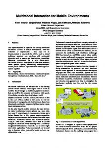
Figure 3: WiFi signal attenuation through walls/floors.
Figure 2: Optimization of system parameters using GAs.
At the initial phase, the population consists of randomly generated heterogeneous chromosomes. After that, all chromosomes go through three principal parts: evaluation, selection, and reproduction modules. The population will be improved as fitter offspring individuals to replace parents. The procedure is repeated until either a maximum number of generations are reached or an optimal solution is obtained, whichever is earlier. In this study, the searching procedure is repeated until a parameter set satisfying the optimization criteria with acceptable tolerance is found. The advantages of GAs over other searching algorithms are that they do not require any gradient information neither continuity assumption in searching for the best parameters and that they can explore many characteristics at once, which is necessary when dealing with complex problems.
3. System Implementation The number of studies to monitor location using smartphones has increased recently due to their advantages and popularity: embedded GPS radio, WiFi functioning, and pedometer using built-in accelerometer sensor [10] as well as other sensors (Bluetooth, orientation, magnetic field, etc.). RFID tags are widely deployed in many applications with the advantages of their small size and variables in contents. We decided to first implement four technologies as inputs in the system: GPS, WiFi, pedometer from Android smartphones, and RFID positioning by RFID tags.
3.1. WiFi. With conventional receivers, distance to WiFi APs can be estimated from the measured RSSI with the help of a RF propagation model which is constructed based on the fact that a radio wave that travels through a certain environment will undergo specific types of signal attenuation. To start off, the empirical model widely used in previous works [11] is considered: 𝑃 = 𝑃0 − 10𝑛 log (
𝑟 ), 𝑟0
(6)
where 𝑃0 is the known signal power at a reference distance 𝑟0 in dBm, 𝑃 is the signal power at an unknown distance 𝑟, and 𝑛 is the path-loss exponent. Equation (6) is a propagation model in an environment without obstacle between the AP and the receiver. When walls and floors are considered in calculation, attenuation due to these factors must be included, and the propagation equation becomes 𝑛
𝑤 𝑑 𝑟 𝑃 = 𝑃0 − 10𝑛 log ( ) − 𝑘𝑑 ∑ 𝑖 , 𝑟0 cos 𝛽𝑖 𝑖=1
(7)
where 𝑛𝑤 is the number of walls and floors in the middle, 𝑑𝑖 and 𝛽𝑖 are the thickness and angle of arrival to the ith wall/floor, respectively, and 𝑘𝑑 is the attenuation factor per wall/floor thickness unit, as illustrated in Figure 3. In general cases, 𝑘𝑑 can be extended to be dependent specifically on each wall/floor. Equation (7) is a deterministic model; that is, the uncertainty of RSSI at a distance is not taken into account. In reality,
4
The Scientific World Journal
PSI department
8th floor
Stair
Director office Secretary
Store
Meet- Receping tion Store Lib.
Showroom Smart room
Stair
Store
WC Classroom
Classroom
Classroom
WC
WiFi access point RFID reader
Figure 4: Testing environment.
given the RSSI 𝑃, the distance 𝑟 might not be exactly the value calculated from (6) but is within a range around this value, which is denoted by 𝑟. To be more precise, 𝑟 will be the nominate value of the distance 𝑟 with highest probability. To address this limitation, a probabilistic model is used, in which the distribution of the distance is assumed to follow the normal distribution with median 𝑟: 𝜌 (𝑟, 𝑃) = Pr (𝑟 |𝑃 ) = (
1 (𝑟 − 𝑟)2 ), ) exp (− 2𝜎2 𝜎√2𝜋
(8)
where 𝜎 = 𝑘𝜎 𝑟 is the standard deviation, with 𝑘𝜎 being a constant. From a tuple of RSSI information received from a WiFi receiving device, the system determines the location with maximal summation of probabilities corresponding to the visible APs, that is, maximizing 𝜌Σ (𝑥, 𝑦, 𝑧) = ∑𝑖=1⋅⋅⋅𝑛AP 𝜌(𝑟𝑖 (𝑥, 𝑦, 𝑧), 𝑃𝑖 ), where 𝑛AP is the number of visible Aps; 𝜌Σ (𝑥, 𝑦, 𝑧), the probability that the user is located at position (𝑥, 𝑦, 𝑧); and 𝜌(𝑟𝑖 (𝑥, 𝑦, 𝑧), 𝑃𝑖 ), the probability component based on the ith visible AP. The search process is achieved by gridifying the space surrounding the environment into a number of points and calculating 𝜌Σ for each of them to find the point that maximizes 𝜌Σ .
3.2. GPS, RFID, and Pedometer. For GPS technology, we use the built-in GPS API from Android platform with extraction information including location (latitude, longitude, and altitude) and its precision. The pedometer is implemented using built-in sensors from Android smartphones. Using derivative applied to the smoothened signal from accelerometer, when the derivative is greater than threshold value, we detect a step [12, 13]. Direction of users is determined by geometry sensor with azimuth, roll, and pitch angle information. After a high precision localization from RFID, the pedometer can make a good localization in a short time. With characteristics of RFID radio signal, it can be assured that at the moment user’s RFID tag is recognized by a reader, the user is within 2 meters around it. The RFID reader position is stored in database and every time a RFID tag is read from a reader, information including user ID and RFID reader ID will be sent to system API. Afterwards user location will be calculated on the basis of the RFID reader location.
4. Experiment Results Experimental scenario is taken in the 8th floor of an 11-floor building, as shown in Figure 4. A user holds a smartphone, walks starting from Point 1 straight to Point 2, Point 3,
The Scientific World Journal
5 0.09
−20
0.08 −30
0.07 0.06 Probability
RSSI (dBm)
−40 −50
0.05 0.04 0.03 0.02
−60
0.01 −70 −80
0
0
10
20
30
40
50
60
70
80
90
0
10
100
30
40 50 60 Distance (m)
−40 dBm −45 dBm −50 dBm −55 dBm
Distance (m) Experiment Model
70
80
90
100
−60 dBm −65 dBm −70 dBm
Figure 6: WiFi probabilistic propagation model.
Figure 5: WiFi deterministic propagation model compared to measurements.
60
50
40
Y (m)
respectively, and then returns to Point 2 and Point 1 at the same path, with the total distance of 160 m. In this experiment, 3 RFID readers, 16 WiFi access points are set up for RFID and WiFi technologies. First, data are collected to tune system parameters, as discussed in Section 2.2. A person holding the first smartphone moves slowly at a constant speed along the corridors on the three floors to measure the WiFi signal strengths. There are totally 672 measurements carried out for the training data. The training process using the GA is set up with configuration provided in Table 2. Using these data, the produced optimal parameter values are given in Table 3. With the optimized parameters, the WiFi propagation model in (6) is compared with measurements of RSSI to APs with no wall/floor in the middle of the lines of sight (LOS), as depicted in Figure 5. With a fixed AP, the smartphone is placed at distances from 5 to 100 m, with increment of 5 m. At each distance, 5 measurements are carried out, and then the average value is used and shown in this figure. It can be observed that the tuned model is closed to the experiment data, with highest error of 1.9 dBm. This comparison verifies the deterministic propagation model of WiFi signals. Figure 6 shows the WiFi probabilistic propagation model in (7) with the tuned parameters. For each RSSI value, a probability distribution function (PDF) is established following the normal distribution with median value calculated with the help of the deterministic model. Results are compared and analysed between multimodal system and WiFi alone system. Figure 7 shows user walking path and localization results in two cases using multimodal localization system, compared with the system using WiFi alone. It can be observed that multimodal-based results almost coincide with user walking path while WiFi-based results have big jumps and it is impossible to track position of user with only WiFi-based system.
20
30
20
10
0 0
10
20
30 X (m)
40
50
Real path Multimodal WiFi only
Figure 7: Localization results.
Figures 8 and 9 present the error distribution and reliability distribution. While multimodal results gather in around 5 meters of error, WiFi results error distribution exceeds 20 meters. It is shown that current implementation for multimodal would be useful for applications with required precision of 5 meters. The error results are summarized in Table 1. Average error of multimodal system is about 4.5 times better, the maximal error is 3.6 times smaller, and the error
6
The Scientific World Journal
Table 1: Multimodal and WiFi-only localization error comparison. Average error (m)
Maximal error (m)
Error at reliability of 90% (m)
10
2.18 9.99
6.62 23.84
4.07 18.44
5
0
Table 2: Genetic algorithm configuration. Parameter Population size Elite count Crossover fraction Time limit Maximal generations Tolerance Selection Crossover Mutation Creation population
Value 20 5 0.5 No No 10−6 Uniform Scattered Uniform Uniform
Y (m)
Multimodal WiFi only
15
−5 −10 −15 −20 −25
Time decay constant 𝜆 𝑖 0.86 0.81 0.52 0.62
at reliability of 90% is 4.5 times smaller compared to WiFibased system. It can be seen that the multimodal system does a much better work, and localization results are improved significantly.
−10 −5 X (m)
0
5
10
Figure 8: Localization error distribution.
100 90 Reliability distribution (%)
Reliability 𝑅𝑖 16.2 5.5 31.7 22.6
−15
Multimodal WiFi only
Table 3: Optimized system parameters. Technology WiFi GPS RFID Pedometer
−20
80 70 60 50 40 30 20 10
5. Conclusion In this paper, an approach to build an indoor/outdoor multimodal system combining multiple localization technologies has been introduced. An implementation with WiFi, GPS, RFID, and pedometer technologies has been successfully built and demonstrated. Evaluation shows promising results for the approach in this system to continue in the future. For future works, the WiFi implementation algorithm will be improved. The pedometer implementation with smartphones also needs to be improved to work in pocket situation (currently, smartphones need to be held in hand). Third, it is necessary to think of some algorithms to turn on/off smartphone sensors on the basis of activities to save battery. Environment information constraints combining user’s history records and Kalman filters could also be used to smoothen the output results. Next localization technology based on video processing will be implemented. At last, user’s location privacy information sending between server and user security should be considered [14].
0
0
5
10
15
20
25
Error (m) Multimodal WiFi only
Figure 9: Localization reliability distribution.
Conflict of Interests The authors declare that there is no conflict of interests regarding the publication of this paper.
Acknowledgment This research is funded by Vietnam National Foundation for Science and Technology Development (NAFOSTED) under Grant no. 102.04-2013.32.
The Scientific World Journal
References [1] J. C. Augusto, V. Callaghan, D. Cook, A. Kameas, and I. Satoh, “Intelligent environments: a manifesto,” Human-Centric Computing and Information Sciences, vol. 3, no. 12, 2013. [2] D. M. Konidala, D. Kim, C. Y. Yeun, and B. Lee, “Security framework for RFID-based applications in smart home environment,” Journal of Information Processing Systems, vol. 7, no. 1, pp. 111– 120, 2011. [3] Y. Luo, Y. P. Chen, and O. Hoeber, “Wi-Fi-based indoor positioning using human-centric collaborative feedback,” in Proceedings of the IEEE International Conference on Communications (ICC ’11), Kyoto, Japan, June 2011. [4] S. Ferdous, K. Vyas, and F. Makedon, “A survey on multiperson identification and localization,” in Proceedings of the 5th International Conference on Pervasive Technologies Related to Assistive Environments, vol. 36, Crete, Greece, 2012. [5] T. Pfeifer, “Redundant positioning architecture,” Computer Communications, vol. 28, no. 13, pp. 1575–1585, 2005. [6] S.-C. Yeh, W.-H. Hsu, and Y.-S. Chiou, “Adaptive-weighting schemes for location-based services over heterogeneous wireless networks,” in Proceedings of the IEEE 71st Vehicular Technology Conference (VTC ’10), Ottawa, Canada, May 2010. [7] E. Martin, O. Vinyals, G. Friedland, and R. Bajcsy, “Precise indoor localization using smart phones,” in Proceedings of the 18th ACM International Conference on Multimedia ACM Multimedia (MM ’10), pp. 787–790, Firenze, Italy, October 2010. [8] M. Anne, J. L. Crowley, V. Devin, and G. Privat, “Localisation intra-bˆatiment multi-technologies: RFID, WiFi et vision,” in Proceedings of the 2nd French-Speaking Conference on Mobility and Ubiquity Computing, pp. 29–35, 2008. [9] R. L. Haupt and S. E. Haupt, Practical Genetic Algorithm, WileyInterscience, 2nd edition, 2004. [10] T. Hoang, T. Nguyen, C. Luong, S. Do, and D. Choi, “Adaptive cross-device Gait recognition using a mobile accelerometer,” Journal of Information Processing Systems, vol. 9, no. 2, pp. 333– 348, 2013. [11] J. Figueiras and S. Frattasi, Mobile Positioning and Tracking: From Conventional to Cooperative Techniques, John Wiley & Sons, 2010. [12] S.-S. Wu and H.-Y. Wu, “The design of an intelligent pedometer using Android,” in Proceedings of the 2nd International Conference on Innovations in Bio-inspired Computing and Applications (IBICA ’11), pp. 313–315, Shenzhen, China, December 2011. [13] J. Ahn and R. Han, “An indoor augmented-reality evacuation system for the smartphone using personalized pedometry,” Human-Centric Computing and Information Sciences, vol. 2, no. 18, 2012. [14] H. I. Kim, Y. K. Kim, and J. W. Chang, “A grid-based cloaking area creation scheme for continuous LBS queries in distributed systems,” Journal of Convergence, vol. 4, no. 1, 2013.
7