USING DISTANCE LEARNING METHODS FOR INCREASING GEOGRAPHICAL INFORMATION SYSTEMS UTILIZATION CAPACITY Saye Nihan ÇABUK Earth and Space Sciences Institute Anadolu University Turkey
[email protected] Saffet ERDOĞAN Afyon Kocatepe University Turkey
[email protected] Alper ÇABUK Earth and Space Sciences Institute Anadolu University Turkey
[email protected] ABSTRACT This paper aims to give information about the distance education based project performed collaboratively by Anadolu University, Afyon Kocatepe University and Ministry of Environment and Urbanisation, in order to increase and disseminate the utilization of Geographical Information Systems (GIS) in Turkey. The first phase of the project focused on raising and training GIS personnel in the Ministry and was completed in 2015. To fulfil this aim a distance education based GIS training model was developed and used for the online training of 650 personnel. Besides, an open courseware portal and course management system, as well as open courseware, training data and application courses were developed. The second phase comprises the organisation of further and more comprehensive online trainings for the managers and technical personnel within the Ministry and is supposed to be conducted in 2016. The experiences presented in this paper is also considered as a significant massive online open course (MOOC) example, which is utilized by a governmental organization for the dissemination of vocational trainings. Key words: MOOC, Distance Education, Geographical Information Systems, Vocational Training INTRODUCTION Distance education first emerged to provide learning opportunities for the people unable to attend face-to-face learning environments (Beldarrain, 2006, p. 139). It started with the correspondence courses for vocational training in 1852 in the USA and gained academic recognition in 1892 when the University of Chicago launched its college-level distance learning program (Casey, 2008, p.45-46). The advancements in information technologies, easy access and communication opportunities have expanded distance education in a wide range of fields as a preferred type of training (Çabuk et. all, 2013, p.231; Saba, 2005, p.257). Major concerns such as access and quality control have also been overcome with the development of theoretical foundation and practical understanding of distance education (Garrison, 1993, p. 9). Thus, distance education today has globally become the most essential media education and training. Deperlioğlu and Yıldırım (2009), specify that electronic learning (e-learning) is of great significance for not only academic institutions, but also small and medium sized enterprises which aim to continuously improve the information and experience levels of their personnel (p. 62). Within this context, distance education methods promise effective solutions and enormous opportunities to create training environments for the employed personnel, who are in need of developing their vocational skills and competencies. GIS related vocations are amongst these worldwide. Having been initially developed as a tool for the storage, retrieval and display of geographic information (Rogerson and Fotheringham, 1994, p.3), GIS have rapidly evolved and become an inevitable asset in a wide range of applications and processes, from comprehensive scientific projects to routine and simple operations. This fact, eventually revealed the need for both academic and vocational GIS education/training programs to raise qualified professionals and staff. Çabuk et. all (2004) underline that the spread of GIS courses at different levels in Turkey, especially among the universities is not enough to meet the qualified GIS personnel need in the sector. Moreover, most of the personnel already working in the governmental organizations, who are charged with the responsibilities to perform various GIS related works, lack sufficient knowledge and competency. Therefore a comprehensive education/training program that is compatible with national vocational standards and qualifications, especially
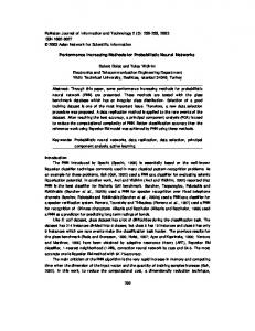
for the mentioned personnel is of great importance to increase the GIS utilization capacity. Regarding the current advancements in technology and the access opportunities, distance learning methods are considered the most suitable solution for the vocational training of the employed GIS personnel. In this respect, the distance education based project focused on the dissemination of GIS use and training of qualified personnel in the public institutions will be presented in this paper. THE PROJECT SCOPE AND OBJECTIVE Urban spaces are the locations where the interaction between geography and people are most intense. The most complicated relations are seen in the urban spaces with the most intense data flow and assessments. Urban population density; distribution and quality of health, education, transportation and cultural services and access to these opportunities determine how liveable the cities are. All branches of science aim to make lives of human beings more relaxed, comfortable, and safe. In that sense, the positive contributions of GIS technologies are abundant in increasing the urban life quality. Consequently, GIS technologies are of great importance in understanding the environment and environmental characteristics for healthy realization of physical designing and planning processes, especially in countries like Turkey, which develops very rapidly and where there are high levels of urban investment and spatial changes. However, the establishment, execution and updating of these systems are only possible with the personnel qualified in this field. Unfortunately, the number of qualified technical personnel with GIS knowledge and skills is inadequate both in public and private sector in the country. Besides, there is a need to employ 15.000 personnel in the Turkish GIS sector in the short term (Çabuk and Çabuk, 2015, p.3; Oflaz et. all, 2013, p.1). This reveals the necessity of the development of vocational standards and qualifications related to GIS jobs, as well as providing education and training activities in the field. The rapid developments in GIS technologies also necessitate the use of efficient and continuous training opportunities so that the GIS personnel are periodically trained on the advancements and innovations in the sector. In that sense, all sorts of trainings delivered on GIS will undoubtlfully contribute greatly to the development of human resources qualified in GIS; thus it will be possible to improve the municipality services in the country. At that point, development of distance training programs on GIS to improve the level of information and skills of the personnel working in the institutions is a requisiteness, as the face-to-face type training is not possible for most of the personnel by means of access and duration. From this point, the Ministry of Environment and Urbanization started an extensive project with the cooperation of Anadolu University and Afyon Kocatepe University in 2014. The main project comprised two essential scopes, respectively legislation and certification activities (development of national vocational standards and qualifications for GIS jobs, development of vocational certification system etc.), and training activities (Figure 1).
Figure 1: The Project Components of Dissemination of GIS Utilization and Capacity Project
Being the theme of this paper, the training activities of the project include the following stages: Development of a distance learning supported model to disseminate the use of GIS o Development of open training courseware course o Development of open courseware portal o Development of course management system o Delivery of an online training to 650 personnel in the central and rural organization of Ministry of Environment and Urbanization Online trainings for the managers and the technical personnel of the Ministry o GIS Awareness raising trainings for the managers o Utilization of self-learning techniques via open training courseware on the portal o Providing academic consultancy to the technical personnel working in physical planning and designing departments via virtual tools supported by online academic consultancy. To sum up, main aims of the project were to generalize the use of GIS for improving the planning, design and engineering activities that shape the physical environment of our country via distance learning based training environment; besides performing research and development for the learning media and material, delivery of necessary trainings, preparation of standards, qualifications and legislation for personnel certification, and working on the certification audit and the online examination systems. Within the project, a virtual learning supported GIS training model based on individual learning media and necessary learning tools have been developed. DISTANCE LEARNING BASED TRAINING ACTIVITIES FOR GIS Development of Distance Learning Model and Pilot Online Training Activities This stage of the project were completed in 2015. In line with the aim of the dissemination of GIS use, this project presents a methodology which ensures the training of technical staff, who take an effective part in decision-making and design processes, on GIS. With this virtual training based methodology, it was aimed to set the basic framework and standards for the preparation of open courseware as well as to provide an inclusive basis for processes such as distance learning portal and simultaneous academic consultancy. It is clear that it is nearly impossible to convey such educational attainments face to face, considering the fact that there are tens of thousands personnel working on this field in various public institutions such as municipalities, local governments, central and provincial bodies of the ministries in Turkey. In this regard, in cooperation with Anadolu University, which is one of the largest universities in the world with the experience of distance learning and training technologies with over two million students, a model was developed in an effort to disseminate GIS training with distance learning technologies. Within the scope of this stage, a web-based training portal and a training management system were developed as a distance learning model (portal). The system includes both virtual classes for academic consultancy (accessible with a user code and a password by the trainees), and self-learning capabilities for the trainees (Figure 2 & Figure 3). The model comprised; design of the process, model structure and the content, determination of the courses (modules) and their context in accordance with the basic knowledge and skills presented in the GIS Experts and GIS Operator vocational standards and qualifications, preparation and development of open courseware such as videos, vocalized powerpoint files, pdf and word documents, sample test questions, designed applied trainings and relevant application data and homework, development of an open courseware portal and development of a training/course management system.
Figure 2: Self-learning applications
Figure 3: Academic consultancy applications
After the completion of the system, online trainings for 650 designated trainees from 81 provinces in the country were conducted during the four-month time period. Training was composed of six basic modules (courses) as follows: Introduction to Surveying and Computer Aided Mapping Computer Aided Mapping GIS Database Applications Remote Sensing Analyses and Interpretation Techniques in GIS The trainees were supplied with the necessary application software during the training. The training and the communication among trainees were ensured by a training/course management system designed exclusively for this purpose. On the management system, trainees were able to view their module performances, participation to academic consultancy, open courseware, homework/coursework data, academic consultancy entries, frequently asked questions and answers regarding modules. At the end of each module, trainees took an exam for assessment and evaluation purposes. Those who successfully passed all modules, were awarded a certificate. Online GIS training for Managers and Technical Staff Focusing primarily on the dissemination of GIS utilization within the Ministry of Environment and Urbanization, this stage of the project is planned to be conducted throughout 2016. The target groups of the project were initially determined as the managers and the technical staff working at the Ministry. However, afterwards, the distance learning model (portal) and its components have been inclusively revised and improved to enable further trainings for the civil servants and the public countrywide, and launch e-certificate programs on GIS. The improved portal also has advanced capabilities to conduct efficient academic consultancy services, and components such as self-learning applications, open courseware portal, and training/course management system. In accordance with the characteristics and expectations of the target groups, open courseware has been updated, diversified, enriched and improved. Figure 4 and 5 illustrate sample windows from the software, respectively online examination application and test question writing modules.
Figure : Online examination module
Figure 5: Test question writing module Regarding the online GIS training for the managers, which is aimed at the awareness raising on GIS and its capabilities, the pilot application will include the below listed courses. The awareness raising trainings is supposed to be performed with the participation of 400 administrators designated by Ministry of Environment and Urbanization, simultaneously in all 81 provinces via training/course management system on the open education materials portal. Training is planned to last for 2 (weeks) and will be conducted by online academic consultancy at least an hour a day. Enrolled personnel will register online. The courses for the managers are as follows: 1. Introduction to GIS 2. GIS Applications in Geology a. Geophysical Applications b. Geological Applications c. Hydrogeological Applications d. Geotechnical Applications e. Geodesic Applications 3. GIS Applications in Agriculture and Forestry a. Agricultural Applications b. Forestry Applications 4. Urban Information Systems 5. GIS Applications in Disaster Management 6. GIS Applications in Environmental Management 7. GIS Applications in Planning a. Urban and Regional Planning Applications b. Landscape Planning Applications 8. GIS Applications in Civil Engineering a. Construction Management Applications b. Building Inventory Applications As previously mentioned, the next target group, was determined as the technical personnel in the Ministry. Nonetheless, the online training context, the course content, open courseware and the system infrastructure were exclusively redesigned and developed in a manner to improve the system capacity and efficiency well enough to launch national online GIS trainings and even e-certificate programs. In this respect, e-certificate programs are planned to be provided on the open courseware portal, supported with the help of self-guided learning open courseware (videos, vocalized files, documents, sample tests, application and coursework/homework data etc.) prepared for disseminating the usage of GIS. Similar to the first phase of the project completed in 2015, the courses and the courseware has been developed in accordance with the basic knowledge and skills presented in the GIS Experts and GIS Operator vocational standards and qualifications, so that the objectives and the learning outcomes of the courses/programs are compatible with the national qualifications.
The main courses planned for these trainings/programs are as follows: Introduction to Mapping and GIS GIS Applications Computer Aided Mapping Remote Sensing Spatial Analyses and Computer Aided Planning Databases and Spatial Database Management The dynamic structure of the system (portal) enables to create new online programs or trainings with differing content and courses, so that the changing requirements are met suitably and the qualified GIS personnel are raised. CONCLUSIONS GIS is the most significant technology today, which facilitates to understand, analyze and model the Earth and its systems to create a sustainable future for both the mankind and the nature. GIS is an important decision-making tool. GIS is not only utilized for planning, engineering and design process, but also for security, logistics, and financial management, education and health applications. We use GIS to conduct global research and scientific projects. We also use GIS to determine the shortest routes between two locations on the internet or mobile applications. Considering this enormous capacity of this technology, it is today inevitable to adopt GIS to perform public services. It is not surprising to witness that the private enterprises using GIS technologies are ahead their competitors. However, the most important factor preventing the widespread use of GIS is the fact that there is a lack of qualified GIS personnel especially in the developing countries, including Turkey. Meeting this need requires the development and application of GIS education/training programs at different levels of information and competencies in accordance with the designated GIS jobs/duties. Considering the advancements in the technology, changing expectations and trends, as well as the characteristics of the target groups, efficient education/training systems are of great importance. Within this context, İşman (2011) specifies the significance of distance education and underlines that the distance education model has to be adopted by relevant organizations and institutions such as universities and ministries. Education and training programs must be provided for the public as well as for the employed personnel in such institutions. In this regard, it is required and significant to develop a distance learning model to train the personnel that are charged with GIS related duties and operations in the first place to ensure that the physical planning and design processes as well as other related responsibilities are conducted properly. Thus more livable, sustainable and disaster safe physical environments are created in the country. To fulfill this aim the Ministry of Environment and Urbanization started a comprehensive project to disseminate the GIS utilization within the ministry and its subunits. One of the phases of this project includes online GIS training activities in which a distance learning model and its components have been developed with the collaboration of Anadolu University and Afyon Kocatepe University. Within the scope of the project the pilot training program was completed in 2015, and the system and the open courseware has been improved for further and more comprehensive online trainings to be conducted by the Ministry. ACKNOWLEDGEMENTS The project was conducted as two separate research and development projects, respectively the development of distance learning portal by ANATEK Teknoloji Transfer San. ve Tic. A.Ş. (Project No: AR-GE/YUB/2015/007), and development of open courseware by Bilkent Cyberpark and NetCAD A.Ş. collaboration (Project No: 00427_035).
REFERENCES Beldarrain, Y. (2006). Distance education trends: integrating new technologies to foster student interaction and collaboration. Distance Education, 27(2), 139-153. Casey, D.M. (2008). A journey to legitimacy: The historical development of distance education through technology. TechTrends, 52 (2), 45-51. Çabuk, A., Ayday, C. & Çabuk, S.N. (2004). GIS education in Turkey: GIS education under the institute of natural and applied sciences of Anadolu University and online education proposal for international world campus. Turkish Online Journal of Distance Education – TOJDE 5 (4), 13-21. Çabuk, A. & Çabuk, S.N. (2015). Yükseköğrenim ve Mesleki Yeterlilik Çerçevesi Kapsamında Coğrafi Bilgi Sistemlerine İlişkin Ulusal Meslek Hiyerarşisinin Tanımlanması Üzerine Bir Öneri. Akademik Bilişim Konferansları 2015, Eskişehir. Çabuk, S.N., Uluçay, D.M & Çabuk, A. (2013). Accreditation of online and distance learning programs: Online GIS education program experience. Turkish Online Journal of Distance Education – TOJDE, 14 (1), 231244. Deperlioğlu, Ö. & Yıldırım, R. (2009). Mesleki Eğitimin Uzaktan Eğitim ile Desteklenmesi ve Örnek Uygulama. AKÜ Fen Bilimleri Dergisi, 2009-01, 61-70. Garrison, D.R. (1993). Quality and access in distance education: theoretical considerations. In D. Keegan (Ed.), Theoretical principles of distance education (pp. 9-21). Routledge. İşman, A. (2011). Uzaktan Eğitim. 4. Baskı, Pegem Akademi. Oflaz, O.E., Bayraktar, H., Köksoy, E., Iravul, Y., Ölmez, A., Çabuk, A., Avdan, U., Çabuk, S.N., Bektöre, E., Orakoğlu, Ö., Çömert, R., Erdogan, S., Tiryakioğlu, İ. (2013). Coğrafi Bilgi Sistemleri Meslek Standartları ve CBS Kullanımının Yaygınlaştırılması. TMMOB Coğrafi Bilgi Sistemleri Kongresi, Ankara. Rogerson, P.A. & Fotheringham, A.S. (1994). Spatial analysis and GIS. In A.S. Fotheringham and P.A. Rogerson (Eds.), GIS and spatial analysis: introduction and overview (pp.1-10). Taylor & Francis. Saba, F. (2005). Critical issues in distance education: A report from the United States. Distance Education, 26 (2), 255-272.