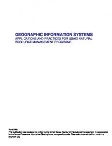
[Proceeding] Using Geographic Information Systems to Increment the Knowledge of Cultural Landscapes Original Citation: A.C. Sparavigna, R. Marazzato (2011). Using Geographic Information Systems to Increment the Knowledge of Cultural Landscapes. In: Smart Tech & Smart Innovation, La strada per costruire il futuro, Torino, 15-17 Novembre 2011. Availability: http://porto.polito.it/2460625/ since: November 2011 Publisher: AICA
(Article begins on next page)
Using Geographic Information Systems to Increment the Knowledge of Cultural Landscapes Amelia Carolina Sparavigna, Roberto Marazzato
1
Dipartimento di Fisica, Politecnico di Torino Corso Duca degli Abruzzi 24, 10129, Torino, Italy
[email protected] 1 Dipartimento di Automatica e Informatica, Politecnico di Torino Corso Duca degli Abruzzi 24, 10129, Torino, Italy
[email protected]
To increment the knowledge of a cultural landscape, the use of Information and Communication Technologies is becoming fundamental. By means of these technologies we can improve the study of areas having ancient or modern cultural evidences, by superimposing data from some territorial information systems on satellite surveys. In particular, we will analyse Geographic Information Systems (GIS), freely available on the World Wide Web. A well-known example is Google Earth, which is offering the possibility of virtual tours to the users of the Web. Moreover, besides being of support for archaeological and other research studies, GIS can be helpful in creating some systems for the management of archaeological and cultural patrimony and for incrementing the revenues from tourism.
1. Introduction The use of the Information and Communication Technologies is crucial in incrementing our knowledge of cultural landscapes. According to the World Heritage Committee, UNESCO, a cultural landscape is a geographical area that is uniquely representing the combined work of nature and of man [UNESCO, 2005]. In fact, the World Heritage Committee is using specific categories to design and describe how a landscape can be modified or intentionally created by man. Let us consider in this paper only the general point of view, where the cultural landscape is a geographical area combined with archaeological, historical or other social evidences. The use of new technologies allows capillary recognitions of all the features of a certain territory. For instance, satellite maps provide high-resolution multispectral images, often associated with the land surveys of topographic maps. Superimposed to these images, we can have road maps and the corresponding labels, such as in the Google Maps. Mainly based on user contribution, pictures and other information can be added. Congresso Nazionale AICA 2011
Congresso Nazionale AICA 2011
Territorial informative systems, which have a registering system of all local evidences based on the geographical coordinates, can become a good opportunity: it can be oriented to the increase of knowledge, management survey and potential development of our patrimony. In this paper, we will propose in particular the use of Geographic Information Systems (GIS), which are freely available to the users of the World Wide Web. Our discussion on GIS will be oriented to the knowledge of archaeological sites and landscapes. It is commonly assumed that the study of sites of our past is the task of archaeology. This is partially true, because this study requires an increasingly multidisciplinary approach. For instance, physics and chemistry are necessary for dating, analysis and for the development of restoration techniques. Moreover, geology, photogrammetry, remote sensing and information technology are necessary for the correct identification and for the subsequent management of sites. All of them help in creating the knowledge of cultural landscapes. In fact, logistics can be considered as a good partner too, in the case that we want the optimization of sites preservation and some profits from tourism. Preservation of ancient remains is an important and challenging issue for our society, because several archaeological sites need protection from urbanization or agricultural and mining exploitations. A certain profit for local population could be helpful in the management - often the rescue - of archaeological remains.
2. Remote sensing augmented by GIS The use of remote sensing in archaeology is based on images obtained by means of aerial or satellite surveys. Depending on the sensors which constitute the survey equipment, we can obtain different information on the surface and on the uppermost layers of the ground. A new opportunity is given by the freely available satellite maps imageries that we find on the World Wide Web. For several areas, we have a high enough resolution: this fact makes the maps suitable for archaeological investigation. Of course, satellite images can be further enhanced and analysed by means of image processing methods. As discussed in [Lasaponara e Masini, 2008], it is the new developments of remote sensing techniques and facilities of the Information and Communication Technologies (ICTs) that produced their strong application in cultural studies. The reference lists the possible remote sensing techniques as: aerial multispectral and hyper-spectral imagery, active airborne data of the Light Detection and Ranging (LIDAR) and Synthetic Aperture Radar (SAR), the detection and spatial reconstruction of sub-surface remains by using GroundPenetrating Radar (GPR), and magnetic and electrical tomography. Nowadays, the remote sensing is often integrated by means of ICTs with image processing, 3D visualization and virtual reconstruction of landscape and sites in the Geographic Information Systems (GIS). GIS is a system developed to collect and manipulate all types of geographically referenced data [Bolstad, 2005, Chang, 2006]. Besides being a system that stores and displays geographic information, a GIS application allows users to create interactive queries and edit data [Chang, 2006].
Using GIS to increment the knowledge of cultural landscapes
For what concerns the aerial photos, their use for archaeological survey is well known [Georgoula et al., 2004]. A large quantity of photos is generally merged to obtain, after being processed with photogrammetric methods, the desired outputs in 2D or 3D models. Let us note that one of the most important applications of the aerial survey is the detection of buried archaeological remains. Under proper conditions, these remains are best identified when viewed from above. In Ref.4 for instance, the researchers evaluated the possibilities that the high resolution satellite imagery offers in the identification of buried remains. The researchers used the satellite images of Quickbird 2, with a spatial resolution of 0.70 m, covering an extended area of the site of Philippoi in Greece. Applying a statistical evaluation on the fusion of panchromatic and multispectral images, the authors found that the spatial ground resolution of satellite images allows the identification of a large range of archaeological features. Quickbird 2 is the USAF designation of QuickBird, a high-resolution commercial constellation of satellites, owned by DigitalGlobe. The satellites collect panchromatic imagery at a resolution of 0.7 m and multispectral imagery at a lower resolution, approximately 2.5 m [WWW1]. The imagery can be used in GIS packages for analysis or for mapping applications, such as Google Earth. Another commercial satellite imagery company is GeoEye, based in Virginia [WWW2]. It was the company which launched the first sub-meter commercial IKONOS satellite. It is an Earth observation satellite, offering multispectral and panchromatic imagery. As soon as the IKONOS imagery became available, it was integrated in GIS applications, such as in an archaeological survey of Tuscany [Campana, 2002]. Garrison et al., 2008, performed a detailed evaluation of the use of IKONOS imagery. In their paper, the authors presented an extensive study on the use of IKONOS in detecting some sub-canopy Maya settlements. Images from DigitalGlobe, GeoEye and others constitute the imagery of Google Earth. This Web service is an example of a popular GIS. Before a detailed discussion on GIS and Google Earth applications, let us consider an example, taken from the site of Google Maps, on how information based on geographic coordinates can appear. Choosing with the Google search engine the archaeological site of Stonehenge for instance, the service provides the satellite image labels and icons of Wikipedia (Fig.1, upper part). To the geographical coordinates we have then associated information. Moreover, dragging the icon of Street View on the image, several dots and lines appear in blue on it (Fig.1, lower part); each dot corresponds to a picture uploaded by the users and the line to a panoramic view. We can check by means of pictures and movies how the landscape is seen from the ground and compare it with the aerial view. It is then quite clear that a GIS service is fundamental to have a precise location of the features of a cultural landscape.
3. Google Earth features Google Earth [WWW3] implements a 3D graphical browser interface to a huge database of images of the earth’s surface, obtained from different imagery
Congresso Nazionale AICA 2011
sources, such as DigitalGlobe, EarthSat, GeoEye, IKONOS, and aerial surveys. The spatial resolution of most images is 15m/px, with better defined (2.5m) spots, mostly from CNES and SPOT Image sources. CNES is the Centre National d'Études Spatiales, which is the French government space agency.
Fig.1 - Google Earth is an example of a popular GIS. For instance, let us choose with the Google search engine the archaeological site of Stonehenge. The service provides the satellite image labels and icons of Wikipedia. Moreover, dragging the icon of Street View on the image, several dots and lines appear in blue on it, each dot corresponds to a picture uploaded by the users and the line to a panoramic view.
Using GIS to increment the knowledge of cultural landscapes
Spot Image is a public limited company created in 1982 by CNES and other societies. The company is the commercial operator for the SPOT Earth observation satellites, providing images with different resolutions. Spot Image also distributes from other optical satellites, in particular from Formosat-2 (Taiwan) and Kompsat-2 (South Korea) and from radar satellites (TerraSar-X, ERS, Envisat, Radarsat). The browser interface of Google Earth allows users to navigate the whole Earth's surface through a 3D pointing system, involving the rendering of the viewer's height (see for instance Fig.2). All visited places can be recorded and then shared by saving them to "placemarks" files. A wide range of superimposed layers can be switched on and off, and a photogrammetry tool is also provided.
Fig.2 – Stonehenge in 3D as seen by Google Earth.
In the case that the user has GIS data, it is possible to import it into Google Earth Pro, the paid version of Google Earth, to be used as part of the corresponding Google Earth visualizations. In the case that the user has only the free version of Google Earth, there are some tools for converting GIS data to KML. We have for instance, a GIS software, like ESRI ArcGIS and MapInfo, possessing tools to export GIS data into KML format for use in Google Earth. Keyhole Markup Language (KML) is the notation of a mark-up language (XML) for expressing geographic annotation and visualization within Internet-based, two-dimensional maps and three-dimensional Earth browsers. KML was developed for use with Google Earth, which was originally named Keyhole Earth Viewer. It was created by Keyhole, Inc, acquired by Google in 2004. In fact, KML is an international standard of the Open Geospatial Consortium, an international voluntary consensus standards organization, originated in 1994. In it, more than 400 commercial, governmental, non-profit and research organizations worldwide collaborate to encourage the development and implementation of open standards for geospatial content and data sharing.
Congresso Nazionale AICA 2011
The fact that a GIS format can be easily converted to KML, through a variety of applications and plugins, widely spread the use of Google Earth among researchers in order to describe and place different sites of archaeological interest [Bousman, 2006, Ur, 2006, WWW4, Conroy et al., 2008, Thomas et al. 2008, WWW5, WWW6, WWW7]. Kris Hirst provides a good guide on Google Earth. As reported in the paper [Kris Hirst, 2011], Google Earth and Google Maps are used in the “searching for crop marks on aerial photos”, which is “a time-tested way to identify possible archaeological sites”. Crop marks are areas where sub-surface archaeological, natural and recent features may be visible from the air. Crop marks arise because vegetation has a different growth. A buried stonewall for instance is negativity affecting the growth above it, whereas, a buried ditch, usually containing more organic matter, provides more nourishment to the plants. Along with soil marks, they can reveal buried archaeological sites not visible from the ground. Soil marks are differences in soil colour that can be the result of archaeological remains. They can be easily seen when fields are ploughed (see Fig.3).
Fig.3 – An example of soil marks near Stonehenge.
Using GIS to increment the knowledge of cultural landscapes
Higher resolution satellite imagery is then fruitful for identification of archaeological remains. There are several users posting on the Web their results. Let us just remember two of them, directly observed by one of the authors: the geoglyphs of Titicaca [Sparavigna, 2010], which are earthworks near the Titicaca Lake, Peru, and some stone structures, desert kites and stone circles, in the Syrian Desert [Sparavigna, 2011]. Examples of the archaeological structures in Peru and in the Syrian Desert are provided by Fig.4 and Fig.5, respectively.
Fig.4 – A geoglyphs near the Titicaca Lake, created by the earthworks of an ancient agricultural system, that of the “raised fields” [Sparavigna, 2010].
Congresso Nazionale AICA 2011
Fig.5 – Desert “kites” and stone circles in the Syrian Desert [Sparavigna, 2011].
4. Conclusions The high accuracy in placement of the marks and the worldwide dissemination of such data can lead to a possible threat for archaeological heritage. Some concerns had been aroused that pothunters, tomb raiders and looters can use such data to spoil unprotected or unexcavated sites [Conroy et al., 2008]. A good practice in this case is to freely and accurately describe and reference the well known sites with educational and security facilities, leaving new and unexcavated sites with more unspecific geographic data, or provide data with a larger uncertainty. But, let us note that satellites and knowledge are not the principal source for threatening the relicts of our past. Tombaroli know very well the ancient burial sites, sometimes better than archaeologists do, as shown by the case of the Caligula statue [Telegraph, 2011]. On the other side, Google Earth has been shown [Contreras and Brodie, 2010] to be a source for highlighting cases of looting and to document them. Therefore, we can conclude that the benefits to the knowledge of sites, to their studies and preservations are more than the concerns. Further applications of GIS are under developments for geophysics researches.
Using GIS to increment the knowledge of cultural landscapes
References [Bolstad, 2005] Bolstad P., GIS fundamentals: a first text on Geographic Information Systems, White Bear Lake, Eider Press, 2005. [Bousman, 2006] Bousman B.C., Satellite archaeology for everyone. The SAA Archaeological Record, 6, May 2006, 32-34. [Campana, 2002] Campana S., Ikonos-2 multispectral satellite imagery to the study of archaeological landscapes: an integrated multi-sensor approach in combination with “traditional” methods, in The Digital Heritage of Archaeology, CAA 2002, Computer Applications and Quantitative Methods in Archaeology, Proceedings of the XXXth Conference, Heraklion, Crete, 2002, 219-225. [Chang, 2006] Chang K.-T., Introduction to Geographic Information Systems, Boston, McGraw Hill, 2006. [Conroy et al., 2008] Conroy G.C., Anemone R.L., Van Regenmorter J., Addison A., Google Earth, GIS, and the Great Divide: A new and simple method for sharing paleontological data, Journal of Human Evolution, 55, October 2008, 751-755. [Contreras and Brodie, 2010] Contreras D.A., Brodie N., Shining light on looting: using Google Earth to quantify damage and raise public awareness, The SAA Archaeological Record, 10, 2010, 30-33. [Garrison et al., 2008] Garrison T.G., Houston S.D., Golden C., Inomata T., Nelson Z., Munson J., Evaluating the use of IKONOS satellite imagery in lowland Maya settlement archaeology, Journal of Archaeological Science, 35, 2008, 2770–2777. [Georgoula et al., 2004] Georgoula O., Kaimaris D., Tsakiri M., Patias P., From the aerial photo to high-resolution satellite image: tools for the archaeological research, Proceedings of the XXth ISPRS Congress, Istanbul, Turkey, 2004. [Kris Hirst, 2011] Kris Hirst K., Google Earth and Archaeology, Serious Science and Serious Fun with GIS, K. Kris Hirst, About.com Guide, http://archaeology.about.com/ [Lasaponara and Masini, 2008] Lasaponara R., Masini N., Advances on remote sensing for archaeology and cultural heritage management, in Lasaponara R. and Masini N. (eds) Proceedings of the 1st International EARSeL Workshop CNR, Rome. 2008. [Sparavigna, 2010] Sparavigna A.C., The geoglyphs of Titicaca, Archaeogate, October 13, 2010, http://www.archaeogate.org/classica/article/1305/1/, [Sparavigna, 2011] Sparavigna A.C., Stone structures in the Syrian Desert, Archaeogate, July 14, 2011, http://www.archaeogate.org/vicino_oriente/article/1445/1/ [Telegraph, 2011] Caligula statue discovered by 'tomb raiders' unveiled in Rome, The Telegraph, July 12, 2011 [Thomas et al. 2008] Thomas D.C., Kidd F.J., Nikolovski S., Zipfel C., The Archaeological Sites of Afghanistan in Google Earth, AARGnews, 37, 2008, 22-30. [UNESCO, 2005] UNESCO, Operational guidelines for the implementation of the World Heritage Convention, UNESCO World Heritage Centre, Paris. 2005, p.83. [Ur, 2006] Ur J., Google Earth and archaeology. The SAA Archaeological Record, 6, May 2006, 35-38. [WWW1] http://www.digitalglobe.com/index.php/85/QuickBird
Congresso Nazionale AICA 2011
[WWW2] http://www.geoeye.com/CorpSite/ [WWW3] http://earth.google.com [WWW4] Ancient Monuments Placemarks, http://www.jqjacobs.net/archaeo/sites [WWW5] http://www.digitaldigging.co.uk [WWW6] http://www.online-archaeology.co.uk/archaeology-maps-and-gis.aspx [WWW7] http://www.megalithic.co.uk/article.php?sid=2146412594