Available online at www.sciencedirect.com
Procedia Computer Science 19 (2013) 794 – 801
The 3rd International Conference on Sustainable Energy Information Technology (SEIT 2013)
Using Wireless Sensor Networks for Reliable Forest Fires Detection Kechar Bouabdellaha, Houache Noureddine, Sekhri Larbi Laboratory of Industrial Computing and Networking, Faculty of Sciences, Oran University, PO Box 1524 El M'naouar, Algeria
Abstract
The improvement of the level of modernization of forest fires monitoring using information and communication technologies has strategic significance for many countries where forest fires occur frequently. Compared with the traditional techniques of forest fires detection, wireless sensor networks (WSNs) technology is a very promising green technology for the future in detecting efficiently the forest fires. In this paper we propose a comparative study between two forest fires detection methods (Canadian and Korean) using a real experimental approach. The methodology adopted for this study is provided. The related hardware schemes and implemented algorithms are given in detail for both methods. Through the preliminaries results, we conclude the effectiveness of the Canadian approach in terms of energy consumption and execution speed, and its suitability to the context of our country. © 2013 The Authors. Published by Elsevier B.V. Open access under CC BY-NC-ND license. © 2013 Published by Elsevier Ltd. Selection and/or peer-review under responsibility of [name organizer] Selection and peer-review under responsibility of Elhadi M. Shakshuki
Keywords: WSN; Forest fires detection; canadian Approach; Korean approch; experimental study;
1. Introduction Forest fires are among the disasters that have multidimensional negative effects in social, economic and ecological matters. The probability of ignition of forests is in solid increase due to climate changes and human activities. Forest fires reduce the cover of tree and lead to an increase in the gas emissions of our planet, and approximately 20% of CO2 emissions in the atmosphere are due to forest fires. Unfortunately, Algeria is one of the countries subjected to forest fires every year. Approximately 13
a Corresponding author. Tel.: +213 (0) 5 52 95 91 45; Fax.:+ 213 (0) 41 42 96 52 E-mail address:
[email protected]
1877-0509 © 2013 The Authors. Published by Elsevier B.V. Open access under CC BY-NC-ND license. Selection and peer-review under responsibility of Elhadi M. Shakshuki doi:10.1016/j.procs.2013.06.104
Kechar Bouabdellah et al. / Procedia Computer Science 19 (2013) 794 – 801
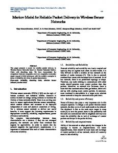
million hectares of forest are destroyed each year in the world [1], in Algeria, more than 78 hectares ravaged by fire only in 2011 [02]. Faced with these horrific numbers, it becomes very urgent to review the classical forest fires detection methods for which a key problem is that when the fire becomes large it becomes very difficult to put out. In this case, a wireless sensor network (WSN) technology could be deployed to detect a forest fire in its early stages. A number of sensor nodes need to be pre-deployed in a forest. Each sensor node can gather different types of row data from sensors, such as temperature, humidity, pressure and position. All sensing data are sent wirelessly in ad-hoc fashion to a sink station, which in turn transmits data to the control center via a transport network such as GSM, UMTS, Satellite, TCP/IP networks. The networked system must be real time; otherwise it will be of no use. Our aim in this paper is to propose a solution based on WSN to detect reliably forest fires by using two concurrent detection systems: Canadian system and South Korean (Korean for short) system. We will conduct a comparative study based on real experiments using a sensor Test-bed based on MICA-Z plateform from CrossbowTM Company. Then we will adopt the suitable system of detection of forest fires among the above systems, which is well suited to the western region of our country in general and in particular on the forest of Oran city, especially during summer seasons (see Fig 1 and Fig 2). The reminder of this paper is organized as follows. Section 2 presents related studies on forest fires detection with WSN. Section 3 presents detection methods commonly used in practice. Section 4 describes the adopted design methodology. Section 5 gives more details on the implemented detection algorithms. Section 6 presents our experimental results. Finally, Section 7 concludes the paper and provides a discussion on future work.
Fig 1. Area of Interest (forest m'sila ORAN - Algeria)
Fig 2. An image of the forest m'sila Oran- Algeria
2. Related Work Traditionally, forest fires were detected using conventional techniques such as guard towers located to fire high points [5] and Osborne fire Finder [03] that is a tool consisting of a card topographic printed on a disc with edge graduated. Unfortunately these primary techniques are inefficient due to the unreliability of human observation towers and difficult life condition [21]. This has allowed some countries to use forest-fire detection systems based on the satellite imagery. MODIS (Moderate Resolution Imaging Spectroradiometer) used in CANADA [13] and AVHRR (Advanced Very High Resolution Radiometer) used in CHINA [22] are satellite-based monitoring systems. These approaches have proven to be limited by terrain, time of day, and weather conditions such as clouds, light reflections and smoke from legitimate industrial or social activities [5, 21]. Recently, the technology of wireless sensor networks (WSN) has emerged and has been adopted by several countries. This technology must consider important design goals and features such as: energy efficiency, early detection and accurate localization, forecast capability and adaptive to harsh environment [21]. Many research works from literature related to forest fires by using WSN have been conducted around the world [6, 9, 12, 15, 17, 18, 21]. Other interesting investigations have also been done
795
796
Kechar Bouabdellah et al. / Procedia Computer Science 19 (2013) 794 – 801
in this area. Authors in [3] surveyed fire detection studies from three perspectives: residual areas, forest fires and contributions of WSN to early fire detection. South Korean project (FFSS) presented in [9] uses an experimental approach based on a networked motes but no evaluation has been made by authors on the proposed detection approach. In [19] authors have conducted simulation study under Castalia and Farsite fire simulators to detect and localize forest fires using WSN. A theoretical architecture of WSN based on Zigbee Technology has been proposed in [14] but neither simulations nor real experiments have been conducted. Research works presented in [5, 16] tried to early detect forest fires by means of cluster tree WSN using simulation and test-bed based approaches respectively. To enhance the conventional WSN detection approaches by reducing the number of false alarms, authors in [20] propose an image-based real time fire detection technique. Unfortunately, most of these studies choose simulating their proposed solutions instead of doing experiments in real test-bed environments, since that kind of setup exposes additional difficulties. Even those using test-bed to carry out real experiments; they have not made a serious study on which detection methods could be very suitable to their context. In the context of the above studies, we propose a comparative study between two forest fires detection methods (Canadian and Korean) using a real testbed based approach to choose the one that fits the context of our country. 3. Forest fires detection Methods In this section we present the best-known detection systems of forest fires used in practice. We focus mainly on those chosen for the comparative study presented in this paper. 3.1 Canadian approach The Canadian study [7, 8] proposed the calculation of the index fire according to FWI (Fire Weather Index). This eliminates the need to communicate all the sensor data to Sink, and only a few aggregated index are reported for reduce energy consumption. FWI system comprises six standardized index (Fig 3). The three first shows daily variations of water content of three types of fuel forest with different speeds drying. The other three relate to fire behavior and are representative of the propagation speed, the quantity of burned fuel and intensity of the fire. The method is based solely on the determination noon daily weather: temperature, relative humidity, speed wind and rain during the last 24 hours (if there was). The month must also be specified. This method is primarily to solve a set of equations (Van Wagner and Pickett, 1985), which can be calculated with fast computer. FFMC (table 1) and FWI (table 2) are explained in [4, 7, 8] 3.2 Korean approach This approach is implemented on the system FFSS (Forest-fires Surveillance System) developed in [9]. The middleware developed in this study receives and processes packets from the transceiver and displays its results. The results contain the level of risk of forest fires. This level is calculated by the formula defined by the equation 1 as follows: Y= 6.87 + (0.64 *P) + (0.15 *EF) + (1774,94 / CS) (1) Where: EF is effective humidity (%), CS is solar radiation of the day (MJ/m²), P: rain (Mm). Then, the software saves the received packets to database server and generates emergency alerts by the table 3. Note that other systems for detecting forest fires can be found in practice such as National Fire Danger Rating System (NFDRS) and D-FLER (Distributed Fuzzy Logic Engine Rule-based WSNs) [3].
Kechar Bouabdellah et al. / Procedia Computer Science 19 (2013) 794 – 801
Fig 3: Structure of FWI system [4] Table 1. Ignition Potential Based upon the FFMC [4]
Table 2. Potential Fire Danger Based on the FWI index [4]
Ignition potential
FFMC value range
FWI
Range
Type of fire
Low Moderate High Very high Extreme
0-76 77-84 85-88 89-91 +92
Low Moderate High Very high Extreme
0-5 5-10 10-20 20-30 30+
Creeping surface fire Low vigor surface fire Moderately vigorous surface fire Very intense surface fire Developing active fire
Table 3: Index danger of wildfire Korean Y
Danger index
10 11 12 13 14 15
100 90 80 70 60 50
Range of fire danger
State and color Extreme (red)
81-100 61-80
High (yellow)
under 60
Low (Blue)
4. The adopted methodology The Fig 4 shows the proposed approach of forest fires detection based on WSN. The methodology we adopted includes three major phases: data collection, communications through the network and analysis of collected data. Data collection module: This module make it possible to capture the various weather conditions necessary for the calculation of index (or formulas), this runs periodically until an event of detection of fire takes place. Communication module: It is used to route urgent data (alarms) generated by the data collection module to the analysis module within certain parameters of quality of service (QoS) such as reliability (the alarm must arrive at sink safely), temporal constraint (alarm must arrive within a reasonable time) and security (the routing path taken by the alarm must be secure against any attack or malicious behavior). Analysis module: After receiving the data in accordance with application of parameters of required QoS, the analysis module must examine the received alarms. Then, this information is processed by
797
798
Kechar Bouabdellah et al. / Procedia Computer Science 19 (2013) 794 – 801
the decision-making center that can judge if it is a false alarm by either using the data collected from other sensors nodes or dispatching a team to check the situation locally. 5. Detection algorithms 5.1 Canadian approach The algorithm used to calculate the FWI index of this method is given as follows: 1. Canadian approach Algorithm 2. Begin 3. Write ('give the value of T and H and P V'); 4. Read (temperature, 'T'); 5. Read (humidity, 'H'); 6. Read (rain, 'P'); 7. Read (wind, 'V'); 8. FFMC (T, H, P, V) // calculate Fine Fuel Moisture Code 9. ISI (FFMC, V) // calculate Initial Spread Index 10. DMC (T, H, P) // calculate Drought Moisture Code 11. DC (T, P) // calculate Drought Code 12. BUI (DMC, DC) // calculate Buildup Index 13. FWI (ISI, BUI) // calculate Fire Weather Index 14. if (FWI> = 0 and FWI = 5 and FWI = 10 and FWI = 20 and FWI = 30) then 27. write ('the danger level is extreme'); 28. end if 29. end if 30. end if 31. end if 32. end if 33. end
Whereas data packet structure used by the algorithm includes the following fields: Board_id (8)
Packet_id (8)
Node_id (8)
Rsvd (8)
Humidity (8)
Temperature (8)
FFMC (8)
DMC (8)
DC (8)
FWI (8)
Where: Board_id: identifier of the used sensor board (MTS400 in our case), Packet_id: the identifier of the package, Node_id: the identifier of sensor node (TOS_LOCAL_ADRESS), RSVD: Reserved field, FFMC, DMC, DC: intermediate indices calculated by the values of humidity, temperature, rain and wind speed, FWI: final index of this method. 5.2 Korean approach The index of the Korean method is calculated by capturing of the humidity, light and rain, Equation (1) shows the calculation of this index. The algorithm implementing this approach is given as follow: 1. Korean approach Algorithm 2. Begin 3. Write ('give the value of H and P and CS'); 4. Read (humidity, 'H'); 5. Read 6. Read (solar radiation, 'CS'); 7. Y(H,P,CS) //calculate the Korean index 8. if (Y> = 10 and Y