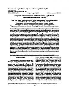
Web-based Near Real-Time Remote Sensing Data System Providing Decision Support for Precision Agriculture Xiaodong Zhang Department of Earth System Science and Policy, University of North Dakota, Grand Forks, ND 58202, USA –
[email protected] Abstract - The U.S. Northern Great Plains is one of the world’s most agriculturally productive areas. Digital Northern Great Plains (DNGP), a web-based remote sensing system available at http://dnpg.umac.org, and Zone Mapping Application for Precision-farming, a decision support tool based on DNGP available at http://zonemap.umac.org, were developed to provide remote sensing imagery and decision support for precision agriculture. The systems provide easy and free access to a variety of imagery and products in near real-time as well as in archive of past 30 years. Developed using open source applications, the systems have helped farmers and ranchers reduce operational costs and increase productivity through a variety of innovative applications. A user is able to use DNGP to define an area of interest, usually his or her own farm or ranch, and to download all the remote sensing data and products available for that area. Or alternatively, the user can have ZoneMAP to delineate management zones automatically using the remote sensing data as well as field data that the user may have collected. The systems are able to ingest virtually unlimited number data layers, each of different sources, formats, and projections, and seamlessly merge them together, analyse and process, all transparently to users.
derived from them occurs when they enable management decisions that enhance productivity and reduces unwanted environmental impacts. In response to these challenges, the Upper Midwest Aerospace Consortium (UMAC), a consortium of seven universities in the US Upper Midwest, executed a project that included the following: delivery of remote sensing data products of no-cost to the farmers and ranchers in the region; training of farmers and ranchers in the use of satellite imagery and derived products such as Normalized Difference Vegetation Index (NDVI) (Seelan et al. 2007); and development and promotion of applications through a learning community approach (Seelan et al. 2003). At the outset we realized that the dynamic nature of agriculture meant remote sensing products and services are useful only when made available in a timely manner and in an easy-to-use format. We designed and developed two web-based systems, Digital Northern Great Plains (DNGP, http://dngp.umac.org), to deliver archived and near real time remote sensing data and products (Zhang et al. 2010); and Zone Mapping Application for Precision-farming (ZoneMAP, http://zonemap.umac.org), to delineate management zones for decision support (Zhang et al. 2010). 2. DECISION SUPPORT SYSTEMS
Keywords: remote sensing, decision support, precision agriculture, DNGP, ZoneMAP. 1. INTRODUCTION Growing demand globally for food over the past 40 years has improved economic returns for the agricultural industry, but producers face higher risks because input costs and land values have also increased significantly (Tilman et al. 2002). To reduce risk, increase energy efficiency, enhance productivity, improve profitability, and minimize environmental impacts agricultural producers are increasingly resorting to the use of information technologies to aid their decision making processes (Hendrickson et al. 2008). In addition to land, labor, and capital, which have been agriculture’s traditional assets, information management has become increasingly important (Hanson et al. 2008). The management strategy that uses information technologies to bring data from many sources to bear on crop-production has come to be known as precision agriculture. Remote sensing imagery acquired from satellites and aircraft provides information in both the spatial and temporal dimensions that can potentially assist crop management. To maximize value to producers, the information has to be easily accessible in a timely manner and useable with a minimum of training (Zhang et al. 2002). Adoption of remote sensing technology is also affected by the depths of scientific and technical knowledge required to analyze and interpret the data (McBratney et al. 2005), and producers are likely to have limited skills and/or interest in this area (Kitchen et al. 2002). One way to lower the barrier to adoption is to develop low or no-cost value-added products that can be easily interpreted. To a producer, the value of remote sensing images and products
2.1 Digital Northern Great Plains The Upper Midwest Aerospace Consortium (UMAC, http://www.umac.org) has collected a rich archive of remote sensing imagery over North and South Dakota, Minnesota, Montana, Wyoming and Idaho spanning more than 30 years. Data include medium resolution (20 – 250 m) multispectral images from Landsat Multispectral Scanner (MSS), Thematic Mapper (TM) and Enhanced Thematic Mapper Plus (ETM+), Advanced Spaceborne Thermal Emission and Reflection Radiometer (ASTER), Moderate Resolution Imaging Spectroradiometer (MODIS); surface relief from the Shuttle Radar Topography Mission (SRTM); and high resolution (1 – 2 m) images from AeroCam (AeroCam 2003), a multispectral airborne camera that was developed and is operated by UMAC. To ensure consistency in temporal and spatial comparisons, all images have been geo-referenced and atmospherically corrected using the ATCOR software (Richter et al. 2006). DNGP system was designed using Open Sources applications. Raster and vector data are processed using Geospatial Data Abstraction Library (GDAL) and OpenGIS Simple Features Reference Implementation (OGR) library, respectively. Various raster and vector layers are combined into a final image using another open source package, MapServer. We also used PROJ.4 Cartographic Projections Library for coordinate conversion between different projections and datum. The data storage is managed by an Oracle database management system with spatial extension. The DNGP system has several features that enable users with low-bandwidth Internet connections to search and download remote sensing data and products easily and quickly. These features include: • An intuitive user interface to allow users to conduct searches via spatial coordinates. This is critical because
•
•
•
•
•
essentially a farm is a spatial object. With thousands of images archived, this allows a user to focus quickly on his or her area of interest. Capability to subset remote sensing images either spatially or spectrally. For example, a typical Landsat scene covers ~ 740,000 acres whereas a farm typically spans ~3,000 acres, or only 1/250th of a scene. Dynamic subsetting helps achieve timely delivery by eliminating data of no interest to a user and saving a significant amount of bandwidth. Products generated on the fly, which not only simplifies the database design but also allows users to access the improved or new products quickly. Currently, the data products include color and false-color composites, NDVI, green NDVI, and sugar beet yield (Beeri et al. 2005). The differences in spectral response functions affect the estimate of vegetation indices (Steven et al. 2003). But for the sensors whose imagery is hosted in DNGP, the differences are < 10% and therefore are not considered in the current products. Compatibility with a wide range of application software. In addition to GeoTIFF format, in which the original images are saved, images or products can also be rendered as ASCII text files. A multitude of vector layers, including township, highways, lakes, rivers, and other geographic features has been incorporated into the system to help users identify their targets. A single interface design with dynamic content update to provide a smooth user experience.
Figure 4 shows the number of unique daily visits, averaged monthly, to the DNGP website as well as the total quantity of data downloaded in Gigabytes. In addition to the overall growth trends, these two parameters also exhibit a strong seasonal pattern, with two peaks occurring around April and October annually. The significant increase in actual download of images during 2006 – 2008 was due to the great expansion in the number of users and their area of interests. For example, for the four months from July to October in 2008, a total of 72 GB of images and products were downloaded, with an accumulated area about half the size of the UMAC’s region.
downloaded has decreased as compared to the previous years. The reason is because UMAC released a new extension to DNGP in 2008, Zone Mapping Application for Precisionfarming (ZoneMAP) (Zhang et al. 2010). ZoneMAP further expanded the service by DNGP in two aspects: 1) the source of data was extended to include field measurements by end users; and 2) instead of raw data, management zones can be delineated automatically based on the selection of data. The decrease in downloading images was accompanied by an increase in use of ZoneMAP. The divergence is explained by the fact that producers are more interested in value-added products that can be used directly for decision making than in the images themselves. 2.2 Zone Mapping Application for Precision-farming With DNGP system providing data access that is tailored to the needs of agriculture producers, ZoneMAP was designed to offer a decision support tool to further enhance productivity (Zhang et al. 2010). By connecting to the same database system with a rich archive of remote sensing data spanning the past 30 years, ZoneMAP allows a user to define variability within a field using spatial information that are multi-spectral and multitemporal. We chose fuzzy c-means (FCM) as the clustering algorithm for ZoneMAP. It is basically the same as that used by Fridgen et al. (2004) except for the method of estimating the measure of similarity between observations and centers of the clusters that are to be determined. Typically, measure of similarity can be estimated using Euclidean distance, diagonal distance, or Mahalanobis distance. Since the Euclidean distance algorithm requires variables to be of equal variances and non-correlated, which are rarely true in reality, we only implemented the latter two algorithms. The diagonal distance algorithm compensates for the difference in variances of different variables, but it is still sensitive to correlated variables. The Mahalanobis distance algorithm is designed for datasets that are both correlated and have different variance by adjusting the distance with variancecovariance matrix within the pool of datasets. We found that both the diagonal and Mahalanobis distance algorithms gave very similar results in our testing. We used the diagonal distance algorithm in classification because it is much faster and therefore highly suitable for a web-based application, such as ZoneMAP. For management zones to be representative, various factors affecting the soil characteristics and potential productivity need to be considered. This often entails the use of data from different sources, of different ground sampling distances, and with different formats and projections. Before being combined for further analysis, different data need to be projected onto a common grid, which often involves sub-setting, re-projecting and re-sampling procedures.
Figure 1. Unique daily visits averaged monthly and total downloads of DNGP images in Gigabytes between July 2004 and January 2011.
The two parameters shown in Figure 1 have diverged since 2009: the daily visits continue to rise, but the quantity of data
Typically, a remote sensing image covers a much bigger area than a farm field. Instead of processing the entire image, ZoneMAP automatically crops the image using an area of interest (AOI) defined by the user, which considerably enhances the overall performance. ZoneMAP also automatically re-projects and re-samples different images to a common projection plane with an equal ground sampling distance determined by the user. In addition to remote-sensed imagery that is available, ZoneMAP can also accept data that a user provides. Data collected by users, such as yield or soil electrical-conductivity (EC), can be uploaded and used in classification. The data can
be either in grid text format or as a raster image. The grid format follows the common convention, i.e., the first two columns are longitude and latitude and the rest of the columns are values for different parameters. The data in text format is automatically converted to an image. A zone map that a user creates is also considered as the user’s data. All the data that a user provides or creates along with their metadata are saved in a secure online database. For each creation of a set of management zones, metadata is generated automatically describing the procedure and datasets used so that the classification can be reproduced later. The created management zones can be downloaded in one of the three formats, raster image, grid text or shape file. For each format, there are multiple projections to choose from. In addition, users can input an application rate for each zone to generate a variable rate application map.
a
An example of using ZoneMAP is shown in Figure 2. Using a yield map collected in 2003 (Fig. 2-a) and an NDVI map by Landsat on August 25, 2004 (Fig. 2-b), the farmer created four subfield zones (Fig. 2-c) to determine the application rates of urea for the year 2005. As a result of this variable-rate application, the spring wheat planted in 2005 delivered a much more uniform yield (Fig. 2-d). While the mean yields of each crop were about the same, 7.33 t/ha for corn and 7.17 t/ha for spring wheat, the standard deviation (SD) was reduced from 1.93 t/ha for corn in 2003 to 1.23 t/ha for spring wheat in 2005. Yield monitoring capability is not available to every farmer. However, spectral data from remote sensing has been shown to have potential to assess the yield variation at both large (county or sub-county) or small (within-field) scales (Tucker et al. 1980; Doraiswamy et al. 2003; Doraiswamy et al. 2004). It is of interest to evaluate whether replacing the yield map with satellite imagery can generate an equivalent zone map. The NDVI derived from Landsat on September 1, 2003 is shown in Fig. 2-e. Visual examination of the image and the yield map of corn for 2003 (Fig. 2-a) does suggest some degree of correlation. The zone map created using the NDVIs from September 1 2003 and August 25 2004 is shown in Fig. 2-f. Zones 1, 3, 5 and 6 roughly correspond to the zones with low, moderate, high and extra high rate in Fig. 2-c, respectively. 3. CONCLUSIONS
b
c
From designing the two systems to promoting their use among the end user community, we followed the innovation adoption/diffusion model of Rogers (Rogers 2003). While remote sensing technology’s potential for improving productivity is generally accepted by agricultural producers, endorsement of the technology by a few key early adopters accelerated widespread adoption of the innovation. To identify and engage early adopters, we followed a learning community approach (Seelan et al. 2003), where producers were treated as full partners and not as clients of researchers. Today, DNGP and ZoneMAP systems serve as a premier tool for users to practice agriculture benefiting from the advancement in space and remote sensing technology.
d
e
ACKNOWLEDGEMENTS The funding for the projects was provided by NASA and USDA through a series of grants. We would like to acknowledge the extensive contributions of the students and faculty of the University of North Dakota who contributed to the design and development of the two systems, in particular our colleagues in the Northern Great Plains Center for People and the Environment. We also wish to acknowledge a number of farmers and ranchers who have collaborated with us.
REFERENCES f AeroCam. (2003). Figure 2. Using 2003 yield map of corn (a) and 2004 NDVI map by Landsat of August 25, 2004 (b), the farmer created the management zones (c) as a basis for determination of variable rate fertilizer application resulting in a more uniform yield for 2005 spring wheat (d). The zone map (f) when the yield data of 2003 is replaced with NDVI data of September 1, 2003 (e).
Retrieved January 11, 2009, from
http://www.umac.org/sensors/aerocam/index.ht ml. Beeri, O., X. Zhang, T. Newcomb, P. Carson and G. Wagner (2005). Using Landsat images to map the quality and quantity of sugar beet yield. Sugarbeet Research and Extension Reports, Sugarbeet Research and Education Board of Minnesota and North Dakota: 125-131.
Doraiswamy, P. C., J. L. Hatfield, T. J. Jackson, B. Akhmedov, J. Prueger and A. Stern (2004). "Crop condition and yield simulations using Landsat and MODIS." Remote Sensing of Environment 92(4): 548-559. Doraiswamy, P. C., S. Moulin, P. W. Cook and A. Stern (2003). "Crop yield assessment from remote sensing." Photogrammetric Engineering & Remote Sensing 69(6): 665-674. Fridgen, J. J., N. R. Kitchen, K. A. Sudduth, S. T. Drummond, W. J. Wiebold and C. W. Fraisse (2004). "Management Zone Analyst (MZA): Software for Subfield Management Zone Delineation." Agronomy Journal 96: 100-108. Hanson, J. D., J. Hendrickson and D. Archer (2008). "Challenges for maintaining sustainable agricultural systems in the United States." Renewable Agriculture and Food Systems 23(Special Issue 04): 325-334. Hendrickson, J., G. F. Sassenrath, D. Archer, J. Hanson and J. Halloran (2008). "Interactions in integrated US agricultural systems: The past, present and future." Renewable Agriculture and Food Systems 23(Special Issue 04): 314-324. Kitchen, N. R., C. J. Snyder, D. W. Franzen and W. J. Wiebold (2002). "Educational Needs of Precision Agriculture." Precision Agriculture 3(4): 341-351. McBratney, A., B. Whelan, T. Ancev and J. Bouma (2005). "Future Directions of Precision Agriculture." Precision Agriculture 6(1): 7-23. Richter, R., D. Schläpfer and A. Mueller (2006). "An automatic atmospheric correction algorithm for visible/NIR imagery." International Journal of Remote Sensing 27(10): 2077 - 2085. Rogers, E. M. (2003). Diffusion of Innovation. New York, NY, USA, Free Press. Seelan, S. K., D. Baumgartner, G. M. Casady, V. Nangia and G. A. Seielstad (2007). "Empowering farmers with remote sensing knowledge: A success story from the US Upper Midwest." Geocarto International 22(2): 141 - 157. Seelan, S. K., S. Laguette, G. M. Casady and G. A. Seielstad (2003). "Remote sensing applications for precision agriculture: A learning community approach." Remote Sensing of Environment 88: 157-169. Steven, M., T. Malthus, F. Baret, H. Xu and M. Chopping (2003). "Intercalibration of vegetation indices from different sensor systems." Remote Sensing of Environment 88(4): 412-422. Tilman, D., K. G. Cassman, P. A. Matson, R. Naylor and S. Polasky (2002). "Agricultural sustainability and intensive production practices." Nature 418(6898): 671-677. Tucker, C. J., N. N. Holben, J. H. E. Jr. and J. E. McMurtrey (1980). "Relationship of spectral data to grain yield variation." Photogrammetric Engineering & Remote Sensing 46(5): 657-666. Zhang, N., M. Wang and N. Wang (2002). "Precision agriculture--a worldwide overview." Computers and Electronics in Agriculture 36(2-3): 113-132. Zhang, X., S. Seelan and G. Seielstad (2010). "Digital Northern Great Plains: A Web-Based System Delivering Near Real Time Remote Sensing Data for Precision Agriculture." Remote Sensing 2(3): 861-873. Zhang, X., L. Shi, X. Jia, G. Seielstad and C. Helgason (2010). "Zone mapping application for precision-farming: A decision support tool for variable rate application." Precision Agriculture 11(2): 103-114.