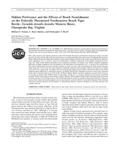
Sep 23, 2011 - seawall protecting the Seisho Bypass was severely damaged and collapsed over a length of 1.1 km near the Oiso Interchange, as shown in ...
RECOVERY OF SANDY BEACH BY GRAVEL NOURISHMENT - EXAMPLE OF NINOMIYA COAST IN KANAGAWA PREFECTURE, JAPAN Toshinori Ishikawa1, Takaaki Uda1, Shiho Miyahara2, Masumi Serizawa2, Minoru Fukuda3 and Yasutoshi Hara3 The effect of gravel nourishment on the Ninomiya coast, located west of the damaged site of the Seisho Bypass, was investigated. On the basis of field data, a method of recovering the sandy beach by gravel nourishment was numerically investigated using the BG model. As a facility to prevent nourishment gravel from being transported alongshore, two groins were considered, and their effectiveness was shown. The high stability of the recovered beach and the effectiveness of gravel nourishment were confirmed. Keywords: Gravel nourishment; Ninomiya coast; BG model; beach changes; groins
INTRODUCTION
Storm waves associated with Typhoon 0709 hit the Seisho coast facing Sagami Bay, as shown in Fig. 1, on September 7, 2007, resulting in severe erosion over an extensive area. In particular, the seawall protecting the Seisho Bypass was severely damaged and collapsed over a length of 1.1 km near the Oiso Interchange, as shown in Figs. 2 and 3, closing the highway to traffic for a long time (Serizawa et al., 2009). Serizawa et al. (2009) showed that the erosion of the coast was primarily triggered by the selective discharge of medium-size sand from the beach composed of both sand and gravel by offshore sand transport associated with the storm waves. After the storm, part of the medium-size sand transported offshore returned to the foreshore under normal wave condition. Although these beach changes were observed, part of the beach sand was assumed to be transported westward by longshore sand transport, and finally discharged into the deep sea through the submarine canyon offshore of the Morito River located 5 km west of the damaged area, as shown in Fig. 1, causing a net loss of sand. In the damaged area of approximately 1 km length on the Ninomiya coast, where the sandy beach has entirely disappeared and houses are located immediately behind the coastline, beach nourishment using coarse materials was planned to recover the sandy beach and prevent wave overtopping as a countermeasure against beach erosion (Fig. 2). In this plan, the beach width in front of houses to be recovered was determined to be 30 m, which was the necessary beach width to prevent wave overtopping. In the beach nourishment, high stability was required for the nourishment so as not to damage the highway again even in the case of storm wave action. In this study, the recovery of the sandy beach by beach nourishment using coarse materials was investigated using the BG model (a three-dimensional model for predicting beach changes based on Bagnold’s concept) proposed by Serizawa et al. (2006). BEACH NOURISHMENT USING COARSE MATERIALS AT YAMANISHI AREA General Conditions
The 690 m stretch of the Yamanishi area between the west end of the damaged area of the Seisho Bypass and the Ninomiya fishing port had been eroded over time, although no erosion was reported during Typhoon 0709. The Kanagawa Prefectural Government carried out beach nourishment using coarse materials containing a large amount of gravel from March, 2008 as a measure against beach erosion. In this beach nourishment, nourishment materials were placed on the backshore along a length of 250 m immediately east of Ninomiya fishing port, as shown in Fig. 4. A total of 3.8×10⁴ m3 of beach nourishment materials, which were transported from the Sakawa River, was used for nourishment between March 2008 and March 2011, which were initially placed forming a mound. The nourishment materials contained 40% gravel, and 60% fine and medium-size sand, as shown in Fig. 5. After the nourishment, a scarp was formed on the seaward slope of the m ound, whereas gravel was selectively deposited on the foreshore, forming a berm because of the high gravel content, as shown in Fig. 6.
1
Public Works Research Center, 1-6-4 Taito, Taito, Tokyo 110-0016, Japan Coastal Engineering Laboratory Co., Ltd., 1-22-301 Wakaba, Shinjuku, Tokyo 160-0011, Japan 3 Kanagawa Prefectural Government, 1 Nihon-odori, Naka-ku, Yokohama, Kanagawa 231-8588, Japan 2
1
2
COASTAL ENGINEERING 2014
Fig. 1. Location of Seisho coast facing Sagami Bay.
Fig. 2. Oblique aerial photograph of damaged Seisho Bypass taken on November 13, 2007.
COASTAL ENGINEERING 2014
3
Fig. 3. Collapse of Seisho Bypass owing to storm waves associated with Typhoon 0709 hit on September 8, 2007.
Fig. 4. Location of Yamanishi area where beach nourishment using coarse materials was carried out.
Fig. 5. Composition of beach nourishment materials used in Yamanishi area.
Fig. 6. Deposition of gravel on foreshore after nourishment (July 12, 2011).
4
COASTAL ENGINEERING 2014
Beach Changes after Beach Nourishment
Figure 7 shows aerial photographs of the Yamanishi area taken on January 2008 after Typhoon 0709 and on March 2011 after the completion of beach nourishment of 3.8×10⁴ m3. In January 2008, detached breakwaters had already been constructed at a depth of 4 m along the coastline for the recovery works of the damaged highway. It can be seen that the foreshore width increased between January 2008 and March 2011 by comparing the beach width along transect No. 4, as shown in Fig. 7. Figure 8 shows the shoreline changes between 2007 and 2011 with reference to the position of the natural shoreline in 1947. The shoreline in the Yamanishi area had retreated by 2007 with a maximum recession of 40 m with reference to that in 1947. Although the retreated shoreline remained at the same location until November 2007, the shoreline had advanced by 10 m by March 2011 because of the beach nourishment.
Fig. 7. Shoreline changes of Yamanishi area between January 2008 and March 2011.
Fig. 8. Shoreline changes between Ninomiya fishing port and Kuzu River mouth with reference to shoreline in 1947.
The changes in the longitudinal profile along transect No. 4 across the center of the Yamanishi area (Fig. 7) are shown in Fig. 9. Although the shoreline did not change along this transect as a result of Typhoon 0709, which hit the coast on September 6, 2007, erosion occurred in the depth zone between the shoreline and -7 m with a maximum decrease of 2 m in seabed elevation, as shown in Fig. 9(a).
COASTAL ENGINEERING 2014
5
Fig. 9. Changes in longitudinal profile along transect No. 4.
Then, sand deposition occurred owing to the effect of the beach nourishment up to March 2011, as shown in Fig. 9(b). Beach Changes under Storm Wave Conditions
In 2011, storm waves hit the Seisho coast several times. During Typhoon 1115 on September 21, 2011, storm waves with a significant wave height of H1/3 = 6-8 m were estimated from the run-up height on the nearby coast and wave data taken at Irozaki Point on the Izu Peninsula, because wave observation at Hiratsuka observatory, the only wave observatory in Sagami Bay, failed because of an electricity failure in the area. Owing to the storm waves of this typhoon, severe beach erosion occurred on the Kozu and Maekawa coasts, located west of the study area. On the Oiso coast, east of the study area, the backshore was eroded by as much as 3.5 m and the seawall was damaged. However, no beach changes occurred on the Yamanishi area because of the deposition of the large amount of gravel supplied by beach nourishment. Figure 10 shows the foreshore changes of the Yamanishi area resulting from the storm waves of Typhoon 1115, which were taken from the top of the slope immediately east of transect No. 4, looking forward the jetty of Ninomiya fishing port. The shoreline on September 24 appears to have slightly retreated compared with that on September 13 because the tide level on September 24 was 0.32 m higher than +0.01 m above mean sea level on September 13. However, marked shoreline recession did not occur, as in the case of a sandy beach composed of fine sand, and instead, a large amount of gravel accumulated on the foreshore. Figure 11 shows the changes in the longitudinal profile along transect No. 4 resulting from Typhoon 1115 on September 21, and the depth distribution of the grain size composition of bed materials measured on October 18, 2011. The profile along transect No. 4 has a slope as steep as 1/8 between the shoreline and -6 m, with a gentle slope of 1/30 in the offshore zone. This steep slope near the shoreline is composed of gravel, whereas the offshore bed in the zone deeper than 6 m is mainly composed of medium-size and fine sand. As shown by the profile on September 23, 2011, after the storm waves, the shoreline was maintained and gravel was deposited on the foreshore. Thus, the sandy beach was well maintained by the deposition of gravel during Typhoon 1115. This strongly implies that beach nourishment using coarse materials containing a high gravel content is effective as a protective measure against beach erosion.
6
COASTAL ENGINEERING 2014
Fig. 10. Foreshore change of Yamanishi area resulting from Typhoon 1115.
Fig. 11. Changes in longitudinal profile and depth distribution in composition of bed materials along transect No. 4.
NUMERICAL SIMULATION USING BG MODEL Calculation Conditions
The stability of the beach produced by beach nourishment using coarse materials was investigated using the BG model proposed by Serizawa et al. (2006). The calculation domain has a length of 1 km including the damaged area of 350 m length between Kinpa and Ginpa Bridges. For the wave conditions, the energy mean wave height of Hb = 0.83 m (T = 6.3 s) measured at Hiratsuka wave observatory was employed, similarly to that in Serizawa et al. (2009). The normal waves were assumed
COASTAL ENGINEERING 2014
7
to be incident from the direction perpendicular to the shoreline (θw = 0°) of the Yamanishi area where the sandy beach has been gradually recovered by beach nourishment. For the storm wave conditions, the energy mean wave height was determined as Hb = 3.0 m (T = 9.1 s) and the wave direction was θw = 10° on the basis of the wave data observed at the Hiratsuka wave observatory between September 4 and 8, 2007, during Typhoon 0709. The wave field was calculated in the same calculation domain as that used for the prediction of beach changes using the angular spreading method for irregular waves (Sakai et al., 2006). In the area under investigation, a number of planar concrete blocks and detached breakwaters have been placed along the shoreline for the urgent construction works after Typhoon 0709, as shown in Fig. 12. The detached breakwaters are planned to be removed, whereas the planar concrete blocks will be left as they are, and are expected to be buried under the nourishment beach. Therefore, the initial profile was assumed to have the same slope of 1/30 as the offshore seabed slope between -4 m at the offshore toe of the detached breakwaters and the seawall. Figure 13 shows the initial bathymetry and the alignment of various coastal structures. The seabed was assumed to be a solid bed above which beach nourishment is carried out. As the composition of the nourishment materials, the volume ratio of fine materials (fine sand and medium-size sand) to coarse materials (coarse sand and gravel) is set to 0.6:0.4. Regarding the equilibrium slope of each grain size, the equilibrium slope of the fine materials is assumed to be tanβc1 = 1/30, taking the seabed slope of 1/30 in the zone deeper than 7 m, as shown in Fig. 11, into account, whereas that of the coarse materials assumed to be tanβc2 = 1/8 on the basis of the measured foreshore slope. The characteristic grain sizes of the fine and coarse materials are assumed to be d1 = 0.2 and d2 = 2 mm, respectively. Serizawa et al. (2009) reproduced beach changes owing to the rapid seaward transport of mediumsize sand during storm waves, and the recovery of the foreshore under normal waves by changing the equilibrium slope of medium-size sand depending on the wave conditions. This condition was selected on the basis of the measured beach changes on the Ohiso coast, east of the present study site. On the other hand, no medium-size sand was contained on the foreshore of the Yamanishi area; therefore, we assumed that medium-size sand was not deposited on the foreshore but deposited in the zone deeper than 6 m, and its equilibrium slope was assumed to be constant at 1/30 as measured in the offshore zone in Fig. 11, regardless of the wave conditions. As the boundary conditions, sand transport was assumed to be 0 at the shoreward and offshore boundaries, with a free boundary at the left and right ends. The calculation domain was divided into 10 m intervals. The beach changes after 10 years were predicted using time intervals of Δt = 0.5 hr. The berm height, the depth of closure and the coefficient of sand transport were the same as those in Serizawa et al. (2009). Beach changes after the beach nourishment were predicted under the condition that groins were constructed at both ends. Table 1 shows the calculation conditions.
Fig. 12 Coastal condition of damaged area of Seisho Bypass (July 8, 2011).
8
COASTAL ENGINEERING 2014
Fig. 13. Initial bathymetry of calculation domain. Table 1. Calculation conditions. Calculation domain Calculation of beach changes Calculation of wave field Cases
Initial bathymetry Typical grain sizes and equilibrium slope
Incident wave conditions
Slope of angle of repose Berm height Depth of closure Coefficient of sand transport Depth distribution of sand transport Boundary conditions Mesh intervals Time intervals Prediction period
Damaged area of Seisho Bypass with 1 km length BG model (Serizawa et al., 2006) Angular spreading method for irregular waves (Sakai et al., 2006) Case 1 Beach nourishment at rate of 3×10⁴ m3/yr (fine and coarse materials 0.6:0.4 with equilibrium slopes of 1/30 and 1/8) + action of normal waves Case 2 Case 1 after five years + action of storm waves Case 3 Results of Case 2 + energy mean waves Solid bed of 1/30 slope + beach nourishment Volume ratio of nourishment materials (fine and coarse materials) = 0.6:0.4 Typical grain size: d1 = 0.2 mm, equilibrium slope tanβc1 = 1/30 Typical grain size: d2 = 2 mm, equilibrium slope tanβc2 = 1/8 Energy mean waves: Hb = 0.83 m and wave direction θw = 0° Storm waves: Hb = 3.0 m and wave direction θw = 10° (measured between September 4 and 8, 2007, during Typhoon 0709) tanβg = 1/2 hR = 3 m hc = 9 m Coefficient of longshore sand transport: A = 0.2, ratio between cross-shore and longshore sand transport: 0.15 Cubic equation given by Uda and Kawano (1996) q = 0 at offshore and shoreward ends, and free boundary at left and right ends Δx = Δy = 10 m Δt = 0.5 hr 10 years
Results of Calculation
Two groins with a point depth of 4 m and a length of 50 m were placed in the initial setup and then beach nourishment was carried out at a rate of 3×10⁴ m3/yr for four years. After the completion of beach nourishment, beach changes for the next 10 years were predicted. The predicted bathymetry in Case 1 and the bathymetric changes with reference to the initial bathymetry are shown in Figs. 14 and 15, along with the shoreline changes and changes in longitudinal profile in Figs. 16 and 17, respectively. It is shown in these figures that, with beach nourishment at a rate of 3×10⁴ m3/yr, a beach width of 30 m, which is the minimum required to protect the backshore, can be recovered at the center of the study site (X = 440 m), where houses have been built very close to the coastline.
COASTAL ENGINEERING 2014
Fig. 14. Recovery of sandy beach by beach nourishment using coarse materials (Case 1).
9
10
COASTAL ENGINEERING 2014
Fig. 15. Depth changes in Case 1 with reference to initial bathymetry.
COASTAL ENGINEERING 2014
11
Fig. 16. Shoreline changes in Case 1.
Fig. 17. Changes in longitudinal profile along transect X = 440 m (Case 1).
In Case 2, storm waves were incident to the beach topography after 10 years of the action of normal waves in Case 1 to investigate the stability of the nourishment beach under storm wave conditions. Figure 18 shows the results. In the beach nourishment area, the eastern part was eroded with accretion in the western part owing to the easterly incidence of storm waves, and the shoreline rotated counterclockwise. Part of the nourishment sand was considered to be transported westward while turning around the tip of the west groin because the contour lines meandered offshore of the tip of the groin. However, the seawall was protected without exposure to waves and a sandy beach of at least 30 m width was maintained at the central part. From this, it is shown that when two groins of 50 m length are constructed with an interval of 300 m, the nourishment beach can be maintained even when easterly extraordinary storm waves are incident. Figure 19 shows the predicted bathymetry, the bathymetric changes with reference to the bathymetry in Case 2 and the shoreline changes in Case 3, in which normal waves are incident to the bathymetry in Case 2 for a year. The western part, where sand was deposited under the incidence of the easterly storm waves, was eroded, whereas the eastern part was accreted, resulting in the clockwise rotation of the shoreline. The shoreline, however, retreated by 3 m compared with that before the storm waves, as shown in Fig. 19(c), because of sand loss of 6600 m3 from the nourishment area. This sand
12
COASTAL ENGINEERING 2014
loss will occur only when storm waves of the same scale as those in Typhoon 0709 hit the coast. Taking the low probability of such storm waves into account, additional beach nourishment will make it possible to maintain the nourishment beach. Even though gravel is discharged to the adjacent beach, it tends to be deposited along the shoreline on the nearby coast, meaning that it is still useful for the protection of the beach. If we construct long groins, the impact on the nearby coast will be large, and groins with a shorter length are preferable from this viewpoint.
Fig. 18. Results of prediction when storm waves were obliquely incident from easterly direction (Case 2).
COASTAL ENGINEERING 2014
13
Fig. 19. Results of prediction when normal waves were incident from direction perpendicular to shoreline (Case 3).
CONCLUSIONS
On the Seisho coast, where foreshore materials were mainly composed of gravel and medium-size sand, severe erosion occurred by the rapid and selective offshore movement of medium-size sand by storm waves associated with Typhoon 0709, resulting in damage to the seawall protecting the Seisho Bypass over a length of 1.1 km. On the other hand, after Typhoon 0709, on the Yamanishi area, where beach nourishment has been carried out using coarse materials containing gravel taken from the river bed of the Sakawa River, the sandy beach was recovered. In this study, the effect of the beach nourishment using coarse materials on the Yamanishi area was first evaluated, and the recovery of the beach over the damaged area of 350 m length was predicted using the BG model. It was concluded that the recovery of a beach of 30 m width is possible when two groins of 50 m length are constructed at both ends, and beach nourishment using coarse materials (gravel and coarse sand) and fine materials (medium-size sand and fine sand) is carried out at a rate of 3×10⁴ m3/yr for 4 years. If storm waves of the same scale as those during Typhoon 0709, hit the nourishment beach, temporal beach changes will occur, but the seawall protecting the roads will not be exposed to waves
14
COASTAL ENGINEERING 2014
and will maintain a minimum width of 30 m at the center of the nourishment area. It was also confirmed that the eroded beach will recover to a shape similar to that before the storm under the action of normal waves. The loss of beach material from the area is expected to be 6600 m3, and such sand loss is considered to be acceptable because of the low probability of such storm waves. If such sand loss is permitted, a groin length of 50 m is sufficient. In 2011, beach nourishment using coarse materials actually began after consensus building with many stakeholders on the basis of our study. Figure 20 shows the changes in coastal condition of damaged area before Typhoon 0709, immediately after the typhoon, and after the beach nourishment. A sandy beach has really recovered by November 2013.
Fig. 20. Changes in coastal condition of damaged area before and after beach nourishment.
COASTAL ENGINEERING 2014
15
REFERENCES
Sakai, K., Uda, T., Serizawa, M., Kumada, T. and Kanda, Y. 2006. Model for predicting threedimensional sea bottom topography of statically stable beach, Proc. 30th ICCE, pp. 3184-3196. Serizawa, M., Uda, T., San-nami, T. and Furuike, K. 2006. Three-dimensional model for predicting beach changes based on Bagnold’s concept, Proc. 30th ICCE, pp. 3155-3167. Serizawa, M., Uda, T., Suzuki, K., Maruyama, S., Takano, H., San-nami, T. and Ishikawa, T. 2009. Numerical simulation of rapid erosion of Seisho coast triggered by storm waves during Typhoon 0709, Proc. Coastal Dynamics 2009, Paper No. 93, pp. 1-14. Uda, T. and Kawano, S. 1996. Development of contour-line change model for predicting beach changes, Proc. JSCE, No.539/II-35, pp. 121-139, 1996. (in Japanese)