3D Modeling of Urban Environments for Enhancing ...
Recommend Documents
AUTOMATED 3D MODELING OF URBAN ENVIRONMENTS. Ioannis Stamos. Department of Computer Science. Hunter College, City University of New York.
George Quercia Bianchi nr 199. Dynamics of Social Networks and Activity ... Alessio Ricci nr 227. Clever Climate Control for Culture: Energy Efficient Indoor ...
Results also showed the 3D visualization system benefited students with low spatial .... Illustration of a model of mental processing [10]. ..... with video tutorials of.
Jan 26, 2001 - have been successfully created with semi-automatic techniques. The success of ... complete, and accurate models of complex environments by in-house intuitive easy to use software tools. The next ... Email: [email protected]; .....
Oct 18, 2011 - an umbrella term that includes all the aspects of social, environmental and ... urban sustainability assessment and decision-support tools, ... best options for sustainable transport systems (Fedra, 2004). ... Monitoring tool.
using the GTSAM library (Dellaert and Kaess, 2006). In this way, 2D lines and 3D ..... map off line, using the Gmap ROS node, so that ac- quired data are only ...
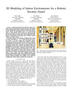
3D Modeling of Indoor Environments for a Robotic. Security Guard. Peter Biber. University of Tübingen. WSI/GRIS. Tübingen, Germany.
future security and surveillance tasks for large scale environments such as shopping malls, ... Robotic platform for security guard with sensors marked. The laser.
strategic data. For example, we must be able to easily position ... constraints as for example : automation of the urban ... useful territories for marketing studies.
strategic data. For example, we must be able to easily position ... constraints as for example : automation of the urban ... useful territories for marketing studies.
pose a methodology for developing educational software for children with vis- ual disabilities. Multimedia software for these children has some particularities.
Urban Scenes for 3D Modeling and. Physical Feature Retrieval at L-Band. Stefan Sauerâ, Laurent Ferro-Familâ, Andreas Reigberâ and Eric Pottierâ. â.
Jun 6, 2017 - the art methods for remote sensing applications in urban 3D modeling. Most publicly available benchmark datasets have consisted of.
technology we use and what pedagogy we implement, but must also pay specific ..... between three types of affordances - educational, social, and technological.
Abstractâ3D scene modeling for indoor environments has stirred significant interest in the last few years. The obtained photo-realistic rendering of internal ...
Detailed 3D visual models of indoor spaces, from walls and floors to objects and their configurations, can provide exten- sive knowledge about the environments ...
Peter Biberâ , Sven Fleckâ , Florian Buschâ , Michael Wandâ , Tom Duckettâ¡, Wolfgang ... Wilhelm Schickard Institute, Graphical-Interactive Systems (WSI/GRIS), ...
Keywordsâ3D modeling, RGB, Kinect, indoor environment, transparent objects. I. INTRODUCTION. The 3D reconstruction process is a set of structured steps by.
representation the free space in front of the vehicle is limited by adjacent rectangular .... Further inspiration can be found in the domain of computer graphics. Unfortunately .... dynamic programming to the polar occupancy grid from. Figure 4b.
easily accessibly environment as Google Earth that provide also information on the ... KLUIJVER, DE H. and STOTER, J.: Noise mapping and GIS: optimising ...
Jun 25, 2018 - To solve the problem of computing complexity, a systematic methodology for computing urban traffic noise maps under 3D complex building ...
Keywords: 3D virtual learning environments, web 2.0, digital natives, generation-y, .... As with Design for Interactive Media, students were free to attend classes ... percent of students stated that they never access 3D online multi-user games, and
developer Linden Lab (2008), the large number of hours Second Life ... sites such as Facebook or MySpace (approximately 3 hours per month ..... http://www.associationofvirtualworlds.com/publishing_blue_book.php [viewed 10 May 2008].
variations on domains of size X x 512 x 21. The upper two series are ... fast and inexpensive energy use and particle dispersion simulation tool for urban areas.
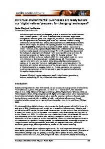
3D Modeling of Urban Environments for Enhancing ...
3D Modeling of Urban Environments for Enhancing GPS Localization’s Accuracy Julien Moreau, S´ebastien Ambellouis, Yassine Ruichek
To cite this version: Julien Moreau, S´ebastien Ambellouis, Yassine Ruichek. 3D Modeling of Urban Environments for Enhancing GPS Localization’s Accuracy. TRA - Transport Research Arena, Apr 2014, France. 10p.
HAL Id: hal-01065044 https://hal.archives-ouvertes.fr/hal-01065044 Submitted on 17 Sep 2014
HAL is a multi-disciplinary open access archive for the deposit and dissemination of scientific research documents, whether they are published or not. The documents may come from teaching and research institutions in France or abroad, or from public or private research centers.
L’archive ouverte pluridisciplinaire HAL, est destin´ee au d´epˆot et `a la diffusion de documents scientifiques de niveau recherche, publi´es ou non, ´emanant des ´etablissements d’enseignement et de recherche fran¸cais ou ´etrangers, des laboratoires publics ou priv´es.