second to model the excavation costs in an area, which are essential for planning forest ... and applies the ANFIS to model and predict the share of rock in different physiographic and ...... able than those of triangular and Gaussian MFs and.
Original scietific paper – Izvorni znanstveni rad
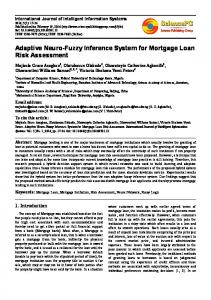
An Adaptive Network-based Fuzzy Inference System for Rock Share Estimation in Forest Road Construction Ismael Ghajar, Akbar Najafi, Seyed Ali Torabi, Mashalah Khamehchiyan, Kevin Boston Abstract – Nacrtak This paper presents a new Rock Share Estimation (RSE) procedure that can estimate the cost of forest road construction. One of the key elements of the total cost in road construction is the cost of embankment. The proportion of the rock directly influences the price of this activity. Hence, a reliable estimation of rock proportion should be made within the entire project area, especially in rocky areas. The objective of the study is to introduce a practical expert system to estimate the share of rock as a function of terrain slope and geological formations using the Adaptive Network – based Fuzzy Inference System (ANFIS) and Analytic Hierarchy Process (AHP). This approach can be very useful first to show the variability of rock proportion and second to model the excavation costs in an area, which are essential for planning forest roads. This study treats geological composition as a decision variable that is solved by AHP method and applies the ANFIS to model and predict the share of rock in different physiographic and geological conditions. In order to investigate the impact of change in membership functions (MF), four types of MFs were adopted to generate the hybrid RSE–ANFIS models. Further more, to show the applicability of the proposed approach, the optimum model was applied to a mountainous forest, where additional forest road network should be constructed in the future periods. Keywords: Rock Proportion, ANFIS, AHP, Forest Road Cost, Membership Function
1. Introduction – Uvod Estimation of rock proportion of subsoil as a real life problem is an important element in both the design and construction stages of road projects. All road planners and contractors prefer to construct the road in a soft terrain with the least rock excavation as this is the most cost-effective construction. However, it is very hard to exactly calculate the rock ratio of subsoil before the excavation of a project begins. In this regard, a number of methods have been suggested for assessment of slope stability and excavation quantities (Hoek and Bray 1981; Goodman 1989; Pettifer and Fookes 1994). Additionally, rock mass classification concept, which provides quantitative data and guidelines for engineering purposes, has been applied extensively for tunneling and underground excavation. Croat. j. for. eng. 33(2012)2
The main shortcoming of the existing traditional rock mass classification systems such as Rock Structure Rating, RSR (Wickham et al. 1972), the Rock Mass Rating, RMR (Bieniawski 1975), and the Q-system (Barton et al. 1974) is that they ignored the regional and local geological features and rock properties, and they were developed with the fixed weight for each rating factor (Liu and Chen 2007). On the other hand, other researchers that have developed tools to estimate the rock share related to forest topics are so limited (e.g. Inaba et al. 2001; Stuckelberger et al. 2006). In most prior studies, the share of rock is introduced as a function of terrain slope and geology information. Inaba et al. (2001) developed a numerical model to estimate the share of rock excavation volume. They assigned a coefficient for each geological unit and used this coefficient along with the slope and road crown
313
I. Ghajar et al.
An Adaptive Network-based Fuzzy Inference System for Rock Share Estimation ... (313–328)
width as inputs of the model to estimate rock portion for each geological unit. Stuckelberger et al. (2006) have adopted the current model and the above mentioned coefficients to estimate rock excavation volume and cost for each geological unit. They calculated the rock excavation cost as a function of earth embankment costs to be used as one of the cost elements of forest road construction cost model. However, considering a fixed coefficient for each type of geological unit regardless of local conditions could lead to inaccurately estimating the rock share and consequently inaccurately estimating the construction costs. The approach performed in practice in Iran is as follows: after visiting the proposed alignment of forest road, three general classes of rock, soft, medium, and hard, are assigned to several parts of the road project by experts. In fact, these linguistic values are used to describe the difficulty levels of the earthwork and to calculate the base price of project appraisal. As a result, providing a framework that could be practical and at the same time have a justifiable analytic foundation is essential for forest managers. From another perspective, developing a model to estimate the share of rock is problematic due to the uncertainty associated with geological information and environmental variables. The numerical modeling and optimization approaches have long been employed in forest researches worldwide. The traditional simulation and optimization tools are appropriate when data are known well enough, while in many real-world problems, there are many uncertain variables, and/or vague and ambiguous input data that should be handled for modeling. A computing system that has the ability to analyze these kinds of data should be more flexible and adaptive than the traditional approaches. In other words, a Real-World Computing (RWC) system should be capable of distributed representation of information, massively parallel processing, learning and self-organization to achieve enough flexibility in information processing (Sreekanth et al. 2010). In this relation, soft computing techniques as the open, robust, and real-time processing systems can be adopted efficiently to cope with the RWC systems. Hereafter, a brief introduction of relevant techniques and literature are provided. Fuzzy logic (Zadeh 1965) is increasingly used in various fields of science and technology for prediction purposes (Gail et al. 2002). Fuzzy systems are stable, easily tunable and could be validated conventionally. One of the significant advantages of linguistic methodology in fuzzy rule based systems is that a welldefined physical relationship is not required to systematically convert an input to an output (ASCE Task
314
Committee on Applications of Artificial Neural Networks in Hydrology 2000). These properties make them sufficiently flexible for solving the real time problems especially when the input or output data are defined by several linguistic values. Fuzzy sets theory has been applied in forest management (Mendoza and Sprouce 1989; Mendoza et al. 1993; Zandik 2006), water runoff, sediment yield, and recreation (Tecle et al. 1994), resource allocation (Ghajar et al. 2010), and forestry planning problems (Kangas et al. 2006). Artificial Neural Networks (ANNs) are another type of soft computing and data driven techniques that, because of their heuristic problem-solving capabilities, have been applied successfully in many fields of geological engineering problems (Shahin et al. 2008). Among them, ANNs have been employed in predicting the settlement and bearing capacity of shallow foundations (Shahin et al. 2005; Padmini et al. 2008), applications concerning earth retaining structures (Kung et al. 2007), site characterization (Najjar and Basheer 1996), mining (Rankine and Sivakugan 2005), groutability of soils (Tekin and Akbas 2010) and many other problems. A comprehensive overview of ANN application in geological engineering problems can be found in Shahin et al. (2008). To gain more efficiency from fuzzy logic and ANNs, a combined approach called neuro-fuzzy was developed by Jang (1993). Neuro-fuzzy systems are fuzzy systems that use ANN theory in order to determine their properties (i.e. the respective fuzzy sets and fuzzy rules) by processing of available data set (Andrews et al. 1995). In this regard, »the adaptive network-based fuzzy inference system (ANFIS), which has shown significant results in modeling nonlinear functions« (Wang et al. 2010) is of particular interest. The important contribution of Jang (1993) to ANFIS development was the establishment of the universal approximant nature of ANFIS, and the functional equivalency of the Sugeno fuzzy inference systems with radial neural networks, providing the essential theoretical support for the practical application of ANFIS to nonlinear system modeling (Roger and Sun 1993). The membership function parameters in the ANFIS representing the system behavior are extracted from input data patterns. ANFIS learns features in data patterns and then adjusts the consequent parameters according to a given error criterion. There is a lack of literature in the application of ANFIS in forestry but, successful implementations of ANFIS in geological engineering have been reported recently (for example for strength prediction, Yilmaz and Yuksek 2009). Determination of compressive strength of a rock material is time consuming, expensive and involves destructive tests. If Croat. j. for. eng. 33(2012)2
An Adaptive Network-based Fuzzy Inference System for Rock Share Estimation ... (313–328)
I. Ghajar et al.
Fig. 1 Geological units of study area Slika 1. Geološke jedinice na području istraživanja reliable predictive models could be obtained to correlate unconfined compressive strength to quick, cheap, and non-destructive test results, they would be very valuable for at least the preliminary stage of designing a structure (Yilmaz and Yuksek 2009). In the present paper, the Analytic Hierarchy Process (AHP) method was used to prioritize geological units of the study area with respect to strength factor. AHP originally developed by Saaty (1977; 1980), is one of the most popular Multi-Criteria Decision Making (MCDM) methods, which has been widely used in many fields, including natural resource management. AHP, as a comprehensive framework for modeling the real-world problems has the ability to incorporate both tangible and intangible criteria into the decision making process. Murray and von Gadow (1991); Kangas (1992); Vacik and Lexer (2001) and; Kangas and Kangas (2005) have used AHP in forestry applications. Furthermore, the number of AHP applications in othCroat. j. for. eng. 33(2012)2
er fields, such as geology, is continuously increasing. As a successful application of fuzzy logic and AHP in Engineering geology problems, Liu and Chen (2007) presented a systemic procedure by combining the AHP and the Fuzzy Delphi method (FDM, Kaufmann and Gupta 1988) for assessing the quality of slope rock mass, and classifying the stability of rocks using Linear Discriminant Analysis (LDA) model. This paper proposes an approach that applies the ANFIS technique along with AHP to develop a novel knowledge-based model for rock share estimation. The model is developed based on two input variables of terrain slope and geological units. Furthermore, the impacts of different membership functions on the static parameters of rock share estimation, which are used in the ANFIS model, were investigated. As a case study, the best resulted model is implemented in the 7938 (ha) of Educational and Research Forest of Tarbiat Modares University (TMU) in the northern Iran,
315
I. Ghajar et al.
An Adaptive Network-based Fuzzy Inference System for Rock Share Estimation ... (313–328)
Table 1 Description of geological units of study area Tablica 1. Opis geoloških jedinica Era (groups)
Period
Abr.
Geološke ere
Geološki periodi
Oznaka
Cretaceous Mesozoic
Kreda
Mezozoik Triassic Trijas Paleozoic
Permian
Paleozoik
Perm
Cenozoic
Quaternary
Cenozoik
Kvartar
Description – Opis
K11
Orbitolina limestone and calcareous shale – Vapnenci s orbitolinama i vapneni škriljevci
K21
Conglomerate in lower part, limestone, marly limestone and sandy limestone – Konglomerati u donjem dijelu, vapnenac, laporoviti vapnenac i pjeskoviti vapnenac
K2ml
Limestone, marl, limy marl and silty marl – Vapnenac, lapor, vapnenasti lapor i pjeskoviti lapor
sh,1 3
Shale, sandstone and limestone – Škriljevac, pješčenjak i vapnenac
R
R2dl
Thick bedded to massive dolomitic limestone, dolomite and limestone – Debeli do masivni dolomitni vapnenac, dolomiti i vapnenci
Pn
Cherty limestone, calcareous and sandy shale – Čertni vapnenac, vapneni i pjeskoviti škriljevci
Pr
Gray, thick bedded to massive limestone and dolomite (Fuzulinid limestone) – Sivi, debeli do masivni vapneci i dolomiti (fuzulinidni vapnenac)
Qal
Recent alluvium in river beds – Rani aluvij u koritima rijeka
where a 24 (km) forest road has already been constructed and additional forest road alignment should be planned and constructed in the future periods.
2. Materials and Methods – Materijal i metode 2.1 Study area and data collection – Područje istraživanja i prikupljanje podataka The research was carried out in districts 2, 3, 4, and 5 of Educational and Research Forest of TMU situated between longitudes 51°40’37’’E–51°51’36’’E and latitudes 36°29’08’’N–36°34’33’’N. The topographic elevation is about 2 to 2 206 m above mean sea level. The slope classes and their area percentage ranged from 0 to 10% (6.3%); 10–25% (21.6%); 25–45% (31.6); 45–70% (22.3%), and more than 70% (18.2%). In order to make adaptable data that could be applied in the study area, similar geological units to the project area and their constructed road network were investigated to find where the sample data should be collected. Fig. 1 shows the map of geological units in the study area. The cut slope of the constructed road in each geological unit was divided into 10 (m) non-overlapping intervals (Fig. 2). In each sample the type of geological unit and slope degree of terrain were recorded as inputs and the amount of rock share was estimated by an expert in the form of linguistic values as the observed output. A total of 130 samples, including all combination of
316
Fig. 2 Input and output data collection Slika 2. Ulazni i izlazni podaci input variables, were recorded. In the current study, we determined the share of rock for cut-slope areas in three groups of geological units; Mesozoic sediment formations, Paleozoic geological units and Quaternary formation of alluvial deposit (Table 1). To quantify the geological information, Analytical Hierarchy Process (AHP) was used to prioritize the geological units regarding strength against the earth embankment. Since the allowable terrain slope for road construction is up to 70%, to collect a complete set of data, additional samples were collected from higher terCroat. j. for. eng. 33(2012)2
An Adaptive Network-based Fuzzy Inference System for Rock Share Estimation ... (313–328)
I. Ghajar et al.
Table 2 Linguistic values of input and output variables Tablica 2. Vrijednosti ulaznih i izlaznih podataka Variables – Varijable
Rating values – Ocjene vrijednosti
Terrain Slope, % – Nagib terena, % Inputs Ulazni podaci
Output Izlazni podaci
Flat
Gentle
Moderate
Steep
Very Steep
Ravnica
Blago
Umjereno
Strmo
Vrlo strmo
0–10
10–25
25–45
45–70
70