Physical Geography
ISSN: 0272-3646 (Print) 1930-0557 (Online) Journal homepage: http://www.tandfonline.com/loi/tphy20
Assessing intrinsic and specific vulnerability models ability to indicate groundwater vulnerability to groups of similar pesticides: a comparative study Steven H. Douglas, Barnali Dixon & Dale Griffin To cite this article: Steven H. Douglas, Barnali Dixon & Dale Griffin (2018): Assessing intrinsic and specific vulnerability models ability to indicate groundwater vulnerability to groups of similar pesticides: a comparative study, Physical Geography, DOI: 10.1080/02723646.2017.1406300 To link to this article: https://doi.org/10.1080/02723646.2017.1406300
Published online: 08 Jan 2018.
Submit your article to this journal
View related articles
View Crossmark data
Full Terms & Conditions of access and use can be found at http://www.tandfonline.com/action/journalInformation?journalCode=tphy20 Download by: [Steven Douglas]
Date: 09 January 2018, At: 05:31
Physical Geography, 2018 https://doi.org/10.1080/02723646.2017.1406300
Assessing intrinsic and specific vulnerability models ability to indicate groundwater vulnerability to groups of similar pesticides: a comparative study Steven H. Douglasa , Barnali Dixonb and Dale Griffinc Cherokee Nation Technologies, St. Petersburg, FL, USA; bCollege of Arts and Sciences, University of South Florida, St. Petersburg, FL, USA; cSt. Petersburg Coastal and Marine Science Center, U.S. Geological Survey, St. Petersburg, FL, USA
Downloaded by [Steven Douglas] at 05:31 09 January 2018
a
ABSTRACT
With continued population growth and increasing use of fresh groundwater resources, protection of this valuable resource is critical. A cost effective means to assess risk of groundwater contamination potential will provide a useful tool to protect these resources. Integrating geospatial methods offers a means to quantify the risk of contaminant potential in cost effective and spatially explicit ways. This research was designed to compare the ability of intrinsic (DRASTIC) and specific (Attenuation Factor; AF) vulnerability models to indicate groundwater vulnerability areas by comparing model results to the presence of pesticides from groundwater sample datasets. A logistic regression was used to assess the relationship between the environmental variables and the presence or absence of pesticides within regions of varying vulnerability. According to the DRASTIC model, more than 20% of the study area is very highly vulnerable. Approximately 30% is very highly vulnerable according to the AF model. When groundwater concentrations of individual pesticides were compared to model predictions, the results were mixed. Model predictability improved when concentrations of the group of similar pesticides were compared to model results. Compared to the DRASTIC model, the AF model more accurately predicts the distribution of the number of contaminated wells within each vulnerability class.
ARTICLE HISTORY
Received 6 February 2017 Accepted 15 September 2017 KEYWORDS
Groundwater; vulnerability; DRASTIC; attenuation factor; bromacil; dibromoethane
Introduction Rapid population growth and landuse change have degraded the quantity and quality of groundwater throughout the United States (U.S.) (DeSimone, McMahon, & Rosen, 2014). Continued population growth is expected to cause further contamination. Under these conditions, freshwater resources will not be able to support economic development in the near future (Allen, 2013; Glennon, 2002; Pittman, 2012). In order to sustain water quantity needs and protect human health in the future, fresh water resources must be protected from contamination. CONTACT Steven H. Douglas
[email protected]
This material is published by permission of the USGS Coastal and Marine Science Center, operated by USGS for the US Department of Interior under Contract No. [DW-14-95774801]. The US Government retains for itself, and others acting on its behalf, a paid-up, nonexclusive, and irrevocable worldwide license in said article to reproduce, prepare derivative works, distribute copies to the public, and perform publicly and display publicly, by or on behalf of the Government.
Downloaded by [Steven Douglas] at 05:31 09 January 2018
2
S. DOUGLAS ET AL.
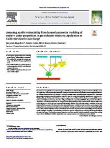
Pesticides are the most cost effective and efficient means of pest control. There are more than 500 pesticide formulations currently being used, mostly for agriculture (Azevedo, 1998). However, as the use of chemical pesticides as pest control on crops, as well as for recreational and urban uses has increased, so have the adverse effects on humans and the environment (Etchegoyen, Ronco, Almada, Abelando, & Marino, 2017; Houbraken, Habimana, Senaeve, López-Dávila, & Spanoghe, 2017; Kard et al., n.d.; Mauffret, Baran, & Joulian, 2017; Potter, 1993; Templeton, Zilberman, & Jick Yoo, 1998). It has been estimated that less than 0.1% of the pesticides applied to crops reach the intended pest (Pimentel & Levitan, 1986). According to the U.S. Geological Survey’s (USGS) National Water Quality Assessment Program (NAWQA), pesticides have been detected in more than 50% of shallow groundwater samples in urban and agricultural watersheds. Approximately 92% of Florida’s population receives drinking water from groundwater sources (Ferguson, Gonzales, & Albritton, 2014). With the population of 5 million in the Southwest Florida Water Management District (SWFWMD) expected to grow another 20% in the next decade, the quantity and quality of available fresh water will be limited (Smith & Rayer, 2013; SWFWMD, 2015). Based on current population growth and urban sprawl trends, by 2070 approximately 30% of the state of Florida is projected to be developed (Carr & Zwick, 2016). Much of this development occurs in the form of suburban sprawl into rural regions where pesticide use has already compromised groundwater quality, and where new wells will be at risk in vulnerable areas. Impacts of increased demand can already be seen around the state in the form of lower spring levels, increased sink hole activity, and saltwater intrusion (DEP, 2010).The Florida Department of Health (FLDOH) GIS database shows there are 23,283 private or multi-family potable wells within the SWFWMD (Figure 1). Private wells are typically not monitored for water quality as routinely as public supply wells and are not treated as thoroughly. Therefore, human health risks are higher in areas that lack water quality monitoring and treatment systems (Macler & Merkle, 2000; Nolan, Ruddy, Hitt, & Helsel, 1998). Due to the high cost and the difficulty of a comprehensive pesticide monitoring program, modeling has been used to prioritize areas to focus monitoring and application management practices (Di Guardo & Finizio, 2015, 2016; Dixon & Uddameri, 2016). Quantifying the spatial variability of groundwater exposure risk to contaminants is known as a vulnerability assessment. This concept assumes that the physical environment may provide some protection against contaminant transport and that some areas are more vulnerable than others (Vrba & Zaporozec, 1994). The potential vulnerability of a water body, based on soil-hydrogeological-landscape characteristics, is called intrinsic vulnerability. Taking contaminant properties into consideration, as well as the environmental variables used in the intrinsic vulnerability model is known as specific vulnerability (Gogu & Dassargues, 2000). Although these characteristics are highly complex in spatial distribution and interaction, Geographic Information Systems (GIS) is a capable tool for modeling (López-Doval et al., 2017; Rahman, 2008; SNIFFER, 2004). Utilizing GIS for regional and watershed assessments is a way to incorporate multiple scales of information in a relatively easy to use and inexpensive model (Vrba & Zaporozec, 1994). DRASTIC, one of the most widely used intrinsic vulnerability models was developed to address general groundwater vulnerability concerns (Aller, Lehr, Petty, & Bennett, 1987). Since its inception, DRASTIC has been applied throughout the world and to several groups
3
Downloaded by [Steven Douglas] at 05:31 09 January 2018
PHYSICAL GEOGRAPHY
Figure 1. SWFWMD study area and the locations of private and multi-family potable wells.
of contaminants, such as pesticides (Brindha & Elango, 2015; Huang et al., 2017; Rahman, 2008; Sadat-Noori & Ebrahimi, 2016; Saha & Alam, 2014; Wang et al., 2007). DRASTIC’s overlay-index method is based on superimposing maps of spatially distributed physical parameters and other information (depth to water, net recharge, aquifer media, soil media, topography, impact of vadose zone, and hydraulic conductivity), which are then weighted.
Downloaded by [Steven Douglas] at 05:31 09 January 2018
4
S. DOUGLAS ET AL.
The overlain maps and their weights are used to develop a final map displaying various levels of vulnerability (National Research Council, 1993). Application of the DRASTIC intrinsic vulnerability model to determine the factors that influence pesticide movement has had some success and is one important tool used to understand groundwater vulnerability to pesticides. However, others have attempted to create specific vulnerability models that predict groundwater vulnerability to specific contaminants more accurately (Ahmed, 2009; Arthur, Wood, Baker, Cichon, & Raines, 2007; Dixon, 2005; Nobre, Rotunno Filho, Mansur, Nobre, & Cosenza, 2007; Pacheco, Pires, Santos, & Sanches Fernandes, 2015; Panagopoulos, Antonakos, & Lambrakis, 2006; Pathak & Hiratsuka, 2011). The specific vulnerability model, the Pesticide Attenuation Factor model (AF), introduced by Rao et al. (1985), is one such index for assessing the transport of pesticide mass from the vadose zone to groundwater (Mylevaganam & Ray, 2016). The attenuation factor considers the processes affecting pesticide fate in the environment. The model can be customized to the characteristics of specific pesticides. Some of the advantages of intrinsic and specific vulnerability models are their applicability to most groundwater systems globally, the flexibility and customizable nature of the models, and their ability to produce useful results with inexpensive and readily available data. The results of each of these types of models can help managers, planners, and administrators focus resources on vulnerable areas and areas that contribute the most to contamination (Aller et al., 1987; Wang, Li, Jia, Qi, & Ding, 2013). However, intrinsic vulnerability models alone are useful for understanding the general vulnerability of groundwater but are not able to be used for specific contaminants. Specific vulnerability models are useful to understand the vulnerability of groundwater to specific contaminants, but have not been widely accepted due to the high data input and computing requirements and time and expertise needed to run the models. In addition, the lack of available pesticide groundwater data hinders the ability to validate model results. The objective of this work is to evaluate the effectiveness of intrinsic and specific vulnerability modeling for predicting groundwater vulnerability to individual pesticides and groupings of similar pesticides.
Background and methodology The aquifer systems in Florida are unique due to the presence of sandy soils, karst features, and high precipitation (Purdum, 2002). In most areas of Florida there are three main systems: the surficial, intermediate, and Floridan. The Floridan aquifer system extends beneath the entire state. In the northern portion of the SWFWMD, the surficial system is nonexistent, the Floridan is the primary source of groundwater, and the clay confining unit overlaying the Floridan is discontinuous. In eastern Polk and Highland Counties, the overlaying confining unit can reach 75 m in thickness and separates the surficial and Floridan systems. In the south, the confining, intermediate aquifer system overlaying the Floridan is thick, and an intermediate aquifer is found between two confining units. Total thickness of the intermediate system ranges from 15 to over 100 m. The Upper Floridan aquifer consists of limestone and dolomite rocks and varies in thickness from 100 to 500 m. The upper portion of the Floridan is the main source of freshwater for public use, agriculture, and industry (SWFWMD, 2009).
Downloaded by [Steven Douglas] at 05:31 09 January 2018
PHYSICAL GEOGRAPHY
5
In order to apply the DRASTIC and AF models to confined aquifers, slight modifications are required. Aller et al. (1987) discusses the modifications required beginning on page 76. The Upper Floridan aquifer was modeled due to its importance for supplying the majority of drinking water for private wells in West-Central Florida. If the surficial aquifer is not separate from the Floridan aquifers by a confining unit then the depth to groundwater is simply the depth to the surface of the unconfined aquifer. If there is a confining unit, the depth to groundwater is measured as the depth to the top of the aquifer. For a confined aquifer, the media parameters used for the impact of vadose zone media come from the confining layer. When Aller et al. (1987) compared the DRASTIC model for confined and unconfined aquifers, the confined aquifers tend to show less vulnerability. We expect to see lower vulnerability within the SWFWMD where the confining layer is thickest. Within the SWFWMD landuse is diverse. Residential (low, medium, and high density) landuses cover 17% of the district. Recreational landuses such as golf courses cover just over 1% of the district. Water covers approximately 11% and “other” landuses, such as commercial, wetlands, and uplands, cover slightly less than 47% of the district. Agricultural landuses cover 24% of the district with crops, row crops, and pastureland covering 16% and tree crops and plantations about 7% of the district. In total, recreational and agricultural landuses total over 10,000 km2 (SWFWMD, 2013). Bromacil and 1,2-Dibromoethane or Ethylene Dibromide (EDB) were selected for study due to their history of use in Florida, threats to groundwater, and due to their similar characteristics such as very low Henry’s Constant values, similar sorption-partition coefficients, and long half-lives in groundwater and soil (Table 1). They are two of the most widely used pesticides in citrus farming, with the chemicals applied directly to the soil. Table 2 lists the numerous acute and chronic health effects associated with EDB and Bromacil (USEPA, 1996; USEPA, 2013). As a result, the EPA set the Maximum Contaminant Level (MCL) for EDB at 0.05 ug/L (parts per billion) and the Human Health Advisory Level (HAL) for Bromacil at 90 ug/L (USEPA, 1990, 2014). Due to the high cancer risk, the state of Florida set its own MCL for EDB at 0.02 ug/L (FLDEP, 2013; FL Dept of Health, 2013). With a long half-life, low sorption coefficients, and low Henry’s constants, as well as application directly in the soil, EDB and Bromacil have a high chance of surviving in the environment that reaches private drinking water sources. The Florida Dept. of Environmental Protection and Dept. of Health, through the Well Supply and Restoration Program (WSRP), has identified more than 2500 and 1400 wells with measurable levels of EDB and Bromacil, respectively. Some wells have detected EDB concentrations as high as 420 ug/L and EDB concentrations as high as 755 ug/L (FDEP, 2003).
Table 1. Henry’s Constant (Kh), Sorption Coefficient (Log Koc), and the half-life (T1/2), in groundwater (gw) and in soil, for Bromacil and EDB pesticides. Kh Log Koc T1/2 * Bromacil EDB
Bromacil EDB 1.28 × 10⁻⁵ 2.25 × 10⁻² 1.86 1.65 1 year to decades (gw and soil) 470 h to 3650 days* (gw and soil) 3650 days refers to pesticide half-life in 100 cm of soil (Jury, Russo, Streile, & El Abd, 1990) Bottoni & Funari, 1992; Delle Site, 2001; Mackay et al., 2006; Madhun & Freed, 1987; Montgomery, 1993; Muir, 1991 Delle Site, 2001; Jury et al., 1990; Mackay et al., 2006; Staudinger & Roberts, 2001; Wilson, Smith, & Rees, 1986
6
S. DOUGLAS ET AL.
Table 2. Health effects from acute and chronic exposure to EDB and Bromacil pesticides (USEPA, 1996; 2013). Health effects EDB
Downloaded by [Steven Douglas] at 05:31 09 January 2018
Bromacil
Acute Skin irritation Blistering Depression Shortness of Breath Liver function changes Kidney function changes Death Eye, nose, throat irritation Skin irritation
Chronic Bronchitis Headaches Depression Liver failure Kidney failure Damaged sperm cells Birth defects Possible human carcinogen Weight loss Thyroid function changes Thyroid cysts Adrenal gland function changes Retinal damage Birth defects Miscarriage Possible human carcinogen
The USGS Epest program has estimated the amount of Bromacil pesticides used for agriculture by county for each year from 1992 to 2012, with preliminary estimates available for 2013 and 2014. Bromacil use in the U.S. peaked in 1993 with an estimated 2 million pounds applied, mostly to orchards, grapes, and cotton throughout the U.S. (Thelin & Stone, 2013). Use of Bromacil has steadily decreased to an estimated 0.2 million pounds, mostly confined to California, Arizona, Texas, and Florida (Baker & Stone, 2015). Within the SWFWMD the Bromacil Epest estimated application for 1993 was over 410,000 kgs or 37.60 kg/km2. In 1993 and 1994, nine counties in the study area averaged over 10,000 kg of Bromacil applied per year. DRASTIC methods To create the DRASTIC groundwater vulnerability model in GIS, an index and overlay system is used. Index and overlay models apply weights and rates to each environmental variable layer. The final model is a combination, usually the sum, of each of these layers. For example, the ratings and weights for the DRASTIC model equation are as follows: Equation 1. DRASTIC intrinsic vulnerability model equation.
DRASTIC = DwDr + RwRr + AwAr + SwSr + TwTr + IwIr + CwCr Where the DRASTIC parameters, (D) Depth to Groundwater (meters; m), (R) Recharge (meters/year; m/yr), (A) Aquifer Media, (S) Soil Media, (T) Topography (percent slope), (I) Impact of Vadose Zone Media, and (C) Hydraulic Conductivity (gal/day/ft2; gfd) are multiplied by (w) the weight, and (r) the rating. DRASTIC weights and rates are based on Aller et al., 1987. Layers and weights are listed in Table 3. The completed intrinsic and specific vulnerability models are reclassified into five classes ranging from 0 to 5, representing vulnerability classes from very low to very high.
PHYSICAL GEOGRAPHY
7
Downloaded by [Steven Douglas] at 05:31 09 January 2018
Table 3. DRASTIC and AF model layer inputs, values, and sources. The weight values provided for DRASTIC model layers are the same as described in Aller et al. (1987). Model DRASTIC DRASTIC DRASTIC DRASTIC DRASTIC DRASTIC DRASTIC
D R A S T I C
Data layer
Model AF AF AF AF AF AF AF AF AF Statistics
Layer BD OC FC L AC q t1/2 Koc Kh Water quality
Name Depth to groundwater Recharge Aquifer media Soil media Topography Impact of vadose zone media Saturated hydraulic conductivity Name Bulk density Organic carbon content Field capacity Depth to GW Porosity Recharge Half-life Sorption coefficient Henry’s law constant All pesticides
Values 0–99 m 0–25 m/yr
1–2000 gfd
Weight 5 4 3 2 1 5 3
Source USGS USGS USGS SSURGO USGS-NED FDEP SSURGO
Values 0–1.85 g/cm3 0–87.5% 1–43% 0–99 m 30–50% 0–25 in/yr 1 yr 1.65 2.25 × 10⁻² μg/L
Weight n/a n/a n/a n/a n/a n/a n/a n/a n/a n/a
Source SSURGO SSURGO SSURGO USGS SSURGO SWFWMD See Table 1 See Table 1 See Table 1 FL DOH, USGS, and EPA
0–18% slope
Abbreviation: m, meters; m/yr, meters/year; gfd, gallons/day/foot2.
Attenuation factor methods The AF value serves as an index for assessing the transport of pesticide mass from the vadose zone. The AF is defined as (Shukla et al., 2000): [ ] −0.693*L*RF*FC AF = exp q*t( 1 ) 2
] [ BD ∗ OC ∗ Koc AC ∗ Kh + where RF = 1 + FC FC and RF is the retardation factor, BD is the bulk density of soils (kg/m3), OC is the organic carbon (fraction), FC is the field capacity of soil (fraction), AC is the air filled porosity (fraction), q is the recharge (in/yr), L is the depth to groundwater (m) or the depth at which AF is to be calculated, Koc is the sorption coefficient of pesticide on organic matter, KH is the Henry’s constant (dimensionless), and t1/2 is the pesticide half-life (years). Figure 2 displays each of the variable layers that were used in the DRASTIC and AF models. The resulting AF values are dimensionless and range between 0 and 1. A value of 1 indicates that all of the pesticides in the vadose zone will leach into the groundwater; conversely a value of 0 suggests that none will leach into the groundwater. EDB pesticide properties will be used in the above equation for AF modeling of both pesticides since both EDB and Bromacil have similar values. The values listed in Table 1 represent the most agreed upon values by multiple sources. However, minimum or maximum values could be used to model best case or worst case scenarios. The ease of building and running a new model with different values is another reason why AF modeling is useful.
S. DOUGLAS ET AL.
Downloaded by [Steven Douglas] at 05:31 09 January 2018
8
Figure 2. The distribution of each environmental input variable used in the DRASTIC and AF models. (a) Bulk Density (kg/m3); (b) Depth to Groundwater (m); (c) Porosity (%); (d) Recharge (inches/year); (e) Organic Carbon Content (%); (f) Field Capacity (%); (g) Aquifer Media; (h) Saturated Hydraulic Conductivity (gallons per square foot per day); (i) Slope (%); (j) Soil Media; (k) Vadose Zone Media.
In this case, the AF values, which are dimensionless and range between 0 and 1, were divided into 5 classes based on the standard deviation: very low (